
Mori Atlas logo
National parkPodyjí National Park

Discover the mapped boundaries and intact river valley geography of this South Moravian natural treasure.

Podyjí National Park: Czech Republic's Premier River Canyon Protected Landscape

Podyjí National Park represents a unique atlas entry for Central Europe, safeguarding a 40-kilometer stretch of the Dyje River canyon within the South Moravian Region. This protected landscape is celebrated for its remarkably intact river valley ecosystem, one of the least disturbed in the region. MoriAtlas provides structured geographic data to explore the park's complex terrain, biodiversity hotspots like its orchid-rich heaths, and its integral role in the broader mapped landscape of the Czech Republic.

river canyonold-growth forestsorchid habitatcross-border parkwetlandsriver ecosystem
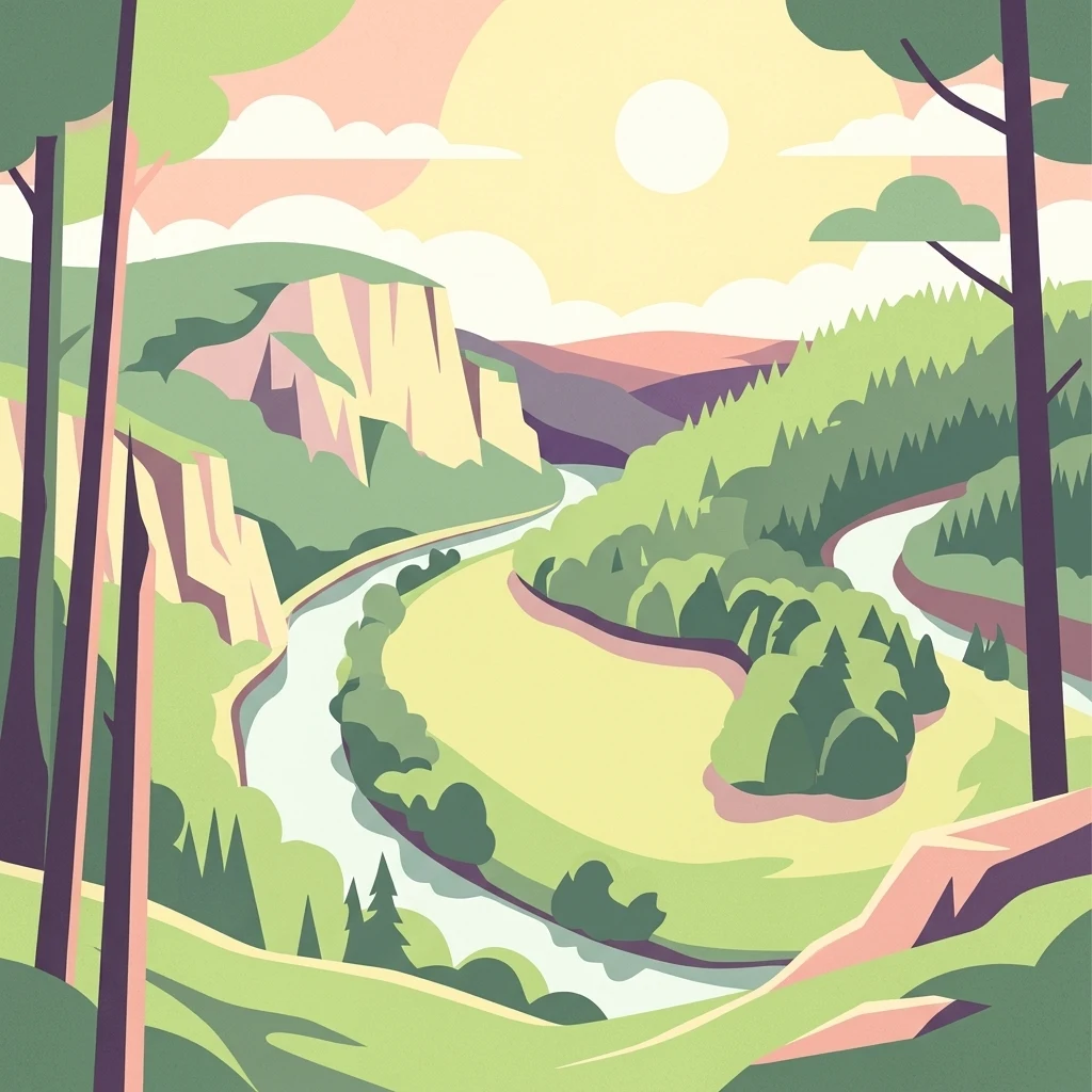
Stylized illustration of a winding river through a forested valley with cliffs and mountains under a bright sun

Podyjí National Park

National park

Park overview

Structured park overview, official facts, and landscape profile for Podyjí National Park

Podyjí National Park park facts, protected area profile, and essential visitor context

Review the core facts for Podyjí National Park, including designation, size, terrain, visitor scale, habitats, and operating context in one park-focused overview.

About Podyjí National Park

Podyjí National Park occupies a spectacular canyon landscape in southern Moravia where the Dyje River has carved a deep meandering valley through the Bohemian-Moravian Highlands. The river's course through the park stretches for 40 kilometers, winding between Vranov nad Dyjí and Znojmo, creating a series of entrenched meanders flanked by rocky cliffs and boulder-strewn slopes. The canyon walls expose a complex geological history, with the rapid incision of the Dyje into the landscape occurring during the Tertiary period, reaching depths of 100 to 200 meters, followed by frost modeling that created the characteristic rocky amphitheaters, stone seas, and pseudokarst caves visible today.

The park's ecological significance stems from its position at the intersection of two major Central European biogeographic regions—the Hercynian and Panonic—creating a corridor where species from both directions can penetrate. This valley phenomenon allows warm-adapted species from the southeastern Panonic basin to extend westward while montane species from the west reach into the warmer valley floors. The result is exceptional biodiversity that includes species more typical of much warmer or cooler climates than would normally occur at this latitude.

What makes Podyjí particularly remarkable is its preservation. Unlike similar valleys across Moravia that were disrupted by holiday settlements or dam constructions, this canyon remained largely untouched due to its location along the former Iron Curtain. The border zone between Czechoslovakia and Austria was inaccessible from the 1950s through the 1980s, effectively preserving a near-pristine river corridor that today represents the most intact valley ecosystem in the Czech Republic.

Quick facts and research context for Podyjí National Park

Podyjí National Park covers 63 square kilometers along the Czech-Austrian border in South Moravia, making it the smallest of the Czech Republic's four national parks. The park protects a deeply incised canyon valley where the Dyje River has cut 220 meters into the landscape. Elevation ranges from 214 to 534 meters. The park is 84% forested, with the remaining area comprising grasslands, rocky outcrops, and the historic Šobes vineyard. The valley has remained undeveloped partly due to its location in the former border zone between Czechoslovakia and Austria during the Cold War period. The park is managed from Znojmo, with a visitor center located in the village of Čížov.

Protection and recognition

Documenting terrestrial designation, transboundary framework, and Natura 2000 network recognition.

Podyjí National Park Protection Status and International Designation Details

Established in 1991, Podyjí National Park represents a key terrestrial conservation zone with documented transboundary status and integration into the Natura 2000 ecological network. Natural resource managers and geographers can verify documented management frameworks and historical designation records to analyze the regional conservation landscape.

International recognition

Protection details

Protection scope
Terrestrial
Designated year
1991
Transboundary protection
Yes
Buffer area
29 km²
Park context

Deeper park guide and search-rich context for Podyjí National Park

Podyjí National Park history, landscape, wildlife, and travel context

Explore Podyjí National Park through its history, landscape character, ecosystems, wildlife, conservation priorities, cultural context, and seasonal travel timing in a structured park guide built for atlas discovery and search intent.

Why Podyjí National Park stands out

Podyjí is best known for its remarkably intact river canyon ecosystem, one of the least disturbed in Central Europe. The park protects a complex mosaic of habitats including oak-hornbeam forests, beech woods, steppe heaths, and wetland corridors. Its botanical significance is extraordinary, with 77 protected plant species including 18 orchid species, making it one of the most species-rich protected areas in the Czech Republic. The park also contains Šobes, one of the Czech Republic's oldest and most renowned vineyard sites, where winemaking traditions have persisted for centuries. The combination of geological complexity, habitat diversity, and historical preservation makes this valley unique in the region.
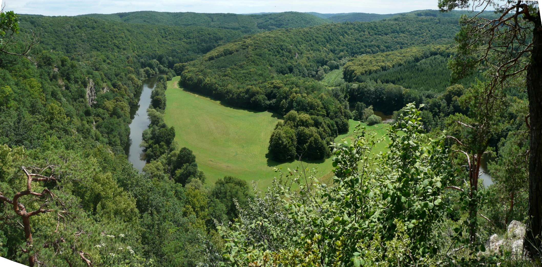
Wide view of Dyje River winding through a forested valley with green meadows and rolling hills in the background
Dyje River canyon with forested hills and meadows in Podyjí National Park

Podyjí National Park history and protected-area timeline

Podyjí National Park was officially established on July 1, 1991, through Government Order No. 164/1991, designating the most valuable portions of the earlier Podyjí Protected Landscape Area (CHKO Podyjí), which had been established in 1979 across a larger 103-square-kilometer area. The creation of the national park effectively absorbed the core of the protected landscape area, which was subsequently dissolved, while the surrounding buffer zone was retained to protect the remaining territory.

The park's first director, Tomáš Rothröckl, served for 33 years from the park's founding until 2024, providing consistent leadership through the establishment and early development of the protection regime. In 2025, Pavel Müller was appointed as his successor. The establishment of Podyjí was followed in 2000 by the creation of Thayatal National Park on the Austrian side of the border, forming a continuous cross-border protected area that maintains the ecological integrity of the valley system regardless of political boundaries.

The park's preservation is intimately tied to its Cold War history. The location along the state border placed much of the valley within the restricted border zone, limiting development and human disturbance during the period when similar valleys elsewhere in Moravia were modified by infrastructure, holiday settlements, or dam projects.

Podyjí National Park landscape and geographic character

The landscape of Podyjí National Park is defined by the dramatic canyon carved by the Dyje River as it winds through the Bohemian-Moravian Highlands. The valley reaches depths of up to 220 meters, with the river following a series of tight meanders that create a classically incised canyon profile. Rocky cliffs and stone seas—the result of frost weathering during the recent geological past—characterize the valley walls, while the river itself flows through a corridor of dense forest.

The terrain is extremely rugged and highly fragmented, with rapid changes in slope exposure as the canyon twists and turns. South-facing slopes support warm, dry conditions suited to steppe vegetation, while north-facing cliffs remain cool and moist, creating a remarkable variety of microclimates within a relatively small area. The landscape also includes unique pseudokarst caves, rock amphitheaters, and boulder fields that attest to the complex geological processes that shaped this valley.

At the eastern boundary of the park, the Znojmo Reservoir marks where the river leaves the protected area, while at the western end, the Vranov Reservoir similarly frames the park's limit. These two dams, constructed on either side of the protected section, have significantly altered the river's thermal regime and created barriers to migratory fish species.
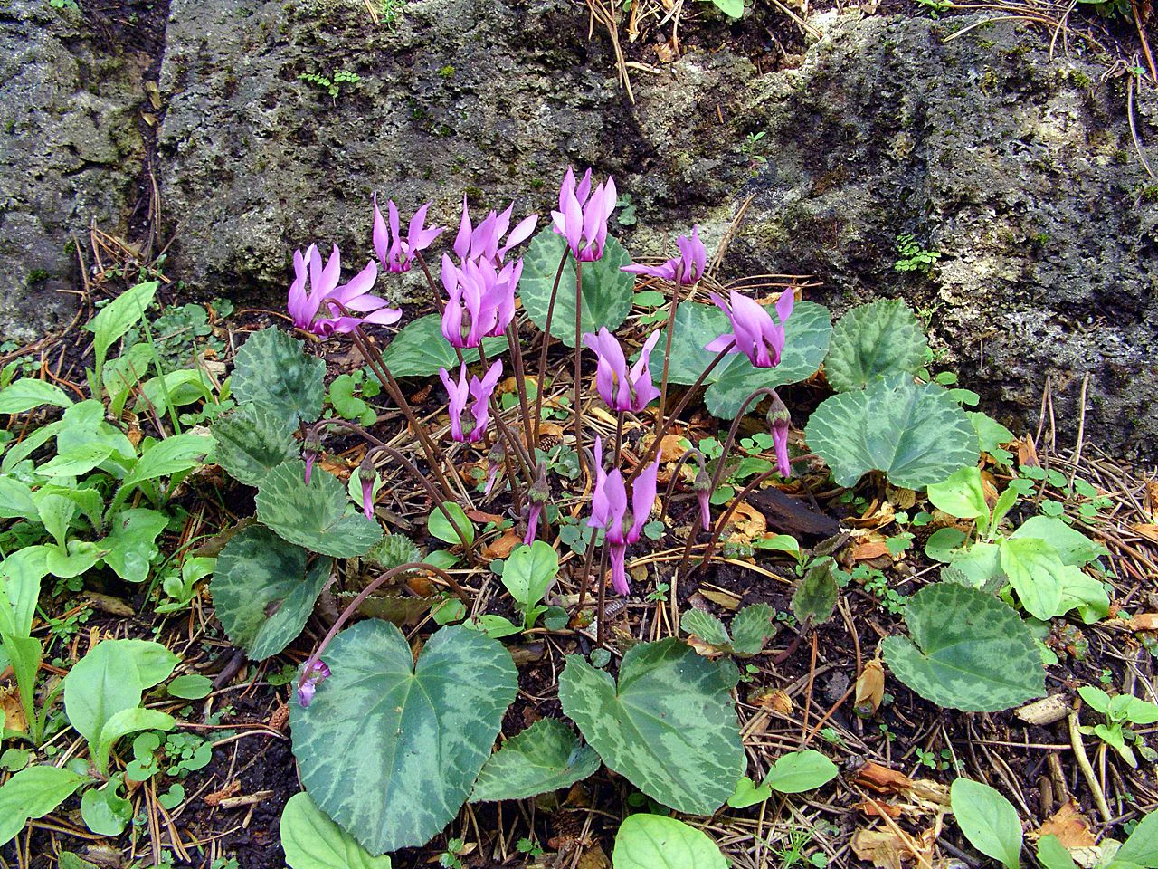
Purple cyclamen flowers with heart-shaped green leaves and rocky background
Purple Cyclamen purpurascens flowers with heart-shaped green leaves growing against a rocky wall

Podyjí National Park ecosystems, habitats, and plant life

The ecological diversity of Podyjí National Park is extraordinary for its size, resulting from the convergence of multiple biogeographic influences and the complex topography of the canyon environment. The park supports forest coverage across 84% of its area, with oak-hornbeam communities dominating the slopes, interspersed with beech forests in cooler locations and alder groves along watercourses. The valley floor supports reed beds and willow shrub communities where moisture accumulates.

The botanical richness is exceptional, with 77 protected plant species documented within the park. Eighteen orchid species occur here, representing one of the highest concentrations in the Czech Republic. The flora includes both cool-adapted species thriving in the shaded canyon depths and warmth-loving plants on the sun-exposed southern slopes, a duality that allows species from very different climatic regimes to coexist. Notable species include cyclamen, various mullein species, pasque flower, spring gentian, and the protected false oat grass communities.

The eastern edge of the park contains a unique zone of steppe heaths and grassland—remnants of once-wider dry grassland systems that have persisted on sites where the shallow soils and warm microclimate mimic more southerly environments. These heather-dominated communities represent a habitat type that is rare in Europe and represents an alternative successional pathway created by centuries of livestock grazing.
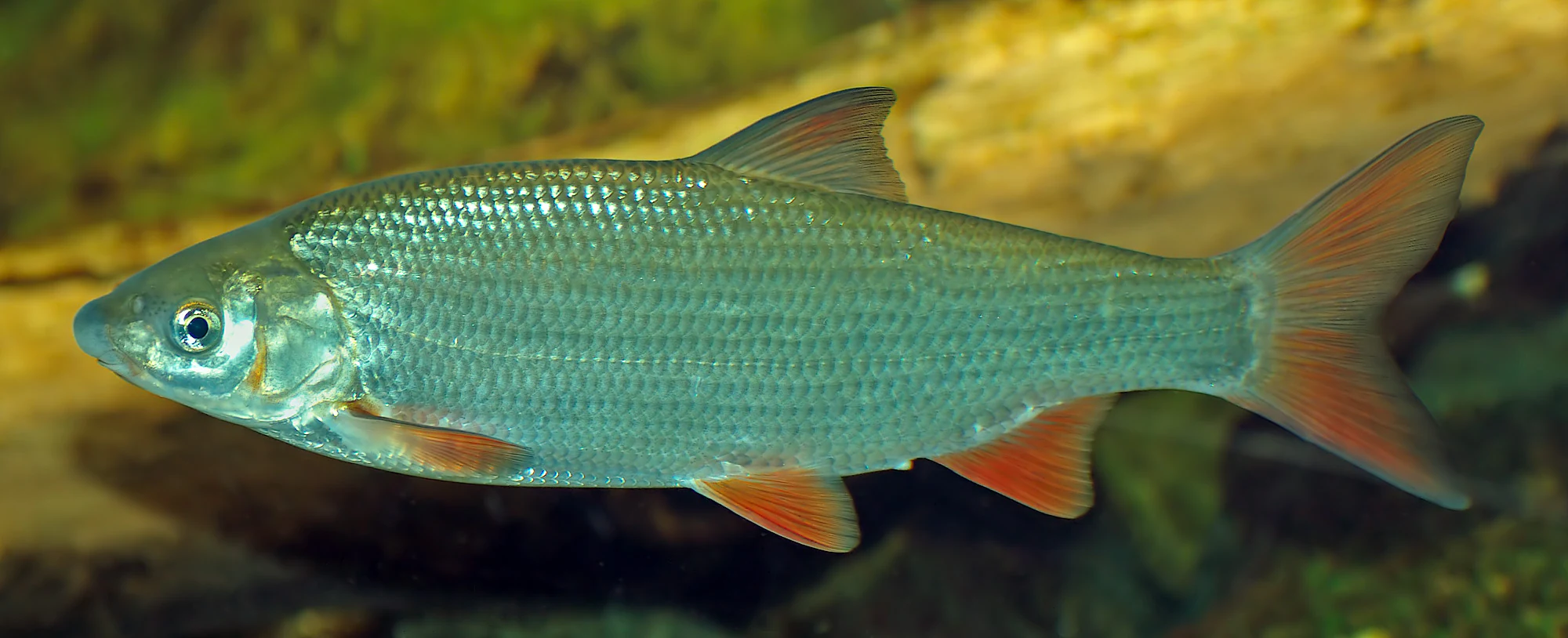
Close-up of common nase fish with silvery body and orange fins in water
Common nase fish (Chondrostoma nasus) swimming in river water

Podyjí National Park wildlife and species highlights

Podyjí supports remarkable wildlife diversity, with 152 bird species recorded within the park—approximately two-thirds of which nest here—alongside 65 mammal species and seven reptile species. The bird community includes significant populations of species associated with the park's mosaic of forest, cliff, and wetland habitats, with the Syrian woodpecker and barred warbler identified as trigger species for the area's BirdLife International designation.

The mammal population includes the European otter, which inhabits the river corridor, and the European ground squirrel in the steppe and heathland areas. The reptile community includes all Czech snake species, with the European green lizard and a tree snake among the more notable inhabitants. The insect fauna is particularly rich, featuring species such as the stag beetle, praying mantis, giant longhorn beetle, rhinoceros beetle, and swallowtail butterflies. Twelve particularly endangered butterfly species have been recorded.

The fish community in the Dyje River has been affected by the dams at either end of the protected section, though 32 fish species have been recorded, dominated by brown trout, grayling, and brook trout. The original riverine fish community, including migratory species like the Schneider and Ukrainian stickleback, has been largely displaced by the temperature changes and migration barriers created by the reservoir structures.
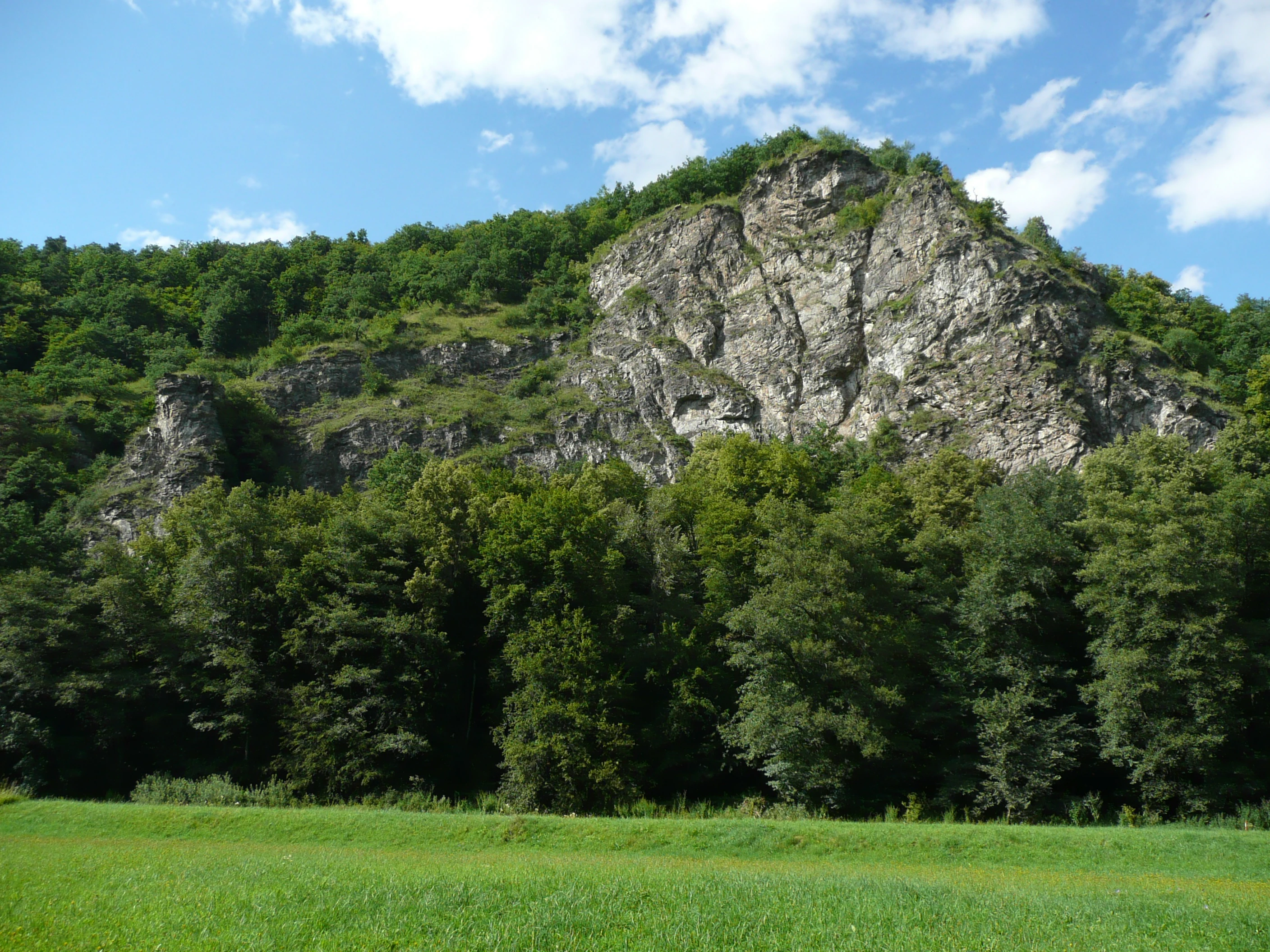
A large rocky cliff face with patches of vegetation, surrounded by dense forest and a grassy field under a partly cloudy sky
Vraní Rock formation in Podyjí National Park, Czech Republic

Podyjí National Park conservation status and protection priorities

Podyjí National Park represents one of the most significant conservation achievements in the Czech Republic, protecting an ecosystem type that has been largely lost from the Central European landscape. The near-pristine state of the 42-kilometer river valley is cited as unique within Central Europe, making this one of the most important river corridor conservation sites in the region. The park's biodiversity is remarkable: it is one of the most species-rich large protected areas in the Czech Republic, supporting numerous protected and endangered species across all taxonomic groups.

The cross-border collaboration with Austria's Thayatal National Park creates a unified conservation approach to the valley ecosystem, allowing species movement and ecological processes to operate across the political boundary. The park is designated as an Important Bird Area by BirdLife International under criteria C6, covering a broader area of 76.66 square kilometers. Conservation challenges include the spread of invasive black locust in the eastern portions of the park and the ongoing impacts of the reservoir structures on river ecology.

Podyjí National Park cultural meaning and human context

The cultural landscape of Podyjí reflects centuries of human presence in this border region, most notably represented by the historic Šobes vineyard—one of the oldest and most renowned vineyard sites in the Czech Republic. Wine production has continued at Šobes for generations, with approximately 12 hectares of vineyards still producing wine under the Znovín Znojmo company, which holds rights to 70% of the site. Efforts have been underway since 2014 to have Šobes designated as a UNESCO World Natural Heritage Site.

The valley contains several cultural landmarks accessible via park trails: the ruins of Nový Hrádek castle, Hardegg Castle on the Austrian side, and the Vranov nad Dyjí Chateau. The village of Čížov, which sits within an enclave surrounded by the park, provides visitor facilities and access to the trail network. The park administration is based in the town of Znojmo, the regional center known for its wine production and historical architecture.
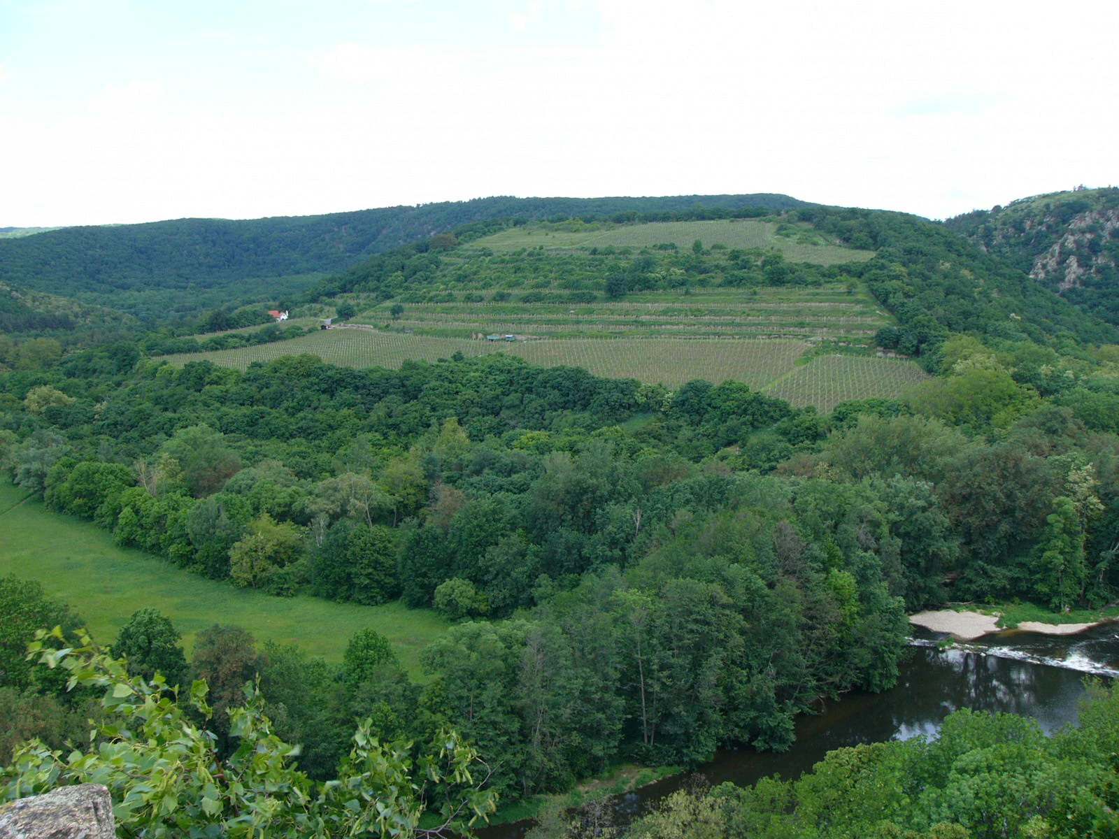
Wide landscape view of a river valley with dense forests, terraced vineyards on hillsides, and a river flowing through green meadows
Terraced vineyards along the Dyje River in Podyjí National Park

Top sights and standout views in Podyjí National Park

Podyjí National Park protects the most intact river valley ecosystem in the Czech Republic, with 42 kilometers of essentially uninhabited canyon landscape. The park's exceptional biodiversity includes 77 protected plant species and 18 orchid varieties, along with 152 bird species and 65 mammal species. The Šobes vineyard represents centuries of winemaking tradition within the protected area. The cross-border connection with Austria's Thayatal National Park creates a unified valley protection system. The dramatic canyon landscape features rocky cliffs, stone seas, and a 220-meter depth of river incision, all preserved largely due to the area's former status as a restricted border zone.
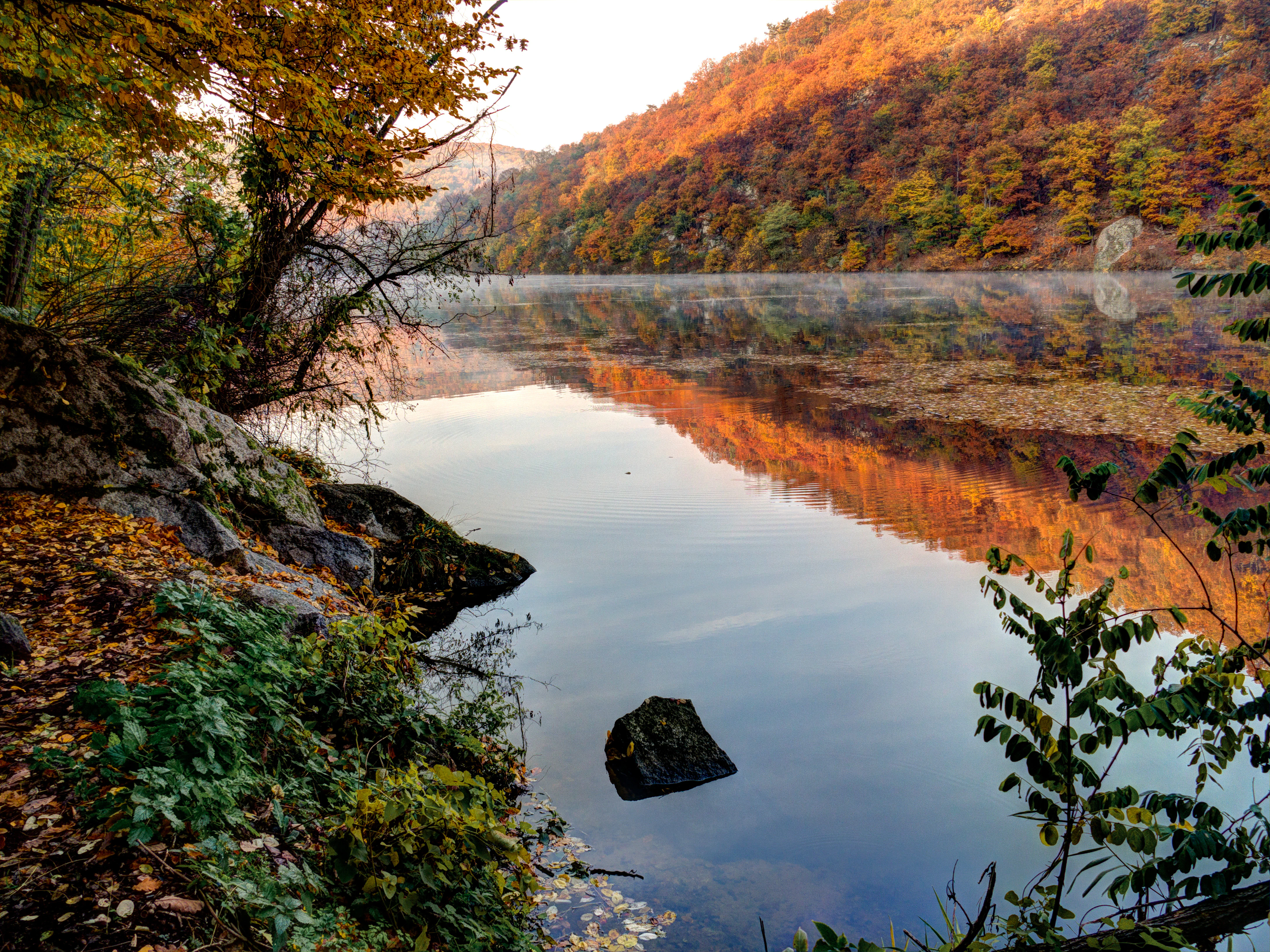
A calm river reflecting autumn trees and mist, surrounded by forested hillsides with fallen leaves on the shore
Morning mist over the Dyje River reflecting autumn foliage in Podyjí National Park

Best time to visit Podyjí National Park

The Dyje valley can be visited year-round, with each season offering distinct experiences. Spring brings flowering of the extensive cyclamen populations and the orchid season, while summer reveals the full heat of the canyon environment with dragonflies along the river and butterflies in the meadow areas. Autumn offers the characteristic golden coloration of the deciduous forests and is traditionally the harvest season for the Šobes vineyard. Winter can be particularly dramatic in the canyon, with ice formation on the river and snow on the rocky outcrops, though some trails may be more challenging. The variety of exposures and microclimats means that wildlife viewing opportunities vary throughout the year, with different species being most active in different seasons.


Monthly climate preview

Long-term temperature and precipitation patterns across the South Moravian Region

Climate Normals and Average Weather by Month in Podyjí National Park

Long-term measurements from a representative coordinate at 480 meters elevation reveal an annual cycle ranging from sub-zero average winter temperatures to warm summer peaks near 19 degrees Celsius. Accessing the complete climatology profile provides monthly precipitation averages alongside detailed minimum and maximum temperature distributions across the seasonal cycle.
Annual mean8 °C
-3 °C19 °C
Jan-3°
Feb-1°
Mar
Apr
May13°
Jun17°
Jul19°
Aug19°
Sep14°
Oct
Nov
Dec-2°
Warmest month
July

19.1 °C

Coolest month
January

-3.1 °C

Wettest month
June

2.7 mm/day

Driest month
February

1 mm/day

Park location guide

Geography guide, regional context, and park location map for Podyjí National Park

Podyjí National Park park geography, regions, and map view in Czechia

Understand where Podyjí National Park sits in Czechia through a broader geographic reading of the surrounding landscape, nearby location context, and its mapped position within the national park landscape.

How Podyjí National Park fits into Czechia

Czech Republic is a landlocked Central European country with a population of approximately 10.9 million people. The nation was established as an independent state on January 1, 1993, following the dissolution of Czechoslovakia. Its capital and largest city is Prague, with other major urban centers including Brno, Ostrava, Plzeň, and Liberec.

Wider geography shaping Podyjí National Park in Czechia

The Czech Republic is a landlocked country in Central Europe. It is bordered by Germany to the west, Austria to the south, Poland to the northeast, and Slovakia to the southeast. The landscape is predominantly hilly, with the territory covering 78,871 square kilometers.

Map view of Podyjí National Park

Use this park location map to pinpoint Podyjí National Park in Czechia, understand its exact geographic position, and read its mapped placement within the surrounding landscape more clearly.

Pigeon | © OpenStreetMap contributors

Location context for Podyjí National Park

South Moravian Region
Natural feature types

Investigate the Natural Landmarks and Diverse Terrain of Podyjí National Park

Continue your geographic exploration by examining the specific natural landmarks identified within Podyjí National Park. MoriAtlas provides a clear view of the river systems, valley formations, and forest types that characterize this protected area. Use these records to better understand the physical boundaries and landscape composition of this unique Czechia region.

Discover the visual character of Central Europe's most intact river valley, from deep canyons and ancient forests to unique steppe heaths.

Podyjí National Park Photos: Explore Dramatic River Canyon Landscapes and Protected Habitats

Browse a curated collection of Podyjí National Park photos to visually understand its rugged river canyon, diverse forest ecosystems, and distinctive protected-area scenery. These images offer a detailed look at the park's geological features and varied microclimates, providing crucial context for its unique conservation landscape.

Wide view of Dyje River winding through a forested valley with green meadows and rolling hills in the background

Map of Podyjí National Park in the Czech Republic with labeled locations including Vranov, Hardegg, Znojmo, and Rakousko, highlighting the river course and adjacent areas

Purple cyclamen flowers with heart-shaped green leaves and rocky background

Close-up of common nase fish with silvery body and orange fins in water

A large rocky cliff face with patches of vegetation, surrounded by dense forest and a grassy field under a partly cloudy sky

Dry grassland with scattered bushes under a partly cloudy sky

Wide landscape view of a river valley with dense forests, terraced vineyards on hillsides, and a river flowing through green meadows

A calm river reflecting autumn trees and mist, surrounded by forested hillsides with fallen leaves on the shore

Two pink anemone flowers with green leaves growing among fallen leaves and tree bark

Park atlas

Trace mapped geography and protected landscapes surrounding Podyjí National Park for regional comparison.

Explore National Parks and Protected Areas Near Podyjí National Park

Explore national parks and protected areas in the Central European region around Podyjí National Park, including its adjacent cross-border partner Thayatal National Park, to understand connected river canyon ecosystems. Compare these protected landscapes to gain a deeper geographic perspective on the unique conservation efforts and ecological connections spanning the Bohemian-Moravian Highlands.
National park
Park boundaries overlap#1 closest

West

Thayatal National Park: Austria's Smallest Protected Landscape and Dramatic River Valley

Explore the mapped geography of a breakthrough valley and its rich biodiversity.

Thayatal National Park, Austria's smallest national park, offers a concentrated study in protected landscape discovery. Its core feature is the spectacular Thaya River breakthrough valley, a deep gorge cutting through gneiss terrain with steep, forested slopes. This page provides context for its mapped protected area, highlighting its exceptional biodiversity and its role as a transboundary conservation zone with the adjacent Czech Podyjí National Park. Understand the geographic setting and unique landscape character of this significant natural region.

Area
13.3 km²
Established
2000
IUCN
II
Relief
Mountain
Watercolor illustration of a karst landscape featuring hills, a lake, and cave-like rock formations with green vegetation
Protected landscapeSouth Moravian Region
About 69 km away#2 closest

Northeast

Moravian Karst Protected Landscape: Detailed Geographic and Cave System Atlas

Mapped protected boundaries and karst phenomena in the South Moravian Region.

Moravian Karst, designated a Protected Landscape Area, offers a profound look into complex karst geology within the South Moravian Region. This entry within MoriAtlas facilitates a structured discovery of its approximately 92 square kilometers, featuring an intricate network of over 1,100 caves and gorges. Users can explore the mapped extent of this geological treasure, understand its relationship with the surrounding regional geography, and appreciate the unique formations sculpted by underground water systems, including the iconic Macocha Abyss.

Area
92 km²
IUCN
V
Scope
Terrestrial
Water
Minor water
National parkLower Austria
77 km away#3 closest

Southeast

Danube-Auen National Park: Protected Floodplain Ecosystem and Regional Geography

Mapped boundaries and vital riparian landscape in Lower Austria.

Delve into the unique protected landscape of Danube-Auen National Park, a cornerstone of Central European riparian conservation. This page offers detailed insights into its mapped boundaries, the dynamic interplay of river channels, lowland forests, and wetlands, and its significant role within the geographic context of Lower Austria. Understand the atlas value of this protected area, ideal for discovering rich natural terrain and ecosystem context.

Area
93 km²
Established
1996
IUCN
II
Relief
Lowland
Watercolor painting showing a landscape with rolling terrain, water features, and distant mountains
National parkBurgenland
118 km away#4 closest

Southeast

Neusiedler See-Seewinkel National Park: Protected Steppe Lake Landscape in Burgenland

Explore mapped wetland geography and birdwatching significance.

Neusiedler See-Seewinkel National Park showcases a rare steppe lake environment and extensive wetland habitats at the eastern edge of Austria, within the Burgenland region. This protected area is globally recognized for its exceptional avian diversity and the unique ecological mosaic formed by reed beds, salt marshes, and seasonal pools. Explore its mapped boundaries and distinctive Pannonian geography for a deep understanding of this vital European protected landscape.

Area
97 km²
Established
1993
IUCN
II
Relief
Lowland
Watercolor illustration of a landscape with green hills, a body of water, and trees under a soft sky
National parkGyőr-Moson-Sopron
128 km away#5 closest

Southeast

Fertő-Hanság National Park: Central European Wetland and Salt Lake Protected Area

Mapped Geographic Boundaries and Landscape Context

Fertő-Hanság National Park, situated in Győr-Moson-Sopron, Hungary, is a vital protected landscape renowned for its shallow salt lake and expansive marshlands. This page provides an atlas-focused discovery of its protected area, highlighting the unique interplay of reed beds and alkaline grasslands. Understand the park's geographic setting and its role as a significant wetland ecosystem for bird populations and specialized flora.

Area
235.88 km²
Established
1991
IUCN
II
Relief
Lowland
Watercolor illustration of a river flowing through a forested landscape with rolling hills in the background
National parkSouth Bohemian Region
134 km away#6 closest

West

Šumava National Park: Czech Republic's Premier Forested National Park and Protected Landscape

Explore the unique glacial lakes, peat bogs, and regional geography.

Šumava National Park, situated in the South Bohemian Region of the Czech Republic, is the nation's largest protected area and a vital component of Central Europe's forest ecosystems. This entry details its expansive terrain, highlighting the significant peat bog complexes and ancient glacial lakes that define its unique landscape. Discover the park's geographic context, mapped boundaries, and its importance as a protected natural asset within the broader regional atlas.

Area
680.64 km²
Established
1991
IUCN
II
Visitors
2M annual
Watercolor painting depicting layered mountain ranges, forests, and water bodies in green and pink tones
National parkUpper Austria
150 km away#7 closest

Southwest

Kalkalpen National Park: Ancient Beech Forests and Karst Protected Landscape

Explore mapped boundaries and unique alpine terrain.

Kalkalpen National Park is a premier protected area in Upper Austria, celebrated for harboring Central Europe's largest remaining ancient beech forests and an extensive karst landscape. This designation underscores its critical role in preserving old-growth forest ecosystems and unique geological formations within the Northern Limestone Alps. Discover the mapped terrain and regional geography that define this significant natural reserve, offering a profound look into the continent's ecological history and protected natural heritage.

Area
208.25 km²
Established
1997
IUCN
II
Relief
Mountain
Watercolor painting showing mountains, forests, and valleys in a landscape.
National park
158 km away#8 closest

West

Bavarian Forest National Park: Protected Landscape and Regional Geography Atlas

Explore mapped terrain and protected park boundaries in Germany.

Dive into the specifics of Bavarian Forest National Park, a key protected area noted for its distinct landscape and geographic importance. This MoriAtlas entry details the park's mapped boundaries and its setting within the surrounding regional geography, offering a clear atlas-style view of its natural terrain. Understand its identity as a national park and discover its place in Germany's protected lands.

Area
242.45 km²
Established
1970
IUCN
II
Visitors
1.3M annual

Common questions about visiting, size, designation, and location context for Podyjí National Park

Podyjí National Park FAQs for park facts, access, geography, and protected area context

Find quick answers about Podyjí National Park, including protected-area facts, park geography, trail and visitor context, and how the park fits into its surrounding country and regional landscape.
MoriAtlas Explorer

Continue Your Protected Areas Search Across the Global Atlas

Deepen your exploration by continuing the structured search for national parks and protected areas worldwide. Utilize the comprehensive filtering capabilities to compare different conservation landscapes and refine your understanding of global park geography. Discover more about the distribution and characteristics of protected natural areas.

Global natural geography