
Mori Atlas logo
Nature reserveRybičková skála

Exploring the Permian fossil-bearing cliffside within the Boskovice Furrow of South Moravia

Rybičková skála Nature Reserve: Geological Exposure and Regional Protected Landscape Context

Rybičková skála serves as a key geological and paleontological site within the Jihomoravský kraj region of the Czech Republic. The protected area centers on a former quarry wall along the Neslovický stream, where sedimentary rocks from the Padochov Formation preserve significant evidence of late Paleozoic life. This landscape combines fossiliferous mudstones with surrounding oak-hornbeam woodlands, offering a unique look at the geological history of the Boskovice Furrow within the broader Moravian countryside.

natural monumentpaleontological sitePermian fossilsBoskovice Furrowgeological exposureoak-hornbeam forest
A stylized digital illustration of a layered brown rock cliff face topped with green evergreen trees and surrounded by fallen autumn leaves.

Rybičková skála

Nature reserve

Park overview

Structured park overview, official facts, and landscape profile for Rybičková skála

Rybičková skála park facts, protected area profile, and essential visitor context

Review the core facts for Rybičková skála, including designation, size, terrain, visitor scale, habitats, and operating context in one park-focused overview.

About Rybičková skála

Rybičková skála is a small but scientifically significant natural monument in the southern part of Moravia, Czech Republic. It lies on the left bank of the Neslovický stream, about one kilometer outside the village of Neslovice, on the cadastral territory of Padochov. The protected site takes its name, meaning roughly "little-fish rock," from the abundant impressions of Permian fish discovered in its layered sediments during the 1880s.

The monument centers on a single cliff face, about 40 meters long and 13 meters high, that represents the surviving wall of a former small quarry. The exposed strata belong to the Padochov Formation of the Boskovice Furrow, a regionally important geological structure that documents late Paleozoic basin development within the Bohemian Massif. Within the alternating greenish-grey mudstones, siltstones, and sandstones, researchers have identified a distinctive pelocarbonate horizon of dark bituminous clayey siltstones that has produced the fossils that define the site's scientific reputation.

Although the protected territory is tiny, the surrounding landscape mixes deciduous and mixed woodland, agricultural fields, meadows, and permanent crops, creating a quiet rural setting typical of this part of Moravia. The broader area has long been shaped by coal mining of the nearby Rosicko-oslavanská pánev, and the Bosnian-style region's geological history, archaeology, and industrial past all intersect at this compact site.

The monument is publicly accessible via a green-marked hiking trail connecting Oslavany, Neslovice, and Padochov, making it a straightforward stop for visitors interested in geology, paleontology, and the layered cultural landscapes of southern Moravia.

Quick facts and research context for Rybičková skála

Rybičková skála is a natural monument (přírodní památka), a Czech protected-area category corresponding to IUCN Category III. It lies in the Brno-venkov District of the South Moravian Region, with its territory falling within the cadastral area of Padochov, a part of the town of Oslavany. The protected site was established on 11 December 1980 by the then Okresní národní výbor Brno-venkov and covers approximately 0.05 hectares at elevations between 305 and 320 meters above sea level.

Protection and recognition

Documented protection history, management scope, and international status facts

Rybičková skála Protection Status and Terrestrial Conservation Scope

Rybičková skála maintains a recorded terrestrial conservation scope that defines its official protected area status. Structured records outline the documented management framework, designation history, and international recognition data associated with the terrain.

Protection details

Protection scope
Terrestrial
Park context

Deeper park guide and search-rich context for Rybičková skála

Rybičková skála history, landscape, wildlife, and travel context

Explore Rybičková skála through its history, landscape character, ecosystems, wildlife, conservation priorities, cultural context, and seasonal travel timing in a structured park guide built for atlas discovery and search intent.

Why Rybičková skála stands out

Rybičková skála is celebrated above all for its paleontological significance. The cliff exposes Permian lacustrine sediments of the Padochov Formation, part of the broader Boskovice Furrow geological complex, and has yielded abundant fossils of ray-finned fish from the family Aeduellidae, as well as scales and spines of the acanthodian Acanthodes gracilis, insect wings, and plant material including rare ferns and cordaites. These finds, first recognized in the 1880s, give the site enduring value for studies of late Paleozoic freshwater life in central Europe.
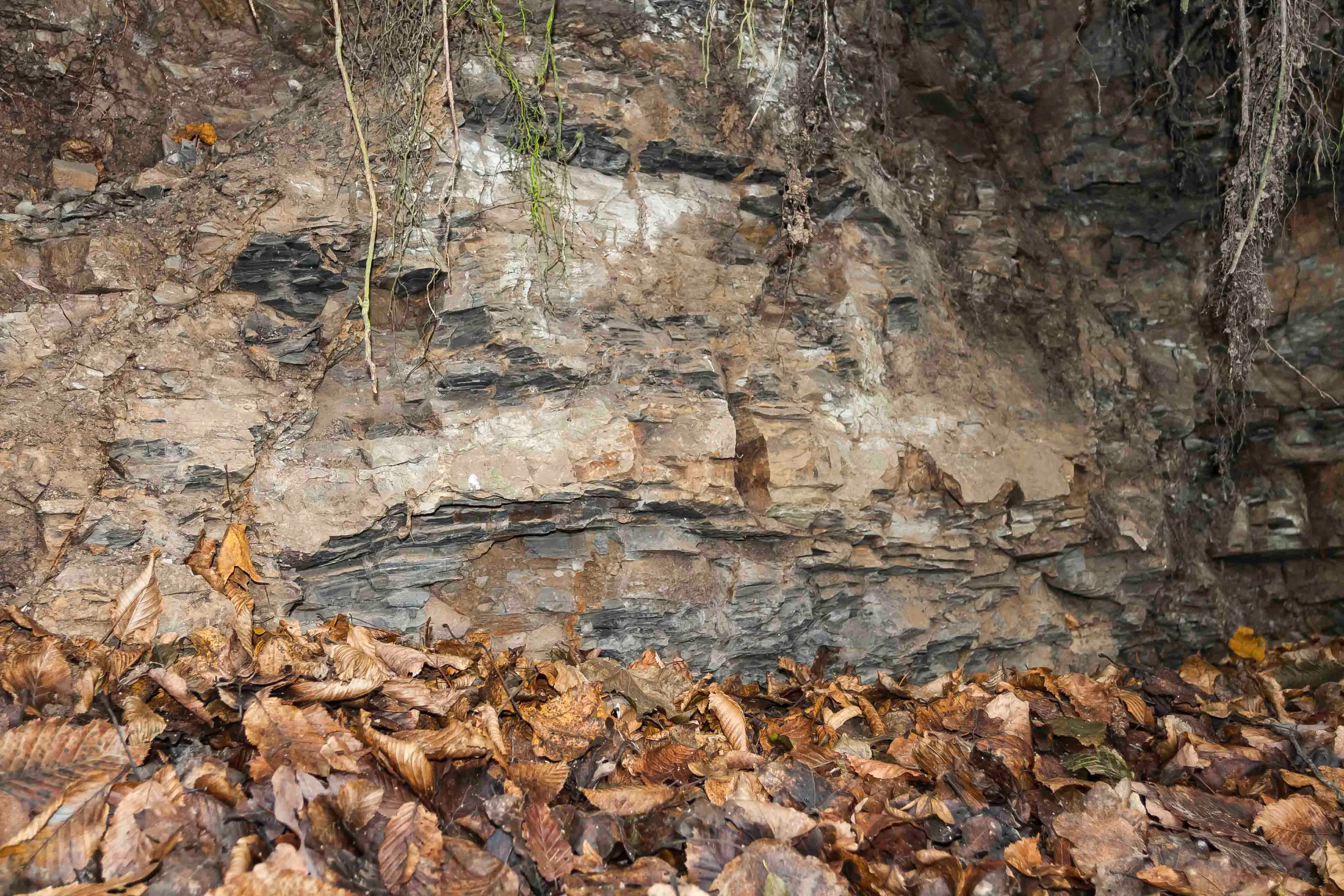
A close up view of layered sedimentary rock strata, with a thick layer of brown fallen autumn leaves covering the ground in the foreground and tree roots hanging from the top.
Exposed rock layers at the Rybičková skála paleontological site.

Rybičková skála history and protected-area timeline

The geological foundations of Rybičková skála reach far back into deep time. The Boskovice Furrow, of which the site is a part, began forming in the Precambrian and experienced its most significant tectonic movements at the close of the Variscan orogeny in the late Carboniferous and early Permian. The exposed cliff thus preserves sediments deposited in the aftermath of one of Europe's defining mountain-building events.

Human presence in the surrounding landscape is documented from the Neolithic period, with occasional stone tools suggesting earlier Paleolithic visits by hunters. In the 1880s, scientists working at the cliff recognized large numbers of fossil fish remains preserved in the layered sediments, and the locality took on the nickname from which its present name derives. The site was already scientifically known to the geologist Dionýz Štúr, who visited in 1860. By the late twentieth century, the locality was considered important enough to warrant formal protection, and on 11 December 1980 the Okresní národní výbor Brno-venkov declared Rybičková skála a natural monument over an area of roughly 0.05 hectares.

In 2002, new collecting work in the vicinity produced roughly 200 additional specimens of ray-finned fish, reaffirming the site's continued importance for paleontological research. The adjacent Oslavany area has its own industrial history: coal mining began here in 1760, and the region later hosted one of the largest early power stations of Austria-Hungary, fueled by local coal seams.

Rybičková skála landscape and geographic character

Rybičková skála is defined less by sweeping scenery than by a single, dramatic geological exposure. The protected cliff stretches about 40 meters along the left bank of the Neslovický stream, rising roughly 13 meters above the surrounding terrain at elevations between 305 and 320 meters above sea level. The face itself has the character of a quarry wall, a reminder that the present-day exposure was shaped in part by historical extraction.

Around the cliff, the wider landscape is gently rolling Moravian countryside. Forest cover includes mixed oak-hornbeam woodland with sessile oak and hornbeam dominating, accompanied by wild service tree, wild cherry, ash, and sycamore and Norway maples. Where soil conditions become richer, conifers such as silver fir and Norway spruce appear, along with broadleaf species typical of the Hercynian phytogeographical region. Outside the wooded patches, the surface is a mosaic of meadows, fields, and permanent crops that frame the geological exposure in a quiet agricultural setting.

The broader regional context is the Boskovice Furrow, an elongate geological depression known for both its late Paleozoic sediments and its later role as a center of coal mining in the Rosicko-oslavanská pánev. The combination of forest, farmland, and immediately adjacent fossil-bearing rock gives Rybičková skála a layered sense of place where geological history, ecology, and traditional land use all meet within a very small area.
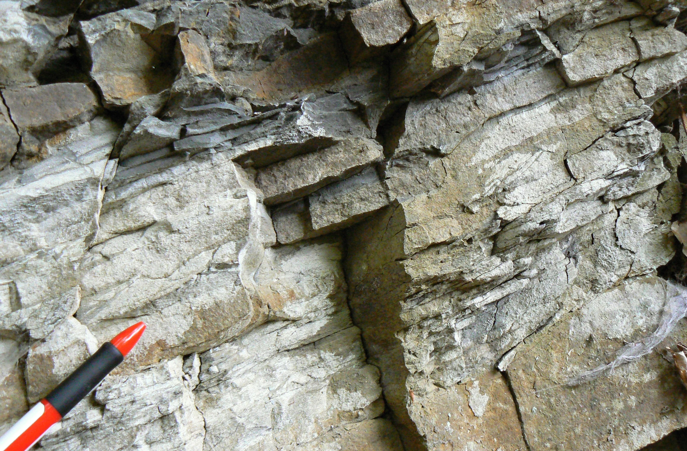
A close up view of layered grey and tan sedimentary rock with a red pen in the foreground for scale.
Layered sedimentary rock formations showing potential fossil-bearing strata at the Rybičková skála site.

Rybičková skála ecosystems, habitats, and plant life

Although Rybičková skála is best known for its fossils rather than its living wildlife, the natural monument sits within a biologically diverse patch of central European woodland. The forest is dominated by deciduous and mixed forest types, especially oak-hornbeam associations. Sessile oak and common hornbeam form the backbone of the canopy, while wild service tree, wild cherry, ash, sycamore maple, and Norway maple contribute diversity at the edge of richer soils. Silver fir and Norway spruce appear locally as conifer elements in the surrounding woodland.

The understory and ground layer carry species typical of the Hercynian forest system, including liverwort, greater stitchwort, purple cyclamen, hairy sedge, and wood spurge. The ecological mix supports both woodland interior species and more open-ground assemblages, reflecting the transitional character of the protected site where forest, meadow, and field meet.

Animal life associated with the area reflects the warm, dry, and semi-open aspects of the locality, with thermophilic, steppe, and forest-steppe fauna present in suitable microhabitats. Open and edge habitats host invertebrates such as the saddle-backed bush-cricket, while amphibians such as the fire salamander occasionally appear, with the alpine newt being more regularly recorded. The mix of woodland and edge environments around the cliff provides nesting and foraging habitat for several bird species and supports larger mammals that move through the forest mosaic from the wider Oslavany countryside.
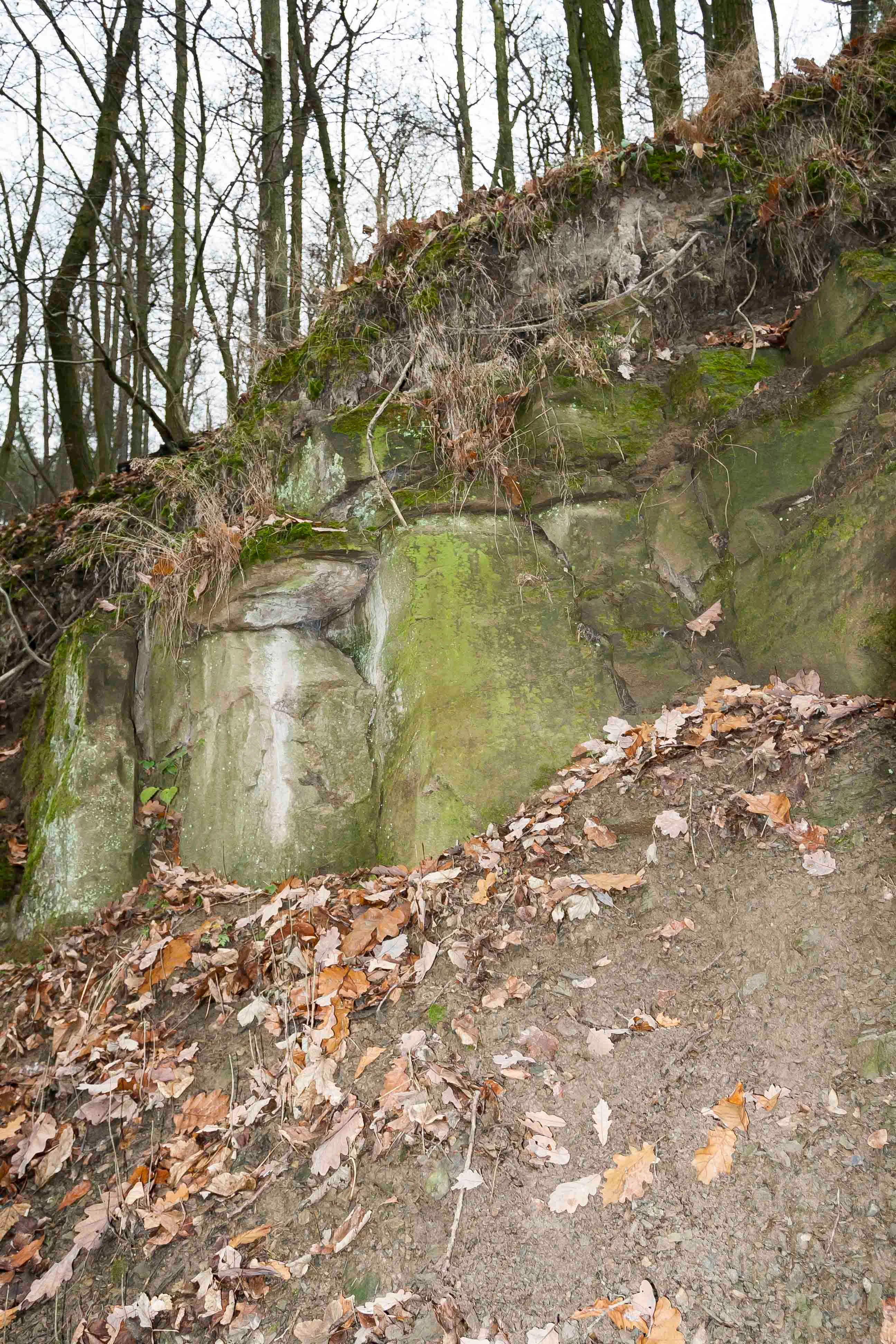
A close up view of a mossy rock outcrop at Rybičková skála, with a dirt slope covered in fallen dry leaves in the foreground and bare trees in the background.
The Rybičková skála rock formation in a woodland setting.

Rybičková skála wildlife and species highlights

Rybičková skála supports wildlife communities shaped by warm, dry, and partly open conditions rather than typical closed-canopy forest. The invertebrate fauna includes thermophilic species adapted to steppe-like microhabitats, with the saddle-backed bush-cricket, Ephippiger ephippiger, among the characteristic insects of the locality. The largely undisturbed forest around the cliff continues to harbor amphibians such as the fire salamander, Salamandra salamandra, though only rarely, and the more common alpine newt, Triturus alpestris.

Birds recorded in the area include the hobby, Falco subbuteo, a fast-flying falcon of open woodland and forest edges, the black stork, Ciconia nigra, a species sensitive to mature mixed forest with quiet foraging streams, and the Eurasian woodcock, Scolopax rusticola, associated with humid broadleaf woodland. Among larger mammals, wild boar, Sus scrofa, and red deer, Cervus elaphus, are the most commonly encountered species, moving through the oak-hornbeam stands and adjoining agricultural land. Together, these animal communities give the small protected site a meaningful wildlife character that complements its geological significance.
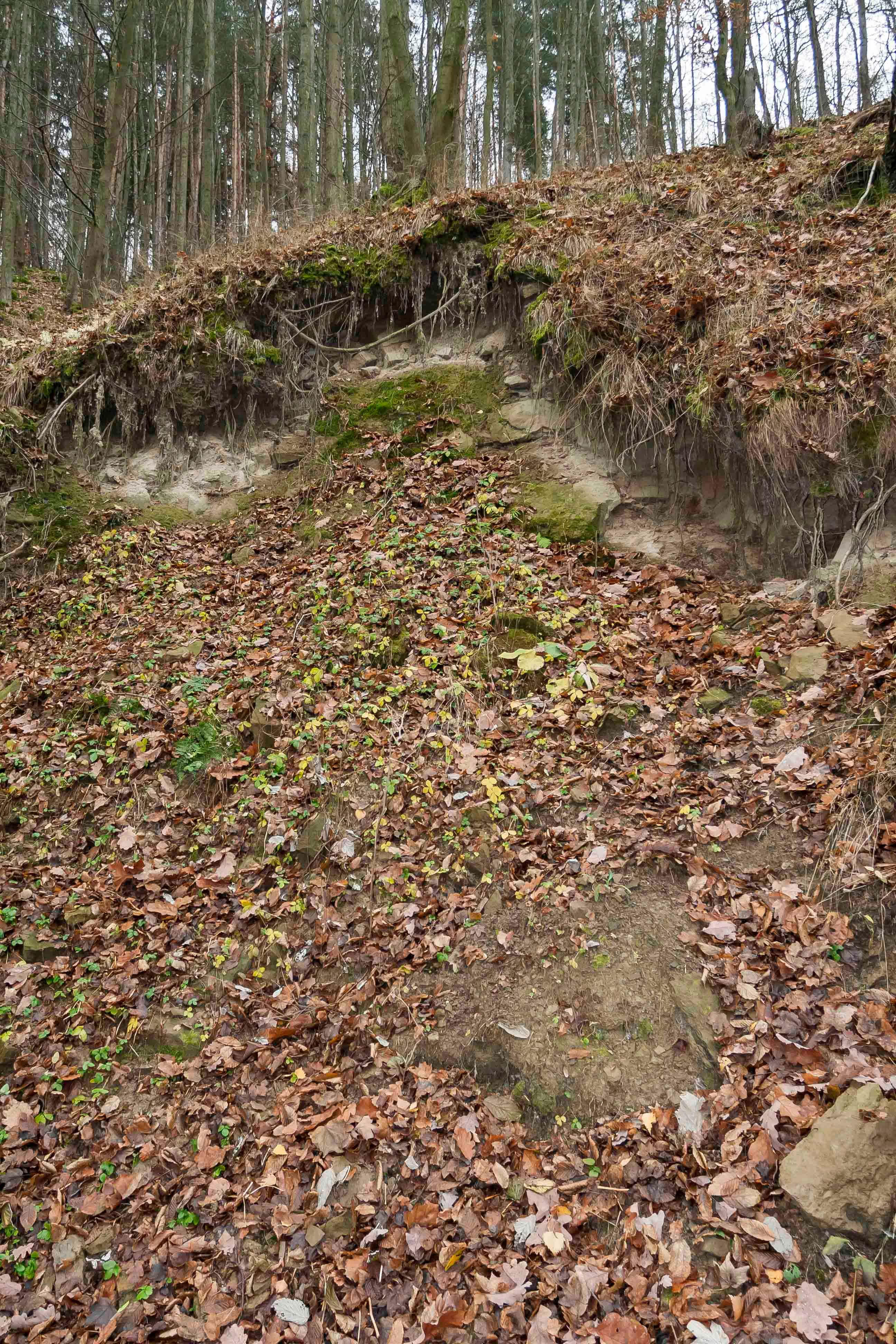
A sloped, wooded hillside showing exposed rocky soil covered in fallen autumn leaves.
A view of the rock formation at the Rybičková skála nature reserve, known for its paleontological significance.

Rybičková skála conservation status and protection priorities

Rybičková skála was designated a natural monument in 1980 primarily to safeguard its paleontological heritage. The formal aim of protection is to ensure that the surrounding woodland is managed in a way that maintains a natural species composition appropriate to the site's conditions, preserving the integrity of the forest environment that frames the fossil-bearing cliff.

Beyond preserving the outcrop itself, the protection status helps retain connectivity between the wooded slopes above the Neslovický stream and the broader forest mosaic of the Oslavany area. By restricting disruptive changes in land use around the small core area, the site contributes to maintaining habitat continuity for forest-steppe species, thermophilic invertebrates, and larger forest mammals that depend on a stable mix of woodland and open ground.

The site's broader conservation relevance lies in its role as a reference locality within the Boskovice Furrow, a geological structure of regional importance whose late Paleozoic sediments support comparative studies across central Europe. Continued protection of Rybičková skála therefore safeguards not only a small cliff but also a benchmark for understanding the fossil record of the Czech Massif.

Rybičková skála cultural meaning and human context

The cultural dimension of Rybičková skála is inseparable from its industrial and scientific surroundings. Although the protected outcrop itself is modest, it sits within the Oslavany coal-mining region, where extraction has been documented since 1760. The broader Rosicko-oslavanská pánev shaped local identity for centuries, supporting not only deep mining but also the construction of one of the largest early electrical power stations of Austria-Hungary, a landmark of regional industrial history.

The site also carries a strong geoscientific heritage. Paleontologists have worked the locality since at least 1860, when Dionýz Štúr visited, and the discovery of abundant fish fossils in the 1880s gave the cliff its enduring name. Continued collecting, including the recovery of roughly 200 ray-finned fish specimens in 2002, has kept the site active in regional paleontological research.

Archaeological finds in the surrounding landscape, ranging from Neolithic occupation traces to possible Paleolithic stone tools, place the broader area within the long human history of southern Moravia. The protected monument today functions as a small but meaningful node where the region's geological past, its industrial era, and its living rural landscape come together.
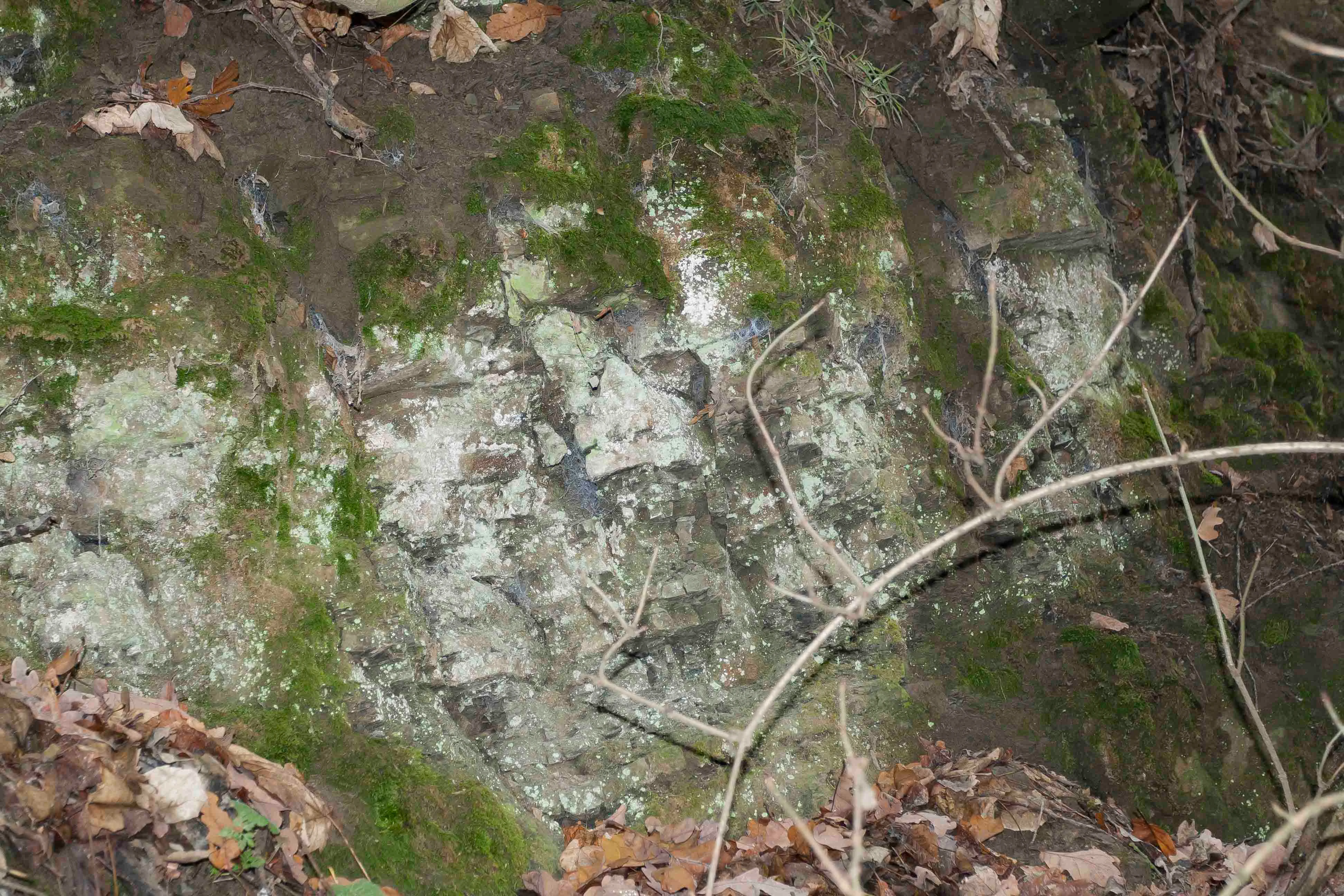
A close up view of a mossy, light colored rock outcrop embedded in a forest floor with scattered brown leaves.
The rock formation at Rybičková skála nature reserve, known for its significant paleontological deposits.

Top sights and standout views in Rybičková skála

Rybičková skála stands out as one of the most compact yet fossil-rich protected sites in the South Moravian Region. Its defining qualities are the 40 meter former quarry wall exposing Permian lake-bed sediments of the Padochov Formation, the wealth of late Paleozoic fish fossils of the family Aeduellidae, and the broader geological context of the Boskovice Furrow. The site is also notable for its accessibility, lying directly on a green hiking trail between Oslavany and Neslovice, and for its cultural setting amid the historical coal-mining landscape of the Rosicko-oslavanská pánev.

Best time to visit Rybičková skála

Rybičková skála is a small geological site rather than a weather-dependent park, so it can be visited at any time of year. Spring and early autumn are especially pleasant, when mild temperatures make it easy to examine the rock face and walk the green trail linking Oslavany, Neslovice, and Padochov through mixed woodland. Summer offers lush forest conditions, though warm weather can also bring higher insect activity around the cliff, while winter visits reveal the structure of the fossil-bearing layers against a more open, leafless landscape.

Monthly climate preview

Long-term representative temperature ranges and monthly precipitation patterns for Rybičková skála

Rybičková skála Climate Normals and Measured Annual Weather by Month

Historical NASA POWER records from 1991 to 2020 outline the measured temperature progression and monthly precipitation rhythm across a representative coordinate at Rybičková skála. Detailed monthly climate normals provide deeper analytical context for the annual thermal and moisture cycle at this location.
Annual mean9 °C
-3 °C20 °C
Jan-3°
Feb-1°
Mar
Apr
May14°
Jun18°
Jul20°
Aug20°
Sep15°
Oct
Nov
Dec-2°
Warmest month
July

20.4 °C

Coolest month
January

-2.8 °C

Wettest month
June

2.5 mm/day

Driest month
February

1 mm/day

Park location guide

Geography guide, regional context, and park location map for Rybičková skála

Rybičková skála park geography, regions, and map view in Czechia

Understand where Rybičková skála sits in Czechia through a broader geographic reading of the surrounding landscape, nearby location context, and its mapped position within the national park landscape.

How Rybičková skála fits into Czechia

Czech Republic is a landlocked Central European country with a population of approximately 10.9 million people. The nation was established as an independent state on January 1, 1993, following the dissolution of Czechoslovakia. Its capital and largest city is Prague, with other major urban centers including Brno, Ostrava, Plzeň, and Liberec.

Wider geography shaping Rybičková skála in Czechia

The Czech Republic is a landlocked country in Central Europe. It is bordered by Germany to the west, Austria to the south, Poland to the northeast, and Slovakia to the southeast. The landscape is predominantly hilly, with the territory covering 78,871 square kilometers.

Map view of Rybičková skála

Use this park location map to pinpoint Rybičková skála in Czechia, understand its exact geographic position, and read its mapped placement within the surrounding landscape more clearly.

Pigeon | © OpenStreetMap contributors

Location context for Rybičková skála

Jihomoravský kraj

Explore detailed imagery of the protected cliff, surrounding woodland, and Moravian field mosaic

Rybičková skála Photos and Geological Landscapes: Visualizing the Fossil-Rich Quarry Exposure

Visual records capture the dramatic rock face and surrounding oak-hornbeam woodlands that define the protected environment. Examining these detailed photographs helps researchers and visitors understand the geological terrain and regional ecosystem more clearly.

A close up view of layered sedimentary rock strata, with a thick layer of brown fallen autumn leaves covering the ground in the foreground and tree roots hanging from the top.

A close up view of a mossy rock face covered in fallen brown leaves with trees growing at the top.

A close up view of layered grey and tan sedimentary rock with a red pen in the foreground for scale.

A close up view of a mossy rock outcrop at Rybičková skála, with a dirt slope covered in fallen dry leaves in the foreground and bare trees in the background.

A sloped, wooded hillside showing exposed rocky soil covered in fallen autumn leaves.

A sloped forest floor covered in fallen autumn leaves with exposed rocky soil and moss patches at the base of a treed ridge.

A close up view of a mossy, light colored rock outcrop embedded in a forest floor with scattered brown leaves.

Park atlas

Compare regional protected landscapes and geological formations across South Moravia

Other Parks and Protected Areas Near Rybičková Skála

Browsing other protected areas near Rybičková skála helps place local paleontological reserves within a wider regional network of natural monuments. Expanding the geographic view allows visitors to compare surrounding geological formations and woodland ecosystems across the Boskovice Furrow.
A horizontal watercolor illustration showing rolling green hills and meadows against a soft, pale background, with trees and soft light.
Protected landscapeBrno-venkov District
About 4.3 km away#1 closest

East

Přírodní park Bobrava Protected Landscape: Geography and Regional Mapping

South Moravian forest and river valley terrain

Přírodní park Bobrava represents an unbroken, forest-heavy landscape situated in the Brno-venkov District. Characterized by its deep river valleys and hilly ridges, this protected territory functions as a crucial natural mosaic of woodlands and meadows, providing a quiet highland retreat that remains distinct from the surrounding urban expansion of the city of Brno.

Area
30.9 km²
Established
1982
Relief
Upland
Climate
Temperate
Protected landscapeBrno-venkov District
About 14 km away#2 closest

North

Přírodní park Údolí Bílého potoka: Protected Landscape in the South Moravian Region

Forested stream valley geography and upland terrain mapping

This protected area centers on the deep, forested valley of the Bílý potok stream. It features a rich mosaic of beech-fir and oak-pine forests on rocky slopes, representing a significant ecological corridor in the agricultural landscape northwest of Brno within the Brno-venkov District.

Area
40.46 km²
Established
1978
Relief
Upland
Climate
Temperate
Natural monumentJihomoravský kraj
About 15 km away#3 closest

Northeast

Skalky u Přehrady: Protected Natural Monument and Mapped Landscape in Jihomoravský kraj

Ecologically significant forest steppe and river gorge terrain

Skalky u Přehrady is a protected natural monument characterized by its rugged diorite cliffs and diverse plant communities. The site serves as a compact example of forest steppe mosaic situated along the Svratka River, offering significant insight into the regional geography and conservation status of rocky slopes within the South Moravian territory.

Area
0.013 km²
Established
1989
IUCN
IV
Relief
Upland
A soft watercolor illustration showing a landscape with rolling hills in the background, a cluster of green trees, and a rocky outcrop on the right side.
Natural monumentJihomoravský kraj
About 15 km away#4 closest

Northeast

Na Skalách Natural Monument: A Protected Limestone Landscape in the South Moravian Highlands

Geographic study of relict oak woodland and cliffside terrain.

Na Skalách stands as a vital natural monument within Jihomoravský kraj, preserving a steep, south-facing limestone slope along the Svratka River gorge. This compact area offers a window into thermophilic oak forest communities and calcareous rock vegetation, showcasing high botanical value and geological diversity despite its small surface area.

Area
0.01 km²
Established
1991
IUCN
IV
Relief
Upland
Nature reserveJihomoravský kraj
About 15 km away#5 closest

Southwest

Velký kopec Nature Reserve: A Detailed Map and Geography Overview for South Moravia

Protected dry grasslands and landscape terrain in Jihomoravský kraj

Velký kopec is a protected nature reserve in the Znojmo district, characterized by its rounded hill profile and rich acidophilous dry grassland habitat. This geographic overview highlights the site's role as a biodiversity refuge, its metamorphic geology, and the ongoing conservation efforts that sustain its rare steppe-like flora and butterfly populations within the Jevišovice hills.

Area
0.259 km²
Established
2023
IUCN
IV
Relief
Upland
A horizontal watercolor painting showing rolling green hills with small patches of trees under a soft, pale sky.
Natural monumentJihomoravský kraj
About 18 km away#6 closest

Northeast

Medlánecké kopce Natural Monument: Exploring Protected Steppe Habitats in Northern Brno

A rare mosaic of dry grasslands and rocky outcrops in Jihomoravský kraj

Medlánecké kopce preserves a critical landscape of thermophilic flora and insect communities on the edge of the Brno basin. The site is noted for its xerothermic vegetation, including the large-flowered pasqueflower, which thrives on its unique metabasite and loess soil composition. This protected area offers a look at how specialized steppe ecosystems persist within a heavily developed regional environment.

Area
0.118 km²
Established
1988
IUCN
IV
Relief
Upland
A soft watercolor painting showing a rolling landscape with hills, scattered trees, and rocky outcrops, rendered in pastel greens and pinks.
Natural monumentBrno
About 18 km away#7 closest

Northeast

Medlánecká skalka Natural Monument: Mapped Protected Landscapes and Geography in Brno

A rare urban-adjacent steppe and rocky habitat site

Medlánecká skalka is a protected natural monument located in the Medlánky district of Brno, Czech Republic. Spanning a small but significant rocky slope, this site preserves thermophilous dry-grassland communities and essential habitats for rare flora like the Pulsatilla grandis. Its unique topography and skeletal soil composition make it an important geographic reference point for understanding steppe-like ecosystems in the South Moravian region.

Area
0.003 km²
Established
1999
IUCN
IV
Relief
Upland
A minimalist watercolor illustration showing rolling green hills and a few trees against a pale yellow and pink background.
Protected landscapeCzechia
About 18 km away#8 closest

Northeast

Přírodní park Baba: A Detailed Geographic Overview of this Czech Protected Landscape

Forested ridges and centuries-old oak woodland topography

Přírodní park Baba is a protected area in Czechia characterized by a continuous six-kilometer ridge rising above the surrounding urban landscape of Brno. This site is defined by its deep-rooted, century-old sessile oak stands and an intricate mosaic of meadows supporting rare orchid species and diverse avian life. Its geological foundation, composed of Paleozoic diorite, supports a resilient ecosystem that serves as a vital natural corridor between Brno and Kuřim.

Area
8.89 km²
Established
1990
Relief
Mountain
Climate
Temperate

Common questions about visiting, size, designation, and location context for Rybičková skála

Rybičková skála FAQs for park facts, access, geography, and protected area context

Find quick answers about Rybičková skála, including protected-area facts, park geography, trail and visitor context, and how the park fits into its surrounding country and regional landscape.
MoriAtlas Explorer

Continue Your Protected Areas Search Across the Global Atlas

Deepen your exploration by continuing the structured search for national parks and protected areas worldwide. Utilize the comprehensive filtering capabilities to compare different conservation landscapes and refine your understanding of global park geography. Discover more about the distribution and characteristics of protected natural areas.

Global natural geography