
Why Geopark Karawanken stands out
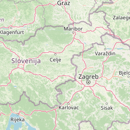
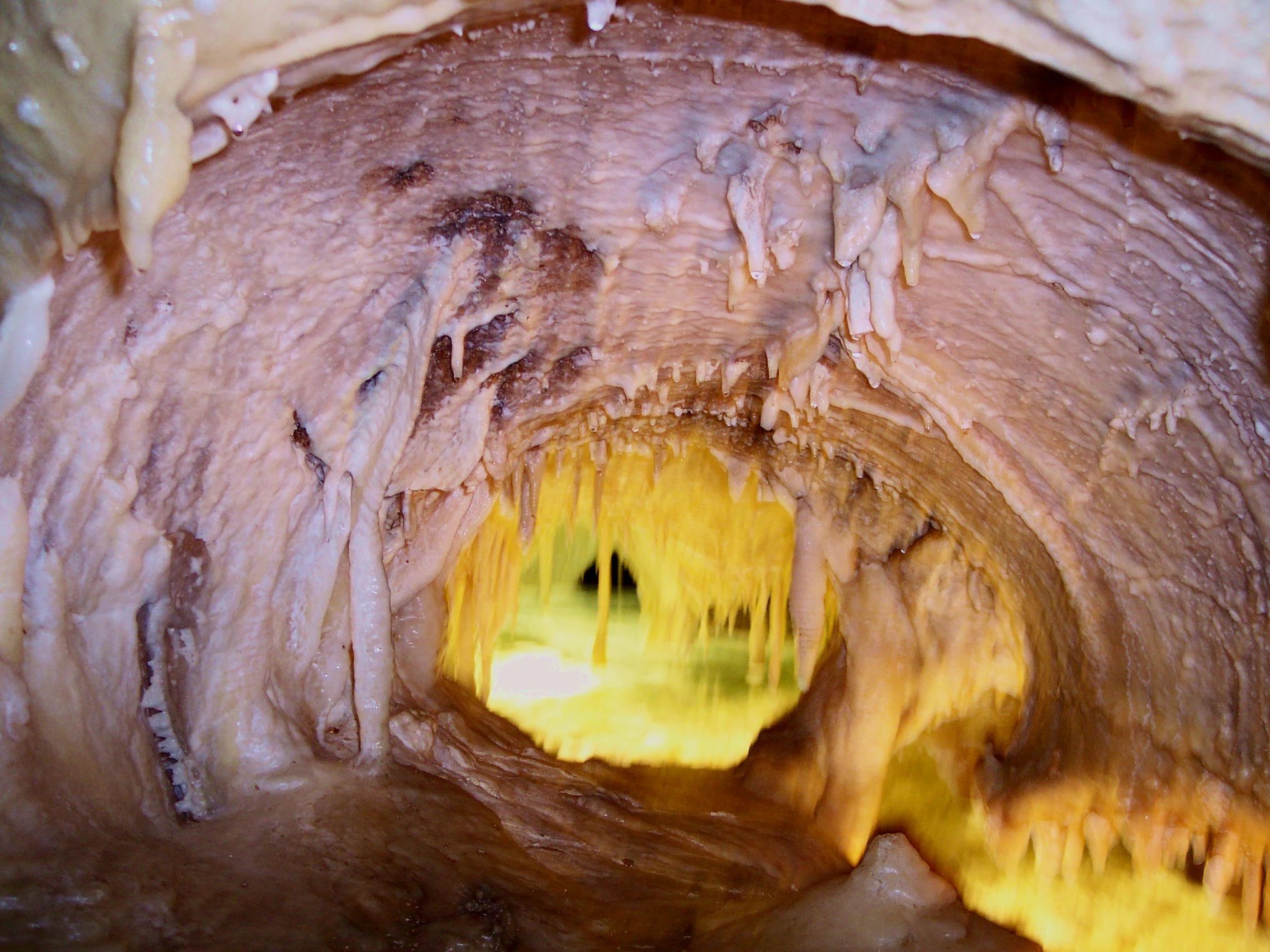
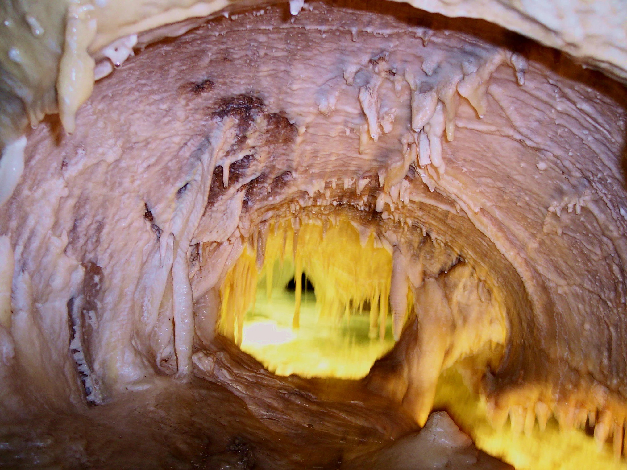
Geopark Karawanken is best known for the geological contact zone along the Periadriatic Seam, where several tectonic plates meet and produce the deep valleys that define the Karawanks landscape. This tectonic setting gives the park a remarkably visible geological record, exposing the rock formations and structural features that tell the story of the mountain range's formation. Within this setting, the park features several signature sites. The Obir Dripstone Caves, discovered during tunnel construction, offer underground views of karst formations, while the Trögern Gorge near Bad Eisenkappel showcases the erosive power of mountain streams. The former Mežica mine, where the mineral wulfenite can still be found, now serves tourism and education. Together, these features make the park a showcase for alpine geology and the overlap of mining heritage with natural landscape.
Geopark Karawanken history and protected-area timeline
The vision for a transboundary protected area in the Karawanks region dates back to the 1960s, when the Austrian-Slovenian botanist and conservationist Angela Piskernik proposed the creation of a cross-border nature park linking the natural and cultural landscapes on both sides of the border. Her early efforts anticipated the kind of international cooperation that would later define the geopark.
The modern history of the park is closely linked to the region's industrial past. Lead, zinc, iron, and coal mining shaped local economies and communities long before the geopark was established. The closure of many mines gradually shifted the regional economy toward tourism, conservation, and education, creating the conditions in which the mining heritage could be reinterpreted as a cultural and geological resource.
A milestone came in 2013, when Geopark Karawanken was admitted to the UNESCO Global Geoparks Network, formalizing its international significance. Visitor information centers in Bad Eisenkappel and Mežica were established to support the park's educational and tourist infrastructure. In 2016, the Austrian municipalities within the park publicly opposed the construction of a border fence linked to the European migrant crisis, underscoring the geopark's role as a symbol of cross-border understanding and cooperation between the German- and Slovenian-speaking populations of the region.
Geopark Karawanken landscape and geographic character
The landscape of Geopark Karawanken is defined by the dramatic relief of the Karawanks mountain range. Sharp ridges and steep slopes rise from deeply incised valleys, creating a classic alpine topography shaped by tectonic uplift and long-term erosion. The highest summits within the park are Hochobir, Petzen, and Koschuta, each contributing distinctive massifs that frame the valleys below.
The exceptionally deep valleys, known locally as Gräben, are among the park's most prominent landscape features. These valleys owe their depth to the tectonic activity along the Periadriatic Seam, where multiple plates meet and fracture the bedrock, accelerating erosion. The result is a landscape of strong vertical contrast, with sheltered valley floors sitting beneath towering mountain faces.
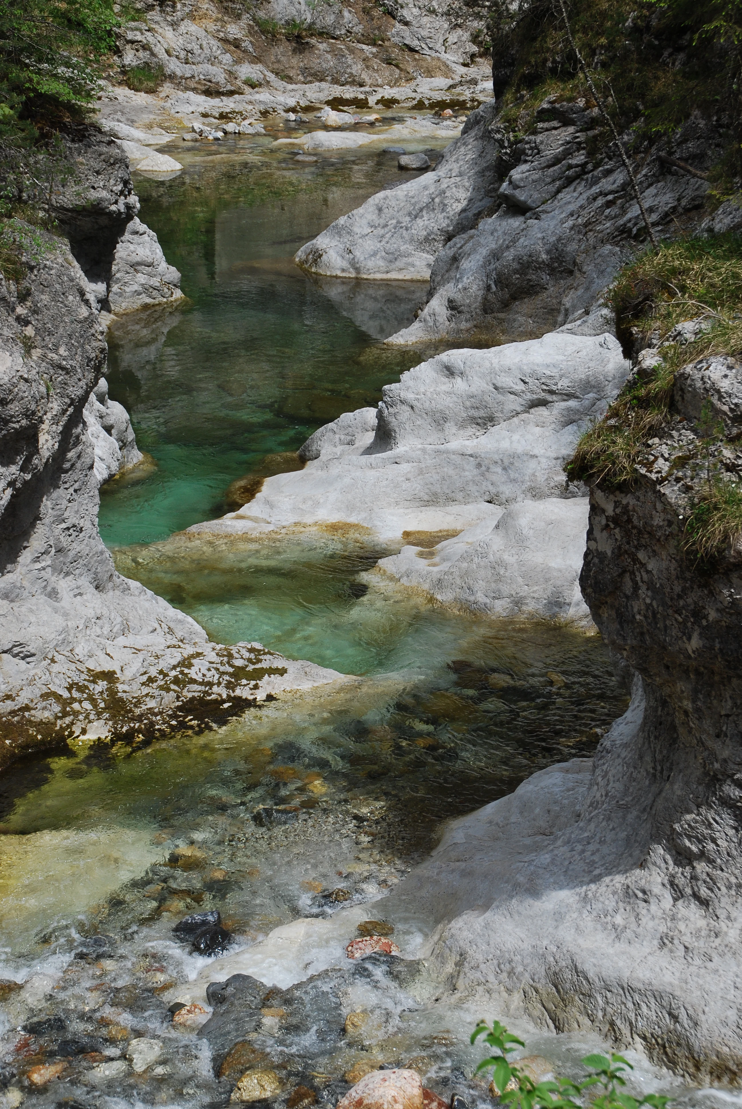
Water has played a significant role in shaping the visible terrain. The Trögern Gorge near Bad Eisenkappel is carved by the Trögern creek, which cuts through bedrock to form narrow, steep-walled sections of canyon. Springs such as the Muri Spring add hydrological variety to the landscape, releasing iron-rich water that has its own geological and cultural significance. Together, these features give the park a varied surface geography that combines high peaks, deep valleys, gorges, cave systems, and mineral springs.
Geopark Karawanken ecosystems, habitats, and plant life
The geopark's natural environment reflects the climatic and topographic diversity of the Karawanks. Elevation differences from valley floors to alpine peaks produce a gradient of habitats that supports varied vegetation communities, ranging from forest associations on the lower slopes to alpine meadow and rock communities higher up. The deep valleys create localized microclimates that further diversify ecological conditions within the park.
Beyond its geology, the park also encompasses important natural monuments and ecologically significant sites. The karst environment of the Obir Dripstone Caves represents a distinct underground ecosystem, while the gorge microclimates along streams like the Trögern creek support specialized riparian and shaded habitats. The combination of mineral-rich springs, forest cover, and alpine zones gives the park an ecological richness that complements its geological prominence.
This ecological setting is closely tied to the park's identity as a landscape shaped by both natural processes and human activity. Past mining has left lasting traces on terrain and water systems, while traditional land use and forestry continue to influence habitat patterns. The geopark's ecological character therefore reflects both the underlying geology and the long history of human presence in the Karawanks.
Geopark Karawanken wildlife and species highlights
The varied habitats of the Karawanks support a typical Eastern Alps wildlife community. Forest environments on the valley slopes provide habitat for deer and other ungulates, while the higher alpine zones offer space for species adapted to rugged terrain and seasonal conditions. Birds of prey are associated with the cliffs and open ridges above the valleys.
Streams, springs, and karst environments contribute additional ecological niches. The iron-rich Muri Spring and the stream corridors of the Trögern Gorge sustain distinctive aquatic and riparian communities, while cave systems such as the Obir Dripstone Caves host specialized fauna adapted to underground conditions. The mosaic of habitats across elevation and moisture gradients gives the park a wildlife profile characteristic of borderland alpine regions between Austria and Slovenia.
Geopark Karawanken conservation status and protection priorities
As a UNESCO Global Geopark since 2013, Geopark Karawanken holds recognized international significance for the protection and interpretation of geological heritage. Its inclusion in the Global Geoparks Network highlights the value of the Periadriatic Seam as a natural laboratory for understanding plate tectonics in the Eastern Alps, as well as the importance of preserving the region's caves, gorges, mineral springs, and mining remnants.
The conservation approach in the park combines geological protection with broader landscape and cultural preservation. Mining heritage is actively reinterpreted through educational tourism, as seen in the former mine at Mežica, allowing industrial history to be preserved and communicated rather than erased. Natural monuments, archaeological sites, and protected ecological areas within the park's boundaries further expand its conservation scope.
Cross-border cooperation forms a central pillar of the park's conservation model. By linking fourteen municipalities across the Austrian-Slovenian border, the geopark demonstrates how shared geological heritage can foster joint environmental management. The park's history, including the 2016 opposition to a border fence by its Austrian municipalities, illustrates how conservation in the Karawanks is intertwined with the broader goal of maintaining ecological and cultural continuity across the border.
Geopark Karawanken cultural meaning and human context
Geopark Karawanken sits at the meeting point of two linguistic and cultural traditions: the German-speaking communities of Carinthia in Austria and the Slovenian-speaking communities on the southern side of the range. The park's fourteen participating municipalities reflect this dual identity and frame the geopark as much as a cultural bridge as a geological site.
The region's industrial past has shaped local identity for generations. Lead, zinc, iron, and coal mining provided economic foundation, and former mining communities have transitioned into centers of geological education and tourism. Sites such as the Obir Dripstone Caves, the Trögern Gorge, and the Mežica mine are woven into local memory and folklore, carrying both practical and symbolic meaning.
Archaeological sites within the park extend this cultural depth further into prehistory, while the geopark's cross-border mission has become itself a cultural statement. The 2016 resistance by Austrian geopark municipalities to a planned border fence showed how strongly local communities associate their landscape with openness and cooperation between neighbors, making the geopark a symbol of regional identity as well as a tool of nature and heritage protection.
Top sights and standout views in Geopark Karawanken
Among the park's standout features are the Obir Dripstone Caves, the Trögern Gorge near Bad Eisenkappel, the iron-rich Muri Spring, and the former mining complex at Mežica, where the mineral wulfenite can still be encountered. Each site reflects a different facet of the Karawanks' geological and cultural character, from underground karst processes to surface erosion and industrial heritage.
The park's broader appeal lies in its cross-border scale and the depth of its geological story. The convergence of tectonic plates along the Periadriatic Seam has produced a landscape of deep valleys, exposed rock formations, and high peaks such as Hochobir, Petzen, and Koschuta. Coupled with a network of visitor information centers and a UNESCO designation, these features make Geopark Karawanken both an accessible destination and a significant reference point for understanding alpine geology in Europe.
Best time to visit Geopark Karawanken
The Karawanks are best explored from late spring through early autumn, when snow has receded from higher elevations, trails through the gorges and valleys are fully accessible, and the alpine meadows are at their most visible. Summer offers long daylight hours and stable conditions for visiting the Obir Dripstone Caves, the Trögern Gorge, and the higher viewpoints around Hochobir, Petzen, and Koschuta.
Autumn brings quieter conditions and clearer visibility across the ridges, while the cooler temperatures make cave and gorge visits especially pleasant. Winter transforms the park into a snow-covered landscape, but high-altitude routes and some geological sites may be harder to access, making the park better suited to broader scenic appreciation during the colder months. Visitors interested in educational programs, visitor centers, and guided tours will generally find the broadest range of activities from late spring through autumn.