Mori Atlas logo
Nearby park discovery

Explore the geographic distribution of protected lands near this alpine geological landmark.

Regional Protected Areas and Landscapes Surrounding Geopark Karawanken, Austria

Examine the regional geography and proximity of various protected areas located near Geopark Karawanken. This resource provides a spatial overview of nearby protected landscapes, helping you visualize the concentration of protected terrain and geological features within the surrounding Karawanks mountain context.

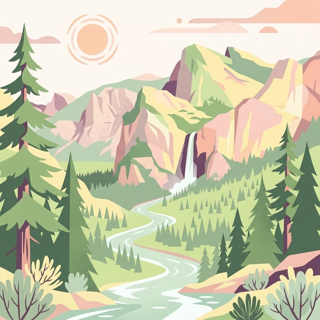
A flat-style digital illustration of a mountainous landscape featuring evergreen trees, a winding river, a central waterfall, and a bright sun in the sky.

A cross-border UNESCO Global Geopark in the Karawanks mountains of Austria and Slovenia.

Geopark Karawanken

Geopark Karawanken is a cross-border geological park that spans the Karawanks mountain range between Austria and Slovenia. Covering roughly 1,067 square kilometers across fourteen participating municipalities, it brings together a striking alpine landscape with deep valleys, mineral-rich formations, caves, gorges, and former mining sites. The park was admitted to the UNESCO Global Geoparks Network in 2013, recognizing its outstanding geological heritage and its role in showcasing the dynamic tectonic contact zone that shapes the range. The area's geology is shaped by the convergence of several tectonic plates along the Periadriatic Seam, producing deep-cut valleys and dramatic exposures of rock strata. This geological character underpins the park's principal attractions, including the Obir Dripstone Caves, the Trögern Gorge, the iron-rich Muri Spring, and the former lead-zinc mine at Mežica. Beyond its geological interest, the geopark functions as an ecotourism and cross-border cooperation initiative. It highlights the shared natural and mining history of German- and Slovenian-speaking communities in the region, while serving as an educational platform for understanding the landscape, ecological heritage, and the cultural ties that link the two sides of the border.

Location
Austria
Park type
Protected area
Established
2013
Area
1,067 km²
Geopark Karawanken Protected Area Map
Regional park map

See the ranked park cluster in its geographic setting

Nearby parks around Geopark Karawanken

This regional map shows the same 20 nearby parks ranked below around Geopark Karawanken. Select a ranked marker to highlight that park’s boundary where boundary data is available.
Reference park: Geopark KarawankenRanked nearby park20 nearby parks shown
20 nearby parks

Distance ranked regional park geography and surrounding protected landscapes

Parks and Protected Areas Geographically Near Geopark Karawanken

Geographic separation metrics establish a ranked collection of protected areas surrounding Geopark Karawanken for comparative regional analysis. Country context and recorded environmental data highlight broader patterns across neighboring alpine terrain and adjacent protected territory.
Watercolor illustration of a river flowing through a forested valley with mountains in the background
National parkSlovenia
About 49 km away#1 closest

West

Triglav National Park: A Mapped Alpine Protected Landscape in Slovenia

Julian Alps geography, glacial lakes, and karst terrain.

Triglav National Park is Slovenia's premier protected area, covering 880 square kilometers of the Julian Alps. This page details its dramatic alpine geography, including Mount Triglav, glacial valleys, and significant karst features. Understand the mapped boundaries and landscape context of this national park, a key entry in the MoriAtlas geographic discovery resource for understanding protected lands.

Area
880 km²
Established
1981
IUCN
II
Visitors
1.6M annual
Protected areaStyria
About 53 km away#2 closest

North

Zirbitzkogel Protected Area: Mapping the Alpine Landscapes and Glacial Terrain of the Seetal Alps

High mountain geography and protected terrain in Styria, Austria

Zirbitzkogel represents the highest point of the Seetal Alps, characterized by crystalline geology, slate, and gneiss. The landscape features a clear progression from subalpine spruce and larch forests to broad, level summit plateaus covered in ragged sedge grasslands. Beyond its alpine vegetation and glacial tarns, the area serves as a critical protected habitat for diverse alpine fauna, offering an ideal setting for understanding regional alpine ecology and complex mountain landforms.

Established
2006
Relief
Mountain
Climate
Alpine
Access
Easy access
A soft watercolor painting of a wetland landscape featuring green meadows, gentle rolling hills, and a river flowing through the scene.
Nature reserveSlovenia
About 65 km away#3 closest

South

Naturreservat Iški morost: Protected Nature Reserve and Wetland Landscape in Central Slovenia

Mapped protected wetlands of the Ljubljana Marsh region

Naturreservat Iški morost serves as a primary conservation site for the distinct wet meadow habitats of the Ljubljana Marsh. This reserve demonstrates the intersection of wetland geography and bird conservation, protecting a crucial, coherent landscape that is rare in contemporary Slovenian lowlands.

Area
0.65 km²
IUCN
Ia
Relief
Lowland
Climate
Temperate
A watercolor painting showing a wide, panoramic view of rolling, grassy mountain slopes with soft pastel colors and small evergreen trees.
Protected landscapeCarinthia
About 84 km away#4 closest

Northwest

Nock Mountains National Park: Mapping the Rounded Alpine Summits and Glacial Terrain of Carinthia

A protected alpine landscape and UNESCO Biosphere Reserve in the Austrian Alps

Discover the geographic character of Nock Mountains National Park, where the Gurktal Alps transition into sweeping, grass-covered dome summits. This protected area offers a look at a unique Tertiary land surface that survived the last Ice Age, supporting a mosaic of larch forests, alpine pastures, and high-altitude lakes that define the regional geography of southern Austria.

Area
184 km²
Established
1987
IUCN
V
Relief
Mountain
Protected landscapeSlovenia
About 91 km away#5 closest

Southwest

Ternowaner Wald Protected Landscape: Karst Plateau and Forest Geography in Slovenia

Dinaric highland exploration and protected terrain mapping.

Ternowaner Wald is a prominent limestone plateau located in southwestern Slovenia. Characterized by deep karst phenomena including sinkholes and the Great Ice Cave in Paradana, the area represents a critical ecological junction of mixed Dinaric beech and fir forests. This overview details the plateau boundaries, tectonic features, and protected status of this diverse highland geography.

Relief
Mountain
Climate
Temperate
Access
Moderate access
Scope
Terrestrial
National parkStyria
About 107 km away#6 closest

North

Gesäuse National Park: Detailed Protected Landscape and Alpine Geography in Styria

Explore Austria's dramatic river gorge and rugged peaks.

Gesäuse National Park in Styria represents a significant alpine protected area, characterized by the striking Enns river gorge cutting through the Gesäuseberge. This national park offers a unique geographic context, showcasing steep limestone peaks, dramatic rock faces, and a rich hydrological network. Discover the mapped boundaries and protected landscape of one of Austria's most visually striking natural passages, ideal for detailed atlas exploration and understanding alpine conservation.

Area
110 km²
Established
2002
IUCN
II
Relief
Mountain
National parkAustria
About 111 km away#7 closest

West

Hohe Tauern National Park: Regional Geography and Protected Alpine Mountain Terrain

Major protected area in the heart of the Austrian Alps

Hohe Tauern National Park protects a grand scale of alpine terrain, including towering summits above 3,000 meters and the longest glacial systems in the country. This atlas record provides insights into the park's vertical landscape, encompassing glacial valleys, waterfalls, and diverse ecological zones that define the High Tauern mountain range in Austria.

Regional parkSlovenia
About 112 km away#8 closest

Southwest

Škocjan Caves Regional Park: Mapped Karst Landscape and UNESCO World Heritage Site in Slovenia

Discover its profound underground river canyon and doline geography.

Škocjan Caves Regional Park in Slovenia is a protected karst landscape of global importance, renowned for its vast subterranean system and the Reka River's underground journey. This site, a UNESCO World Heritage designation, features dramatic collapse dolines like Mala and Velika dolina, alongside immense cave chambers that illustrate classic karst hydrology. It serves as a key reference point for understanding regional geology and protected area networks within southeastern Europe's unique terrains.

Area
4.15 km²
Established
1996
IUCN
V
Relief
Lowland
Watercolor illustration of a mountainous landscape with green forests, a lake, and distant pink-hued mountains under a light sky
National parkPrimorje-Gorski Kotar County
About 113 km away#9 closest

South

Risnjak National Park: Protected Mountain Landscape in Primorje-Gorski Kotar

Explore karst terrain and regional geographic context.

Risnjak National Park represents a substantial protected area within the rugged mountain geography of Croatia's Gorski Kotar region. This national park is distinguished by its dramatic karst formations, diverse alpine flora reaching from forested slopes to rocky summits, and the significant natural landmark of the Kupa River's source. Discover its mapped boundaries and the ecological importance of this unique landscape situated in Primorje-Gorski Kotar County.

Area
63.5 km²
Established
1949
IUCN
II
Visitors
16.8K annual
Watercolor illustration of green fields, trees, and distant hills
National parkHungary
About 114 km away#10 closest

East

Őrség National Park: A Protected Landscape Explored Through Geographic Atlas Context

Mapped terrain, peat bogs, and ancient forests in Hungary.

As Hungary's youngest national park, Őrség National Park offers a distinctive protected landscape defined by rolling hills, ancient woodlands, and rare peat bogs. This entry provides detailed geographic context, mapping its boundaries and showcasing its natural terrain. Discover the unique ecosystem, shaped by centuries of traditional land use and its subalpine climate, presented within MoriAtlas for structured exploration and regional geographic understanding.

Area
440 km²
Established
2002
IUCN
II
Relief
Highland
Watercolor illustration of a landscape with rolling hills, scattered trees, and a winding river.
Protected landscapeCroatia
About 120 km away#11 closest

Southeast

Medvednica Nature Park: Mapped Protected Landscape and Central European Karst Geography

Explore protected area boundaries and natural terrain.

Medvednica Nature Park stands as a significant protected landscape, renowned for its complex karst topography and extensive cave networks, including the notable Veternica cave. Located immediately north of Zagreb, Croatia, this park offers a rich tapestry of central European mountain geography, dominated by dense beech and oak forests. Its unique features, such as the karst fields and rounded ridges, contribute to its distinct identity within Croatia's protected areas. MoriAtlas maps its geography, providing context for its ecological value and recreational significance.

Established
1981
IUCN
V
Relief
Mountain
Climate
Temperate
Protected areaFriuli-Venezia Giulia
About 122 km away#12 closest

Southwest

Val Rosandra Protected Area: Mapped Karst Landscapes and Geography in Northeastern Italy

A canyon-like river valley and natural reference for karst phenomena

Val Rosandra stands as a defining protected area within the Friuli Venezia Giulia region, characterized by its sharp limestone cliffs, narrow gorges, and the distinct Supet waterfall. Its unique geological layering creates a compact environment where contrasting climates produce an extraordinary botanical intersection, set against a rich backdrop of historical remnants ranging from Roman aqueducts to former railway paths.

Area
7.46 km²
Established
1996
Relief
Mixed relief
Climate
Mediterranean
A horizontal watercolor painting showing a meandering river flowing through a lush green valley with light pink reeds in the foreground.
Protected areaAustria
About 125 km away#13 closest

Northeast

Lafnitztal Protected Area: River Valley Geography and Floodplain Landscapes

A preserved riparian corridor in southeastern Austria

The Lafnitztal protected area serves as a primary reference site for riverine conservation in Austria. It features a complex network of meandering river reaches, alluvial forests, and moorgrass meadows that bridge the gap between the Eastern Alps and the Pannonian basin, creating a unique study of Central European lowland geography.

Established
2002
Relief
Mixed relief
Climate
Temperate
Scope
Terrestrial
Watercolor painting depicting layered mountain ranges, forests, and water bodies in green and pink tones
National parkUpper Austria
About 126 km away#14 closest

North

Kalkalpen National Park: Ancient Beech Forests and Karst Protected Landscape

Explore mapped boundaries and unique alpine terrain.

Kalkalpen National Park is a premier protected area in Upper Austria, celebrated for harboring Central Europe's largest remaining ancient beech forests and an extensive karst landscape. This designation underscores its critical role in preserving old-growth forest ecosystems and unique geological formations within the Northern Limestone Alps. Discover the mapped terrain and regional geography that define this significant natural reserve, offering a profound look into the continent's ecological history and protected natural heritage.

Area
208.25 km²
Established
1997
IUCN
II
Relief
Mountain
A soft watercolor painting of a coastal scene featuring green vegetation, a light shoreline, and hazy distant mountains.
Protected landscapeAnkaran
About 131 km away#15 closest

Southwest

Landschaftspark Debeli rtič: Coastal Protected Landscape and Regional Geography Map

Protected marine and terrestrial landscape near Ankaran, Slovenia

Located on the Muggia Peninsula, Landschaftspark Debeli rtič protects a rare combination of flysch cliffs and shallow underwater reefs. This record provides a geographic breakdown of the park, including its distinct transition from agricultural vineyards to coastal woodland, offering a clear view of the protected area boundaries and surrounding Adriatic terrain.

Area
3.4 km²
Established
2018
Relief
Upland
Climate
Mediterranean
National parkAustria
About 140 km away#16 closest

North

Limestone Alps National Park: A National Park in Austria's Mapped Protected Landscapes

Explore protected area boundaries and regional geography.

Limestone Alps National Park represents a vital component of Austria's protected lands, contributing to the nation's atlas of natural landscapes. This page details the park's identity as a national park, focusing on its geographic scope and mapped boundaries. Users can delve into the regional context and understand the protected-area significance of Limestone Alps National Park, enriching their exploration of Austria's diverse geography.

A soft watercolor illustration showing a panoramic view of mountain ridgelines in muted green, blue, and faint pink tones against a white background.
Nature reserveSalzkammergut
About 142 km away#17 closest

Northwest

Loser Plateau Nature Reserve: Alpine Karst Geography in the Salzkammergut Mountain Range

Protected high alpine plateau and extensive karst systems

The Loser Plateau is a distinctive high-altitude nature reserve in the Salzkammergut region of Austria. This protected area features expansive limestone pavements, complex karst sinkholes, and massive mountain crags that dominate the skyline above Lake Altaussee. It provides a unique window into high alpine geology, showcasing fossil-rich layers and an intricate network of documented cave systems that rank among the most significant in the Eastern Alps.

Area
12 km²
Relief
Mountain
Climate
Alpine
Access
Easy access
Watercolor painting showing mountain ranges with green, yellow, and pink hues, depicting layered peaks and cloud formations
National parkAustria
About 160 km away#18 closest

West

Hohe Tauern National Park: Alpine Geography and Protected Landscape Atlas

High-altitude mountain terrain and glacial systems in Austria

Hohe Tauern serves as a primary protected area within the Austrian Alps, showcasing a vast sequence of glacial valleys, sharp mountain massifs, and high-alpine tundra. This exploration details the park's physical boundaries and its significance in preserving diverse ecological gradients and wilderness core zones across the Central Eastern Alps.

Area
1,806 km²
Established
1981
IUCN
II
Relief
Mountain
Watercolor illustration showing mountain ranges, forests, and a river under a light sky.
National parkBavaria
About 164 km away#19 closest

Northwest

Berchtesgaden National Park: Protected Landscape and Regional Geographic Context in Bavaria

Mapped natural terrain and protected area exploration.

Berchtesgaden National Park represents a crucial protected landscape situated in Bavaria, Germany. This entry provides detailed information focused on its protected area status, unique geographic setting, and mapped natural terrain. It serves as a gateway to understanding the park's specific identity within the regional atlas of Germany, offering insights into its boundaries and its significance as a curated natural landscape for discovery.

Area
210 km²
Established
1978
IUCN
II
Relief
Mountain
Watercolor illustration of a wetland with river, trees, and distant hills
Protected landscapeSisak-Moslavina County
About 174 km away#20 closest

Southeast

Lonjsko Polje Protected Landscape: Explore Croatia's Largest Inland Wetland and Pastoral Heritage

Discover mapped natural landscapes and unique floodplain geography.

Lonjsko Polje, a significant protected landscape in Croatia's Sisak-Moslavina County, represents the largest inland wetland within the Danube basin. This area is characterized by its vast alluvial floodplain, shaped by seasonal river dynamics, which fosters diverse habitats for wildlife and preserves a rare example of traditional pastoral culture. Explore the mapped geography and understand the ecological importance of this unique wetland ecosystem through structured atlas-style content.

Area
505.6 km²
Established
1998
IUCN
V
Relief
Lowland
Distance methodology

Geographic measurements, not driving distances

How nearby park distances are calculated

Distances use park boundaries whenever the available geometry allows it. When one or both boundaries are missing, the mapped park locations provide a clearly labelled estimate. Every value represents straight-line geographic separation and does not use roads or routing.

Boundary distance

Calculated between the nearest points of both park boundaries.

Location-to-boundary estimate

Estimated from one mapped park location to the nearest boundary of the other park.

Mapped-location estimate

Estimated between the mapped locations of both parks.

MoriAtlas Explorer

Trace the Geological Boundaries and Mountain Terrain of Geopark Karawanken

Begin a deeper examination of the protected lands within Geopark Karawanken. Use this MoriAtlas resource to understand how tectonic activity and mountain evolution have shaped this critical alpine landscape, from its high-altitude summits to the deep valleys carved by historical geological shifts.