
Mori Atlas logo
Protected areaVal Rosandra

Trace the dramatic convergence of subalpine and Mediterranean natural terrains across this river-carved gorge

Val Rosandra: A Landmark Protected Area and Karst Landscape in Friuli Venezia Giulia, Italy

(Riserva naturale regionale della Val Rosandra)

Val Rosandra represents a distinct protected area carved by the Rosandra torrent, serving as a critical geographic boundary between the limestone Carso plateau and the Adriatic coast. This narrow valley showcases a rare climatic collision where subalpine and Mediterranean ecosystems merge within a compact, canyon-like terrain. The landscape features deep gorges, vertical rock faces, and the significant Supet waterfall, offering a natural laboratory for studying karst phenomena and diverse botanical life.

Karst landscapeRiver gorgeMediterranean-Alpine transitionRegional nature reserveClimbing schoolSpeleology
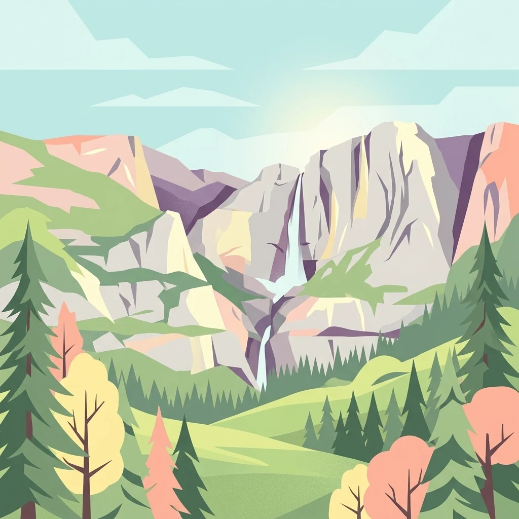
A flat vector-style illustration of a mountain valley featuring a prominent cascading waterfall, rocky cliffs, and surrounding evergreen and deciduous forests under a pale sky.

Val Rosandra

Protected area

Park overview

Structured park overview, official facts, and landscape profile for Val Rosandra

Val Rosandra park facts, protected area profile, and essential visitor context

Review the core facts for Val Rosandra, including designation, size, terrain, visitor scale, habitats, and operating context in one park-focused overview.

About Val Rosandra

Val Rosandra is a short but deeply cut river valley at the southeastern edge of the Trieste Karst, just south of the city of Trieste. Flowing through the valley is the Rosandra torrent, called Glinščica in Slovenian, which has carved a winding break through the limestone plateau that otherwise separates the Adriatic coast from the inland regions toward Slovenia. The result is a landscape of sudden vertical walls, scree fields, narrow gorges, caves, and the well known Supet waterfall, all contained within the approximately 746 hectares now protected as a regional nature reserve.

What makes the valley especially distinctive is its compressed climatic gradient. Above the Supet waterfall, conditions are subalpine and continental, while immediately below it the climate shifts to fully Mediterranean. The same altitudes can show temperature differences of more than 10 degrees Celsius between sun-facing and bora-exposed slopes, which strongly shapes both the vegetation and the fauna. Because the valley escaped the most intense glacial impacts of the surrounding region, it has preserved many rare and endemic plant species that have vanished elsewhere on the Carso, including alpine and Mediterranean relicts growing within sight of one another.

Beyond its natural value, Val Rosandra has long been a corridor of human history. It was inhabited since prehistoric times, hosted a Roman aqueduct that carried water from the Rosandra spring to central Trieste, served as the historic salt road linking Trieste's coastal salt pans to the interior, and later carried the Trieste-Hrpelje railway. Today it functions mainly as a recreational and scientific space, offering hiking, climbing, caving, and cycling along the former railway alignment, all within a short distance of the city.

Quick facts and research context for Val Rosandra

Val Rosandra lies a few kilometers south of Trieste, between San Dorligo della Valle in Italy and Hrpelje-Kozina in Slovenia, cutting through the Carso plateau at the edge of the Adriatic. The valley is drained by the Rosandra torrent, known in Slovenian as the Glinščica, and is dominated by limestone and flysch landscapes shaped by intense karst processes.

The reserve covers roughly 746 hectares and was formally established in 1996 as a regional nature reserve under Friuli Venezia Giulia law. It also holds recognition as a Site of Community Importance and a Special Protection Area, and is considered an important bird area. The valley records more than 900 vascular plant species alongside notable populations of amphibians and reptiles, and it is one of the few places in the Trieste Karst where alpine and Mediterranean flora grow side by side.

Protection and recognition

Documented terrestrial protection records and official designation timeline for Val Rosandra

Val Rosandra Protection Status, Designation History, and Transboundary Scope

Val Rosandra preserves documented terrestrial protection status established in 1996 alongside verified transboundary boundaries. Structured conservation records provide an official overview of designated management scope and administrative recognition history.

Protection details

Protection scope
Terrestrial
Designated year
1996
Transboundary protection
Yes
Park context

Deeper park guide and search-rich context for Val Rosandra

Val Rosandra history, landscape, wildlife, and travel context

Explore Val Rosandra through its history, landscape character, ecosystems, wildlife, conservation priorities, cultural context, and seasonal travel timing in a structured park guide built for atlas discovery and search intent.

Why Val Rosandra stands out

Val Rosandra is best known for being one of the rare places in Europe where subalpine and Mediterranean climates come together within a single small valley, producing an extraordinary concentration of plant and animal diversity. The valley is also famous among climbers and speleologists. Its walls, gorges, caves, and the Supet waterfall form an outdoor laboratory for karst studies, while the historic climbing school founded by Emilio Comici in 1929 attracts rock climbers from across Italy. The dramatic contrast between the continental upper valley and the Mediterranean lower valley gives Val Rosandra a strongly layered character that distinguishes it from the rest of the Trieste Karst.
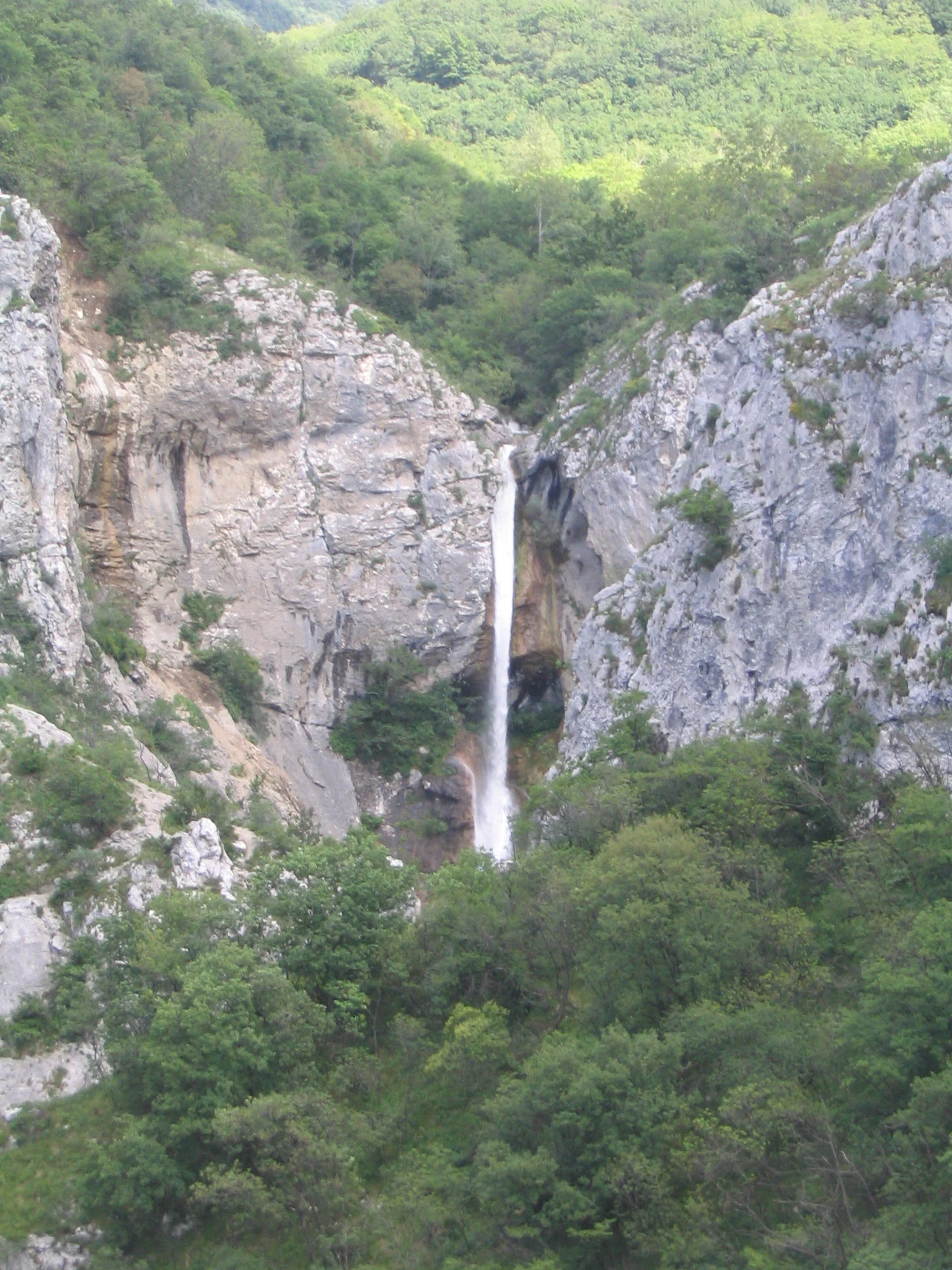
A waterfall flows down a vertical cliff face surrounded by dense green forest in a rocky valley.
The Rosandra Waterfall cascading through the limestone cliffs of Val Rosandra.

Val Rosandra history and protected-area timeline

Val Rosandra has been a corridor of human activity since prehistoric times. Archaeological evidence shows human presence in the Neolithic, and finds from the horizontal caves on the right side of the valley, especially the Grotta delle Finestre, indicate continuous use of the landscape as shelter, storage, and refuge, although no permanent prehistoric settlement has been confirmed.

During the Roman period the valley became part of the city's infrastructure. The spring of the Rosandra, which Count Domenico Rossetti later named Fons Oppia, was tapped in the first century AD to feed a 14 kilometer aqueduct running into the center of Trieste. The aqueduct remained functional for centuries and may have survived in some form into the sixth or seventh century, when damage interrupted its use. Eighteenth century authorities still considered restoring it for the growing city of Trieste, but the proposal was abandoned when other local sources were developed instead. Only about one hundred meters of the Roman structure survive today.

In the medieval and early modern eras the valley defined Trieste's commercial lifeline. Large salt pans once lay near the mouth of the Rosandra, and the only natural route linking them to the inland markets ran through the valley, the so called salt road. This corridor was defended by fortifications including the castle of Moccò, later replaced by the customs stronghold of Fünfenberg, the Tabor di Draga built by local inhabitants against Turkish raids, and the castle of Vicumberg near Becca on the present-day Slovenian side. When Venice forced the destruction of the salt pans, the valley's commercial importance collapsed, Trieste opened new roads from the city center, and Val Rosandra gradually returned to a quieter, more agricultural rhythm.

Alongside the salt trade, the valley became a center of milling. A 1276 contract already records three mills along the Rosandra, which by 1757 had grown to sixteen mills driven by the torrent's steady flow. The mills processed spices and other goods arriving at the port of Trieste before distribution inland. Many of these structures were lost to war damage and neglect during the twentieth century.

In 1887 the Austro-Hungarian Empire opened the short Trieste-Erpelle railway through the valley, designed to shorten the route between Trieste and Istria by 38 kilometers. Construction on the karst terrain was difficult, and during tunneling near Botazzo a sinkhole opened, killing three workers whose bodies were never recovered. The line survived into the postwar period, was finally closed in 1958, and had its tracks removed in 1966. Its alignment is now the Giordano Cottur pedestrian and cycling path. In 1996 the Friuli Venezia Giulia regional law formally established the Riserva naturale regionale della Val Rosandra, placing centuries of layered human history under modern nature protection.

Val Rosandra landscape and geographic character

Val Rosandra cuts a sharp, irregular path through the limestone Carso plateau just behind Trieste, producing one of the most dramatic small-scale landscapes in the region. The upper valley, above the Supet waterfall, opens gently over softer flysch terrain with richer vegetation along both banks of the torrent. Below the waterfall, the character changes abruptly. The river plunges through tight gorges, vertical rock faces, and scree fields cut into pure karst limestone, with cliffs often dropping in sheer drops.

Geologically the valley shows two clearly contrasting sides. The left slope, on Monte Carso, is shaped by limestone layers dipping along the slope, producing unstable scree and shrubby patches. The right slope, on Monte Stena, has limestone dipping against the slope and exposes tall cliffs dotted with cyanobacteria, alternating with bands of woodland. The small flysch areas around Botazzo soften this contrast with rolling forms, denser green vegetation, and gentler agricultural use. Together these features give the valley a layered appearance that has been compared to the great Dinaric valleys of Dalmatia rather than to typical alpine scenery.
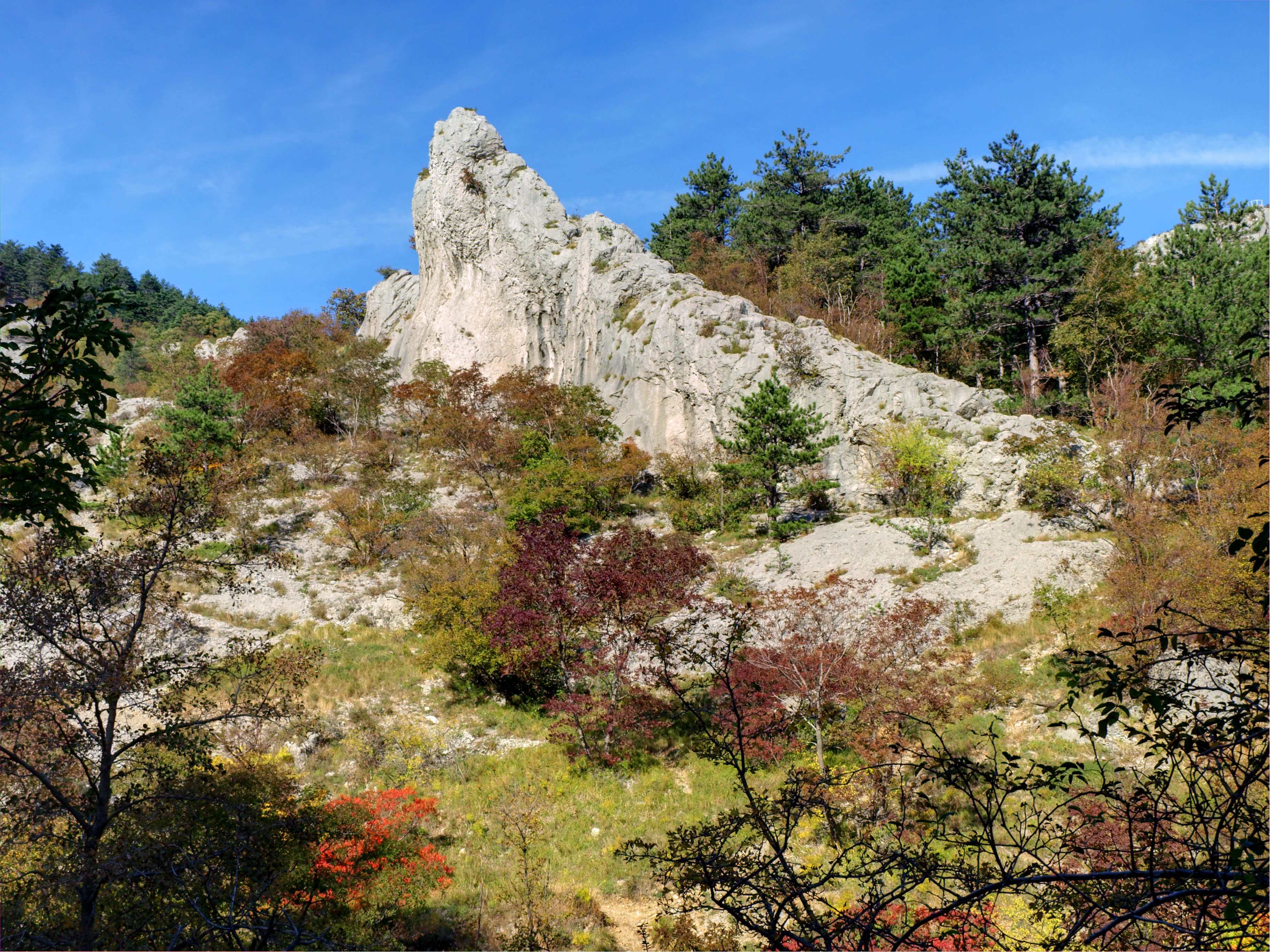
A jagged, light-colored limestone rock formation rises above a hillside covered in sparse trees and shrubs displaying autumn colors under a clear blue sky.
The distinctive limestone cliffs and autumn foliage of Val Rosandra.

Val Rosandra ecosystems, habitats, and plant life

Val Rosandra is exceptional for the way it concentrates an enormous variety of habitats and species within a very small area. Surveys indicate around 988 vascular plant species, more than 1,000 fungi, around 300 lichens, about 150 bryophytes, and roughly 100 myxomycetes, giving a total of roughly 2,700 recorded biological entities. Many of the higher plants are endemics or regional rarities, some of them known in Italy only from this valley.

The climatic interplay between the continental upper valley and the Mediterranean lower valley is the driving force behind this diversity. Alpine relicts, Illyrian species, prealpine plants, and Mediterranean taxa all find refuges here because the valley escaped the worst effects of glaciation and because its bedrock alternates between water-retentive flysch and dry, fissured limestone. The flysch slopes near Botazzo show a softer, greener
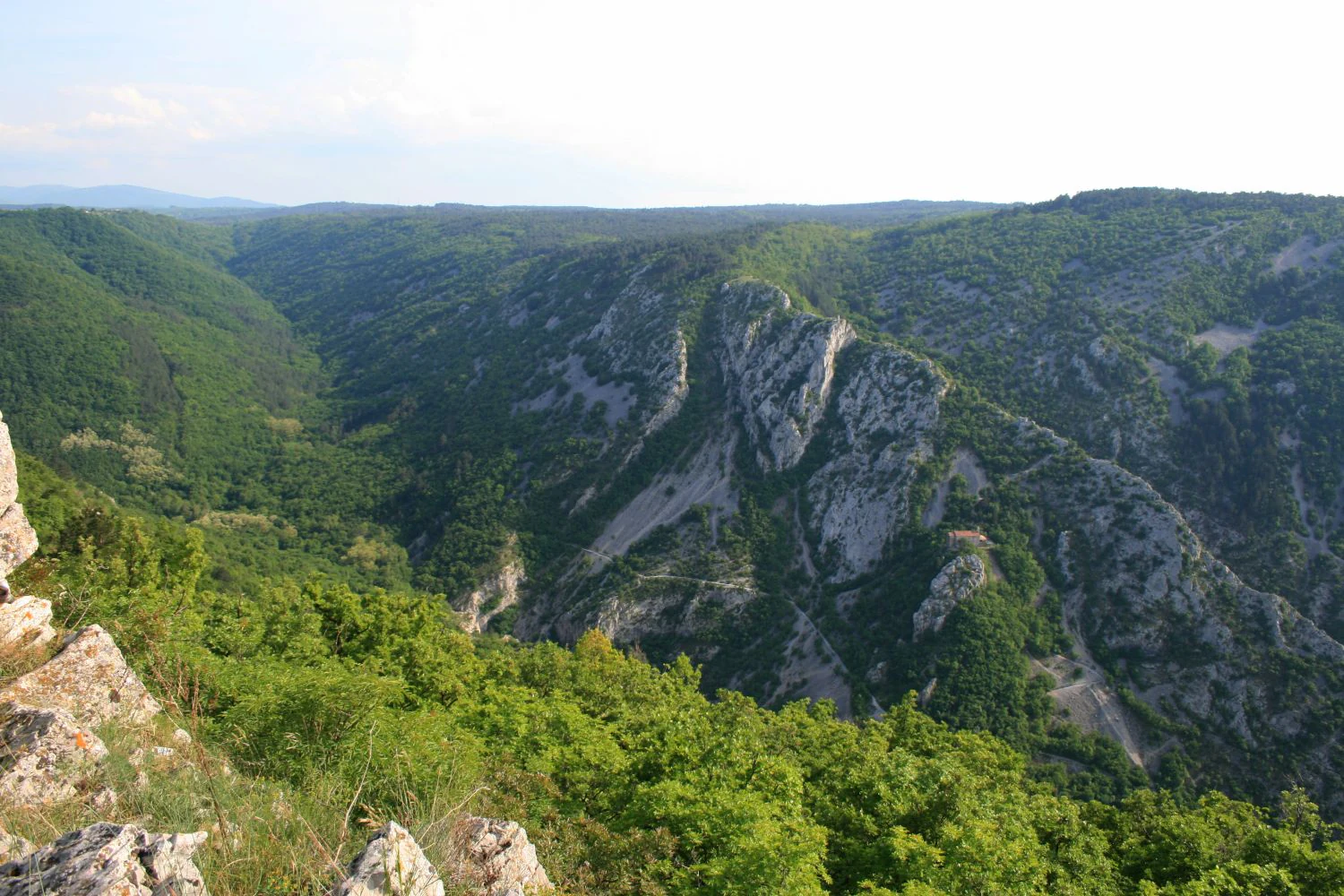
A high vantage point looking down into a deep, forested valley with steep rocky limestone cliffs on the right side under a hazy sky.
Panoramic view of the Val Rosandra valley, characterized by its karst limestone cliffs and dense woodland.

Val Rosandra wildlife and species highlights

The wildlife profile of Val Rosandra is shaped by its unusually compressed climatic gradient and its mix of aquatic, rocky, and forested habitats. Reptiles and amphibians are particularly notable, with several species that are rare elsewhere in the region finding important populations in the valley. Among them is the grass snake, which feeds mainly on fish and small tree frogs and is known for feigning death and releasing a foul-smelling liquid when threatened. The yellow-bellied toad also occurs in the valley, displaying its bright ventral markings and emitting a repellent secretion when disturbed.

Birds are another important element, and the reserve's status as an Important Bird Area reflects the significance of the site for nesting, migrating, and feeding species around the Carso edge. The combination of cliffs, riverine vegetation, woodland patches, and open rocky slopes supports a varied bird community that includes both Mediterranean and Central European species. Smaller mammals, bats, and typical karst invertebrates also inhabit the numerous caves and fissures, contributing to the valley's broad faunal richness.
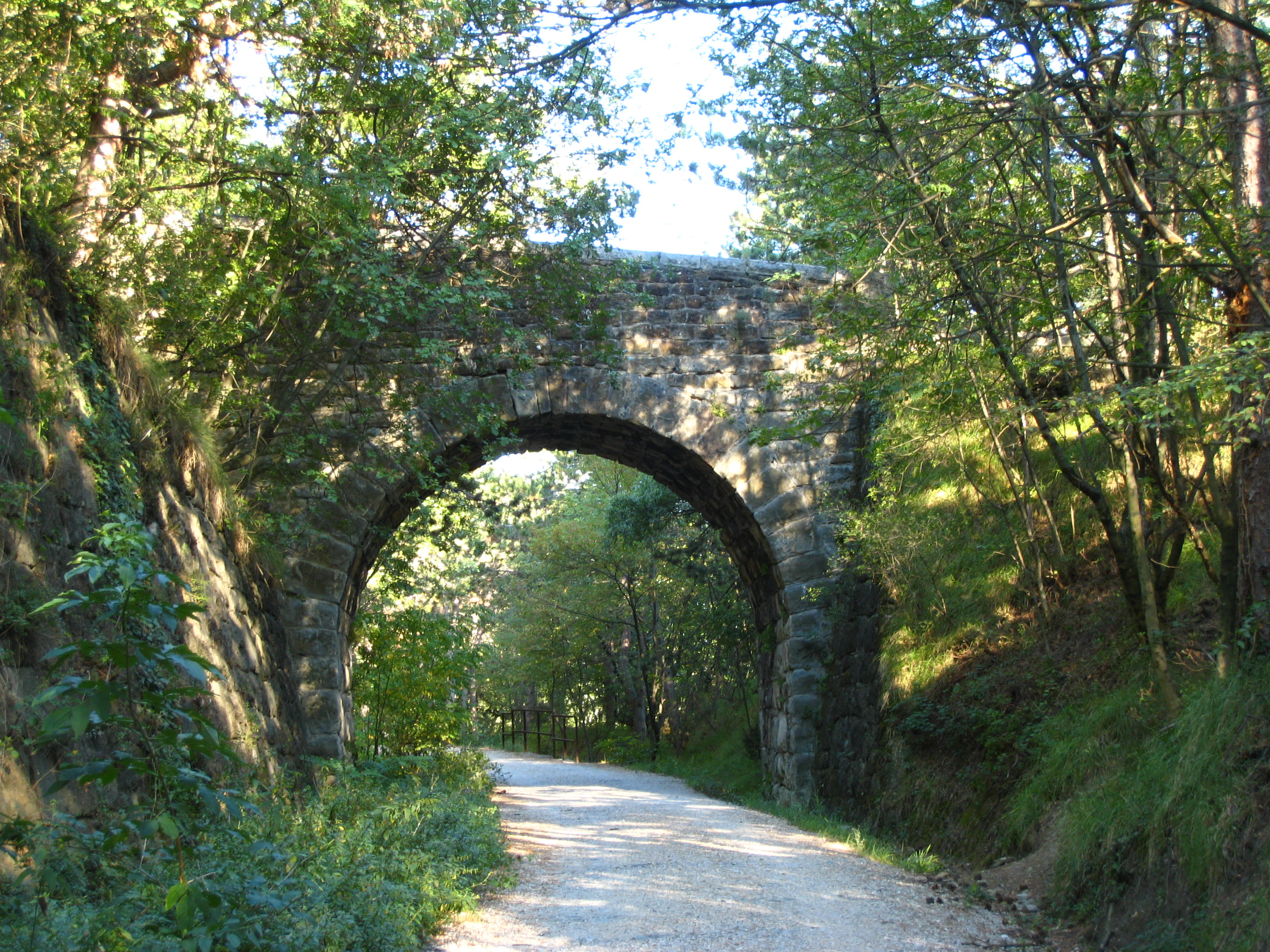
A gravel hiking trail runs through a wooded area under a historic stone arched bridge.
A scenic gravel path passing beneath an old stone railway bridge in Val Rosandra.

Val Rosandra conservation status and protection priorities

The conservation value of Val Rosandra rests on its concentration of relict species, its unusual coexistence of alpine and Mediterranean biota, and its intact karst morphology. The valley preserves numerous priority habitats at the European level, including vertical cliff communities, primary shrubland on scree, humid zones along the torrent, and old woodland on flysch that has resisted agricultural conversion.

This significance is reflected in its layered protection status. It is a regional nature reserve established in 1996, a Site of Community Importance, a Special Protection Area, and an Important Bird Area. These designations safeguard not only the biodiversity but also the geomorphological features that allow such diversity to persist. Concerns about conservation management have surfaced occasionally, notably in 2012 when a regional riverbed maintenance operation called Alvei puliti involved heavy clearing of riparian vegetation and triggered protests from environmental groups and parts of the local scientific community.

Val Rosandra cultural meaning and human context

Val Rosandra carries a layered cultural identity tied to its role as a borderland corridor. The valley has long been a meeting point of Italian and Slovenian populations, with bilingual place names such as Bagnoli della Rosandra, known locally as Boljunec, and the river itself called both Rosandra and Glinščica. This linguistic duality is part of the reserve's official identity, and the Slovenian name Naravni rezervat doline Glinščice is used alongside the Italian designation.

Culturally, the valley has shaped Trieste's identity as a gateway between the Adriatic and Central Europe. Roman engineers, medieval salt traders, Venetian administrators, Austrian railway builders, and twentieth-century climbers have all left marks on the landscape, from aqueduct fragments and ruined mills to the abandoned railway alignment now used as a cycling path. The little church of Santa Maria in Siaris, set against the Carso at the upper end of the valley, adds a spiritual layer to this heritage, while the long history of climbing at Val Rosandra, starting with Napoleone Cozzi and his Squadra Volante and culminating in the school founded by Emilio Comici in 1929, places the valley at the origins of modern Italian rock climbing.
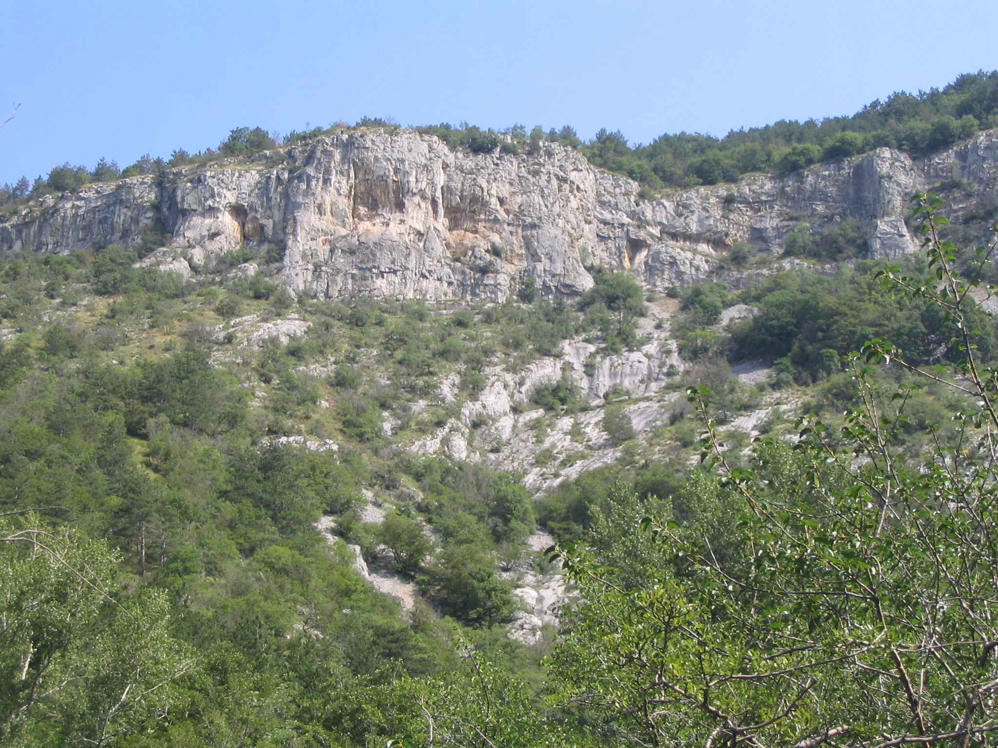
A view of rugged limestone cliffs rising above a vegetated valley, featuring sparse trees and rocky terrain.
Limestone cliffs overlooking the green slopes of Val Rosandra.

Top sights and standout views in Val Rosandra

Val Rosandra stands out for the abrupt transition within a few hundred meters from a subalpine to a Mediterranean climate, a phenomenon that drives its extraordinary botanical richness and makes it a natural reference site for biogeographical study. The Supet waterfall, the narrow gorges below it, and the surrounding cliffs form one of the most compact karst landscapes in the Trieste region. The valley is also a cornerstone of Italian climbing history through the school founded by Emilio Comici, and remains an active training ground for climbers and speleologists.

Equally striking is the way human history is preserved in the landscape: fragments of a Roman aqueduct, the ruins of medieval salt mills, the fortified ridge of Tabor di Draga, and the cycling path that follows the old Trieste-Hrpelje railway together turn the reserve into an open-air record of Trieste's evolution from Roman port to Habsburg city to modern nature reserve.
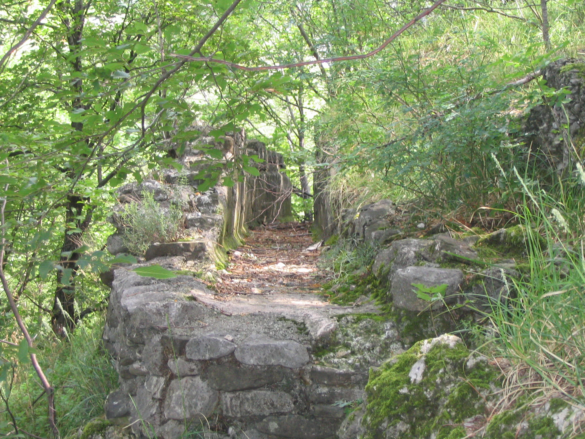
A section of an old stone wall ruin partially overgrown with moss and vegetation, forming a path through a forest.
Remains of an ancient Roman waterworks structure integrated into the wooded landscape of Val Rosandra.

Best time to visit Val Rosandra

Val Rosandra can be visited through much of the year, but spring is especially rewarding, when the difference between the Mediterranean lower slopes and the continental upper slopes produces overlapping bloom cycles and the fresh green of the flysch contrasts with the bright flowers on the limestone. Spring is also a good time for birdwatching and for enjoying cooler temperatures before the summer heat sets in along the exposed cliffs.

Autumn brings vivid color to the deciduous woodland on Monte Stena and along the river, and is a popular season for hikers and photographers. Summer visits are possible but can be hot in the lower valley, and the bora wind can be strong on exposed ridges. Winter tends to be quieter, with fewer visitors, and the lowest parts of the valley generally remain accessible while higher karst plateaus may be more exposed to cold and wind.

Monthly climate preview

Long-term representative weather by month and monthly averages for Val Rosandra

Val Rosandra Climate Normals, Annual Temperature and Precipitation Rhythm

Historical data records the annual temperature progression from winter lows to summer highs alongside shifting monthly precipitation levels across representative coordinates. Examining the complete twelve-month profile provides deeper analytical context for long-term regional climate patterns.
Annual mean13 °C
3 °C23 °C
Jan
Feb
Mar
Apr12°
May16°
Jun20°
Jul23°
Aug23°
Sep18°
Oct14°
Nov
Dec
Warmest month
August

23 °C

Coolest month
January

3.4 °C

Wettest month
November

4.1 mm/day

Driest month
January

2 mm/day

Park location guide

Geography guide, regional context, and park location map for Val Rosandra

Val Rosandra park geography, regions, and map view in Italy

Understand where Val Rosandra sits in Italy through a broader geographic reading of the surrounding landscape, nearby location context, and its mapped position within the national park landscape.

How Val Rosandra fits into Italy

Italy is a unitary parliamentary republic in Southern and Western Europe, located on the Italian Peninsula with the Alps to the north. It borders France, Switzerland, Austria, Slovenia, Vatican City, and San Marino, and shares maritime boundaries with several Mediterranean countries. The country has approximately 59 million residents and uses the Euro as its currency.

Wider geography shaping Val Rosandra in Italy

Italy occupies a boot-shaped peninsula in southern Europe, bordered by the Alps to the north. It shares land borders with France, Switzerland, Austria, Slovenia, Vatican City, and San Marino. The country includes the Mediterranean islands of Sicily and Sardinia, along with approximately 800 smaller islands.

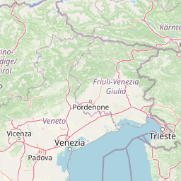
Map view of Val Rosandra

Use this park location map to pinpoint Val Rosandra in Italy, understand its exact geographic position, and read its mapped placement within the surrounding landscape more clearly.

Pigeon | © OpenStreetMap contributors

Location context for Val Rosandra

Friuli-Venezia Giulia

Explore detailed imagery of limestone cliffs, deep river gorges, and rare regional habitats.

Val Rosandra Photos and Scenery: Visualizing Karst Landscapes and Protected Terrain

Visual records capture the dramatic limestone canyons, vertical climbing walls, and striking waterfalls that define the protected nature reserve. Photographic documentation reveals complex geological formations and diverse microclimates across the rugged river valley.

A waterfall flows down a vertical cliff face surrounded by dense green forest in a rocky valley.

A view through a stone tunnel with a natural stone archway, looking toward a bright, sunlit exit framed by lush green foliage.

A jagged, light-colored limestone rock formation rises above a hillside covered in sparse trees and shrubs displaying autumn colors under a clear blue sky.

A high vantage point looking down into a deep, forested valley with steep rocky limestone cliffs on the right side under a hazy sky.

A gravel hiking trail runs through a wooded area under a historic stone arched bridge.

A calm, shallow stream with rocky banks surrounded by a lush green forest, reflecting the trees on its surface.

A view of rugged limestone cliffs rising above a vegetated valley, featuring sparse trees and rocky terrain.

A section of an old stone wall ruin partially overgrown with moss and vegetation, forming a path through a forest.

A high-angle view of a deep, green limestone valley with rocky cliffs and a thin trail visible along the side of the slope.

A narrow stone-lined channel, identified as an ancient Roman aqueduct, with mossy walls and a floor covered in loose stones and dirt, surrounded by trees.

A wide angle view of a steep rocky valley with sparse trees in the foreground, looking out toward a distant urban cityscape under a hazy sky.

A small, historic stone church with a red-tiled roof sits on a hillside, nestled between steep limestone cliffs and dense vegetation in Val Rosandra.

Park atlas

Compare surrounding karst terrain and regional protected areas

Explore Parks Near Val Rosandra and Related Protected Landscapes

Discover other protected areas near Val Rosandra to examine matching geological formations and regional conservation boundaries. Comparing these neighboring habitats provides deeper context into the rugged limestone terrain of the surrounding karst region.
Regional parkSlovenia
About 9 km away#1 closest

Northeast

Škocjan Caves Regional Park: Mapped Karst Landscape and UNESCO World Heritage Site in Slovenia

Discover its profound underground river canyon and doline geography.

Škocjan Caves Regional Park in Slovenia is a protected karst landscape of global importance, renowned for its vast subterranean system and the Reka River's underground journey. This site, a UNESCO World Heritage designation, features dramatic collapse dolines like Mala and Velika dolina, alongside immense cave chambers that illustrate classic karst hydrology. It serves as a key reference point for understanding regional geology and protected area networks within southeastern Europe's unique terrains.

Area
4.15 km²
Established
1996
IUCN
V
Relief
Lowland
A soft watercolor painting of a coastal scene featuring green vegetation, a light shoreline, and hazy distant mountains.
Protected landscapeAnkaran
About 14 km away#2 closest

West

Landschaftspark Debeli rtič: Coastal Protected Landscape and Regional Geography Map

Protected marine and terrestrial landscape near Ankaran, Slovenia

Located on the Muggia Peninsula, Landschaftspark Debeli rtič protects a rare combination of flysch cliffs and shallow underwater reefs. This record provides a geographic breakdown of the park, including its distinct transition from agricultural vineyards to coastal woodland, offering a clear view of the protected area boundaries and surrounding Adriatic terrain.

Area
3.4 km²
Established
2018
Relief
Upland
Climate
Mediterranean
Protected landscapeSlovenia
About 36 km away#3 closest

North

Ternowaner Wald Protected Landscape: Karst Plateau and Forest Geography in Slovenia

Dinaric highland exploration and protected terrain mapping.

Ternowaner Wald is a prominent limestone plateau located in southwestern Slovenia. Characterized by deep karst phenomena including sinkholes and the Great Ice Cave in Paradana, the area represents a critical ecological junction of mixed Dinaric beech and fir forests. This overview details the plateau boundaries, tectonic features, and protected status of this diverse highland geography.

Relief
Mountain
Climate
Temperate
Access
Moderate access
Scope
Terrestrial
Watercolor illustration of a mountainous landscape with green forests, a lake, and distant pink-hued mountains under a light sky
National parkPrimorje-Gorski Kotar County
About 55 km away#4 closest

East

Risnjak National Park: Protected Mountain Landscape in Primorje-Gorski Kotar

Explore karst terrain and regional geographic context.

Risnjak National Park represents a substantial protected area within the rugged mountain geography of Croatia's Gorski Kotar region. This national park is distinguished by its dramatic karst formations, diverse alpine flora reaching from forested slopes to rocky summits, and the significant natural landmark of the Kupa River's source. Discover its mapped boundaries and the ecological importance of this unique landscape situated in Primorje-Gorski Kotar County.

Area
63.5 km²
Established
1949
IUCN
II
Visitors
16.8K annual
A soft watercolor painting of a wetland landscape featuring green meadows, gentle rolling hills, and a river flowing through the scene.
Nature reserveSlovenia
About 62 km away#5 closest

Northeast

Naturreservat Iški morost: Protected Nature Reserve and Wetland Landscape in Central Slovenia

Mapped protected wetlands of the Ljubljana Marsh region

Naturreservat Iški morost serves as a primary conservation site for the distinct wet meadow habitats of the Ljubljana Marsh. This reserve demonstrates the intersection of wetland geography and bird conservation, protecting a crucial, coherent landscape that is rare in contemporary Slovenian lowlands.

Area
0.65 km²
IUCN
Ia
Relief
Lowland
Climate
Temperate
Watercolor illustration of a river flowing through a forested valley with mountains in the background
National parkSlovenia
About 64 km away#6 closest

North

Triglav National Park: A Mapped Alpine Protected Landscape in Slovenia

Julian Alps geography, glacial lakes, and karst terrain.

Triglav National Park is Slovenia's premier protected area, covering 880 square kilometers of the Julian Alps. This page details its dramatic alpine geography, including Mount Triglav, glacial valleys, and significant karst features. Understand the mapped boundaries and landscape context of this national park, a key entry in the MoriAtlas geographic discovery resource for understanding protected lands.

Area
880 km²
Established
1981
IUCN
II
Visitors
1.6M annual
Watercolor painting of coastal landscape with green islands, trees, and calm water under a soft sky
National parkCroatia
About 75 km away#7 closest

South

Brijuni Islands National Park: Adriatic Protected Landscape and Historical Atlas

Mapped boundaries, regional geography, and ecological context.

Brijuni Islands National Park is a significant protected area comprising a Croatian archipelago in the northern Adriatic Sea. This national park showcases a unique Mediterranean landscape blending natural habitats with extensive archaeological sites, offering a rich context for atlas-based exploration. Understanding Brijuni Islands National Park contributes to a broader appreciation of regional geography and the mapped distribution of protected lands.

Area
7.5 km²
Established
1983
IUCN
II
Relief
Lowland
A horizontal watercolor painting showing a soft mountain range with green forests, a winding river valley, and wildflowers in the foreground.
Protected areaAustria
About 122 km away#8 closest

Northeast

Geopark Karawanken: Alpine Protected Landscape and Tectonic Geography in Austria

A cross-border protected area defined by tectonic uplift and deep alpine valleys.

Geopark Karawanken showcases a profound geological record formed by tectonic plate convergence. The protected area features sharp mountain massifs, subterranean karst systems, and deep-cut gorges that reveal the underlying structural complexity of the alpine range, offering a clear view of how tectonic forces shape regional geography.

Area
1,067 km²
Established
2013
Relief
Mountain
Climate
Alpine

Common questions about visiting, size, designation, and location context for Val Rosandra

Val Rosandra FAQs for park facts, access, geography, and protected area context

Find quick answers about Val Rosandra, including protected-area facts, park geography, trail and visitor context, and how the park fits into its surrounding country and regional landscape.
MoriAtlas Explorer

Continue Your Protected Areas Search Across the Global Atlas

Deepen your exploration by continuing the structured search for national parks and protected areas worldwide. Utilize the comprehensive filtering capabilities to compare different conservation landscapes and refine your understanding of global park geography. Discover more about the distribution and characteristics of protected natural areas.

Global natural geography