Mori Atlas logo
National parkBrijuni Islands National Park

Explore mapped park boundaries, landscape context, and regional geography of this unique national park.

Brijuni Islands National Park: A Protected Mediterranean Archipelago in Croatia

(Nacionalni park Brijuni)

Brijuni Islands National Park represents a distinct protected archipelago situated in the northern Adriatic Sea, off the coast of Croatia's Istrian peninsula. This national park encompasses fourteen islands and islets, offering a unique combination of Mediterranean landscape, significant archaeological remains, and rich ecological diversity. As a key entity within the Croatian atlas, Brijuni Islands National Park provides vital insights into regional geography and protected land conservation.

Mediterranean islandsNational parkArchaeological sitesDinosaur footprintsSafari parkHistorical site
Illustration of ancient stone ruins on a grassy coastal area with cliffs, trees, and a building by the water

Brijuni Islands National Park

National park

Park overview

Structured park overview, official facts, and landscape profile for Brijuni Islands National Park

Brijuni Islands National Park park facts, protected area profile, and essential visitor context
Review the core facts for Brijuni Islands National Park, including designation, size, terrain, visitor scale, habitats, and operating context in one park-focused overview.

About Brijuni Islands National Park

Brijuni Islands National Park represents one of Croatia's most distinctive protected areas, combining natural beauty with remarkable historical significance across multiple eras. The archipelago sits in the northern Adriatic Sea, separated from the Istrian peninsula by the narrow Fažana Strait, creating a Mediterranean landscape that has attracted human settlement and activity for millennia. The islands' strategic position and favorable climate have shaped their development from ancient times through the modern era.

The park's identity transcends simple natural protection, encompassing cultural landscapes shaped by Venetian stone quarries, Austro-Hungarian military fortifications, and elite resort development. When Viennese businessman Paul Kupelwieser purchased the islands in 1893, he transformed them into an exclusive Mediterranean retreat complete with luxury hotels, golf courses, and polo facilities. The subsequent decades saw the islands become a favored destination for European aristocracy, cultural figures, and members of the Imperial family. This aristocratic heritage remains visible in the architectural elements and parkland layouts that characterize the islands today.

Following World War II, the islands became part of Yugoslavia and President Tito's personal summer residence, initiating a new chapter in which the previously exclusive resort became a venue for international diplomacy. The 1956 Brioni Meeting remains the archipelago's most historically significant moment, establishing the political framework that would define Cold War-era non-alignment. The declaration signed here crystallized the principles that would guide the Non-Aligned Movement's policies throughout the latter half of the 20th century. Today, the park balances its dual roles as a protected natural area and a living museum of political history, with visitor facilities reflecting both its ecological mission and its diplomatic legacy.

Quick facts and research context for Brijuni Islands National Park

Brijuni Islands National Park is located in Istria County, Croatia, approximately two kilometres off the Istrian peninsula coast in the northern Adriatic Sea. The archipelago consists of fourteen islands and islets, with Veli Brijun (5.6 km²) as the largest and Mali Brijun (1.07 km²) as the second-largest. The park was established on October 27, 1983, protecting a total area of 33.9 km² including surrounding waters. The islands feature Mediterranean vegetation including maquis shrubland, holm oak forests, and laurel forests, with approximately 600 plant species recorded on Veli Brijun alone. The park contains significant archaeological sites spanning from the Bronze Age through Roman and Byzantine periods.

Park context

Deeper park guide and search-rich context for Brijuni Islands National Park

Brijuni Islands National Park history, landscape, wildlife, and travel context
Explore Brijuni Islands National Park through its history, landscape character, ecosystems, wildlife, conservation priorities, cultural context, and seasonal travel timing in a structured park guide built for atlas discovery and search intent.

Why Brijuni Islands National Park stands out

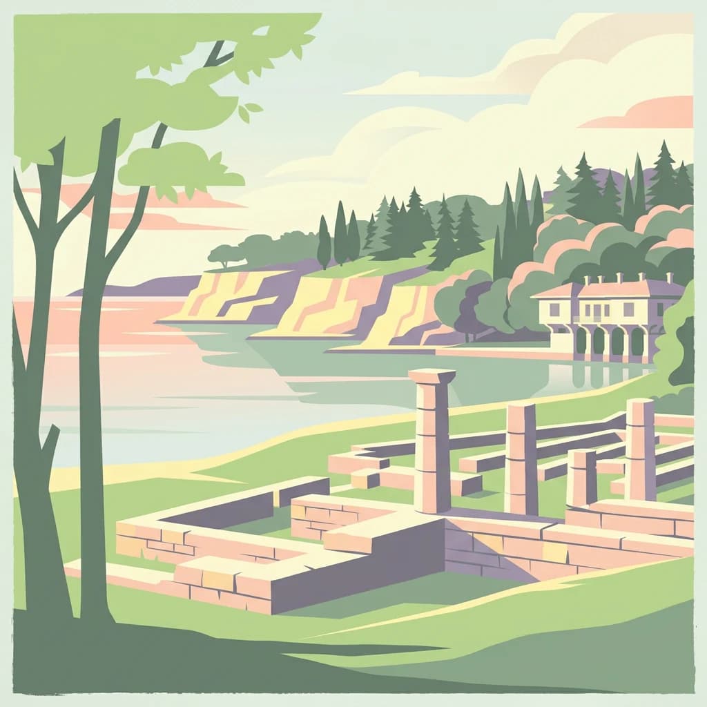
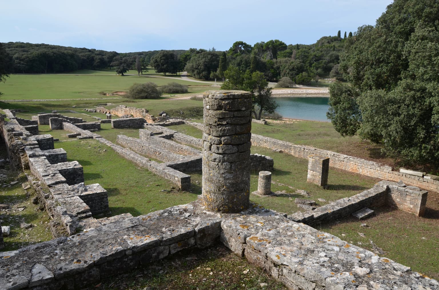
Brijuni Islands National Park is best known for its unique combination of political history, archaeological significance, and ecological diversity. The 1956 Brioni Meeting that gave birth to the Non-Aligned Movement established the islands' place in 20th-century world history. The archipelago contains over 200 dinosaur footprints from the Cretaceous period, making it significant for paleontological study. The Safari Park houses exotic animals gifted by international diplomatic partners, including Asian elephants presented by Indian Prime Minister Indira Gandhi. Archaeological sites include Roman villa complexes from the 1st-2nd century BC with thermal baths and a Venus temple, Byzantine fortress remains, and a 13th-century Knights Templar church.

Tall weathered stone column standing amidst grassy field with ancient stone ruins, trees, and clear blue sky
Remains of a Roman villa on Brijuni Island

Brijuni Islands National Park history and protected-area timeline

The Brijuni Islands possess a history extending to the third millennium BCE, with evidence of early human settlement involving agricultural, pastoral, hunting, and fishing activities by inhabitants who crafted tools from stone, bone, and wood. The Illyrian Histri tribe, after whom the region of Istria takes its name, inhabited the islands during the first millennium BCE, followed by Roman settlement beginning in the 2nd century BC.

Under Venetian rule from the Middle Ages, the islands served primarily as a source of building stone, with materials used in Venetian palaces and bridges. Following Napoleon's brief annexation as part of the Illyrian Provinces, the islands became part of the Austrian Empire in 1815 and later Austria-Hungary. The Austro-Hungarian Navy constructed Fort Tegetthoff on Veli Brijun and maintained a submarine base during this period.

In 1893, Viennese businessman Paul Kupelwieser acquired the archipelago and transformed it into a luxurious beach resort. The renowned microbiologist Robert Koch was invited in 1900 to conduct malaria eradication experiments, successfully eliminating the disease by 1901. The resort period saw the islands become a playground for the Viennese upper class, industrialists, cultural figures, and members of the Imperial family.

After World War I, the islands passed to Italy, with Karl Kupelwieser attempting to maintain the resort's international character by developing an 18-hole golf course and polo facilities. Following financial difficulties and bankruptcy, Italian government acquired ownership in 1936, maintaining control until the 1943 capitulation. German forces occupied the islands until the war's end in 1945.

In 1945, the islands became part of Yugoslavia and President Tito's state summer residence. The 1956 Brioni Meeting with Nasser and Nehru proved historically transformative, while the 1991 Brioni Agreement marked a significant moment in Croatian independence negotiations. The islands were declared a national park in 1983.

Brijuni Islands National Park landscape and geographic character

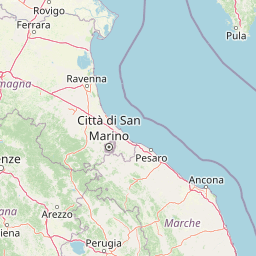
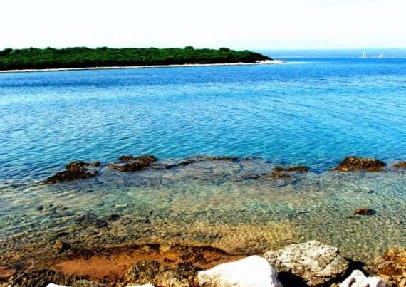
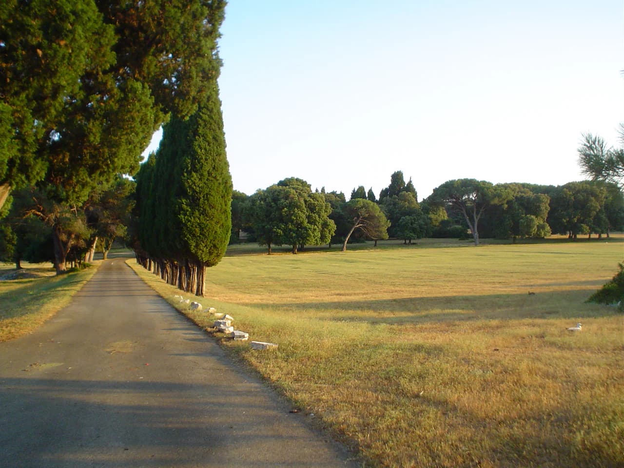
The Brijuni Islands present a Mediterranean landscape characterized by gentle rolling terrain, forested areas, and a varied coastline of coves, beaches, and rocky shores. The largest island, Veli Brijun, features a landscape shaped by centuries of human modification through quarrying, agriculture, and deliberate garden design. The island reaches modest elevations but offers panoramic views across the Adriatic toward the Istrian peninsula.

The coastline features numerous small bays and inlets, with the eastern shores offering sheltered anchorages while the western aspects face the open sea. The surrounding waters form part of the northern Adriatic, a shallow sea with distinctive marine characteristics. The islands' position in the Fažana Strait creates a transitional marine environment between the open Adriatic and coastal waters.

Ancient stone quarries that supplied Venice remain visible across the islands, their activity having shaped the terrain over centuries. The landscape combines natural Mediterranean vegetation with planted exotic species and structured parkland, creating a hybrid environment that reflects the islands' varied history. Woodland areas of Holm oak and laurel forest alternate with more open maquis shrubland and cultivated areas, while the coastline transitions between rocky shores and sandy beaches.

Two white cattle standing and resting on a grassy field with wooden fences and stone buildings in the background
Istrian oxen grazing in a pasture on Brijuni Islands National Park

Brijuni Islands National Park ecosystems, habitats, and plant life

The Brijuni Islands support Mediterranean vegetation communities typical of the northern Adriatic coast, with approximately 600 indigenous plant species recorded on Veli Brijun alone. The principal plant associations include maquis shrubland, Holm Oak forests, laurel forest, and conifer plantings, representing the characteristic vegetation of the Mediterranean region. The islands have been enriched over time with exotic species that have successfully acclimatized, including various conifers and ornamental plantings.

The marine environment surrounding the islands serves as important hatching grounds and representative marine habitat for organisms typical of the northern Adriatic. Protected marine species including pen-shells and date-shells inhabit the seabed, while sea turtles and dolphins occasionally visit the surrounding waters. Endemic species such as black tang and the tunicate Jadranski ciganin occur in these waters, alongside diverse populations of sponges, shellfish, sea urchins, and crustaceans.

Three marshy lakes covering approximately eight acres on Veli Brijun form a significant ornithological habitat, with the largest lake overgrown with reed and serving as nesting grounds for numerous bird species. Some smaller islands provide excellent nesting habitats for gulls, sea swallows, and rare cormorant species, while the archipelago serves as important seasonal habitat for northern bird species during migration periods.

Roman villa ruins along a coastal shore with calm blue water, pebbles, and green trees in the background
Remains of a Roman villa on a pebbly beach with calm blue water and green trees

Brijuni Islands National Park wildlife and species highlights

The wildlife of Brijuni Islands encompasses both indigenous Mediterranean species and a remarkable collection of imported and gifted animals. Indigenous terrestrial fauna includes typical Istrian species, while the early 20th century saw the introduction of chital deer, fallow deer, and mouflon to Veli Brijun. These species have thrived in the island environment and can be observed roaming freely through forests, parks, and glades.

The Safari Park houses exotic animals presented as diplomatic gifts to Tito, including Asian elephants (notably Sony, gifted by Indira Gandhi in 1970, and Lanka), nilgai and zebu from India, plains zebra and mountain zebra from Guinea, and waterbuck from Ethiopia. An ethno-park within the Safari Park showcases typical Istrian domestic animals including the Istrian ox (descendant of aurochs), Istrian sheep, and Istrian donkeys.

The ornithological significance of the islands centers on the wetland areas and small island habitats. The lakes at Saline provide crucial nesting and feeding grounds for waterfowl and marsh birds, while the smaller outer islands support colonial nesting seabirds. Seasonal bird migration brings northern species to the archipelago, enhancing its avian diversity. The surrounding marine environment supports marine mammals including dolphins and periodic sea turtle visitors, along with commercially important fish and shellfish populations.

Clear blue water with rocky shore, distant green island, and sailboats on horizon
Rocky shoreline and clear blue waters at Brijuni Islands National Park

Brijuni Islands National Park conservation status and protection priorities

Brijuni Islands National Park protects a significant Mediterranean ecosystem combining terrestrial and marine environments. The park's conservation value derives from its diverse habitats ranging from forested islands and wetland lakes to coastal waters and seabed communities. The protection of endemic marine species in surrounding waters demonstrates the park's ecological significance within the northern Adriatic region.

The designation as a national park in 1983 established formal protection for the islands' natural and cultural resources, recognizing their combined scientific, educational, and scenic value. Archaeological sites spanning from the Bronze Age through Roman and Byzantine periods receive protection alongside living ecosystems, reflecting an integrated approach to heritage conservation. The presence of endangered plant species such as marine poppy and wild cucumber, which thrive on the islands despite facing threats on the Istrian mainland, demonstrates the conservation importance of these protected habitats.

The marine protected waters around the archipelago serve as representative habitat for northern Adriatic marine organisms, with specific legal protections for pen-shells, date-shells, sea turtles, and dolphins. The wetland areas have been recognized as ornithological reservations, providing protected habitat essential for breeding and migratory bird populations.

Brijuni Islands National Park cultural meaning and human context

The Brijuni Islands have served as a crossroads of Mediterranean civilizations, with archaeological evidence spanning from Bronze Age settlements through Greek, Roman, Byzantine, Venetian, and modern periods. The Illyrian Histri tribe, after whom the Istrian peninsula takes its name, inhabited the islands during the first millennium BCE. Roman presence is marked by substantial villa complexes from the 1st-2nd century BC, including thermal baths and a temple to Venus, while Byzantine fortifications and a 5th-6th century basilica to St. Mary represent later settlement layers.

The 13th-century St. Mary's Church, constructed by the Knights Templar, adds another dimension to the islands' religious and architectural heritage. The historical narrative continued through Venetian quarrying operations that shaped the islands' economy for centuries, followed by the Austro-Hungarian military presence and the exclusive resort development of the early 20th century.

The islands' modern political significance stems from Tito's use of the archipelago as his state summer residence from 1945 to 1980, during which nearly a hundred foreign heads of state visited. This diplomatic history, beginning with the 1956 Brioni Meeting that founded the Non-Aligned Movement and continuing through the 1991 Brioni Agreement during Croatian independence, has made the islands an important venue for international negotiations. Cultural figures including writers James Joyce and George Bernard Shaw, composer Richard Strauss, and artists such as Gustav Klimt visited during the resort era, adding to the islands' cultural associations.

Paved road with cypress trees on left and grassy field on right under clear sky
Paved road through grassy fields with cypress trees lining the left side in Brijuni Islands National Park

Top sights and standout views in Brijuni Islands National Park

The Brijuni Islands combine multiple layers of significance that distinguish this national park from others in the region. The 1956 Brioni Meeting that gave birth to the Non-Aligned Movement represents a pivotal moment in 20th-century world history, with the islands serving as the site where leaders from Egypt, India, and Yugoslavia shaped the policies of a movement that would influence global politics for decades. The archaeological complex spanning Roman villas, Byzantine fortifications, and a Knights Templar church demonstrates continuous human presence across millennia.

The Safari Park's collection of diplomatically gifted exotic animals creates a unique wildlife experience, with Asian elephants, African zebras, and Indian antelope species roaming in a Mediterranean setting. The dinosaur footprint discoveries on Veli Brijun provide paleontological significance, while the wetland areas support significant bird populations. The cultural landscape combining Mediterranean vegetation, historic architecture, and designed parkland reflects the aristocratic resort era and creates a distinctive visitor experience.

Stone ruins of ancient Roman villa structures with walls and cylindrical tower, grassy landscape, body of water, and trees in background
Ancient Roman villa ruins in Verige Bay within Brijuni Islands National Park, Croatia

Best time to visit Brijuni Islands National Park

The Brijuni Islands enjoy a Mediterranean climate with warm, dry summers and mild, relatively wet winters, making spring and early autumn particularly pleasant for visiting. The summer months of June through August offer the warmest conditions and peak visitor numbers, with average temperatures suitable for beach activities and outdoor exploration. However, the popular International Polo Tournament occurs during summer, adding to visitor interest.

Spring (April through May) and early autumn (September through October) provide comfortable temperatures for walking tours, wildlife observation, and experiencing the archaeological sites without peak-season crowds. These shoulder seasons allow visitors to enjoy the parks and gardens in more tranquil conditions while still accessing all visitor facilities. The islands operate year-round, though some facilities may have reduced hours during the winter months. The Mediterranean vegetation remains attractive throughout the year, with spring bringing flowering plants and autumn offering pleasant conditions for coastal walks.

Park location guide

Geography guide, regional context, and park location map for Brijuni Islands National Park

Brijuni Islands National Park park geography, regions, and map view in Croatia
Understand where Brijuni Islands National Park sits in Croatia through a broader geographic reading of the surrounding landscape, nearby location context, and its mapped position within the national park landscape.

How Brijuni Islands National Park fits into Croatia

Croatia is a unitary parliamentary republic located in Central and Southeast Europe along the Adriatic Sea. With an area of approximately 56,600 km² and a population of nearly 3.9 million, it is a member of the European Union and uses the Euro as its currency. Zagreb serves as both the capital and largest city.

Wider geography shaping Brijuni Islands National Park in Croatia

Croatia is located in Central and Southeast Europe, bordering Slovenia and Hungary to the northwest and northeast respectively, Serbia to the east, Bosnia and Herzegovina and Montenegro to the southeast, with a maritime border with Italy to the west. The country occupies the eastern shores of the Adriatic Sea and spans the Dinaric Alps, Pannonian plain, and coastal islands.

Map view of Brijuni Islands National Park

Use this park location map to pinpoint Brijuni Islands National Park in Croatia, understand its exact geographic position, and read its mapped placement within the surrounding landscape more clearly.

Pigeon | © OpenStreetMap contributors

Location context for Brijuni Islands National Park

Istria County

Understanding the Mediterranean Archipelago's Coastal Habitats, Forested Terrain, and Cultural-Natural Blends through Photography

Visual Exploration of Brijuni Islands National Park: Landscapes, Scenery, and Protected Area Imagery
Explore the diverse landscapes and unique protected-area character of Brijuni Islands National Park, featuring its Mediterranean coastlines, historical sites, and varied island terrain. Gain a deeper understanding of the archipelago's distinct habitats, cultural layers, and environment through curated park photography, essential for regional atlas discovery.

Tall weathered stone column standing amidst grassy field with ancient stone ruins, trees, and clear blue sky

A dirt path lined by tall pine trees forming a natural tunnel, with a golf cart and two people visible in the distance

Two white cattle standing and resting on a grassy field with wooden fences and stone buildings in the background

Roman villa ruins along a coastal shore with calm blue water, pebbles, and green trees in the background

Clear blue water with rocky shore, distant green island, and sailboats on horizon

Large olive tree with thick trunk and sprawling branches, enclosed by wooden fence in open grassy field with forested background

Paved road with cypress trees on left and grassy field on right under clear sky

Stone ruins of ancient Roman villa structures with walls and cylindrical tower, grassy landscape, body of water, and trees in background

A beige villa with a red-tiled roof and arched openings standing on stilts over calm water, with trees in the background.

Rocky shoreline with sparse vegetation along the Adriatic Sea

Aerial view of islands and sea at sunset showing the Brijuni archipelago from above

Stone relief sculpture showing a standing male figure and a female figure touching his shoulder, with inscribed text above, mounted on a stone wall with vines

A person riding a horse with a polo mallet on a grassy field with trees and water in the background

Two birds with wings spread standing on rocks in shallow water with splashes.

A sunlit meadow with scattered trees and a clear blue sky, located in Brijuni Islands National Park

White multi-story hotel building with red roof and trees, situated on a shoreline with calm blue water

Park atlas

Continue exploring the Adriatic's protected landscapes and map the regional context of parks surrounding Brijuni Islands National Park.

Browse Nearby National Parks and Protected Areas for Brijuni Islands National Park Comparison
Explore other national parks and protected areas in the northern Adriatic Sea and across the Istrian peninsula after reviewing Brijuni Islands National Park. Trace their mapped geography, compare diverse protected landscapes, and gain deeper insight into regional conservation efforts and park characteristics.
Watercolor illustration of a mountainous landscape with green forests, a lake, and distant pink-hued mountains under a light sky
National parkPrimorje-Gorski Kotar County

Risnjak National Park: Protected Mountain Landscape in Primorje-Gorski Kotar

Explore karst terrain and regional geographic context.

Risnjak National Park represents a substantial protected area within the rugged mountain geography of Croatia's Gorski Kotar region. This national park is distinguished by its dramatic karst formations, diverse alpine flora reaching from forested slopes to rocky summits, and the significant natural landmark of the Kupa River's source. Discover its mapped boundaries and the ecological importance of this unique landscape situated in Primorje-Gorski Kotar County.

Area
63.5 km²
Established
1949
Visitors
16.8K annual
Relief
Mountain
National park

Northern Velebit National Park: Croatia's Mapped Protected Landscape Identity

Explore the geography and protected area context.

Northern Velebit National Park stands as a prominent protected area, contributing significantly to the geographic understanding of Croatia's Velebit mountain range. This page provides focused details on its protected landscape features, mapped boundaries, and position within the Dinaric Alps. It serves as an essential entry point for users seeking structured atlas-based information on national parks and their role in regional conservation efforts, highlighting its unique geographic characteristics.

National park

Paklenica National Park: Croatia's Iconic Karst Canyon and UNESCO Beech Forests

Explore dramatic protected landscape and regional geography.

Paklenica National Park presents a spectacular protected area defined by its deep karst canyons, with Velika Paklenica and Mala Paklenica carving dramatic vertical walls into the Velebit mountain range. This national park is celebrated for its status as a leading European climbing destination and its ancient beech forests, part of a UNESCO World Heritage site. Exploring Paklenica offers insight into unique geological formations, extensive cave systems, and the rich biodiversity of this significant Croatian landscape.

Area
95 km²
Relief
Mountain
Climate
Mediterranean
Access
Moderate access
National park

Plitvice Lakes National Park: Croatia's Iconic National Park and UNESCO Heritage Site

Mapped protected area with cascading lakes and karst geography.

Delve into the protected landscape of Plitvice Lakes National Park, a jewel of Croatia's natural heritage. This atlas entry highlights the park's famous system of 16 terraced lakes and cascading waterfalls, set within a unique karst terrain. Understand the geographic context and mapped boundaries of this significant protected area, renowned for its geological processes and ancient forest ecosystems. Explore the full spectrum of its protected natural identity.

Watercolor illustration of a river flowing through a forested valley with mountains in the background
National park

Triglav National Park: A Mapped Alpine Protected Landscape in Slovenia

Julian Alps geography, glacial lakes, and karst terrain.

Triglav National Park is Slovenia's premier protected area, covering 880 square kilometers of the Julian Alps. This page details its dramatic alpine geography, including Mount Triglav, glacial valleys, and significant karst features. Understand the mapped boundaries and landscape context of this national park, a key entry in the MoriAtlas geographic discovery resource for understanding protected lands.

Area
880 km²
Established
1981
IUCN
II
Visitors
1.6M annual
National parkŠibenik-Knin County

Kornati Islands National Park: Dense Mediterranean Archipelago and Protected Karst Landscape

Explore the mapped geography and unique protected island terrain.

Kornati Islands National Park, located in Šibenik-Knin County, Croatia, is distinguished as the Mediterranean's most densely packed archipelago. This national park protects a vast expanse of karst limestone islands, dramatic sea cliffs, and unique flat rock plateaus, alongside its significant marine environment. MoriAtlas provides detailed geographic context and mapped boundaries, enabling structured exploration of this exceptional protected landscape and its ecological significance within the Adriatic Sea.

Area
320 km²
Established
1980
Relief
Lowland
Climate
Mediterranean
National park

Una National Park: Bosnia and Herzegovina's Largest National Park and Protected Landscape

Explore its dramatic river canyons and karst geography.

Una National Park represents a significant protected landscape in Bosnia and Herzegovina, covering approximately 198 square kilometers of the Upper Una River basin. This page details the park's protected area identity, focusing on its spectacular riverine geography, including iconic features like the Štrbački Buk waterfall and the deep Unac River canyon. Users can explore the park's mapped boundaries, understand its place within the regional Dinaric mountain context, and discover the characteristics of its unique karst terrain and pristine river ecosystems. MoriAtlas provides essential geographic context for this vital natural area.

Area
350 km²
Established
2008
IUCN
II
Relief
Mixed relief
National parkForlì-Cesena Province

Foreste Casentinesi, Monte Falterona, Campigna National Park: A Mapped Protected Landscape in Italy

National Park within Forlì-Cesena Province, Emilia-Romagna

Foreste Casentinesi, Monte Falterona, Campigna National Park is an important protected natural area situated in Forlì-Cesena Province, northeastern Italy. As a designated national park, it serves as a key landmark for exploring mapped protected land boundaries and understanding its specific contribution to the regional geography. This page provides an atlas-centric view, highlighting the park's geographic context and its identity as a significant protected landscape for discovery and reference.

Area
368 km²
Established
1993
IUCN
II
Relief
Mountain

Common questions about visiting, size, designation, and location context for Brijuni Islands National Park

Brijuni Islands National Park FAQs for park facts, access, geography, and protected area context
Find quick answers about Brijuni Islands National Park, including protected-area facts, park geography, trail and visitor context, and how the park fits into its surrounding country and regional landscape.
MoriAtlas Explorer

Continue Your Protected Areas Search Across the Global Atlas

Deepen your exploration by continuing the structured search for national parks and protected areas worldwide. Utilize the comprehensive filtering capabilities to compare different conservation landscapes and refine your understanding of global park geography. Discover more about the distribution and characteristics of protected natural areas.

Global natural geography