Mori Atlas logo
National parkNorthern Velebit National Park

Discover the geographic setting and mapped boundaries of this significant national park.

Northern Velebit National Park: Croatia's Protected Landscape in the Velebit Mountains

Northern Velebit National Park represents a crucial protected area within the Dinaric Alps, offering a distinct geographic identity for atlas exploration. Situated within the Velebit mountains, this national park provides a unique lens through which to understand Croatia's natural landscapes and regional topography. MoriAtlas helps users navigate its mapped boundaries and connect its protected status to the surrounding geography, facilitating structured discovery of this significant natural entity.

national parkCroatiaDinaric Alpsprotected areaVelebit mountains
Stylized illustration of rocky mountains, pine trees, and a small chapel with a setting sun

Northern Velebit National Park

National park

Park overview

Structured park overview, official facts, and landscape profile for Northern Velebit National Park

Northern Velebit National Park park facts, protected area profile, and essential visitor context
Review the core facts for Northern Velebit National Park, including designation, size, terrain, visitor scale, habitats, and operating context in one park-focused overview.
Park location guide

Geography guide, regional context, and park location map for Northern Velebit National Park

Northern Velebit National Park park geography, regions, and map view in Croatia
Understand where Northern Velebit National Park sits in Croatia through a broader geographic reading of the surrounding landscape, nearby location context, and its mapped position within the national park landscape.

How Northern Velebit National Park fits into Croatia

Croatia is a unitary parliamentary republic located in Central and Southeast Europe along the Adriatic Sea. With an area of approximately 56,600 km² and a population of nearly 3.9 million, it is a member of the European Union and uses the Euro as its currency. Zagreb serves as both the capital and largest city.

Wider geography shaping Northern Velebit National Park in Croatia

Croatia is located in Central and Southeast Europe, bordering Slovenia and Hungary to the northwest and northeast respectively, Serbia to the east, Bosnia and Herzegovina and Montenegro to the southeast, with a maritime border with Italy to the west. The country occupies the eastern shores of the Adriatic Sea and spans the Dinaric Alps, Pannonian plain, and coastal islands.

Map view of Northern Velebit National Park

Use this park location map to pinpoint Northern Velebit National Park in Croatia, understand its exact geographic position, and read its mapped placement within the surrounding landscape more clearly.

Pigeon | © OpenStreetMap contributors

Explore the Velebit Mountains scenery, unique Karst formations, and diverse habitats of this Dinaric Alps region.

Northern Velebit National Park Photos: Visualizing Croatian Protected Area Landscapes
Browse compelling imagery of Northern Velebit National Park to visually understand its distinct geographic character and varied protected environments. These views offer crucial insights into the rugged mountain terrain, dense forest ecosystems, and characteristic Karst topography that define this significant Croatian protected area, enhancing comprehension of its unique park environment.

Grassy hillside with scattered rocks, a small stone chapel, and forested mountains under a partly cloudy sky

A wide landscape view of Lomska Duliba, a karst depression in Northern Velebit National Park, showing mountain valleys, dense forests, and a partly cloudy sky

Limestone rock formations with deep grooves and ridges in Northern Velebit National Park.

Stone hut atop rocky hillside with mountain peaks and forested valley under partly cloudy sky

Information signboard displaying park details including text, map, and logos about Northern Velebit National Park

Grassy hillside with white rock outcrops and coniferous trees under clear sky

Purple wildflowers in a meadow with pine trees and a mountain under clear blue sky

Wide view of rocky mountain peaks with green valleys and scattered vegetation under a partly cloudy sky.

Rocky hill with a small building featuring a red roof, surrounded by brown and orange foliage on a clear day with distant mountain ranges visible.

Park atlas

Trace the regional spread of conservation landscapes across Croatia and the Dinaric Alps.

Explore Other National Parks and Protected Areas Near Northern Velebit National Park
Continue your geographic discovery beyond Northern Velebit National Park by exploring other national parks and protected areas within Croatia's Velebit mountains and the broader Dinaric Alps region. This curated selection allows for easy comparison of landscapes, tracing the regional spread of conservation efforts and diverse terrain across the Western Balkans.
Watercolor illustration of a mountain landscape with trees and water
National park

Paklenica National Park: Croatia's Iconic Karst Canyon and UNESCO Beech Forests

Explore dramatic protected landscape and regional geography.

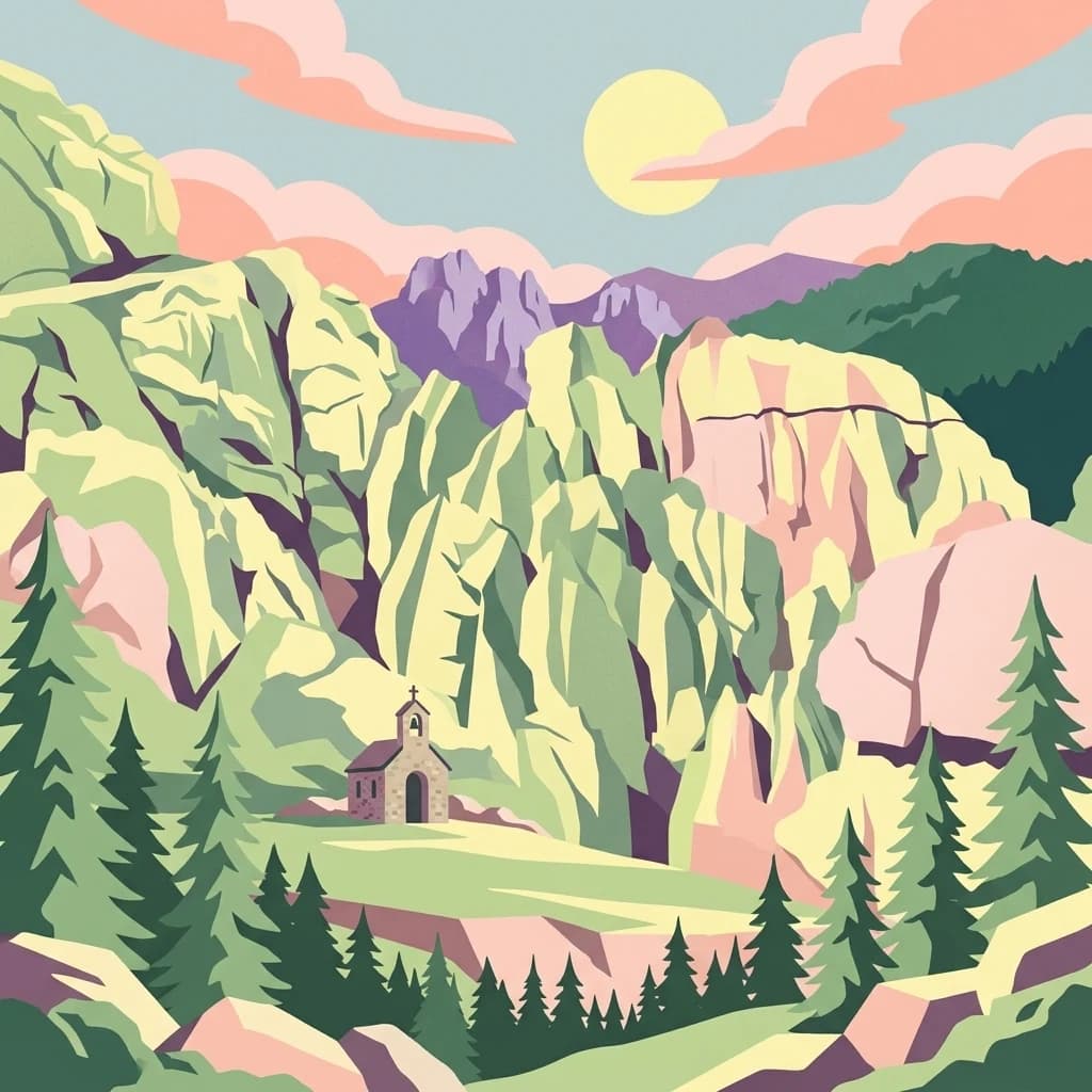
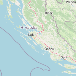
Paklenica National Park presents a spectacular protected area defined by its deep karst canyons, with Velika Paklenica and Mala Paklenica carving dramatic vertical walls into the Velebit mountain range. This national park is celebrated for its status as a leading European climbing destination and its ancient beech forests, part of a UNESCO World Heritage site. Exploring Paklenica offers insight into unique geological formations, extensive cave systems, and the rich biodiversity of this significant Croatian landscape.

Area
95 km²
IUCN
II
Relief
Mountain
Climate
Mediterranean
National park

Plitvice Lakes National Park: Croatia's Iconic National Park and UNESCO Heritage Site

Mapped protected area with cascading lakes and karst geography.

Delve into the protected landscape of Plitvice Lakes National Park, a jewel of Croatia's natural heritage. This atlas entry highlights the park's famous system of 16 terraced lakes and cascading waterfalls, set within a unique karst terrain. Understand the geographic context and mapped boundaries of this significant protected area, renowned for its geological processes and ancient forest ecosystems. Explore the full spectrum of its protected natural identity.

IUCN
II
Watercolor illustration of a mountainous landscape with green forests, a lake, and distant pink-hued mountains under a light sky
National parkPrimorje-Gorski Kotar County

Risnjak National Park: Protected Mountain Landscape in Primorje-Gorski Kotar

Explore karst terrain and regional geographic context.

Risnjak National Park represents a substantial protected area within the rugged mountain geography of Croatia's Gorski Kotar region. This national park is distinguished by its dramatic karst formations, diverse alpine flora reaching from forested slopes to rocky summits, and the significant natural landmark of the Kupa River's source. Discover its mapped boundaries and the ecological importance of this unique landscape situated in Primorje-Gorski Kotar County.

Area
63.5 km²
Established
1949
IUCN
II
Visitors
16.8K annual
Watercolor illustration of rolling hills, trees, and a body of water
Nature reserveDugi Otok

Telašćica Nature Park: Adriatic Sea Cliffs, Lake Mir, and Protected Landscape

Dugi Otok's Premier Nature Reserve on the Dalmatian Coast

Telašćica Nature Park safeguards a highly distinctive coastal environment on Croatia's Dugi Otok island. This protected area is defined by its imposing 161-meter-high vertical limestone cliffs, locally named 'stene,' which create a breathtaking interface with the Adriatic Sea. Within the park, the unique saltwater Lake Mir offers a fascinating geological feature, while the sheltered bay and its surrounding landscape showcase a rich Mediterranean flora and a complex archipelago. The park serves as a prime example of Adriatic karst landscape preservation and mapped coastal geography.

Area
70.5 km²
Established
1988
IUCN
II
Relief
Mixed relief
Watercolor illustration showing mountains, a river, a waterfall, trees, and flowers.
National park

Una National Park: Bosnia and Herzegovina's Largest National Park and Protected Landscape

Explore its dramatic river canyons and karst geography.

Una National Park represents a significant protected landscape in Bosnia and Herzegovina, covering approximately 198 square kilometers of the Upper Una River basin. This page details the park's protected area identity, focusing on its spectacular riverine geography, including iconic features like the Štrbački Buk waterfall and the deep Unac River canyon. Users can explore the park's mapped boundaries, understand its place within the regional Dinaric mountain context, and discover the characteristics of its unique karst terrain and pristine river ecosystems. MoriAtlas provides essential geographic context for this vital natural area.

Area
350 km²
Established
2008
IUCN
II
Relief
Mixed relief
Watercolor painting of coastal landscape with green islands, trees, and calm water under a soft sky
National park

Brijuni Islands National Park: Adriatic Protected Landscape and Historical Atlas

Mapped boundaries, regional geography, and ecological context.

Brijuni Islands National Park is a significant protected area comprising a Croatian archipelago in the northern Adriatic Sea. This national park showcases a unique Mediterranean landscape blending natural habitats with extensive archaeological sites, offering a rich context for atlas-based exploration. Understanding Brijuni Islands National Park contributes to a broader appreciation of regional geography and the mapped distribution of protected lands.

Area
7.5 km²
Established
1983
IUCN
II
Relief
Lowland
National parkŠibenik-Knin County

Kornati Islands National Park: Dense Mediterranean Archipelago and Protected Karst Landscape

Explore the mapped geography and unique protected island terrain.

Kornati Islands National Park, located in Šibenik-Knin County, Croatia, is distinguished as the Mediterranean's most densely packed archipelago. This national park protects a vast expanse of karst limestone islands, dramatic sea cliffs, and unique flat rock plateaus, alongside its significant marine environment. MoriAtlas provides detailed geographic context and mapped boundaries, enabling structured exploration of this exceptional protected landscape and its ecological significance within the Adriatic Sea.

Area
320 km²
Established
1980
IUCN
II
Relief
Lowland
National parkŠibenik-Knin County

Krka National Park: Croatia's National Park with European Cascade Waterfalls

Explore the mapped protected landscape and karst geography.

Krka National Park, designated as a national park in Croatia, offers a rich exploration of its protected landscape. Located in Šibenik-Knin County, the park is defined by the Krka River and its extraordinary seven travertine waterfalls, most notably Skradinski buk, the largest cascade system of its kind in Europe. This atlas-focused view highlights the park's unique karst terrain, Mediterranean ecosystems, and its position within the regional geography, providing essential context for understanding its protected natural heritage.

Area
109 km²
Established
1985
IUCN
II
Relief
Lowland

Common questions about visiting, size, designation, and location context for Northern Velebit National Park

Northern Velebit National Park FAQs for park facts, access, geography, and protected area context
Find quick answers about Northern Velebit National Park, including protected-area facts, park geography, trail and visitor context, and how the park fits into its surrounding country and regional landscape.
MoriAtlas Explorer

Continue Your Protected Areas Search Across the Global Atlas

Deepen your exploration by continuing the structured search for national parks and protected areas worldwide. Utilize the comprehensive filtering capabilities to compare different conservation landscapes and refine your understanding of global park geography. Discover more about the distribution and characteristics of protected natural areas.

Global natural geography