Mori Atlas logo
National parkKrka National Park

Mapping the protected karst landscape and spectacular travertine waterfalls of Krka River.

Krka National Park: Croatia's Landmark National Park in Šibenik-Knin County

Krka National Park stands as a protected national park in the heart of Dalmatia, situated within Šibenik-Knin County, Croatia. This page offers an atlas-driven exploration of its remarkable geography, focusing on the Krka River's middle-lower course and its iconic chain of seven travertine waterfalls, culminating in the expansive Skradinski buk cascades. Discover the mapped boundaries and landscape context of this significant protected area, renowned for its unique karst terrain and rich biodiversity, providing a foundation for structured geographic discovery.

travertine waterfallsKarst landscapeMediterranean ecosystemsbirdwatchingendemic fish speciesOrthodox monastery

Krka National Park

National park

Park overview

Structured park overview, official facts, and landscape profile for Krka National Park

Krka National Park park facts, protected area profile, and essential visitor context
Review the core facts for Krka National Park, including designation, size, terrain, visitor scale, habitats, and operating context in one park-focused overview.

About Krka National Park

Krka National Park protects one of Croatia's most distinctive river landscapes, where the Krka River cascades through a Karst terrain of extraordinary geological complexity. The river originates at the foot of Mount Dinara near Knin and flows through a deep canyon before passing through Prokljansko Lake and entering the Adriatic Sea at Šibenik. The park encompasses not only the main Krka channel but also the lower reaches of its tributary, the Čikola River. What makes this landscape exceptional is the ongoing geological process of travertine deposition—calcium carbonate precipitated by mosses and algae that builds terraced platforms and creates the park's signature waterfalls. Seven distinct falls punctuate the river's course, each with unique character and scale. The largest, Skradinski buk, forms a massive natural pool with cascading tiers stretching 400 meters in length. Beneath it operates the Jaruga hydroelectric plant, commissioned in 1895 and among the oldest continuously operating AC power facilities in the world. The park's visitor infrastructure includes boardwalks, boat tours, and educational presentations, though the experience remains centered on the river's natural rhythm and the interplay of water, rock, and Mediterranean vegetation.

Quick facts and research context for Krka National Park

Krka National Park is located in Šibenik-Knin County in central Dalmatia, Croatia, just a few kilometers northeast of the city of Šibenik. The protected area follows the Krka River through a 75-kilometer canyon before it empties into the Šibenik Bay via a 23.5-kilometer ria—a submerged river valley created after the last glacial period. The park features seven travertine (sedimentary limestone) waterfalls: Bilušića buk, Brljanski slap, Manojlovac, Rošnjak, Miljacka, Roški slap, and Skradinski buk. Skradinski buk contains 17 individual falls across a 400-meter length, with a total height drop of 47.7 meters. The Jaruga Hydroelectric Power Plant, located below Skradinski buk, is one of the oldest alternating current power plants in the world, commissioned in 1895.

Park context

Deeper park guide and search-rich context for Krka National Park

Krka National Park history, landscape, wildlife, and travel context
Explore Krka National Park through its history, landscape character, ecosystems, wildlife, conservation priorities, cultural context, and seasonal travel timing in a structured park guide built for atlas discovery and search intent.

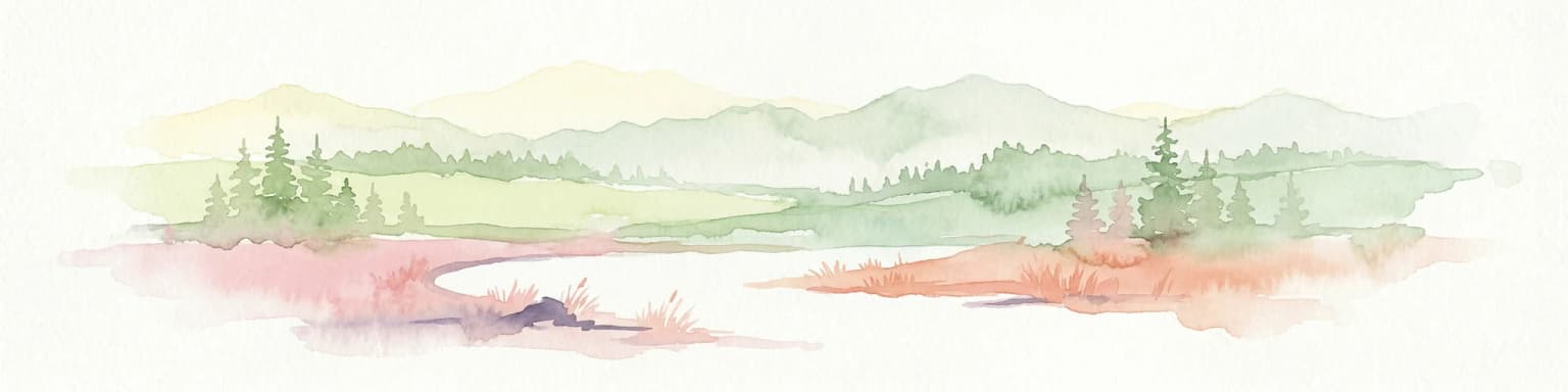
Why Krka National Park stands out

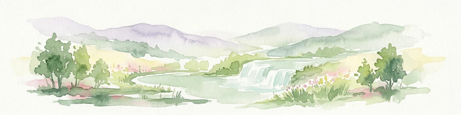
Krka National Park is best known for its extraordinary travertine waterfall system, which represents the largest cascade formation of its kind in Europe. The Skradinski buk waterfall complex is particularly celebrated for its wealth and variety of geomorphological forms, lush vegetation, and the interplay of light on whirlpools and mist, considered among the most beautiful calcium carbonate waterfalls on the continent. The park is also notable for its high-density lavender fields (second only to Provence in Europe), which support abundant pollinator populations. Its ornithological significance is exceptional, with 222 documented bird species and critical importance for spring and autumn migratory routes. The presence of two historic monasteries, Visovac Island's Franciscan foundation and the Krka Orthodox Monastery, adds cultural depth to the natural wonder.

Krka National Park history and protected-area timeline

Krka National Park was established in 1985 as the seventh national park in Croatia, created to safeguard the Krka River and its remarkable natural heritage. The park's establishment reflected growing recognition of the region's geological, ecological, and cultural significance. Prior to national park status, the area had been protected under various designations, and its exceptional waterfalls had long attracted visitors. The park's cultural heritage extends far deeper than its modern protection—human presence in the region dates to ancient times, with archaeological evidence of Roman settlements and fortifications. The Visovac Monastery, founded during the reign of Louis I of Hungary in the 14th century and formally established by Franciscans in 1445, sits on its island in the Krka River. The Krka Orthodox Monastery, founded as a spiritual endowment by Jelena Šubić (sister of Serbian Emperor Dušan) in 1345, represents another significant historical layer. Construction and reconstruction of the Orthodox monastery continued until the late 18th century. The Jaruga Hydroelectric Power Plant, built beneath Skradinski buk and operational since 1895, marks an important chapter in technological history as one of the world's first alternating current hydroelectric installations.

Krka National Park landscape and geographic character

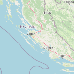
The Krka National Park landscape is defined by the Karst (Karstic) terrain characteristic of the Dalmatian coast, where limestone bedrock has been sculpted by water into a complex topography of canyons, caves, and sinkholes. The Krka River itself has carved a dramatic 75-kilometer canyon, descending through multiple elevation changes that create the park's signature waterfalls. The landscape transitions from the more mountainous upper reaches near Knin to the gentler coastal-influenced lower course. Along the river, the terrain creates natural pools, cascades, and marshy wetlands. The ria—the submerged lower portion of the river valley that extends 23.5 kilometers inland from the coast to the base of Skradinski buk—represents a unique geographical phenomenon where seawater mixes with fresh river water. The area around Skradinski buk features the densest concentration of waterfalls, with 17 individual falls spread across a relatively compact area, their collective height difference totaling 47.7 meters. Mediterranean vegetation including maquis (scrubland), oak forests, and dry grassland covers the surrounding slopes, while wetter areas along the river support reeds and meadows.

Krka National Park ecosystems, habitats, and plant life

The Krka National Park supports exceptionally rich and varied biodiversity due to its transitional position between Mediterranean and sub-Mediterranean climatic zones and the mosaic distribution of diverse habitat types. The park contains 860 documented species and subspecies of plants, including several endemic Illyrian-Adriatic species such as the stone bellflower, chimney bellflower, mullein inula, Dalmatian pellitory, and the Illyrian iris that grows directly on exposed rock faces. The wet areas along the Krka and Čikola rivers host meadow squill, knotweed, European hornbeam, wood melick, and lady orchid. The Krka River itself harbors 18 fish species, ten of which are endemic—making it a natural landmark of the highest conservation category. Brown trout and Dalmatian barbelgudgeon are among the notable residents. The travertine formations and aquatic habitats support particularly significant invertebrate communities, while the mosaic of wetlands, reed beds, and surrounding forests creates ideal conditions for amphibians and reptiles. The park's high lavender density—second only to Provence—creates extraordinary conditions for pollinators, with abundant wasps and bees throughout the summer months.

Krka National Park wildlife and species highlights

Krka National Park's wildlife significance centers on its exceptional bird populations and the river's unique fish communities. With 222 documented bird species, the park ranks among Europe's most ornithologically valuable regions, particularly due to its critical role as a migration corridor during spring and autumn. Birds of prey are especially well represented: osprey, short-toed eagle, golden eagle, Bonelli's eagle, lanner falcon, and peregrine falcon all inhabit the area. The European bee-eater, griffon vulture, and Eurasian eagle-owl add to the raptor diversity. The Krka River's fish community is remarkable for its endemism—ten of the eighteen species are found nowhere else, a level of localized biodiversity that places this watercourse among Europe's most significant fluvial ecosystems. Brown trout and Dalmatian barbelgudgeon are flagship species. Mammal diversity includes 18 species of bats, several of which are endangered or near extinction elsewhere in Europe, including long-fingered bat and Daubenton's bat. The European otter, a threatened species throughout much of its range, also persists in the park's wetland habitats. Reptile populations inhabit the thickets and stone quarries, while amphibians thrive in the reed beds, lakes, and swamped meadows.

Krka National Park conservation status and protection priorities

Krka National Park represents a cornerstone of Croatian nature conservation, protecting a river ecosystem of exceptional scientific and ecological value. The Krka River's fish communities—particularly the ten endemic species—qualify it as a natural landmark of the highest category. The park's designation as a national park in 1985 reflected recognition that the travertine waterfall system, the river's ecological processes, and the surrounding Karst landscape required formal protection. The ria's biological vitality and lack of pollution further enhance its conservation significance, supporting diverse communities of shellfish, freshwater fish, and saltwater fish in a relatively undisturbed environment. The bat populations—18 species including several endangered or threatened forms—represent another conservation priority, as these mammals are declining across much of Europe. The bird migration corridor function adds international conservation relevance, as the park serves as a critical waypoint for species traveling between northern Europe and Mediterranean wintering grounds.

Krka National Park cultural meaning and human context

The Krka National Park contains significant cultural heritage that predates modern protection and adds historical depth to the natural landscape. The Visovac Monastery, located on an island in the Krka River, was founded during the reign of Louis I of Hungary (14th century) and formally established by Franciscan monks in 1445. The island and monastery can be visited via boat tours departing from Skradinski buk, offering visitors a glimpse into over five centuries of continuous religious presence. The Krka Orthodox Monastery, founded in 1345 as an endowment by Jelena Šubić (sister of Serbian Emperor Dušan), served as the spiritual center of the Orthodox Dalmatian Eparchy and was first mentioned in written documents in 1402. Construction and rebuilding continued until the late 18th century, reflecting centuries of continuous religious and cultural significance. The park also contains archaeological remains of unpreserved fortresses dating to Roman times at locations including Čučevo, Nečven, Bogočin, Ključica, and Burnum, indicating human settlement and strategic importance of the river corridor throughout antiquity.

Top sights and standout views in Krka National Park

Krka National Park's standout feature is its chain of seven travertine waterfalls, with Skradinski buk—the largest travertine cascade system in Europe—providing the park's signature sight. The combination of cascading water, limestone formations, and lush Mediterranean vegetation creates one of Croatia's most recognizable natural landscapes. The park's high biodiversity across multiple taxonomic groups—plants, fish, birds, and bats—reinforces its ecological significance beyond mere scenic beauty. The historical presence of two monasteries, one Catholic and one Orthodox, demonstrates the region's long-standing cultural importance. The Jaruga Hydroelectric Power Plant represents an unusual intersection of natural heritage and technological history. The ria phenomenon—where seawater extends 23.5 kilometers inland—offers a distinctive coastal-inland mixing habitat found in few other European locations.

Best time to visit Krka National Park

The Krka National Park can be visited year-round, though each season offers a different experience. Summer brings the highest visitor numbers and the most active tourist facilities, but also the lowest water flow (18 cubic meters per second), meaning some waterfalls may appear less impressive than in spring when flow reaches 55 cubic meters per second on average. Spring and autumn generally provide more dramatic waterfall displays and fewer crowds, making these shoulder seasons ideal for those seeking a more contemplative experience. The high summer months coincide with peak lavender bloom, attracting exceptional numbers of bees and wasps to the area—a detail worth considering for visitors with insect sensitivities. Winter offers the highest water flow (43 cubic meters per second) but reduced visitor services and cooler temperatures. The walking trails and boat tours operate throughout the year, though specific facilities may have seasonal schedules.

Park location guide

Geography guide, regional context, and park location map for Krka National Park

Krka National Park park geography, regions, and map view in Croatia
Understand where Krka National Park sits in Croatia through a broader geographic reading of the surrounding landscape, nearby location context, and its mapped position within the national park landscape.

How Krka National Park fits into Croatia

Croatia is a unitary parliamentary republic located in Central and Southeast Europe along the Adriatic Sea. With an area of approximately 56,600 km² and a population of nearly 3.9 million, it is a member of the European Union and uses the Euro as its currency. Zagreb serves as both the capital and largest city.

Wider geography shaping Krka National Park in Croatia

Croatia is located in Central and Southeast Europe, bordering Slovenia and Hungary to the northwest and northeast respectively, Serbia to the east, Bosnia and Herzegovina and Montenegro to the southeast, with a maritime border with Italy to the west. The country occupies the eastern shores of the Adriatic Sea and spans the Dinaric Alps, Pannonian plain, and coastal islands.

Map view of Krka National Park

Use this park location map to pinpoint Krka National Park in Croatia, understand its exact geographic position, and read its mapped placement within the surrounding landscape more clearly.

Pigeon | © OpenStreetMap contributors

Location context for Krka National Park

Šibenik-Knin County
Park atlas

Compare the regional park geography and connected protected landscapes surrounding Krka's unique Karst terrain.

Discover Nearby National Parks and Protected Areas Beyond Krka National Park, Croatia
After exploring Krka National Park's iconic travertine waterfalls and rich river ecosystems, browse other national parks and protected areas within the surrounding Karst landscape. Compare these natural reserves to trace the regional spread of Mediterranean ecosystems and understand broader conservation efforts.
National parkŠibenik-Knin County

Kornati Islands National Park: Dense Mediterranean Archipelago and Protected Karst Landscape

Explore the mapped geography and unique protected island terrain.

Kornati Islands National Park, located in Šibenik-Knin County, Croatia, is distinguished as the Mediterranean's most densely packed archipelago. This national park protects a vast expanse of karst limestone islands, dramatic sea cliffs, and unique flat rock plateaus, alongside its significant marine environment. MoriAtlas provides detailed geographic context and mapped boundaries, enabling structured exploration of this exceptional protected landscape and its ecological significance within the Adriatic Sea.

Area
320 km²
Established
1980
Relief
Lowland
Climate
Mediterranean
National park

Paklenica National Park: Croatia's Iconic Karst Canyon and UNESCO Beech Forests

Explore dramatic protected landscape and regional geography.

Paklenica National Park presents a spectacular protected area defined by its deep karst canyons, with Velika Paklenica and Mala Paklenica carving dramatic vertical walls into the Velebit mountain range. This national park is celebrated for its status as a leading European climbing destination and its ancient beech forests, part of a UNESCO World Heritage site. Exploring Paklenica offers insight into unique geological formations, extensive cave systems, and the rich biodiversity of this significant Croatian landscape.

Area
95 km²
Relief
Mountain
Climate
Mediterranean
Access
Moderate access
National park

Una National Park: Bosnia and Herzegovina's Largest National Park and Protected Landscape

Explore its dramatic river canyons and karst geography.

Una National Park represents a significant protected landscape in Bosnia and Herzegovina, covering approximately 198 square kilometers of the Upper Una River basin. This page details the park's protected area identity, focusing on its spectacular riverine geography, including iconic features like the Štrbački Buk waterfall and the deep Unac River canyon. Users can explore the park's mapped boundaries, understand its place within the regional Dinaric mountain context, and discover the characteristics of its unique karst terrain and pristine river ecosystems. MoriAtlas provides essential geographic context for this vital natural area.

Area
350 km²
Established
2008
IUCN
II
Relief
Mixed relief
Watercolor illustration of a landscape with green hills, a river, and distant mountains under a light sky
Protected landscapeDalmatia

Biokovo Nature Park: Protected Landscape and Karst Terrain in Dalmatia

Explore Dalmatia's premier protected mountain range along the Adriatic.

Biokovo Nature Park is a striking protected landscape situated in the Dalmatia region of Croatia, characterized by its immense limestone massifs that create a formidable barrier between the coast and the continental interior. This protected area is defined by its classic karst topography, featuring a complex network of sinkholes and caves, and offers unparalleled views from peaks like Sveti Jure. MoriAtlas provides detailed geographic context for understanding Biokovo Nature Park's unique terrain, mapped boundaries, and its significant role in the regional landscape.

Area
196 km²
Established
1981
Relief
Mountain
Climate
Mediterranean
National park

Plitvice Lakes National Park: Croatia's Iconic National Park and UNESCO Heritage Site

Mapped protected area with cascading lakes and karst geography.

Delve into the protected landscape of Plitvice Lakes National Park, a jewel of Croatia's natural heritage. This atlas entry highlights the park's famous system of 16 terraced lakes and cascading waterfalls, set within a unique karst terrain. Understand the geographic context and mapped boundaries of this significant protected area, renowned for its geological processes and ancient forest ecosystems. Explore the full spectrum of its protected natural identity.

National park

Northern Velebit National Park: Croatia's Mapped Protected Landscape Identity

Explore the geography and protected area context.

Northern Velebit National Park stands as a prominent protected area, contributing significantly to the geographic understanding of Croatia's Velebit mountain range. This page provides focused details on its protected landscape features, mapped boundaries, and position within the Dinaric Alps. It serves as an essential entry point for users seeking structured atlas-based information on national parks and their role in regional conservation efforts, highlighting its unique geographic characteristics.

Watercolor illustration of rolling hills, green vegetation, and distant mountains under a light sky
Protected area

Lastovo Nature Park: Discover the Adriatic Karst Archipelago's Protected Landscape

Mapped karst terrain, ancient architecture, and natural island geography.

Lastovo Nature Park protects a remote Croatian archipelago characterized by its striking karst landscape, featuring 46 hills and 46 karstic fields. This protected area offers significant natural biodiversity and remarkably preserved cultural heritage, with extensive Holm Oak and Aleppo Pine forests covering over 60% of the island. Explore Lastovo's unique geography, mapped terrain, and its distinct place within the Adriatic region.

Area
46.87 km²
Established
2006
Relief
Upland
Climate
Mediterranean
National park

Kozara National Park: Bosnia and Herzegovina's Distinctive Forested Mountain Landscape

Mapped protected area in the Pannonian Plain's highland oasis.

Kozara National Park represents a significant protected natural area within Bosnia and Herzegovina, distinguished by its rounded, forested peaks that ascend from the surrounding Pannonian lowlands. This national park offers a unique landscape characterized by dense deciduous and mixed forests, interspersed with clearings and meadows, covering a considerable portion of its 39 square kilometer area. The park's geographic identity is further defined by its proximity to major rivers like the Una, Sava, Sana, and Vrbas, which delineate its natural boundaries and contribute to its distinct regional context. For atlas-based discovery, Kozara provides insight into how isolated highlands create unique protected landscapes within flatter terrain.

Area
39.08 km²
Established
1967
IUCN
II
Relief
Upland

Common questions about visiting, size, designation, and location context for Krka National Park

Krka National Park FAQs for park facts, access, geography, and protected area context
Find quick answers about Krka National Park, including protected-area facts, park geography, trail and visitor context, and how the park fits into its surrounding country and regional landscape.
MoriAtlas Explorer

Continue Your Protected Areas Search Across the Global Atlas

Deepen your exploration by continuing the structured search for national parks and protected areas worldwide. Utilize the comprehensive filtering capabilities to compare different conservation landscapes and refine your understanding of global park geography. Discover more about the distribution and characteristics of protected natural areas.

Global natural geography