Mori Atlas logo
National parkUna National Park

Discover the mapped geography and dramatic karst terrain of the Una River's pristine ecosystems.

Una National Park: Bosnia and Herzegovina's Premier National Park and Protected Landscape

Una National Park, designated as a national park in Bosnia and Herzegovina, offers a profound exploration of one of Europe's most intact river ecosystems. This page details the park's protected boundaries, its defining karst landscape, and the spectacular geography shaped by the Una River and its tributaries. Understand the unique mapped terrain, from the iconic Štrbački Buk waterfall to the deep Unac River canyon, and appreciate its significance within the Dinaric mountain region. MoriAtlas provides a structured view of this vital protected area, focusing on its geographic context and landscape features.

River ProtectionWaterfallsKarst LandscapeCanyon EcosystemsDinaric MountainsTransboundary Conservation

Una National Park

National park

Park overview

Structured park overview, official facts, and landscape profile for Una National Park

Una National Park park facts, protected area profile, and essential visitor context
Review the core facts for Una National Park, including designation, size, terrain, visitor scale, habitats, and operating context in one park-focused overview.

About Una National Park

Una National Park represents one of Europe's most significant protected riverine ecosystems, established to preserve the unspoiled character of the Una River and its tributary network. The park occupies a strategic position in the Dinaric Alps of northwestern Bosnia and Herzegovina, where the Una River has carved spectacular canyons through karst terrain over millions of years. The protected area encompasses the upper reaches of the Una River from its confluence with the Krka downstream to the town of Martin Brod, as well as the lower canyon of the Unac River from Drvar to its confluence with the Una. This landscape of exceptional natural beauty features dramatic waterfalls, cascading rapids, ancient river-carved gorges, and rich biodiversity that together create a park of national and European significance. The park's establishment in 2008 reflected growing recognition that the Una River system, with its unique combination of ecological, aesthetic, and cultural values, required formal protection to ensure its preservation for future generations.

Quick facts and research context for Una National Park

Una National Park occupies the northwestern extremity of Bosnia and Herzegovina in the Una-Sanska Canton. The park was formally established in May 2008 through the Law on Una National Park, making it one of the country's younger protected areas. The park protects a network of three rivers—the Una, Krka, and Unac—each contributing distinct ecological and scenic values. The protection regime designates approximately 13,500 hectares for strict and directed protection, with around 6,300 hectares allocated for sustainable development. The park lies at the intersection of three climatic regions, creating unique ecological conditions. Visitors can engage in activities including rafting, fishing, hiking, cycling, and camping, with the annual International Una Regatta drawing kayakers to the park's rapids.

Park context

Deeper park guide and search-rich context for Una National Park

Una National Park history, landscape, wildlife, and travel context
Explore Una National Park through its history, landscape character, ecosystems, wildlife, conservation priorities, cultural context, and seasonal travel timing in a structured park guide built for atlas discovery and search intent.

Why Una National Park stands out

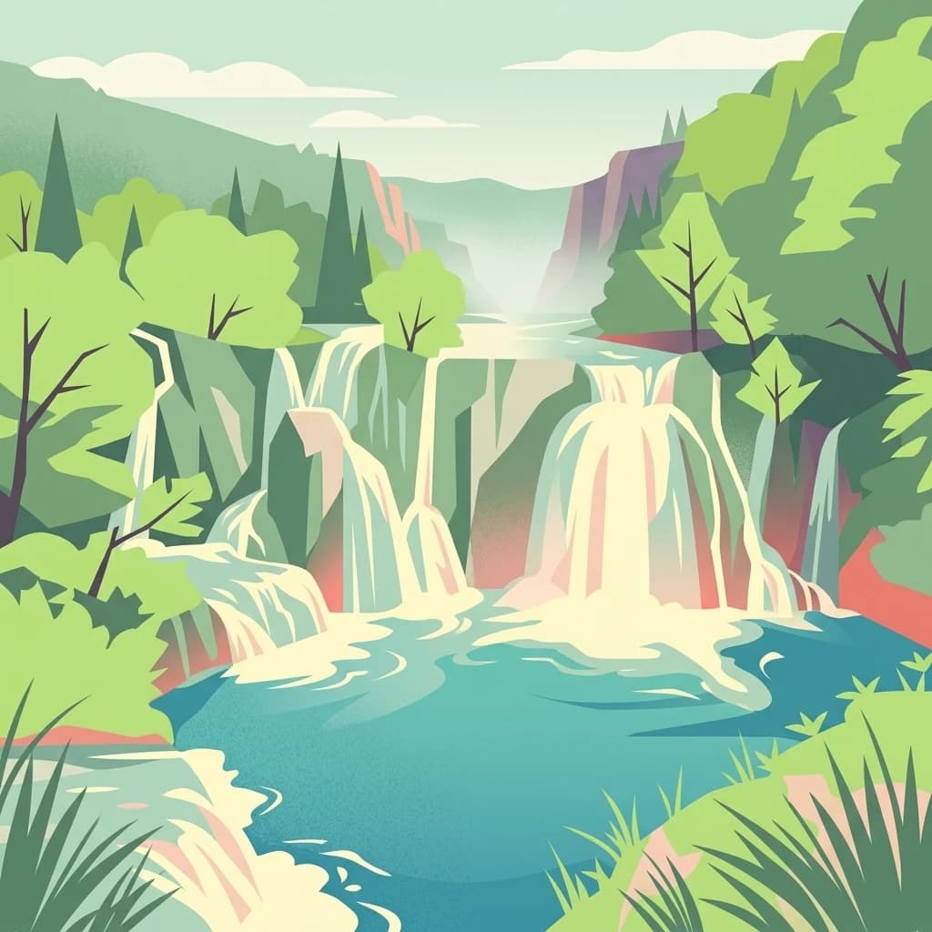
Una National Park is best known for its spectacular riverine landscape, characterized by the Una River's dramatic waterfalls and cascades. The park features the renowned Štrbački Buk waterfall, one of the largest on the Una River, as well as the falls at Martin Brod, where the river forms calcareous sinter banks and cascades. The park's karst canyon landscapes, particularly along the Unac River which plunges through gorges reaching 350 meters in depth, represent outstanding geological features. The river system supports exceptional biodiversity with 30 fish species and 130 bird species, while the broader ecosystem hosts significant populations of large mammals including lynx, wolf, bear, and chamois. The combination of pristine river ecosystems, dramatic waterfalls, and deep canyon landscapes makes this park distinctive within the Dinaric mountain region.

Una National Park history and protected-area timeline

The area comprising Una National Park has been inhabited since prehistoric times, with archaeological evidence of Japodi civilization dating to the Bronze and Iron Ages. The Japodi people established distinctive pile-dwelling settlements along the Una River, particularly at Ripač, leaving a rich cultural legacy that remains significant in the region's heritage. During the Roman period, the area fell under imperial administration, with remnants of Roman fortifications and settlements scattered throughout the park territory. The medieval period saw the construction of numerous fortresses, including Ostrovica Castle above Kulen Vakuf, which was among the most fortified towns in the upper Una River basin before falling to Ottoman administration in 1523. The Rmanj Monastery, located at the confluence of the Unac and Una rivers in Martin Brod, emerged as an important spiritual center at the crossroads of Bosnia, Lika, and Dalmatia, and is now designated as a National Monument of Bosnia and Herzegovina. Formal protection initiatives began with a feasibility study in 2005, which provided the scientific basis for establishing the national park. The Law on Una National Park was enacted on May 29, 2008, formally creating Bosnia and Herzegovina's largest national park and defining its boundaries, protection regime, and management framework.

Una National Park landscape and geographic character

The landscape of Una National Park is defined by its dramatic river canyons, karst terrain, and waterfall systems. The Una River, rising as a karst spring in Croatia near the mountain Stražbenica, enters Bosnia and Herzegovina with a distinctive green-blue color characteristic of limestone-fed waters. Over its course through the park, the river drops nearly three meters per kilometer, creating a succession of rapids, cascades, and waterfalls. The most spectacular of these is Štrbački Buk, where the river tumbles over a series of steps forming one of the largest waterfalls on the Una. Near Martin Brod, the Una forms extensive calcareous sinter terraces and cascades, including the Milančetov Buk waterfall, where mineral deposits create bright white travertine formations. The Unac River, the Una's largest tributary, cuts through a particularly deep canyon reaching 350 meters in depth as it flows through the park from Drvar to Martin Brod. The park's valley floors sit at elevations between 200 and 450 meters, framed by the mountains of Plješevica, Grmeč, and Osječenica which rise along the park's margins.

Una National Park ecosystems, habitats, and plant life

Una National Park supports exceptional ecological diversity resulting from its position at the intersection of three climatic regions and its varied topography and habitats. The park contains over 1,900 plant species, representing more than 52 percent of all plant species found in Bosnia and Herzegovina—a remarkable concentration for a relatively limited area. The karst landscape hosts distinctive vegetation adapted to calcareous substrates, including numerous endemic and relict species. Notable botanical treasures include the yellow gentian (Gentiana lutea), spotted gentian (Gentiana punctata), edelweiss (Leontopodium alpinum), and the Bosnian iris (Iris reichenbachii var. bosniaca). The unska zvončika (Campanilla unensis) is an endemic species bearing the river's name. Forest communities cover the largest portion of the park, ranging from lowland riparian forests along the river corridors to montane forests on the slopes. Grasslands and pastures, maintained through traditional agricultural practices, add to the habitat mosaic. The rivers themselves support specialized aquatic communities, with the travertine waterfalls providing unique habitats for endemic organisms including 42 plant species specifically adapted to these dynamic aquatic environments.

Una National Park wildlife and species highlights

The wildlife communities of Una National Park reflect the park's diverse habitats and position within the Dinaric ecological corridor. The park hosts 30 fish species in its river systems, making it one of Europe's most significant fly fishing destinations. The avian fauna includes 130 recorded bird species, with populations of both resident and migratory birds utilizing the various habitats throughout the park. The mammalian community features notable large carnivores including the Eurasian lynx, wolf, and brown bear—species that require extensive territories and intact habitats. The chamois, a mountain ungulate adapted to rocky terrain, inhabits the steeper sections of the park's canyons and slopes. Foxes are commonly observed throughout the park, while the diverse smaller mammal community includes species typical of Dinaric forests and rocky habitats. The Unac River's karst character, where the river alternately disappears underground and reemerges, creates unique aquatic habitats supporting specialized species. The overall biodiversity value of the park is further enhanced by its position as a corridor connecting the ecosystems of the Dinaric mountain chain.

Una National Park conservation status and protection priorities

Una National Park was established specifically to protect the outstanding natural values of the Una River system, representing Bosnia and Herzegovina's commitment to preserving its most pristine river ecosystems. The park's protection regime divides the territory into strict and directed protection zones covering approximately 13,500 hectares, with an additional development zone of around 6,300 hectares where sustainable activities are permitted. The park's karst landscape and river systems are considered unique in European context, with the combination of hydrological features, canyon formations, and biodiversity representing values of continental significance. The presence of 30 fish species and 130 bird species, along with populations of large carnivores including lynx, wolf, and bear, indicates the ecosystem's ecological integrity. The proposed Peace Park Plitvice-Una concept envisions cross-border cooperation between Una National Park and Croatia's Plitvice Lakes National Park, potentially creating a transboundary protected area that would enhance conservation of the shared ecosystem. The park is expected to contribute to the Natura 2000 network, Europe's coordinated approach to habitat conservation.

Una National Park cultural meaning and human context

The territory of Una National Park contains layers of human history spanning millennia, beginning with the prehistoric Japodi civilization that inhabited the region during the Bronze and Iron Ages. The Japodi people developed a distinctive culture characterized by pile-dwelling settlements along the Una River, with archaeological evidence at Ripač revealing artifacts crafted from clay, bronze, amber, and glass depicting animal and human figures. The area's strategic position on transit routes toward the Adriatic Sea brought it under Roman administration, leaving archaeological sites including the Roman fort Milančeva Kula. Medieval fortresses such as Ostrovica above Kulen Vakuf and Orašac attest to the region's importance in medieval political dynamics. The Rmanj Monastery, founded at the confluence of the Unac and Una rivers in the late 14th or early 15th century, served as a spiritual center at the intersection of Bosnian, Lika, and Dalmatian territories. Traditional agricultural practices of the local population, including livestock raising and extensive farming, have shaped the park's cultural landscape over centuries and continue to inform the park's management approach balancing conservation with sustainable development.

Top sights and standout views in Una National Park

Una National Park offers exceptional experiences centered on its spectacular river landscapes. The Štrbački Buk waterfall, the largest on the Una River, stands as the park's signature natural feature, where cascading waters create a dramatic display amid travertine formations. The Martin Brod area contains multiple waterfalls including the Milančetov Buk, where the river's calcareous sinter deposits have built ornate terraces over geological time. The Unac River canyon, reaching depths of 350 meters, provides a dramatic setting for hiking and exploration. The annual International Una Regatta transforms the river into a competitive kayaking course, while the broader river system offers excellent conditions for rafting, sport fishing, and recreational canoeing. Cultural heritage sites including medieval fortresses, ancient monasteries, and prehistoric archaeological areas add historical depth to the visitor experience. The Ljutoč viewpoint offers panoramic views over the canyon landscape, providing an accessible introduction to the park's dramatic topography.

Best time to visit Una National Park

The best time to experience Una National Park depends on the visitor's interests, though the summer months from June through September offer the most reliable conditions for outdoor activities and river-based recreation. During this period, water levels are typically sufficient for rafting and kayaking, while warm temperatures make hiking and camping comfortable. The waterfalls are at their most impressive during spring and early summer when snowmelt and rainfall maintain strong flows. Autumn brings golden foliage to the forest corridors and fewer visitors, creating a more tranquil atmosphere for those seeking peaceful exploration. Winter visits offer a different perspective, with reduced tourist activity and the possibility of seeing the landscape under snow, though some facilities may have limited operating hours. The shoulder seasons of spring and autumn provide excellent conditions for wildlife observation and photography, with the park's bird populations and larger mammals more active during these transitional periods.

Park location guide

Geography guide, regional context, and park location map for Una National Park

Una National Park park geography, regions, and map view in Bosnia and Herzegovina
Understand where Una National Park sits in Bosnia and Herzegovina through a broader geographic reading of the surrounding landscape, nearby location context, and its mapped position within the national park landscape.

How Una National Park fits into Bosnia and Herzegovina

Bosnia and Herzegovina is a federal parliamentary republic in Southeast Europe on the Balkan Peninsula. It borders Serbia, Montenegro, and Croatia, with a 20-kilometre coastline on the Adriatic Sea. The country has a population of approximately 2.9 million and features diverse geography ranging from mountainous Dinaric Alps in the north to Mediterranean climate in the southern Herzegovina region. Sarajevo serves as the capital and largest city.

Wider geography shaping Una National Park in Bosnia and Herzegovina

Bosnia and Herzegovina occupies the central and eastern parts of the Balkan Peninsula. The country is largely mountainous, dominated by the Dinaric Alps in the central and eastern regions. Bosnia occupies the northern and central areas, while Herzegovina covers the southern region. The country has a small coastline along the Adriatic Sea, approximately 20 kilometres long, near the town of Neum.

Map view of Una National Park

Use this park location map to pinpoint Una National Park in Bosnia and Herzegovina, understand its exact geographic position, and read its mapped placement within the surrounding landscape more clearly.

Pigeon | © OpenStreetMap contributors
Park atlas

Trace the Dinaric region's protected landscapes and river canyons, comparing Una National Park with adjacent protected areas.

Discover Other National Parks and Protected Areas Near Una National Park
Browse national parks and protected areas near Una National Park, mapping the extended geographic context of river canyons, waterfalls, and karst landscapes across the Dinaric Mountains region. Compare additional protected areas by their unique conservation priorities and shared regional terrain, furthering your atlas-based exploration beyond Una National Park.
National park

Paklenica National Park: Croatia's Iconic Karst Canyon and UNESCO Beech Forests

Explore dramatic protected landscape and regional geography.

Paklenica National Park presents a spectacular protected area defined by its deep karst canyons, with Velika Paklenica and Mala Paklenica carving dramatic vertical walls into the Velebit mountain range. This national park is celebrated for its status as a leading European climbing destination and its ancient beech forests, part of a UNESCO World Heritage site. Exploring Paklenica offers insight into unique geological formations, extensive cave systems, and the rich biodiversity of this significant Croatian landscape.

Area
95 km²
Relief
Mountain
Climate
Mediterranean
Access
Moderate access
National park

Plitvice Lakes National Park: Croatia's Iconic National Park and UNESCO Heritage Site

Mapped protected area with cascading lakes and karst geography.

Delve into the protected landscape of Plitvice Lakes National Park, a jewel of Croatia's natural heritage. This atlas entry highlights the park's famous system of 16 terraced lakes and cascading waterfalls, set within a unique karst terrain. Understand the geographic context and mapped boundaries of this significant protected area, renowned for its geological processes and ancient forest ecosystems. Explore the full spectrum of its protected natural identity.

National parkŠibenik-Knin County

Krka National Park: Croatia's National Park with European Cascade Waterfalls

Explore the mapped protected landscape and karst geography.

Krka National Park, designated as a national park in Croatia, offers a rich exploration of its protected landscape. Located in Šibenik-Knin County, the park is defined by the Krka River and its extraordinary seven travertine waterfalls, most notably Skradinski buk, the largest cascade system of its kind in Europe. This atlas-focused view highlights the park's unique karst terrain, Mediterranean ecosystems, and its position within the regional geography, providing essential context for understanding its protected natural heritage.

Area
109 km²
Established
1985
Relief
Lowland
Climate
Mediterranean
National park

Kozara National Park: Bosnia and Herzegovina's Distinctive Forested Mountain Landscape

Mapped protected area in the Pannonian Plain's highland oasis.

Kozara National Park represents a significant protected natural area within Bosnia and Herzegovina, distinguished by its rounded, forested peaks that ascend from the surrounding Pannonian lowlands. This national park offers a unique landscape characterized by dense deciduous and mixed forests, interspersed with clearings and meadows, covering a considerable portion of its 39 square kilometer area. The park's geographic identity is further defined by its proximity to major rivers like the Una, Sava, Sana, and Vrbas, which delineate its natural boundaries and contribute to its distinct regional context. For atlas-based discovery, Kozara provides insight into how isolated highlands create unique protected landscapes within flatter terrain.

Area
39.08 km²
Established
1967
IUCN
II
Relief
Upland
National park

Northern Velebit National Park: Croatia's Mapped Protected Landscape Identity

Explore the geography and protected area context.

Northern Velebit National Park stands as a prominent protected area, contributing significantly to the geographic understanding of Croatia's Velebit mountain range. This page provides focused details on its protected landscape features, mapped boundaries, and position within the Dinaric Alps. It serves as an essential entry point for users seeking structured atlas-based information on national parks and their role in regional conservation efforts, highlighting its unique geographic characteristics.

National parkŠibenik-Knin County

Kornati Islands National Park: Dense Mediterranean Archipelago and Protected Karst Landscape

Explore the mapped geography and unique protected island terrain.

Kornati Islands National Park, located in Šibenik-Knin County, Croatia, is distinguished as the Mediterranean's most densely packed archipelago. This national park protects a vast expanse of karst limestone islands, dramatic sea cliffs, and unique flat rock plateaus, alongside its significant marine environment. MoriAtlas provides detailed geographic context and mapped boundaries, enabling structured exploration of this exceptional protected landscape and its ecological significance within the Adriatic Sea.

Area
320 km²
Established
1980
Relief
Lowland
Climate
Mediterranean
Protected landscapeSisak-Moslavina County

Lonjsko Polje Protected Landscape: Explore Croatia's Largest Inland Wetland and Pastoral Heritage

Discover mapped natural landscapes and unique floodplain geography.

Lonjsko Polje, a significant protected landscape in Croatia's Sisak-Moslavina County, represents the largest inland wetland within the Danube basin. This area is characterized by its vast alluvial floodplain, shaped by seasonal river dynamics, which fosters diverse habitats for wildlife and preserves a rare example of traditional pastoral culture. Explore the mapped geography and understand the ecological importance of this unique wetland ecosystem through structured atlas-style content.

Area
505.6 km²
Established
1998
Relief
Lowland
Climate
Temperate
Watercolor illustration of a landscape with green hills, a river, and distant mountains under a light sky
Protected landscapeDalmatia

Biokovo Nature Park: Protected Landscape and Karst Terrain in Dalmatia

Explore Dalmatia's premier protected mountain range along the Adriatic.

Biokovo Nature Park is a striking protected landscape situated in the Dalmatia region of Croatia, characterized by its immense limestone massifs that create a formidable barrier between the coast and the continental interior. This protected area is defined by its classic karst topography, featuring a complex network of sinkholes and caves, and offers unparalleled views from peaks like Sveti Jure. MoriAtlas provides detailed geographic context for understanding Biokovo Nature Park's unique terrain, mapped boundaries, and its significant role in the regional landscape.

Area
196 km²
Established
1981
Relief
Mountain
Climate
Mediterranean

Common questions about visiting, size, designation, and location context for Una National Park

Una National Park FAQs for park facts, access, geography, and protected area context
Find quick answers about Una National Park, including protected-area facts, park geography, trail and visitor context, and how the park fits into its surrounding country and regional landscape.
MoriAtlas Explorer

Continue Your Protected Areas Search Across the Global Atlas

Deepen your exploration by continuing the structured search for national parks and protected areas worldwide. Utilize the comprehensive filtering capabilities to compare different conservation landscapes and refine your understanding of global park geography. Discover more about the distribution and characteristics of protected natural areas.

Global natural geography