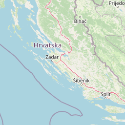

Why Telašćica Nature Park stands out
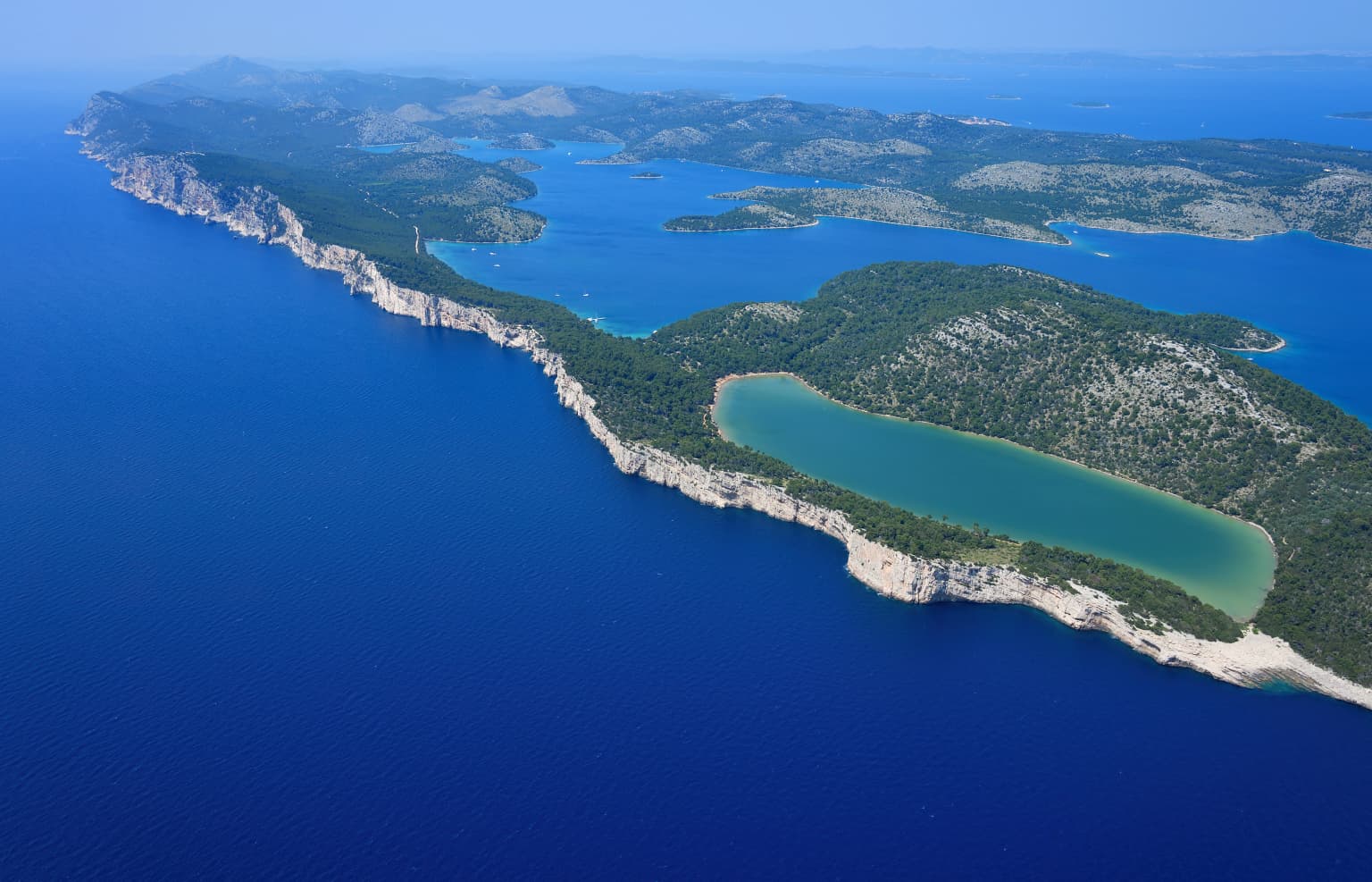
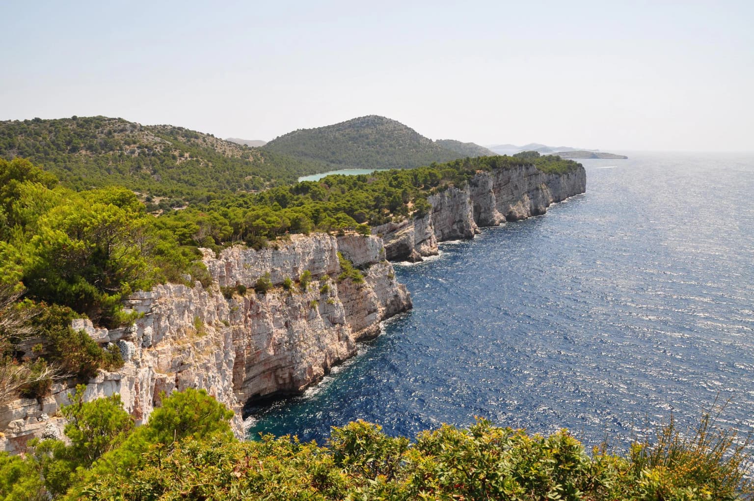
Telašćica is best known for its extraordinary vertical limestone cliffs that represent the most prominent cliff formation along the entire Adriatic Sea. The cliffs, locally called "stene," create a striking landscape where sheer rock faces meet the deep blue waters below. The park is also renowned for Lake Mir, a unique saltwater lake with documented healing properties that sits on a narrow strip between the bay and the open sea. The combination of dramatic coastal cliffs, a marine-protected inlet, and an inland salt lake makes Telašćica a distinctive coastal protected area with remarkable geological diversity within a relatively compact area.
Telašćica Nature Park history and protected-area timeline
Telašćica received formal protected status in 1980, recognizing the exceptional natural value of its geological formations, marine ecosystems, and archaeological heritage. The area was subsequently designated as a Nature Park in 1988, placing it within Croatia's system of protected areas that sit just below national parks in terms of protection stringency. The designation recognized not only the dramatic cliffs and coastal geography but also the ecological communities—both terrestrial and marine—that the area supports. The park's establishment reflected a growing movement in Yugoslav-era Croatia to preserve representative examples of the nation's diverse coastal and island landscapes. Prior to formal protection, the area had long been recognized locally as significant, with the dramatic "stene" cliffs forming a prominent landmark for maritime navigation through the Adriatic.
Telašćica Nature Park landscape and geographic character
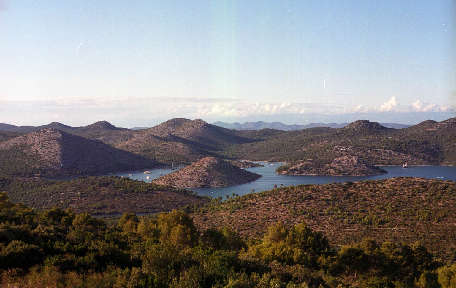
The Telašćica landscape is defined by the dramatic interplay between vertical limestone cliffs and the deep coastal waters of the Adriatic Sea. The imposing cliff faces, known locally as "stene," represent the most significant coastal cliff formation along the entire Adriatic, rising sharply from sea level to heights of 161 meters and continuing below the waterline to depths of 90 meters. These white limestone cliffs create a spectacular backdrop against the deep blue海水, particularly when viewed from the water or from elevated vantage points along the coastal path. The inlet itself is a complex body of water comprising three connected smaller bays, forming a natural harbor that has historically provided safe anchorage for vessels. A narrow strip of land separates the inner bay from the open sea, and on this strip sits Lake Mir, a saltwater lake connected to the Adriatic through underground fissures. The landscape supports a stark contrast between exposed and sheltered areas—while the northeastern shores are nearly devoid of vegetation due to exposure to prevailing winds, the southwestern slopes are covered in thick Mediterranean forest. Six islets scatter across the inner bay, their rocky profiles adding to the archipelago character of the scene.
Telašćica Nature Park ecosystems, habitats, and plant life
Telašćica supports a remarkable diversity of terrestrial and marine habitats within its 70.5-square-kilometer boundary. The park's plant and animal communities—both on land and beneath the sea—comprise more than 100 species, reflecting the ecological richness of this transition zone between Mediterranean terrestrial and marine ecosystems. The vegetation ranges from the exposed, wind-scoured northeastern shores with their minimal plant cover to the thickly forested southwestern slopes where Aleppo pines, olive groves, and fig trees create a classic Mediterranean woodland character. The marine environment within the protected inlet supports distinctive communities adapted to the sheltered conditions of the bay, while the underwater cliff faces host their own specialized assemblages. Lake Mir represents a unique habitat type—a coastal saltwater lake with direct underground connections to the sea, creating conditions that support specialized brackish-water organisms. The surrounding sea grass beds and rocky substrates contribute to the marine biodiversity that makes this area significant beyond its terrestrial features.
Telašćica Nature Park wildlife and species highlights
The wildlife of Telašćica reflects the park's position at the intersection of Mediterranean terrestrial and marine ecosystems. The terrestrial fauna includes species typical of Dalmatian coastal islands, with the forested southwestern slopes providing habitat for various bird species and small mammals. The marine environment within the protected inlet supports diverse fish communities, invertebrate species, and occasional marine visitors. The underwater cliff faces to 90 meters depth create an unusual vertical habitat that supports specialized benthic communities. The surrounding islands and islets provide nesting habitat for seabirds, while the Lake Mir environment supports its own distinctive brackish-water community adapted to the lake's unusual hydrological conditions. The combination of cliff, forest, marine, and lake habitats ensures that Telašćica supports a broader range of species than a single-habitat protected area would.
Telašćica Nature Park conservation status and protection priorities
Telašćica was protected initially in 1980 and formally designated as a Nature Park in 1988 primarily due to its exceptional geological and ecological significance. The dramatic cliff formations represent the most outstanding coastal cliffs in the Adriatic and required protection as geological monuments of national importance. The marine environment within the inlet was recognized for its ecological value, with the protected status extending to underwater areas and the seafloor communities. Lake Mir received attention both for its geological formation—resulting from underground connections to the sea—and for its documented healing properties, adding a cultural dimension to the conservation rationale. The park's protected status also acknowledges the archaeological heritage present within the area, with underwater and terrestrial archaeological sites contributing to the broader conservation rationale. As a Nature Park, Telašćica receives IUCN Category II protection, placing it in the company of national parks worldwide while allowing for sustainable use that is compatible with conservation objectives.
Telašćica Nature Park cultural meaning and human context
The Telašćica area carries historical significance beyond its natural features, with archaeological evidence indicating human presence and activity in the region over extended periods. The dramatic cliffs have long served as navigation landmarks for sailors traversing the Adriatic, with the distinctive "stene" providing a recognizable visual reference point in maritime travel. The local name for the cliffs—"stene"—reflects the deep connection between the landscape and local identity, with this term embedded in the regional vocabulary. Lake Mir has historically been recognized for its purported healing properties, adding a cultural and somewhat medicinal dimension to the site's significance that has persisted in local tradition. The surrounding network of 13 islands and islets creates a complex maritime setting that has historically supported fishing and maritime communities, though the nature park status now regulates such activities within the protected boundary.
Top sights and standout views in Telašćica Nature Park
The vertical limestone cliffs of Telašćica, called "stene," stand as the most impressive coastal cliffs along the Adriatic Sea, rising 161 meters above sea level and plunging 90 meters below. Lake Mir, a unique saltwater lake with healing properties, sits on a narrow land strip between the bay and the open sea, connected to the Adriatic through underground channels. The protected inlet encompasses six interior islets and is surrounded by an additional 13 islands and islets, creating a complex archipelago environment. The park offers a striking contrast between bare, wind-exposed northeastern shores and thickly forested southwestern slopes of pine, olive, and fig trees. The sheltered bay provides safe harbor for vessels and supports diverse marine communities within its protected waters.
Best time to visit Telašćica Nature Park
Telašćica Nature Park is open year-round, allowing visitors to experience the landscape across different seasons. The summer months bring the most stable weather conditions and warm sea temperatures ideal for swimming and boating, though this is also the peak visitor season. Spring and autumn offer more tranquil visitation opportunities with fewer crowds, and the shoulder seasons provide excellent conditions for hiking along the coastal trails while the landscape displays different seasonal characteristics. The dramatic cliff scenery remains impressive in all seasons, though winter storms can create particularly dramatic sea conditions along the exposed shores. The lake and marine environments are accessible throughout the year, though water activities are naturally more appealing during warmer months.