Mori Atlas logo
Protected landscapeBiokovo Nature Park

Discover mapped boundaries, regional geography, and unique alpine ecosystems of this Croatian natural landmark.

Biokovo Nature Park: Dalmatia's Dramatic Protected Landscape and Karst Terrain

Biokovo Nature Park represents a significant protected landscape along Croatia's Dalmatian coast, defined by its steep limestone mountains that rise dramatically from the Adriatic. This high-altitude region showcases extraordinary karst topography, featuring extensive sinkholes, caves, and rock formations sculpted by millennia of erosion. As a key geographic feature within Dalmatia, Biokovo Nature Park offers a unique window into the intersection of Mediterranean and continental climates, supporting diverse flora and fauna adapted to its challenging terrain. MoriAtlas provides map-based context to understand its scale, geographic position, and ecological importance.

karst landscapecoastal mountainsDalmatiaAdriatic coastnature parkmountain hiking
Watercolor illustration depicting a mountainous landscape with a lake, trees, and a coastal town

Biokovo Nature Park

Protected landscape

Park overview

Structured park overview, official facts, and landscape profile for Biokovo Nature Park

Biokovo Nature Park park facts, protected area profile, and essential visitor context
Review the core facts for Biokovo Nature Park, including designation, size, terrain, visitor scale, habitats, and operating context in one park-focused overview.

About Biokovo Nature Park

Biokovo Nature Park protects a remarkable mountain environment that forms the scenic backdrop to Croatia's celebrated Makarska Riviera. The park encompasses the northern and most accessible portion of the Biokovo mountain range, a massive limestone formation that rises nearly 1,800 meters directly from the Adriatic coast, creating one of the most impressive mountain-to-sea transitions in the Mediterranean. The protected area was established in 1981 to preserve this ecologically and scenically significant landscape, with the Republic of Croatia founding the Biokovo Nature Park public institution in 1998 to oversee management and development of the park's conservation, recreation, and educational functions.

The mountain's geology is dominated by Cretaceous limestone and dolomite, with flysch and breccia layers creating a complex substrate that has been shaped by karst processes for millions of years. This karst landscape is characterized by sinkholes, disappearing streams, caves, and a distinctive lack of surface water drainage—all hallmark features of limestone terrain. The Biokovo range extends along the Dalmatian coast from the Dubci pass to the Baćina lakes near Ploče, with the northeastern boundary marked by the A1 highway. The mountain is part of the broader Dinaric Alps system that runs parallel to the Adriatic coast, with adjacent ranges including Mosor to the northwest and the Sutvid and Rilić mountains to the southeast.

The park serves as an important ecological corridor and refuge for species adapted to the mountain's diverse habitats, which range from dry Mediterranean scrub on the lower slopes through beech and fir forests to alpine grasslands at the highest elevations. The Biokovo Nature Park Visitor Center, located in downtown Makarska, provides educational resources and information for visitors exploring the area.

Quick facts and research context for Biokovo Nature Park

Biokovo Nature Park covers approximately 196 square kilometers along the Dalmatian coast in southern Croatia. The protected area was established in 1981, with a dedicated public institution created in 1998 to manage conservation, maintenance, and promotion of the park. The mountain range reaches 1,762 meters at Sveti Jure and includes several other significant peaks exceeding 1,500 meters, including Troglav at 1,658 meters and Sveti Ilija at 1,642 meters. The geology is dominated by Cretaceous limestone, dolomites, breccias, and flysch, with more than 400 catalogued cave systems. The park lies within Split-Dalmatian County, with Makarska serving as the primary gateway town.

Park context

Deeper park guide and search-rich context for Biokovo Nature Park

Biokovo Nature Park history, landscape, wildlife, and travel context
Explore Biokovo Nature Park through its history, landscape character, ecosystems, wildlife, conservation priorities, cultural context, and seasonal travel timing in a structured park guide built for atlas discovery and search intent.

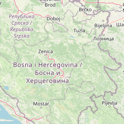
Why Biokovo Nature Park stands out

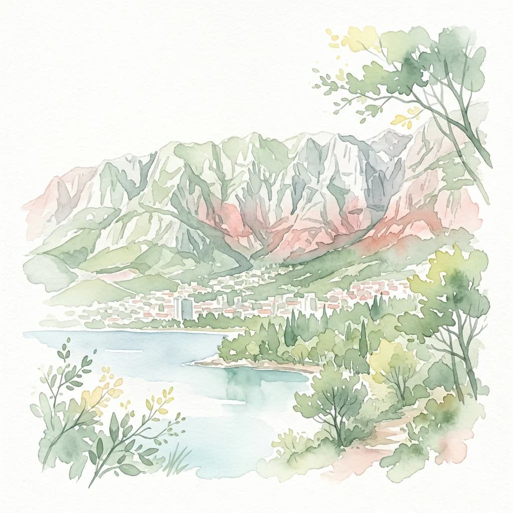
Biokovo is best known for its dramatic coastal mountain scenery, where sheer limestone cliffs rise abruptly from the Adriatic coastline, creating one of the most striking vertical transitions in European geography. The summit of Sveti Jure, accessible by the Biokovska cesta road, Croatia's highest public road, offers panoramic views spanning the Makarska Riviera, the offshore islands, and on clear days the Italian mainland. The mountain's karst landscape is exceptional, featuring an extensive network of sinkholes, caves, and underground passages that rank among the most developed in the Dinaric region. Biokovo also serves as a challenging venue for professional cycling, featuring as a summit finish in the Tour of Croatia race. The mountain is home to endemic flora and fauna adapted to its unique combination of Mediterranean sunshine and alpine conditions.

Panoramic view of Biokovo mountain range with Makarska town and the Adriatic Sea under a blue sky with scattered clouds
Panoramic view of Biokovo mountain range and Makarska town from Biokovo Nature Park

Biokovo Nature Park history and protected-area timeline

Biokovo has long held significance as a landmark and resource for the coastal communities of Dalmatia. The mountain's slopes have been used for cattle raising, grape growing, and hunting for generations, particularly in the Zabiokovlje region—a mountainous area encompassing villages such as Gornja Brela, Zadvarje, Žeževica, Grabovac, Rastovac, Zagvozd, Župa, Rašćane, and Kozica. These settlements, situated at elevations around 1,100 meters in the mountain's shadow, developed distinctive agricultural traditions suited to the karst terrain.

The modern protected area was established in 1981 when the northern portion of the Biokovo range was declared a nature park. In 1998, the Republic of Croatia created the public institution Park prirode Biokovo to manage the protected area, charge with its protection, maintenance, and promotion. The construction of Biokovska cesta—the mountain road leading to Sveti Jure—represented a significant development in the region's infrastructure, with the original road built for the construction of the television transmitter in 1965 and asphalted in 1978. The road was built through the efforts and dedication of local residents. The mountain has also been a destination for hikers since the early twentieth century, with the Aleksandrov dom mountain hut on Vošac at 1,400 meters welcoming visitors as early as the 1935-1936 season, attracting climbers from Czechoslovakia, Germany, England, Austria, and France.

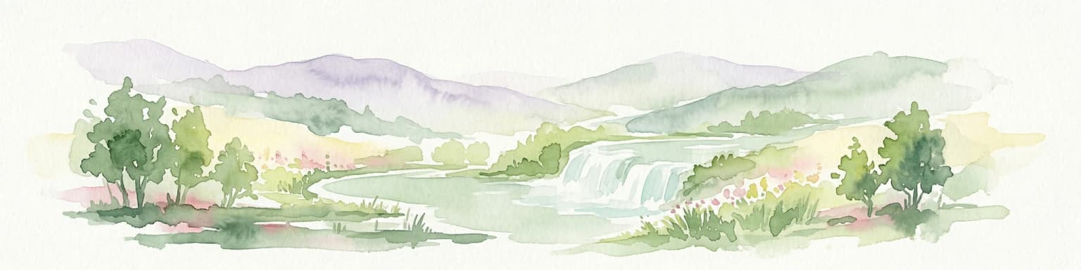
Biokovo Nature Park landscape and geographic character

The Biokovo landscape is defined by its dramatic elevation change from sea level to 1,762 meters, accomplished within a relatively short horizontal distance. The mountain presents a massive, steep-walled face to the Adriatic, with ridges and peaks breaking the skyline above the coastal towns of the Makarska Riviera. The terrain is dominated by karst topography, with the landscape featuring an extraordinary density of sinkholes—locally called ponikve—some of which exceed 100 meters in depth. These depressions, along with collapsed caves and deep vertical shafts, create the distinctive terrain known as mrežasti krš or network karst.

The limestone geology has been carved by water and gravity into a landscape of crags, cliffs, and rock towers. The summit area of Sveti Jure and the surrounding peaks feature a more subdued terrain of grass-covered slopes and rocky plateaus, with snow persisting for much of the year in the highest areas. Below the summit, the mountain slopes descend through distinct vegetation zones toward the coastal plain. The mountain includes several notable peaks besides Sveti Jure: Troglav reaches 1,658 meters, Sveti Ilija stands at 1,642 meters, and Šćirovac, Kimet, Veliki Šibenik, and Vošac all exceed 1,400 meters. The Vošac peak offers what is considered one of the finest viewpoints over the Makarska Riviera.

Panoramic landscape of Biokovo Nature Park showing rugged mountains, dense forests, and the Adriatic Sea under a clear blue sky
Panoramic view of Biokovo Nature Park mountains and Adriatic Sea coastline near Makarska, Croatia

Biokovo Nature Park ecosystems, habitats, and plant life

Biokovo's nature is shaped by the intersection of Mediterranean and continental climatic influences, creating a mosaic of habitats that support remarkable biodiversity. The mountain's elevation gradient, combined with its position along the Adriatic, produces a range of microclimates that support both Mediterranean species at lower elevations and continental alpine species near the summit. The park's vegetation includes dry Mediterranean garrigue and maquis on the sun-exposed lower slopes, giving way to forests of beech and fir in the cooler, shadier positions and at higher elevations. The summit zones feature alpine grassland communities adapted to the harsh conditions, including strong winds and significant temperature fluctuations.

The park protects over 1,500 plant and animal species, with numerous endemic species found in the karst cave systems and on the mountain's isolated peaks. The karst landscape provides critical habitat for cave-dwelling organisms, with more than 400 speleological objects catalogued within the Biokovo range. These underground environments, with their constant temperature and humidity, host specialized fauna found nowhere else. The combination of different habitat types—cliff faces, rock ledges, forest stands, sinkholes, and caves—creates the ecological diversity that makes Biokovo significant for conservation within the Dinaric region.

Rocky mountain slopes descending toward the sea with coastal areas visible in the distance
Panoramic view from Vošac peak overlooking Biokovo Nature Park and the Makarska Riviera coastline

Biokovo Nature Park wildlife and species highlights

Biokovo supports a diverse fauna reflecting its position at the crossroads of Mediterranean and Alpine biogeographic regions. The mountain's forests and rocky habitats provide shelter for several species of raptors, including eagles and falcons that nest on the limestone cliffs. The karst cave systems host specialized invertebrate communities, with numerous species adapted to the dark, stable conditions of the underground environment. In the higher elevations, species such as chamois and wild boar traverse the rocky terrain, while the forest zones support deer and other woodland mammals. The diverse plant communities attract insects and pollinators, particularly in the flower-rich alpine meadows during summer months. The sinkholes and rock faces provide breeding habitat for birds adapted to cliff environments, while the transitional forests host species typical of both Mediterranean and continental European faunal communities.

Rocky mountain range with green patches overlooking a coastal town and sea. Buildings line the shoreline with trees between the town and mountains.
Panoramic view of Biokovo Mountains from Makarska coastline, Croatia

Biokovo Nature Park conservation status and protection priorities

Biokovo Nature Park represents an important protected area within Croatia's coastal mountain systems, preserving a landscape that exemplifies the intersection of Mediterranean and Alpine ecological zones. The park protects significant karst ecosystems, including both surface landforms and the extensive cave systems that harbor endemic biodiversity. The protected status helps preserve the mountain's natural vegetation communities, which include old-growth forests and alpine grasslands that would otherwise face pressure from development or intensive land use. The park also serves as a critical ecological corridor, connecting coastal and continental habitats and allowing species to migrate between different elevation zones. The karst landscape's sensitivity to disturbance—karst ecosystems recover very slowly from damage—makes protected area status essential for long-term conservation of these unique environments.

Biokovo Nature Park cultural meaning and human context

Biokovo has been an integral part of the cultural landscape of Dalmatia for centuries, with the mountain's slopes and villages forming a distinctive cultural region known as Zabiokovlje. The local population developed unique traditions suited to the challenging karst environment, including specialized agricultural practices such as cattle raising, grape cultivation, and seasonal transhumance. The mountain's peaks hold religious significance, with chapels at Sveti Jure and Sveti Ilija serving as destinations for annual pilgrimages. The church at Sveti Jure, built in 1968 near the site of an older chapel destroyed for transmitter construction, hosts a mass on the last Saturday of July that draws faithful from both the coastal Primorje region and the Zagora interior. The annual pilgrimage to Sveti Ilija, held in late July, is described as one of the most inaccessible masses in Croatia, with the chapel having been restored by local residents in the 1990s.

Wide view of snow-covered mountain range with TV transmitter tower visible on the left side
Wide view of snow-capped mountains with TV transmitter visible on the left side

Top sights and standout views in Biokovo Nature Park

The summit of Sveti Jure at 1,762 meters provides the park's most spectacular highlight, with panoramic views encompassing the Makarska Riviera, the Adriatic islands, and on clear days the Italian mainland 250 kilometers away. The Biokovska cesta road—Croatia's highest public road—allows vehicle access to near the summit, making the alpine experience accessible to visitors without climbing ability. The karst landscape, with its network of sinkholes and over 400 catalogued caves, represents one of the most developed karst systems in the Dinaric region and offers exceptional opportunities for speleological exploration. The mountain's ecological diversity, with over 1,500 species including endemic cave organisms, demonstrates the conservation significance of the protected area. The challenging cycling ascent to Sveti Jure, featured in the Tour of Croatia, has established Biokovo as a landmark in professional cycling. The visitor center in Makarska provides orientation and educational resources for exploring the park's trails and natural features.

Best time to visit Biokovo Nature Park

Biokovo can be visited throughout the year, though each season offers different experiences and considerations for visitors. Summer brings the most accessible conditions, with warm weather on the coast and the mountain trails generally clear, though the summit can remain cool and windy. The summer months see the highest visitor numbers, particularly at Sveti Jure where minibus tours operate during July and August. Spring and autumn offer milder conditions and fewer crowds, with spring bringing wildflower displays in the mountain meadows and autumn providing clear visibility for panoramic views. Winter conditions can be severe at higher elevations, with snow persisting on the summit and temperatures well below freezing; the mountain road may be closed or require caution during this season. The harshest conditions typically prevail from December through March, while May through October represents the most suitable period for general visitation. Visitors should be aware that the mountain can be dangerous for unprepared hikers, and the terrain demands appropriate equipment and awareness of weather changes.

Park location guide

Geography guide, regional context, and park location map for Biokovo Nature Park

Biokovo Nature Park park geography, regions, and map view in Croatia
Understand where Biokovo Nature Park sits in Croatia through a broader geographic reading of the surrounding landscape, nearby location context, and its mapped position within the national park landscape.

How Biokovo Nature Park fits into Croatia

Croatia is a unitary parliamentary republic located in Central and Southeast Europe along the Adriatic Sea. With an area of approximately 56,600 km² and a population of nearly 3.9 million, it is a member of the European Union and uses the Euro as its currency. Zagreb serves as both the capital and largest city.

Wider geography shaping Biokovo Nature Park in Croatia

Croatia is located in Central and Southeast Europe, bordering Slovenia and Hungary to the northwest and northeast respectively, Serbia to the east, Bosnia and Herzegovina and Montenegro to the southeast, with a maritime border with Italy to the west. The country occupies the eastern shores of the Adriatic Sea and spans the Dinaric Alps, Pannonian plain, and coastal islands.

Map view of Biokovo Nature Park

Use this park location map to pinpoint Biokovo Nature Park in Croatia, understand its exact geographic position, and read its mapped placement within the surrounding landscape more clearly.

Pigeon | © OpenStreetMap contributors

Location context for Biokovo Nature Park

Dalmatia

Visualizing Croatia's Coastal Mountain Protected Area, Tracing Unique Karst Terrain and Adriatic Views

Biokovo Nature Park Photos: Explore Dramatic Karst Landscapes and Coastal Scenery
Browse a comprehensive gallery of Biokovo Nature Park images to visually explore its dramatic coastal mountain landscapes, striking karst formations, and unique protected-area environment. These photographs offer deep insights into the park's distinct terrain, diverse habitats, and the breathtaking scenery that defines this prominent segment of Croatia's Dinaric Alps.

Panoramic view of Biokovo mountain range with Makarska town and the Adriatic Sea under a blue sky with scattered clouds

Mountain range with rocky terrain and snow-covered peaks under clear blue sky

Panoramic landscape of Biokovo Nature Park showing rugged mountains, dense forests, and the Adriatic Sea under a clear blue sky

Rocky mountain slopes descending toward the sea with coastal areas visible in the distance

Rocky mountain range with green patches overlooking a coastal town and sea. Buildings line the shoreline with trees between the town and mountains.

Satellite view of coastal mountain range with patches of snow or ice along the ridge

Wide view of snow-covered mountain range with TV transmitter tower visible on the left side

Park atlas

Compare the diverse protected landscapes of the Dinaric Alps and Adriatic coast, extending your exploration from Biokovo Nature Park.

Discover Other National Parks and Protected Areas Near Biokovo Nature Park, Dalmatia
Explore additional national parks and protected areas near Biokovo Nature Park, encompassing diverse karst landscapes and coastal mountains across the broader Dalmatian region. Continue your atlas-style park discovery by comparing these regional protected landscapes, understanding their unique geographic spread and conservation contexts.
Watercolor illustration of rolling hills, green vegetation, and distant mountains under a light sky
Protected area

Lastovo Nature Park: Discover the Adriatic Karst Archipelago's Protected Landscape

Mapped karst terrain, ancient architecture, and natural island geography.

Lastovo Nature Park protects a remote Croatian archipelago characterized by its striking karst landscape, featuring 46 hills and 46 karstic fields. This protected area offers significant natural biodiversity and remarkably preserved cultural heritage, with extensive Holm Oak and Aleppo Pine forests covering over 60% of the island. Explore Lastovo's unique geography, mapped terrain, and its distinct place within the Adriatic region.

Area
46.87 km²
Established
2006
Relief
Upland
Climate
Mediterranean
National park

Mljet National Park: Protected Karst Terrain and Unique Marine Lakes in Croatia

Explore mapped park boundaries and Mediterranean island geography.

Mljet National Park represents a significant protected landscape within the Adriatic Sea, celebrated for its distinctive karst terrain and the extraordinary phenomenon of its saltwater lakes, Veliko and Malo jezero. This national park showcases some of the most intact Mediterranean forests in the region, offering a unique geographic profile for atlas-based discovery. Examine the park's protected status and its relationship to the surrounding island and marine geography.

Area
53 km²
Established
1960
Relief
Lowland
Climate
Mediterranean
National parkŠibenik-Knin County

Krka National Park: Croatia's National Park with European Cascade Waterfalls

Explore the mapped protected landscape and karst geography.

Krka National Park, designated as a national park in Croatia, offers a rich exploration of its protected landscape. Located in Šibenik-Knin County, the park is defined by the Krka River and its extraordinary seven travertine waterfalls, most notably Skradinski buk, the largest cascade system of its kind in Europe. This atlas-focused view highlights the park's unique karst terrain, Mediterranean ecosystems, and its position within the regional geography, providing essential context for understanding its protected natural heritage.

Area
109 km²
Established
1985
Relief
Lowland
Climate
Mediterranean
Watercolor illustration of mountain ranges, a lake, and forested hills in soft pastel colors
National park

Sutjeska National Park: Bosnia and Herzegovina's Oldest National Park and Primeval Forest Reserve

Explore the mapped geography and protected landscape of this vital Balkan natural area.

Sutjeska National Park, Bosnia and Herzegovina's inaugural national park, protects a dramatic mountainous region defined by primeval forests and its highest peak, Maglić. As a strict nature reserve, Perućica's ancient trees represent a rare ecological treasure within the Balkan landscape. This page offers a detailed look at the park's protected boundaries, its diverse natural terrain, and its significant geographic setting for atlas exploration.

Area
160.52 km²
Established
1962
IUCN
II
Relief
Mountain
National parkŠibenik-Knin County

Kornati Islands National Park: Dense Mediterranean Archipelago and Protected Karst Landscape

Explore the mapped geography and unique protected island terrain.

Kornati Islands National Park, located in Šibenik-Knin County, Croatia, is distinguished as the Mediterranean's most densely packed archipelago. This national park protects a vast expanse of karst limestone islands, dramatic sea cliffs, and unique flat rock plateaus, alongside its significant marine environment. MoriAtlas provides detailed geographic context and mapped boundaries, enabling structured exploration of this exceptional protected landscape and its ecological significance within the Adriatic Sea.

Area
320 km²
Established
1980
Relief
Lowland
Climate
Mediterranean
National park

Una National Park: Bosnia and Herzegovina's Largest National Park and Protected Landscape

Explore its dramatic river canyons and karst geography.

Una National Park represents a significant protected landscape in Bosnia and Herzegovina, covering approximately 198 square kilometers of the Upper Una River basin. This page details the park's protected area identity, focusing on its spectacular riverine geography, including iconic features like the Štrbački Buk waterfall and the deep Unac River canyon. Users can explore the park's mapped boundaries, understand its place within the regional Dinaric mountain context, and discover the characteristics of its unique karst terrain and pristine river ecosystems. MoriAtlas provides essential geographic context for this vital natural area.

Area
350 km²
Established
2008
IUCN
II
Relief
Mixed relief
National park

Paklenica National Park: Croatia's Iconic Karst Canyon and UNESCO Beech Forests

Explore dramatic protected landscape and regional geography.

Paklenica National Park presents a spectacular protected area defined by its deep karst canyons, with Velika Paklenica and Mala Paklenica carving dramatic vertical walls into the Velebit mountain range. This national park is celebrated for its status as a leading European climbing destination and its ancient beech forests, part of a UNESCO World Heritage site. Exploring Paklenica offers insight into unique geological formations, extensive cave systems, and the rich biodiversity of this significant Croatian landscape.

Area
95 km²
Relief
Mountain
Climate
Mediterranean
Access
Moderate access
National park

Kozara National Park: Bosnia and Herzegovina's Distinctive Forested Mountain Landscape

Mapped protected area in the Pannonian Plain's highland oasis.

Kozara National Park represents a significant protected natural area within Bosnia and Herzegovina, distinguished by its rounded, forested peaks that ascend from the surrounding Pannonian lowlands. This national park offers a unique landscape characterized by dense deciduous and mixed forests, interspersed with clearings and meadows, covering a considerable portion of its 39 square kilometer area. The park's geographic identity is further defined by its proximity to major rivers like the Una, Sava, Sana, and Vrbas, which delineate its natural boundaries and contribute to its distinct regional context. For atlas-based discovery, Kozara provides insight into how isolated highlands create unique protected landscapes within flatter terrain.

Area
39.08 km²
Established
1967
IUCN
II
Relief
Upland

Common questions about visiting, size, designation, and location context for Biokovo Nature Park

Biokovo Nature Park FAQs for park facts, access, geography, and protected area context
Find quick answers about Biokovo Nature Park, including protected-area facts, park geography, trail and visitor context, and how the park fits into its surrounding country and regional landscape.
MoriAtlas Explorer

Continue Your Protected Areas Search Across the Global Atlas

Deepen your exploration by continuing the structured search for national parks and protected areas worldwide. Utilize the comprehensive filtering capabilities to compare different conservation landscapes and refine your understanding of global park geography. Discover more about the distribution and characteristics of protected natural areas.

Global natural geography