Mori Atlas logo
National parkDurmitor National Park

Discover the mapped geography and dramatic glacial terrain of this Balkan wilderness.

Durmitor National Park: Montenegro's Premier Protected Area & Alpine Landscape

Durmitor National Park represents a significant protected landscape in northern Montenegro, celebrated for its towering limestone peaks, deep glacial valleys, and pristine mountain lakes. This national park preserves one of the last great wilderness areas in the Balkans, offering a dramatic mountain environment shaped by millennia of glacial activity. Explore its rugged terrain, dense forests, and the iconic Tara River canyon, all mapped within this essential protected area.

national parkprotected areamountain parkalpine landscapeglacial lakesforest protection
Illustration of green mountains, pine forests, and rolling fields under a sky with pink and orange clouds

Durmitor National Park

National park

Park overview

Structured park overview, official facts, and landscape profile for Durmitor National Park

Durmitor National Park park facts, protected area profile, and essential visitor context
Review the core facts for Durmitor National Park, including designation, size, terrain, visitor scale, habitats, and operating context in one park-focused overview.

About Durmitor National Park

Durmitor National Park occupies a significant portion of northern Montenegro, centered on the Durmitor mountain massif. The park was established to protect an outstanding example of Dinaric alpine landscape, preserving the region's natural diversity and scenic grandeur. The protected area encompasses high mountain peaks rising above timberline, forested slopes descending into deep valleys, and the dramatic canyon country where the Tara River has carved through the landscape. The park's ecological significance stems from its range of habitats, from alpine meadows to forest ecosystems, and its role in protecting watersheds that feed major river systems. The establishment of Durmitor as a national park reflects recognition that this mountain landscape represents a natural heritage of international importance, requiring formal protection to ensure its preservation for future generations.

Quick facts and research context for Durmitor National Park

Durmitor National Park is located in northern Montenegro, centered around the Durmitor mountain range. The protected area encompasses alpine terrain, glacial valleys, and extensive forest coverage. The park is part of a broader region known for its outstanding natural beauty and ecological significance within the Balkans. Montenegro established this national park to protect the mountain's unique combination of geological features, diverse habitats, and panoramic landscapes.

Park context

Deeper park guide and search-rich context for Durmitor National Park

Durmitor National Park history, landscape, wildlife, and travel context
Explore Durmitor National Park through its history, landscape character, ecosystems, wildlife, conservation priorities, cultural context, and seasonal travel timing in a structured park guide built for atlas discovery and search intent.

Why Durmitor National Park stands out

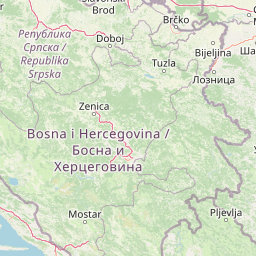
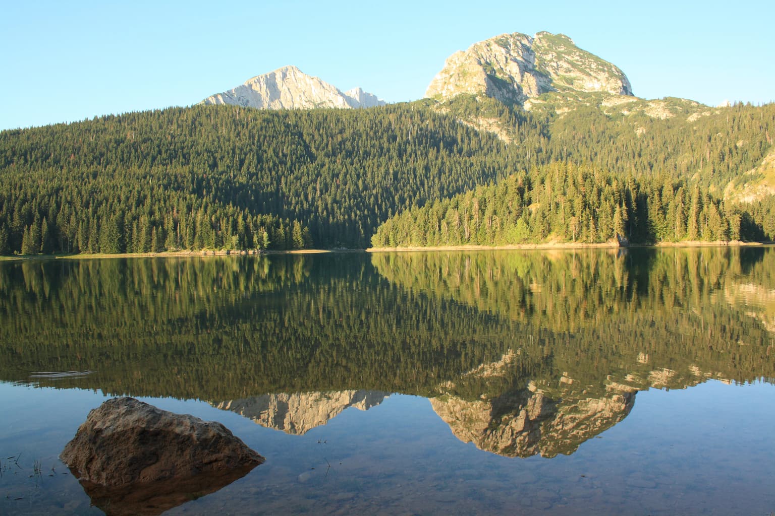
Durmitor National Park is renowned for its dramatic alpine landscape characterized by steep limestone peaks, deep glacial valleys, and pristine mountain lakes. The park protects one of the most significant wilderness areas in the Balkans, with extensive old-growth forests and exceptional geological diversity. The area is known for its network of glacial lakes, rugged mountain terrain, and the dramatic Tara River canyon that forms part of the park's boundary.

A calm lake reflecting mountains and forests with a large rock in the foreground
Mountain lake reflecting forested slopes and peaks in Durmitor National Park

Durmitor National Park history and protected-area timeline

Durmitor National Park was formally designated as a protected area to preserve the exceptional natural values of the Durmitor mountain region in Montenegro. The park's creation reflected growing post-war recognition in Yugoslavia of the need to conserve significant natural landscapes. The protected area was established with boundaries designed to encompass the core of the Durmitor massif and its most ecologically and scenically important zones. Over time, the park has maintained its protected status through changes in Montenegro's political landscape, continuing to serve as the primary mechanism for safeguarding this mountain wilderness.

Durmitor National Park landscape and geographic character

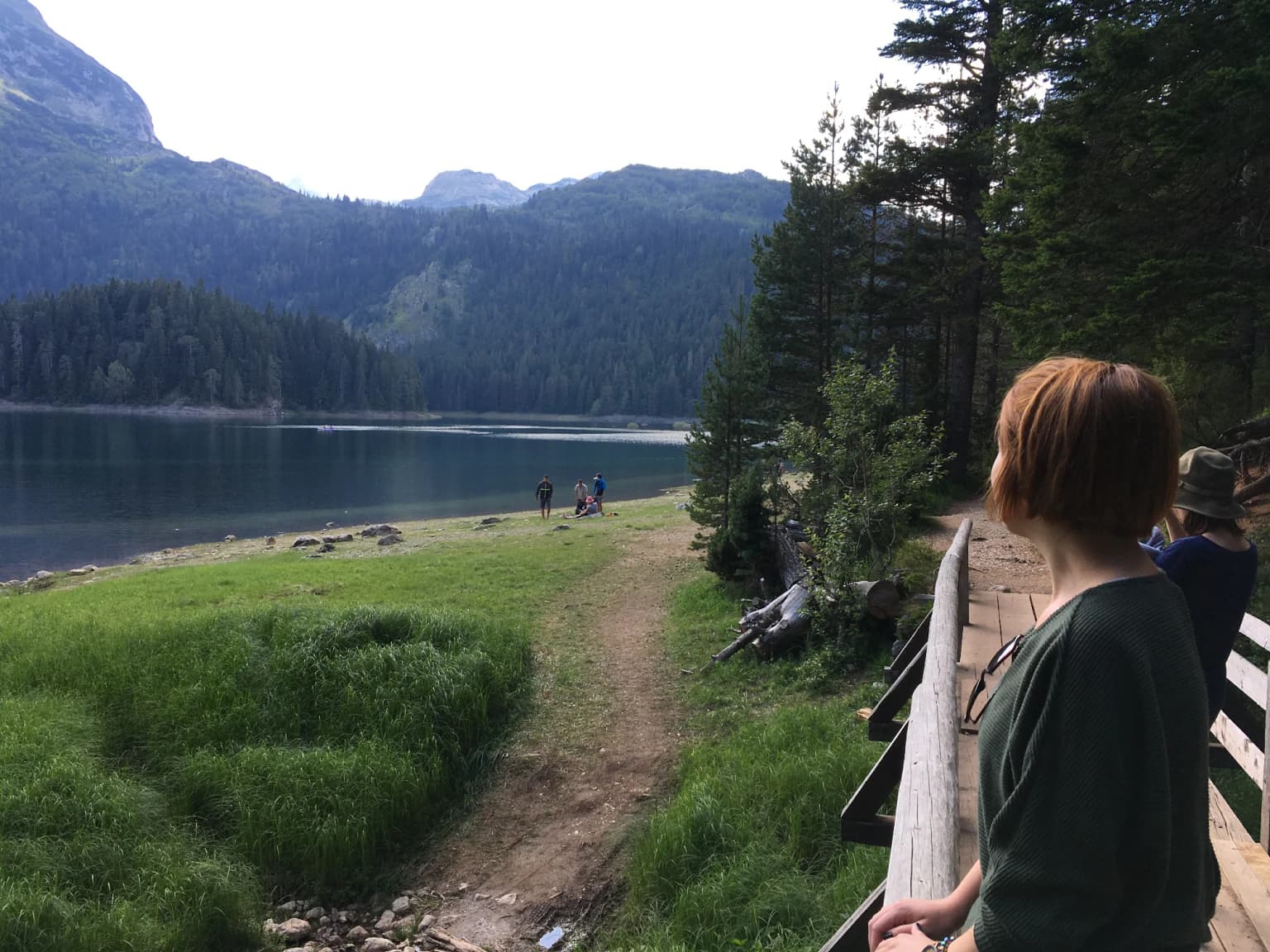
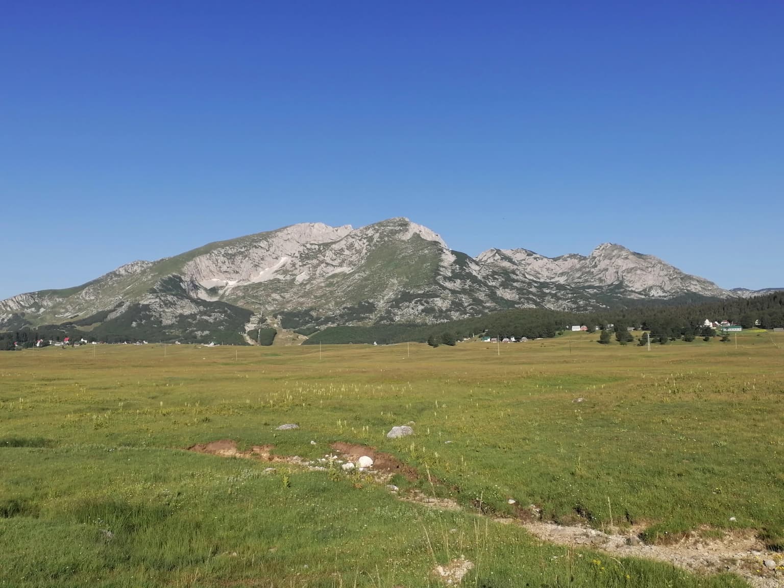
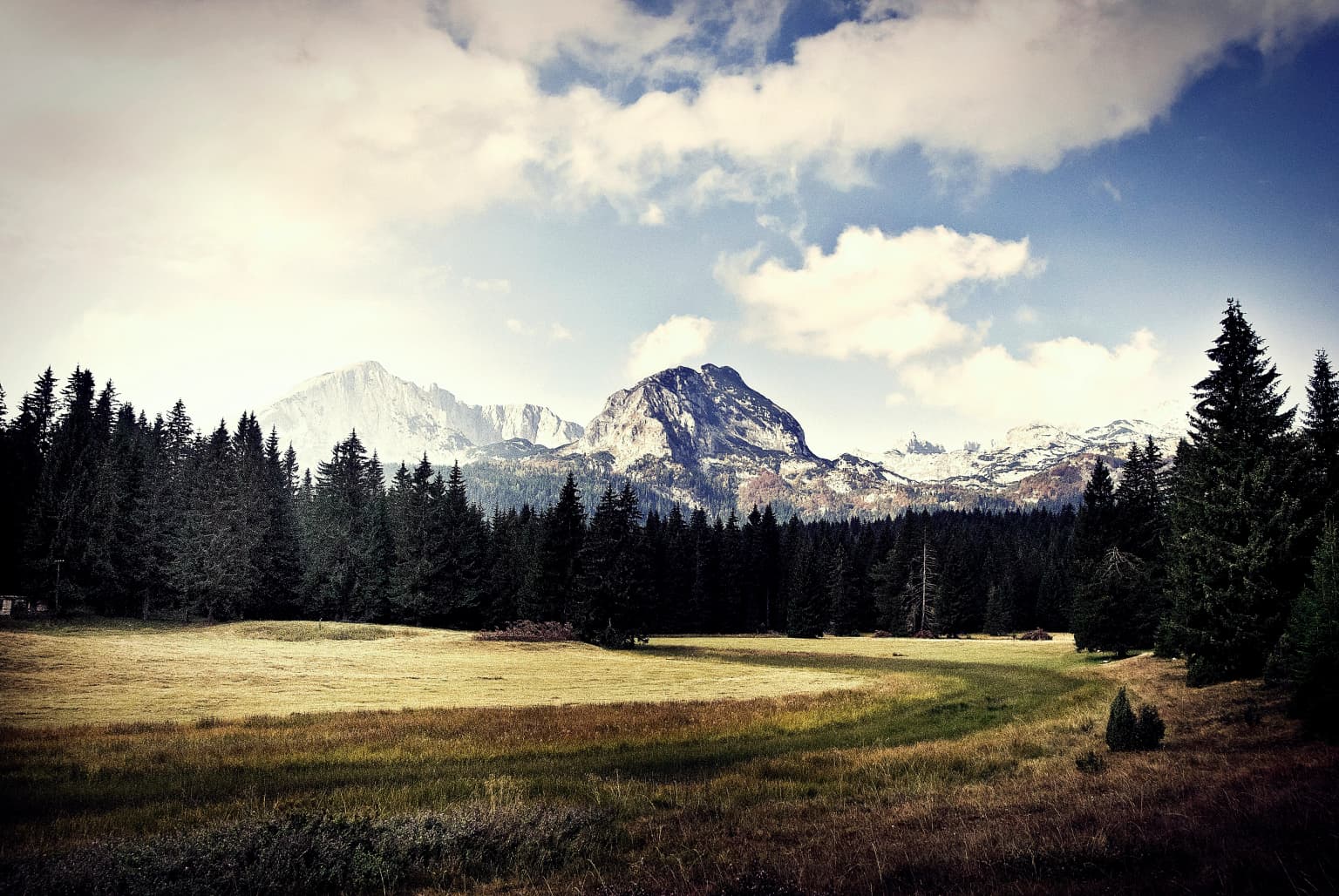
The Durmitor landscape is defined by a dramatic mountain environment shaped by glacial processes during the Pleistocene epoch. The massif rises sharply from the surrounding terrain, presenting a rugged skyline of limestone peaks, sharp ridges, and steep-walled valleys. Glacial activity carved deep cirques and U-shaped valleys, leaving behind a landscape of dramatic vertical relief. The terrain includes extensive areas above the tree line where alpine vegetation dominates exposed slopes and meadows. Below the timberline, the mountainsides are covered in dense forest, primarily composed of beech and conifer species. The park also encompasses portions of the Tara River canyon, one of the deepest river canyons in Europe, where the river has cut through the limestone bedrock to create a striking geomorphological feature.

A lake surrounded by mountains and forest, with a wooden boardwalk and several people walking along a path
Black Lake in Durmitor National Park with visitors on a wooden boardwalk

Durmitor National Park ecosystems, habitats, and plant life

The Durmitor region supports a remarkable diversity of habitats across its altitudinal range. The park encompasses montane and subalpine forest communities, alpine meadows and grasslands, rock habitats, and wetland areas associated with glacial lakes and streams. The forest ecosystems include both deciduous and coniferous species, forming structured communities that vary with elevation and aspect. The alpine zone supports specialized plant communities adapted to harsh mountain conditions. These diverse habitats together support the park's ecological significance, maintaining biological diversity across multiple ecosystem types within a relatively compact mountain landscape.

Grass field with trees and mountains in the background under a clear blue sky
Mountainous landscape with forested hills and buildings under a clear blue sky

Durmitor National Park wildlife and species highlights

Durmitor National Park provides habitat for diverse wildlife species adapted to the mountain environment. The forest ecosystems support populations of large mammals including several species of ungulates that inhabit the wooded slopes and valleys. The park's various habitats, from forests to alpine meadows, create conditions supporting a range of bird species and other wildlife. The protected status of the area helps maintain populations of species that depend on the region's relatively intact natural habitats for their survival.

Grassy field with rocky mountain range in background under clear blue sky
Grassy meadow with Durmitor mountain range under clear blue sky

Durmitor National Park conservation status and protection priorities

Durmitor National Park represents one of the most significant protected areas in the Balkans, safeguarding a mountain ecosystem of international importance. The park's designation recognizes the outstanding universal value of its natural landscapes, with the Durmitor area having been considered for UNESCO World Heritage status. The protected area serves as a crucial reservoir of biodiversity, preserving habitats and species in a region where natural environments have faced pressures from development and land use changes. Conservation of the Durmitor region reflects broader efforts to maintain Montenegro's natural heritage and the ecological services provided by healthy mountain ecosystems.

Durmitor National Park cultural meaning and human context

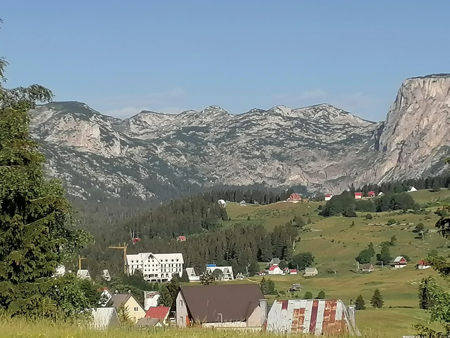
The Durmitor region has historically been inhabited by communities whose traditional lifestyles were closely connected to the mountain environment. The local population developed patterns of land use adapted to the rugged terrain, including pastoral activities that shaped the landscape over centuries. These traditional relationships between human communities and the mountain environment contributed to the cultural landscape character of the region, though the core of the national park is focused on preserving natural rather than cultural values.

Grassy field, dense pine forest, and snow-capped mountains under a partly cloudy sky
Landscape view of Durmitor National Park featuring forested mountains and meadow

Top sights and standout views in Durmitor National Park

Durmitor National Park protects one of the most spectacular mountain landscapes in southeastern Europe, with its combination of towering peaks, glacial lakes, and deep canyons representing exceptional natural beauty. The park preserves extensive old-growth forests, alpine meadows, and the dramatic Tara River canyon, all within a relatively compact protected area. The geological diversity of the Durmitor massif, with its karst features and glacial landforms, adds to the park's significance as a natural science resource. The protected area maintains Montenegro's commitment to preserving its most important natural landscapes for future generations.

Mountainous landscape with rocky peaks, forested hills, and a village with scattered buildings under a clear blue sky
Landscape view of Durmitor National Park featuring mountain ranges, forested slopes, and a village settlement

Best time to visit Durmitor National Park

The summer months from June through September offer the most accessible conditions for exploring Durmitor National Park, with mild temperatures in the mountain environment and generally favorable weather for outdoor activities. Winter brings heavy snowfall to the mountains, transforming the landscape but limiting access to higher elevations. The shoulder seasons of spring and autumn provide alternative periods for visiting, each offering different environmental conditions and landscape characteristics.

Park location guide

Geography guide, regional context, and park location map for Durmitor National Park

Durmitor National Park park geography, regions, and map view in Montenegro
Understand where Durmitor National Park sits in Montenegro through a broader geographic reading of the surrounding landscape, nearby location context, and its mapped position within the national park landscape.

How Durmitor National Park fits into Montenegro

Montenegro is a unitary parliamentary republic in Southeast Europe on the Balkan Peninsula. With a population of approximately 623,000 and an area of 13,883 km², it borders five countries and has a coastline on the Adriatic Sea. The capital and largest city is Podgorica, while Cetinje serves as the old royal capital. The country declared independence in 2006 following the breakup of Serbia and Montenegro.

Wider geography shaping Durmitor National Park in Montenegro

Montenegro is located on the Balkan Peninsula in Southeast Europe. It is bordered by Serbia to the northeast, Bosnia and Herzegovina to the northwest, Kosovo to the east, Albania to the southeast, and Croatia to the west. The country has a coastline along the Adriatic Sea to the southwest. The terrain is predominantly mountainous, with the Dinaric Alps running through the country.

Map view of Durmitor National Park

Use this park location map to pinpoint Durmitor National Park in Montenegro, understand its exact geographic position, and read its mapped placement within the surrounding landscape more clearly.

Pigeon | © OpenStreetMap contributors

Explore the dramatic alpine landscapes, pristine glacial lakes, and dense forests that define Durmitor's protected natural environment.

Durmitor National Park Photos: Visual Guide to Montenegro's Alpine Landscapes and Protected Terrain
View comprehensive imagery of Durmitor National Park, showcasing its distinctive limestone peaks, deep glacial valleys, and the extensive forests within this protected area. These visual resources offer essential insights into the park's geological diversity, unique alpine habitats, and the overall conservation landscape of Montenegro's Dinaric Alps region.

A calm lake reflecting mountains and forests with a large rock in the foreground

Wide view of Durmitor National Park showing a mountain, grassy field, houses, and trees under clear blue sky

A lake surrounded by mountains and forest, with a wooden boardwalk and several people walking along a path

Grass field with trees and mountains in the background under a clear blue sky

Grassy field with rocky mountain range in background under clear blue sky

A serene lake with turquoise water bordered by green grass and a forested mountain backdrop

Grassy field, dense pine forest, and snow-capped mountains under a partly cloudy sky

Mountainous landscape with rocky peaks, forested hills, and a village with scattered buildings under a clear blue sky

Grassland field with mountain range in background under clear blue sky

Grassy field with scattered white spots and rocky mountain peaks under clear blue sky.

Grassy hills with a white church, small house, utility poles, and mountains under a clear blue sky

Rugged mountain peaks and valleys with fog in Durmitor National Park

Park atlas

Explore adjacent mountain parks, tracing the geographic spread of protected landscapes within the Balkan wilderness.

Discover Nearby National Parks and Protected Areas Beyond Durmitor National Park
Explore other significant national parks and protected areas across Montenegro and the wider Dinaric Alps region, comparing diverse mountain terrain and extensive forest reserves. Discover how these connected protected landscapes contribute to the broader geographic understanding of the Balkans' unique alpine wilderness, expanding beyond Durmitor National Park's specific features.
Watercolor illustration of mountain ranges, a lake, and forested hills in soft pastel colors
National park

Sutjeska National Park: Bosnia and Herzegovina's Oldest National Park and Primeval Forest Reserve

Explore the mapped geography and protected landscape of this vital Balkan natural area.

Sutjeska National Park, Bosnia and Herzegovina's inaugural national park, protects a dramatic mountainous region defined by primeval forests and its highest peak, Maglić. As a strict nature reserve, Perućica's ancient trees represent a rare ecological treasure within the Balkan landscape. This page offers a detailed look at the park's protected boundaries, its diverse natural terrain, and its significant geographic setting for atlas exploration.

Area
160.52 km²
Established
1962
IUCN
II
Relief
Mountain
Watercolor painting showing a mountain landscape with green forests, valleys, and distant hills
National park

Biogradska Gora National Park: Ancient Beech Forest and Protected Landscape Exploration

Discover Montenegro's oldest national park with mapped terrain and regional geography.

Biogradska Gora National Park represents a critical protected area in Montenegro, celebrated for its exceptionally well-preserved ancient beech forest. This national park features a heterogeneous terrain of rolling hills and river valleys that create a unique natural setting. The dense, old-growth canopy offers an immersive experience of a primeval forest ecosystem, providing significant value for understanding Balkan nature and protected forest dynamics. Explore the mapped boundaries and discover the distinct landscape character that defines this remarkable natural reserve.

IUCN
II
Watercolor illustration showing rolling hills, a river, trees, and distant mountains
Protected landscape

Zlatibor Protected Landscape: Explore its Mapped Geography and Unique Alpine Meadows

Discover Dinaric Alps protected terrain and landscape context.

Zlatibor Protected Landscape offers a distinct exploration of mountainous terrain and protected natural areas in Serbia. Situated in the Dinaric Alps, its landscape is defined by rolling upland plateaus, dense coniferous forests, and open alpine meadows, creating a visually rich environment. The park's geography includes notable karst features and extensive cave systems, complemented by the natural boundaries of significant rivers. Delve into the mapped protected area to understand its landscape character, from the highest peak at Tornik to the unique geological formations and the rare endemic pine subspecies, providing a concrete geographic perspective for atlas-based discovery.

Area
0.419 km²
Established
2017
IUCN
VI
Relief
Mixed relief
National park

Lovćen National Park: Protected National Park Landscape & Geographic Context

Mapped protected area with unique regional geography.

Dive into the detailed geography of Lovćen National Park, a designated national park in Montenegro. This protected landscape is mapped for structured exploration, revealing its specific natural terrain and its significance within the regional atlas. Understand the park's precise boundaries and its contribution to the diverse geographic tapestry of the area, providing context for further map-based discovery.

IUCN
II
Scope
Terrestrial
Water
No major water
Watercolor painting depicting a river flowing through a valley with mountains in the background and trees on both sides
National park

Tara National Park: Endemic Flora and Dramatic Dinaric Alps Geography

Discover Serbia's iconic protected mountain landscape and its unique botanical heritage.

Tara National Park is a significant protected area in Serbia, celebrated for its exceptional botanical value and dramatic mountainous terrain. It is the last refuge for Pančić's spruce, a living fossil conifer, and hosts a remarkable diversity of Balkan flora. The park's landscape is defined by steep limestone cliffs, deep river valleys like the Drina canyon, and expansive forest ecosystems, offering a unique geographic study of protected lands. Explore its mapped features and discover a vital conservation area within the Dinaric Alps.

Area
249.92 km²
Established
1981
IUCN
II
Relief
Mountain
Watercolor painting showing a river canyon with mountains in the background and green vegetation in the foreground
National park

Drina National Park: Bosnia and Herzegovina's Protected Canyon and Endemic Ecosystem

Explore mapped geography and natural landscapes in this Balkan national park.

Drina National Park is a protected area in eastern Bosnia and Herzegovina, celebrated for its striking Drina River canyon landscape. As a national park, it preserves vital habitats for endemic species such as the Serbian spruce and provides a crucial geographic anchor for regional conservation. Its deep gorges and steep slopes offer a rich context for understanding the natural terrain and mapped boundaries within the broader Balkan geography.

Area
63.15 km²
Established
2017
IUCN
II
Relief
Mountain
Watercolor painting showing a mountainous landscape with a lake, green hills, and pink flowers
National park

Alps of Albania National Park: Explore Albania's Largest Protected Alpine Wilderness

Dramatic karst, glacial valleys, and high-altitude ecosystems await.

The Alps of Albania National Park offers an expansive view into one of the Balkans' most significant mountain protected areas. This national park encompasses a spectacular landscape characterized by towering limestone peaks, deep glacial valleys carved over millennia, and intricate karst formations like Grunas Canyon. Its pristine wilderness protects diverse high-altitude ecosystems and unique geological features, serving as a key destination for understanding regional geography and protected landscapes.

Area
828.447 km²
Established
2022
IUCN
II
Relief
Mountain
Watercolor painting of green mountains, forests, and fields under a light sky
National parkKosovo

Bjeshkët e Nemuna National Park: Kosovo's Largest Alpine Protected Landscape

Explore dramatic mountains, glacial lakes, and diverse ecosystems.

Delve into the protected geography of Bjeshkët e Nemuna National Park, Kosovo's expansive national park located in the Accursed Mountains. This atlas entry details its significant alpine terrain, from dense forests to high-altitude meadows, and highlights the presence of glacial lakes like Liqenat. Understand its role as a vital conservation corridor and a key component of the Balkan's natural heritage.

Area
630.28 km²
Established
2012
IUCN
II
Relief
Mountain

Common questions about visiting, size, designation, and location context for Durmitor National Park

Durmitor National Park FAQs for park facts, access, geography, and protected area context
Find quick answers about Durmitor National Park, including protected-area facts, park geography, trail and visitor context, and how the park fits into its surrounding country and regional landscape.
MoriAtlas Explorer

Continue Your Protected Areas Search Across the Global Atlas

Deepen your exploration by continuing the structured search for national parks and protected areas worldwide. Utilize the comprehensive filtering capabilities to compare different conservation landscapes and refine your understanding of global park geography. Discover more about the distribution and characteristics of protected natural areas.

Global natural geography