Mori Atlas logo
National parkMljet National Park

Discover the unique geography and mapped protected landscape of Croatia's first Mediterranean marine park.

Mljet National Park: A Croatian National Park of Karst Lakes and Pristine Mediterranean Forests

Mljet National Park, a protected national park in Croatia, safeguards a remarkable island landscape shaped by karst geology and dense Mediterranean forests. Situated on the western third of Mljet island, this park is renowned for its unique saltwater lakes, Veliko jezero and Malo jezero, which represent a rare hydrological phenomenon where ancient freshwater bodies have connected to the Adriatic Sea. Covering a significant portion of the island and its surrounding waters, the park offers a compelling case study in protected landscape preservation, showcasing pristine ecosystems and a rich geographic context ideal for atlas-based exploration.

national parkkarst landscapemediterranean islandssaltwater lakesmedieval monasteriesroman heritage
Illustration of a lake surrounded by forests with a small island featuring a historic structure under a sunset sky

Mljet National Park

National park

Park overview

Structured park overview, official facts, and landscape profile for Mljet National Park

Mljet National Park park facts, protected area profile, and essential visitor context
Review the core facts for Mljet National Park, including designation, size, terrain, visitor scale, habitats, and operating context in one park-focused overview.

About Mljet National Park

Mljet National Park protects one of Croatia's most ecologically and culturally significant island landscapes. The park encompasses the northwestern portion of Mljet, extending from the Crna klada area to the westernmost point of the island at Cape Goli. This karst landscape rises steeply from the sea, with rolling hills and ancient stone settlements tucked into protected valleys. The park's interior features two remarkable saltwater lakes that form its central ecological and visual core. Veliko jezero, the larger lake, reaches depths of 46 meters and contains the tiny Isle of St. Mary with its medieval Benedictine monastery. Malo jezero, connected to its larger neighbor by a narrow channel, functions more like a lagoon with limited water exchange. The entire area represents a microcosm of Mediterranean biodiversity, where Aleppo pine forests descend to the water's edge because the lakes are sheltered from strong winds. The park's coastal section includes dramatic sea cliffs, rocky shores exposed to the open Adriatic, and a 500-meter-wide marine belt that protects the underwater environment. Human presence on Mljet dates to ancient times, with the park containing remnants of Illyrian fortifications, Roman palace complexes, and medieval ecclesiastical structures that illustrate the island's long history of settlement.

Quick facts and research context for Mljet National Park

Mljet National Park is located on the island of Mljet in southern Croatia, the southernmost inhabited island in the Croatian Adriatic archipelago. The park was established in 1960 and covers the western third of the island, encompassing coastal karst landscapes, two marine lakes, and a surrounding sea belt. The park contains the villages of Polače, Goveđari, and Pomena within its boundaries. The Great Lake (Veliko jezero) spans 1.45 km² with depths reaching 46 meters, while the Small Lake (Malo jezero) covers 0.25 km². A Benedictine monastery from the 12th century sits on St. Mary's Island in the Great Lake, serving as one of the park's most iconic landmarks.

Park context

Deeper park guide and search-rich context for Mljet National Park

Mljet National Park history, landscape, wildlife, and travel context
Explore Mljet National Park through its history, landscape character, ecosystems, wildlife, conservation priorities, cultural context, and seasonal travel timing in a structured park guide built for atlas discovery and search intent.

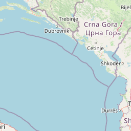
Why Mljet National Park stands out

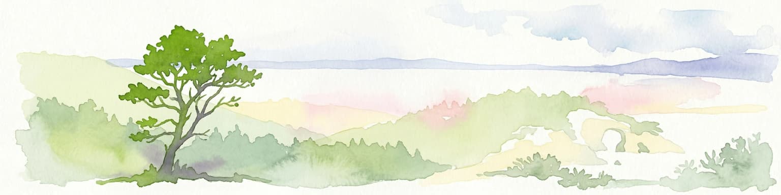
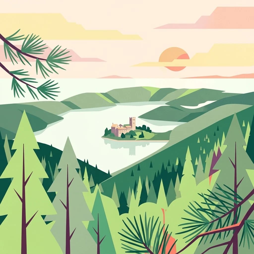
Mljet National Park is best known for its pair of unique marine lakes, Veliko jezero and Malo jezero, which represent a rare karst phenomenon where ancient freshwater lakes became connected to the sea. The park is also celebrated for its exceptionally well-preserved Mediterranean forests, particularly the Aleppo pine groves surrounding the lakes and the holm oak forests that rank among the most intact in the Adriatic. The 12th-century Benedictine monastery on St. Mary's Island, perched in the middle of Veliko jezero, provides a striking cultural landmark visible from the lake's shores. The park's rugged southern coastline with dramatic cliffs, hidden caves, and scattered islets contrasts with the more sheltered northern shores facing the mainland.

Sunset over a lake surrounded by dense forest with distant hills under an orange and blue sky
Sunset over Mljet National Park's lakes

Mljet National Park history and protected-area timeline

Mljet National Park was established on November 11, 1960, making it one of Croatia's earliest national parks and the first protected area in the Mediterranean representing an attempt to preserve original ecosystem characteristics. The selection of Mljet for national park status reflected its exceptional natural beauty, the uniqueness of its lake system, and the preservation of Mediterranean forest communities that had largely disappeared from other coastal areas. The park's territory includes several historic settlements—Polače, Goveđari, and Pomena—each with their own historical significance. Polače contains the ruins of a Roman palace and fortification complex dating to the 3rd century, illustrating the island's importance during the Roman period. The Benedictine monastery on St. Mary's Island was established in the 12th century when Benedictine monks arrived from Apulia in southern Italy. The monastery functioned as a religious community until 1869, when the monks abandoned the island under circumstances that gave rise to local legends about curses and reversed rituals. Throughout the centuries of the Dubrovnik Republic's rule, Mljet served as a source of salt, timber, and agricultural products, with the lake system playing a role in salt production through tidal-powered mills.

Mljet National Park landscape and geographic character

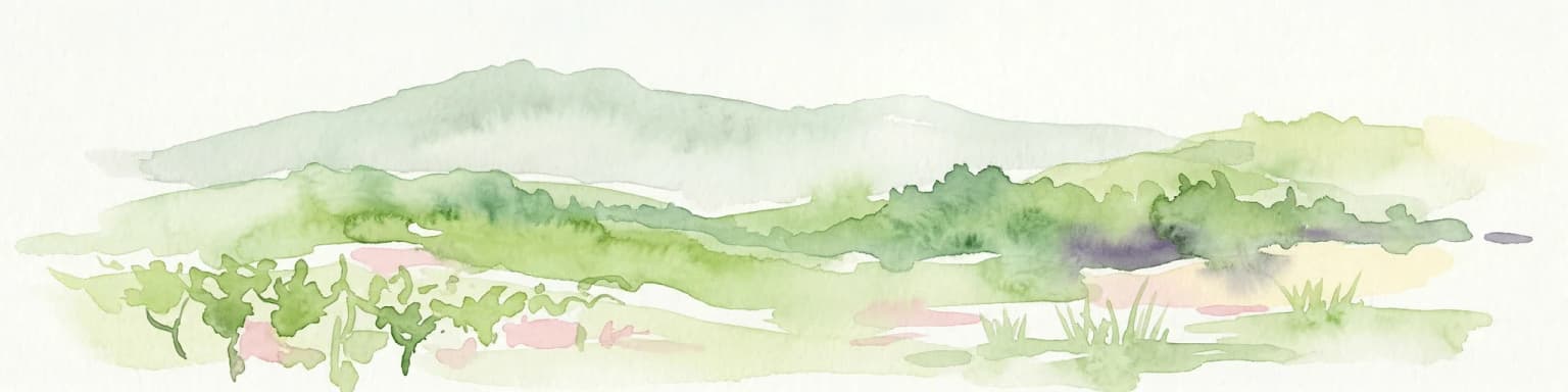
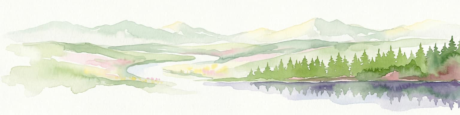
The landscape of Mljet National Park presents a striking combination of karst terrain, forested hills, and marine environments. The island's geology consists of Cretaceous limestone that has been carved by solution processes into the characteristic karst topography of sinkholes, caves, and underground drainage systems. The park's interior rises gently from the lakes toward the island's central ridge, with slopes covered in dense Mediterranean vegetation. The southern coastline is particularly dramatic, featuring steep cliffs that drop directly into the open Adriatic Sea, with numerous small caves and collapsed sea caves ( locally called garme) carved by wave action. The northern and eastern shores, protected from the dominant bora wind, are lower and more accessible. The two lakes—Veliko jezero and Malo jezero—represent the park's most distinctive hydrological feature. Veliko jezero is a flooded karst polje, approximately 2.5 kilometers long and 1 kilometer wide, connected to the sea through the Solinski kanal (Solin Channel) at a point called Veliki most (Great Bridge). The lake's connection to the sea creates a tidal system where strong currents flow in and out every six hours. Malo jezero, to the northwest, is smaller and more lagoon-like, with limited water exchange creating different ecological conditions.

A historic stone building complex on a small island surrounded by calm blue water with trees and hills in the background
St. Mary's Islet with historic buildings on Veliko jezero lake in Mljet National Park

Mljet National Park ecosystems, habitats, and plant life

The vegetation of Mljet National Park represents some of the finest preserved Mediterranean forest communities in the region. Over 90% of the park's surface is covered in forest, earning Mljet its reputation as the "Green Island." The Aleppo pine (Pinus halepensis) forests surrounding the lakes are considered the most beautiful and well-preserved examples of this species in the Mediterranean. These pines grow right to the water's edge, a phenomenon enabled by the lakes' protection from strong winds. Holm oak (Quercus ilex) forests, locally known as česvina or crnika, represent another dominant forest type and are among the most pristine examples remaining on the Adriatic coast. The understory includes Mediterranean maquis (makija) with aromatic shrubs, and the park supports numerous endemic plant species. The dalmatian centaurea (Centaurea ragusina), Jupiter's beard (Anthyllis barba-jovis), and woody spurge (Euphorbia dendroides) are among the most notable endemic species found only in this region. The lakes themselves support specialized marine and brackish water communities, with the Great Lake containing the only endemic jellyfish in Croatia—Aurelia relict—a species that can reach over half a meter in diameter and lacks stinging nematocysts.

Stone ruins of an early Christian basilica with open walls and windows, set against a clear blue sky with trees and rocky terrain
Ruins of an early Christian basilica in Polače, Mljet National Park, Croatia

Mljet National Park wildlife and species highlights

The wildlife of Mljet reflects both the island's Mediterranean setting and the ecological impacts of historical introductions. The terrestrial fauna underwent significant change following the introduction of the Indian small mongoose (Herpestes auropunctatus) in 1909, a predator released to control snakes. While this successfully eliminated venomous snakes from the island, it also reduced populations of other wildlife. The park still supports wild boar (Sus scrofa), fallow deer (Dama dama), and mouflon (Ovis musimon) as the larger mammals. The bird population is particularly notable during migration seasons, when the pine forests and maquis host species including finches, robins, blackbirds, and nightingales. Birds of prey present in the park include kestrels, sparrowhawks, honey buzzards, scops owls, tawny owls, and eagle owls. The marine environment supports diverse fish populations, shellfish, and crustaceans in both the coastal waters and the lakes. The Great Lake's endemic jellyfish, Aurelia relict, represents a unique species found nowhere else in Croatia. The karst cave systems harbor endemic invertebrate species that have been named after Mljet, including several species of cave-adapted crustaceans and insects that were first discovered in the park's underground habitats.

Wide view of Veliko jezero lake with St. Mary's Island, a historic monastery, and surrounding greenery under clear blue sky
Veliko jezero lake with St. Mary's Island and historic monastery, Mljet National Park

Mljet National Park conservation status and protection priorities

Mljet National Park was established to protect a representative sample of Mediterranean ecosystems and landscape, representing the first systematic conservation effort for natural environments in the Mediterranean region. The park's significance stems from multiple factors: the unique lake system with its geological and oceanographic characteristics, the exceptionally well-preserved forests that once covered much of the Mediterranean coast but have largely disappeared elsewhere, and the presence of endemic species found only in this region. The marine component of the park, extending 500 meters from the coast, provides protection for coastal and shallow-water ecosystems including seagrass beds, rocky reef communities, and the unusual environments of the semi-enclosed lakes. Management challenges include balancing visitor access with protection of the island's ecological integrity, addressing the impacts of the introduced mongoose on native wildlife populations, and maintaining the cultural heritage features embedded within the park's landscape. The park's designation as a national park reflects both national recognition of its value and international acknowledgment of the Mediterranean ecosystems it preserves.

Mljet National Park cultural meaning and human context

Mljet National Park contains a rich tapestry of human history spanning from antiquity through the medieval period to the present. The island was inhabited by Illyrian tribes before Roman conquest, and the park preserves traces of Illyrian fortifications on hills above the Great Lake. The Roman period left a significant imprint, most notably the palace complex at Polače, a 3rd-century villa with associated thermae, storage facilities, and a defensive enclosure. Legend connects this palace to the Greek writer Oppian and his father Agesilaus, who reportedly fled to Mljet after being exiled by Roman emperors. The Benedictine monastery on St. Mary's Island represents the most prominent cultural landmark, founded in the 12th century by monks arriving from Apulia in Italy. This monastery became a significant intellectual center, hosting Dubrovnik poets Mavro Vetranović and Ignjat Đordjević, as well as the notable Byzantine scholar Anselmo Banduri. The monastery was abandoned in 1869, and local tradition preserves legends of the monks' curse placed on the island before their departure. The villages within the park—Polače, Goveđari, and Pomena—maintain traditional stone architecture and connections to historical patterns of settlement and land use.

A paved road through dense forest with a triangular warning sign and white road markings
Entrance road to Mljet National Park with forest surroundings and warning signs

Top sights and standout views in Mljet National Park

Mljet National Park combines natural wonders with cultural heritage in a compact island setting. The twin lakes, Veliko jezero and Malo jezero, form a unique hydrological system where ancient freshwater lakes became connected to the Adriatic Sea, creating a rare karst phenomenon. The Benedictine monastery on St. Mary's Island, dating to the 12th century, stands as a symbol of the island's spiritual and intellectual history, its Renaissance architecture and defensive tower visible from the lake's surface. The Aleppo pine forests surrounding the lakes represent some of the finest examples of Mediterranean woodland, with trees growing directly to the water's edge in protection from winds. The southern coastline offers dramatic scenery with sea cliffs, hidden caves, and the rugged character of the open Adriatic. The Roman palace ruins at Polače provide tangible evidence of the island's ancient importance, while the surrounding landscape preserves endemic plants found nowhere else on Earth.

Rocky shoreline with stone cross overlooking blue water and forested hills
Stone cross visible on rocky shoreline of Mljet National Park, Croatia

Best time to visit Mljet National Park

Mljet National Park can be visited year-round, though the character of the experience changes substantially with the seasons. The spring months of April and May bring mild temperatures, blooming vegetation, and excellent birdwatching as migratory species pass through the island. The lakes reflect the fresh greens of new growth in the surrounding forests, and the Benedictine monastery appears at its most evocative against spring skies. Summer brings the warmest weather and peak visitor numbers, with the lakes and coastal waters suitable for swimming. The dense forest provides shade, but summer heat can be significant. Autumn, particularly September and October, offers a second ideal visiting period with comfortable temperatures, fewer visitors, and the forest taking on autumn colors. Winter transforms the park into a quieter, more contemplative space, though some facilities may have reduced operating hours. The lake system functions in all seasons, and the seasonal changes in light and atmosphere provide different perspectives on this ancient island landscape.

Park location guide

Geography guide, regional context, and park location map for Mljet National Park

Mljet National Park park geography, regions, and map view in Croatia
Understand where Mljet National Park sits in Croatia through a broader geographic reading of the surrounding landscape, nearby location context, and its mapped position within the national park landscape.

How Mljet National Park fits into Croatia

Croatia is a unitary parliamentary republic located in Central and Southeast Europe along the Adriatic Sea. With an area of approximately 56,600 km² and a population of nearly 3.9 million, it is a member of the European Union and uses the Euro as its currency. Zagreb serves as both the capital and largest city.

Wider geography shaping Mljet National Park in Croatia

Croatia is located in Central and Southeast Europe, bordering Slovenia and Hungary to the northwest and northeast respectively, Serbia to the east, Bosnia and Herzegovina and Montenegro to the southeast, with a maritime border with Italy to the west. The country occupies the eastern shores of the Adriatic Sea and spans the Dinaric Alps, Pannonian plain, and coastal islands.

Map view of Mljet National Park

Use this park location map to pinpoint Mljet National Park in Croatia, understand its exact geographic position, and read its mapped placement within the surrounding landscape more clearly.

Pigeon | © OpenStreetMap contributors

Explore diverse Mljet Island scenery, karst terrain, ancient forests, and unique saltwater lakes through comprehensive protected-area imagery.

Mljet National Park Photos: Visual Guide to Croatia's Pristine Island Landscape and Protected Marine Lakes
Explore a comprehensive gallery of Mljet National Park imagery to visually grasp its distinct karst topography, lush Mediterranean forests, and unique saltwater lakes. These park photos offer essential geographic context, helping you understand the island's varied coastal and inland protected landscapes, from dramatic cliffs to historic monastery views.

Sunset over a lake surrounded by dense forest with distant hills under an orange and blue sky

Dirt path surrounded by tall pine trees and green foliage under a clear blue sky

A historic stone building complex on a small island surrounded by calm blue water with trees and hills in the background

Stone ruins of an early Christian basilica with open walls and windows, set against a clear blue sky with trees and rocky terrain

Wide view of Veliko jezero lake with St. Mary's Island, a historic monastery, and surrounding greenery under clear blue sky

Lush green vegetation surrounding a calm body of water with rocky shoreline and distant hills under a clear sky

A paved road through dense forest with a triangular warning sign and white road markings

Rocky shoreline with stone cross overlooking blue water and forested hills

Park atlas

Compare Mljet's Unique Karst and Island Ecosystems with Neighboring Protected Areas Across the Adriatic

Discover More National Parks and Protected Areas Near Mljet National Park
Browse a curated selection of national parks and protected areas geographically adjacent to Mljet National Park, extending your exploration of the Adriatic Sea's karst islands and coastal ecosystems. Compare conservation landscapes, unique geological features, and marine environments to deepen your atlas-style understanding of the region's diverse natural heritage and protected areas.
Watercolor illustration of rolling hills, green vegetation, and distant mountains under a light sky
Protected area

Lastovo Nature Park: Discover the Adriatic Karst Archipelago's Protected Landscape

Mapped karst terrain, ancient architecture, and natural island geography.

Lastovo Nature Park protects a remote Croatian archipelago characterized by its striking karst landscape, featuring 46 hills and 46 karstic fields. This protected area offers significant natural biodiversity and remarkably preserved cultural heritage, with extensive Holm Oak and Aleppo Pine forests covering over 60% of the island. Explore Lastovo's unique geography, mapped terrain, and its distinct place within the Adriatic region.

Area
46.87 km²
Established
2006
IUCN
V
Relief
Upland
Watercolor illustration of a landscape with green hills, a river, and distant mountains under a light sky
Protected landscapeDalmatia

Biokovo Nature Park: Protected Landscape and Karst Terrain in Dalmatia

Explore Dalmatia's premier protected mountain range along the Adriatic.

Biokovo Nature Park is a striking protected landscape situated in the Dalmatia region of Croatia, characterized by its immense limestone massifs that create a formidable barrier between the coast and the continental interior. This protected area is defined by its classic karst topography, featuring a complex network of sinkholes and caves, and offers unparalleled views from peaks like Sveti Jure. MoriAtlas provides detailed geographic context for understanding Biokovo Nature Park's unique terrain, mapped boundaries, and its significant role in the regional landscape.

Area
196 km²
Established
1981
IUCN
V
Relief
Mountain
Watercolor illustration of mountain ranges, a lake, and forested hills in soft pastel colors
National park

Sutjeska National Park: Bosnia and Herzegovina's Oldest National Park and Primeval Forest Reserve

Explore the mapped geography and protected landscape of this vital Balkan natural area.

Sutjeska National Park, Bosnia and Herzegovina's inaugural national park, protects a dramatic mountainous region defined by primeval forests and its highest peak, Maglić. As a strict nature reserve, Perućica's ancient trees represent a rare ecological treasure within the Balkan landscape. This page offers a detailed look at the park's protected boundaries, its diverse natural terrain, and its significant geographic setting for atlas exploration.

Area
160.52 km²
Established
1962
IUCN
II
Relief
Mountain
National park

Lovćen National Park: Protected National Park Landscape & Geographic Context

Mapped protected area with unique regional geography.

Dive into the detailed geography of Lovćen National Park, a designated national park in Montenegro. This protected landscape is mapped for structured exploration, revealing its specific natural terrain and its significance within the regional atlas. Understand the park's precise boundaries and its contribution to the diverse geographic tapestry of the area, providing context for further map-based discovery.

IUCN
II
Scope
Terrestrial
Water
No major water
Watercolor illustration showing mountains, a winding river, and forested areas
National park

Durmitor National Park: Dramatic Balkan Alpine Landscape & Protected Area

Explore its rugged terrain and glacial geography.

Durmitor National Park, a protected area in Montenegro, offers a spectacular alpine landscape defined by sharp limestone peaks, deep glacial valleys, and pristine mountain lakes. This national park preserves extensive old-growth forests and unique karst features, showcasing one of the Balkans' most significant wilderness areas. Its dramatic terrain and geological diversity make it a key destination for understanding regional protected lands and mountain geography.

IUCN
II
Relief
Mountain
Climate
Alpine
Scope
Terrestrial
National parkŠibenik-Knin County

Krka National Park: Croatia's National Park with European Cascade Waterfalls

Explore the mapped protected landscape and karst geography.

Krka National Park, designated as a national park in Croatia, offers a rich exploration of its protected landscape. Located in Šibenik-Knin County, the park is defined by the Krka River and its extraordinary seven travertine waterfalls, most notably Skradinski buk, the largest cascade system of its kind in Europe. This atlas-focused view highlights the park's unique karst terrain, Mediterranean ecosystems, and its position within the regional geography, providing essential context for understanding its protected natural heritage.

Area
109 km²
Established
1985
IUCN
II
Relief
Lowland
Watercolor illustration of a tree, green hills, and distant water view
National parkApulia

Gargano National Park: Apulia's Protected Landscape and Regional Geographic Context

Mapped boundaries and natural terrain of a key Italian national park.

Delve into Gargano National Park, a designated national park situated in the Apulia region of Italy. This protected landscape offers valuable insights into the geography of the Gargano promontory. Through MoriAtlas, users can explore its mapped boundaries, understand its terrain, and connect it to the broader regional geography of southern Italy, providing a solid foundation for protected-area discovery.

Area
1,181.44 km²
Established
1991
IUCN
II
Relief
Mixed relief
Watercolor painting showing a mountain landscape with green forests, valleys, and distant hills
National park

Biogradska Gora National Park: Ancient Beech Forest and Protected Landscape Exploration

Discover Montenegro's oldest national park with mapped terrain and regional geography.

Biogradska Gora National Park represents a critical protected area in Montenegro, celebrated for its exceptionally well-preserved ancient beech forest. This national park features a heterogeneous terrain of rolling hills and river valleys that create a unique natural setting. The dense, old-growth canopy offers an immersive experience of a primeval forest ecosystem, providing significant value for understanding Balkan nature and protected forest dynamics. Explore the mapped boundaries and discover the distinct landscape character that defines this remarkable natural reserve.

IUCN
II

Common questions about visiting, size, designation, and location context for Mljet National Park

Mljet National Park FAQs for park facts, access, geography, and protected area context
Find quick answers about Mljet National Park, including protected-area facts, park geography, trail and visitor context, and how the park fits into its surrounding country and regional landscape.
MoriAtlas Explorer

Continue Your Protected Areas Search Across the Global Atlas

Deepen your exploration by continuing the structured search for national parks and protected areas worldwide. Utilize the comprehensive filtering capabilities to compare different conservation landscapes and refine your understanding of global park geography. Discover more about the distribution and characteristics of protected natural areas.

Global natural geography