Mori Atlas logo
National parkGargano National Park

Discover the mapped boundaries and natural terrain of this key national park in southern Italy.

Gargano National Park: Exploring Apulia's Coastal Protected Landscape and Regional Geography

(Parco Nazionale del Gargano)

Gargano National Park represents a significant protected landscape within the Apulia region of southern Italy. As a national park, it offers a unique opportunity to explore the distinct geographic features of the Gargano promontory. This page provides atlas-driven insights into its mapped boundaries, natural terrain, and its role within the regional geography of Italy, serving as a core entry point for understanding this protected area.

National ParkMediterranean ForestAncient WoodlandBeech ForestOrchid HabitatCoastal Islands

Gargano National Park

National park

Park overview

Structured park overview, official facts, and landscape profile for Gargano National Park

Gargano National Park park facts, protected area profile, and essential visitor context
Review the core facts for Gargano National Park, including designation, size, terrain, visitor scale, habitats, and operating context in one park-focused overview.

About Gargano National Park

Gargano National Park occupies a remarkable geographic position at the southeastern edge of the Italian peninsula, projecting into the Adriatic Sea as a dramatic promontory. The park's territory extends from the mountainous interior of the Gargano headland outward to include the offshore Tremiti Islands and the marshland systems along the coastal fringe. This diversity of landscape within a single protected area creates a mosaic of habitats ranging from karst plateaus and forested slopes to sandy beaches, sea cliffs, and brackish wetlands. The park takes its name from Monte Gargano, a limestone massif that rises steeply from the surrounding plain and forms the physical backbone of the territory. The Foresta Umbra, literally the "Shadow Forest," represents the most significant woodland tract within the park and ranks among the last remaining old-growth beech forests in southern Europe. Beyond the forested uplands, the Tremiti Islands add marine and coastal dimensions to the park's protected mandate, supporting Mediterranean maquis, coastal scrub, and important seabird colonies.

Quick facts and research context for Gargano National Park

Gargano National Park lies in the province of Foggia along Italy's Adriatic coast in the southern region of Apulia. The park was established in 1991 and spans roughly 118,000 hectares, protecting the Gargano promontory, the Tremiti Islands archipelago, and inland wetland areas including Lago Salso. The park falls under IUCN Category II designation and is managed by Italy's Ministry of Environment. The Foresta Umbra contains centuries-old beech trees, with documented specimens reaching 350 years of age.

Park context

Deeper park guide and search-rich context for Gargano National Park

Gargano National Park history, landscape, wildlife, and travel context
Explore Gargano National Park through its history, landscape character, ecosystems, wildlife, conservation priorities, cultural context, and seasonal travel timing in a structured park guide built for atlas discovery and search intent.

Why Gargano National Park stands out

Gargano National Park is renowned for its exceptional biodiversity, particularly its extraordinary orchid populations. The park supports one of the highest concentrations of orchid species in Europe, including numerous varieties of Ophrys, commonly known as bee orchids. The Foresta Umbra, an ancient beech forest that is one of the southernmost surviving beech woodlands in Europe, contains trees estimated at 350 years old. The park also protects the Tremiti Islands, a small archipelago in the Adriatic Sea with distinctive coastal landscapes and Mediterranean maquis vegetation.

Gargano National Park history and protected-area timeline

Gargano National Park was officially established in 1991 through Italian national legislation, creating a formal protected area that encompassed the pre-existing Foresta Umbra state forest and extended protection to the broader Gargano promontory landscape. The creation of the park represented recognition of the exceptional ecological value of the Gargano territory, which had long been appreciated for its forests, wildlife, and dramatic scenery but lacked coordinated national protection. In subsequent years, the park became involved in international conservation initiatives, including participation in the "un Bosco per Kyoto" project, which engaged local schools in environmental awareness and sustainable tourism programs. The park's UNESCO association and its role in European biodiversity conservation have contributed to its reputation as one of Italy's most effectively managed protected areas, with notable success in fire prevention and environmental education.

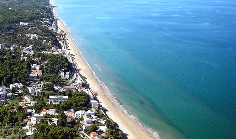
Gargano National Park landscape and geographic character

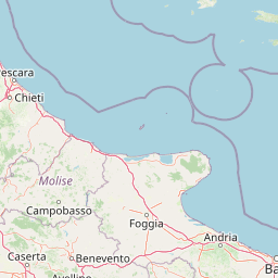
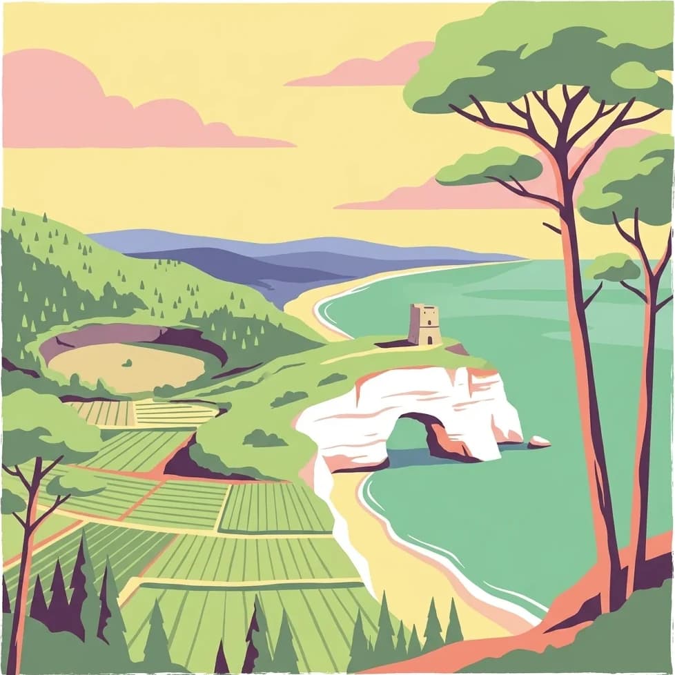
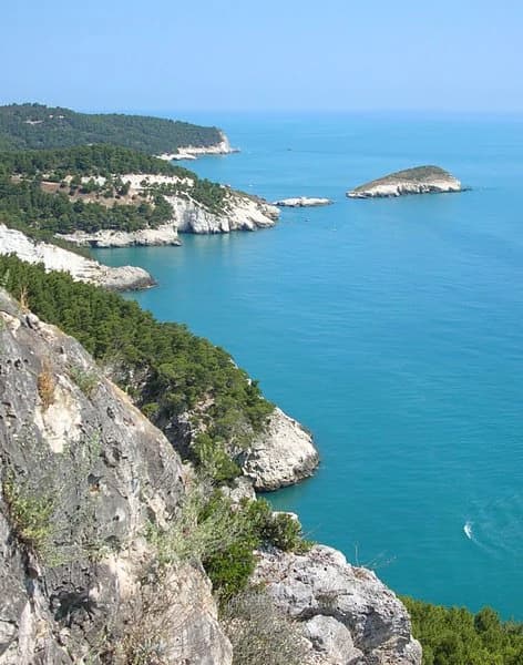
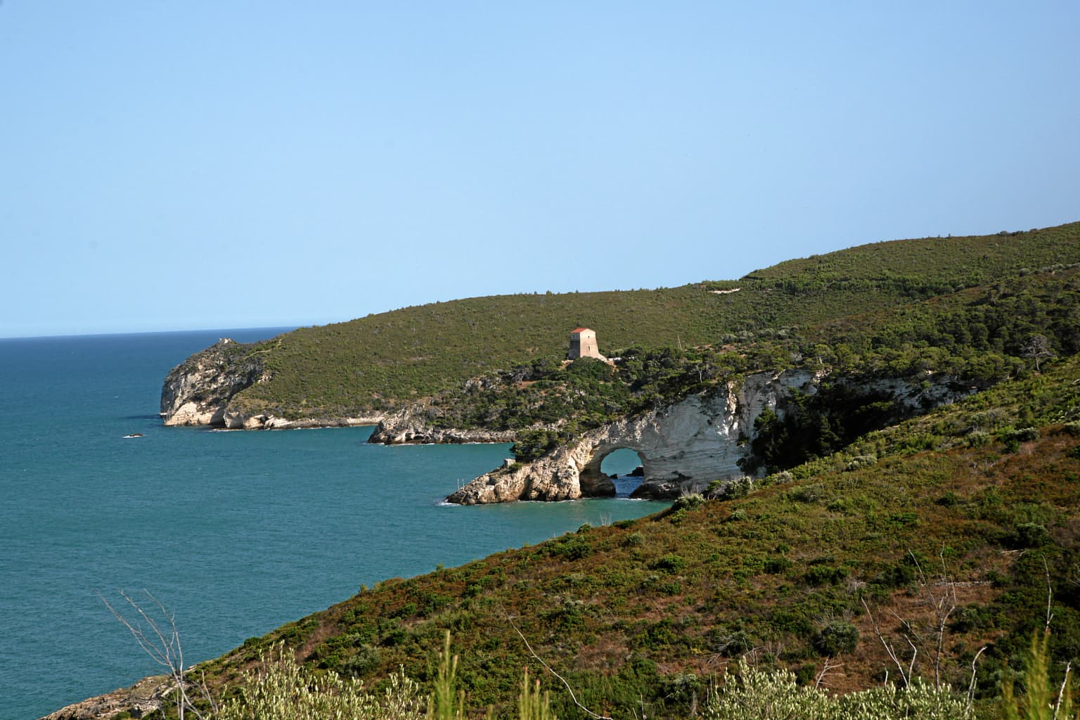
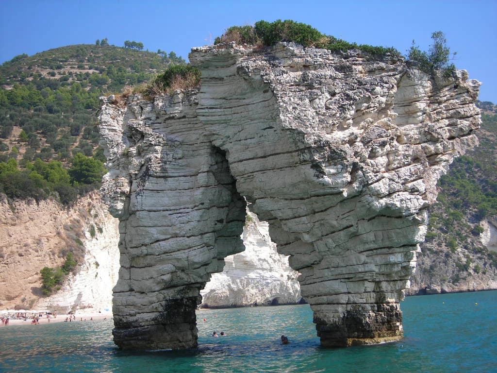
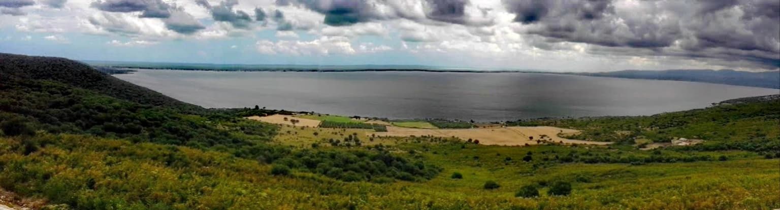
The Gargano promontory presents a dramatic landscape of limestone ridges, steep-sided valleys, and forested slopes rising from the Adriatic coastal plain. The highest points of Monte Gargano reach elevations exceeding 1,000 meters, creating a mountainous backdrop visible from far out at sea. The Foresta Umbra occupies a significant portion of the higher ground, forming a dense canopy of beech trees that create a distinctive dark, shadowy environment beneath the forest floor. Along the coast, the landscape transitions to rugged sea cliffs, sheltered coves, and sandy beaches, particularly around the town of Vieste. The Tremiti Islands, situated roughly 22 kilometers offshore in the Adriatic, consist of small limestone islands with steep coastal walls and limited vegetation. The Lago Salso wetland area near the coast provides a contrasting flat, marshy landscape that supports waterbirds and maintains ecological connections between the terrestrial and marine environments.

Gargano National Park ecosystems, habitats, and plant life

The ecological significance of Gargano National Park stems from its remarkable habitat diversity within a relatively compact territory. The Foresta Umbra represents a southern outlier of the European beech forest type, with ancient trees creating a closed canopy forest that supports a distinctive understory community. The park's position at the crossroads of Mediterranean and continental Europe produces a blend of species that includes both warmth-loving Mediterranean flora and more temperate European species. The orchid populations represent one of the park's most exceptional botanical features, with multiple Ophrys species recorded across the park's grasslands, scrublands, and forest edges. The Mediterranean maquis vegetation dominates the lower slopes and coastal areas, characterized by aromatic shrubs including rosemary, thyme, and cistus. Coastal wetlands and the Tremiti Islands add marine-influenced habitats that support specialized plant and animal communities adapted to saline and disturbed conditions.

Gargano National Park wildlife and species highlights

Gargano National Park supports rich faunal communities across its diverse habitats. The forests of the Foresta Umbra provide habitat for various woodland birds, including species typical of European beech forests, while the open grasslands and scrublands support Mediterranean bird species. The park's orchid-rich meadows attract numerous pollinator insects, and the overall biodiversity of invertebrate communities contributes to the park's ecological significance. The Tremiti Islands host breeding seabird colonies, with species adapted to coastal cliff nesting using the rocky island shores. The wetland areas around Lago Salso provide important habitat for migratory waterbirds, supporting populations that move through the Mediterranean flyway. While specific large mammal populations are limited by the park's Mediterranean character, the diverse habitat structure supports a range of smaller mammals, reptiles, and amphibians.

Gargano National Park conservation status and protection priorities

Gargano National Park represents one of Italy's most important protected areas for European biodiversity conservation. The park's designation as an IUCN Category II national park reflects its primary mandate of protecting natural ecosystems while allowing for sustainable recreation and environmental education. The Foresta Umbra component has particular conservation significance as one of the southernmost old-growth beech forests in Europe, representing a vegetation type that has retreated dramatically from Mediterranean regions due to climatic and human pressures. The park's participation in the "un Bosco per Kyoto" initiative demonstrates its engagement with international climate and conservation frameworks. Notable conservation achievements include significant reduction in wildfire occurrence compared to surrounding regions and effective environmental awareness programs that have fostered local support for protection objectives. The diversity of protected habitats, from mountain forests to coastal islands and wetlands, creates a comprehensive conservation framework that protects ecological processes across multiple landscape types.

Gargano National Park cultural meaning and human context

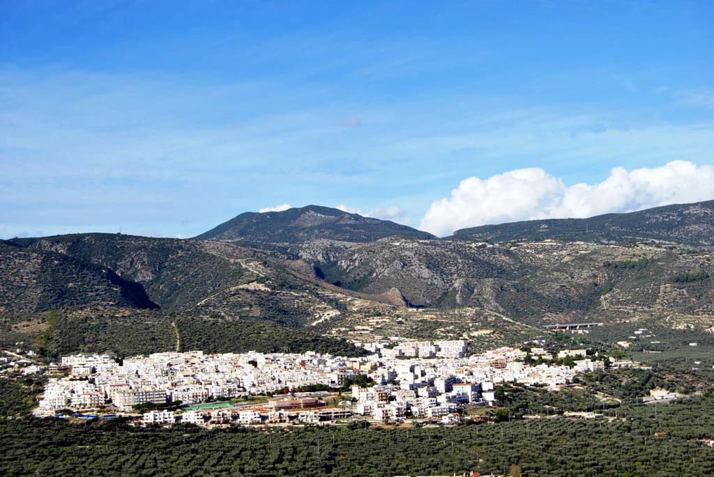
The Gargano promontory has been inhabited since antiquity, with the territory featuring in historical records from Roman times and earlier. The town of Vieste, located on the coast within the park's boundaries, has historical roots extending to the Norman period and serves as a traditional fishing port. The Tremiti Islands have a monastic history, with the island of San Nicola developed around a Benedictine monastery established in the early medieval period. The traditional agricultural landscape of the Gargano interior, characterized by olive groves, vineyards, and pastoral areas, surrounds the core protected zones and reflects centuries of human interaction with the land. While the park's primary mandate focuses on natural protection, the landscape retains evidence of this long human presence, with historic settlements, dry-stone walls, and traditional land-use patterns forming the cultural context within which the protected ecosystems function.

Top sights and standout views in Gargano National Park

The Foresta Umbra ancient beech forest stands as Gargano's most iconic natural feature, a centuries-old woodland that creates an atmospheric, shadowy environment beneath its canopy. The extraordinary orchid diversity of the park, particularly the various Ophrys species, makes it a destination of particular interest for botanical enthusiasts. The Tremiti Islands offer a distinctive island wilderness experience within the park's marine territory, with dramatic coastal cliffs and Mediterranean vegetation. The dramatic mountain scenery of the Gargano promontory, with its limestone ridges rising above the Adriatic coast, provides exceptional walking and panoramic views. The Lago Salso wetlands offer a contrasting wetland landscape that attracts migratory birds and provides ecological diversity within the park system.

Best time to visit Gargano National Park

Gargano National Park can be visited throughout the year, with different seasons offering distinct experiences. Spring and early summer bring the park's most spectacular botanical displays, as the orchid populations flower across meadows and forest clearings, while the beech forest reaches its fullest leaf development. The warmer summer months attract visitors to the coastal areas and Tremiti Islands, though the mountain forests provide cooler retreats from peak heat. Autumn offers another excellent season for forest exploration as the beech trees display their seasonal color change. The winter months see fewer visitors and provide a different perspective on the park's landscapes, though some facilities may have reduced services outside the main season.

Park location guide

Geography guide, regional context, and park location map for Gargano National Park

Gargano National Park park geography, regions, and map view in Italy
Understand where Gargano National Park sits in Italy through a broader geographic reading of the surrounding landscape, nearby location context, and its mapped position within the national park landscape.

How Gargano National Park fits into Italy

Italy is a unitary parliamentary republic in Southern and Western Europe, located on the Italian Peninsula with the Alps to the north. It borders France, Switzerland, Austria, Slovenia, Vatican City, and San Marino, and shares maritime boundaries with several Mediterranean countries. The country has approximately 59 million residents and uses the Euro as its currency.

Wider geography shaping Gargano National Park in Italy

Italy occupies a boot-shaped peninsula in southern Europe, bordered by the Alps to the north. It shares land borders with France, Switzerland, Austria, Slovenia, Vatican City, and San Marino. The country includes the Mediterranean islands of Sicily and Sardinia, along with approximately 800 smaller islands.

Map view of Gargano National Park

Use this park location map to pinpoint Gargano National Park in Italy, understand its exact geographic position, and read its mapped placement within the surrounding landscape more clearly.

Pigeon | © OpenStreetMap contributors

Location context for Gargano National Park

ApuliaProvince of Foggia
Park atlas

Compare diverse protected landscapes and park geography within Italy's Apulia region.

Explore Nearby National Parks and Protected Areas Surrounding Gargano National Park
Continue your discovery of protected areas by mapping other national parks and protected landscapes near Gargano National Park. Explore their diverse terrain, from mountainous ridges to ancient woodlands, to gain valuable regional context for Italy's varied protected lands.
National park

Alta Murgia National Park: National Park Exploration and Protected Landscape Context

Explore mapped terrain and regional geography.

Alta Murgia National Park is a designated national park offering unique opportunities for geographic discovery. Delve into its protected landscape, understand its mapped boundaries, and situate it within the broader Italian atlas. This entry provides essential context for exploring the park's terrain and regional significance.

Area
677.39 km²
Established
2004
IUCN
II
Relief
Mixed relief
Watercolor illustration of rolling hills, green vegetation, and distant mountains under a light sky
Protected area

Lastovo Nature Park: Discover the Adriatic Karst Archipelago's Protected Landscape

Mapped karst terrain, ancient architecture, and natural island geography.

Lastovo Nature Park protects a remote Croatian archipelago characterized by its striking karst landscape, featuring 46 hills and 46 karstic fields. This protected area offers significant natural biodiversity and remarkably preserved cultural heritage, with extensive Holm Oak and Aleppo Pine forests covering over 60% of the island. Explore Lastovo's unique geography, mapped terrain, and its distinct place within the Adriatic region.

Area
46.87 km²
Established
2006
Relief
Upland
Climate
Mediterranean
Watercolor illustration showing a landscape with mountains, green forests, and a river under a soft sky
National parkBasilicata

Appennino Lucano - Val d'Agri - Lagonegrese National Park: Protected Mountain Landscape in Basilicata, Italy

Explore its geography, mapped terrain, and ecological role.

Gain insight into Appennino Lucano - Val d'Agri - Lagonegrese National Park, a significant protected mountain landscape in the heart of Basilicata. This detailed page focuses on the park's distinct geographic features, its role as a crucial ecological corridor connecting major southern Italian protected areas, and the mapped contours of its diverse terrain. Understand its place within the Lucano Apennine range and the broader natural atlas of Italy.

Area
689.96 km²
Established
2007
IUCN
II
Relief
Mountain
Watercolor painting showing mountains, forests, and a body of water in a scenic landscape
National parkAbruzzo

Maiella National Park: Abruzzo's Protected Landscape and Regional Geography

Explore mapped park boundaries and natural terrain.

Delve into the protected landscape of Maiella National Park, situated within the Abruzzo region of southern Italy. This page offers detailed atlas-level insights into its mapped boundaries, allowing for a clear understanding of its geographic setting. Discover how this national park contributes to the regional natural terrain and protected area context, providing a foundation for structured geographic exploration.

Area
628.38 km²
Established
1991
IUCN
II
Relief
Mountain
National park

Mljet National Park: Protected Karst Terrain and Unique Marine Lakes in Croatia

Explore mapped park boundaries and Mediterranean island geography.

Mljet National Park represents a significant protected landscape within the Adriatic Sea, celebrated for its distinctive karst terrain and the extraordinary phenomenon of its saltwater lakes, Veliko and Malo jezero. This national park showcases some of the most intact Mediterranean forests in the region, offering a unique geographic profile for atlas-based discovery. Examine the park's protected status and its relationship to the surrounding island and marine geography.

Area
53 km²
Established
1960
Relief
Lowland
Climate
Mediterranean
Watercolor illustration of a mountainous landscape with green hills, a valley with a river, and distant mountains under a pink and yellow sky
National parkCampania

Vesuvius National Park: Protected Volcanic Landscape in Campania, Italy

Explore mapped boundaries and regional geography.

Discover Vesuvius National Park, a vital protected area safeguarding Italy's iconic active volcano. This page provides essential geographic context, detailed mapped terrain, and insights into the park's unique volcanic landscape within the Campania region. It serves as a key entry point for understanding the park's protected status and its geological significance for structured atlas exploration.

Area
72.59 km²
Established
1995
IUCN
II
Relief
Mountain
National park

Abruzzo, Lazio and Molise National Park

Protected landscape in Italy's Apennines.

Explore the mapped boundaries and protected status of Abruzzo, Lazio and Molise National Park. This historic Italian national park offers a detailed look at Apennine mountain geography and landscape.

Established
1923
Watercolor painting showing mountains, a lake, and grassy fields
National park

Cilento, Vallo di Diano and Alburni National Park: An Italian National Park's Geographic and Protected Landscape Identity

Mapped protected area boundaries and regional context.

Delve into the core geographic and protected-area characteristics of Cilento, Vallo di Diano and Alburni National Park. As a designated National Park in Italy, its mapped boundaries and landscape context are essential for atlas exploration. This entry provides the foundational geographic understanding needed to place this protected land within a broader map-based discovery framework, highlighting its significance as a natural landscape.

Area
1,810.48 km²
Established
1991
IUCN
II
Relief
Mountain

Common questions about visiting, size, designation, and location context for Gargano National Park

Gargano National Park FAQs for park facts, access, geography, and protected area context
Find quick answers about Gargano National Park, including protected-area facts, park geography, trail and visitor context, and how the park fits into its surrounding country and regional landscape.
MoriAtlas Explorer

Continue Your Protected Areas Search Across the Global Atlas

Deepen your exploration by continuing the structured search for national parks and protected areas worldwide. Utilize the comprehensive filtering capabilities to compare different conservation landscapes and refine your understanding of global park geography. Discover more about the distribution and characteristics of protected natural areas.

Global natural geography