Mori Atlas logo
National parkCilento, Vallo di Diano and Alburni National Park

Explore the mapped boundaries and regional geographic context of this significant natural area.

Cilento, Vallo di Diano and Alburni National Park: Italy's National Park Protected Landscape Identity

(Parco Nazionale del Cilento, Vallo di Diano e Alburni)

Cilento, Vallo di Diano and Alburni National Park stands as a key protected landscape within Italy, designated as a National Park. This page offers an in-depth view of its protected-area identity and geographic setting, focusing on its mapped boundaries and its place within the broader regional atlas. Discover the contours and context of this significant natural expanse, crucial for understanding Italy's protected lands through a structured, map-driven approach.

National ParkMediterranean CoastUNESCO World Heritage SiteUNESCO GeoparkBiosphere ReserveKarst Landscape
Stylized illustration showing a waterfall flowing through a valley with a classical temple on a hilltop

Cilento, Vallo di Diano and Alburni National Park

National park

Park overview

Structured park overview, official facts, and landscape profile for Cilento, Vallo di Diano and Alburni National Park

Cilento, Vallo di Diano and Alburni National Park park facts, protected area profile, and essential visitor context
Review the core facts for Cilento, Vallo di Diano and Alburni National Park, including designation, size, terrain, visitor scale, habitats, and operating context in one park-focused overview.

About Cilento, Vallo di Diano and Alburni National Park

Cilento, Vallo di Diano and Alburni National Park represents one of Italy's most important protected areas, covering a vast territory in the southern part of Campania along the Tyrrhenian coast. The park encompasses the entire Cilento peninsula, the Vallo di Diano intermontane basin, and the Monti Alburni mountain chain, creating a protected landscape of remarkable geographical and ecological diversity. The park's establishment in 1991 marked a significant achievement in Italian conservation history, driven by growing concern over uncontrolled urban development threatening the region's natural beauty and cultural heritage. Today the park serves as a model of integrated conservation, combining protection of natural ecosystems with preservation of archaeological sites and traditional rural landscapes. The park's territory extends from the Piana del Sele plain in the north to the Basilicata border in the east and south, with the Tyrrhenian Sea forming its western boundary. This strategic location at the crossroads of different environmental zones results in extraordinary biodiversity, with Mediterranean maquis along the coast transitioning to deciduous forests in the hills and beech forests at higher elevations. The park administration works closely with the 80 municipalities within its boundaries to balance conservation objectives with sustainable development, recognizing that the region's long-term prosperity depends on protecting its natural and cultural assets.

Quick facts and research context for Cilento, Vallo di Diano and Alburni National Park

Cilento, Vallo di Diano and Alburni National Park covers approximately 1,810 square kilometers in the Province of Salerno, making it the largest national park in Italy. The park stretches from the Tyrrhenian coast along the Cilentan Riviera inland to the Alburni mountains, encompassing 80 municipalities across 8 mountain community territories. The park was formally established on December 6, 1991 and achieved UNESCO World Heritage status in 1998 as part of a cultural landscape designation that includes the ancient Greek archaeological sites of Paestum and Velia, plus the Certosa di Padula charterhouse. The park headquarters are located in Vallo della Lucania.

Park context

Deeper park guide and search-rich context for Cilento, Vallo di Diano and Alburni National Park

Cilento, Vallo di Diano and Alburni National Park history, landscape, wildlife, and travel context
Explore Cilento, Vallo di Diano and Alburni National Park through its history, landscape character, ecosystems, wildlife, conservation priorities, cultural context, and seasonal travel timing in a structured park guide built for atlas discovery and search intent.

Why Cilento, Vallo di Diano and Alburni National Park stands out

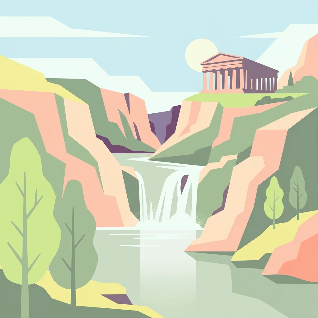
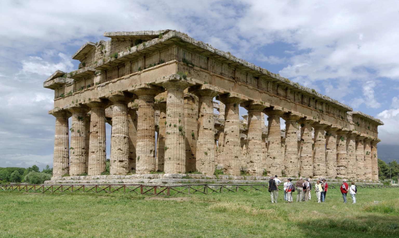
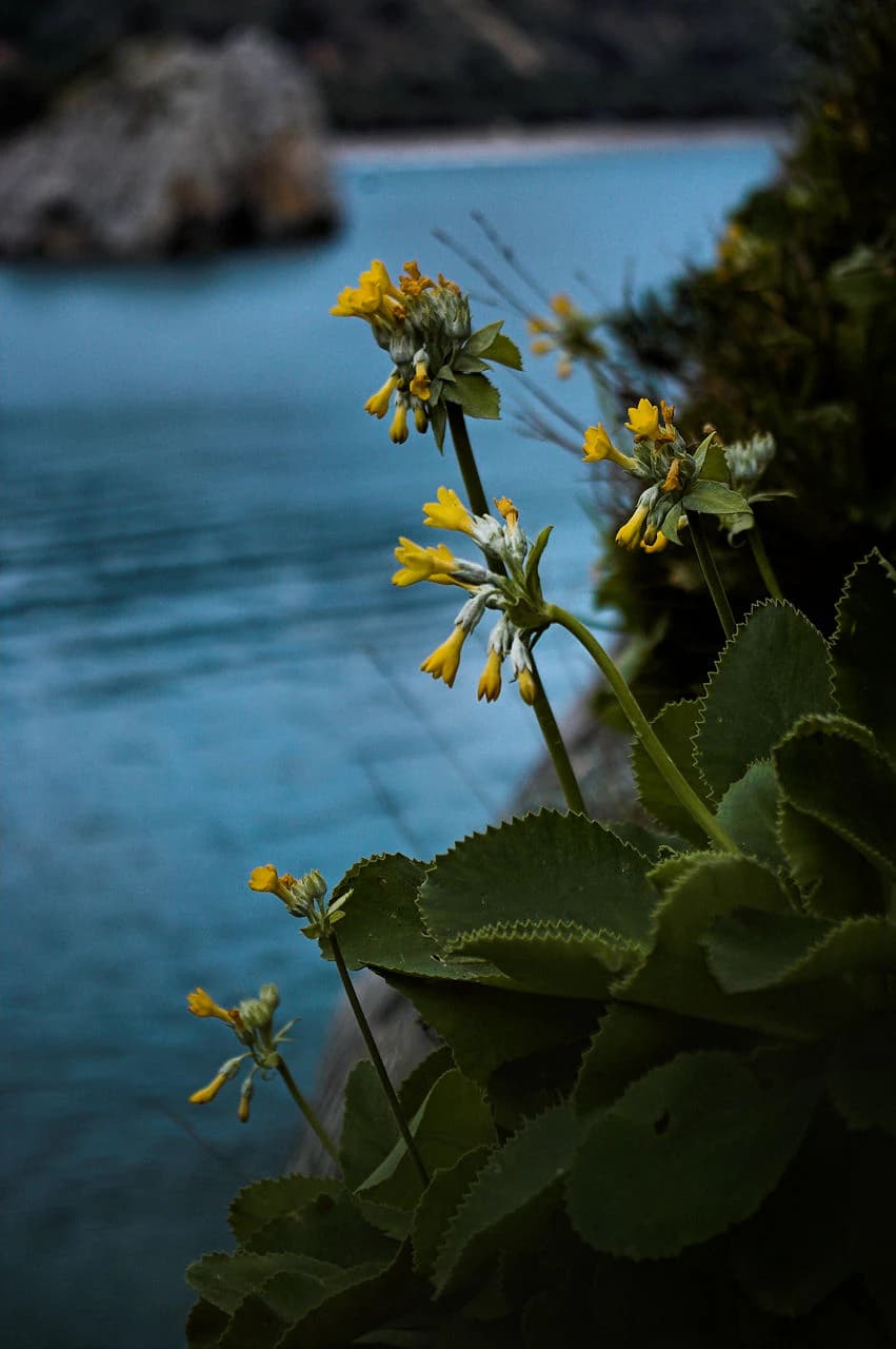
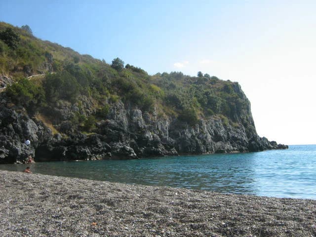
Cilento National Park is best known for its extraordinary blend of natural and cultural heritage. The park protects the Cilentan Coast, a landscape of dramatic contrast between sandy beaches, towering cliffs, and hidden sea caves including the famous Grotte di Castelcivita and Grotte di Capo Palinuro. Inland, the Monti Alburni and Monte Cervati rise to nearly 1,900 meters, harboring old-growth beech forests and karst systems. The park is celebrated for its botanical wealth, including approximately 1,800 plant species and 254 orchid varieties, with notable endemics like the Primula di Palinuro serving as the park's symbol. The ancient Greek archaeological sites of Paestum and Velia, with their remarkably preserved temples, lie within the park's territory and contributed to its UNESCO World Heritage inscription.

Ancient stone temple with tall columns, grassy field, and several people standing nearby under a partly cloudy sky
Temple of Hera in Paestum, a historic structure within Cilento National Park

Cilento, Vallo di Diano and Alburni National Park history and protected-area timeline

The creation of Cilento, Vallo di Diano and Alburni National Park emerged from decades of advocacy for protecting southern Italy's natural and cultural landscape. Discussions about establishing protected status for the Cilento region began as early as 1973, following an international conference on Mediterranean coastal parks held in Castellabate. The initial push focused on establishing two natural reserves covering approximately 36,000 hectares on Monte Cervati and along the Calore River, representing the first formal protection measures for the area. The national park was officially instituted on December 6, 1991 through Italy's framework law on protected areas, with subsequent administrative decrees in 1992 and 1993 defining the park's boundaries and zoning system. The park was originally named Parco Nazionale del Cilento e Vallo di Diano, later expanded to include the Alburni mountains. A milestone came in 1998 when the park, together with the archaeological sites of Paestum, Velia, and the Certosa di Padula, was inscribed on the UNESCO World Heritage List, recognizing the outstanding universal value of the cultural landscape. The park also gained recognition as a Biosphere Reserve under UNESCO's Man and the Biosphere Programme in 1997. In 2010, the park became Italy's first national park to achieve UNESCO Geopark status, acknowledging its exceptional geological heritage. The park entity itself was formally established in 1995, and in 2011 it became the first Italian national park to digitize its library, making the 20,000 volumes of the Giambattista Vico library in Vatolla available online.

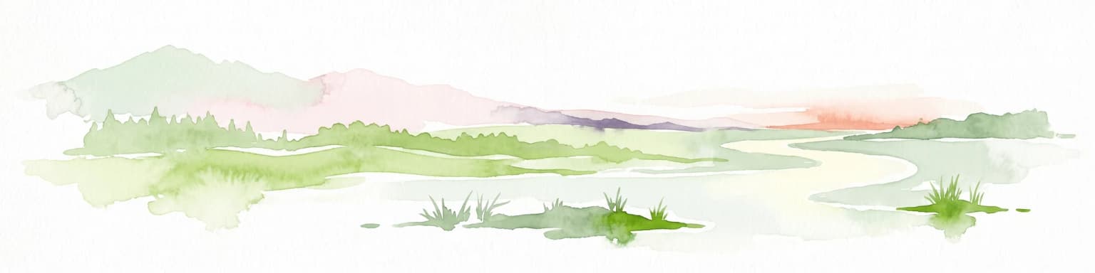
Cilento, Vallo di Diano and Alburni National Park landscape and geographic character

The landscape of Cilento National Park displays remarkable topographical variety across its extensive territory. Along the Cilentan Coast, the shoreline alternates between low sandy beaches stretching from the Sele River to Agropoli and between Casal Velino and Ascea, and dramatic high rocky cliffs elsewhere, carved by wave action into hidden coves, sea caves, and limestone headlands. Cape Palinuro stands as one of the most iconic features, its towering cliffs and underwater caves representing the park's marine landscape character. The coastal area contains significant karst systems, with the Caves of Marina di Camerota being among the most notable. Moving inland, the terrain becomes increasingly rugged, with the Monti Alburni rising to 1,742 meters and Monte Cervati reaching 1,898 meters as the park's highest peak. Other significant summits include Monte Gelbison at 1,705 meters and Monte Motola at 1,743 meters. The Vallo di Diano forms a basin area between the mountain ranges, though true flatland is limited, with valley floors concentrated along the main river courses of the Alento and Tanagro. The park's rivers, including the Alento, Tanagro, Mingardo, Bussento, and Calore, typically display torrent-like characteristics with irregular flow patterns. The geological framework combines the colorful, stratified Flysch of the Cilento basin along the northern coast with extensive limestone formations in the internal mountain areas, creating distinctive visual landscapes and supporting complex karst cave systems.

Yellow and white Primula palinuri flowers with large green leaves set against a blurred blue coastal background
Close-up of Primula palinuri flowers with coastal waters in the background

Cilento, Vallo di Diano and Alburni National Park ecosystems, habitats, and plant life

The ecological diversity of Cilento National Park reflects its position at the intersection of multiple biogeographical regions and its varied topography from sea level to nearly 1,900 meters. Approximately 1,800 plant species have been recorded within the park, representing extraordinary botanical wealth for a Mediterranean protected area. The coastal cliffs support specialized vegetation adapted to salt spray and exposure, including the rare sea daffodil and the endemic Primula di Palinuro, chosen as the park's symbol. The gariga formation, dominated by ampelodesma grass, covers extensive areas up to 700 meters elevation, interspersed with juniper, Montpellier cistus, and the endemic ginestra del Cilento. Where ancient olive groves and carob forests survive, they represent historical agricultural landscapes of significant ecological value. The interior forests feature deciduous oak species including holm oak, Turkey oak, and pubescent oak, transitioning to pure beech forest above 1,000 meters. The park is particularly renowned for its orchid diversity, with 254 species recorded out of 319 known in Europe and the Mediterranean basin. Twenty-five distinct habitat types are recognized within the park, reflecting the complex ecological gradients from coastal to mountain environments.

Large ancient olive tree with thick trunk and dense green foliage, set against a sunlit rural landscape with wooden fence and scattered trees
Ancient olive tree in Cilento National Park, Italy

Cilento, Vallo di Diano and Alburni National Park wildlife and species highlights

The wildlife populations of Cilento National Park benefit from the mosaic of habitats spanning the park's extensive territory. The park supports 63 species of Community Interest, including several priority conservation species. Among mammals, the Apennine gray wolf roams the forests and rocky terrain, representing one of the park's most significant conservation achievements. Wild boar populations are abundant, while red deer were reintroduced in 2004 and roe deer introduced in 2003 have established growing populations. The European otter inhabits watercourses throughout the park, and the critically endangered Italian hare occupies appropriate habitats. Among invertebrates, the hermit beetle and Rosalia alpine beetle represent priority species requiring specialized old-growth forest habitats. The bird community includes significant raptors such as the golden eagle, short-toed eagle, peregrine falcon, and lanner falcon, while the Eurasian eagle-owl and tawny owl occupy cliff and forest habitats. Marine turtles, particularly loggerhead turtles, have been documented nesting on the park's sandy beaches, with the most recent nesting and egg-laying event recorded at Marina di Camerota in 2020. The marine environment also hosts cetacean species including common bottlenose whales, sperm whales, and striped dolphins.

Pebbly beach with turquoise water, rocky cliffs covered in green vegetation, and a person walking along the shore under a clear blue sky
Lentiscella Beach in Marina di Camerota, Cilento National Park

Cilento, Vallo di Diano and Alburni National Park conservation status and protection priorities

Cilento, Vallo di Diano and Alburni National Park represents a flagship of Italian conservation, holding multiple international designations that recognize its outstanding universal value. The UNESCO World Heritage inscription in 1998 acknowledged not only the natural values but the integration of cultural landscape elements, including archaeological sites and traditional rural territories, as essential components of the park's identity. The Biosphere Reserve designation in 1997 positioned the park within the global network of sites demonstrating sustainable development approaches, while the 2010 Geopark status made it the first Italian national park to achieve this recognition of geological heritage importance. The park encompasses several nested protected areas, including the Foce Sele-Tanagro Natural Reserve established in 1993 and the Maritime Reserve of Punta Licosa along the coastline. These designations reflect the park's success in integrating biodiversity protection with cultural heritage preservation and sustainable regional development. The presence of 25 habitat types of Community Interest under the European Habitats Directive, combined with the presence of species like the wolf and priority invertebrates, demonstrates the ecological significance that justified the comprehensive protection framework.

Cilento, Vallo di Diano and Alburni National Park cultural meaning and human context

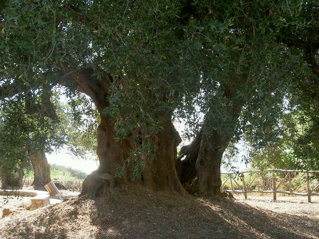
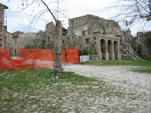
The cultural heritage embedded within Cilento National Park extends far beyond the famous archaeological sites, encompassing a landscape shaped by millennia of human presence. The ancient Greek colonies of Paestum and Velia, with their remarkably preserved temples dating to the 6th and 5th centuries BCE, stand as testament to the region's classical past and contributed fundamentally to the park's World Heritage designation. The Certosa di Padula, a Carthusian monastery of extraordinary architectural grandeur, represents the later medieval and Renaissance periods. Throughout the park's territory, medieval towns like Castellabate, Ottati, and Teggiano preserve historical cores with traditional architecture, while scattered religious sites including sanctuaries and churches reflect the region's deep Catholic heritage. The park supports active traditional agricultural practices, with olive cultivation, chestnut production, and pastoral activities maintaining connections to the cultural landscape. Linguistically, the Cilento dialect reflects the region's historical complexity, with distinct variations between northern and southern forms. The park's cultural dimension is further enriched by archaeological sites ranging from prehistoric settlements through Greek and Roman periods to medieval contexts, creating a palimpsest of human occupation that enhances the natural landscape's significance.

Clear river with visible rocky bottom flowing between rocky cliffs with vegetation and trees
Clear springs of the Sammaro River flowing through rocky terrain within Cilento National Park

Top sights and standout views in Cilento, Vallo di Diano and Alburni National Park

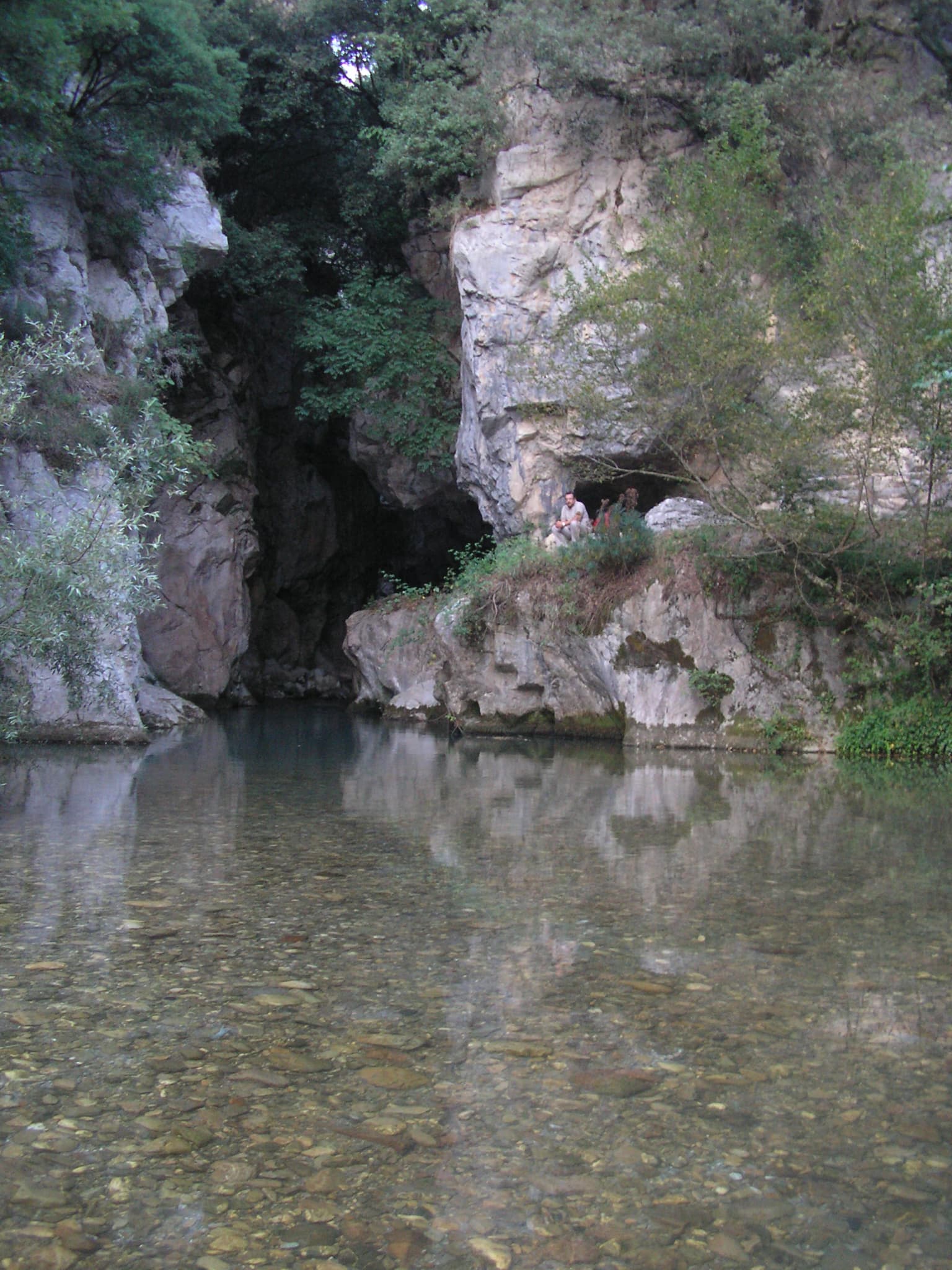
Cilento National Park offers exceptional diversity across its vast territory, with highlights ranging from natural wonders to cultural treasures. The coastal section features the spectacular cliffs and sea caves of Cape Palinuro and the Grotte di Castelcivita, while the Marina di Camerota area provides access to underwater cave systems. The mountain interior includes the imposing Monte Cervati and the karst landscape of the Alburni range, with hiking trails accessing remote beech forests and panoramic viewpoints. Archaeological highlights include the spectacularly preserved Greek temples at Paestum and the ancient city walls and philosophical school of Velia. The Certosa di Padula represents one of southern Italy's most impressive monastic complexes. Traditional hill towns like Trentinara, known as the terrace of Cilento for its panoramic views, and the abandoned village of Roscigno Vecchia offer insight into rural heritage. The park's botanical highlights include the Primula di Palinuro endemic to coastal cliffs and the extraordinary diversity of wild orchids. The WWF Oasis at Morigerati, where the Bussento River resurfaces from underground caves, provides accessible wildlife observation opportunities.

Stone ruins with orange construction netting, a tree, and cobblestone path in grassy area
Old stone ruins in the central square of Roscigno Vecchia, a ghost town within Cilento National Park

Best time to visit Cilento, Vallo di Diano and Alburni National Park

The optimal time to explore Cilento National Park depends on interests and tolerance for different conditions. Spring, particularly May and June, offers pleasant temperatures ideal for hiking, with wildflowers in bloom including the park's famous orchids and the Primula di Palinuro along coastal areas. This season provides comfortable conditions for combining coastal and mountain activities. Summer brings peak heat, especially inland, though coastal areas benefit from sea breezes and swimming opportunities at beaches and in sea caves. Summer also coincides with cultural festivals in park municipalities. Autumn, particularly September and October, presents another excellent period with comfortable temperatures, harvest activities in traditional towns, and the onset of fall color in deciduous forests. Winter offers the fewest visitors and opportunities for winter wildlife observation, though some mountain trails may be less accessible and shorter daylight limits activities. The shoulder seasons of spring and autumn provide the most balanced conditions for experiencing the full range of the park's offerings, from archaeological sites to mountain trails, while avoiding peak summer crowds.

Park location guide

Geography guide, regional context, and park location map for Cilento, Vallo di Diano and Alburni National Park

Cilento, Vallo di Diano and Alburni National Park park geography, regions, and map view in Italy
Understand where Cilento, Vallo di Diano and Alburni National Park sits in Italy through a broader geographic reading of the surrounding landscape, nearby location context, and its mapped position within the national park landscape.

How Cilento, Vallo di Diano and Alburni National Park fits into Italy

Italy is a unitary parliamentary republic in Southern and Western Europe, located on the Italian Peninsula with the Alps to the north. It borders France, Switzerland, Austria, Slovenia, Vatican City, and San Marino, and shares maritime boundaries with several Mediterranean countries. The country has approximately 59 million residents and uses the Euro as its currency.

Wider geography shaping Cilento, Vallo di Diano and Alburni National Park in Italy

Italy occupies a boot-shaped peninsula in southern Europe, bordered by the Alps to the north. It shares land borders with France, Switzerland, Austria, Slovenia, Vatican City, and San Marino. The country includes the Mediterranean islands of Sicily and Sardinia, along with approximately 800 smaller islands.

Map view of Cilento, Vallo di Diano and Alburni National Park

Use this park location map to pinpoint Cilento, Vallo di Diano and Alburni National Park in Italy, understand its exact geographic position, and read its mapped placement within the surrounding landscape more clearly.

Pigeon | © OpenStreetMap contributors

Location context for Cilento, Vallo di Diano and Alburni National Park

Campania

View coastal cliffs, karst caves, and mountain terrain across the diverse habitats and distinct protected-area character of Southern Italy.

Cilento, Vallo di Diano and Alburni National Park: Visualizing Protected Landscapes and Diverse Scenery
Browse compelling imagery of Cilento, Vallo di Diano and Alburni National Park, revealing its Mediterranean coastlines, karst mountain terrain, and ancient cultural heritage. These detailed views provide essential context for understanding the park's diverse protected landscapes, unique habitats, and geological formations, enhancing geographic comprehension.

Ancient stone temple with tall columns, grassy field, and several people standing nearby under a partly cloudy sky

Panoramic view of Santa Maria di Castellabate town with red-roofed buildings along the coastline, ocean waves, and surrounding hills under a partly cloudy sky

Yellow and white Primula palinuri flowers with large green leaves set against a blurred blue coastal background

Large ancient olive tree with thick trunk and dense green foliage, set against a sunlit rural landscape with wooden fence and scattered trees

Pebbly beach with turquoise water, rocky cliffs covered in green vegetation, and a person walking along the shore under a clear blue sky

Aerial view of a coastal headland with blue water on both sides, green hills, and mountains in the background.

Clear river with visible rocky bottom flowing between rocky cliffs with vegetation and trees

Stone ruins with orange construction netting, a tree, and cobblestone path in grassy area

Park atlas

Compare a wider selection of Mediterranean coastal, mountain, and karst protected landscapes surrounding this UNESCO World Heritage Site in Southern Italy.

Discover Other National Parks and Protected Areas Near Cilento, Vallo di Diano and Alburni National Park
Continue your discovery beyond Cilento, Vallo di Diano and Alburni National Park by browsing other national parks and protected areas in its regional context. Compare nearby Mediterranean coastal zones, inland mountain ranges, and karst landscapes, expanding your atlas view across connected conservation territories.
Watercolor illustration showing a landscape with mountains, green forests, and a river under a soft sky
National parkBasilicata

Appennino Lucano - Val d'Agri - Lagonegrese National Park: Protected Mountain Landscape in Basilicata, Italy

Explore its geography, mapped terrain, and ecological role.

Gain insight into Appennino Lucano - Val d'Agri - Lagonegrese National Park, a significant protected mountain landscape in the heart of Basilicata. This detailed page focuses on the park's distinct geographic features, its role as a crucial ecological corridor connecting major southern Italian protected areas, and the mapped contours of its diverse terrain. Understand its place within the Lucano Apennine range and the broader natural atlas of Italy.

Area
689.96 km²
Established
2007
IUCN
II
Relief
Mountain
Watercolor illustration showing green hills, a valley, and pink rock formations under a pale sky
National parkBasilicata

Pollino National Park: Protected Landscape of Ancient Forests and Alpine Terrain

Italy's largest national park and UNESCO Global Geopark

Pollino National Park, located in the Basilicata region, is a significant protected landscape renowned for its extensive ancient forests, particularly its rare Bosnian pines, and its dramatic, high-altitude mountain geography. Covering over 1,925 square kilometers, this national park is also recognized as a UNESCO Global Geopark, highlighting its exceptional geological heritage and unique ecosystems. The park's rugged terrain, soaring peaks, and rare ancient trees offer rich opportunities for understanding regional protected areas and mapped natural landscapes in southern Italy.

Area
1,925.65 km²
Established
1992
IUCN
II
Relief
Mountain
Watercolor illustration of a mountainous landscape with green hills, a valley with a river, and distant mountains under a pink and yellow sky
National parkCampania

Vesuvius National Park: Protected Volcanic Landscape in Campania, Italy

Explore mapped boundaries and regional geography.

Discover Vesuvius National Park, a vital protected area safeguarding Italy's iconic active volcano. This page provides essential geographic context, detailed mapped terrain, and insights into the park's unique volcanic landscape within the Campania region. It serves as a key entry point for understanding the park's protected status and its geological significance for structured atlas exploration.

Area
72.59 km²
Established
1995
IUCN
II
Relief
Mountain
National park

Alta Murgia National Park: National Park Exploration and Protected Landscape Context

Explore mapped terrain and regional geography.

Alta Murgia National Park is a designated national park offering unique opportunities for geographic discovery. Delve into its protected landscape, understand its mapped boundaries, and situate it within the broader Italian atlas. This entry provides essential context for exploring the park's terrain and regional significance.

Area
677.39 km²
Established
2004
IUCN
II
Relief
Mixed relief
Watercolor illustration of a lake surrounded by green landscape with mountains in the background
National parkCalabria

Sila National Park: Protected Landscape and Geographic Context in Calabria

Explore its mapped boundaries and regional natural area.

Sila National Park represents a vital protected landscape within the Calabria region, situated in southern Italy. This page details its specific geographic features and mapped park boundaries, offering a focused view of its place within the broader Italian atlas. Understanding Sila National Park provides insight into the region's natural terrain and the distribution of its protected lands, serving as a key point for geographic discovery.

Area
736.95 km²
Established
2002
IUCN
II
Relief
Mixed relief
National parkApulia

Gargano National Park: Apulia's Protected Landscape and Regional Geographic Context

Mapped boundaries and natural terrain of a key Italian national park.

Delve into Gargano National Park, a designated national park situated in the Apulia region of Italy. This protected landscape offers valuable insights into the geography of the Gargano promontory. Through MoriAtlas, users can explore its mapped boundaries, understand its terrain, and connect it to the broader regional geography of southern Italy, providing a solid foundation for protected-area discovery.

Area
1,181.44 km²
Established
1991
IUCN
II
Relief
Mixed relief
National park

Abruzzo, Lazio and Molise National Park

Protected landscape in Italy's Apennines.

Explore the mapped boundaries and protected status of Abruzzo, Lazio and Molise National Park. This historic Italian national park offers a detailed look at Apennine mountain geography and landscape.

Established
1923
Watercolor painting showing mountains, forests, and a body of water in a scenic landscape
National parkAbruzzo

Maiella National Park: Abruzzo's Protected Landscape and Regional Geography

Explore mapped park boundaries and natural terrain.

Delve into the protected landscape of Maiella National Park, situated within the Abruzzo region of southern Italy. This page offers detailed atlas-level insights into its mapped boundaries, allowing for a clear understanding of its geographic setting. Discover how this national park contributes to the regional natural terrain and protected area context, providing a foundation for structured geographic exploration.

Area
628.38 km²
Established
1991
IUCN
II
Relief
Mountain

Common questions about visiting, size, designation, and location context for Cilento, Vallo di Diano and Alburni National Park

Cilento, Vallo di Diano and Alburni National Park FAQs for park facts, access, geography, and protected area context
Find quick answers about Cilento, Vallo di Diano and Alburni National Park, including protected-area facts, park geography, trail and visitor context, and how the park fits into its surrounding country and regional landscape.
MoriAtlas Explorer

Continue Your Protected Areas Search Across the Global Atlas

Deepen your exploration by continuing the structured search for national parks and protected areas worldwide. Utilize the comprehensive filtering capabilities to compare different conservation landscapes and refine your understanding of global park geography. Discover more about the distribution and characteristics of protected natural areas.

Global natural geography