Mori Atlas logo
National parkAppennino Lucano - Val d'Agri - Lagonegrese National Park

Discover the diverse terrain and ecological significance of this major southern Apennine protected area.

Appennino Lucano - Val d'Agri - Lagonegrese National Park: Mapped Protected Landscape in Basilicata

(Parco Nazionale dell'Appennino Lucano - Val d'Agri - Lagonegrese)

Appennino Lucano - Val d'Agri - Lagonegrese National Park represents a core protected landscape within Italy's southern Apennines, located in the Basilicata region. This National Park spans approximately 69,000 hectares and is defined by its rugged mountainous terrain, from the dramatic peaks of the Sirino Massif to the gentler ridges of the Maddalena chain and the central Val d'Agri basin. As a vital ecological corridor connecting larger protected areas, the park offers a significant opportunity for atlas-based discovery of its diverse ecosystems, mapped boundaries, and regional geography.

national parkmountain landscapeapenninesbasilicataecological corridorprotected area
Stylized illustration of a snow-capped mountain range with bare trees, a dirt road, and wooden fences in a forested landscape

Appennino Lucano - Val d'Agri - Lagonegrese National Park

National park

Park overview

Structured park overview, official facts, and landscape profile for Appennino Lucano - Val d'Agri - Lagonegrese National Park

Appennino Lucano - Val d'Agri - Lagonegrese National Park park facts, protected area profile, and essential visitor context
Review the core facts for Appennino Lucano - Val d'Agri - Lagonegrese National Park, including designation, size, terrain, visitor scale, habitats, and operating context in one park-focused overview.

About Appennino Lucano - Val d'Agri - Lagonegrese National Park

Appennino Lucano - Val d'Agri - Lagonegrese National Park protects a substantial mountain territory in the heart of Basilicata, representing Italy's commitment to preserving the ecological integrity of the southern Apennine ridge system. The park's establishment followed more than a decade of planning and negotiation, with the original protection framework envisioned under Italy's framework law 394/1991 and subsequently reinforced by law 426/1998. The protected area encompasses a complex landscape where imposing mountain massifs give way to agricultural valleys and traditional hilltop settlements that have shaped the Basilicata interior for centuries.

The park's geography centers on the Agri River basin, a valley that has historically served as both an agricultural corridor and a route for transhumance between the mountainous interior and the coastal lowlands. Surrounding the valley floor, the terrain rises sharply to include the northern ramparts of the Sirino Massif, which contains some of the highest peaks in the southern Apennines, and the distinctive ridge of Monte Volturino. Between these more dramatic formations, the Maddalena mountain chain presents a gentler profile, its rounded summits and forested slopes enclosing the upper reaches of the Agri valley. This topographic diversity creates a range of microclimates and habitat conditions that support the park's ecological significance.

The park functions as the central node in a chain of protected areas running through southern Italy's mountain spine. By connecting the Pollino range to the south with the Cilento and Vallo di Diano landscape to the west, the park helps maintain ecological continuity across a landscape that would otherwise be fragmented by roads, agriculture, and development. This corridor function is particularly important for large mammals requiring extensive home ranges and for migratory species moving between different elevations and habitats throughout the year.

Quick facts and research context for Appennino Lucano - Val d'Agri - Lagonegrese National Park

The park occupies 68,996 hectares in the Province of Potenza, making it one of Italy's larger national parks. Established by presidential decree on December 8, 2007, it was the third-to-last Italian national park created. The territory is organized into three management zones: a core zone of elevated natural and landscape interest with minimal human presence, a surrounding zone of significant natural and cultural interest, and an outer zone of landscape and historical value with higher human activity. The park encompasses 29 municipalities grouped into 9 mountain community associations. The Agri River, flowing through the valley that gives the park its name, supports riparian ecosystems and provides habitat for species including otter.

Park context

Deeper park guide and search-rich context for Appennino Lucano - Val d'Agri - Lagonegrese National Park

Appennino Lucano - Val d'Agri - Lagonegrese National Park history, landscape, wildlife, and travel context
Explore Appennino Lucano - Val d'Agri - Lagonegrese National Park through its history, landscape character, ecosystems, wildlife, conservation priorities, cultural context, and seasonal travel timing in a structured park guide built for atlas discovery and search intent.

Why Appennino Lucano - Val d'Agri - Lagonegrese National Park stands out

The park is distinguished by its role as a biological corridor connecting two of southern Italy's largest protected areas, creating an extended mountain habitat network across the Lucano Apennines. Its landscape character blends the dramatic, jagged peaks of the Sirino Massif and Monte Volturino with the gentler rolling ridges of the Maddalena mountain chain. The park protects significant populations of wolf and other mammals in the Apennine fauna community, while the Agri River corridor provides critical aquatic habitat. The territory encompasses a notable residual fir forest at Laurenzana, representing a relict stand of silver fir in the southern Apennines.

Snow-capped mountain peak with patches of snow, surrounded by leafless trees and a dirt road with a fence
North spur of Monte Volturino mountain in Appennino Lucano - Val d'Agri - Lagonegrese National Park

Appennino Lucano - Val d'Agri - Lagonegrese National Park history and protected-area timeline

The establishment of Appennino Lucano - Val d'Agri - Lagonegrese National Park required more than a decade of legislative and administrative process. Protection for the Val d'Agri area was first anticipated under Italy's framework law for protected areas, Law 394 of 1991, which established the foundational framework for creating national parks throughout Italy. This initial recognition was reinforced by Law 426 of 1998, which specifically called for the creation of a protected area in the Val d'Agri region.

A presidential decree was issued in July 2006 to formally establish the park, but this decree did not receive favorable opinion from the unified conference, causing a procedural delay. A second presidential decree was ultimately issued on December 8, 2007, formally creating the national park. The extended timeline between initial concept and final establishment reflected significant political and economic pressures, particularly from petroleum exploration companies and wind energy development interests that sought access to resources within the territory that became the protected area. These same pressures continue to affect other areas of Basilicata with high natural value that would merit protection.

The park represents the third-to-last national park established in Italy, reflecting both the relative lateness of protection for southern Italian mountain ecosystems and the complex process of balancing conservation objectives with regional economic interests. The governance body, Ente Parco Nazionale dell'Appennino Lucano-Val d'Agri-Lagonegrese, administers the protected area and oversees implementation of the management plan that guides conservation activities and permitted uses within the park boundaries.

Appennino Lucano - Val d'Agri - Lagonegrese National Park landscape and geographic character

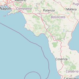
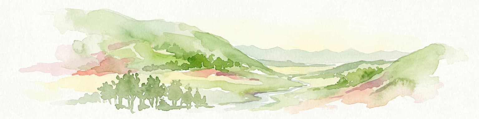
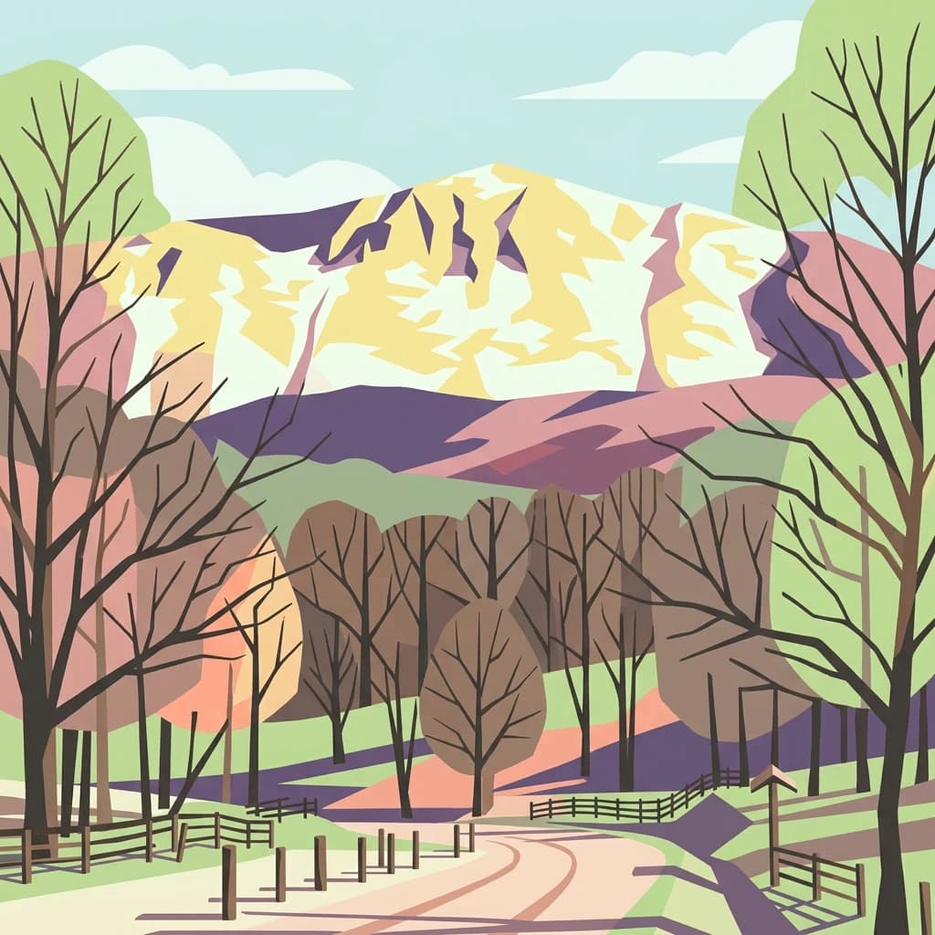
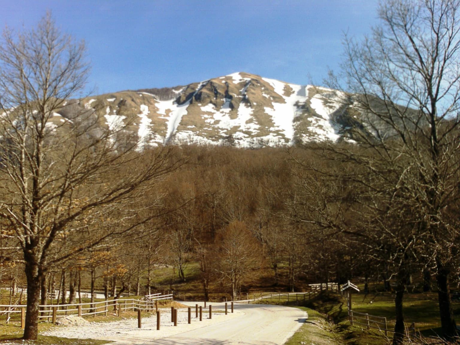
The park's landscape character is defined by the meeting of two distinct mountainous terrains within the Lucano Apennine system. The northern portion features the imposing Sirino Massif, a complex of peaks and ridges that represents one of the highest and most rugged sections of the southern Apennines. Monte Volturino, at 1,836 meters, anchors the northern boundary of the park and presents dramatic northern faces and rocky outcrops that contrast with the softer profiles found elsewhere in the protected area.

The central portion of the park is characterized by the Maddalena mountain chain, a series of more gentle, rounded ridges that enclose the upper Val d'Agri. This area presents a different character than the more dramatic peaks, with smoother profiles and more extensive forest cover creating a landscape of considerable beauty if less dramatic than the higher summits. The Agri River originates in this area and flows through the valley that gives the park its name, cutting a green corridor through the mountainous terrain.

The transition from these mountain landscapes to the surrounding lowlands creates the park's eastern and western boundaries, where the protected area encompasses the upper catchments of streams flowing outward from the Apennine core. Throughout the park, the interplay of rock, forest, and agricultural land creates a mosaic characteristic of mountain landscapes where human settlement and natural processes have shaped the terrain together over centuries.

Appennino Lucano - Val d'Agri - Lagonegrese National Park ecosystems, habitats, and plant life

The park's ecological character reflects its position within the Apennine biogeographic region and its role as a connector between larger protected areas. The vegetation follows distinct altitudinal patterns corresponding to the mountain environment. At lower elevations, evergreen oak woodland and thermophilic shrub communities dominate, featuring species adapted to the relatively mild Mediterranean-influenced climate of the valleys. The lower slopes support roverella oak, white hornbeam, ash, and flowering ash in varying combinations depending on aspect and soil conditions.

As elevation increases, the vegetation transitions through belts of deciduous oak and then into beech forest, which forms the dominant woodland type on the park's higher slopes. Within these beech forests, other species including holly and Lobel's maple create diverse forest structure. The presence of silver fir represents a particular ecological significance, as the residual fir forest at Laurenzana represents one of the southernmost relict populations of this species in Italy, a living reminder of the forests that once covered broader areas of the Apennines during cooler climatic periods.

The park's position as a corridor between Pollino and Cilento enhances its conservation value considerably, allowing species to move between larger protected populations and maintaining genetic connectivity across what would otherwise be isolated fragments of suitable habitat. This corridor function is especially important for species requiring large territories or seasonal movement patterns.

Appennino Lucano - Val d'Agri - Lagonegrese National Park wildlife and species highlights

The mammal community of the park reflects the Apennine fauna assemblage, with the European wolf representing the apex predator and a species of particular conservation significance. Wolf populations in the southern Apennines have demonstrated resilience despite historical persecution and habitat fragmentation, and the protected area network including this park supports their persistence. The park also supports populations of red deer and the Italian roe deer, a subspecies endemic to the Italian peninsula. Wild boar are present throughout the territory, their populations responding to the mix of forest and agricultural habitats.

The Agri River corridor provides aquatic habitat supporting otter, a species that has recovered from historical persecution and now occupies waterways throughout the Apennine region where water quality and riparian habitat permit. The river and its tributaries also support fish communities and provide drinking water for wildlife throughout the year. Birdlife includes species associated with forest, rocky habitats, and open areas, though detailed species records are limited in the available source material.

Appennino Lucano - Val d'Agri - Lagonegrese National Park conservation status and protection priorities

The park's establishment addressed a significant gap in the protected area network of southern central Italy. Prior to 2007, the mountain landscapes of the Lucano Apennines lacked the formal protection that comparable ecosystems enjoyed in the Pollino range to the south and the Cilento area to the west. By creating this protected area, Italy established a connective framework that allows ecological processes to operate across a broader mountain landscape than any single park could sustain alone.

The three-zone management structure provides a framework for balancing conservation with the continued presence of human communities within the park boundary. The 29 municipalities within the park include settlements whose residents maintain traditional relationships with the land through agriculture, forestry, and related activities. Zone 1 provides the highest protection for the most ecologically sensitive areas, while Zone 3 accommodates the greater human presence associated with settled areas and traditional land uses. The park has received recognition through the European Charter for Sustainable Tourism, indicating alignment with broader European frameworks for reconciling conservation with sustainable economic activity in protected areas.

Appennino Lucano - Val d'Agri - Lagonegrese National Park cultural meaning and human context

The park encompasses territory that has been inhabited and cultivated for millennia, with evidence of human presence throughout the Basilicata interior dating to ancient periods. The 29 municipalities within the park boundary represent communities whose identity is closely tied to the mountain landscape and its resources. Traditional agricultural practices, including pastoral activities and small-scale farming, have shaped both the landscape and the cultural character of the region.

The road networks and settlements reflect centuries of movement between the mountain interior and the coastal regions, with the Val d'Agri serving as a passage through the Apennine barrier. Historical routes connected Basilicata with Calabria and the southern Adriatic coast, and the region's relative remoteness has helped preserve elements of traditional culture that have been lost in more accessible areas. The park's establishment required consideration of these human dimensions, and the management framework acknowledges the ongoing relationship between local communities and the protected landscape.

Top sights and standout views in Appennino Lucano - Val d'Agri - Lagonegrese National Park

The park stands out for its strategic position as the central connector in a chain of protected areas spanning the southern Apennines, enabling ecological continuity across a landscape of significant topographic and habitat diversity. The combination of dramatic peaks like Monte Volturino, the gentler Maddalena ridges, and the agricultural valley of the Agri River creates a varied landscape that rewards exploration. The presence of wolf and other characteristic Apennine mammals, along with the residual fir forest at Laurenzana, highlight the ecological values the park protects. Its relatively recent establishment and the ongoing pressures from extractive industries underscore both the challenges facing protected areas in this region and the importance of continued vigilance.

Best time to visit Appennino Lucano - Val d'Agri - Lagonegrese National Park

The mountain setting of the park offers distinct seasonal experiences throughout the year. Spring brings mild temperatures and blooming vegetation, with wildflowers appearing in the meadows and forest edges as the snow recedes from higher elevations. Summer offers warm conditions in the valleys and pleasant temperatures at higher elevations, though afternoon thunderstorms are common in the mountain environment. Autumn provides a second favorable season, with foliage color in the deciduous forests and generally stable weather conditions. Winter brings cold temperatures and snow to the higher peaks, with the mountain environment experiencing a quiet season when visitor activity decreases substantially.

Park location guide

Geography guide, regional context, and park location map for Appennino Lucano - Val d'Agri - Lagonegrese National Park

Appennino Lucano - Val d'Agri - Lagonegrese National Park park geography, regions, and map view in Italy
Understand where Appennino Lucano - Val d'Agri - Lagonegrese National Park sits in Italy through a broader geographic reading of the surrounding landscape, nearby location context, and its mapped position within the national park landscape.

How Appennino Lucano - Val d'Agri - Lagonegrese National Park fits into Italy

Italy is a unitary parliamentary republic in Southern and Western Europe, located on the Italian Peninsula with the Alps to the north. It borders France, Switzerland, Austria, Slovenia, Vatican City, and San Marino, and shares maritime boundaries with several Mediterranean countries. The country has approximately 59 million residents and uses the Euro as its currency.

Wider geography shaping Appennino Lucano - Val d'Agri - Lagonegrese National Park in Italy

Italy occupies a boot-shaped peninsula in southern Europe, bordered by the Alps to the north. It shares land borders with France, Switzerland, Austria, Slovenia, Vatican City, and San Marino. The country includes the Mediterranean islands of Sicily and Sardinia, along with approximately 800 smaller islands.

Map view of Appennino Lucano - Val d'Agri - Lagonegrese National Park

Use this park location map to pinpoint Appennino Lucano - Val d'Agri - Lagonegrese National Park in Italy, understand its exact geographic position, and read its mapped placement within the surrounding landscape more clearly.

Pigeon | © OpenStreetMap contributors

Location context for Appennino Lucano - Val d'Agri - Lagonegrese National Park

Basilicata

Visual Guide to Protected Mountain Terrain, Habitats, and Scenic Views within Basilicata's Crucial Ecological Corridor

Appennino Lucano - Val d'Agri - Lagonegrese National Park Photos: Explore Southern Apennine Landscapes
Explore Appennino Lucano - Val d'Agri - Lagonegrese National Park through a curated visual gallery, revealing its dramatic mountain peaks, gentle forest ridges, and vital riverine habitats. This imagery provides essential geographic context, allowing users to deeply understand the diverse protected landscapes and unique Apennine environment of southern Italy.

Snow-capped mountain peak with patches of snow, surrounded by leafless trees and a dirt road with a fence

Park atlas

Uncover additional protected mountain landscapes within Basilicata and the Southern Apennine chain for deeper geographic context.

Nearby National Parks and Protected Areas: Explore Beyond Appennino Lucano - Val d'Agri - Lagonegrese
Discover other national parks and protected areas within Basilicata and the Southern Apennines after exploring Appennino Lucano - Val d'Agri - Lagonegrese National Park. Compare these significant conservation landscapes to understand the broader regional geography and the network of protected mountain habitats.
Watercolor painting showing mountains, a lake, and grassy fields
National park

Cilento, Vallo di Diano and Alburni National Park: An Italian National Park's Geographic and Protected Landscape Identity

Mapped protected area boundaries and regional context.

Delve into the core geographic and protected-area characteristics of Cilento, Vallo di Diano and Alburni National Park. As a designated National Park in Italy, its mapped boundaries and landscape context are essential for atlas exploration. This entry provides the foundational geographic understanding needed to place this protected land within a broader map-based discovery framework, highlighting its significance as a natural landscape.

Area
1,810.48 km²
Established
1991
IUCN
II
Relief
Mountain
Watercolor illustration showing green hills, a valley, and pink rock formations under a pale sky
National parkBasilicata

Pollino National Park: Protected Landscape of Ancient Forests and Alpine Terrain

Italy's largest national park and UNESCO Global Geopark

Pollino National Park, located in the Basilicata region, is a significant protected landscape renowned for its extensive ancient forests, particularly its rare Bosnian pines, and its dramatic, high-altitude mountain geography. Covering over 1,925 square kilometers, this national park is also recognized as a UNESCO Global Geopark, highlighting its exceptional geological heritage and unique ecosystems. The park's rugged terrain, soaring peaks, and rare ancient trees offer rich opportunities for understanding regional protected areas and mapped natural landscapes in southern Italy.

Area
1,925.65 km²
Established
1992
IUCN
II
Relief
Mountain
National park

Alta Murgia National Park: National Park Exploration and Protected Landscape Context

Explore mapped terrain and regional geography.

Alta Murgia National Park is a designated national park offering unique opportunities for geographic discovery. Delve into its protected landscape, understand its mapped boundaries, and situate it within the broader Italian atlas. This entry provides essential context for exploring the park's terrain and regional significance.

Area
677.39 km²
Established
2004
IUCN
II
Relief
Mixed relief
Watercolor illustration of a mountainous landscape with green hills, a valley with a river, and distant mountains under a pink and yellow sky
National parkCampania

Vesuvius National Park: Protected Volcanic Landscape in Campania, Italy

Explore mapped boundaries and regional geography.

Discover Vesuvius National Park, a vital protected area safeguarding Italy's iconic active volcano. This page provides essential geographic context, detailed mapped terrain, and insights into the park's unique volcanic landscape within the Campania region. It serves as a key entry point for understanding the park's protected status and its geological significance for structured atlas exploration.

Area
72.59 km²
Established
1995
IUCN
II
Relief
Mountain
Watercolor illustration of a lake surrounded by green landscape with mountains in the background
National parkCalabria

Sila National Park: Protected Landscape and Geographic Context in Calabria

Explore its mapped boundaries and regional natural area.

Sila National Park represents a vital protected landscape within the Calabria region, situated in southern Italy. This page details its specific geographic features and mapped park boundaries, offering a focused view of its place within the broader Italian atlas. Understanding Sila National Park provides insight into the region's natural terrain and the distribution of its protected lands, serving as a key point for geographic discovery.

Area
736.95 km²
Established
2002
IUCN
II
Relief
Mixed relief
National parkApulia

Gargano National Park: Apulia's Protected Landscape and Regional Geographic Context

Mapped boundaries and natural terrain of a key Italian national park.

Delve into Gargano National Park, a designated national park situated in the Apulia region of Italy. This protected landscape offers valuable insights into the geography of the Gargano promontory. Through MoriAtlas, users can explore its mapped boundaries, understand its terrain, and connect it to the broader regional geography of southern Italy, providing a solid foundation for protected-area discovery.

Area
1,181.44 km²
Established
1991
IUCN
II
Relief
Mixed relief
National park

Abruzzo, Lazio and Molise National Park

Protected landscape in Italy's Apennines.

Explore the mapped boundaries and protected status of Abruzzo, Lazio and Molise National Park. This historic Italian national park offers a detailed look at Apennine mountain geography and landscape.

Established
1923
Watercolor painting showing mountains, forests, and a body of water in a scenic landscape
National parkAbruzzo

Maiella National Park: Abruzzo's Protected Landscape and Regional Geography

Explore mapped park boundaries and natural terrain.

Delve into the protected landscape of Maiella National Park, situated within the Abruzzo region of southern Italy. This page offers detailed atlas-level insights into its mapped boundaries, allowing for a clear understanding of its geographic setting. Discover how this national park contributes to the regional natural terrain and protected area context, providing a foundation for structured geographic exploration.

Area
628.38 km²
Established
1991
IUCN
II
Relief
Mountain

Common questions about visiting, size, designation, and location context for Appennino Lucano - Val d'Agri - Lagonegrese National Park

Appennino Lucano - Val d'Agri - Lagonegrese National Park FAQs for park facts, access, geography, and protected area context
Find quick answers about Appennino Lucano - Val d'Agri - Lagonegrese National Park, including protected-area facts, park geography, trail and visitor context, and how the park fits into its surrounding country and regional landscape.
MoriAtlas Explorer

Continue Your Protected Areas Search Across the Global Atlas

Deepen your exploration by continuing the structured search for national parks and protected areas worldwide. Utilize the comprehensive filtering capabilities to compare different conservation landscapes and refine your understanding of global park geography. Discover more about the distribution and characteristics of protected natural areas.

Global natural geography