Mori Atlas logo
National parkPollino National Park

Discover Italy's largest national park and its UNESCO Global Geopark protected area

Pollino National Park: Ancient Forests and Rugged Mountain Landscapes in Basilicata

(Parco Nazionale del Pollino)

Pollino National Park, situated in the Basilicata region of southern Italy, stands as the country's largest national park, safeguarding over 1,925 square kilometers of exceptional mountain terrain. This vast protected area is a pivotal component of the Italian atlas, distinguished by its ancient Bosnian pine forests, including Europe's oldest tree, and dramatic limestone peaks. As a UNESCO Global Geopark, Pollino National Park offers a unique lens through which to explore its remarkable geology, diverse ecosystems, and rugged protected landscapes, providing essential context for regional geographic understanding.

Italian national parksUNESCO Global GeoparksAncient forestsBosnian pineMountain protected areasMediterranean mountains
Illustration of a mountain valley with forested slopes, rocky cliffs, a bare tree, and colorful sky

Pollino National Park

National park

Park overview

Structured park overview, official facts, and landscape profile for Pollino National Park

Pollino National Park park facts, protected area profile, and essential visitor context
Review the core facts for Pollino National Park, including designation, size, terrain, visitor scale, habitats, and operating context in one park-focused overview.

About Pollino National Park

Pollino National Park represents the pinnacle of nature conservation in southern Italy, protecting a vast and diverse landscape that spans the border between Basilicata and Calabria. As Italy's largest national park and one of the fifty largest in the world, it encompasses an extraordinary range of ecosystems, from Mediterranean shrubland at lower elevations to alpine meadows and rocky peaks above 2,200 meters. The park's central feature is the Pollino massif, a complex mountain system whose highest summits retain snow for many months each year and offer sweeping views of both the Tyrrhenian and Ionian coasts on clear days. The protection of this mountain landscape began in the late 1980s, with formal establishment in 1993, and since 2015 the entire territory has been recognized as a UNESCO Global Geopark, placing it among the world's most significant geological heritage sites. The park supports remarkable biodiversity, including several species that have become extinct or rare elsewhere in Italy and Europe, while its network of 56 municipalities preserves centuries of cultural traditions, including Albanian-speaking communities that settled here in the late 15th century.

Quick facts and research context for Pollino National Park

Pollino National Park covers approximately 1,925 square kilometers across 56 municipalities in the provinces of Cosenza, Potenza, and Matera. The park was formally established in 1993, though initial protection measures were put in place in 1988 and 1990. Its territory is divided between the Lucanian side (Basilicata) and the Calabrian side, with the Calabrian portion being slightly larger. The park is governed by the Ente Parco Nazionale del Pollino, based in the town of Rotonda. The highest peaks include Serra Dolcedorme at 2,267 meters and Monte Pollino at 2,248 meters, both among the tallest in southern Italy. Major rivers flowing through the park include the Sinni, Lao, Coscile, and Raganello, which have carved deep gorges through the limestone terrain. The park contains four oriented natural reserves: Valle del Fiume Lao, Gole del Raganello, Valle del Fiume Argentino, and Rubbio.

Park context

Deeper park guide and search-rich context for Pollino National Park

Pollino National Park history, landscape, wildlife, and travel context
Explore Pollino National Park through its history, landscape character, ecosystems, wildlife, conservation priorities, cultural context, and seasonal travel timing in a structured park guide built for atlas discovery and search intent.

Why Pollino National Park stands out

Pollino National Park is best known for its exceptional ancient forests of Bosnian pine, particularly the famous Heldreich's pine specimens that dominate the high-altitude landscape. The park contains the oldest tree in Europe, a 1,230-year-old Bosnian pine named Italus, standing in the ancient beech forest of Cozzo Ferriero, which has been recognized by UNESCO as the southernmost old-growth beech forest in Europe. The park's UNESCO Global Geopark status highlights its extraordinary geological heritage, including glacial cirques, morainic deposits from the Würm glaciation, fossil-rich limestone formations, and dramatic gorges such as the Gole del Raganello. The park is also renowned for its populations of golden eagle, Italian wolf, and the rare Calabrian black squirrel, as well as its Albanian-speaking communities that preserve unique cultural traditions dating to the 15th century.

A narrow gorge with steep rocky cliffs and a calm river flowing through, surrounded by green vegetation
Gorges of the Raganello River in Pollino National Park, Italy

Pollino National Park history and protected-area timeline

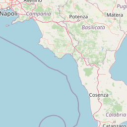
The establishment of Pollino National Park represents the culmination of decades of efforts to protect southern Italy's most significant mountain landscape. Initial protection measures were enacted through legislation in 1988, with provisional boundaries defined in 1990 and formal designation following in 1993. The park's administrative structure was put in place between 1993 and 1994, when the presidency, administrative council, and technical direction were established, with the management headquarters located in Rotonda. The park's territory encompasses 56 municipalities distributed across Basilicata and Calabria, along with nine mountain communities and four oriented natural reserves. Throughout its history, the park has expanded its conservation mandate to include not only wildlife and habitat protection but also geological preservation, culminating in the UNESCO Global Geopark designation in November 2015. This international recognition came through the UNESCO Global Geoparks Network, which now includes Pollino among its members, acknowledging the outstanding geological values of the mountain massif and surrounding territories.

Pollino National Park landscape and geographic character

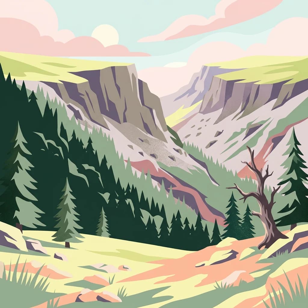
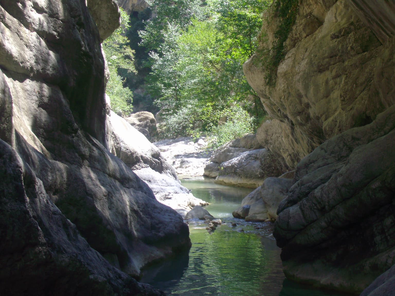
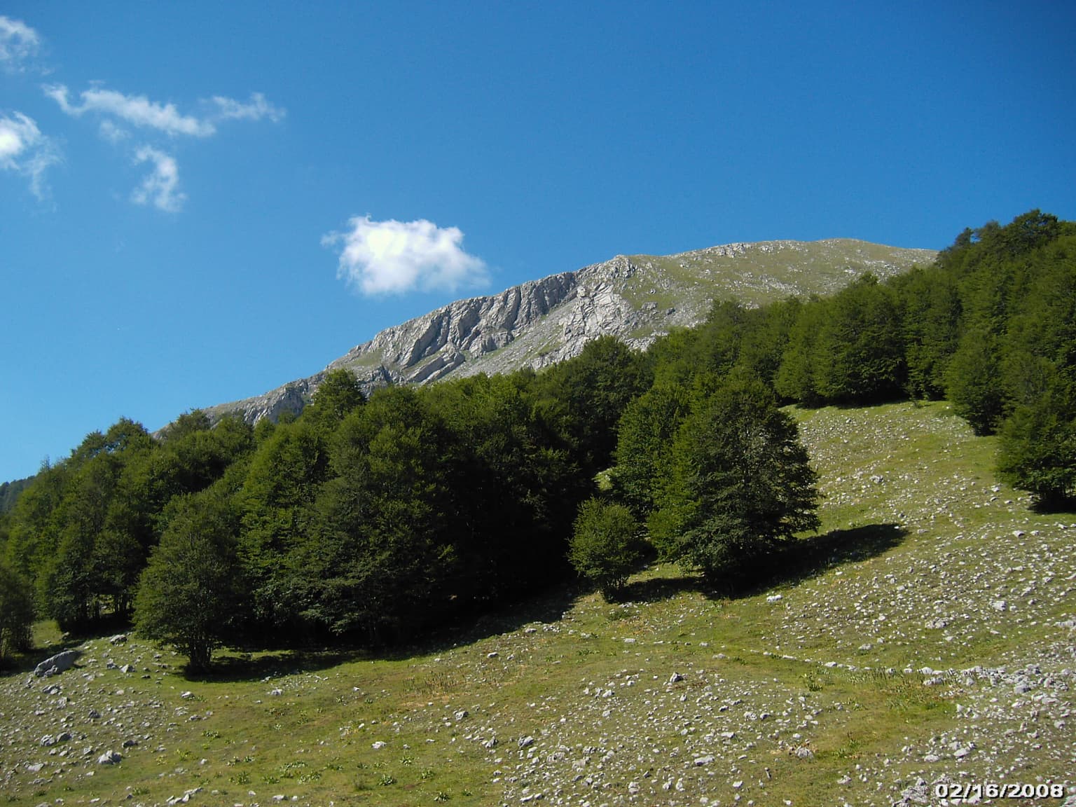
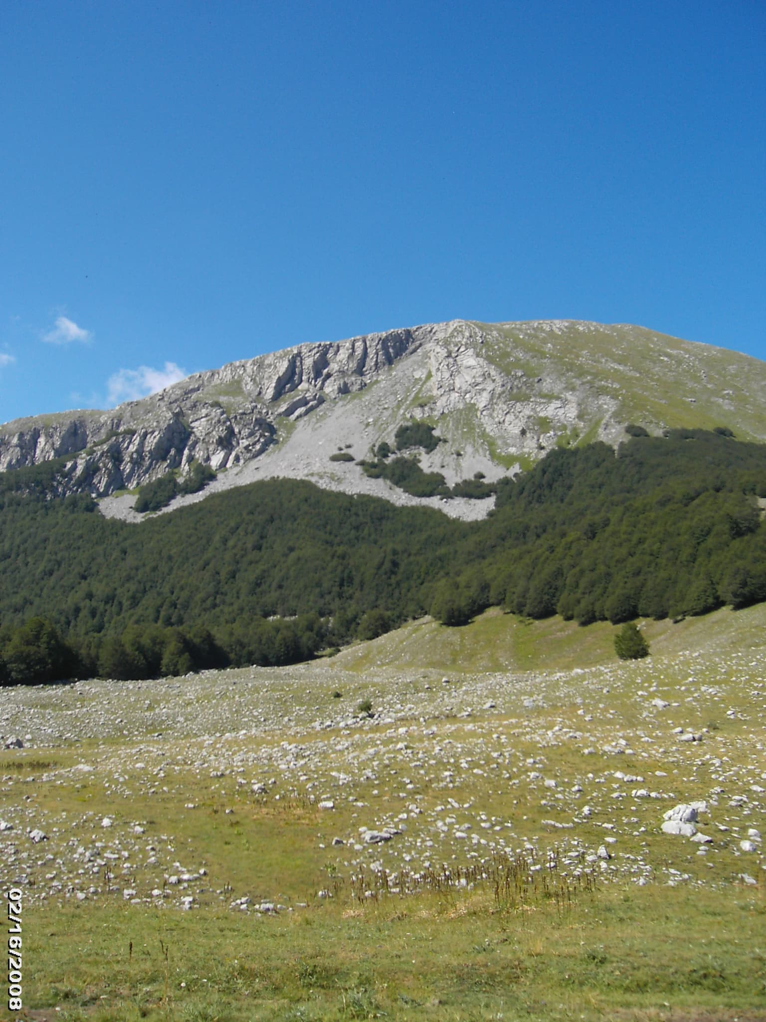
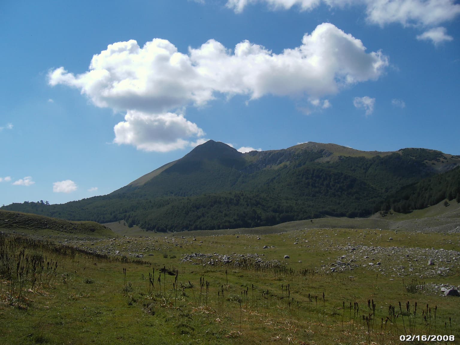
The landscape of Pollino National Park is defined by its dramatic mountain terrain, where limestone peaks rise abruptly from surrounding hills and valleys, creating one of the most spectacular mountain settings in southern Italy. The park's highest summits, including Serra Dolcedorme at 2,267 meters, Monte Pollino at 2,248 meters, and Serra del Prete at 2,181 meters, form a rugged alpine environment that stands in stark contrast to the lower-lying terrain of the surrounding peninsula. These peaks bear the clear marks of ancient glaciation, with glacial cirques, morainic deposits, and characteristic U-shaped valleys providing evidence of the ice ages that shaped this landscape. Below the alpine zone, extensive beech forests cover the mountain slopes, while the valleys are carved by rivers including the Sinni, Lao, Coscile, and Raganello, the latter cutting through spectacular limestone gorges. The park also contains significant karst features, including sinkholes, caves, and the Abisso del Bifurto, one of the world's deepest caves descending 683 meters. The landscape varies dramatically with elevation, from rocky peaks through forest-covered slopes to the more cultivated valleys where traditional agricultural practices continue.

Grassy slope with scattered trees and rocky terrain leading up to Mount Pollino under a clear blue sky
Mount Pollino in Pollino National Park, Italy, with forested slopes and clear blue sky

Pollino National Park ecosystems, habitats, and plant life

The ecological character of Pollino National Park is defined by its position at the junction of different climatic and biogeographic zones, creating a mosaic of habitats supporting extraordinary biodiversity. The park's forests are dominated by common beech, which forms extensive stands across the mountain slopes, including the remarkable old-growth beech forest at Cozzo Ferriero, recognized by UNESCO as the southernmost ancient beech forest in Europe. At higher elevations, the rare Bosnian pine, locally known as pino loricato, dominates the landscape, forming distinctive open woodlands on rocky terrain where few other trees can survive. This species, the park's official symbol, represents one of the most important populations in the Mediterranean region. The park's flora includes seven different maple species, silver fir, black pine, yew, and numerous oaks and chestnuts, while the understory supports a rich community of medicinal and aromatic plants, including many species of mint, thyme, sage, lavender, and hyssop. Spring brings spectacular displays of orchids, violets, and gentians, while summer features the rare red lily and abundant wild berries along the forest trails.

Grassy field with scattered rocks leading to a large mountain with rocky upper slopes and forested lower slopes under a clear blue sky
View of Monte Pollino from the surrounding landscape

Pollino National Park wildlife and species highlights

Pollino National Park supports a remarkable diversity of wildlife, including several species that have become rare or extinct in other parts of Italy and Europe. The park's mammalian fauna includes the endangered Italian wolf, which roams the forests and mountain slopes in search of prey, alongside wild boar, roe deer, red deer (reintroduced in the early 2000s), and the distinctive Calabrian black squirrel, a endemic subspecies found only in this region. The European otter inhabits the park's rivers and streams, while the forest dormouse and southern black squirrel occupy the woodland canopy. The park's avifauna is particularly impressive, with golden eagle nesting on the cliff faces, Egyptian vulture and griffon vulture (reintroduced in 2002) soaring on the thermal currents, and a range of raptor species including peregrine falcon, lanner falcon, red kite, and short-toed eagle. The forest supports the rare black woodpecker, while the high peaks are home to the red-billed chough and rock partridge. Reptiles include the endemic Italian wall lizard and both collared snake and asp viper, while amphibians such as the yellow-bellied toad and fire salamander occupy the park's wetlands and streams.

Grassy field with scattered rocks leading to a mountain range under a partly cloudy sky
Scenic mountain landscape in Pollino National Park with grassy meadows and clear sky

Pollino National Park conservation status and protection priorities

Pollino National Park holds exceptional conservation significance at both national and European levels, representing the largest protected area in Italy and one of the most important mountain conservation landscapes in the Mediterranean. The park's designation as a UNESCO Global Geopark in 2015 reflects the international recognition of its outstanding geological heritage, which includes 69 documented geosites representing a complete record of the region's geological history. The ancient beech forest at Cozzo Ferriero received UNESCO recognition as a World Heritage Site as part of the serial transnational inscription of primeval beech forests of the Carpathians and other regions of Europe, making it the southernmost old-growth beech forest on the continent. The park's populations of Italian wolf and golden eagle represent key conservation priorities for these species, which have suffered significant range contraction across Italy and Europe. The rare Bosnian pine forests are of particular conservation importance, as they represent isolated populations of a species with limited distribution in the Balkans and Greece. The network of four oriented natural reserves within the park provides additional protection for critical habitats, including the river valleys of the Lao, Raganello, Argentino, and Rubbio streams.

Pollino National Park cultural meaning and human context

The cultural heritage of Pollino National Park is as rich as its natural values, with the park's territory preserving evidence of human presence spanning thousands of years. The Valle del Mercure has yielded paleontological findings including remains of Elephas antiquus and Hippopotamus major, demonstrating the presence of prehistoric megafauna in this region. Within the park's boundaries lie numerous medieval towns and villages whose architecture reflects centuries of settlement, including Morano Calabro, famous for its Convent of Colloreto, and Castrovillari, a historic center controlling the strategic pass between Calabria and Basilicata. The park is notable for its Albanian-speaking communities, known as Arbëreshë, which settled in this region between 1470 and 1540 following the Ottoman expansion into the Balkans. Communities such as San Paolo Albanese, San Costantino Albanese, San Basile, Lungro, Plataci, Frascineto, and Civita preserve distinctive linguistic, cultural, and religious traditions that represent an important element of the park's cultural landscape. Religious sites include the Sanctuary of Madonna delle Armi in Cerchiara, the Sanctuary-Basilica of Madonna del Pettoruto in San Sosti, and the Sanctuary of Madonna del Pollino at 1,537 meters altitude in San Severino Lucano, a site of deep local pilgrimage tradition.

Two tall Bosnian pine trees with dense green foliage on a grassy hillside scattered with rocks under a clear blue sky
Bosnian Pines (Pinus heldreichii) in Pollino National Park

Top sights and standout views in Pollino National Park

The most compelling highlights of Pollino National Park include the ancient Bosnian pine forests, where the 1,230-year-old Italus tree stands as Europe's oldest living tree and a powerful symbol of the park's conservation values. The UNESCO-recognized old-growth beech forest at Cozzo Ferriero represents a unique ecological treasure, being the southernmost ancient beech forest in Europe. The dramatic mountain peaks of the Pollino massif offer spectacular hiking opportunities and panoramic views spanning both the Tyrrhenian and Ionian seas. The park's gorges, particularly the Gole del Raganello, provide thrilling opportunities for torrentism and caving, while the deep cave of Abisso del Bifurto has attracted international scientific attention and served as a filming location for the award-winning documentary Il buco. The presence of Italian wolf, golden eagle, and the endemic Calabrian black squirrel makes the park a destination of choice for wildlife enthusiasts, while the cultural heritage of Albanian-speaking communities offers a unique dimension to the visitor experience.

A large, twisted Bosnian Pine tree with a person standing on its trunk, surrounded by grassy terrain with scattered stones and forest in the background
A person stands on the ancient Bosnian Pine tree in Pollino National Park

Best time to visit Pollino National Park

The best time to visit Pollino National Park depends on the experiences sought, with each season offering distinct advantages for exploration. Summer, from June through September, brings warm temperatures ideal for hiking and outdoor activities, with wildflowers carpeting the meadows and the high peaks accessible for day trips. Autumn, particularly October and November, offers spectacular fall colors in the beech forests and is often considered the most beautiful season for photography and scenic drives. Spring, from April through May, brings blooming flora including orchids and other wildflowers, though higher elevations may still have snow patches. Winter transforms the park into a snowy mountain landscape, with cross-country skiing possible at higher elevations, though many trails become inaccessible and some facilities close for the season. The shoulder seasons of spring and autumn generally offer the best combination of accessible trails, comfortable temperatures, and fewer visitors, making them ideal for those seeking a more tranquil experience of the park's natural wonders.

Park location guide

Geography guide, regional context, and park location map for Pollino National Park

Pollino National Park park geography, regions, and map view in Italy
Understand where Pollino National Park sits in Italy through a broader geographic reading of the surrounding landscape, nearby location context, and its mapped position within the national park landscape.

How Pollino National Park fits into Italy

Italy is a unitary parliamentary republic in Southern and Western Europe, located on the Italian Peninsula with the Alps to the north. It borders France, Switzerland, Austria, Slovenia, Vatican City, and San Marino, and shares maritime boundaries with several Mediterranean countries. The country has approximately 59 million residents and uses the Euro as its currency.

Wider geography shaping Pollino National Park in Italy

Italy occupies a boot-shaped peninsula in southern Europe, bordered by the Alps to the north. It shares land borders with France, Switzerland, Austria, Slovenia, Vatican City, and San Marino. The country includes the Mediterranean islands of Sicily and Sardinia, along with approximately 800 smaller islands.

Map view of Pollino National Park

Use this park location map to pinpoint Pollino National Park in Italy, understand its exact geographic position, and read its mapped placement within the surrounding landscape more clearly.

Pigeon | © OpenStreetMap contributors

Location context for Pollino National Park

BasilicataCalabria

Uncover the visual character of Pollino National Park: from ancient Bosnian pine forests to dramatic limestone peaks and river gorges.

Pollino National Park Landscapes: Explore Italy's Rugged Mountain Scenery and Ancient Forests
Explore Pollino National Park's dramatic mountain landscapes, ancient Bosnian pine forests, and unique protected habitats through compelling imagery, capturing its distinctive scenery and terrain. These detailed photos provide essential context for understanding the park's ecological significance, geological features, and the rugged, diverse character of Italy's largest protected area.

A narrow gorge with steep rocky cliffs and a calm river flowing through, surrounded by green vegetation

Dense forested mountain slope with grassy field in foreground under partly cloudy sky

Grassy slope with scattered trees and rocky terrain leading up to Mount Pollino under a clear blue sky

Grassy field with scattered rocks leading to a large mountain with rocky upper slopes and forested lower slopes under a clear blue sky

Grassy field with scattered rocks leading to a mountain range under a partly cloudy sky

Rocky mountain cliffs with dense forest under a partly cloudy sky

Two tall Bosnian pine trees with dense green foliage on a grassy hillside scattered with rocks under a clear blue sky

A large, twisted Bosnian Pine tree with a person standing on its trunk, surrounded by grassy terrain with scattered stones and forest in the background

Black squirrel with white underbelly sitting on tree branch in forest

Mountainous landscape showing Monte Pollino and Serra del Prete with rocky terrain, scattered Bosnian Pine trees, and blue sky with clouds

Mountain range with grassy field in foreground under partly cloudy sky

Park atlas

Trace the surrounding regional park geography and compare other protected landscapes across southern Italy.

Discover Nearby National Parks and Protected Areas Beyond Pollino National Park
After exploring Pollino National Park, continue your journey through Italy's diverse protected areas to discover nearby national parks and regional reserves. Compare similar mountain landscapes, ancient forests, and unique geological features across the southern Apennine range, gaining deeper geographic context and understanding of the country's conservation efforts.
Watercolor illustration showing a landscape with mountains, green forests, and a river under a soft sky
National parkBasilicata

Appennino Lucano - Val d'Agri - Lagonegrese National Park: Protected Mountain Landscape in Basilicata, Italy

Explore its geography, mapped terrain, and ecological role.

Gain insight into Appennino Lucano - Val d'Agri - Lagonegrese National Park, a significant protected mountain landscape in the heart of Basilicata. This detailed page focuses on the park's distinct geographic features, its role as a crucial ecological corridor connecting major southern Italian protected areas, and the mapped contours of its diverse terrain. Understand its place within the Lucano Apennine range and the broader natural atlas of Italy.

Area
689.96 km²
Established
2007
IUCN
II
Relief
Mountain
Watercolor painting showing mountains, a lake, and grassy fields
National park

Cilento, Vallo di Diano and Alburni National Park: An Italian National Park's Geographic and Protected Landscape Identity

Mapped protected area boundaries and regional context.

Delve into the core geographic and protected-area characteristics of Cilento, Vallo di Diano and Alburni National Park. As a designated National Park in Italy, its mapped boundaries and landscape context are essential for atlas exploration. This entry provides the foundational geographic understanding needed to place this protected land within a broader map-based discovery framework, highlighting its significance as a natural landscape.

Area
1,810.48 km²
Established
1991
IUCN
II
Relief
Mountain
Watercolor illustration of a lake surrounded by green landscape with mountains in the background
National parkCalabria

Sila National Park: Protected Landscape and Geographic Context in Calabria

Explore its mapped boundaries and regional natural area.

Sila National Park represents a vital protected landscape within the Calabria region, situated in southern Italy. This page details its specific geographic features and mapped park boundaries, offering a focused view of its place within the broader Italian atlas. Understanding Sila National Park provides insight into the region's natural terrain and the distribution of its protected lands, serving as a key point for geographic discovery.

Area
736.95 km²
Established
2002
IUCN
II
Relief
Mixed relief
National park

Alta Murgia National Park: National Park Exploration and Protected Landscape Context

Explore mapped terrain and regional geography.

Alta Murgia National Park is a designated national park offering unique opportunities for geographic discovery. Delve into its protected landscape, understand its mapped boundaries, and situate it within the broader Italian atlas. This entry provides essential context for exploring the park's terrain and regional significance.

Area
677.39 km²
Established
2004
IUCN
II
Relief
Mixed relief
Watercolor illustration of a mountainous landscape with green hills, a valley with a river, and distant mountains under a pink and yellow sky
National parkCampania

Vesuvius National Park: Protected Volcanic Landscape in Campania, Italy

Explore mapped boundaries and regional geography.

Discover Vesuvius National Park, a vital protected area safeguarding Italy's iconic active volcano. This page provides essential geographic context, detailed mapped terrain, and insights into the park's unique volcanic landscape within the Campania region. It serves as a key entry point for understanding the park's protected status and its geological significance for structured atlas exploration.

Area
72.59 km²
Established
1995
IUCN
II
Relief
Mountain
National parkApulia

Gargano National Park: Apulia's Protected Landscape and Regional Geographic Context

Mapped boundaries and natural terrain of a key Italian national park.

Delve into Gargano National Park, a designated national park situated in the Apulia region of Italy. This protected landscape offers valuable insights into the geography of the Gargano promontory. Through MoriAtlas, users can explore its mapped boundaries, understand its terrain, and connect it to the broader regional geography of southern Italy, providing a solid foundation for protected-area discovery.

Area
1,181.44 km²
Established
1991
IUCN
II
Relief
Mixed relief
National park

Abruzzo, Lazio and Molise National Park

Protected landscape in Italy's Apennines.

Explore the mapped boundaries and protected status of Abruzzo, Lazio and Molise National Park. This historic Italian national park offers a detailed look at Apennine mountain geography and landscape.

Established
1923
Watercolor scene featuring a blue lake, green trees, and mountains under a yellow-pink sky
National park

Karaburun-Sazan Marine Park: A National Park with Dramatic Limestone Cliffs and Island Ecosystems

Explore Albania's protected coastline and marine geography.

Karaburun-Sazan Marine Park, Albania's sole national park, offers a profound exploration of a unique protected landscape. This marine protected area combines the rugged Karaburun Peninsula, characterized by high limestone cliffs, with Sazan Island, Albania's largest island, known for its distinct geology and subtropical climate. The park's waters are critical habitats for endangered species, making it a significant site for marine biodiversity and regional geographic study. Discover the mapped boundaries and ecological context of this vital protected area.

Area
124.377 km²
Established
2010
IUCN
II
Relief
Mixed relief

Common questions about visiting, size, designation, and location context for Pollino National Park

Pollino National Park FAQs for park facts, access, geography, and protected area context
Find quick answers about Pollino National Park, including protected-area facts, park geography, trail and visitor context, and how the park fits into its surrounding country and regional landscape.
MoriAtlas Explorer

Continue Your Protected Areas Search Across the Global Atlas

Deepen your exploration by continuing the structured search for national parks and protected areas worldwide. Utilize the comprehensive filtering capabilities to compare different conservation landscapes and refine your understanding of global park geography. Discover more about the distribution and characteristics of protected natural areas.

Global natural geography