Mori Atlas logo
National parkAspromonte National Park

Discover the mapped boundaries and natural terrain of this vital Italian national park.

Aspromonte National Park: Calabria's Protected Landscape and Regional Geography Atlas

(Parco Nazionale dell'Aspromonte)

Aspromonte National Park stands as a key protected landscape within the Calabria region of southern Italy. This page offers an atlas-oriented exploration of its geographic identity, focusing on its mapped boundaries and the regional terrain that defines this significant national park. Understand its place within the broader geography of the Italian peninsula and discover the structured context MoriAtlas provides for its unique natural landscape.

National ParksMediterranean MountainsApennine RangeUNESCO Global GeoparkWolf HabitatItalian Wildlife
Stylized illustration of a mountainous valley with green hills, winding river, and scattered trees under a sky with clouds

Aspromonte National Park

National park

Park overview

Structured park overview, official facts, and landscape profile for Aspromonte National Park

Aspromonte National Park park facts, protected area profile, and essential visitor context
Review the core facts for Aspromonte National Park, including designation, size, terrain, visitor scale, habitats, and operating context in one park-focused overview.

About Aspromonte National Park

Aspromonte National Park occupies a unique position in Italy's protected areas network as one of the few parks where Mediterranean coastal environments transition directly into high mountain Apennine terrain. The park's territory in the southern Calabrian Apennines presents a landscape of remarkable topographic diversity, with deep valleys, steep ridges, and dramatic cliffs creating a visually spectacular environment. The proximity of the mountains to the sea means that the park encompasses multiple ecological zones within a relatively compact area, from coastal Mediterranean shrubland through deciduous and coniferous forests to subalpine beech woodlands. The park lies within the broader Calabrian territory that has historically been known for its rugged character and relative isolation, which has contributed to the preservation of both natural habitats and traditional cultural practices. The park's governance falls under Italy's Ministry of Environment, and the protected area extends across multiple municipalities in the Reggio Calabria province. The establishment of the park in 1989 reflected growing recognition that this distinctive landscape required formal protection to preserve its ecological integrity and cultural heritage for future generations.

Quick facts and research context for Aspromonte National Park

Aspromonte National Park is located in the province of Reggio di Calabria in southern Italy, making it one of the southernmost protected mountain areas on the Italian peninsula. The park was established in 1989 and is managed by the Italian Ministry of Environment. Its landscape is characterized by steep mountainous terrain that descends sharply toward the Tyrrhenian Sea, creating dramatic changes in elevation within relatively short distances. The park contains numerous watercourses that flow from the higher elevations down to the coast, and its forests are dominated by beech, silver fir, black pine, holm oak, and sweet chestnut, with extensive Mediterranean maquis in lower zones. The park achieved UNESCO Global Geopark status in April 2021, recognizing its geological importance and educational value.

Park context

Deeper park guide and search-rich context for Aspromonte National Park

Aspromonte National Park history, landscape, wildlife, and travel context
Explore Aspromonte National Park through its history, landscape character, ecosystems, wildlife, conservation priorities, cultural context, and seasonal travel timing in a structured park guide built for atlas discovery and search intent.

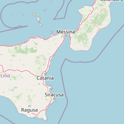
Why Aspromonte National Park stands out

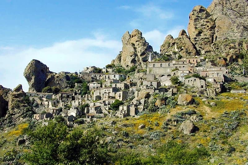
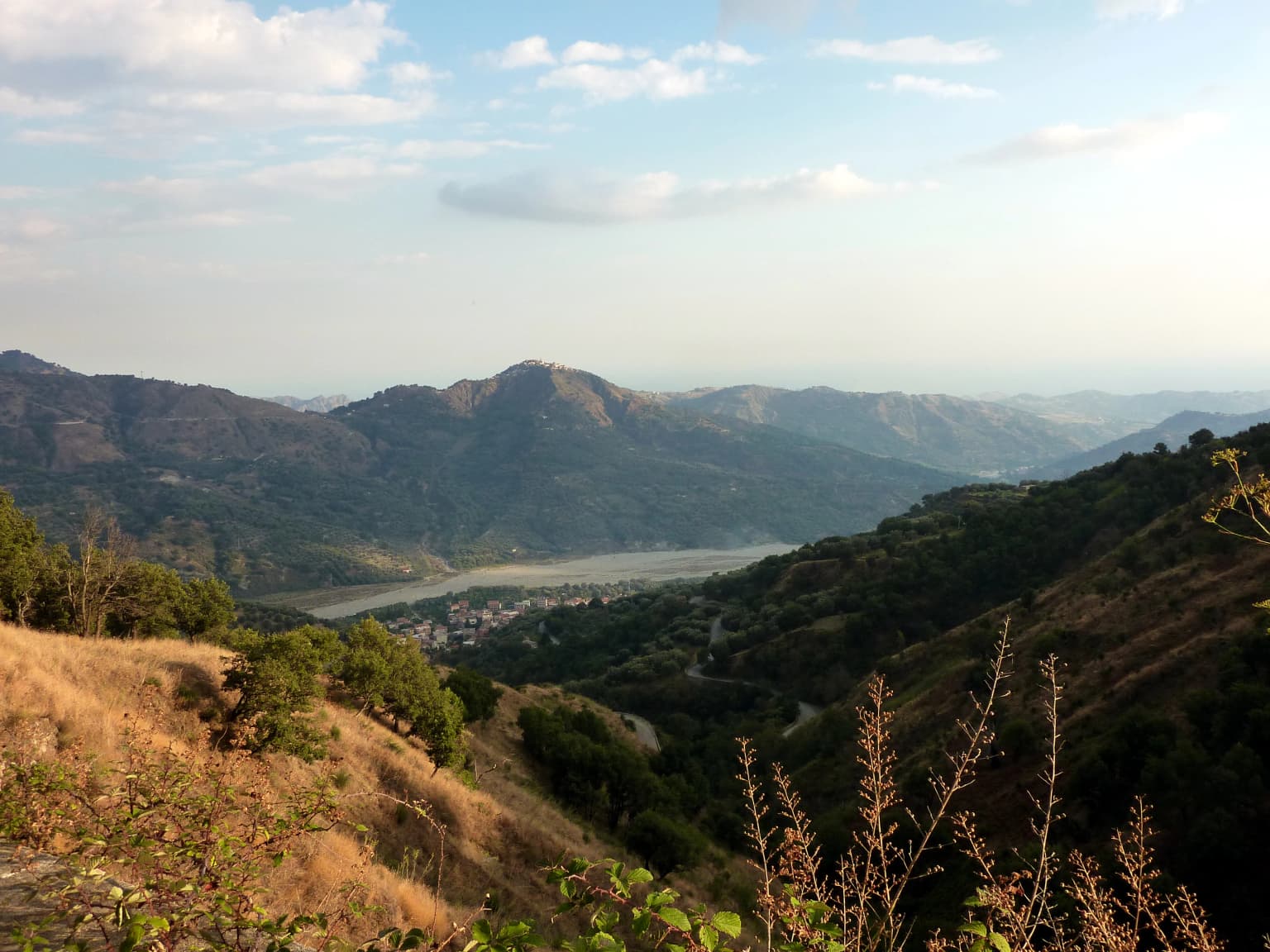
Aspromonte National Park is best known for its extraordinary vertical landscape that drops from nearly 2,000-meter Apennine summits directly to the Mediterranean coast, creating one of Italy's most dramatic mountain-to-sea transitions in a protected area. The park protects significant populations of apex predators including the Italian wolf, Eurasian eagle-owl, and peregrine falcon, along with the rare Bonelli's eagle. Its recognition as a UNESCO Global Geopark in 2021 highlights the geological significance of the territory, while the presence of rare species like the tropical fern Woodwardia radicans demonstrates the park's ecological importance. The historical dimension is equally notable, with the park containing ancient villages such as Pentedattilo and important archaeological heritage.

Stone village buildings on a rocky hillside with large rock formations and greenery under a clear blue sky
Pentedattilo village nestled among rocky cliffs in Aspromonte National Park, Italy

Aspromonte National Park history and protected-area timeline

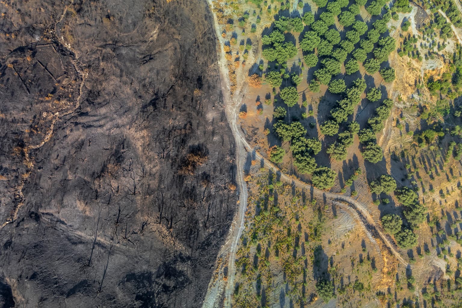
Aspromonte National Park was officially established in 1989 through Italian national legislation, creating a protected framework for the distinctive mountainous territory in southern Calabria. The creation of the park reflected increasing awareness during the late twentieth century of the need to conserve Italy's remaining wilderness areas and to manage the tension between traditional land use practices and ecological preservation. The park's history is deeply intertwined with the broader environmental movement in Italy and the recognition that the Apennine region, despite its proximity to populated areas, contained significant natural value requiring protection. More recently, the park gained international recognition when it was designated as a UNESCO Global Geopark on April 21, 2021, acknowledging the geological significance of the territory and its value for earth science education. The park has faced significant challenges, including devastating wildfires in 2021 that caused substantial damage to portions of the territory, with investigations suggesting involvement of organized crime in some fire events.

Aspromonte National Park landscape and geographic character

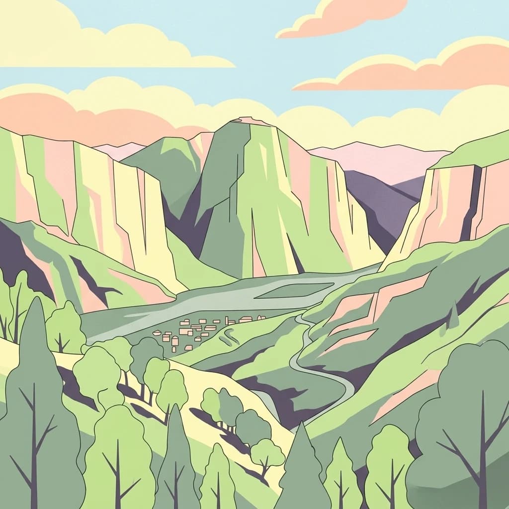
The landscape of Aspromonte National Park is defined by the dramatic encounter between the southern Apennine mountain system and the Mediterranean Sea, creating terrain of exceptional topographic complexity. The park's highest point, Montalto, reaches 1,955 meters and forms part of a ridge system that runs roughly parallel to the coastline before descending sharply toward the Tyrrhenian coast. The terrain is characterized by steep-sided valleys carved by numerous watercourses that flow from the higher elevations down to the sea, creating a network of streams and small rivers that dissect the mountain mass. Rock formations throughout the park showcase the geological history of the Apennine range, with diverse lithologies contributing to the visual variety of the landscape. The transition from mountain to coast occurs over relatively short horizontal distances, meaning that visitors can experience dramatic changes in scenery within the park's boundaries. The presence of traditional villages such as Pentedattilo, built on dramatic rock formations, adds cultural dimension to the natural landscape.

Aerial view of burned landscape and forested area in Aspromonte National Park with a road running between the two sections
Aerial view of Aspromonte National Park showing a burned area adjacent to a forested region

Aspromonte National Park ecosystems, habitats, and plant life

The ecological character of Aspromonte National Park reflects its position at the intersection of Mediterranean and Apennine biogeographic zones, creating a region of considerable biodiversity. The forest communities within the park display strong elevational zonation, with Mediterranean maquis shrubland dominating the lower slopes and transitioning through deciduous oak and chestnut woodlands into beech-dominated forests at higher elevations. Silver fir and black pine form important coniferous components of the higher forest communities, while the variety of habitats supports an impressive diversity of species. The park's designation as a UNESCO Global Geopark recognizes not only its biological significance but also the geological processes that have shaped this diverse landscape over millions of years. The rare tropical fern Woodwardia radicans represents a particularly noteworthy element of the park's flora, occurring in sheltered locations where microclimate conditions allow this species to survive at the northern edge of its range.

Mountainous landscape in Aspromonte National Park with dry grass, hills, and distant mountains under a partly cloudy sky
Panoramic view of Aspromonte National Park showing mountain ridges and the Fiumara di Melito dry river bed

Aspromonte National Park wildlife and species highlights

The wildlife of Aspromonte National Park includes several species of significant conservation importance that characterize the park's ecological identity. The Italian wolf inhabits the forested mountainsides, representing one of the last remaining populations of this distinctive subspecies in southern Italy. Bird species of particular note include the peregrine falcon and Eurasian eagle-owl, both apex predators in their respective ecological niches, as well as the northern goshawk and the rare Bonelli's eagle. The combination of forested habitats, open rocky areas, and the vertical complexity of the landscape provides suitable breeding and hunting grounds for these raptorial species. The presence of such a complex of large predators indicates a relatively healthy ecosystem with intact trophic chains, a conservation priority across European protected areas. The park's wildlife community reflects the broader Apennine fauna while incorporating Mediterranean-influenced species from the coastal zones.

Group of hikers walking on a paved road through a rural landscape with a mountain in the background
Hikers walking along a road toward Monte Sant'Elia in Aspromonte National Park

Aspromonte National Park conservation status and protection priorities

Aspromonte National Park serves as a critical conservation area within Italy's protected areas network, preserving an important example of Mediterranean mountain ecosystems that have faced significant pressure from human activity. The park's dual designation as both a national park under IUCN Category II and a UNESCO Global Geopark reflects its conservation value from both ecological and geological perspectives. The protection of forest communities, particularly the beech and silver fir woodlands that represent the southernmost extent of these typically central and northern European species in Italy, addresses important conservation targets. The presence of apex predators including wolves and large raptors indicates that the park supports functional ecological communities, though challenges remain in managing human-wildlife interactions and maintaining connectivity with surrounding landscapes. The 2021 wildfires demonstrated the vulnerability of Mediterranean protected areas to fire risk and highlighted ongoing challenges in managing these landscapes sustainably.

Aspromonte National Park cultural meaning and human context

The cultural landscape of Aspromonte National Park reflects centuries of human habitation in this mountainous Calabrian territory, with archaeological and historical heritage contributing to the park's significance beyond its ecological value. The park contains numerous small villages and settlements whose architecture and traditional practices reflect the cultural heritage of the Calabrian Apennines. The area has historically been characterized by relative isolation and economic marginalization, factors that have paradoxically contributed to the preservation of both natural habitats and traditional cultural practices. The park's proximity to the ancient city of Reggio di Calabria, one of the oldest Greek colonies in Italy, connects the protected area to broader historical narratives of Mediterranean civilization. The dramatic setting of villages like Pentedattilo, perched on distinctive rock formations, exemplifies the traditional relationship between human settlement and the rugged landscape that the park now protects.

Top sights and standout views in Aspromonte National Park

Aspromonte National Park offers visitors one of Italy's most distinctive mountain-to-sea protected area experiences, where nearly 2,000-meter Apennine summits drop directly to the Mediterranean coast within a compact territory. The combination of geological significance recognized by UNESCO Global Geopark status, exceptional wildlife including Italian wolves and Bonelli's eagle, and dramatic Mediterranean mountain scenery creates a unique conservation landscape. The park's forests of beech, silver fir, and black pine represent the southernmost occurrences of these species in Italy, while the rare tropical fern Woodwardia radicans demonstrates the ecological complexity of the area. Historical villages and archaeological heritage add cultural depth to the natural landscape, making the park significant for both ecological and cultural conservation.

Best time to visit Aspromonte National Park

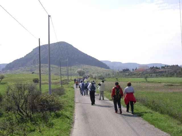
The best time to visit Aspromonte National Park depends on the experience sought, with spring and early summer offering pleasant temperatures for hiking and optimal conditions for observing wildlife activity. The spring months bring wildflower displays in the lower elevations and manageable conditions for exploring the mountain trails, while the summer period can bring high temperatures in the lower elevations but offers the longest days for exploration. Autumn provides another excellent visiting season with comfortable temperatures and the opportunity to observe forest color as the deciduous trees change. Winter conditions in the higher elevations can be challenging but offer a different character for experienced visitors. The park's Mediterranean location generally provides mild conditions year-round, though visitors should be aware that the rugged terrain demands appropriate preparation regardless of season.

Park location guide

Geography guide, regional context, and park location map for Aspromonte National Park

Aspromonte National Park park geography, regions, and map view in Italy
Understand where Aspromonte National Park sits in Italy through a broader geographic reading of the surrounding landscape, nearby location context, and its mapped position within the national park landscape.

How Aspromonte National Park fits into Italy

Italy is a unitary parliamentary republic in Southern and Western Europe, located on the Italian Peninsula with the Alps to the north. It borders France, Switzerland, Austria, Slovenia, Vatican City, and San Marino, and shares maritime boundaries with several Mediterranean countries. The country has approximately 59 million residents and uses the Euro as its currency.

Wider geography shaping Aspromonte National Park in Italy

Italy occupies a boot-shaped peninsula in southern Europe, bordered by the Alps to the north. It shares land borders with France, Switzerland, Austria, Slovenia, Vatican City, and San Marino. The country includes the Mediterranean islands of Sicily and Sardinia, along with approximately 800 smaller islands.

Map view of Aspromonte National Park

Use this park location map to pinpoint Aspromonte National Park in Italy, understand its exact geographic position, and read its mapped placement within the surrounding landscape more clearly.

Pigeon | © OpenStreetMap contributors

Location context for Aspromonte National Park

Calabria

Witness the diverse terrain, rich habitats, and unique protected-area character through compelling imagery.

Aspromonte National Park Photos: Explore Dramatic Mountain to Sea Landscapes
Browse a curated collection of Aspromonte National Park imagery, showcasing its rugged Apennine summits, steep valleys, and Mediterranean coastal transitions. These visual references help you understand the park's exceptional vertical landscape, distinct geological features, and significant conservation value as a protected area in Southern Italy.

Stone village buildings on a rocky hillside with large rock formations and greenery under a clear blue sky

Multi-tiered waterfall flowing over rocky cliffs with surrounding green trees and yellow flowering plants.

Aerial view of burned landscape and forested area in Aspromonte National Park with a road running between the two sections

Mountainous landscape in Aspromonte National Park with dry grass, hills, and distant mountains under a partly cloudy sky

Group of hikers walking on a paved road through a rural landscape with a mountain in the background

Park atlas

Compare protected landscapes across Calabria and Southern Italy, mapping regional park geography

Explore Other National Parks and Protected Areas Near Aspromonte National Park
Continue your atlas discovery of Italy's protected areas by exploring other national parks and regional reserves situated near Aspromonte National Park. This geographic overview allows you to compare diverse mountain-to-sea transitions and conservation landscapes throughout Calabria and Southern Italy.
Watercolor illustration of a lake surrounded by green landscape with mountains in the background
National parkCalabria

Sila National Park: Protected Landscape and Geographic Context in Calabria

Explore its mapped boundaries and regional natural area.

Sila National Park represents a vital protected landscape within the Calabria region, situated in southern Italy. This page details its specific geographic features and mapped park boundaries, offering a focused view of its place within the broader Italian atlas. Understanding Sila National Park provides insight into the region's natural terrain and the distribution of its protected lands, serving as a key point for geographic discovery.

Area
736.95 km²
Established
2002
IUCN
II
Relief
Mixed relief
Watercolor illustration showing green hills, a valley, and pink rock formations under a pale sky
National parkBasilicata

Pollino National Park: Protected Landscape of Ancient Forests and Alpine Terrain

Italy's largest national park and UNESCO Global Geopark

Pollino National Park, located in the Basilicata region, is a significant protected landscape renowned for its extensive ancient forests, particularly its rare Bosnian pines, and its dramatic, high-altitude mountain geography. Covering over 1,925 square kilometers, this national park is also recognized as a UNESCO Global Geopark, highlighting its exceptional geological heritage and unique ecosystems. The park's rugged terrain, soaring peaks, and rare ancient trees offer rich opportunities for understanding regional protected areas and mapped natural landscapes in southern Italy.

Area
1,925.65 km²
Established
1992
IUCN
II
Relief
Mountain
Watercolor painting showing mountains, a lake, and grassy fields
National park

Cilento, Vallo di Diano and Alburni National Park: An Italian National Park's Geographic and Protected Landscape Identity

Mapped protected area boundaries and regional context.

Delve into the core geographic and protected-area characteristics of Cilento, Vallo di Diano and Alburni National Park. As a designated National Park in Italy, its mapped boundaries and landscape context are essential for atlas exploration. This entry provides the foundational geographic understanding needed to place this protected land within a broader map-based discovery framework, highlighting its significance as a natural landscape.

Area
1,810.48 km²
Established
1991
IUCN
II
Relief
Mountain
Watercolor illustration showing a landscape with mountains, green forests, and a river under a soft sky
National parkBasilicata

Appennino Lucano - Val d'Agri - Lagonegrese National Park: Protected Mountain Landscape in Basilicata, Italy

Explore its geography, mapped terrain, and ecological role.

Gain insight into Appennino Lucano - Val d'Agri - Lagonegrese National Park, a significant protected mountain landscape in the heart of Basilicata. This detailed page focuses on the park's distinct geographic features, its role as a crucial ecological corridor connecting major southern Italian protected areas, and the mapped contours of its diverse terrain. Understand its place within the Lucano Apennine range and the broader natural atlas of Italy.

Area
689.96 km²
Established
2007
IUCN
II
Relief
Mountain
National park

Ta' Qali National Park: Malta's Largest Urban Protected Landscape and Recreation Hub

Mapped Gardens, Event Venues, and Recreational Zones

Ta' Qali National Park serves as a vital green lung in central Malta, showcasing a landscape transformed from a wartime airfield into a modern urban protected area. This national park is recognized for its extensive recreational zones, meticulously designed formal gardens, and a prominent open-air concert venue that hosts major cultural events. Its relatively flat terrain and planned infrastructure offer a distinct map-based perspective on urban parkland, highlighting its significance as a major public amenity and a key feature of Malta's landscape.

Area
0.35 km²
IUCN
V
Relief
Lowland
Climate
Mediterranean
Watercolor illustration showing green grasslands, distant hills, and a winding path under a light sky
National park

Alta Murgia National Park: National Park Exploration and Protected Landscape Context

Explore mapped terrain and regional geography.

Alta Murgia National Park is a designated national park offering unique opportunities for geographic discovery. Delve into its protected landscape, understand its mapped boundaries, and situate it within the broader Italian atlas. This entry provides essential context for exploring the park's terrain and regional significance.

Area
677.39 km²
Established
2004
IUCN
II
Relief
Mixed relief
Watercolor illustration of a mountainous landscape with green hills, a valley with a river, and distant mountains under a pink and yellow sky
National parkCampania

Vesuvius National Park: Protected Volcanic Landscape in Campania, Italy

Explore mapped boundaries and regional geography.

Discover Vesuvius National Park, a vital protected area safeguarding Italy's iconic active volcano. This page provides essential geographic context, detailed mapped terrain, and insights into the park's unique volcanic landscape within the Campania region. It serves as a key entry point for understanding the park's protected status and its geological significance for structured atlas exploration.

Area
72.59 km²
Established
1995
IUCN
II
Relief
Mountain
Watercolor painting of a landscape with rolling hills, pink wildflowers, and scattered trees
National park

Pantelleria National Park: A Protected Landscape within Italy's Atlas

Mapped boundaries and regional geographic context.

Pantelleria National Park is a designated national park in Italy offering a distinct protected landscape for exploration. This page provides essential geographic context, highlighting the park's mapped boundaries and its significance within the regional atlas. Understand the terrain and protected land features that define this important natural area.

Area
66.4 km²
Established
2016
IUCN
II
Relief
Highland

Common questions about visiting, size, designation, and location context for Aspromonte National Park

Aspromonte National Park FAQs for park facts, access, geography, and protected area context
Find quick answers about Aspromonte National Park, including protected-area facts, park geography, trail and visitor context, and how the park fits into its surrounding country and regional landscape.
MoriAtlas Explorer

Continue Your Protected Areas Search Across the Global Atlas

Deepen your exploration by continuing the structured search for national parks and protected areas worldwide. Utilize the comprehensive filtering capabilities to compare different conservation landscapes and refine your understanding of global park geography. Discover more about the distribution and characteristics of protected natural areas.

Global natural geography