Mori Atlas logo
National parkTa' Qali National Park

Mapped Recreational Zones and Formal Gardens within Central Malta's Geography

Ta' Qali National Park: Malta's Key Protected Landscape and Event Venue

(Malta National Park (Park Nazzjonali ta' Malta))

Ta' Qali National Park represents a substantial urban green infrastructure project on the island of Malta, transforming former military airfield grounds into a significant protected landscape. This national park offers a unique exploration of planned recreational zones, formal gardens, and a large open-air concert venue, situated within the central geography of Malta. Its designed terrain contrasts with natural wilderness parks, focusing instead on structured public amenity and community engagement, making it a distinct feature on the island's mapped terrain.

Urban ParkMaltaRecreational ParkFamily FriendlyEvent VenueHistoric Site

Ta' Qali National Park

National park

Park overview

Structured park overview, official facts, and landscape profile for Ta' Qali National Park

Ta' Qali National Park park facts, protected area profile, and essential visitor context

Review the core facts for Ta' Qali National Park, including designation, size, terrain, visitor scale, habitats, and operating context in one park-focused overview.

About Ta' Qali National Park

Ta' Qali National Park stands as Malta's flagship urban green space, located in the heart of the island's central region within the locality of Attard. The park's history is uniquely tied to Malta's wartime past, as it occupies part of the former RAF Ta' Kali airfield that served during the Siege of Malta in the Second World War. Following the end of RAF operations, the site was progressively converted to recreational use, eventually becoming the public park that exists today.

The park encompasses a diverse range of facilities and landscaped zones spread across approximately 350,000 square metres. The Formal Garden, spanning 16,000 square metres, was designed by architect Joseph Spiteri and has undergone recent re-landscaping with new paving, planting, and irrigation systems. The larger Picnic and Recreation Area covers roughly 6 hectares of open lawns and shaded seating, serving as the primary family gathering space on weekends.

A significant feature is the Adventure Park, a 16,000 square metre children's zone equipped with play structures, fountains, and a café. The park also includes a petting farm offering family-friendly animal interactions and Malta's first dedicated dog park, which opened in 2012 and remains popular among pet owners.

The open-air Concert Area represents one of the park's most prominent features, with a 14,700 square metre site including a stage, kiosks, lighting, irrigation tanks, and approximately 1,500 trees and shrubs. This venue has become central to Malta's event calendar, hosting major festivals and concerts throughout the year.

Quick facts and research context for Ta' Qali National Park

Ta' Qali National Park is located in central Malta, within the limits of Attard, adjacent to the National Stadium and Malta Aviation Museum. The 35-hectare site was formerly RAF Ta' Kali, a wartime airfield from the Second World War era. The park is managed by the Government of Malta through Public Works and Ambjent Malta, with a specialised management unit created in 2023. It features approximately 1,500 trees and shrubs as part of ongoing afforestation efforts. The park is open year-round and served by Malta Public Transport routes connecting to Valletta, Mosta, and St Julian's.

Protection and recognition

Exploring terrestrial management boundaries and documented conservation status

Ta' Qali National Park Protected Area Designation and Recognition

Researchers and conservation explorers can examine the documented terrestrial protection status and established boundaries of Ta' Qali National Park. Verified records compile essential designation history and management scope to assist in mapping regional conservation networks.

Protection details

Protection scope
Terrestrial
Transboundary protection
No
Park context

Deeper park guide and search-rich context for Ta' Qali National Park

Ta' Qali National Park history, landscape, wildlife, and travel context

Explore Ta' Qali National Park through its history, landscape character, ecosystems, wildlife, conservation priorities, cultural context, and seasonal travel timing in a structured park guide built for atlas discovery and search intent.

Why Ta' Qali National Park stands out

Ta' Qali National Park is best known as Malta's largest urban park and a major venue for public events and concerts. The park's concert area, spanning 14,700 square metres, has become a flagship venue for major cultural events including the annual Earth Garden festival and Farsons Beer Festival. It also houses Malta's first dedicated dog park, opened in 2012, and a popular adventure zone for children. The park's transformation from a wartime airfield to a modern recreational facility represents one of Malta's most significant green-infrastructure projects.
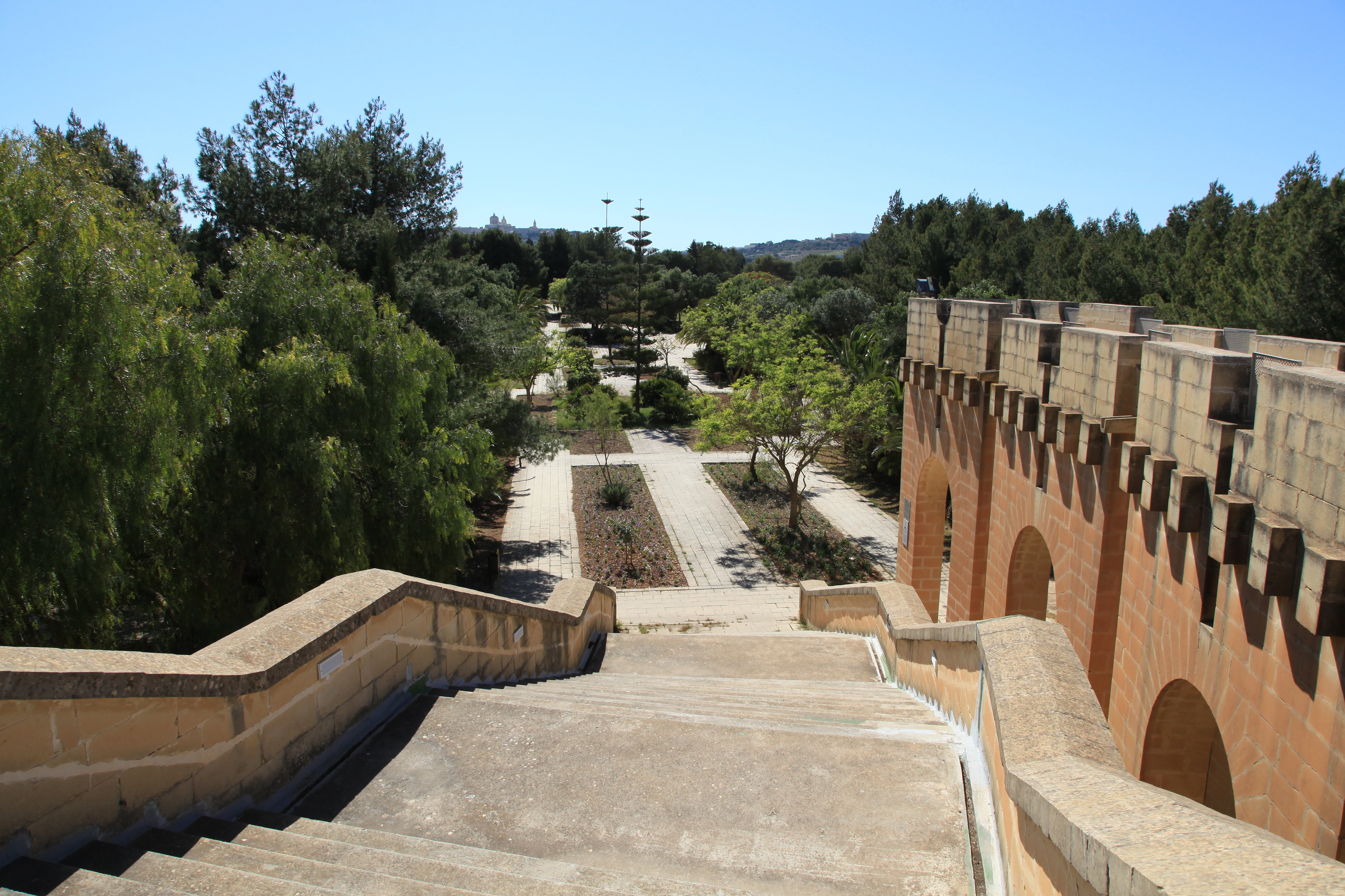
Concrete staircase descending into a park with trees and a historic building featuring arched openings on the right
Staircase leading into Ta' Qali National Park with historic building on the right

Ta' Qali National Park history and protected-area timeline

The site that now comprises Ta' Qali National Park was originally part of RAF Ta' Kali, a wartime airfield with grass runways that played a significant role during the Second World War. The airfield was operational during the Siege of Malta, when the island faced intense bombardment while maintaining its strategic importance as a British naval base. Following the end of the war and the conclusion of RAF operations, the former airfield land was progressively decommissioned and converted to civilian recreational use.

In May 2019, the Maltese government announced comprehensive plans to expand and upgrade the park, including new trails and amenities. A multi-year regeneration programme began in 2020, representing one of Malta's most ambitious green-infrastructure projects. The works have been led by Public Works entities, and by 2023, a specialised management unit was established to coordinate large public-realm projects including Ta' Qali.

A significant milestone came on 4 May 2024 when the Prime Minister inaugurated a €16 million concert zone within the park, the culmination of months of finishing works. By April 2025, further progress was reported on the regeneration of the Picnic Area, which is heavily used by families each weekend. The regeneration has included procurement of irrigation water supply systems and construction of accessibility features at the Concert Area.

Ta' Qali National Park landscape and geographic character

The landscape of Ta' Qali National Park reflects its origins as a military airfield, now transformed into a planned urban green space. The terrain is predominantly flat, consistent with its former use as a runway and dispersal area. The park is characterised by a mix of formal landscaped gardens, open grass lawns, and tree-lined pathways.

The Formal Garden area features designed planting beds, paving, and irrigation systems, creating a more structured horticultural environment compared to the open recreational zones. The broader park includes scattered mature trees and shrubs, with approximately 1,500 trees and shrubs having been planted as part of ongoing afforestation and landscaping works.

The park's setting within central Malta places it in an urban context, surrounded by residential areas, the National Stadium, and other institutional buildings. Unlike natural parks with dramatic topography, Ta' Qali's landscape is defined by its designed recreational spaces and the contrast between formal garden areas and open lawn recreation zones.

Ta' Qali National Park ecosystems, habitats, and plant life

The ecological character of Ta' Qali National Park is that of a managed urban green space rather than a natural wilderness area. The park's vegetation consists of cultivated gardens, planted trees, and maintained lawns, created through deliberate landscaping and afforestation efforts rather than natural succession. Ongoing planting programmes have introduced approximately 1,500 trees and shrubs alongside upgraded irrigation systems, building on earlier reforestation initiatives.

The park's nature offerings focus on providing green space within Malta's densely populated central region, rather than protecting significant natural habitats or ecosystems. The petting farm provides family-friendly interactions with small domestic animals. The managed nature trails allow visitors to explore the planted areas while the formal gardens demonstrate ornamental horticulture appropriate for Malta's Mediterranean climate.

Ta' Qali National Park wildlife and species highlights

Wildlife at Ta' Qali National Park reflects its character as an urban recreational park rather than a natural habitat preserve. The petting farm provides close encounters with domestic animals including goats, sheep, rabbits, and other small farm animals popular with children. Birdlife in the park includes common species attracted to the green spaces and trees, though the park does not serve as a significant habitat for rare or protected bird species.

The park's value for wildlife is primarily indirect, providing green space within Malta's urban environment that offers some habitat elements for common urban-adapted species. The trees and shrubs planted throughout the park provide nesting and foraging opportunities for urban birds, while the open areas attract various insects and other small creatures typical of maintained grassland.

Ta' Qali National Park conservation status and protection priorities

Ta' Qali National Park's conservation significance lies primarily in its role as Malta's largest urban green space and its contribution to the island's limited green infrastructure. While not a nature reserve protecting significant ecological habitats, the park represents an important green lung within Malta's densely built central region.

The ongoing regeneration programme has emphasised sustainable practices including water-efficient irrigation systems and the extensive tree planting programme with approximately 1,500 trees and shrubs. These efforts contribute to carbon sequestration, urban cooling effects, and biodiversity enhancement within the urban fabric. The park also serves an important recreational function in preserving green space for community use as Malta faces pressures from urban development.

The management approach focuses on balancing recreational facilities with green space preservation, though the development of the concert area has generated public discussion about the appropriate balance between event infrastructure and open green space.

Ta' Qali National Park cultural meaning and human context

Ta' Qali National Park occupies a site with significant modern Maltese history, having served as RAF Ta' Kali during the Second World War. The airfield played a role in Malta's wartime defence during the Siege of Malta, one of the most challenging periods in the island's modern history. While the physical remains of the wartime airfield have been largely transformed, the site's historical association remains part of its identity.

The park's name derives from the locality of Ta' Qali, and it holds a place in Maltese cultural life as a primary venue for community events and gatherings. The annual Earth Garden festival and Farsons Beer Festival have become established events in the Maltese calendar, drawing large crowds to the park. The adjacent Ta' Qali Crafts Village and Malta Aviation Museum add to the cultural context of the area, creating a hub for recreation, heritage, and community activities.

The park serves as a gathering space for families and community groups, particularly on weekends when the Picnic Area sees heavy use. This social function represents an important aspect of Maltese urban culture, where gathering spaces in the limited land-available island nation carry particular value.

Top sights and standout views in Ta' Qali National Park

Ta' Qali National Park stands as Malta's largest and most significant urban park, representing a major green-infrastructure project on an island with limited open space. The park's transformation from a WWII airfield to a modern recreational facility is unique among European parks. The 14,700 square metre concert venue has become a premier cultural venue hosting major festivals and events that draw visitors from across Malta. The presence of Malta's first dedicated dog park, established in 2012, demonstrates the park's role in pioneering recreational facilities. The ongoing regeneration programme, representing an investment of many millions of euros, continues to develop the park's facilities and green spaces.

Best time to visit Ta' Qali National Park

Ta' Qali National Park is open year-round and can be enjoyed in any season, though the optimal time for outdoor recreation is during the cooler months from autumn through spring. The Mediterranean climate means summer temperatures can be very high, making midday visits uncomfortable. Early morning or late afternoon visits are preferable during warmer months. The park sees particularly high weekend usage, especially on Saturdays and Sundays when families gather at the Picnic Area. Major events such as Earth Garden and the Farsons Beer Festival draw large crowds during summer months, offering a different experience for those interested in Maltese cultural events.
Monthly climate preview

Long term temperature averages and daily precipitation trends for the surrounding region

Ta' Qali National Park Monthly Climate Normals and Average Weather Patterns

Representative coordinates for Ta' Qali National Park indicate a climate profile with warm mean temperatures peaking around 26.58 degrees Celsius in Month 8 alongside minimal daily precipitation during mid year months. Exploring the complete twelve-month sequence reveals the full range of temperature fluctuations and seasonal moisture gradients across the region.
Annual mean20 °C
14 °C27 °C
Jan15°
Feb14°
Mar15°
Apr16°
May19°
Jun22°
Jul25°
Aug27°
Sep25°
Oct23°
Nov19°
Dec16°
Warmest month
August

26.6 °C

Coolest month
February

13.9 °C

Wettest month
November

3 mm/day

Driest month
July

0.1 mm/day

Park location guide

Geography guide, regional context, and park location map for Ta' Qali National Park

Ta' Qali National Park park geography, regions, and map view in Malta

Understand where Ta' Qali National Park sits in Malta through a broader geographic reading of the surrounding landscape, nearby location context, and its mapped position within the national park landscape.

How Ta' Qali National Park fits into Malta

Malta is a small island nation in the Mediterranean, located between Italy, Tunisia, and Libya. With a population of about 520,000 spread over 316 km², it is one of the world's most densely populated countries. The country has a long history of foreign rule and is known for its strategic position, historic sites, and membership in the EU, Commonwealth, and UN.

Wider geography shaping Ta' Qali National Park in Malta

Malta is located in the Mediterranean Sea between Sicily and North Africa, approximately 80 km south of Italy, 284 km east of Tunisia, and 333 km north of Libya. The archipelago sits at coordinates 35°54′N 14°31′E.

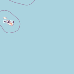
Map view of Ta' Qali National Park

Use this park location map to pinpoint Ta' Qali National Park in Malta, understand its exact geographic position, and read its mapped placement within the surrounding landscape more clearly.

Pigeon | © OpenStreetMap contributors

Explore the diverse scenery, from formal gardens to open lawns, understanding the protected-area character and managed urban landscape of this Maltese gem.

Ta' Qali National Park Images: Visual Exploration of Malta's Premier Urban Green Space

Browse comprehensive images of Ta' Qali National Park to visually understand its distinctive landscape, urban green spaces, and recreational facilities. These photographs provide essential context for appreciating the park's transformation from a former airfield into Malta's premier managed protected area, showcasing its gardens, open areas, and community environments.

Concrete staircase descending into a park with trees and a historic building featuring arched openings on the right

Park atlas

Browse the Maltese landscape for additional protected areas and urban green spaces, comparing their unique characteristics and geographic distribution.

Discover Other Parks Near Ta' Qali National Park, Explore Related Protected Areas in Malta

Explore a curated selection of national parks and significant protected areas located near Ta' Qali National Park, allowing for geographic comparison of urban green spaces and broader conservation landscapes across Malta. This direct atlas view helps users understand the regional spread of Malta's managed recreational spaces and nature reserves, providing essential context for further park discovery.
A soft, pastel-toned watercolor painting of a rolling green landscape with a small body of water in the foreground and a silhouette of a building on a hill in the distance.
Wildlife reserveMalta
About 4 km away#1 closest

Southwest

Buskett Gardens Wildlife Reserve: Geography and Protected Landscape Map of Malta

A rare sheltered woodland valley in the central Mediterranean

Buskett Gardens serves as a critical protected woodland in the heart of the Maltese islands. Nestled in the fertile Wied il-Luq valley, the site offers an unusually green, shaded environment of broadleaved trees and conifers. This reserve functions as an Important Bird Area and a historic cultural landscape, providing a lush contrast to the exposed limestone plateau of rural Malta.

Area
0.47 km²
Relief
Upland
Scope
Terrestrial
Water
Minor water
A pale, minimalist watercolor painting depicting St Paul's Island in Malta, showing green rolling landforms and a hint of a structure against a light background.
Protected areaMalta
About 8.3 km away#2 closest

North

St Paul's Island Protected Landscape and Maltese Coastal Geography Overview

Uninhabited Mediterranean island and heritage landmark

St Paul's Island represents a unique Mediterranean limestone islet featuring maritime garigue habitat and historic ruins. Located near the Mellieħa coastline, this protected area provides a compact example of Maltese coastal geography, defined by exposed cliffs and an enduring connection to local maritime history.

Area
0.101 km²
Relief
Lowland
Scope
Mixed
Water
Water-dominated
A horizontal watercolor painting depicting a soft-toned, abstract coastal landscape with gentle green hills, grassy foreground patches, and a calm, pale pool of water against a white background.
Marine protected areaMalta
About 8.6 km away#3 closest

West

Ras ir-Raħeb Marine Protected Area: Geographic Profile and Mapped Coastal Landscape

Coastal cliffs and protected marine zones in north western Malta.

Ras ir-Raħeb serves as a pivotal marine protected area along the Malta coastline, where high limestone cliffs meet complex underwater habitats. This site links historical archaeological remnants with modern ecological conservation, offering a unique geographic snapshot of the Rabat plateau edge. Its mapped boundaries encompass both the terrestrial promontory and the essential seagrass meadows beneath the surface, providing a critical reference point for Mediterranean coastal geography and protected land status.

Established
2005
Relief
Upland
Climate
Mediterranean
Access
Moderate access
A horizontal watercolor illustration showing soft, blended washes of green, yellow, and pale pink depicting an abstract rolling landscape or horizon line against a white background.
Natural monumentMalta
About 11 km away#4 closest

Southeast

Għar Dalam Natural Monument: A Protected Maltese Cave and Paleontological Landmark

Geological and prehistoric landscape context in southeastern Malta

Għar Dalam is a protected natural monument in Malta that preserves a complex phreatic cave passage and essential fossil records of extinct dwarf species. This cave site acts as a major cornerstone for understanding the prehistoric Mediterranean, documenting the arrival of early Neolithic cultures and the long-term evolution of island-bound animal life through stratified sediment analysis.

Established
1933
Relief
Lowland
Climate
Mediterranean
Access
Easy access
A pale, minimalist watercolor illustration showing soft, rolling green and yellow hills against a white background.
Nature reserveMalta
About 12 km away#5 closest

South

Filfla Nature Reserve: The Protected Limestone Plateau and Geography of Malta

Tracing the limestone cliffs and seabird sanctuary of the Maltese archipelago

Filfla is a small, uninhabited limestone islet lying 4.5 kilometres south of the main island of Malta. Defined by its 60-metre sea cliffs and flat plateau, this protected nature reserve functions as a crucial Important Bird Area and a landmark for regional Mediterranean biodiversity. Examine the mapped boundaries and geological profile of this site to understand its status as the southernmost extremity of the Maltese archipelago.

Area
0.06 km²
Established
1980
Relief
Upland
Climate
Mediterranean
A watercolor painting showing a soft landscape with green rolling hills, low vegetation, and a calm water surface against a pastel sky.
Nature reserveSouth Eastern Region
About 13 km away#6 closest

Southeast

Il-Ballut ta' Marsaxlokk Nature Reserve: Geography and Protected Wetland Landscapes

Essential salt marsh habitat in Malta's South Eastern Region

Il-Ballut ta' Marsaxlokk serves as a critical protected area, preserving a rare salt marsh landscape within the coastal environment of Malta. This reserve features a compact mosaic of muddy canals, halophytic vegetation, and Mediterranean coastal terrain. Its inclusion in the Natura 2000 network highlights its regional importance as a refuge for migratory birds and a focal point for environmental conservation in the South Eastern Region.

Area
0.23 km²
Established
2018
IUCN
IV
Relief
Lowland
Nature reserveMarsaxlokk
About 15 km away#7 closest

Southeast

Xrobb l-Għaġin Nature Park: Protected Coastal Landscape in Marsaxlokk, Malta

A compact peninsula of protected cliffs and historic archaeological sites

Xrobb l-Għaġin Nature Park spans a low-lying coastal peninsula near Marsaxlokk, combining rocky Mediterranean shoreline with significant prehistoric temple remains. This protected area serves as a focal point for environmental education and coastal terrain analysis, showcasing the integration of natural heritage and historical coastal defense within a compact geographic boundary.

Area
0.155 km²
Relief
Lowland
Scope
Terrestrial
Water
Minor water
A horizontal watercolor painting showing soft green hills, grassy marshland, and a calm water channel under a light, hazy sky.
Nature reserveGozo
About 15 km away#8 closest

Northwest

Comino Nature Reserve: Geography, Protected Marine Areas, and Karst Terrain in Gozo

Island ecology and coastal landscape mapping

Examine the protected geography of Comino, an island nature reserve near Gozo defined by limestone plateaus and sheltered bays. This overview covers the ecological boundaries of the Natura 2000 marine area, the distribution of coastal sea caves, and the topographic patterns of this Important Bird Area.

Area
3.5 km²
Relief
Lowland
Climate
Mediterranean
Access
Moderate access

Common questions about visiting, size, designation, and location context for Ta' Qali National Park

Ta' Qali National Park FAQs for park facts, access, geography, and protected area context

Find quick answers about Ta' Qali National Park, including protected-area facts, park geography, trail and visitor context, and how the park fits into its surrounding country and regional landscape.
MoriAtlas Explorer

Continue Your Protected Areas Search Across the Global Atlas

Deepen your exploration by continuing the structured search for national parks and protected areas worldwide. Utilize the comprehensive filtering capabilities to compare different conservation landscapes and refine your understanding of global park geography. Discover more about the distribution and characteristics of protected natural areas.

Global natural geography