
Mori Atlas logo
Nature reserveXrobb l-Għaġin Nature Park

A coastal peninsula defining the natural terrain near the village of Marsaxlokk

Xrobb l-Għaġin Nature Park and Protected Coastal Landscape in Southeastern Malta

Xrobb l-Għaġin Nature Park represents a protected coastal reserve situated on a distinctive peninsula in the southeastern region of Malta. This landscape encompasses rocky cliffs and Mediterranean shoreline, offering a unique intersection of natural conservation, prehistoric archaeological remains, and historical defensive structures. The site serves as a vital area for understanding regional coastal geography and environmental research within the Maltese Islands.

coastal nature parkpeninsulaMaltese IslandsMediterranean coastlinecliff scenerywildlife rehabilitation
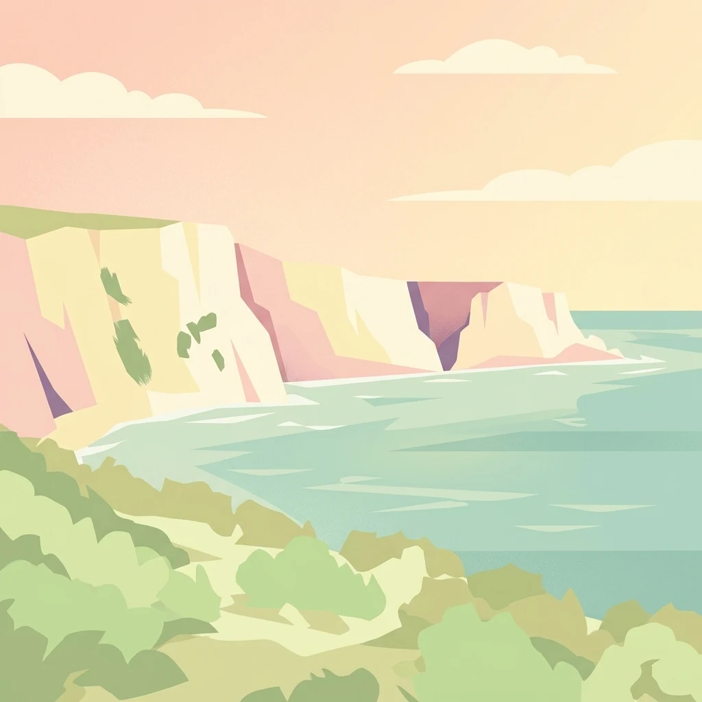
A stylized vector-style illustration of steep light-colored cliffs meeting a calm sea under a soft peach-colored sky.

Xrobb l-Għaġin Nature Park

Nature reserve

Park overview

Structured park overview, official facts, and landscape profile for Xrobb l-Għaġin Nature Park

Xrobb l-Għaġin Nature Park park facts, protected area profile, and essential visitor context

Review the core facts for Xrobb l-Għaġin Nature Park, including designation, size, terrain, visitor scale, habitats, and operating context in one park-focused overview.

About Xrobb l-Għaġin Nature Park

Xrobb l-Għaġin Nature Park stretches across a small peninsula in the southeast of Malta, close to the fishing village of Marsaxlokk and not far from the country capital Valletta. Although modest in size, the park offers a concentrated mix of coastal landscape, ecological restoration, archaeology, and sustainable development practice, making it a useful example of how a single protected site can serve several purposes at once.

The peninsula is low and compact, rising only to about 32 metres above sea level and bounded by a coastline of roughly 2,169 metres. This setting gives the park a strongly Mediterranean coastal character, with cliff exposures, exposed rocky shoreline, and open sea views toward the southern Maltese coast. The site's small footprint makes it well suited to interpretive walks, educational visits, and fieldwork rather than mass tourism.

Within the park, environmental goals are taken seriously. The facility emphasizes renewable energy adoption, sustainable wastewater management, and the protection of biodiversity through teaching, demonstration, and research. A wildlife rehabilitation centre has been planned within the park, and BirdLife Malta has previously run oil spill response training on site, reflecting the importance of the surrounding marine and coastal environment for seabirds and other wildlife.

The park is also notable for the historical layers it preserves. A megalithic temple complex, first identified in 1913 by Temi Zammit and Thomas Ashby and excavated between 1914 and 1915, sits on a vulnerable cliff section that continues to erode. The site also includes the remains of a De Redin watchtower, part of Malta's historic seventeenth-century coastal defense network. Together with the main building, originally built as a Deutsche Welle transmitting station and later adapted for environmental use, these features give Xrobb l-Għaġin a heritage profile that extends well beyond its natural landscape value.

Quick facts and research context for Xrobb l-Għaġin Nature Park

Xrobb l-Għaġin Nature Park lies on a protruding peninsula near Marsaxlokk in southeastern Malta, in the Marsaxlokk area. It covers approximately 155,000 square metres, has a coastline of around 2,169 metres, and rises to a maximum elevation of only about 32 metres above sea level. The site combines a coastal nature park with a sustainable development centre housed in a former telecommunications relay station building. It also contains the ruins of a megalithic temple and a historic De Redin watchtower, making it a multi-layered cultural and natural site.

Protection and recognition

Explore documented terrestrial protection metrics and official designation records

Xrobb l-Għaġin Nature Park Protection Status and Regional Conservation Scope

Xrobb l-Għaġin Nature Park holds a defined terrestrial protection scope within its regional landscape. Structured records detail the established conservation boundaries and international designation status associated with the reserve.

Protection details

Protection scope
Terrestrial
Transboundary protection
No
Park context

Deeper park guide and search-rich context for Xrobb l-Għaġin Nature Park

Xrobb l-Għaġin Nature Park history, landscape, wildlife, and travel context

Explore Xrobb l-Għaġin Nature Park through its history, landscape character, ecosystems, wildlife, conservation priorities, cultural context, and seasonal travel timing in a structured park guide built for atlas discovery and search intent.

Why Xrobb l-Għaġin Nature Park stands out

Xrobb l-Għaġin is best known as a compact coastal nature park that combines biodiversity protection with a hands-on sustainable development centre. The park showcases renewable energy use, wastewater management, and environmental education, and has also been associated with oil spill response training linked to BirdLife Malta's seabird conservation work in the region. The site is equally recognized for its layered history: a megalithic temple dating back to roughly 4000 BC sits alongside the remains of a De Redin coastal watchtower, while the main park building was originally constructed as a Deutsche Welle relay station before being converted into an environmental facility.
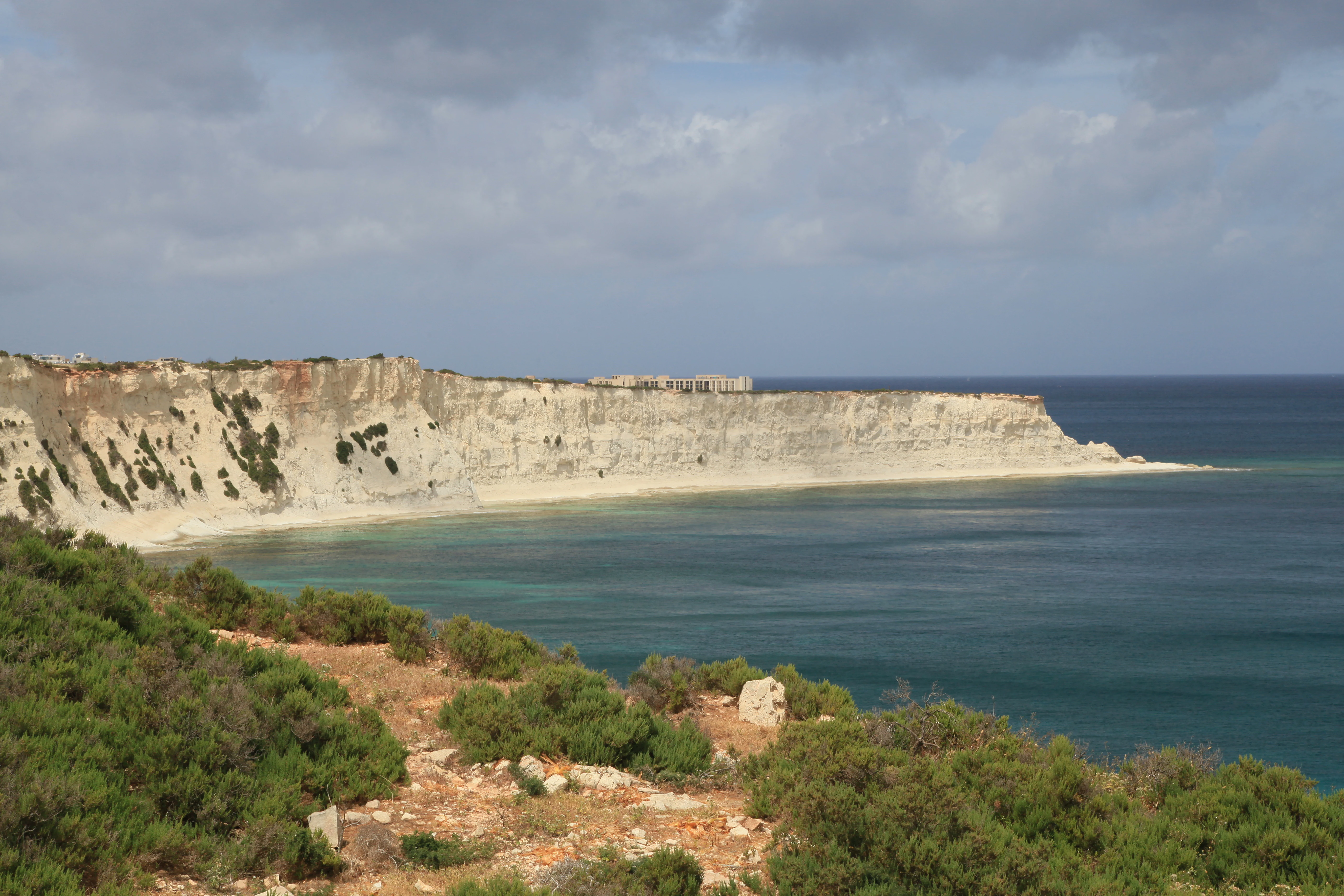
A wide coastal landscape showing limestone cliffs meeting the sea, with green Mediterranean scrubland in the foreground.
Coastal view of the limestone cliffs at Xrobb l-Għaġin Nature Park.

Xrobb l-Għaġin Nature Park history and protected-area timeline

The peninsula of Xrobb l-Għaġin has a long history of human use, beginning in the prehistoric period. The earliest known site on the peninsula is a megalithic temple whose earliest remains date to around 4000 BC. The temple was first identified in 1913 by Temi Zammit and Thomas Ashby, and was excavated between 1914 and 1915. Investigations carried out one hundred years later, in 2015, confirmed that significant remains of the structure still survive on the cliff-side, although the location is increasingly threatened by coastal erosion.

In the early modern era, the peninsula became part of Malta's coastal defense system through the construction of a De Redin watchtower, a type of small fortification built along the Maltese coast in the seventeenth century. The tower now stands as a ruin within the nature park.

In the twentieth century, the site took on an entirely new role as a telecommunications location. A Deutsche Welle relay station, known as the Delimara Transmitting Station, was built on the peninsula. When transmission operations ended, the building complex was repurposed and now serves as the main facility of Xrobb l-Għaġin Nature Park and Sustainable Development Centre, complete with a hostel offering around 30 beds for visitors, researchers, and educational groups.

Xrobb l-Għaġin Nature Park landscape and geographic character

Xrobb l-Għaġin's landscape is defined by its position as a small, low-lying coastal peninsula on the southeastern edge of Malta. The terrain reaches only about 32 metres at its highest point and extends along roughly 650 metres in length, with a coastline of approximately 2,169 metres curling around the promontory.

The shoreline forms an irregular outline of rocky cliffs, low coastal slopes, and sea-facing edges typical of the southern Maltese coast. The exposed cliff sections are not only visually dominant but also archaeologically significant, since they host the remains of the prehistoric temple complex. The contrast between the open sea on three sides and the inland connection to the Marsaxlokk area gives the park a sense of separation, almost like an island environment, despite being technically part of the Maltese mainland.

Xrobb l-Għaġin Nature Park ecosystems, habitats, and plant life

The park is located in a typical Mediterranean coastal environment, where salt-exposed rock, low scrub, and sea-influenced habitats shape the local ecology. The peninsula's small size concentrates this habitat variety into a compact area, where marine, cliff, and coastal plain ecosystems meet within a short walking distance.

The site's conservation focus reflects its vulnerability. Coastal erosion is an ongoing concern, particularly around the cliff-edge archaeological zone, and the park's management aims to balance biodiversity protection with sustainable land use. As a peninsula surrounded by sea, the area is also closely linked to the marine environment, and conservation activities on land are complemented by attention to the condition of surrounding waters, including seabird habitat.

Xrobb l-Għaġin Nature Park wildlife and species highlights

Although the park is small, its location on a southern Maltese peninsula gives it importance for seabirds and coastal wildlife. The surrounding sea and cliff habitats support birdlife typical of the Maltese coastal zone, and the site's role as a host for BirdLife Malta's oil spill response training underlines its recognized importance for marine and seabird conservation.

Plans for a wildlife rehabilitation centre within the park reflect a broader intent to expand the site's role in caring for injured or affected animals, particularly seabirds and other coastal species that may come into conflict with human activity in this part of Malta.

Xrobb l-Għaġin Nature Park conservation status and protection priorities

Xrobb l-Għaġin Nature Park combines several strands of conservation work in one location. Its primary purpose is biodiversity protection, pursued through habitat preservation on the peninsula and through active environmental management around the park's facilities. The reuse of the former telecommunications building as a sustainable development centre reflects a deliberate decision to demonstrate renewable energy use, sustainable wastewater management, and environmentally conscious construction within a working protected site.

The park also has a strong marine dimension. Its use as a training site for oil spill response, organized in cooperation with BirdLife Malta, highlights the importance of keeping coastal waters clean for seabirds and other wildlife. The ongoing challenge of cliff erosion, especially around the prehistoric temple, adds an archaeological-conservation layer to the site's work.

Xrobb l-Għaġin Nature Park cultural meaning and human context

The cultural profile of Xrobb l-Għaġin stretches from prehistoric Malta to the modern environmental movement. The megalithic temple links the peninsula to the island's Neolithic temple-building tradition, one of the oldest monumental building cultures in the Mediterranean. The De Redin watchtower, meanwhile, ties the site to the era of Hospitaller rule, when Malta's coastline was fortified against seaborne threats in the seventeenth century.

More recently, the former Deutsche Welle relay station represents a Cold War era infrastructure footprint, while its conversion into a sustainable development centre signals the site's present identity as a place where Malta's layered heritage meets contemporary environmental values.

Top sights and standout views in Xrobb l-Għaġin Nature Park

Xrobb l-Għaġin's strongest features include its compact but layered identity as coastal nature park, sustainable development centre, prehistoric temple site, and historic watchtower location all in one. Visitors and researchers encounter a Mediterranean cliff-and-sea setting combined with working examples of renewable energy and wastewater management, while the surrounding marine environment has hosted BirdLife Malta's seabird and oil spill training activities.

Best time to visit Xrobb l-Għaġin Nature Park

Xrobb l-Għaġin has a typical Mediterranean coastal climate, with mild winters and hot, dry summers. Spring and early autumn are often the most comfortable periods for walking the cliff-side paths and exploring the peninsula on foot, when temperatures are moderate and the coastal light is particularly clear.

For visitors interested in seabirds and coastal wildlife, the shoulder seasons offer good conditions without the highest summer heat. Summer visits can still be rewarding, especially for those focused on the sea and outdoor education programs, but the strong midday sun makes early morning or late afternoon the most pleasant times for exploration.
Monthly climate preview

Long-term representative point measurements tracking monthly temperature and precipitation rhythms

Xrobb l-Għaġin Nature Park Climate Normals and Annual Temperature Patterns

Representative coordinate records show average temperatures ranging from 13.94 degrees Celsius to 26.58 degrees Celsius alongside recorded monthly precipitation values from 0.14 to 3.02 millimeters per day. Examining the complete twelve-month climate profile provides deeper statistical clarity on long-term meteorological trends across the coordinate point.
Annual mean20 °C
14 °C27 °C
Jan15°
Feb14°
Mar15°
Apr16°
May19°
Jun22°
Jul25°
Aug27°
Sep25°
Oct23°
Nov19°
Dec16°
Warmest month
August

26.6 °C

Coolest month
February

13.9 °C

Wettest month
November

3 mm/day

Driest month
July

0.1 mm/day

Park location guide

Geography guide, regional context, and park location map for Xrobb l-Għaġin Nature Park

Xrobb l-Għaġin Nature Park park geography, regions, and map view in Malta

Understand where Xrobb l-Għaġin Nature Park sits in Malta through a broader geographic reading of the surrounding landscape, nearby location context, and its mapped position within the national park landscape.

How Xrobb l-Għaġin Nature Park fits into Malta

Malta is a small island nation in the Mediterranean, located between Italy, Tunisia, and Libya. With a population of about 520,000 spread over 316 km², it is one of the world's most densely populated countries. The country has a long history of foreign rule and is known for its strategic position, historic sites, and membership in the EU, Commonwealth, and UN.

Wider geography shaping Xrobb l-Għaġin Nature Park in Malta

Malta is located in the Mediterranean Sea between Sicily and North Africa, approximately 80 km south of Italy, 284 km east of Tunisia, and 333 km north of Libya. The archipelago sits at coordinates 35°54′N 14°31′E.

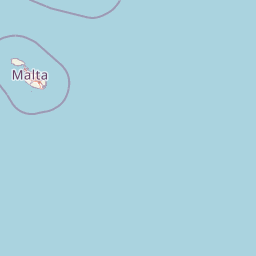
Map view of Xrobb l-Għaġin Nature Park

Use this park location map to pinpoint Xrobb l-Għaġin Nature Park in Malta, understand its exact geographic position, and read its mapped placement within the surrounding landscape more clearly.

Pigeon | © OpenStreetMap contributors

Explore protected coastal terrain, cliff scenery, and Mediterranean habitats.

Xrobb l-Għaġin Nature Park Photos and Visual Landscape Guide

Visual documentation captures the rugged coastal terrain, exposed limestone cliffs, and open Mediterranean shoreline defining the protected peninsula. Photographic records reveal the distinctive landscape features, natural habitats, and historic elements embedded across the coastal sanctuary.

A wide coastal landscape showing limestone cliffs meeting the sea, with green Mediterranean scrubland in the foreground.

A wide outdoor view of a low, peach-colored building with a parking lot in front under a partly cloudy blue sky.

Park atlas

Compare nearby regional geography, Mediterranean coastal terrain, and protected natural areas.

Exploring Other Parks Near Xrobb l-Għaġin Nature Park and Surrounding Protected Landscapes

Browsing other parks near Xrobb l-Għaġin Nature Park reveals connected protected areas along the southern Mediterranean coastline. Comparing these surrounding landscapes provides broader regional context for coastal terrain and conservation geography.
A watercolor painting showing a soft landscape with green rolling hills, low vegetation, and a calm water surface against a pastel sky.
Nature reserveSouth Eastern Region
About 1.9 km away#1 closest

West

Il-Ballut ta' Marsaxlokk Nature Reserve: Geography and Protected Wetland Landscapes

Essential salt marsh habitat in Malta's South Eastern Region

Il-Ballut ta' Marsaxlokk serves as a critical protected area, preserving a rare salt marsh landscape within the coastal environment of Malta. This reserve features a compact mosaic of muddy canals, halophytic vegetation, and Mediterranean coastal terrain. Its inclusion in the Natura 2000 network highlights its regional importance as a refuge for migratory birds and a focal point for environmental conservation in the South Eastern Region.

Area
0.23 km²
Established
2018
IUCN
IV
Relief
Lowland
A horizontal watercolor illustration showing soft, blended washes of green, yellow, and pale pink depicting an abstract rolling landscape or horizon line against a white background.
Natural monumentMalta
About 3.8 km away#2 closest

West

Għar Dalam Natural Monument: A Protected Maltese Cave and Paleontological Landmark

Geological and prehistoric landscape context in southeastern Malta

Għar Dalam is a protected natural monument in Malta that preserves a complex phreatic cave passage and essential fossil records of extinct dwarf species. This cave site acts as a major cornerstone for understanding the prehistoric Mediterranean, documenting the arrival of early Neolithic cultures and the long-term evolution of island-bound animal life through stratified sediment analysis.

Established
1933
Relief
Lowland
Climate
Mediterranean
Access
Easy access
National parkMalta
About 15 km away#3 closest

Northwest

Ta' Qali National Park: Malta's Largest Urban Protected Landscape and Recreation Hub

Mapped Gardens, Event Venues, and Recreational Zones

Ta' Qali National Park serves as a vital green lung in central Malta, showcasing a landscape transformed from a wartime airfield into a modern urban protected area. This national park is recognized for its extensive recreational zones, meticulously designed formal gardens, and a prominent open-air concert venue that hosts major cultural events. Its relatively flat terrain and planned infrastructure offer a distinct map-based perspective on urban parkland, highlighting its significance as a major public amenity and a key feature of Malta's landscape.

Area
0.35 km²
IUCN
V
Relief
Lowland
Climate
Mediterranean
A soft, pastel-toned watercolor painting of a rolling green landscape with a small body of water in the foreground and a silhouette of a building on a hill in the distance.
Wildlife reserveMalta
About 16 km away#4 closest

West

Buskett Gardens Wildlife Reserve: Geography and Protected Landscape Map of Malta

A rare sheltered woodland valley in the central Mediterranean

Buskett Gardens serves as a critical protected woodland in the heart of the Maltese islands. Nestled in the fertile Wied il-Luq valley, the site offers an unusually green, shaded environment of broadleaved trees and conifers. This reserve functions as an Important Bird Area and a historic cultural landscape, providing a lush contrast to the exposed limestone plateau of rural Malta.

Area
0.47 km²
Relief
Upland
Scope
Terrestrial
Water
Minor water
A pale, minimalist watercolor illustration showing soft, rolling green and yellow hills against a white background.
Nature reserveMalta
About 16 km away#5 closest

West

Filfla Nature Reserve: The Protected Limestone Plateau and Geography of Malta

Tracing the limestone cliffs and seabird sanctuary of the Maltese archipelago

Filfla is a small, uninhabited limestone islet lying 4.5 kilometres south of the main island of Malta. Defined by its 60-metre sea cliffs and flat plateau, this protected nature reserve functions as a crucial Important Bird Area and a landmark for regional Mediterranean biodiversity. Examine the mapped boundaries and geological profile of this site to understand its status as the southernmost extremity of the Maltese archipelago.

Area
0.06 km²
Established
1980
Relief
Upland
Climate
Mediterranean
A pale, minimalist watercolor painting depicting St Paul's Island in Malta, showing green rolling landforms and a hint of a structure against a light background.
Protected areaMalta
About 21 km away#6 closest

Northwest

St Paul's Island Protected Landscape and Maltese Coastal Geography Overview

Uninhabited Mediterranean island and heritage landmark

St Paul's Island represents a unique Mediterranean limestone islet featuring maritime garigue habitat and historic ruins. Located near the Mellieħa coastline, this protected area provides a compact example of Maltese coastal geography, defined by exposed cliffs and an enduring connection to local maritime history.

Area
0.101 km²
Relief
Lowland
Scope
Mixed
Water
Water-dominated
A horizontal watercolor painting depicting a soft-toned, abstract coastal landscape with gentle green hills, grassy foreground patches, and a calm, pale pool of water against a white background.
Marine protected areaMalta
About 23 km away#7 closest

West

Ras ir-Raħeb Marine Protected Area: Geographic Profile and Mapped Coastal Landscape

Coastal cliffs and protected marine zones in north western Malta.

Ras ir-Raħeb serves as a pivotal marine protected area along the Malta coastline, where high limestone cliffs meet complex underwater habitats. This site links historical archaeological remnants with modern ecological conservation, offering a unique geographic snapshot of the Rabat plateau edge. Its mapped boundaries encompass both the terrestrial promontory and the essential seagrass meadows beneath the surface, providing a critical reference point for Mediterranean coastal geography and protected land status.

Established
2005
Relief
Upland
Climate
Mediterranean
Access
Moderate access
A horizontal watercolor painting showing soft green hills, grassy marshland, and a calm water channel under a light, hazy sky.
Nature reserveGozo
About 28 km away#8 closest

Northwest

Comino Nature Reserve: Geography, Protected Marine Areas, and Karst Terrain in Gozo

Island ecology and coastal landscape mapping

Examine the protected geography of Comino, an island nature reserve near Gozo defined by limestone plateaus and sheltered bays. This overview covers the ecological boundaries of the Natura 2000 marine area, the distribution of coastal sea caves, and the topographic patterns of this Important Bird Area.

Area
3.5 km²
Relief
Lowland
Climate
Mediterranean
Access
Moderate access

Common questions about visiting, size, designation, and location context for Xrobb l-Għaġin Nature Park

Xrobb l-Għaġin Nature Park FAQs for park facts, access, geography, and protected area context

Find quick answers about Xrobb l-Għaġin Nature Park, including protected-area facts, park geography, trail and visitor context, and how the park fits into its surrounding country and regional landscape.
MoriAtlas Explorer

Continue Your Protected Areas Search Across the Global Atlas

Deepen your exploration by continuing the structured search for national parks and protected areas worldwide. Utilize the comprehensive filtering capabilities to compare different conservation landscapes and refine your understanding of global park geography. Discover more about the distribution and characteristics of protected natural areas.

Global natural geography