Mori Atlas logo
National parkVesuvius National Park

Discover the geographic context and mapped terrain of this active volcano's protected slopes.

Vesuvius National Park: Italy's Iconic Volcanic Landscape & Protected Area

(Parco Nazionale del Vesuvio)

Vesuvius National Park stands as a significant protected area in Italy's Campania region, safeguarding the dramatic geography of the active Mount Vesuvius volcano and the ancient Monte Somma crater. This park offers a unique lens for atlas exploration, revealing the striking volcanic terrain, mapped boundaries, and the interplay of Mediterranean ecosystems on its slopes. Engage with the structured data of this iconic natural landscape to understand its place in regional geography and its distinctive geological history.

volcanic landscapeactive volcanoMediterranean ecosystemsMount VesuviusCampaniaItalian national parks
Stylized illustration of a mountainous landscape with a winding river, forests, and hills under a light sky

Vesuvius National Park

National park

Park overview

Structured park overview, official facts, and landscape profile for Vesuvius National Park

Vesuvius National Park park facts, protected area profile, and essential visitor context
Review the core facts for Vesuvius National Park, including designation, size, terrain, visitor scale, habitats, and operating context in one park-focused overview.

About Vesuvius National Park

Vesuvius National Park was established to protect the extraordinary geological, biological, and historical values of the Somma-Vesuvius volcanic complex. The park sits in a densely populated area southeast of Naples, yet preserves significant natural habitats amid the urban landscape of the Campanian plain. The volcanic complex represents a classic example of a Somma-type volcano, consisting of an outer crater ring (Monte Somma, now inactive) enclosing a younger inner cone (Vesuvius) that remains active. This geological structure creates a dramatic landscape of stark volcanic terrain, ancient lava flows, and vegetation-covered slopes transitioning from Mediterranean maquis at lower elevations to more forested areas higher up. The park's mission, as defined in its founding decree, encompasses conserving animal and plant species, vegetation associations, geological singularities, paleontological formations, biological communities, scenic and panoramic values, natural processes, and hydrological and hydrogeological equilibria within the Vesuvius territory.

Quick facts and research context for Vesuvius National Park

Vesuvius National Park is located in Campania, southern Italy, within the Province of Naples. The park protects the Somma-Vesuvius volcanic complex, one of the few active volcanoes on the European mainland. The highest point reaches 1,277 meters at the Vesuvius crater, which currently measures 450 meters in diameter and 300 meters in depth. The park's territory encompasses volcanic terrain, Mediterranean shrubland, and forest areas across thirteen municipalities. The last eruption occurred in 1944, after which the volcano entered its current phase of active rest, with small fumaroles still visible on the Gran Cono.

Park context

Deeper park guide and search-rich context for Vesuvius National Park

Vesuvius National Park history, landscape, wildlife, and travel context
Explore Vesuvius National Park through its history, landscape character, ecosystems, wildlife, conservation priorities, cultural context, and seasonal travel timing in a structured park guide built for atlas discovery and search intent.

Why Vesuvius National Park stands out

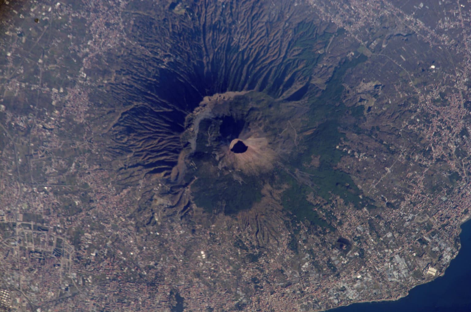
Vesuvius National Park is best known for protecting one of Europe's most iconic and dangerous volcanoes. The park encompasses both Monte Somma, the ancient caldera-forming volcano, and the active Gran Cone of Vesuvius that dominates the Neapolitan landscape. The 79 AD eruption that destroyed Pompeii and Herculaneum occurred from this volcano, making it one of history's most famous volcanic events. The park also preserves remarkable volcanic geology including lava flows, volcanic caves, and the dramatic Valle dell'Inferno (Valley of Hell) with its spectacular rope-like lava formations. Additionally, the park is notable for supporting significant biodiversity on its volcanic slopes, with over 600 plant species and 200 animal species in a relatively compact area.

Punta del Nasone peak viewed from Vesuvius crater with rocky mountains, green vegetation, and a dirt path in the foreground
View of Punta del Nasone from the Vesuvius crater showing rocky mountains and valley

Vesuvius National Park history and protected-area timeline

The Somma-Vesuvius volcanic complex began forming over 400,000 years ago, though the most reliable geological records cover the past 25,000 years. The volcanic history is typically divided into three periods: the formation of the ancient Monte Somma volcano from its origins until the catastrophic 79 AD eruption; the intermediate period from 79 AD to 1631; and the modern period from 1631 to the present. The catastrophic 79 AD eruption buried the Roman cities of Pompeii, Oplontis, Herculaneum, and Stabiae under meters of hot ash and mud flows, a disaster that has provided invaluable archaeological insights into Roman life. After centuries of intermittent activity, a violent eruption in 1631 opened a new phase of persistent activity characterized by numerous effusive eruptions. The last eruption occurred in 1944, after which Vesuvius entered its current state of active rest. The national park was announced by Italy's framework law on protected areas in 1991 and formally established by Presidential Decree on June 5, 1995, with the dual goals of conserving environmental values and safeguarding animal and plant species along with geological singularities.

Vesuvius National Park landscape and geographic character

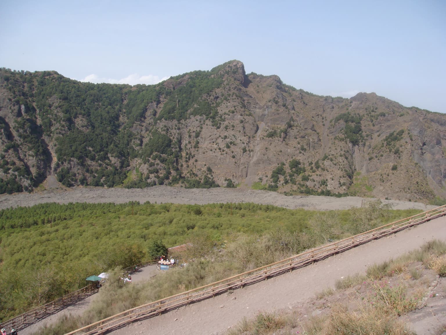
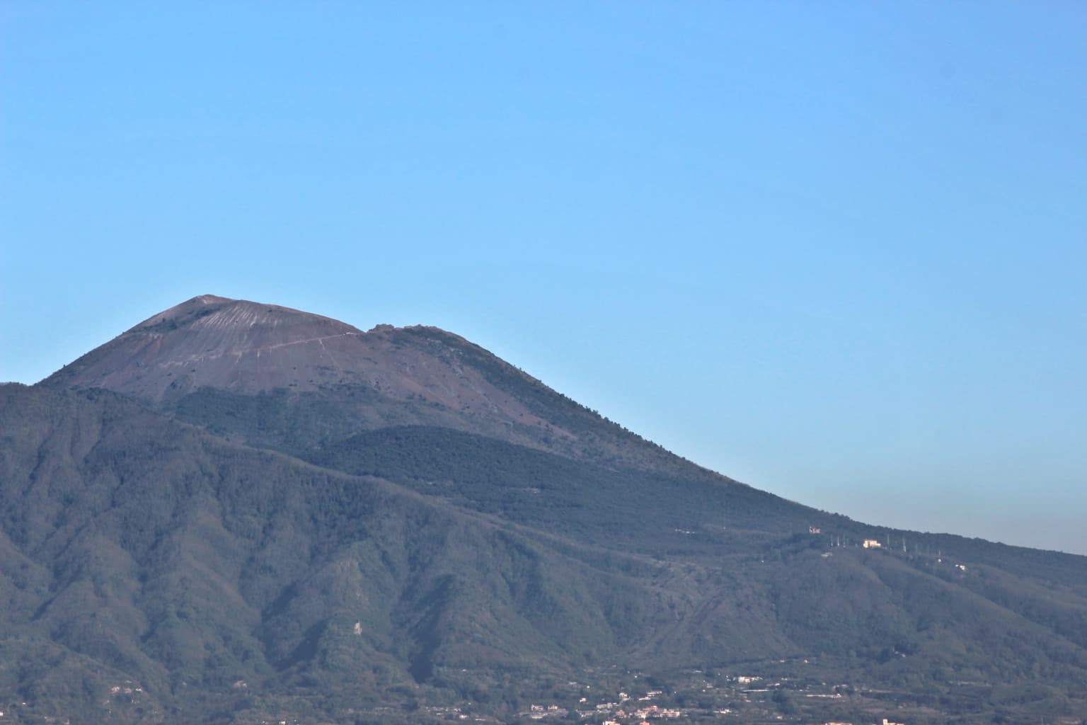
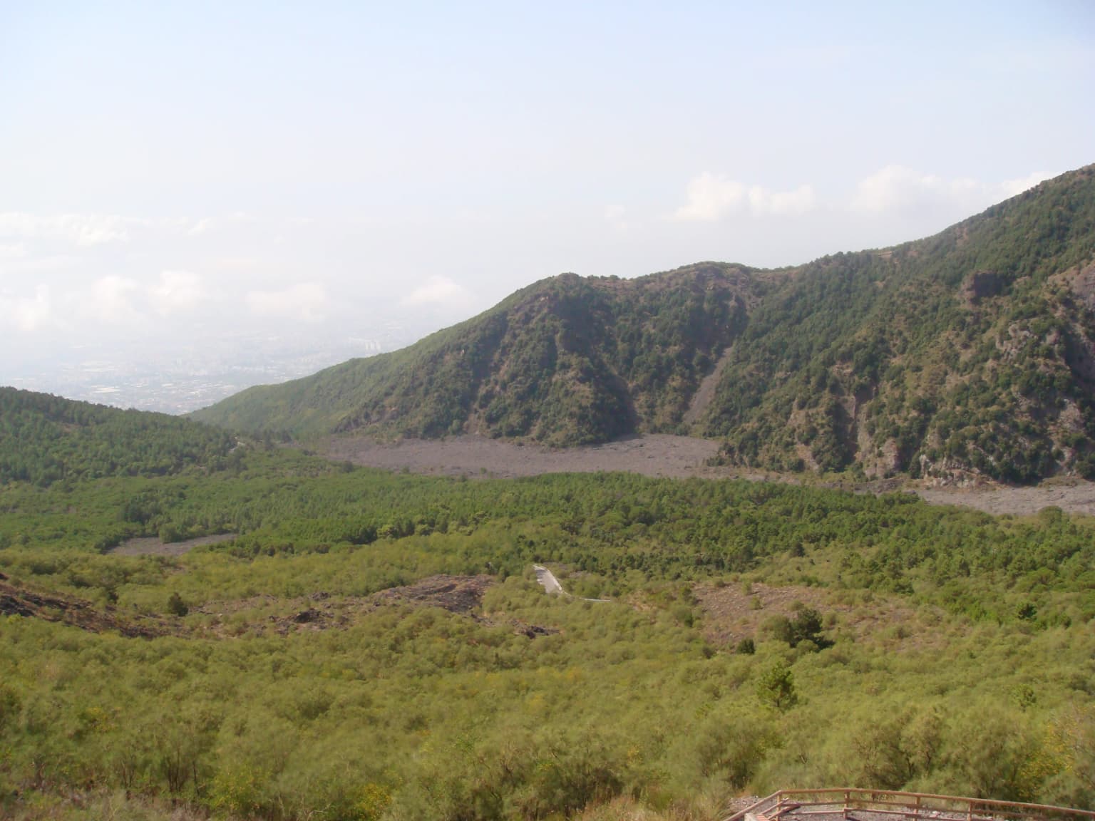
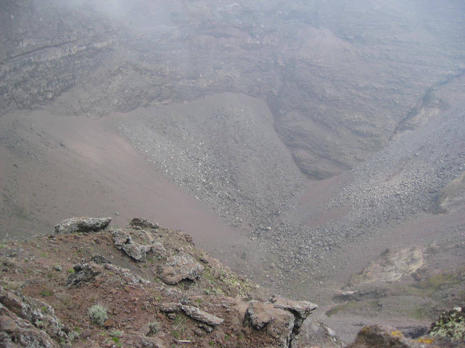
The landscape of Vesuvius National Park is defined by its dramatic volcanic terrain. The outer slope of Monte Somma forms a roughly circular crater rim, now inactive and partially eroded, while within this ancient caldera rises the steeper, truncated cone of Vesuvius reaching 1,277 meters above sea level. The crater at Vesuvius's summit currently measures approximately 450 meters in diameter and 300 meters in depth. Throughout the park, visitors encounter volcanic features including ancient lava flows, volcanic caves, and the distinctive Cognoli—steep volcanic vents that rise dramatically from the slopes. The Valle dell'Inferno (Valley of Hell) showcases spectacular rope-like lava formations, while the Valle del Gigante (Giant's Valley) preserves the lava flow from the 1944 eruption. The terrain varies from nearly flat areas to steep ascents, with elevations ranging from the volcanic base to the summit crater. Vegetation creates patches of green across the dark volcanic substrate, particularly in the Monte Somma area and along certain trails through the maquis and forest.

Mount Vesuvius volcano under a clear blue sky with green hills in the foreground
View of Mount Vesuvius from the north

Vesuvius National Park ecosystems, habitats, and plant life

Despite its volcanic and urban Setting, Vesuvius National Park supports remarkable ecological diversity. The park's vegetation reflects Mediterranean climate conditions, with extensive Mediterranean maquis (shrubland) dominating lower slopes, transitioning to forested areas at higher elevations. The park records 612 plant species, a notably high number for its relatively small area of approximately 72.6 square kilometers. The volcanic soil, despite its rocky nature, supports diverse plant communities adapted to the challenging conditions. Pine forests occur in certain areas, such as the Pineta di Terzigno. The park's animal population includes 227 documented species. Mammals present include foxes, weasels (faine), dormice (moscardini), and various small rodents including field mice. Notably, some species previously present in the park—the European wildcat and badger—are now considered locally extinct. The diverse habitats, from rocky volcanic terrain to shrubland and forest, support the ecological communities that make this small park biologically significant.

Wide landscape view of the valley between Monte Somma and Vesuvius mountains with green vegetation and forested hills under a partly cloudy sky
The valley separating Monte Somma from Vesuvius in Vesuvius National Park

Vesuvius National Park wildlife and species highlights

The wildlife of Vesuvius National Park reflects Mediterranean ecological patterns adapted to volcanic terrain. Among the park's mammals, foxes are among the more commonly observed species, along with weasels that hunt in the shrubland and rocky areas. Dormice inhabit the forested zones, while small rodents including various mouse species occupy diverse habitats throughout the park. The volcanic landscape, with its mix of exposed rock, shrubland, and forest patches, provides varied microhabitats supporting these animal communities. Birdlife is characteristic of Mediterranean parks, though specific avian species are not detailed in available sources. The park's relatively small area supports a notable density of species, demonstrating the ecological resilience of Mediterranean ecosystems even in geologically dynamic volcanic landscapes.

Satellite image of Mount Vesuvius volcano with visible crater and surrounding terrain
Satellite view of Mount Vesuvius showing its crater and surrounding landscape

Vesuvius National Park conservation status and protection priorities

Vesuvius National Park holds significant conservation value on multiple levels. Geologically, it preserves one of Europe's few active continental volcanoes and its associated volcanic features, providing natural laboratories for studying volcanic processes and geological history. The park protects the Somma-Vesuvius complex as an ecosystem, preserving the ecological relationships between volcanic terrain and Mediterranean biodiversity. Biologically, the park's 612 plant species and 227 animal species within 72.6 square kilometers demonstrate remarkable biodiversity concentration, reflecting the ecological complexity possible even in small, geologically extreme areas. The park is classified as IUCN Category II (National Park) and includes EUAP0009 designation with SIC (Sito di Interesse Comunitario/Community Interest Site) status. The conservation framework aims to preserve geological formations, biological communities, scenic values, natural processes, and hydrological equilibria while integrating environmental protection with the human presence that characterizes this densely populated region.

Vesuvius National Park cultural meaning and human context

The Vesuvius area carries profound human history intertwined with volcanic activity. The 79 AD eruption that destroyed Pompeii and Herculaneum represents one of antiquity's most famous natural disasters and has shaped the region's identity for nearly two millennia. The cities at the volcano's base—Pompei, Ercolano (Herculaneum), and others—were major Roman settlements whose well-preserved remains provide unmatched archaeological insights into Roman civilization. The park encompasses territory within thirteen municipalities that have developed over centuries in the volcanic shadow, creating cultural landscapes where agriculture, particularly the distinctive pomodorino a piennolo (a type of cherry tomato), thrives in the volcanic soil. The mountain has long held significance beyond economics—geologically, it has been studied since the establishment of the Osservatorio Vesuviano (Vesuvius Observatory) in the 19th century, one of the world's first volcanic observatories. The relationship between this active volcano and the surrounding human communities represents an enduring dialogue between natural forces and human settlement.

Rocky volcanic crater landscape with mist above the slopes
View of the crater of Mount Vesuvius with rocky terrain and misty atmosphere

Top sights and standout views in Vesuvius National Park

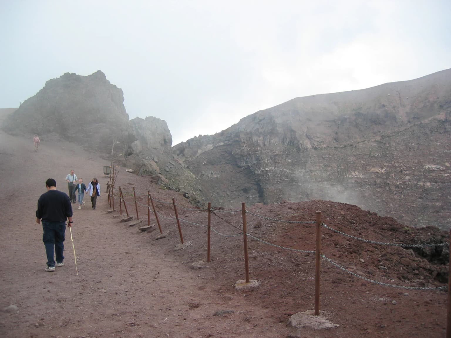
Vesuvius National Park offers visitors access to one of Europe's most historically significant active volcanoes. The eleven official hiking trails traverse diverse terrain from easy walks through forests to challenging ascents to the crater rim. Trail number 5, ascending the Gran Cono to the crater, is the most popular route, offering dramatic views across the Bay of Naples from approximately 1,170 meters elevation. The Monte Somma trail provides accessible exploration of the ancient caldera with panoramic views. For geology enthusiasts, the Valle dell'Inferno showcases remarkable rope lava formations, while Trail 9 (Il Fiume di Lava) directly traverses a 1944 lava flow, allowing visitors to walk on volcanic material from the last eruption. The park's biodiversity, with over 600 plant species, creates seasonal interest as different flora blooms throughout the year. The Pineta di Terzigno offers a shaded pine forest walk, while the Tirone-Alto Vesuvio nature reserve provides relatively flat walking through suggestive woodland.

Hikers walking on a dirt trail with a roped barrier system, approaching a mountainous landscape with rocky terrain and mist
Hikers walking along a dirt trail with roped barriers leading toward Mount Vesuvius

Best time to visit Vesuvius National Park

The optimal time to explore Vesuvius National Park depends on visitor preferences and tolerance for volcanic terrain conditions. Spring and autumn generally offer the most comfortable temperatures for hiking, with mild weather allowing exploration of the various trails without summer heat stress or winter cold. Spring brings flowering plants to the maquis and lower slopes, adding ecological interest to hikes. Summer can be very hot on exposed volcanic terrain, making early morning or late afternoon hiking advisable for those visiting during warmer months. Winter provides fewer crowds and clear visibility across the Bay of Naples from elevated points, though some trails may be less suitable due to conditions. Year-round, the park remains accessible, though visitors should check current conditions and trail accessibility, particularly for routes approaching the active crater where monitoring may affect access. The active rest status of the volcano means continuous observation, so visitors should respect any access restrictions for safety.

Park location guide

Geography guide, regional context, and park location map for Vesuvius National Park

Vesuvius National Park park geography, regions, and map view in Italy
Understand where Vesuvius National Park sits in Italy through a broader geographic reading of the surrounding landscape, nearby location context, and its mapped position within the national park landscape.

How Vesuvius National Park fits into Italy

Italy is a unitary parliamentary republic in Southern and Western Europe, located on the Italian Peninsula with the Alps to the north. It borders France, Switzerland, Austria, Slovenia, Vatican City, and San Marino, and shares maritime boundaries with several Mediterranean countries. The country has approximately 59 million residents and uses the Euro as its currency.

Wider geography shaping Vesuvius National Park in Italy

Italy occupies a boot-shaped peninsula in southern Europe, bordered by the Alps to the north. It shares land borders with France, Switzerland, Austria, Slovenia, Vatican City, and San Marino. The country includes the Mediterranean islands of Sicily and Sardinia, along with approximately 800 smaller islands.

Map view of Vesuvius National Park

Use this park location map to pinpoint Vesuvius National Park in Italy, understand its exact geographic position, and read its mapped placement within the surrounding landscape more clearly.

Pigeon | © OpenStreetMap contributors

Location context for Vesuvius National Park

Campania

Visual reference for Mount Vesuvius, its dramatic active cone, diverse Mediterranean habitats, and unique protected-area character.

Vesuvius National Park Photos: Explore Volcanic Landscapes, Ancient Craters, and Protected Scenery
Gain visual clarity on Vesuvius National Park's compelling volcanic terrain and rich biodiversity with a curated collection of protected area imagery. These park photos reveal the dramatic active cone of Mount Vesuvius, its ancient Somma caldera, unique lava flows, and the resilient Mediterranean ecosystems thriving across this iconic Italian landscape.

Punta del Nasone peak viewed from Vesuvius crater with rocky mountains, green vegetation, and a dirt path in the foreground

Rocky mountain slope with scattered vegetation under a partly cloudy sky

Mount Vesuvius volcano under a clear blue sky with green hills in the foreground

Wide landscape view of the valley between Monte Somma and Vesuvius mountains with green vegetation and forested hills under a partly cloudy sky

Satellite image of Mount Vesuvius volcano with visible crater and surrounding terrain

A misty volcanic landscape with rocky terrain and clouds surrounding Mount Vesuvius

Rocky volcanic crater landscape with mist above the slopes

Hikers walking on a dirt trail with a roped barrier system, approaching a mountainous landscape with rocky terrain and mist

Sepia-toned photograph of Mount Vesuvius showing a winding dirt road, sparse vegetation, and a group of people on horseback in the foreground

Mountain landscape showing Vesuvius volcano cone with elevation markers '1281mt' and 'parcheggio (1011mt)' under a hazy sky

Panoramic view of Monte Somma mountain range with labeled peaks and valleys from Vesuvius summit

Panoramic landscape view of Valle del Gigante with Colle Umberto mountain at 886 meters, surrounded by rocky hills and trees in Vesuvius National Park

Man-made stone and wooden structure built into a hillside with steps, surrounded by forest vegetation and a gravel path

Wide view of a mountainous valley with green terrain and distant peaks. Text overlay reads 'Parco Nazionale del Vesuvio - Valle dell'Inferno'.

Park atlas

Compare the diverse protected landscapes and regional park geography around Vesuvius National Park.

Continue Your Discovery: Explore National Parks and Protected Areas Beyond Vesuvius National Park
Browse additional national parks and protected areas near Vesuvius National Park, extending your discovery across Italy's Campania region and its diverse landscapes. Compare varied conservation efforts and trace the geographic distribution of protected areas, revealing regional context for volcanic landscapes and Mediterranean ecosystems.
Watercolor painting showing mountains, a lake, and grassy fields
National park

Cilento, Vallo di Diano and Alburni National Park: An Italian National Park's Geographic and Protected Landscape Identity

Mapped protected area boundaries and regional context.

Delve into the core geographic and protected-area characteristics of Cilento, Vallo di Diano and Alburni National Park. As a designated National Park in Italy, its mapped boundaries and landscape context are essential for atlas exploration. This entry provides the foundational geographic understanding needed to place this protected land within a broader map-based discovery framework, highlighting its significance as a natural landscape.

Area
1,810.48 km²
Established
1991
IUCN
II
Relief
Mountain
National park

Abruzzo, Lazio and Molise National Park

Protected landscape in Italy's Apennines.

Explore the mapped boundaries and protected status of Abruzzo, Lazio and Molise National Park. This historic Italian national park offers a detailed look at Apennine mountain geography and landscape.

Established
1923
Watercolor illustration showing a landscape with mountains, green forests, and a river under a soft sky
National parkBasilicata

Appennino Lucano - Val d'Agri - Lagonegrese National Park: Protected Mountain Landscape in Basilicata, Italy

Explore its geography, mapped terrain, and ecological role.

Gain insight into Appennino Lucano - Val d'Agri - Lagonegrese National Park, a significant protected mountain landscape in the heart of Basilicata. This detailed page focuses on the park's distinct geographic features, its role as a crucial ecological corridor connecting major southern Italian protected areas, and the mapped contours of its diverse terrain. Understand its place within the Lucano Apennine range and the broader natural atlas of Italy.

Area
689.96 km²
Established
2007
IUCN
II
Relief
Mountain
Watercolor painting showing mountains, forests, and a body of water in a scenic landscape
National parkAbruzzo

Maiella National Park: Abruzzo's Protected Landscape and Regional Geography

Explore mapped park boundaries and natural terrain.

Delve into the protected landscape of Maiella National Park, situated within the Abruzzo region of southern Italy. This page offers detailed atlas-level insights into its mapped boundaries, allowing for a clear understanding of its geographic setting. Discover how this national park contributes to the regional natural terrain and protected area context, providing a foundation for structured geographic exploration.

Area
628.38 km²
Established
1991
IUCN
II
Relief
Mountain
National park

Alta Murgia National Park: National Park Exploration and Protected Landscape Context

Explore mapped terrain and regional geography.

Alta Murgia National Park is a designated national park offering unique opportunities for geographic discovery. Delve into its protected landscape, understand its mapped boundaries, and situate it within the broader Italian atlas. This entry provides essential context for exploring the park's terrain and regional significance.

Area
677.39 km²
Established
2004
IUCN
II
Relief
Mixed relief
National parkApulia

Gargano National Park: Apulia's Protected Landscape and Regional Geographic Context

Mapped boundaries and natural terrain of a key Italian national park.

Delve into Gargano National Park, a designated national park situated in the Apulia region of Italy. This protected landscape offers valuable insights into the geography of the Gargano promontory. Through MoriAtlas, users can explore its mapped boundaries, understand its terrain, and connect it to the broader regional geography of southern Italy, providing a solid foundation for protected-area discovery.

Area
1,181.44 km²
Established
1991
IUCN
II
Relief
Mixed relief
Watercolor illustration showing green hills, a valley, and pink rock formations under a pale sky
National parkBasilicata

Pollino National Park: Protected Landscape of Ancient Forests and Alpine Terrain

Italy's largest national park and UNESCO Global Geopark

Pollino National Park, located in the Basilicata region, is a significant protected landscape renowned for its extensive ancient forests, particularly its rare Bosnian pines, and its dramatic, high-altitude mountain geography. Covering over 1,925 square kilometers, this national park is also recognized as a UNESCO Global Geopark, highlighting its exceptional geological heritage and unique ecosystems. The park's rugged terrain, soaring peaks, and rare ancient trees offer rich opportunities for understanding regional protected areas and mapped natural landscapes in southern Italy.

Area
1,925.65 km²
Established
1992
IUCN
II
Relief
Mountain
National park

Gran Sasso and Monti della Laga National Park: Italy's National Park Geographic Context

Mapped protected areas and regional natural landscape details.

Delve into the geography of Gran Sasso and Monti della Laga National Park, a prominent national park in Italy. This resource provides essential context for understanding its protected landscape, mapped boundaries, and integration within the regional geography. Ideal for users seeking detailed atlas-style information on protected areas and their natural terrain, it serves as a foundational point for exploring the park's unique geographic character and landscape significance.

Common questions about visiting, size, designation, and location context for Vesuvius National Park

Vesuvius National Park FAQs for park facts, access, geography, and protected area context
Find quick answers about Vesuvius National Park, including protected-area facts, park geography, trail and visitor context, and how the park fits into its surrounding country and regional landscape.
MoriAtlas Explorer

Continue Your Protected Areas Search Across the Global Atlas

Deepen your exploration by continuing the structured search for national parks and protected areas worldwide. Utilize the comprehensive filtering capabilities to compare different conservation landscapes and refine your understanding of global park geography. Discover more about the distribution and characteristics of protected natural areas.

Global natural geography