Mori Atlas logo
Protected landscapeLonjsko Polje

Mapping the vast alluvial floodplain and its unique natural and cultural landscapes.

Lonjsko Polje Protected Landscape: Croatia's Premier Inland Wetland and Pastoral Region

(Lonjsko Polje Nature Park)

Lonjsko Polje stands as Croatia's largest protected wetland, a critical component of the Danube basin's expansive natural heritage. Situated within Sisak-Moslavina County, this protected landscape encompasses a sprawling alluvial plain shaped by the Sava River, creating a dynamic mosaic of wet meadows, marshes, and forests. Its significance lies not only in its vast mapped area and ecological richness but also in its preservation of traditional floodplain pastoral culture, offering a unique glimpse into a landscape type that has largely vanished elsewhere in Europe.

wetlandfloodplainnature parkbirdwatchingRamsar sitepastoral landscape

Lonjsko Polje

Protected landscape

Park overview

Structured park overview, official facts, and landscape profile for Lonjsko Polje Nature Park

Lonjsko Polje Nature Park park facts, protected area profile, and essential visitor context
Review the core facts for Lonjsko Polje Nature Park, including designation, size, terrain, visitor scale, habitats, and operating context in one park-focused overview.

About Lonjsko Polje Nature Park

Lonjsko Polje represents a remarkable example of how natural flood dynamics and human pastoral traditions have co-created an extraordinary cultural landscape over centuries. The nature park occupies the alluvial plain of the Sava River in central Croatia's Sava River basin, where the river's seasonal floods have shaped a heterogeneous environment of wet meadows, reed beds, marsh forests, and open pastures. This dynamic hydrological regime, which can produce flooding at any time of year depending on exceptional combinations of Sava and tributary water levels, creates constantly shifting conditions that sustain exceptional biodiversity. The park's approximately 12,000 hectares of traditional pastures support one of Europe's last remaining examples of the floodplain pastoral landscape that once dominated much of Central Europe until the late 19th century. Local communities have maintained these grazing lands using traditional methods and indigenous animal breeds, preserving both cultural heritage and ecological functions. The park administration, based in Krapje, works to balance conservation of this unique ecosystem with the ongoing agricultural practices that define its character.

Quick facts and research context for Lonjsko Polje Nature Park

Lonjsko Polje spans roughly 506 square kilometers along the Sava River in central Croatia, making it the largest wetland in the Danube basin. The protected area encompasses three distinct floodplain fields: Lonjsko, Mokro, and Poganovo. The park serves as a critical flood control system for surrounding communities, with the Sava River and its tributaries creating dynamic water regimes throughout the year. It is recognized as an Important Bird Area under EU directives and supports exceptional biodiversity across its wet meadows, marshes, and traditional pastures.

Park context

Deeper park guide and search-rich context for Lonjsko Polje Nature Park

Lonjsko Polje Nature Park history, landscape, wildlife, and travel context
Explore Lonjsko Polje Nature Park through its history, landscape character, ecosystems, wildlife, conservation priorities, cultural context, and seasonal travel timing in a structured park guide built for atlas discovery and search intent.

Why Lonjsko Polje Nature Park stands out

Lonjsko Polje is particularly renowned for its exceptional bird populations, most notably the white stork, which has made the village of Čigoč famous as the "European Stork Village" where nearly every household hosts a stork nest. The park preserves one of Europe's most significant examples of traditional floodplain pastoral culture, with the highest concentration of native livestock breeds in Croatia, including the Croatian Posavac horse, Turopolje pig, and Slavonian-Srem grey cattle. Its complex flood regime creates diverse habitats that support over 200 bird species and numerous rare fish, amphibians, and invertebrate species.

Lonjsko Polje Nature Park history and protected-area timeline

Lonjsko Polje was designated as a Ramsar Wetland of International Importance on January 18, 1993, recognizing its outstanding universal value as a wetland ecosystem. The nature park institution itself was formally established in 1998, with its headquarters located in the village of Krapje within the Jasenovac municipality. The protection of this area reflected growing recognition of the wetland's ecological significance within the broader European conservation framework, particularly as an Important Bird Area under the European Union's Birds Directive. The establishment of the nature park provided a formal framework for managing the complex interactions between flood protection, biodiversity conservation, and traditional land use practices that characterize this floodplain landscape.

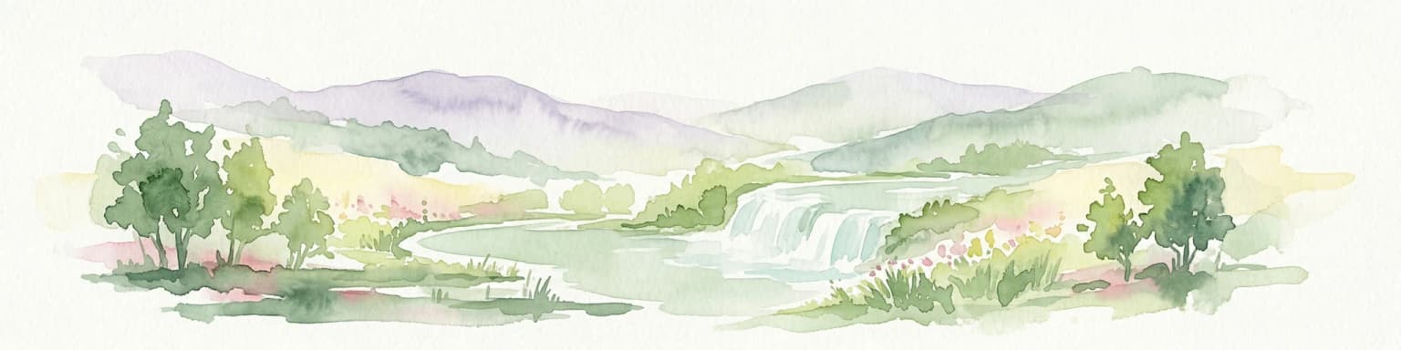
Lonjsko Polje Nature Park landscape and geographic character

The physical landscape of Lonjsko Polje is defined by the Sava River's extensive alluvial plain, a flat to gently undulating terrain characterized by meandering river channels, oxbow lakes, marshy depressions, and natural levees. The floodplain creates a subtle microtopography where slight elevation differences determine whether an area becomes inundated during floods or remains as higher ground. The park's three component fields—Lonjsko, Mokro, and Poganovo—represent distinct but interconnected areas of the broader floodplain system. The river Veliki Strug and the Lonja River, a major Sava tributary, contribute additional hydrological complexity to the landscape. Throughout the area, traditional drainage ditches and channels from historical land management practices add to the human-modified hydrological network while still functioning within the natural flood regime.

Lonjsko Polje Nature Park ecosystems, habitats, and plant life

The ecological character of Lonjsko Polje is shaped by its dynamic hydrological cycle, where seasonal and episodic flooding events create an ever-changing mosaic of wetland habitats. The flood pulses generate diverse conditions ranging from permanently inundated marshes and reed beds to seasonally wet meadows and drier upland pastures. This habitat heterogeneity supports remarkable plant diversity, with communities ranging from aquatic vegetation in permanent water bodies to meadow flora on higher ground. The wet forests of alder and willow occur along watercourses and in depressions, while the open grasslands support distinctive floodplain meadow plant communities. The complex interface between aquatic and terrestrial habitats, driven by the natural flood regime, maintains the ecological processes that sustain this wetland system's exceptional biodiversity.

Lonjsko Polje Nature Park wildlife and species highlights

Lonjsko Polje supports exceptional wildlife populations, particularly avifauna, making it one of Europe's most important bird areas. The white stork is the park's iconic species, with the village of Čigoč earning recognition as the "European Stork Village" in 1994 due to the extraordinary density of stork nests—nearly every household hosts a nest on its chimney or rooftop. The park provides critical habitat for grey herons, spoonbards, white-tailed eagles, wild ducks, corncrakes, and pygmy cormorants. Among the notable fish species are sterlet, Danube salmon, and Danubian longnosed gudgeon. European pond turtles, common tree frogs, and Danube newts inhabit the wetland margins, while European otters hunt along the watercourses. The park also supports rare invertebrate species including the large copper butterfly and the endangered alpine longhorn beetle.

Lonjsko Polje Nature Park conservation status and protection priorities

Lonjsko Polje holds international conservation significance as a Ramsar Wetland site and an Important Bird Area recognized under the EU Birds Directive, placing it within the core network of Europe's protected areas. The park is considered one of the world's most threatened wetland areas, despite its protected status, facing pressures from altered hydrological regimes, agricultural intensification, and development pressures in the surrounding landscape. Its designation as a nature park reflects the Croatian government's commitment to preserving this unique floodplain ecosystem while maintaining the traditional pastoral practices that have shaped its character for centuries. The park serves a vital function as a natural flood defense system, absorbing and storing flood waters that would otherwise threaten downstream communities, integrating environmental protection with practical landscape management.

Lonjsko Polje Nature Park cultural meaning and human context

The cultural landscape of Lonjsko Polje reflects centuries of human interaction with the floodplain's dynamic ecology. The traditional pastoral economy, maintained through grazing on common lands, has produced one of Europe's finest examples of the historical floodplain agricultural landscape. Local communities developed specialized animal breeds adapted to the challenging flood conditions, including the Croatian Posavac horse, Turopolje pig, and Slavonian-Srem grey cattle—breeds that now represent the highest concentration of native livestock in Croatia. The village of Čigoč embodies this cultural heritage through its extraordinary relationship with white storks, which have nested on village houses for generations, earning it the designation as a European Stork Village. This intimate connection between human settlement and stork nesting represents a unique cultural-ecological relationship found few places in Europe.

Top sights and standout views in Lonjsko Polje Nature Park

Lonjsko Polje stands as the Danube basin's largest and most significant protected wetland, a dynamic floodplain where seasonal flooding creates constantly shifting ecological conditions. The park preserves Europe's finest example of traditional floodplain pastoral culture, with indigenous livestock breeds roaming extensive meadows that represent a landscape type now largely vanished from Central Europe. The extraordinary concentration of white storks in the village of Čigoč, where nearly every building hosts a stork nest, creates one of Europe's most remarkable wildlife-viewing spectacles. The wetland supports exceptional biodiversity across all taxonomic groups, from breeding populations of corncrakes and white-tailed eagles to rare fish species like sterlet and Danube salmon, making it a flagship site for European wetland conservation.

Best time to visit Lonjsko Polje Nature Park

The character of Lonjsko Polje changes substantially with the seasons, each offering distinct visitor experiences. Spring flooding brings the landscape to life as waters rise across the floodplain, creating ideal conditions for birdwatching as migratory species return to breed. The summer months offer accessible terrain as floodwaters recede, revealing extensive meadows and providing excellent opportunities to observe storks and other nesting birds. Autumn can bring secondary flooding and offers different atmospheric conditions as the landscape takes on muted colors. Winter transforms the park into a stark but beautiful expanse, with frozen marshes and snow-covered pastures offering a completely different character. The timing of actual flooding varies year to year depending on Sava River conditions, making each visit uniquely different.

Park location guide

Geography guide, regional context, and park location map for Lonjsko Polje Nature Park

Lonjsko Polje Nature Park park geography, regions, and map view in Croatia
Understand where Lonjsko Polje Nature Park sits in Croatia through a broader geographic reading of the surrounding landscape, nearby location context, and its mapped position within the national park landscape.

How Lonjsko Polje Nature Park fits into Croatia

Croatia is a unitary parliamentary republic located in Central and Southeast Europe along the Adriatic Sea. With an area of approximately 56,600 km² and a population of nearly 3.9 million, it is a member of the European Union and uses the Euro as its currency. Zagreb serves as both the capital and largest city.

Wider geography shaping Lonjsko Polje Nature Park in Croatia

Croatia is located in Central and Southeast Europe, bordering Slovenia and Hungary to the northwest and northeast respectively, Serbia to the east, Bosnia and Herzegovina and Montenegro to the southeast, with a maritime border with Italy to the west. The country occupies the eastern shores of the Adriatic Sea and spans the Dinaric Alps, Pannonian plain, and coastal islands.

Map view of Lonjsko Polje Nature Park

Use this park location map to pinpoint Lonjsko Polje Nature Park in Croatia, understand its exact geographic position, and read its mapped placement within the surrounding landscape more clearly.

Pigeon | © OpenStreetMap contributors

Location context for Lonjsko Polje Nature Park

Sisak-Moslavina County
Park atlas

Trace the geographic context and connected protected landscapes beyond Lonjsko Polje

Compare Nearby National Parks and Protected Areas Surrounding Lonjsko Polje
Explore a curated list of national parks and other protected areas situated near Lonjsko Polje, providing a geographic overview of Croatia's diverse conservation landscapes. Use this detailed atlas view to compare wetland ecosystems, trace riverine floodplains, and understand regional protected area distribution.
National park

Kozara National Park: Bosnia and Herzegovina's Distinctive Forested Mountain Landscape

Mapped protected area in the Pannonian Plain's highland oasis.

Kozara National Park represents a significant protected natural area within Bosnia and Herzegovina, distinguished by its rounded, forested peaks that ascend from the surrounding Pannonian lowlands. This national park offers a unique landscape characterized by dense deciduous and mixed forests, interspersed with clearings and meadows, covering a considerable portion of its 39 square kilometer area. The park's geographic identity is further defined by its proximity to major rivers like the Una, Sava, Sana, and Vrbas, which delineate its natural boundaries and contribute to its distinct regional context. For atlas-based discovery, Kozara provides insight into how isolated highlands create unique protected landscapes within flatter terrain.

Area
39.08 km²
Established
1967
IUCN
II
Relief
Upland
Watercolor illustration of a landscape with rolling hills, scattered trees, and a winding river.
Protected landscape

Medvednica Nature Park: Mapped Protected Landscape and Central European Karst Geography

Explore protected area boundaries and natural terrain.

Medvednica Nature Park stands as a significant protected landscape, renowned for its complex karst topography and extensive cave networks, including the notable Veternica cave. Located immediately north of Zagreb, Croatia, this park offers a rich tapestry of central European mountain geography, dominated by dense beech and oak forests. Its unique features, such as the karst fields and rounded ridges, contribute to its distinct identity within Croatia's protected areas. MoriAtlas maps its geography, providing context for its ecological value and recreational significance.

Established
1981
Relief
Mountain
Climate
Temperate
Access
Moderate access
Watercolor painting of a mountain landscape featuring a river, hills, and vegetation
Nature reservePožega-Slavonia County

Papuk Nature Park: Explore Croatia's Foremost Geopark and Mountain Landscape

Mapped protected area with significant geological heritage in Slavonia.

Papuk Nature Park stands as a cornerstone of geological discovery in Croatia, celebrated as the nation's first UNESCO Global Geopark. Within Požega-Slavonia County, its mountainous terrain features dramatic ridgelines, ancient rock formations like Sokoline stijene, and extensive forests. This protected area offers a unique landscape context for atlas-driven exploration, detailing its mapped boundaries and its critical role in preserving Slavonia's highland geography and geological heritage.

Established
1999
Relief
Highland
Climate
Temperate
Access
Moderate access
National park

Plitvice Lakes National Park: Croatia's Iconic National Park and UNESCO Heritage Site

Mapped protected area with cascading lakes and karst geography.

Delve into the protected landscape of Plitvice Lakes National Park, a jewel of Croatia's natural heritage. This atlas entry highlights the park's famous system of 16 terraced lakes and cascading waterfalls, set within a unique karst terrain. Understand the geographic context and mapped boundaries of this significant protected area, renowned for its geological processes and ancient forest ecosystems. Explore the full spectrum of its protected natural identity.

National park

Una National Park: Bosnia and Herzegovina's Largest National Park and Protected Landscape

Explore its dramatic river canyons and karst geography.

Una National Park represents a significant protected landscape in Bosnia and Herzegovina, covering approximately 198 square kilometers of the Upper Una River basin. This page details the park's protected area identity, focusing on its spectacular riverine geography, including iconic features like the Štrbački Buk waterfall and the deep Unac River canyon. Users can explore the park's mapped boundaries, understand its place within the regional Dinaric mountain context, and discover the characteristics of its unique karst terrain and pristine river ecosystems. MoriAtlas provides essential geographic context for this vital natural area.

Area
350 km²
Established
2008
IUCN
II
Relief
Mixed relief
Watercolor illustration of a mountainous landscape with green forests, a lake, and distant pink-hued mountains under a light sky
National parkPrimorje-Gorski Kotar County

Risnjak National Park: Protected Mountain Landscape in Primorje-Gorski Kotar

Explore karst terrain and regional geographic context.

Risnjak National Park represents a substantial protected area within the rugged mountain geography of Croatia's Gorski Kotar region. This national park is distinguished by its dramatic karst formations, diverse alpine flora reaching from forested slopes to rocky summits, and the significant natural landmark of the Kupa River's source. Discover its mapped boundaries and the ecological importance of this unique landscape situated in Primorje-Gorski Kotar County.

Area
63.5 km²
Established
1949
Visitors
16.8K annual
Relief
Mountain
National park

Paklenica National Park: Croatia's Iconic Karst Canyon and UNESCO Beech Forests

Explore dramatic protected landscape and regional geography.

Paklenica National Park presents a spectacular protected area defined by its deep karst canyons, with Velika Paklenica and Mala Paklenica carving dramatic vertical walls into the Velebit mountain range. This national park is celebrated for its status as a leading European climbing destination and its ancient beech forests, part of a UNESCO World Heritage site. Exploring Paklenica offers insight into unique geological formations, extensive cave systems, and the rich biodiversity of this significant Croatian landscape.

Area
95 km²
Relief
Mountain
Climate
Mediterranean
Access
Moderate access
National park

Northern Velebit National Park: Croatia's Mapped Protected Landscape Identity

Explore the geography and protected area context.

Northern Velebit National Park stands as a prominent protected area, contributing significantly to the geographic understanding of Croatia's Velebit mountain range. This page provides focused details on its protected landscape features, mapped boundaries, and position within the Dinaric Alps. It serves as an essential entry point for users seeking structured atlas-based information on national parks and their role in regional conservation efforts, highlighting its unique geographic characteristics.

Common questions about visiting, size, designation, and location context for Lonjsko Polje Nature Park

Lonjsko Polje Nature Park FAQs for park facts, access, geography, and protected area context
Find quick answers about Lonjsko Polje Nature Park, including protected-area facts, park geography, trail and visitor context, and how the park fits into its surrounding country and regional landscape.
MoriAtlas Explorer

Continue Your Protected Areas Search Across the Global Atlas

Deepen your exploration by continuing the structured search for national parks and protected areas worldwide. Utilize the comprehensive filtering capabilities to compare different conservation landscapes and refine your understanding of global park geography. Discover more about the distribution and characteristics of protected natural areas.

Global natural geography