Mori Atlas logo
National parkRisnjak National Park

Discover mapped boundaries and regional geography in the heart of Gorski Kotar.

Risnjak National Park: Croatia's Karst Mountain Landscape and Protected Area

(Nacionalni park Risnjak)

Risnjak National Park is a significant protected landscape within Croatia's mountainous Gorski Kotar region, located in Primorje-Gorski Kotar County. This national park is defined by its dramatic karst terrain, encompassing the peaks of Risnjak and Snježnik, and serving as the source for the Kupa River. Its strategic position within the Dinaric Alps creates a vital ecological and climatic divide, offering a unique setting for atlas-driven exploration of diverse vegetation zones and protected natural habitats.

Karst landscapesMountain parksDinaric AlpsOld-growth forestsLynx habitatBrown bear conservation
Illustration of mountain landscape featuring cliffs, waterfall, and forested valley under sunlit sky with clouds

Risnjak National Park

National park

Park overview

Structured park overview, official facts, and landscape profile for Risnjak National Park

Risnjak National Park park facts, protected area profile, and essential visitor context
Review the core facts for Risnjak National Park, including designation, size, terrain, visitor scale, habitats, and operating context in one park-focused overview.

About Risnjak National Park

Risnjak National Park represents one of Croatia's most significant protected mountain ecosystems, lying in the heart of Gorski Kotar, a region renowned for its dense forests and rugged terrain. The park centers on the Risnjak massif with its highest peak Veliki Risnjak reaching 1,528 meters, while the adjacent Snježnik massif reaches 1,506 meters and forms part of the park's southern boundary. The Kupa River originates within the park at an elevation of 313 meters, emerging from a remarkable oval pond approximately 50 meters wide, with underwater channels reaching depths of 86 meters. This hydrological feature is one of the park's most distinctive landmarks and can be reached via a half-hour walk from the village of Razloge.

The park's karst landscape is characterized by porous limestone and dolomite formations that create limited surface water flow, with water instead moving through underground channels and emerging at various points throughout the terrain. The area serves as a critical watershed divide, separating waters that flow to the Adriatic Sea from those destined for the Black Sea. This geographic positioning, combined with the collision of Adriatic and continental weather patterns, makes Risnjak a significant climatic barrier and creates the diverse ecological conditions that support the park's remarkable biodiversity.

Quick facts and research context for Risnjak National Park

Risnjak National Park is situated in Primorje-Gorski Kotar County, covering 63.5 km² of mountainous terrain with elevations ranging from 313 meters at the Kupa source to 1,528 meters at Veliki Risnjak peak. The park is administered from the village of Crni Lug and receives approximately 16,835 visitors annually. The area is characterized by dramatic karst topography including ponikvas, karren, caves, and swallow holes, formed in porous limestone and dolomite. The park is divided between the cities of Čabar and Delnice and the municipality of Jelenje.

Park context

Deeper park guide and search-rich context for Risnjak National Park

Risnjak National Park history, landscape, wildlife, and travel context
Explore Risnjak National Park through its history, landscape character, ecosystems, wildlife, conservation priorities, cultural context, and seasonal travel timing in a structured park guide built for atlas discovery and search intent.

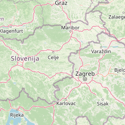
Why Risnjak National Park stands out

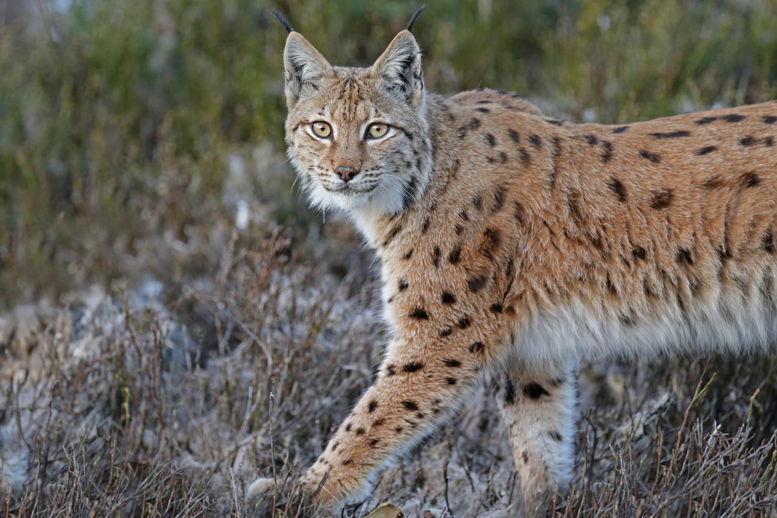
Risnjak is best known for its dramatic karst landscapes, rich biodiversity where coastal and continental vegetation zones meet, and the source of the Kupa River at the park's lowest point. The park is named after the lynx, an animal that was exterminated in the 19th century but has returned through successful reintroduction efforts from neighboring Slovenia. The mountain's flora is exceptionally diverse, featuring edelweiss and other rare alpine species on its rocky peaks, while the beech and fir forests that dominate the lower slopes transition through distinct ecological zones up to the subalpine pine forests near the summit.

Eurasian lynx (Lynx lynx) standing in a grassy, bushy terrain with a blurred natural background
Eurasian lynx in its natural habitat at Risnjak National Park

Risnjak National Park history and protected-area timeline

The first documented scientific exploration of the Risnjak area occurred in 1825 when Budapest botanist Joseph Standler visited the region. Following this initial investigation, numerous botanists were drawn to the area's exceptional flora, with Josip Schlosser emerging as the most prominent 19th-century researcher, producing extensive publications on Risnjak's botanical diversity. The first organized mountaineering expedition was conducted by the Rijeka alpine club, and in 1932, the first mountain refuge was constructed in the area.

In 1949, following recommendations from botanist Ivo Horvat, the Socialist Republic of Croatia parliament declared approximately 36 km² around Risnjak as a national park. This initial protected area was reduced in 1956 to 30.14 km², with 21.06 km² placed under stricter protection. The park underwent significant expansion in 1997 when the Croatian parliament voted to enlarge the boundaries to their current size, incorporating the Snježnik massif and the Kupa source area, along with the inhabited villages of Razloge, Razloški okrug, and Krašćevica. This expansion marked the first time residential areas were included within the park's boundaries.

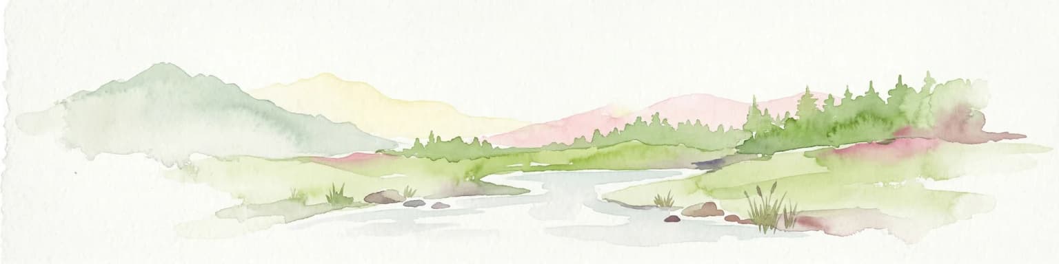
Risnjak National Park landscape and geographic character

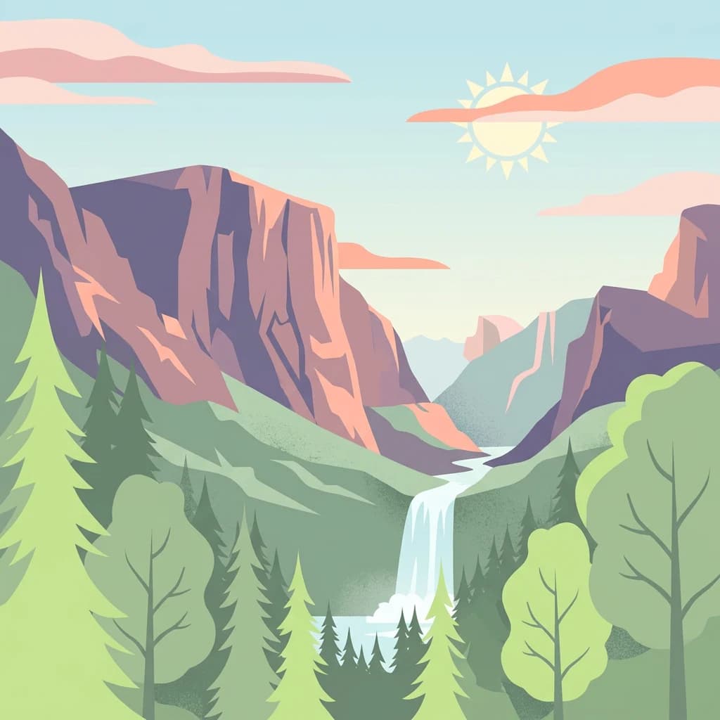
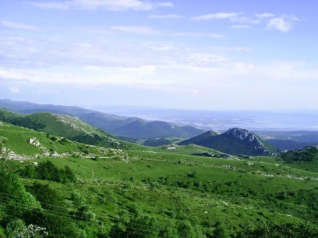
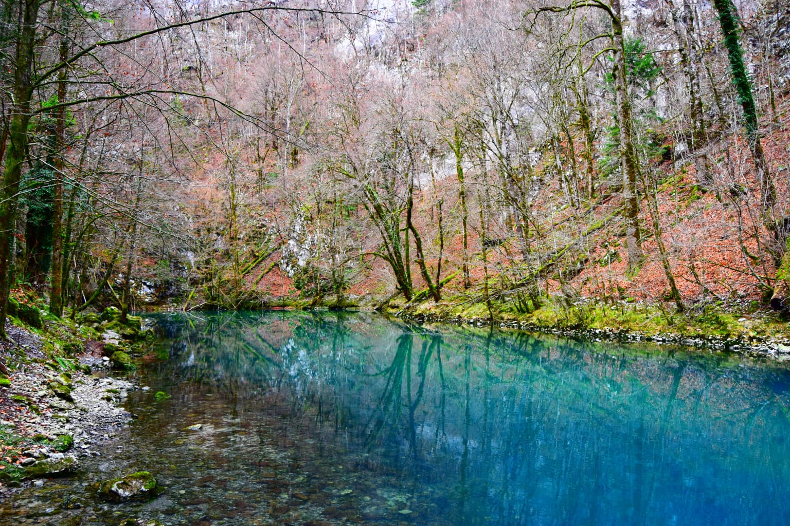
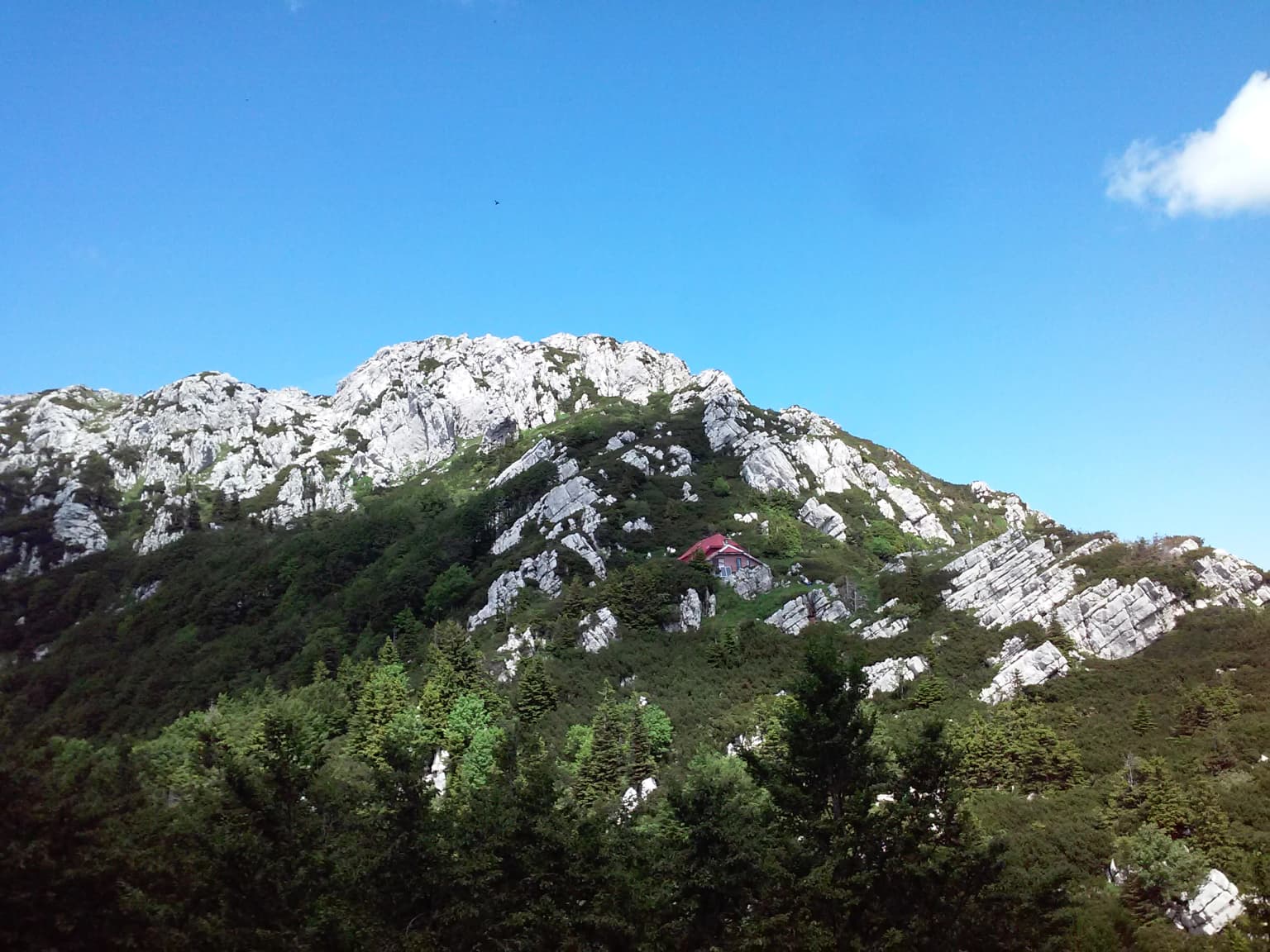
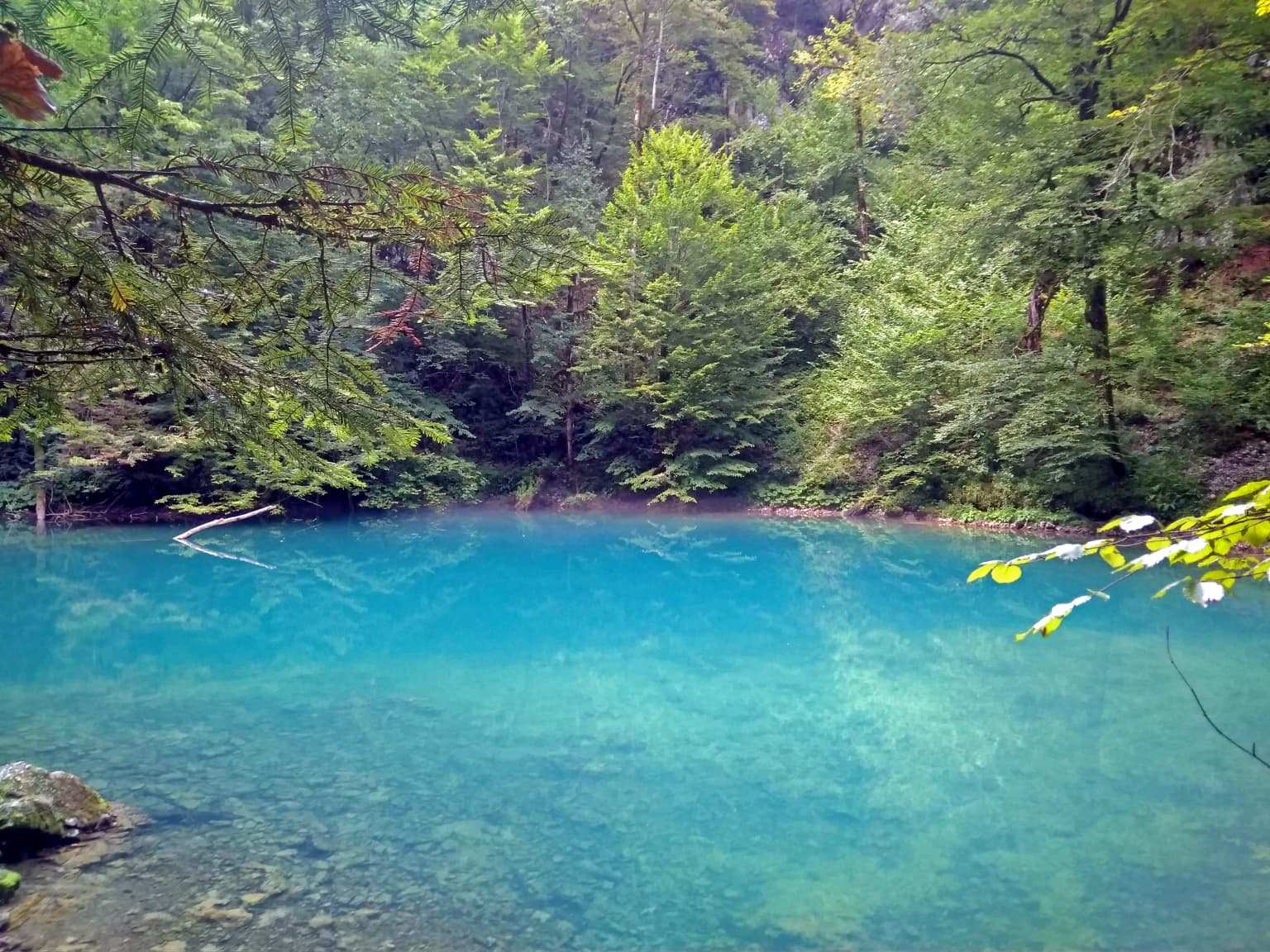
The landscape of Risnjak National Park is dominated by the mountainous terrain of the northern Dinaric Alps, characterized by dramatic limestone and dolomite peaks, rocky ridges, and deep valleys. The park's terrain rises from approximately 313 meters at the Kupa River source to 1,528 meters at Veliki Risnjak, creating substantial elevation variation across its 63.5 km² area. The geology is typical of karst regions, featuring ponikvas (depressions), karren (limestone pavement), rock falls, swallow holes, and numerous caves that attest to the ongoing erosive processes shaping the landscape.

The mountainous scenery includes the dual massifs of Risnjak and Snježnik, with Veliki Risnjak being the second-highest peak in Gorski Kotar after Bjelolasica. The landscape transitions from forested slopes in the lower elevations through the subalpine zone to rocky alpine summits. Near the Kupa source, the terrain opens into a marshy oval basin before the river begins its descent through the park. The abandoned Yugoslav military complex at Guslica peak, left derelict since 1991, adds an unusual historical element to the mountain landscape.

Green mountainous landscape with rolling hills, distant mountains, and a visible sea horizon with islands under a partly cloudy sky
View from Risnjak peak overlooking the sea and distant islands

Risnjak National Park ecosystems, habitats, and plant life

The ecological significance of Risnjak National Park stems from its position at the convergence of multiple vegetation zones: coastal and continental, as well as Dinaric and Alpine. This geographic meeting point creates remarkable botanical diversity despite the park's relatively limited area. Most of the park is covered by beech and fir forests growing on limestone and dolomite substrates, with variations influenced by local microclimates and soil types. Scattered individuals of sycamore maple, elm, ash, and occasional yew add diversity to the dominant forest composition.

Above 1,200 meters, the beech and fir forest transitions to subalpine beech forest with lettuce grass, which in turn gives way to dense underbrush forming a unique ecosystem termed Fagelatum croaticum subalpinum fruticosu. The highest forest ecosystem consists of crooked shrubby pine. The rocky alpine summits support particularly rare species including edelweiss, black vanilla orchid, alpine yellow violet, livelong saxifrage, alpine snowbell, mountain avens, and hairy alpine rose. The climate exhibits dramatic seasonal variation with pleasant summers reaching 22°C, rainy springs and autumns, and long snowy winters with snow depths averaging between 122 and 448 centimeters.

A clear blue river flowing through a forested area with bare trees and autumn-colored foliage
Clear blue spring of the Kupa River in Risnjak National Park

Risnjak National Park wildlife and species highlights

The fauna of Risnjak National Park is equally diverse as its flora, with the park supporting significant populations of large mammals including brown bear, red deer, roe deer, chamois, wild boar, and wolf. The lynx, after which the park is named, was historically present but exterminated during the 19th century before being successfully reintroduced from Slovenia three decades ago, restoring this apex predator to the ecosystem. Smaller mammals include pine marten, stone marten, badger, weasel, squirrel, and dormouse.

The bird population is particularly noteworthy, with species such as capercaillie, hazel grouse, northern goshawk, eagle owl, and several woodpecker species inhabiting the forested slopes and alpine meadows. The park also supports populations of amphibians, reptiles, and diverse insect and snail taxa, reflecting the complex ecological relationships within this mountain ecosystem.

Rocky mountain peak with dense forest under clear blue sky
View of Risnjak peak in Croatia's Risnjak National Park

Risnjak National Park conservation status and protection priorities

Risnjak National Park represents one of Croatia's highest-tier protected areas, designated under the Register of Protected Natural Values of Croatia. The park is divided into two management zones: a strict protection zone where natural processes are allowed to continue with minimal intervention, and a directed protection zone that accommodates sustainable visitor access while preserving natural values. The 1997 expansion significantly increased the park's conservation scope by incorporating the Kupa source area and the Snježnik massif, both of which contain significant natural features.

The park's conservation value is enhanced by its role as a climatic and ecological barrier between coastal and continental Croatia, protecting the headwaters of the Kupa River and maintaining connectivity between different biogeographic regions. The reintroduction of lynx demonstrates successful conservation management, restoring an essential apex predator to the ecosystem. The diverse habitats from karst valleys through beech-fir forests to alpine meadows create a comprehensive protected landscape that preserves both species and ecosystem diversity.

Risnjak National Park cultural meaning and human context

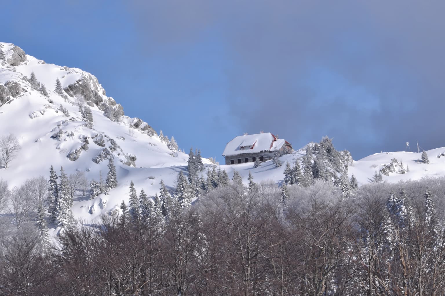
The human presence within Risnjak National Park is represented by several villages that were incorporated into the park during the 1997 expansion, including Razloge, Razloški okrug, and Krašćevica. The village of Crni Lug, located on the eastern edge of the park, serves as the administrative center and visitor contact point. The mountain refuge known as Šloserov dom, built on the southern slope of Veliki Risnjak by Josip Schlosser in the 1930s, reflects the long tradition of mountaineering and scientific exploration in the area. The name Risnjak itself derives from the Croatian word for lynx or possibly from the local term for a specific grass species, connecting the landscape to local linguistic and cultural heritage.

Clear blue body of water surrounded by dense green forest with visible rocks along the shore
Spring of the Kupa River in Risnjak National Park, Croatia

Top sights and standout views in Risnjak National Park

Risnjak National Park offers exceptional mountain landscapes where karst geology meets rich biodiversity, with the source of the Kupa River providing a dramatic natural landmark. The park's network of mountain trails, including the educational Leska path starting from the visitor center in Crni Lug, allows visitors to explore diverse vegetation zones from beech-fir forests through subalpine meadows to alpine peaks. The reintroduction of lynx has restored the park's namesake predator, while populations of brown bear and wolf maintain the ecological integrity of this mountainous wilderness. The mountain lodges at Risnjak and Snježnik peaks provide access to panoramic views spanning from the peaks to the Adriatic Sea on clear days.

Snow-covered mountain landscape with a building, snow-laden trees, and rocky peaks under a partly cloudy sky
Winter scene at Risnjak National Park featuring the Risnjak dom mountain hut

Best time to visit Risnjak National Park

The best time to visit Risnjak National Park depends on the type of experience sought. Summer months offer warm temperatures and full trail accessibility, with the mountain lodge providing comfortable access to the higher elevations. Spring and autumn bring increased rainfall but also rich atmospheric conditions as the park's vegetation transforms with the seasons. Winter transforms the park into a snowy wilderness with substantial snow depths making it popular for skiing, particularly from the nearby Platak resort, though many higher trails become challenging or inaccessible. The ponikva areas experience temperature inversions where lower elevations are actually colder than higher ground during winter, creating unique microclimate conditions that extend snow cover in these valleys well into spring.

Park location guide

Geography guide, regional context, and park location map for Risnjak National Park

Risnjak National Park park geography, regions, and map view in Croatia
Understand where Risnjak National Park sits in Croatia through a broader geographic reading of the surrounding landscape, nearby location context, and its mapped position within the national park landscape.

How Risnjak National Park fits into Croatia

Croatia is a unitary parliamentary republic located in Central and Southeast Europe along the Adriatic Sea. With an area of approximately 56,600 km² and a population of nearly 3.9 million, it is a member of the European Union and uses the Euro as its currency. Zagreb serves as both the capital and largest city.

Wider geography shaping Risnjak National Park in Croatia

Croatia is located in Central and Southeast Europe, bordering Slovenia and Hungary to the northwest and northeast respectively, Serbia to the east, Bosnia and Herzegovina and Montenegro to the southeast, with a maritime border with Italy to the west. The country occupies the eastern shores of the Adriatic Sea and spans the Dinaric Alps, Pannonian plain, and coastal islands.

Map view of Risnjak National Park

Use this park location map to pinpoint Risnjak National Park in Croatia, understand its exact geographic position, and read its mapped placement within the surrounding landscape more clearly.

Pigeon | © OpenStreetMap contributors

Location context for Risnjak National Park

Primorje-Gorski Kotar County

Discover the Protected Terrain, Alpine Flora, and Forest Habitats of Croatia's Dinaric Alps through Comprehensive Imagery

Explore Risnjak National Park Photos: Visual Guide to Karst Landscapes and Mountain Scenery
Browse images showcasing Risnjak National Park's dramatic karst geology, rising peaks, and diverse forest environments, offering a visual journey into its unique Dinaric Alps character. Understand the park's distinct ecological zones, from the Kupa River's source to its subalpine and alpine summits, tracing the visual identity of this vital European protected area.

Eurasian lynx (Lynx lynx) standing in a grassy, bushy terrain with a blurred natural background

Grassy hillside leading to dense forested mountains under clear blue sky

Green mountainous landscape with rolling hills, distant mountains, and a visible sea horizon with islands under a partly cloudy sky

A clear blue river flowing through a forested area with bare trees and autumn-colored foliage

Rocky mountain peak with dense forest under clear blue sky

Mountain landscape with green forest, rocky peaks, mist, and a red-roofed lodge under clear blue sky

Clear blue body of water surrounded by dense green forest with visible rocks along the shore

Snow-covered mountain landscape with a building, snow-laden trees, and rocky peaks under a partly cloudy sky

Wooden deck with brown bench, wooden railings, and expansive forested mountain range under partly cloudy sky

Park atlas

Map the connected karst geology, Dinaric Alps terrain, and diverse conservation landscapes across the wider region.

Discover Other Protected Areas Near Risnjak National Park and Explore Related Mountain Landscapes
Explore national parks and protected areas geographically related to Risnjak National Park, tracing similar mountain terrains, karst landscapes, and crucial conservation zones in the wider region. Compare these adjacent protected landscapes to understand their ecological connections, geographic spread, and their collective role within the Dinaric Alps' diverse natural habitats.
National park

Northern Velebit National Park: Croatia's Mapped Protected Landscape Identity

Explore the geography and protected area context.

Northern Velebit National Park stands as a prominent protected area, contributing significantly to the geographic understanding of Croatia's Velebit mountain range. This page provides focused details on its protected landscape features, mapped boundaries, and position within the Dinaric Alps. It serves as an essential entry point for users seeking structured atlas-based information on national parks and their role in regional conservation efforts, highlighting its unique geographic characteristics.

National park

Plitvice Lakes National Park: Croatia's Iconic National Park and UNESCO Heritage Site

Mapped protected area with cascading lakes and karst geography.

Delve into the protected landscape of Plitvice Lakes National Park, a jewel of Croatia's natural heritage. This atlas entry highlights the park's famous system of 16 terraced lakes and cascading waterfalls, set within a unique karst terrain. Understand the geographic context and mapped boundaries of this significant protected area, renowned for its geological processes and ancient forest ecosystems. Explore the full spectrum of its protected natural identity.

Watercolor painting of coastal landscape with green islands, trees, and calm water under a soft sky
National park

Brijuni Islands National Park: Adriatic Protected Landscape and Historical Atlas

Mapped boundaries, regional geography, and ecological context.

Brijuni Islands National Park is a significant protected area comprising a Croatian archipelago in the northern Adriatic Sea. This national park showcases a unique Mediterranean landscape blending natural habitats with extensive archaeological sites, offering a rich context for atlas-based exploration. Understanding Brijuni Islands National Park contributes to a broader appreciation of regional geography and the mapped distribution of protected lands.

Area
7.5 km²
Established
1983
Relief
Lowland
Climate
Mediterranean
Watercolor illustration of a landscape with rolling hills, scattered trees, and a winding river.
Protected landscape

Medvednica Nature Park: Mapped Protected Landscape and Central European Karst Geography

Explore protected area boundaries and natural terrain.

Medvednica Nature Park stands as a significant protected landscape, renowned for its complex karst topography and extensive cave networks, including the notable Veternica cave. Located immediately north of Zagreb, Croatia, this park offers a rich tapestry of central European mountain geography, dominated by dense beech and oak forests. Its unique features, such as the karst fields and rounded ridges, contribute to its distinct identity within Croatia's protected areas. MoriAtlas maps its geography, providing context for its ecological value and recreational significance.

Established
1981
Relief
Mountain
Climate
Temperate
Access
Moderate access
Watercolor illustration of a river flowing through a forested valley with mountains in the background
National park

Triglav National Park: A Mapped Alpine Protected Landscape in Slovenia

Julian Alps geography, glacial lakes, and karst terrain.

Triglav National Park is Slovenia's premier protected area, covering 880 square kilometers of the Julian Alps. This page details its dramatic alpine geography, including Mount Triglav, glacial valleys, and significant karst features. Understand the mapped boundaries and landscape context of this national park, a key entry in the MoriAtlas geographic discovery resource for understanding protected lands.

Area
880 km²
Established
1981
IUCN
II
Visitors
1.6M annual
National park

Paklenica National Park: Croatia's Iconic Karst Canyon and UNESCO Beech Forests

Explore dramatic protected landscape and regional geography.

Paklenica National Park presents a spectacular protected area defined by its deep karst canyons, with Velika Paklenica and Mala Paklenica carving dramatic vertical walls into the Velebit mountain range. This national park is celebrated for its status as a leading European climbing destination and its ancient beech forests, part of a UNESCO World Heritage site. Exploring Paklenica offers insight into unique geological formations, extensive cave systems, and the rich biodiversity of this significant Croatian landscape.

Area
95 km²
Relief
Mountain
Climate
Mediterranean
Access
Moderate access
Protected landscapeSisak-Moslavina County

Lonjsko Polje Protected Landscape: Explore Croatia's Largest Inland Wetland and Pastoral Heritage

Discover mapped natural landscapes and unique floodplain geography.

Lonjsko Polje, a significant protected landscape in Croatia's Sisak-Moslavina County, represents the largest inland wetland within the Danube basin. This area is characterized by its vast alluvial floodplain, shaped by seasonal river dynamics, which fosters diverse habitats for wildlife and preserves a rare example of traditional pastoral culture. Explore the mapped geography and understand the ecological importance of this unique wetland ecosystem through structured atlas-style content.

Area
505.6 km²
Established
1998
Relief
Lowland
Climate
Temperate
National park

Una National Park: Bosnia and Herzegovina's Largest National Park and Protected Landscape

Explore its dramatic river canyons and karst geography.

Una National Park represents a significant protected landscape in Bosnia and Herzegovina, covering approximately 198 square kilometers of the Upper Una River basin. This page details the park's protected area identity, focusing on its spectacular riverine geography, including iconic features like the Štrbački Buk waterfall and the deep Unac River canyon. Users can explore the park's mapped boundaries, understand its place within the regional Dinaric mountain context, and discover the characteristics of its unique karst terrain and pristine river ecosystems. MoriAtlas provides essential geographic context for this vital natural area.

Area
350 km²
Established
2008
IUCN
II
Relief
Mixed relief

Common questions about visiting, size, designation, and location context for Risnjak National Park

Risnjak National Park FAQs for park facts, access, geography, and protected area context
Find quick answers about Risnjak National Park, including protected-area facts, park geography, trail and visitor context, and how the park fits into its surrounding country and regional landscape.
MoriAtlas Explorer

Continue Your Protected Areas Search Across the Global Atlas

Deepen your exploration by continuing the structured search for national parks and protected areas worldwide. Utilize the comprehensive filtering capabilities to compare different conservation landscapes and refine your understanding of global park geography. Discover more about the distribution and characteristics of protected natural areas.

Global natural geography