
Mori Atlas logo
Protected landscapeLandschaftspark Debeli rtič

Analyzing the geographic character of flysch cliffs, marine reefs, and coastal terrain

Landschaftspark Debeli rtič: A Mapped Protected Landscape on the Slovenian Adriatic Coast

(Krajinski park Debeli rtič)

Landschaftspark Debeli rtič serves as a significant protected landscape on the northern tip of the Slovenian Adriatic coast near Ankaran. This geographic data entry details the stratification of the region, from the dramatic vertical flysch cliffs and submerged reef systems to the inland vineyards and native oak woodlands. Users can trace the boundaries of this 340 hectare protected area to understand the interplay between its sedimentary geological foundation, diverse Mediterranean marine habitats, and the cultural landscape.

coastal landscapeAdriatic coastflysch cliffsmarine protected areasubmarine reefseagrass meadows
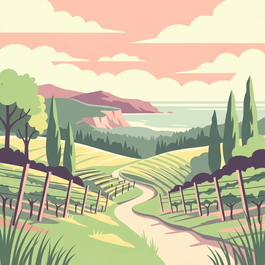
A stylized flat illustration of a coastal landscape with vineyards in the foreground, cypress trees, rolling hills, and sea cliffs in the background under a soft pastel sky.

Landschaftspark Debeli rtič

Protected landscape

Park overview

Structured park overview, official facts, and landscape profile for Debeli rtič Landscape Park

Debeli rtič Landscape Park park facts, protected area profile, and essential visitor context

Review the core facts for Debeli rtič Landscape Park, including designation, size, terrain, visitor scale, habitats, and operating context in one park-focused overview.

About Debeli rtič Landscape Park

The Debeli rtič Landscape Park is situated at the extreme northern tip of the Slovenian coast, where Slovenia meets Italy along the Bay of Koper on the Adriatic. The protected area occupies most of the Ankaran Peninsula, a small but geographically distinct piece of northern Istria that has remained remarkably undeveloped compared to the busier coastal stretches further south. Because the cape was historically difficult to access, large-scale construction and heavy industry never transformed its shores, allowing an unusually pristine coastal environment to survive along an otherwise heavily modified coastline.

The park's defining geological feature is its flysch coastline, a layered sedimentary formation that produces steep cliffs, rocky slabs, and a shallow underwater shelf extending a hundred meters or more into the sea. The flysch creates an extended, very flat coastal platform that rarely exceeds five meters in depth, forming the foundation for one of the more unusual shallow-water marine habitats in the northern Adriatic. The most dramatic expression of this geology is the Debeli rtič cliff itself, reaching elevations between twelve and thirty-six meters, and the nearby Valdoltra rock formation.

A second ecological pillar of the park is its offshore marine zone. The protected waters include a submarine reef sheltered by a submerged sand dune, seagrass meadows of the genera typical of Mediterranean shallow coasts, and sandbanks kept permanently under a thin layer of seawater. These habitats shelter a wide range of species, including halophytes, cordgrass, cattails in the transitional zones, and underwater communities of seagrass that support more conspicuous fauna such as seahorses, pen shells, sponges, and stone corals.

On land, the park combines cultural and natural landscapes. Traditional vineyards dominate much of the surface, reflecting centuries of agricultural use, while small woodlands of native pubescent oak, oak in general, black beech, and ash survive on steeper or less accessible ground. Planted Mediterranean pine has been introduced along parts of the coast, and warmth-loving shrubs cling to the exposed cliff faces. The combination of cultivated land, native woodland fragments, coastal cliffs, and rich shallow sea makes the park a compact mosaic of Mediterranean environments.

Because of its border position and historical isolation, Debeli rtič is also marked by a small but distinctive human footprint: a youth health resort built by the Slovenian Red Cross on seven hectares of previously overgrown land, complemented by a few scattered houses and seasonal vacation cabins. These buildings were deliberately integrated into the vegetation rather than imposed on the landscape, and the park continues to operate under strict rules that prohibit camping, fires, and construction in sensitive zones.

Quick facts and research context for Debeli rtič Landscape Park

The Debeli rtič Landscape Park encompasses approximately 340 hectares in total, of which roughly 160 hectares are marine territory at the northern end of Slovenia's coastline. It lies within the Municipality of Ankaran on the Ankaran Peninsula, which is part of northern Istria along the Adriatic.

Administratively, the park is managed by the Municipality of Ankaran following an agreement with Slovenia's Ministry of the Environment and Spatial Planning. The underlying natural monument at the cape itself has been protected since 1991, while the broader landscape park designation came into force in 2018 under the official decree number 48/2018.

Protection and recognition

Explore documented protection status and official designation history for Landschaftspark Debeli rtič.

Landschaftspark Debeli rtič Protection Status and Designated History

Examine documented protection metrics, mixed management scope, and establishment history for Landschaftspark Debeli rtič following its 2018 designation. Review verified conservation records and official protected area attributes without external assumptions.

Protection details

Protection scope
Mixed
Designated year
2018
Transboundary protection
No
Park context

Deeper park guide and search-rich context for Debeli rtič Landscape Park

Debeli rtič Landscape Park history, landscape, wildlife, and travel context

Explore Debeli rtič Landscape Park through its history, landscape character, ecosystems, wildlife, conservation priorities, cultural context, and seasonal travel timing in a structured park guide built for atlas discovery and search intent.

Why Debeli rtič Landscape Park stands out

The park is best known for preserving a rare intact fragment of the Slovenian Adriatic coast, anchored by a dramatic flysch cliff landscape and a sheltered underwater reef. The headland of Debeli rtič itself rises between roughly twelve and thirty-six meters above the sea and forms one of the most visually distinctive stretches of shoreline in the region. Equally important is the park's marine environment, which combines shallow flysch shelves, seagrass meadows, and reefs that support protected species such as seahorses, nacreous pen shells, date mussels, sponges, and stony corals. The combination of Mediterranean coastal woodland, vineyards, and biologically rich sea makes the park a compact but ecologically diverse protected zone.
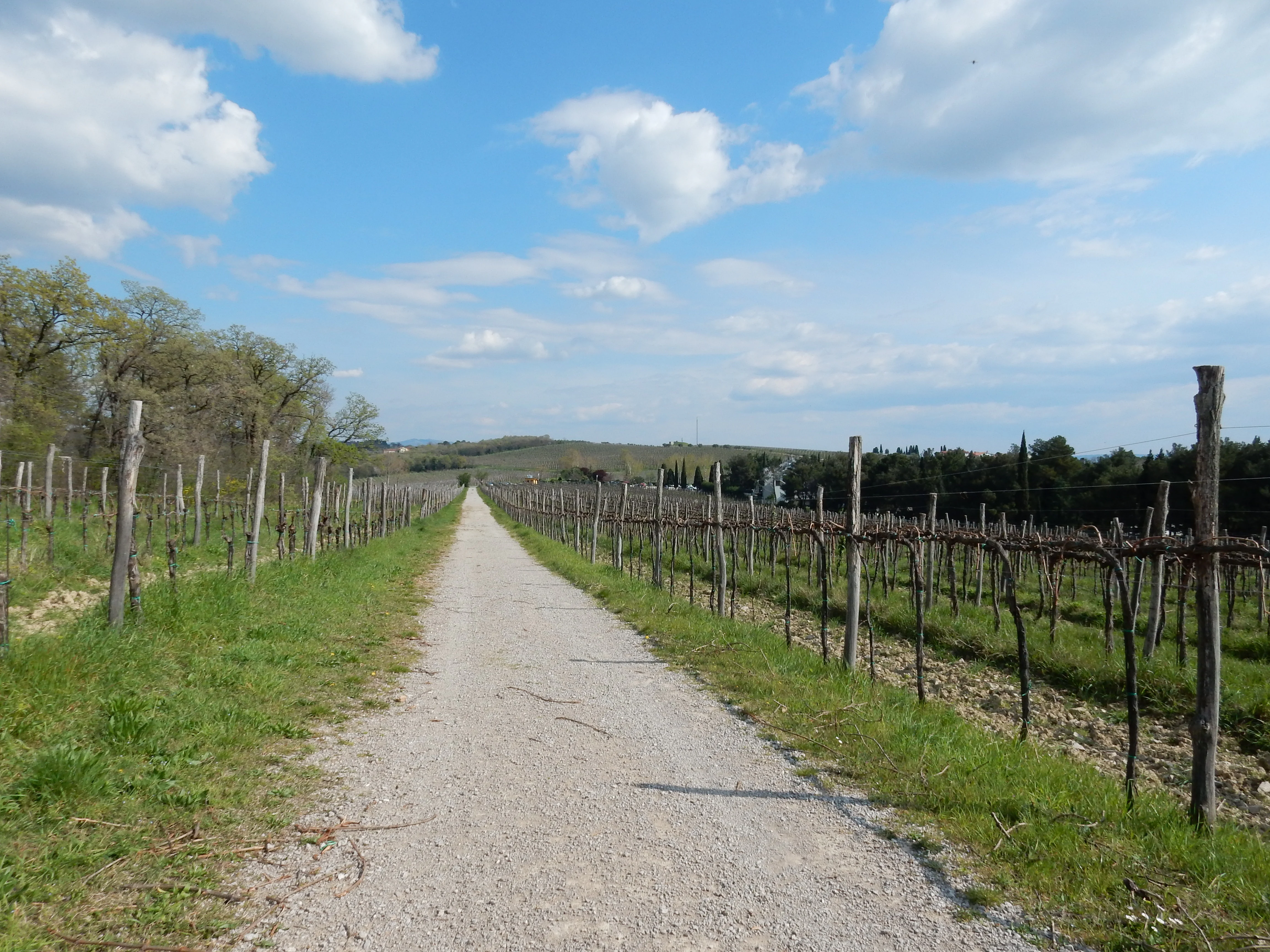
A straight gravel path extends through the center of a vineyard with rows of grapevines on either side under a blue sky with white clouds.
A gravel path leads through a vineyard in the Landschaftspark Debeli rtič.

Debeli rtič Landscape Park history and protected-area timeline

The area's protection history began in 1991, when the natural landscape around the cape of Debeli rtič was designated a natural monument. Because no major settlement ever developed on the peninsula and only a handful of houses were scattered across it, the headland escaped the heavy industrial and port-associated pressure that transformed much of the nearby Slovenian coast. This early protection, combined with limited access, allowed the coastal cliffs and adjacent waters to remain largely undisturbed.

A significant chapter in the park's human history began in 1955, when the Slovenian Red Cross selected the site for a youth health resort. On roughly seven hectares of overgrown, abandoned vegetation, planners created a park-like landscape that deliberately respected the existing natural features, integrating new plantings and two pre-existing buildings into the surrounding greenery. The resulting complex became a model of how medical and recreational facilities can coexist with a protected coastal environment.

The modern landscape park designation came in 2018, when the Municipality of Ankaran formally established the broader Debeli rtič Landscape Park through a municipal ordinance and an agreement with the Ministry of the Environment and Spatial Planning. This step expanded the original 1991 natural monument into a 340-hectar protected zone that explicitly includes both land and sea, formalizing conservation objectives around flysch preservation, native oak woodland, halophyte habitats, seagrass meadows, and the broader marine biodiversity of the cape. The decree (No. 48/2018) also consolidated the rules limiting activities such as camping, fires, and construction that could damage the area.

Debeli rtič Landscape Park landscape and geographic character

The landscape of the Debeli rtič Landscape Park is built around the contrast between a steep flysch coastline and a gentle, cultivated interior. The defining feature is the cape of Debeli rtič, also known by its Italian name Punta Grossa, whose cliffs rise between twelve and thirty-six meters above the Adriatic. To the south lies the prominent Valdoltra rock, and to the north the small bay of Sv. Jernej with its accompanying headland, Rt. Svet Jerneja, completing a varied coastal silhouette.

Geologically, the park sits on flysch, a finely layered sedimentary rock typical of parts of the Adriatic coast. This rock produces both dramatic vertical cliff faces and a very flat underwater shelf that extends outward for about a hundred meters and rarely exceeds five meters in depth. The underwater reef associated with the park is partly sheltered by a submerged sand dune, an unusual combination that shapes the character of the marine environment.

Inland, the terrain softens into rolling ground traditionally given over to vineyards, which today still cover much of the park's surface. Small patches of native oak woodland, originally widespread across the entire peninsula, survive on steeper or less cultivable slopes, while planted Mediterranean pine traces the upper edge of the coast. The interplay of vineyard, woodland, cliff, and sea gives the park a strongly stratified visual identity, where every elevation change reflects a different relationship between geology, vegetation, and human use.
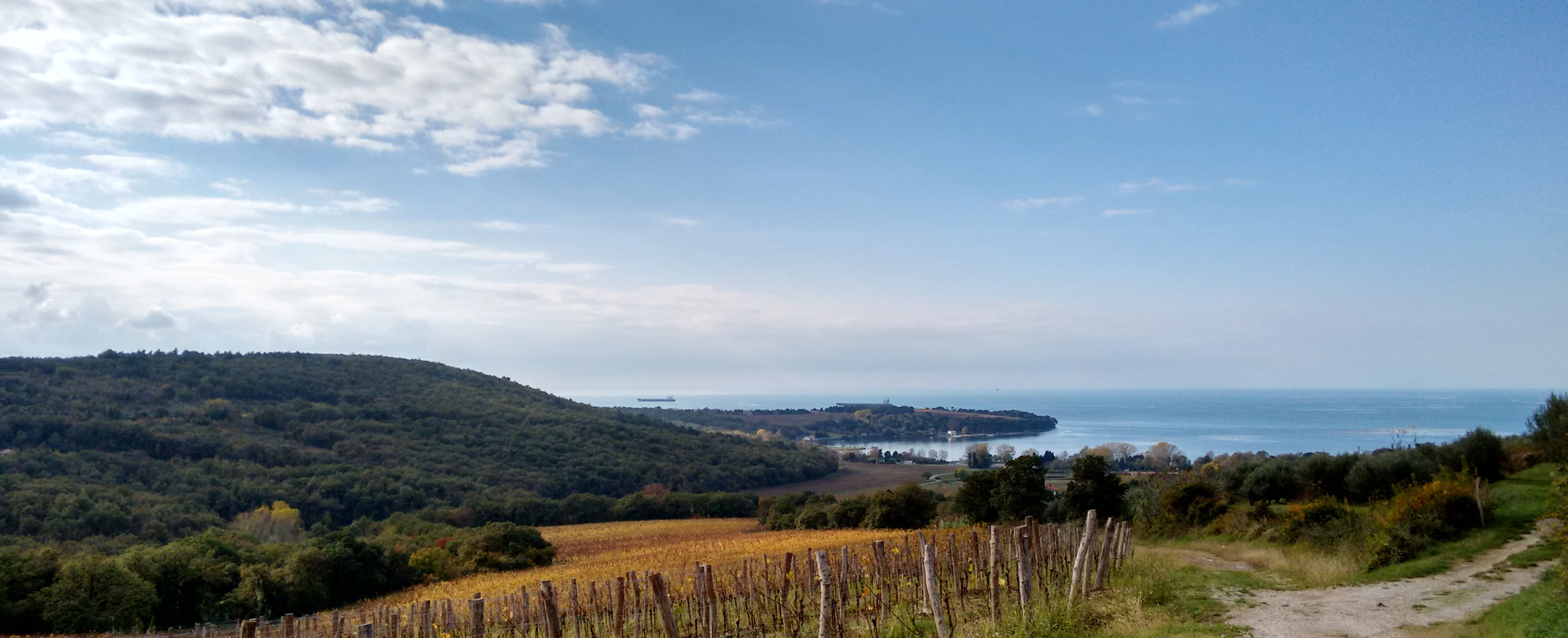
A wide landscape view featuring a vineyard in the foreground, rolling forested hills, and the distant coastline meeting the sea under a partly cloudy sky.
A view overlooking the Ankaran Peninsula and the Adriatic Sea toward Debeli rtič.

Debeli rtič Landscape Park ecosystems, habitats, and plant life

Ecologically, the park is defined by the meeting point of three very different environments: Mediterranean coastal cliffs, oak-dominated inland woodland, and the shallow flysch shelf of the northern Adriatic. The terrestrial habitats, although fragmented, include surviving patches of native pubescent oak forest, areas with ash and black beech on shaded slopes, and strand vegetation with warmth-loving shrubs clinging to the rocks. The coastal belt also contains halophyte communities adapted to saline conditions, including cordgrass and cattail stands that mark the transition between land and sea.

The marine environment is the most ecologically distinctive part of the park. The shallow flysch bottom supports seagrass meadows and sandbank communities that are kept permanently submerged under a thin film of seawater. These meadows in turn are linked to the broader reef system, which provides habitat for marine flora and fauna that are otherwise increasingly rare along the heavily altered northern Adriatic coast.

The combination of preserved flysch platforms, seagrass beds, reefs, and halophyte-influenced shoreline ecosystems gives the park its character as a compact but biologically rich Mediterranean landscape. The relatively limited human disturbance within its boundaries has allowed these habitats to retain a degree of natural structure that is difficult to find elsewhere along Slovenia's short coastline.

Debeli rtič Landscape Park wildlife and species highlights

Because of its location at the intersection of terrestrial, cliff, and marine habitats, the park supports a notably varied fauna for its small size. The marine zone is the most species-rich component: the seagrass meadows, sandbanks, and reef structures shelter Mediterranean species such as seahorses, date mussels, white nacreous pen shells, sponges, and stony corals, several of which are recognized as internationally protected or threatened.

The cliffs and shrubby coastal vegetation provide habitat for warmth-loving invertebrates and reptile communities typical of Mediterranean rocky shores, while the small oak and ash woodland patches inland act as refuges for woodland birds and small mammals. The transition zones around the bays and the halophyte communities along the shore are particularly important for migratory and shore-associated species.

Although the park is compact, the combination of flysch cliffs, semi-natural oak fragments, vineyard margins, and a relatively healthy shallow sea creates conditions for a striking diversity of life. This biodiversity, preserved within a few kilometers of the busy Port of Koper, is one of the main reasons the area has been progressively strengthened in its protected status.

Debeli rtič Landscape Park conservation status and protection priorities

The conservation significance of Debeli rtič lies in its role as one of the last relatively undisturbed coastal and marine stretches along Slovenia's very short Adriatic coastline. Because the cape lies at a border area, was historically difficult to access, and was never subject to large-scale construction, its cliffs, flysch formations, native oak patches, and shallow marine habitats survived a period when much of the nearby coast was industrialized or transformed by port expansion.

The formal protection framework has grown over time, beginning with the 1991 natural monument designation and culminating in the 2018 landscape park ordinance. The 2018 decree sets out explicit conservation objectives: preservation of natural values, biodiversity, and landscape diversity on both land and sea; protection of the flysch cliffs and the natural character of the coastline; maintenance of habitats important for biological diversity, including halophytes, cordgrass, cattails, and native pubescent oak; and the protection of marine habitats such as seagrass meadows, sandbank communities, and reefs that host protected species including seahorses, pen shells, sponges, and stony corals.

Strict activity rules complement these objectives. Within the sensitive zones, camping, fires, construction work, and other interventions that could damage the natural heritage are prohibited. The combined legal, administrative, and land-use framework, managed by the Municipality of Ankaran in cooperation with national authorities, makes the park a key reference point for coastal conservation in the Slovenian portion of the northern Adriatic.

Debeli rtič Landscape Park cultural meaning and human context

The cultural identity of the area is closely linked to its borderland character at the meeting point of Slovenian and Italian Istria. The cape has historically been home to only scattered houses and small-scale agriculture, in part because political and administrative divisions along the frontier discouraged the growth of a larger settlement. This pattern of low-density, traditional land use has allowed centuries-old practices, particularly viticulture, to remain visible across much of the park.

The most distinctive cultural landmark is the Debeli rtič Youth Health Resort, established in 1955 by the Slovenian Red Cross. The resort was designed deliberately to follow the existing topography and vegetation, blending new plantings and converted older buildings into a continuous green landscape. It remains a notable example of mid-twentieth-century integration of health, recreation, and conservation in a coastal setting, and it continues to play a practical role in maintaining the park's environment today.

Top sights and standout views in Debeli rtič Landscape Park

The park's standout quality is the rare pairing of a flysch cliff landscape with an unusually well-preserved shallow marine environment, both compressed into a small peninsula at Slovenia's northern coastal border. The Debeli rtič cliffs themselves, the Valdoltra rock, and the bay of Sv. Jernej each offer a distinct coastal character within walking distance of one another, while vineyards, native oak patches, and planted Mediterranean pine provide equally varied inland scenery.

Underwater, the protected reef, seagrass meadows, and sandbanks shelter a Mediterranean fauna that includes seahorses, pen shells, sponges, and stony corals, an exceptional concentration of biodiversity along such a short stretch of coastline. Combined with the cultural presence of the Youth Health Resort and the long-standing local tradition of viticulture, the park offers a layered identity where geology, ecology, and human history all remain visible.

Best time to visit Debeli rtič Landscape Park

The park has a typical Mediterranean coastal climate, with mild winters and warm, dry summers. Spring is one of the most rewarding periods, when coastal shrubs come into flower, woodland patches are fresh, and the marine waters are calm and clear, making underwater habitats easier to appreciate for divers and snorkelers. Early summer offers long days and stable weather before the harshest heat of July and August.

Late summer and early autumn continue to be pleasant for coastal walks and exploration of the cliff and vineyard landscapes, while the shoulder seasons are typically less crowded than midsummer. Winter is mildest along the coast, though some visitor facilities and boat-based marine activities may operate on reduced schedules. As in any protected coastal zone, visitors are expected to respect regulations that prohibit camping, fires, and other potentially damaging activities throughout the year.
Monthly climate preview

Examine measured monthly averages for temperature and precipitation across the protected area

Landschaftspark Debeli rtič Climate Normals and Annual Temperature Patterns

Long-term representative records reveal annual temperature swings from sub-zero winter lows to warm summer maximums alongside measured monthly precipitation values. Exploring the full twelve-month climate profile provides deeper analytical context into regional atmospheric rhythms.
Annual mean13 °C
3 °C23 °C
Jan
Feb
Mar
Apr12°
May16°
Jun20°
Jul23°
Aug23°
Sep18°
Oct14°
Nov
Dec
Warmest month
August

23 °C

Coolest month
January

3.4 °C

Wettest month
November

4.1 mm/day

Driest month
January

2 mm/day

Park location guide

Geography guide, regional context, and park location map for Debeli rtič Landscape Park

Debeli rtič Landscape Park park geography, regions, and map view in Slovenia

Understand where Debeli rtič Landscape Park sits in Slovenia through a broader geographic reading of the surrounding landscape, nearby location context, and its mapped position within the national park landscape.

How Debeli rtič Landscape Park fits into Slovenia

Slovenia is a developed European country with a population of approximately 2.1 million people. It declared independence from Yugoslavia in 1991 and joined the European Union in 2004. The country features diverse geography including the Julian Alps, forests, and a short Adriatic coastline.

Wider geography shaping Debeli rtič Landscape Park in Slovenia

Slovenia is located in Central and Southeast Europe, bordered by Italy to the west, Austria to the north, Hungary to the northeast, and Croatia to the south and southeast. It has a 46.6 km coastline on the Adriatic Sea. The terrain is mostly mountainous and forested, with the Julian Alps in the northwest.

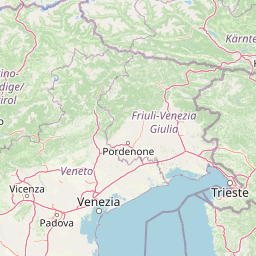
Map view of Debeli rtič Landscape Park

Use this park location map to pinpoint Debeli rtič Landscape Park in Slovenia, understand its exact geographic position, and read its mapped placement within the surrounding landscape more clearly.

Pigeon | © OpenStreetMap contributors

Visual exploration of flysch cliffs, coastal woodland, and marine habitats across the protected Adriatic headland

Landschaftspark Debeli rtič Photos, Scenery, and Protected Landscape Views

Visual documentation of Landschaftspark Debeli rtič reveals the sharp contrast between steep flysch cliffs and gentle cultivated vineyards across the coastal headland. Examining these protected habitats and terrain features provides a clearer understanding of the rare Adriatic marine ecosystem and shoreline geography.

A straight gravel path extends through the center of a vineyard with rows of grapevines on either side under a blue sky with white clouds.

A wide shot showing the wooded Debeli rtič peninsula coastline projecting into the calm blue waters of Koper bay, with a range of faint blue mountains visible in the distance under a partly cloudy sky.

A wide landscape view featuring a vineyard in the foreground, rolling forested hills, and the distant coastline meeting the sea under a partly cloudy sky.

Park atlas

Compare adjacent coastal landscapes and regional nature reserves

Parks Near Landschaftspark Debeli rtič and Surrounding Protected Areas

Browsing other protected areas near Landschaftspark Debeli rtič reveals broader geological patterns across the Adriatic coastal strip. Comparing adjacent reserves helps contextualize local flysch cliffs within a larger network of regional sanctuaries.
Protected areaFriuli-Venezia Giulia
About 14 km away#1 closest

East

Val Rosandra Protected Area: Mapped Karst Landscapes and Geography in Northeastern Italy

A canyon-like river valley and natural reference for karst phenomena

Val Rosandra stands as a defining protected area within the Friuli Venezia Giulia region, characterized by its sharp limestone cliffs, narrow gorges, and the distinct Supet waterfall. Its unique geological layering creates a compact environment where contrasting climates produce an extraordinary botanical intersection, set against a rich backdrop of historical remnants ranging from Roman aqueducts to former railway paths.

Area
7.46 km²
Established
1996
Relief
Mixed relief
Climate
Mediterranean
Regional parkSlovenia
About 22 km away#2 closest

East

Škocjan Caves Regional Park: Mapped Karst Landscape and UNESCO World Heritage Site in Slovenia

Discover its profound underground river canyon and doline geography.

Škocjan Caves Regional Park in Slovenia is a protected karst landscape of global importance, renowned for its vast subterranean system and the Reka River's underground journey. This site, a UNESCO World Heritage designation, features dramatic collapse dolines like Mala and Velika dolina, alongside immense cave chambers that illustrate classic karst hydrology. It serves as a key reference point for understanding regional geology and protected area networks within southeastern Europe's unique terrains.

Area
4.15 km²
Established
1996
IUCN
V
Relief
Lowland
Protected landscapeSlovenia
About 42 km away#3 closest

North

Ternowaner Wald Protected Landscape: Karst Plateau and Forest Geography in Slovenia

Dinaric highland exploration and protected terrain mapping.

Ternowaner Wald is a prominent limestone plateau located in southwestern Slovenia. Characterized by deep karst phenomena including sinkholes and the Great Ice Cave in Paradana, the area represents a critical ecological junction of mixed Dinaric beech and fir forests. This overview details the plateau boundaries, tectonic features, and protected status of this diverse highland geography.

Relief
Mountain
Climate
Temperate
Access
Moderate access
Scope
Terrestrial
Watercolor illustration of a river flowing through a forested valley with mountains in the background
National parkSlovenia
About 67 km away#4 closest

North

Triglav National Park: A Mapped Alpine Protected Landscape in Slovenia

Julian Alps geography, glacial lakes, and karst terrain.

Triglav National Park is Slovenia's premier protected area, covering 880 square kilometers of the Julian Alps. This page details its dramatic alpine geography, including Mount Triglav, glacial valleys, and significant karst features. Understand the mapped boundaries and landscape context of this national park, a key entry in the MoriAtlas geographic discovery resource for understanding protected lands.

Area
880 km²
Established
1981
IUCN
II
Visitors
1.6M annual
Watercolor illustration of a mountainous landscape with green forests, a lake, and distant pink-hued mountains under a light sky
National parkPrimorje-Gorski Kotar County
About 67 km away#5 closest

East

Risnjak National Park: Protected Mountain Landscape in Primorje-Gorski Kotar

Explore karst terrain and regional geographic context.

Risnjak National Park represents a substantial protected area within the rugged mountain geography of Croatia's Gorski Kotar region. This national park is distinguished by its dramatic karst formations, diverse alpine flora reaching from forested slopes to rocky summits, and the significant natural landmark of the Kupa River's source. Discover its mapped boundaries and the ecological importance of this unique landscape situated in Primorje-Gorski Kotar County.

Area
63.5 km²
Established
1949
IUCN
II
Visitors
16.8K annual
Watercolor painting of coastal landscape with green islands, trees, and calm water under a soft sky
National parkCroatia
About 71 km away#6 closest

South

Brijuni Islands National Park: Adriatic Protected Landscape and Historical Atlas

Mapped boundaries, regional geography, and ecological context.

Brijuni Islands National Park is a significant protected area comprising a Croatian archipelago in the northern Adriatic Sea. This national park showcases a unique Mediterranean landscape blending natural habitats with extensive archaeological sites, offering a rich context for atlas-based exploration. Understanding Brijuni Islands National Park contributes to a broader appreciation of regional geography and the mapped distribution of protected lands.

Area
7.5 km²
Established
1983
IUCN
II
Relief
Lowland
A soft watercolor painting of a wetland landscape featuring green meadows, gentle rolling hills, and a river flowing through the scene.
Nature reserveSlovenia
About 74 km away#7 closest

Northeast

Naturreservat Iški morost: Protected Nature Reserve and Wetland Landscape in Central Slovenia

Mapped protected wetlands of the Ljubljana Marsh region

Naturreservat Iški morost serves as a primary conservation site for the distinct wet meadow habitats of the Ljubljana Marsh. This reserve demonstrates the intersection of wetland geography and bird conservation, protecting a crucial, coherent landscape that is rare in contemporary Slovenian lowlands.

Area
0.65 km²
IUCN
Ia
Relief
Lowland
Climate
Temperate
Watercolor illustration showing a mountainous landscape with a waterfall, green hills, and layered colors
National parkProvince of Belluno
About 130 km away#8 closest

Northwest

Dolomiti Bellunesi National Park: National Park, Province of Belluno Protected Landscape

Explore mapped boundaries and regional geography

This entry details Dolomiti Bellunesi National Park, a distinct national park situated within the Province of Belluno. It provides essential geographic context and protected landscape information, enabling users to understand the park's boundaries and its role within the regional terrain. Dive into the mapped features and discover the atlas-driven details of this significant Italian protected area.

Area
32 km²
Established
1988
IUCN
II
Relief
Mountain

Common questions about visiting, size, designation, and location context for Debeli rtič Landscape Park

Debeli rtič Landscape Park FAQs for park facts, access, geography, and protected area context

Find quick answers about Debeli rtič Landscape Park, including protected-area facts, park geography, trail and visitor context, and how the park fits into its surrounding country and regional landscape.
MoriAtlas Explorer

Continue Your Protected Areas Search Across the Global Atlas

Deepen your exploration by continuing the structured search for national parks and protected areas worldwide. Utilize the comprehensive filtering capabilities to compare different conservation landscapes and refine your understanding of global park geography. Discover more about the distribution and characteristics of protected natural areas.

Global natural geography