
Mori Atlas logo
Nature reserveRhine Delta

Tracing the active sediment processes, riparian forests, and expansive reed beds of the Lake Constance shoreline

Rhine Delta Nature Reserve: A Detailed Geographic Atlas of Alpine Wetlands in Vorarlberg, Austria

(Naturschutzgebiet Rheindelta)

The Rhine Delta sits at the intersection of the Alpine Rhine and Lake Constance, forming a vast alluvial plain defined by its dynamic geological growth. This protected nature reserve in Vorarlberg showcases a complex mosaic of shallow lagoons, reed-covered peninsulas, and wet meadows that sustain diverse waterbird populations. Examine the physical map and landscape structure of this transboundary wetland system that continues to reshape the Austrian shoreline today.

wetlandriver deltaLake ConstanceRamsar siteNatura 2000birdwatching
A graphic illustration depicting a green valley landscape with tall cliffs, cascading waterfalls on both sides, a winding river, and silhouetted trees in the foreground.

Rhine Delta

Nature reserve

Park overview

Structured park overview, official facts, and landscape profile for Rhine Delta

Rhine Delta park facts, protected area profile, and essential visitor context

Review the core facts for Rhine Delta, including designation, size, terrain, visitor scale, habitats, and operating context in one park-focused overview.

About Rhine Delta

The Rhine Delta lies at the south-eastern end of Lake Constance, where the Alpine Rhine discharges into the lake after descending from the Swiss and Austrian Alps. It is the largest freshwater delta connected to Lake Constance and forms a joint delta system with the smaller eastern deltas of the Dornbirner Ach and Bregenzer Ach, giving the whole bay a broad alluvial character.

The area stretches across political borders: the great majority of the reserve sits in Vorarlberg, Austria, while a smaller but ecologically valuable portion falls within the canton of St. Gallen in Switzerland. Two peninsulas, Rheinspitz on the west near the Old Rhine and Rohrspitz on the east near the new Rhine channel, push into the lake and frame the protected waters. The alluvial forest on the Austrian side of the Rheinspitz, locally known as Rheinholz, is one of the most distinctive wooded features of the reserve.

Beyond its scenery, the Rhine Delta carries substantial ecological weight. Its shallow waters, reed beds, wet meadows, and riparian forests form the largest contiguous wetland biotope complex on Lake Constance and a habitat of recognized international importance. The reserve supports a remarkable density of waterbirds and waders, large amphibian populations, and a species-rich flora that includes both threatened native plants and newly arrived non-native species. The Rhine Delta therefore combines an active geological setting with one of the most carefully managed freshwater wetland conservation areas in the Alpine region.

Quick facts and research context for Rhine Delta

The Rhine Delta occupies roughly 2,065 hectares in total, of which about 1,960 hectares lie on Austrian territory; approximately two-thirds of the area is open water with depths of only a few meters. It is the largest wetland biotope reserve on Lake Constance.

The delta has been a Ramsar Wetland of international importance since 16 December 1982 (Reference no. 275) and has been part of the Natura 2000 network since the mid-1990s. Both Austria and Switzerland maintain formal nature reserves on their respective sides of the border, protecting shallow water, reed beds, wet meadows, riparian forests, and small patches of reed marsh (Streuwiesen). Over 300 bird species have been observed in the area.

Protection and recognition

Documented conservation status and transboundary management framework established in 1982

Rhine Delta Protection Status and Designated Area Recognition History

Rhine Delta maintains a mixed protection scope backed by documented designation history originating in 1982. Structured records outline the official transboundary status and administrative recognition details for this protected area.

Protection details

Protection scope
Mixed
Designated year
1982
Transboundary protection
Yes
Park context

Deeper park guide and search-rich context for Rhine Delta

Rhine Delta history, landscape, wildlife, and travel context

Explore Rhine Delta through its history, landscape character, ecosystems, wildlife, conservation priorities, cultural context, and seasonal travel timing in a structured park guide built for atlas discovery and search intent.

Why Rhine Delta stands out

The Rhine Delta is best known for its exceptional importance for waterbirds and waders, with shallow bays, reed beds, and silt flats providing major breeding, resting, and feeding habitat on a major European flyway. It is widely regarded as one of the bird-richest areas in Central Europe. A second defining feature is the ongoing formation of the delta itself. The Alpine Rhine continues to deposit sediment into Lake Constance, extending the delta and the two peninsulas of Rheinspitz and Rohrspitz into the lake. This combination of dynamic freshwater geology and a richly protected wetland ecosystem gives the area its distinctive character.
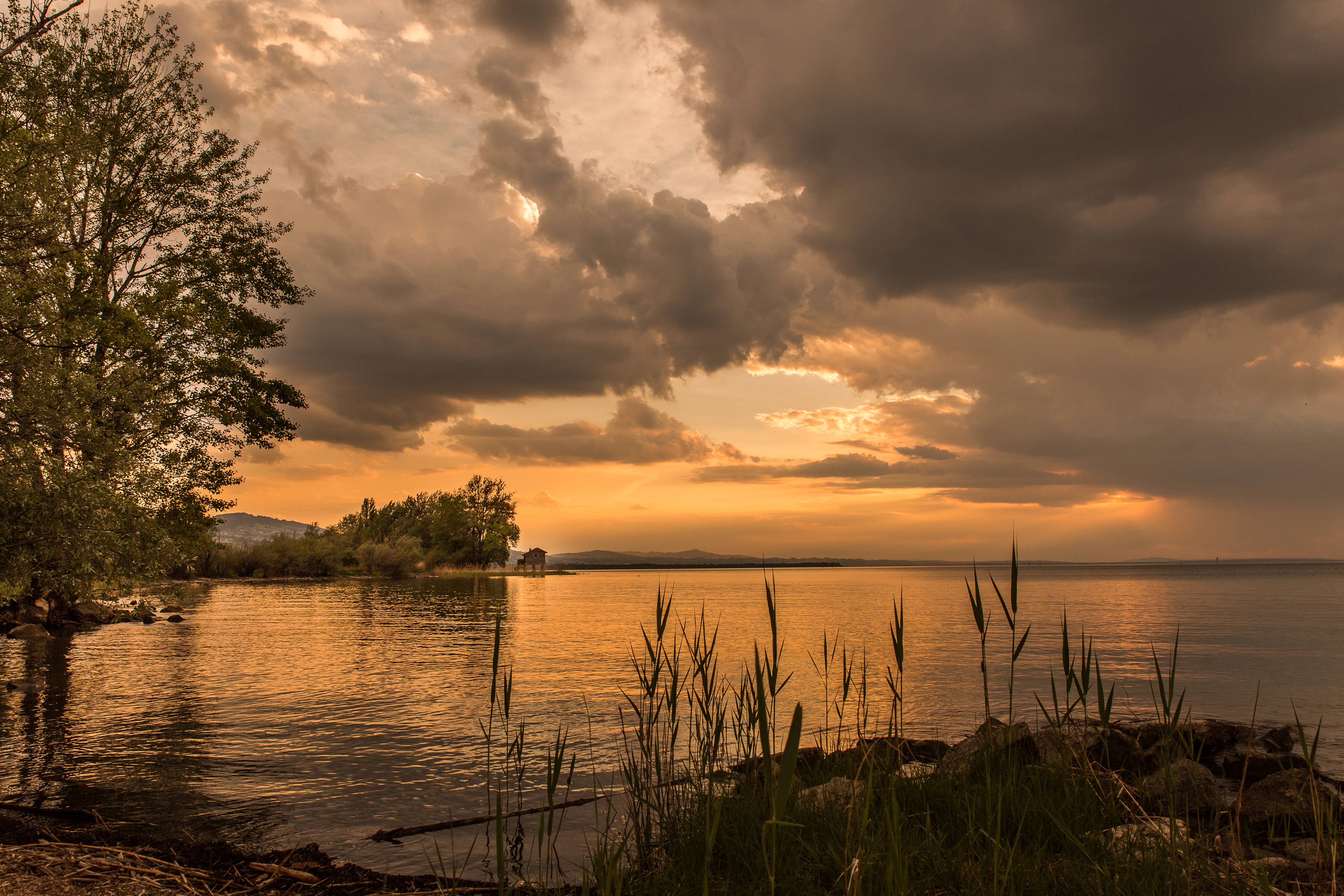
A peaceful lake landscape at sunset, with reeds in the foreground, trees on the left shore, and dark, dramatic clouds illuminated by the golden light.
Sunset view over the water at the Rhine Delta nature reserve.

Rhine Delta history and protected-area timeline

The geological foundations of the Rhine Delta date to the end of the last glacial period. As the Rhine glacier retreated, Lake Constance formed ahead of the receding ice, originally reaching further south into the Rhine Valley. The Alpine Rhine began to build its delta into this newly formed lake, and it continues to do so today, a process that, given enough time, would eventually silt up the lake entirely.

Human intervention reshaped the delta in the twentieth century. In 1900, the Rhine channel was straightened in a major flood-control project between Lustenau and Fußach, redirecting the main flow and shifting active delta growth away from the Old Rhine toward the new mouth. Between 1956 and 1963, a polder dam was constructed across the area, water levels were lowered by pumping stations, and floodplain and swamp forests were cleared to convert large areas to intensive agriculture. In 1963, the Swiss magazine Schweizer Naturschutz warned that, without protection, the area, described as the richest bird habitat in Central Europe, would be lost. One year later, WWF International adopted the Rhine Delta as an urgent conservation project, and by 1971 the Austrian Institute for Nature Conservation was calling for full protection of the site.

Formal protection followed in stages. The earliest reserve, the Naturschutzgebiet Rheinau on the Austrian side, traces back to wartime orders in 1942 and was repeatedly renewed in the postwar period. In 1976, Vorarlberg issued a protection ordinance covering roughly 1,972 hectares of shallow water, reeds, wet meadows, and riparian forest. From the early 1990s these designations were extended to ten-year and then indefinite terms, and additional areas such as the Gaißauer Ried were incorporated. Since 16 December 1982 the delta has been protected under the Ramsar Convention (site no. 275), and since the mid-1990s it has formed part of the pan-European Natura 2000 network under both the Birds Directive and the Habitats Directive.

Rhine Delta landscape and geographic character

The Rhine Delta forms a flat, low-lying alluvial plain between the steep western slopes of the Alpine Rhine Valley and the open shoreline of Lake Constance. The active delta geomrphology continues today: a roughly five-kilometer-long S-shaped dam constructed from the 1970s onward channels sediment out into the deeper portions of the lake, prolonging and shaping the growth of the delta.

Two prominent peninsulas define the visual character of the site. To the west, Rheinspitz extends into the lake near the mouth of the Old Rhine, and the alluvial forest (Rheinholz) on its Austrian side creates a dense ribbon of riparian woodland along the national border. To the east, Rohrspitz projects out near the mouth of the present-day Rhine channel between Fußach and Hard. Together with the wide lagoon area in between, these two spits frame the bay and give the delta its distinctive shape.

The mosaic of habitats that fills this space includes open shallow water, extensive beds of reeds, wet meadows subject to seasonal flooding, scattered alluvial woodland, and the small reed-marsh areas (Streuwiesen) on the inland side of the polder dam. Dams, embankments, and ruderal areas add further structural variety. The result is a low-relief but visually rich landscape, where quiet water, dense reed walls, and grazing pastures alternate within a short distance.
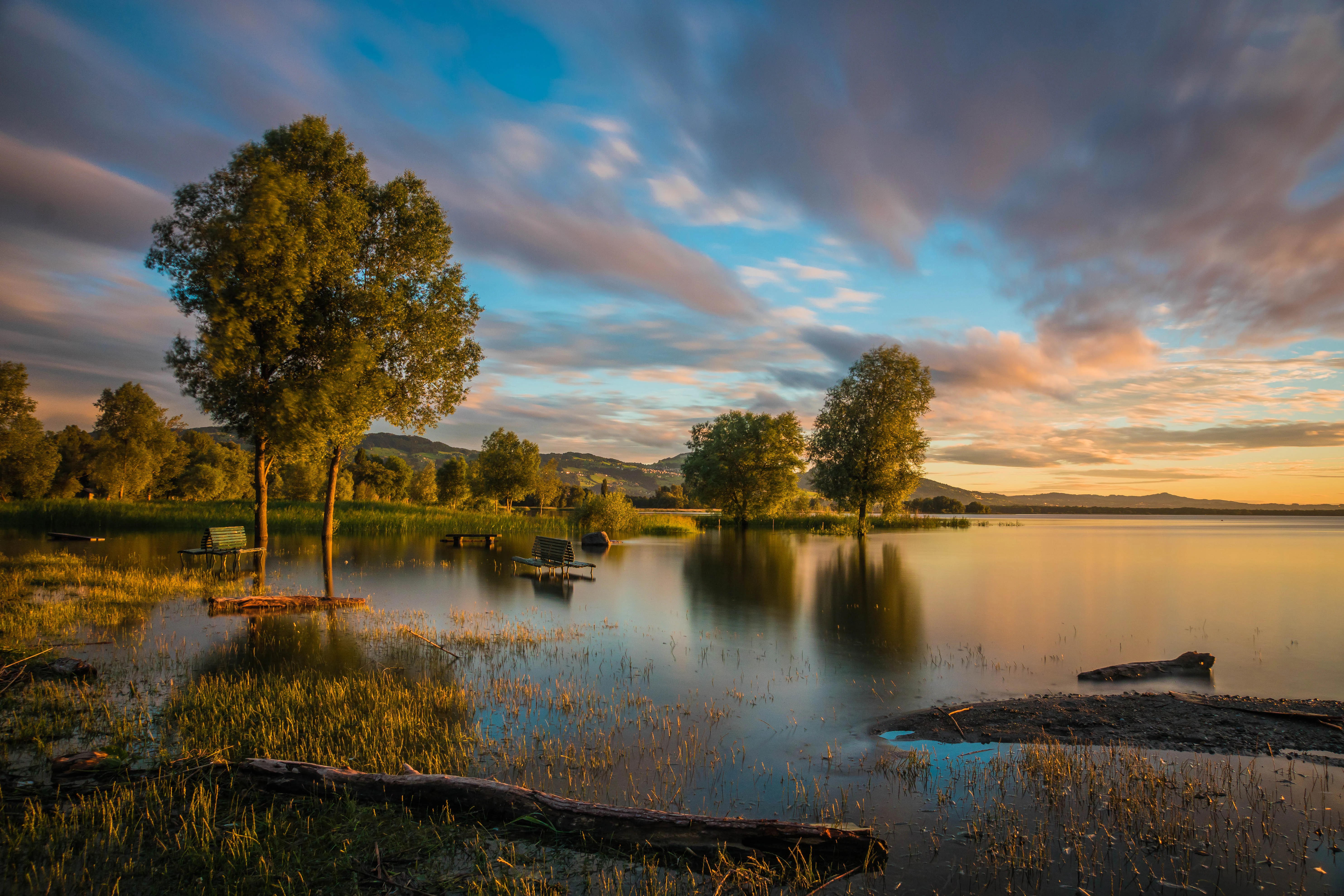
A peaceful lake landscape at sunset featuring trees standing in shallow water, calm reflections, and a colorful, cloudy sky.
A sunset view over the wetlands of the Rhine Delta nature reserve at Lake Constance.

Rhine Delta ecosystems, habitats, and plant life

Ecologically, the Rhine Delta is defined by its wetland mosaic. About two-thirds of the reserve consists of open shallow water typically only a few meters deep, and the remaining land supports reed beds (Schilfröhrichte), wet meadows, riparian forests, and small patches of Streuwiesen. This combination of aquatic and semi-aquatic habitats, set within a larger lake basin, produces an unusually high habitat density for a freshwater site.

Plant diversity is high for such a compact area, with around 600 flowering plants and ferns recorded, including several species that are threatened within Austria or Central Europe. Riparian forests, scattered meadows, reed beds, and grass beds are the most ecologically valuable of the rural habitats, while dams and ruderal areas contribute additional niches that have in turn allowed new arrivals, mainly from America and Asia, to establish. Notable losses include species such as the carnivorous waterwheel plant (Aldrovanda vesiculosa), once a famous rarity here, illustrating how drainage, river engineering, and intensified land use have left lasting marks on the flora.

The dynamic boundary between water and land, maintained by ongoing sedimentation and by active management, supports the biodiversity baseline that makes the delta so significant for fauna, particularly for waterbirds and amphibians. Protection under the Ramsar Convention and Natura 2000 reflects the international recognition of this wetland mosaic as a habitat of European importance.
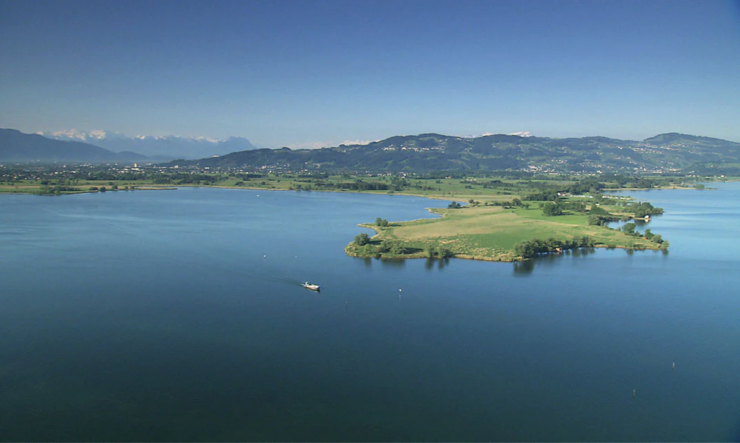
An aerial view of the Rohrspitz peninsula jutting into the calm blue waters of Lake Constance, with forested hills and distant mountains in the background under a clear sky.
Aerial view of the Rohrspitz headland extending into Lake Constance.

Rhine Delta wildlife and species highlights

The Rhine Delta is best known for its birdlife. More than 300 species have been recorded in the reserve, and the area is considered among the most important breeding, resting, and feeding sites for waterbirds and waders in Central Europe. Shallow waters, silt flats, and reed edges attract a wide variety of ducks, geese, herons, and shorebirds, and the site has long been popular with ornithologists and bird watchers seeking rarities.

The wetland is also rich in amphibians. Nine amphibian species, plus a hybrid form (the edible frog), have been identified here. Populations of water frogs are particularly notable, and the European tree frog and the northern crested newt occur locally in significant numbers. Five native reptile species are present, with the wall lizard observed at the mouth of the Rhine from 2006 onward, likely a range expansion aided by human activity.

Mammal life is more modest but includes some signs of recovery. Four bat species have been confirmed in the area, and small mammals such as the crowned shrew and the greater white-toothed shrew are restricted within Austria to the Alpine Rhine Valley. Beavers, eradicated in Vorarlberg in 1686, were detected again on the Old Rhine in 2006 after more than 300 years of absence and have since spread into several other water bodies in the Rhine Valley, marking a striking chapter in the reserve's ecological history.
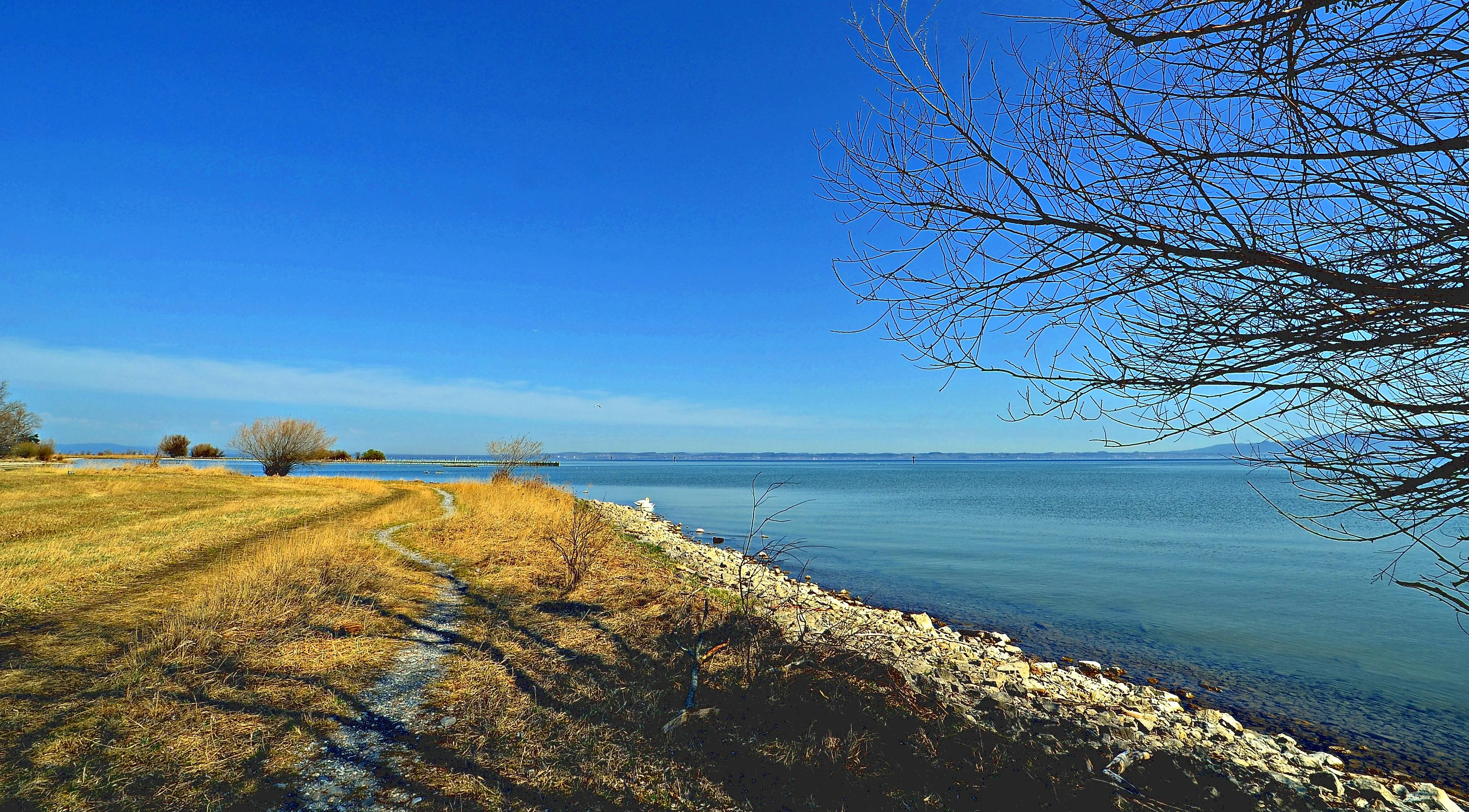
A wide landscape view of a rocky and grassy lakeshore on a bright sunny day. A leafless tree branch hangs in the upper right corner, with a clear blue sky above and calm water stretching to the horizon.
A scenic view of the shoreline and meadow at Rheinspitz in the Rhine Delta nature reserve.

Rhine Delta conservation status and protection priorities

The Rhine Delta is one of the most significant freshwater wetland conservation sites in the Alpine region. It carries overlapping layers of legal protection: a Ramsar designation under the international wetland convention since 1982 (site no. 275), and inclusion in the European Natura 2000 network under both the Birds Directive and the Habitats Directive since the mid-1990s. On the Austrian side, the Revier of Vorarlberg maintains a dedicated nature reserve covering around 1,972 hectares, now part of the Europaschutzgebiet Rheindelta; on the Swiss side, the smaller Altenrhein reserve adds complementary protection for floodplain meadows and amphibian spawning sites of national importance.

The conservation story is also one of recovery. The construction of the polder dam and the drainage-driven conversion of floodplain forests into farmland in the 1950s and 1960s provoked strong protests from Austrian and Swiss conservationists, who warned that without intervention the delta would lose its role as one of the most important bird areas in Central Europe. Subsequent decades of protection have allowed habitats to stabilize, while ongoing concerns include the effect of changes in groundwater balance, river engineering, and land use outside the reserve, as well as the establishment of new, often non-native, plant species on artificial sites along the Rhine dams.

Rhine Delta cultural meaning and human context

The Rhine Delta carries cultural significance connected to its long history of human use. The Rheinspitz at Gaißau has been grazed for centuries, and centuries of seasonal pasture use are still part of the delta's rural character. The area also sits at a politically meaningful borderland between Austria and Switzerland, with the Old Rhine forming part of the international boundary and the landscapes of Vorarlberg and St. Gallen meeting across the wetlands.

The reserve's institutions carry their own cultural memory. The Rheindeltahaus, completed in 1998 and raised on stilts to accommodate flood levels, serves both as a research station and as a public outreach point with changing exhibitions about the delta. The history of protection itself, from the wartime 1942 ordinance creating the first formal reserve through to the conservation campaigns of the 1960s and the international designations of the 1980s, has become part of the regional identity of Vorarlberg's environmental movement, and the delta is today a defining natural landmark of the Lake Constance region.
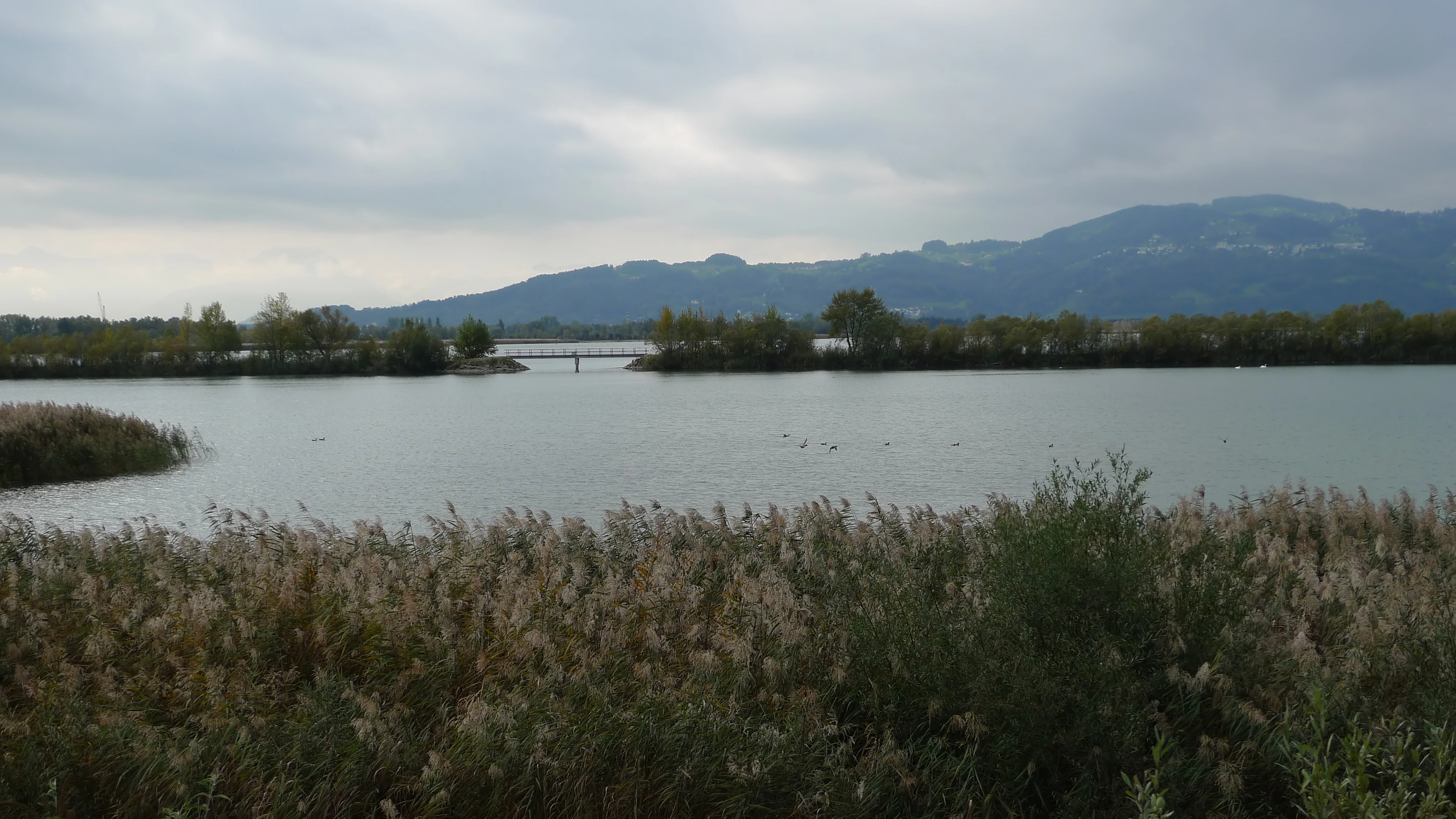
A wide landscape view of a calm, greyish-blue lagoon surrounded by dense reeds and marsh vegetation, with a distant bridge connecting a strip of land and hazy mountains on the horizon under a cloudy sky.
A view across the wetlands and lagoon of the Rhine Delta nature reserve at Lake Constance.

Top sights and standout views in Rhine Delta

Two qualities set the Rhine Delta apart from other wetland reserves. First, it sits at the active mouth of a large Alpine river, so the landscape is genuinely in motion: sediment continues to extend the delta, the shallow lagoon keeps shifting, and the polder dam and modern S-shaped training dam have reshaped the shoreline in living memory. Second, the overlap of bird diversity, amphibian richness, and recovering mammal populations on a site of this size is unusual in Central Europe. With well over 300 recorded bird species, notable water-frog populations, and even the return of the beaver after more than three centuries of absence, the delta offers an unusually complete illustration of what a protected freshwater wetland can sustain.

The reserve is also notable for being a genuinely transboundary site, with coordinated protection on both the Austrian and Swiss sides, and for combining Ramsar, Natura 2000, and national reserve status in a single area that lies within easy reach of a densely populated lake-side region.
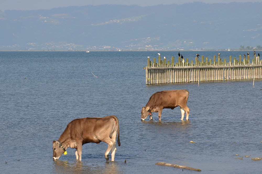
Two brown cows standing in shallow lake water; a wooden pier structure in the background is occupied by several black cormorant birds.
Cattle grazing in the shallow waters of the Rhine Delta near Lake Constance, with cormorants perched on a pier structure.

Best time to visit Rhine Delta

As a wetland reserve defined most strongly by its birdlife and shallow-water habitats, the Rhine Delta offers its richest experience outside the deepest winter months. Spring and early summer are generally favorable for observing breeding waterbirds and the full songbird activity of the reed beds, while late summer and autumn bring migratory waders, geese, and ducks to the shallow bays. Winter can still attract wildfowl concentrations, though shorter daylight and colder conditions reduce the variety of species seen.

The flat terrain and the network of cycling routes, lagoon circular walks, and lake-shore paths also mean that the reserve is appealing whenever weather conditions are mild and water levels allow access to wet meadows and the lagoon loop. Visitors interested in peak bird activity should generally aim for the migration periods in spring and autumn, while those seeking a quieter landscape experience may find the warmer months of summer particularly pleasant.


Monthly climate preview

Long term representative point temperature and monthly precipitation averages for Rhine Delta

Rhine Delta Climate Normals and Measured Annual Temperature Patterns

Representative coordinate records show measured monthly temperature ranges and precipitation rhythms across the protected landscape. Examining the complete twelve month climate profile reveals detailed long term averages for temperature and moisture.
Annual mean8 °C
-1 °C18 °C
Jan-1°
Feb-1°
Mar
Apr
May12°
Jun16°
Jul18°
Aug18°
Sep13°
Oct
Nov
Dec
Warmest month
July

17.9 °C

Coolest month
January

-1.3 °C

Wettest month
June

5.1 mm/day

Driest month
February

2.8 mm/day

Park location guide

Geography guide, regional context, and park location map for Rhine Delta

Rhine Delta park geography, regions, and map view in Austria

Understand where Rhine Delta sits in Austria through a broader geographic reading of the surrounding landscape, nearby location context, and its mapped position within the national park landscape.

How Rhine Delta fits into Austria

Austria is a landlocked country in Central Europe, bordered by Germany, Czech Republic, Slovakia, Hungary, Slovenia, Italy, Switzerland, and Liechtenstein. The country is a federal semi-presessional republic composed of nine states, with Vienna as its capital and largest city. It has a population of approximately 9.1 million people.

Wider geography shaping Rhine Delta in Austria

Austria is located in Central Europe, lying in the Eastern Alps. It is bordered by Germany and Czech Republic to the north, Slovakia to the northeast, Hungary to the east, Slovenia and Italy to the south, and Switzerland and Liechtenstein to the west.

Map view of Rhine Delta

Use this park location map to pinpoint Rhine Delta in Austria, understand its exact geographic position, and read its mapped placement within the surrounding landscape more clearly.

Pigeon | © OpenStreetMap contributors

Location context for Rhine Delta

St. GallenVorarlberg

Visualizing wetlands, riparian forests, and shallow lake habitats

Rhine Delta Photos and Protected Landscape Scenery

Photographic records illustrate the complex wetland terrain and active river delta environment of Rhine Delta. Visual documentation reveals the distinct geography of shallow bays, reed beds, and alluvial woodlands along Lake Constance.

A peaceful lake landscape at sunset, with reeds in the foreground, trees on the left shore, and dark, dramatic clouds illuminated by the golden light.

A Great Crested Grebe and its young chick swimming together on the surface of calm water.

A peaceful lake landscape at sunset featuring trees standing in shallow water, calm reflections, and a colorful, cloudy sky.

An aerial view of the Rohrspitz peninsula jutting into the calm blue waters of Lake Constance, with forested hills and distant mountains in the background under a clear sky.

A wide landscape view of a rocky and grassy lakeshore on a bright sunny day. A leafless tree branch hangs in the upper right corner, with a clear blue sky above and calm water stretching to the horizon.

A massive flock of birds fills the air above the water of Lake Constance, with snow-capped mountains visible in the distance behind a treeline.

A wide landscape view of a calm, greyish-blue lagoon surrounded by dense reeds and marsh vegetation, with a distant bridge connecting a strip of land and hazy mountains on the horizon under a cloudy sky.

Two brown cows standing in shallow lake water; a wooden pier structure in the background is occupied by several black cormorant birds.

A massive flock of birds fills the air and water at the Rhine Delta, with snow-capped mountains visible in the distant background.

Wide aerial photograph of the Rhine Delta on the edge of Lake Constance, showing water, marshland, and a nearby runway.

A wide panorama showing a flooded wetland area with submerged trees and vegetation leading out to a large body of water under a blue, cloudy sky.

Panoramic landscape view of a calm wetland lagoon with scattered green islets and reeds, under a sky with cumulus clouds.

A calm pond reflects colorful autumn trees, including yellowing birches and a red-leafed shrub, against a blue sky with light clouds.

High angle view of the Rhine River flowing into Lake Constance, with the delta shoreline visible and a town in the foreground.

Park atlas

Compare surrounding regional geography and adjacent wetland reserves

Other Parks Near Rhine Delta and Connected Protected Landscapes

Browse other protected areas and nearby national parks that share regional geography with Rhine Delta. Extending the comparison helps map related wetland reserves and adjacent terrain across the wider Alpine foothills.
Protected landscapeBaden-Württemberg
About 12 km away#1 closest

North

Steilrand und Schotterfeld des Argentals südlich der Kochermühle Protected Landscape Atlas

Glacial geomorphology and river terrace geography in Baden-Württemberg

This protected area provides a diagrammatic view of the Argen valley's ice-age origins. By preserving a Late Glacial terrace complete with its characteristic steep edge and gravel-strewn surfaces, it offers an essential geographic reference for understanding the retreat of the Würm ice within the wider Bodenseebecken region.

Area
0.081 km²
Established
1954
Relief
Lowland
Climate
Temperate
A flat, stylized illustration showing a waterfall cascading from a cliff into a river that flows alongside a forest towards a large body of water under a soft-toned sky.
Protected landscapeBaden-Württemberg
About 15 km away#2 closest

Northwest

Württembergisches Bodenseeufer: Protected Shoreline Landscapes of Lake Constance

A regional atlas of riparian habitats in Baden-Württemberg

Württembergisches Bodenseeufer preserves over 180 hectares of natural shoreline across Friedrichshafen, Langenargen, and Kressbronn am Bodensee. This protected landscape highlights essential riparian ecology, featuring diverse river mouth environments and largely unaltered forest edges that define the southern borders of the Bodenseekreis district.

Area
1.88 km²
Established
1940
Relief
Lowland
Climate
Temperate
Protected landscapeBaden-Württemberg
About 17 km away#3 closest

North

Tettnanger Wald mit Hochwacht, Krüntenbühl, Reichenbühl, Argenhardter Kopf, Schoos und Steilrand des Argentales an dem Schwandenbogen: Geography and Protected Boundaries

A Glacial Landscape Protection Area in the Lake Constance Basin

This protected landscape in Baden-Württemberg captures a classic moraine terrain shaped by glacial retreat. With its system of ridges, dead-ice hollows, and escarpments along the Argen valley, the area serves as a critical geological reference point. Explore the detailed topography and mapped boundaries of this forest landscape within the broader Bodenseebecken region.

Area
7.01 km²
Established
1954
A soft watercolor painting of a rolling landscape featuring a winding river, grassy plains, and distant hills in muted green, pink, and yellow tones.
Protected landscapeBodenseekreis
About 21 km away#4 closest

North

Spätwürmeiszeitliche Terrassen zwischen Burnau, Prestenberg, Vorderreute, Buch und Krumbach Geography

A protected landscape site in the Bodenseekreis district

Spätwürmeiszeitliche Terrassen zwischen Burnau, Prestenberg, Vorderreute, Buch und Krumbach is defined by its series of level river terraces resulting from Würm ice age glacial retreat. Spanning roughly 22 hectares near the Schwarzach river, the site remains a vital example of fluvioglacial geomorphology and regional landscape preservation within the pre-Alpine foreland.

Area
0.22 km²
Established
1963
Relief
Upland
Climate
Temperate
Protected landscapeBaden-Württemberg
About 26 km away#5 closest

Northwest

Württembergisches Bodenseeufer, Neufassung Teilbereich Friedrichshafen-West Protected Landscape

Mapped greenbelt corridor along the Lake Constance shoreline in Baden-Württemberg.

This protected landscape encompasses a vital 114-hectare corridor of lakeshore habitats and cultural land near Friedrichshafen. It preserves a critical mix of reed beds, shallow-water zones, and riparian woodland galleries that maintain the near-natural state of the Württemberg lakeshore. The area serves as a significant ecological bridge between the waters of Lake Constance and the urbanised inland terrain of the surrounding Bodenseekreis district.

Area
1.14 km²
Established
2004
Relief
Lowland
Scope
Mixed
A watercolor illustration of a landscape with green meadows, trees, and soft mountains in the background, set against a white background.
Nature reserveLiechtenstein
About 28 km away#6 closest

South

Ruggeller Riet Nature Reserve: Geographic Context and Mapped Wetland Boundaries in Liechtenstein

A vital lowland moorland and wetland ecosystem in the Rhine valley.

Ruggeller Riet serves as the primary lowland nature reserve in Liechtenstein, featuring an expansive 88-hectare wetland landscape. Positioned in the Alpine Rhine valley near the tripoint with Austria and Switzerland, this protected area preserves the post-glacial history of the region through its distinctive peat meadows, bogs, and grassland habitats.

Area
0.88 km²
Established
1978
IUCN
Ia
Relief
Lowland
A horizontal watercolor painting depicting a soft-focus valley scene with rolling hills, scattered green trees, and a light sky.
Nature reserveBaden-Württemberg
About 31 km away#7 closest

Northwest

Deggenhauser Tal Nature Reserve: Mapped Geography and Protected Valley Landscapes

Glacial terrain and watershed ridges in Baden-Württemberg

Investigate the protected geography of Deggenhauser Tal, an expansive nature reserve in the Oberschwäbisches Hügelland. This record maps the complex network of stream corridors, steep valley slopes, and ridge heights that define this Natura 2000 protected area. Gain insights into the glacial relief and varied land use patterns that characterize this essential southwestern German valley ecosystem.

Area
8.492 km²
Established
2019
A soft, panoramic watercolor painting featuring green, rolling hills and a winding river or stream through a forested landscape against a bright, hazy sky.
Nature reserveBaden-Württemberg
About 32 km away#8 closest

North

Altdorfer Wald Nature Reserve: Geographic Atlas and Protected Landscape Overview

Mire, spring, and forest ecosystems in Baden-Württemberg

The Altdorfer Wald nature reserve consolidates a significant network of watercourses, peatlands, and old-growth forest stands across the Upper Swabian Pre-Alpine hills. This protected area stands as a primary focal point for understanding the interplay between hydrological richness, calcareous deposits, and diverse temperate forest habitats within the regional geography of Baden-Württemberg.

Area
13.71 km²
Established
2019
Relief
Upland
Climate
Temperate

Common questions about visiting, size, designation, and location context for Rhine Delta

Rhine Delta FAQs for park facts, access, geography, and protected area context

Find quick answers about Rhine Delta, including protected-area facts, park geography, trail and visitor context, and how the park fits into its surrounding country and regional landscape.
MoriAtlas Explorer

Continue Your Protected Areas Search Across the Global Atlas

Deepen your exploration by continuing the structured search for national parks and protected areas worldwide. Utilize the comprehensive filtering capabilities to compare different conservation landscapes and refine your understanding of global park geography. Discover more about the distribution and characteristics of protected natural areas.

Global natural geography