Mori Atlas logo
National parkCoelacanth National Park

Explore the mapped boundaries and unique marine landscape of this vital Indian Ocean sanctuary.

Coelacanth National Park: Marine Protected Area Atlas and Geographic Context on Grande Comore

(Parc National Coelacanth)

Coelacanth National Park represents a crucial marine protected area safeguarding the waters off Grande Comore, a region known for its unique geological features and rich biodiversity. Established as a national park, this sanctuary encompasses vital coastal and offshore zones, playing a significant role in Indian Ocean conservation. The park's identity is intrinsically linked to the survival of the coelacanth, a prehistoric fish species that has found refuge in these deep waters, making it a site of exceptional scientific and ecological importance.

Marine Protected AreaIndian OceanCoral ReefCoelacanthCetaceansVolcanic Island

Coelacanth National Park

National park

Park overview

Structured park overview, official facts, and landscape profile for Coelacanth National Park

Coelacanth National Park park facts, protected area profile, and essential visitor context

Review the core facts for Coelacanth National Park, including designation, size, terrain, visitor scale, habitats, and operating context in one park-focused overview.

About Coelacanth National Park

Coelacanth National Park occupies a distinctive position among the world's marine protected areas as a sanctuary for the West Indian Ocean coelacanth, a species of profound evolutionary and scientific importance. The park encompasses the coastal and offshore waters surrounding Grande Comore, the largest and most volcanically active island in the Comoros archipelago. This Indian Ocean archipelago nation, positioned between the African mainland and Madagascar, harbors marine ecosystems of exceptional biodiversity, and the creation of Coelacanth National Park reflects Comoros's recognition that its waters contain biological treasures of global significance. The park's establishment in 2010 and its formal announcement in 2016 as part of a broader national initiative to protect marine resources demonstrate the country's commitment to sustainable conservation. The Comoros National Parks Agency oversees management of the protected area, working to balance ecological preservation with the needs of local communities whose livelihoods are tied to the surrounding waters. The park's seascape includes coral reef formations, rocky substrates, and deepwater zones that together create diverse habitats supporting numerous marine species.

Quick facts and research context for Coelacanth National Park

Coelacanth National Park covers 9,276 hectares of marine territory off the coast of Grande Comore in the Comoros archipelago. The park was designated in 2010 and formally announced in 2016 as part of Comoros's 25-by-2021 marine protection initiative. The protected area is managed by the Comoros National Parks Agency. The park's namesake species, the coelacanth (Latimeria chalumnae), represents one of the most significant biological rediscoveries in natural history, and the waters here remain one of the few known habitats for this living fossil. Coral reef systems within the park support diverse marine life, while the surrounding deep waters attract cetaceans including whales and dolphins throughout the year.

Protection and recognition

Exploring the documented marine conservation scope and boundary classification

Documenting the Official Protection Status of Coelacanth National Park

Marine conservation records outline how Coelacanth National Park is officially designated to safeguard critical aquatic ecosystems. Verifying documented marine boundaries and official designation history provides essential framework context for global conservation mapping.

Protection details

Protection scope
Marine
Transboundary protection
No
Park context

Deeper park guide and search-rich context for Coelacanth National Park

Coelacanth National Park history, landscape, wildlife, and travel context

Explore Coelacanth National Park through its history, landscape character, ecosystems, wildlife, conservation priorities, cultural context, and seasonal travel timing in a structured park guide built for atlas discovery and search intent.

Why Coelacanth National Park stands out

Coelacanth National Park is uniquely renowned for its protection of one of Earth's most extraordinary living fossils. The coelacanth, a fish species that predates the extinction of dinosaurs and was presumed extinct for 66 million years before its dramatic rediscovery in the 1990s, persists in the deep waters surrounding Grande Comore. This park represents one of the very few places on the planet where this primitive fish can be found in its natural habitat, making it a site of immense scientific and conservation significance. Beyond the coelacanth, the park protects healthy coral reef ecosystems and serves as a seasonal destination for migratory cetaceans, including various whale and dolphin species that pass through these Indian Ocean waters.

Coelacanth National Park history and protected-area timeline

The establishment of Coelacanth National Park represents a significant milestone in Comoros's environmental conservation history, emerging from decades of scientific discovery and growing awareness of the nation's unique marine biodiversity. The waters surrounding Grande Comore gained international attention following the rediscovery of the coelacanth in the Indian Ocean during the 1990s, a find that shocked the scientific community and sparked global interest in Comoros's marine environment. This rediscovered species, known scientifically as Latimeria chalumnae, had previously been known only from the fossil record and was presumed to have vanished along with the dinosaurs. The discovery of living coelacanths in Comoros waters positioned this small island nation at the center of marine biology research and conservation advocacy. In response to mounting scientific evidence of the species' vulnerability and the broader ecological importance of these waters, the Comoros government established the national park in 2010 and subsequently announced its formal creation in 2016 as part of an ambitious framework to protect 25 percent of the nation's marine environment by 2021.

Coelacanth National Park landscape and geographic character

The marine landscape of Coelacanth National Park encompasses a diverse range of underwater environments characteristic of the Indian Ocean waters surrounding Grande Comore. The island itself is volcanic in origin, with its steep coastal slopes descending directly into the sea, creating dramatic underwater topography that includes rocky shores, submarine cliffs, and deepwater zones that plunge rapidly away from the coastline. Within the park's boundaries, coral reef systems form complex three-dimensional structures that provide habitat for countless marine organisms, while the deeper offshore waters offer the dark, cold conditions that coelacanths prefer. The transition from shallow reef environments to deeper pelagic waters creates a mosaic of habitats that supports both reef-dwelling species and open-ocean visitors. The surrounding ocean currents bring nutrient-rich waters to these shores, fueling the productivity that sustains the park's diverse marine communities.

Coelacanth National Park ecosystems, habitats, and plant life

The ecological significance of Coelacanth National Park extends far beyond its association with the famous coelacanth, encompassing a rich tapestry of marine habitats and biological communities. The park's coral reef ecosystems, though facing the regional challenges of climate change and ocean warming, continue to support high levels of biodiversity including numerous fish species, invertebrates, and marine plants. These reef systems form the foundation of the park's marine food web, providing nursery habitat for many species and serving as feeding grounds for larger predators. The deeper waters within the park's boundaries provide critical habitat for the coelacanth, which inhabits depths typically between 100 and 500 meters, where the cold, dark conditions allow this ancient fish to survive. The park also lies along major cetacean migration routes, with whales and dolphins regularly passing through these waters as they move between feeding and breeding areas across the Indian Ocean.

Coelacanth National Park wildlife and species highlights

The wildlife of Coelacanth National Park is headlined by the West Indian Ocean coelacanth, a species whose presence in these waters represents one of the most remarkable biological stories of the modern era. Prior to its rediscovery, the coelacanth was known only from fossils dating back to the Cretaceous period, leading scientists to conclude that the species had vanished from Earth approximately 66 million years ago. The specimens found in Comoros waters, particularly around the Salimani area of Grande Comore, provided the first confirmed evidence of living coelacanths and remain among the only known populations of this living fossil. Beyond the coelacanth, the park supports abundant marine life across its coral reef systems, where diverse fish species, including groupers, snappers, surgeonfish, and butterflyfish, create vibrant underwater communities. The park's waters also attract seasonal visitors from the cetacean world, with various whale and dolphin species migrating through the area and frequently observed by those exploring these waters.

Coelacanth National Park conservation status and protection priorities

Coelacanth National Park represents a cornerstone of Comoros's marine conservation strategy and serves as a critical refuge for species of global significance. The park's primary conservation purpose centers on protecting the coelacanth, a species classified as vulnerable by international conservation assessments and facing threats from deepwater fishing activities and potential habitat degradation. By establishing this protected area, Comoros has created a framework for managing human activities in waters that harbor one of Earth's most scientifically valuable species. The park also contributes to broader conservation goals, including the nation's commitment to protecting 25 percent of its marine environment by 2021. The coral reefs within the park boundaries receive additional protection from the pressures that might otherwise threaten their integrity, while the migratory cetaceans that pass through these waters benefit from reduced vessel traffic and fishing pressure within the protected zone. Management by the Comoros National Parks Agency ensures ongoing monitoring and enforcement to maintain the park's conservation values.

Coelacanth National Park cultural meaning and human context

The waters surrounding Grande Comore have sustained Comorian communities for generations, with fishing providing livelihoods for coastal populations throughout the archipelago's history. The discovery of the coelacanth in these waters added a new dimension to the relationship between local communities and their marine environment, transforming these waters from simply productive fishing grounds to a site of global scientific importance. This transition has created both opportunities and challenges for local communities, as the establishment of the protected area has affected traditional fishing practices while also opening possibilities for sustainable marine tourism and scientific research. The park's French name, Parc National Coelacanth, reflects the colonial linguistic heritage of Comoros, while the continued use of local place names such as Salimani and Selimani for specific sites within the park's waters maintains connections to Comorian maritime traditions and local geographic knowledge.

Top sights and standout views in Coelacanth National Park

Coelacanth National Park stands as one of the world's few marine protected areas dedicated to preserving a living fossil, offering exceptional opportunities for scientific research and conservation. The park's coral reef systems provide accessible underwater environments for exploration, while the deeper waters hold the promise of encounters with the legendary coelacanth for those equipped for deepwater observation. Seasonal cetacean migrations bring whales and dolphins to the park's waters, creating additional wildlife viewing opportunities that complement the marine biodiversity found in shallower reef areas. The park represents Comoros's commitment to sustainable marine management and positions the archipelago as a significant player in Indian Ocean conservation efforts.

Best time to visit Coelacanth National Park

The waters of Coelacanth National Park can be explored throughout the year, though conditions vary with the Indian Ocean's seasonal patterns. The period from October through April generally offers calmer seas and warmer water temperatures, making this timeframe favorable for underwater exploration and marine wildlife observation. However, visitors interested specifically in cetacean activity should note that whale and dolphin migrations follow their own seasonal patterns that may not align perfectly with the most comfortable surface conditions. The coelacanth, being a deepwater species, can potentially be encountered year-round, though observation requires specialized deep-diving equipment and expertise. Planning a visit to this unique marine protected area benefits from consultation with local operators who understand current conditions and can provide guidance on the best opportunities for experiencing the park's remarkable marine environments.
Monthly climate preview

Long-term representative point measurements tracking temperature and precipitation rhythm

Coelacanth National Park Climate Normals and Annual Weather by Month

Coelacanth National Park exhibits a measured annual temperature range from roughly twenty-five to twenty-eight degrees Celsius alongside distinct monthly precipitation shifts at the sampled coordinate. Examining the complete twelve-month climate profile reveals granular shifts in baseline meteorological normals across the protected area.
Annual mean27 °C
25 °C28 °C
Jan28°
Feb28°
Mar28°
Apr28°
May27°
Jun26°
Jul25°
Aug25°
Sep25°
Oct26°
Nov27°
Dec28°
Warmest month
March

28.1 °C

Coolest month
August

24.7 °C

Wettest month
January

6.9 mm/day

Driest month
September

0.6 mm/day

Park location guide

Geography guide, regional context, and park location map for Coelacanth National Park

Coelacanth National Park park geography, regions, and map view in Comoros

Understand where Coelacanth National Park sits in Comoros through a broader geographic reading of the surrounding landscape, nearby location context, and its mapped position within the national park landscape.

How Coelacanth National Park fits into Comoros

Comoros is an island nation in the Indian Ocean located at the northern end of the Mozambique Channel. It consists of three main islands: Grande Comore, Anjouan, and Mohéli. The country gained independence from France in 1975 and is a member of the Arab League, African Union, and Organisation of Islamic Co-operation. It has three official languages: Comorian, French, and Arabic.

Wider geography shaping Coelacanth National Park in Comoros

Comoros is situated in the Indian Ocean at the northern end of the Mozambique Channel, between Madagascar and the African mainland. The country consists of three main volcanic islands: Grande Comore, Anjouan, and Mohéli. The islands are part of the Comoro Islands archipelago.

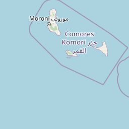
Map view of Coelacanth National Park

Use this park location map to pinpoint Coelacanth National Park in Comoros, understand its exact geographic position, and read its mapped placement within the surrounding landscape more clearly.

Pigeon | © OpenStreetMap contributors

Location context for Coelacanth National Park

Grande Comore
Park atlas

Explore connected marine landscapes and island protected areas in the Comoros and surrounding Indian Ocean region

Discover Nearby Marine Protected Areas and National Parks in the Comoros Archipelago After Exploring Coelacanth National Park

Continue your exploration from Coelacanth National Park by browsing other significant marine protected areas and national parks throughout the Comoros archipelago and adjacent Indian Ocean waters. Compare varied coastal ecosystems, deepwater zones, and conservation efforts across similar island nations, expanding your understanding of regional protected landscapes and their unique biodiversity.
National parkComoros
About 11 km away#1 closest

Northeast

Karthala National Park: Comoros' Active Volcano and Endemic Protected Landscape

Explore mapped volcanic terrain and unique island biodiversity.

Karthala National Park, situated on Grande Comore, is defined by its active shield volcano, Mount Karthala, the highest peak in the Comoros. This protected area is celebrated for its extraordinary endemism, housing unique bird species and plant life evolved in isolation. The park's dramatic caldera system and sloping volcanic mass present a fascinating geological and ecological landscape, offering critical context for understanding island ecosystems and protected areas in the Indian Ocean.

Area
262.14 km²
Established
2010
Relief
Mountain
Climate
Tropical
National parkComoros
About 67 km away#2 closest

Southeast

Mohéli National Park: Comoros National Park and Protected Landscape Exploration

Mapped geography and protected area identity.

Mohéli National Park is a dedicated national park within the Comoros, providing a specific focus for exploring protected lands and their geographic distribution. This entry details the park's mapped boundaries and its significance as a conservation landscape. Understanding Mohéli National Park offers valuable insight into the regional geography of the Comoros archipelago and its unique natural context.

Area
643.62 km²
Established
2010
Relief
Mixed relief
Climate
Tropical
National parkAnjouan
About 109 km away#3 closest

East

Shisiwani National Park: Anjouan's Protected Marine and Island Landscape Atlas

Coastal and terrestrial protected area mapping in Comoros.

Delve into the protected landscape of Shisiwani National Park, a critical national park situated on Anjouan's Sima Peninsula in Comoros. This atlas entry details the park's combined marine and terrestrial boundaries, highlighting its vital coral reefs, mangrove forests, and unique island geography. Understand the park's role in conservation through its mapped extent and diverse natural environments, offering a clear geographic context for protected area exploration.

Area
64.97 km²
Established
2016
IUCN
II
Climate
Tropical
Watercolor illustration of a mountainous landscape with a lake and grassy fields.
National parkAnjouan
About 134 km away#4 closest

East

Mount Ntringui National Park: Protected Volcanic Landscape and Highland Geography on Anjouan

Explore its dramatic peaks, crater lake, and remnant montane forests.

Mount Ntringui National Park is a significant protected area situated in the rugged volcanic highlands of Anjouan. This national park preserves the island's highest peaks, Mount Ntringui and Mount Trindrini, alongside the unique Dzialandzé crater lake and the crucial Moya Forest. It stands as a vital refuge for endemic species and represents the last substantial tract of montane forest on Anjouan, offering deep insights into the region's unique ecology and mapped natural terrain.

Area
79.14 km²
Established
2010
IUCN
II
Relief
Mountain
Wildlife reserveMayotte
About 234 km away#5 closest

Southeast

Baie de Bouéni Wildlife Reserve: Mapping Coastal Biodiversity and Volcanic Terrain

A protected bay and mangrove system on the coast of Mayotte.

Baie de Bouéni stands as a significant wildlife reserve in Mayotte, framed by the volcanic massifs of Mont Bénara and Mont Choungui. This coastal sanctuary protects the largest mangrove belt in the Comoros and offers a clear example of the meeting of intertidal mudflats and marine ecosystems within the western Indian Ocean.

Area
5.19 km²
Established
2007
IUCN
IV
Relief
Lowland
Nature reserveMayotte
About 242 km away#6 closest

Southeast

Vasière des Badamiers: Mapping the Protected Coastal Wetlands of Petite-Terre

Nature reserve geography and intertidal ecosystem character

Vasière des Badamiers is an essential protected coastal wetland in Mayotte, characterized by its tidal mudflats and mangrove fringes. This site acts as a key migratory refuge for waterbirds while functioning as a natural filter for the surrounding lagoon. Use this data to analyze the unique brackish basin and the ecological boundaries that define this Ramsar-recognized environment.

Area
1.25 km²
Established
2002
IUCN
IV
Protected areaMayotte
About 243 km away#7 closest

Southeast

Pointes et plages de Saziley et Charifou Protected Area Geography and Map Context

Coastal ridgelines, mangrove habitats, and Mayotte island terrain

Delve into the physical geography and protected area configuration of Pointes et plages de Saziley et Charifou. This site presents a striking contrast between steep, dry inland ridges and low-lying coastal mangrove systems, offering an essential look at the complex environmental layering found across the southeastern coast of Mayotte.

Area
6.65 km²
Established
1997
IUCN
IV
Relief
Upland
National parkCabo Delgado Province
About 311 km away#8 closest

West

Quirimbas National Park: Coastal Protected Landscape and Island Archipelago Atlas

Discover marine conservation and inselberg terrain in Cabo Delgado.

Quirimbas National Park, located in Cabo Delgado Province, Mozambique, is a key protected area defined by its exceptional combination of marine and terrestrial environments. The park's geography includes eleven islands, extensive mangrove forests, and vibrant coral reefs, alongside a mainland characterized by striking inselberg formations. This national park is a vital site for understanding coastal landscape diversity, marine ecosystems, and protected-area geography within East Africa.

Area
1,430 km²
Established
1971
IUCN
II
Relief
Mixed relief

Common questions about visiting, size, designation, and location context for Coelacanth National Park

Coelacanth National Park FAQs for park facts, access, geography, and protected area context

Find quick answers about Coelacanth National Park, including protected-area facts, park geography, trail and visitor context, and how the park fits into its surrounding country and regional landscape.
MoriAtlas Explorer

Continue Your Protected Areas Search Across the Global Atlas

Deepen your exploration by continuing the structured search for national parks and protected areas worldwide. Utilize the comprehensive filtering capabilities to compare different conservation landscapes and refine your understanding of global park geography. Discover more about the distribution and characteristics of protected natural areas.

Global natural geography