
Why Dharug National Park stands out
Dharug National Park is best known for containing significant sections of the Old Great North Road, one of the eleven UNESCO World Heritage-listed Australian Convict Sites. The relatively intact Devine's Hill and Finch's Line sections of this historic road, approximately 16 kilometres in length, were inscribed on the World Heritage register in July 2010 as part of the Australian Convict Sites. This makes the park unique among Australian national parks, as it preserves a major example of colonial infrastructure that demonstrates the forced migration of convicts and the punishment and reform practices of the penal era. The park also provides important habitat for Australian native wildlife including satin bowerbirds, gang-gang cockatoos, and green catbirds.

Dharug National Park history and protected-area timeline
Dharug National Park was established on October 1, 1967, as part of the expansion of protected areas in the Sydney Basin region during the mid-twentieth century. The park takes its name from the Darug people, an Indigenous group traditionally associated with lands south of the Hawkesbury River. However, it is noted that this naming may be problematic, as the traditional custodians of the land within the park are the Darkinjung people. The park's historical significance was substantially enhanced with the 2010 World Heritage inscription of the Old Great North Road sections within its boundaries as part of the Australian Convict Sites listing. The Great North Road was constructed between 1826 and 1836 using convict labor, representing one of the most ambitious colonial infrastructure projects in early Australian history. The preserved sections within the park, including Devine's Hill and Finch's Line, demonstrate the engineering techniques and harsh labor conditions of the convict era.
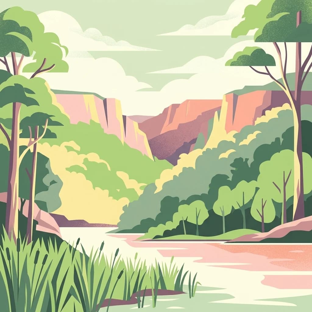
Dharug National Park landscape and geographic character
The landscape of Dharug National Park is characterized by the rolling terrain of the Hornsby Plateau, a subdivision of the Sydney Basin. The underlying geology consists entirely of Permian and Triassic sedimentary rocks, approximately 270 to 180 million years old, that were deposited in ancient river systems and shallow seas. These horizontally bedded sandstones, shales, and conglomerates have been subsequently eroded to create the current landforms of ridges, valleys, and gentle slopes. The park contains several creek systems that drain into the Hawkesbury River and Mangrove Creek, with the watercourses typically following valleys carved into the softer rock layers. The terrain varies from ridgeline areas with exposed sandstone to lower slopes and valleys where deeper soils have developed, supporting more dense vegetation cover.
Dharug National Park ecosystems, habitats, and plant life
The vegetation of Dharug National Park reflects the Sydney Basin environment, characterized by sclerophyllous forests and woodlands adapted to the region's seasonal climate and nutrient-poor soils. The park contains a mix of open forests dominated by various eucalyptus species, with understory layers of shrubs and grasses adapted to periodic fire. The riparian zones along creeks and drainage lines support more lush vegetation, including ferns and moisture-loving plants. The park forms part of a larger contiguous network of protected areas that provides important habitat connectivity in the Sydney region, allowing wildlife to move between larger conservation areas. The combination of sandstone ridges, valley floors, and creek systems creates diverse microhabitats that support a range of plant communities.
Dharug National Park wildlife and species highlights
Dharug National Park supports a variety of Australian wildlife, with birdlife being particularly notable in the park's forested environments. The satin bowerbird, known for its remarkable courtship behavior and elaborate bower constructions, is a characteristic species of the park's taller forests. The gang-gang cockatoo, with its distinctive call and grey plumage accented by red markings in males, inhabits the eucalypt forests and is often observed in small flocks. The green catbird, another notable avian resident, contributes to the park's bird diversity with its distinctive meowing call. These species represent the park's role as important habitat within the Sydney Basin, providing refuges for wildlife in close proximity to the metropolitan area.
Dharug National Park conservation status and protection priorities
Dharug National Park contributes to conservation in the Sydney region by protecting significant areas of remnant native vegetation within a largely cleared and modified landscape. The park's inclusion in the World Heritage-listed Australian Convict Sites demonstrates recognition that cultural and natural heritage are intertwined in this landscape. The preservation of the Old Great North Road sections requires ongoing management that balances visitor access with the protection of this significant colonial infrastructure. The park also contributes to the protected area network that includes Yengo National Park, Popran National Park, and Marramarra National Park, creating a relatively continuous corridor of protected land that supports wildlife movement and ecosystem function in the Sydney metropolitan region's north.
Dharug National Park cultural meaning and human context
Dharug National Park exists within a landscape of complex Indigenous heritage and colonial history. The park is named after the Darug people, though the traditional custodians of the land are the Darkinjung people, highlighting the importance of understanding and respecting Indigenous connections to Country. The park preserves physical evidence of the colonial period through the Old Great North Road, which was constructed using convict labor during the early to mid-nineteenth century. This road represents both the forced migration and imprisonment of convicts in Australia and the broader colonial expansion and development of New South Wales. The intersection of Indigenous and colonial heritage makes the park a place of significant cultural meaning that extends beyond its value as a recreational area.
Top sights and standout views in Dharug National Park
The World Heritage-listed Old Great North Road sections within Dharug National Park represent the park's most significant highlight, offering visitors the opportunity to walk along portions of this historic convict-built road and contemplate its place in Australian history. The relatively intact Devine's Hill and Finch's Line sections demonstrate the engineering capabilities and harsh conditions of the colonial penal system. The park's location within the Sydney Basin provides scenic bushwalking opportunities through diverse terrain on the Hornsby Plateau, with views across the Hawkesbury River valley and access to the park via Wisemans Ferry. The wildlife viewing opportunities, particularly for bird species such as satin bowerbirds, gang-gang cockatoos, and green catbirds, add to the park's appeal as a nature destination near Sydney.
Best time to visit Dharug National Park
The cooler months from late autumn through winter to early spring generally offer comfortable conditions for exploring Dharug National Park, with mild daytime temperatures suitable for walking and outdoor activities. During these seasons, the park's forests display seasonal changes, and wildlife may be more active during cooler parts of the day. Summer months can bring hot conditions, particularly on exposed ridgelines and during midday, so early morning or late afternoon visits are recommended during warmer periods. The park can be visited throughout the year, though visitors should be prepared for variable weather conditions typical of the New South Wales Central Coast region. The World Heritage-listed road sections can be explored year-round, though checking current conditions and any park closures before visiting is advisable.