Mori Atlas logo
National parkDuida–Marahuaca National Park

Mapped Boundaries and Remote Wilderness Character of a Guiana Shield National Park

Duida–Marahuaca National Park: Venezuela's Tepui National Park & Protected Landscape

(Parque Nacional Duida–Marahuaca)

Duida–Marahuaca National Park in Venezuela's Amazonas state protects a dramatic landscape dominated by ancient tepui table-top mountains rising from the Amazonian lowlands. As a significant national park within the Guiana Shield, it safeguards unique cloud forest ecosystems and remarkable biodiversity. This entry provides detailed geographic context and a clear atlas view of the park's protected boundaries, highlighting its remote wilderness and geological significance for structured park discovery.

Tepui MountainsAmazon RainforestGuiana ShieldCloud ForestRemote WildernessTable-Top Mountains

Duida–Marahuaca National Park

National park

Park overview

Structured park overview, official facts, and landscape profile for Duida, Marahuaca National Park

Duida, Marahuaca National Park park facts, protected area profile, and essential visitor context

Review the core facts for Duida, Marahuaca National Park, including designation, size, terrain, visitor scale, habitats, and operating context in one park-focused overview.

About Duida, Marahuaca National Park

Duida–Marahuaca National Park protects a portion of the Guiana Shield in southern Venezuela, an area of exceptional geological and ecological significance. The park encompasses the dramatic tepui formations of the Duida and Marahuaca massifs, which are composed of Precambrian sandstone that has been eroded over millions of years to form the distinctive flat-topped mountains with vertical cliffs. The elevation range within the park spans from approximately 150 meters in the lowland valleys to over 2,300 meters at the summit of Marahuaca. This dramatic altitudinal gradient creates multiple distinct ecological zones, from tropical rainforest in the lower elevations to cloud forest on the mountain slopes and sparse montane vegetation on the exposed plateaus. The isolation of these tepui formations has resulted in high levels of endemism, with many plant and animal species found nowhere else on Earth. The park is located in a region that has historically been difficult to access, contributing to its ecological integrity and making it one of Venezuela's more remote protected areas.

Quick facts and research context for Duida, Marahuaca National Park

Duida–Marahuaca National Park is situated in southern Venezuela within the Amazonas state, protecting a portion of the Guiana Shield region. The park features the distinctive tepui formations of the Duida and Marahuaca massifs, which are among the most iconic landscape features of the Venezuelan Amazon. The area is characterized by steep-sided sandstone plateaus rising to elevations exceeding 2,000 meters, surrounded by dense tropical forest. The region is ecologically significant as part of the larger Amazon basin and Guiana Shield biodiversity hotspot.

Protection and recognition

Documenting boundaries and official conservation governance records for terrestrial reserves

Duida-Marahuaca National Park Protection Status and Terrestrial Designation

Atlas visitors can examine the official terrestrial protection scope and designation framework established for Duida-Marahuaca National Park. Analyzing verified global databases helps conservationists and researchers understand how high-priority wilderness areas are categorized and protected.

Protection details

Protection scope
Terrestrial
Transboundary protection
No
Park context

Deeper park guide and search-rich context for Duida, Marahuaca National Park

Duida, Marahuaca National Park history, landscape, wildlife, and travel context

Explore Duida, Marahuaca National Park through its history, landscape character, ecosystems, wildlife, conservation priorities, cultural context, and seasonal travel timing in a structured park guide built for atlas discovery and search intent.

Why Duida, Marahuaca National Park stands out

Duida, Marahuaca National Park is best known for its spectacular tepui mountains, which are among the most distinctive geological formations in northern South America. These ancient table-top mountains harbor unique ecosystems and have inspired scientific curiosity since the early explorations of the region. The park represents one of the more remote and less-visited protected areas in Venezuela, offering a wilderness experience characterized by pristine forest, dramatic topography, and ecological isolation that has driven evolutionary divergence.

Duida, Marahuaca National Park history and protected-area timeline

Duida–Marahuaca National Park was established as part of Venezuela's national park system to protect the unique geological and ecological values of the tepui region. The creation of the park reflected growing recognition during the mid-to-late twentieth century of the need to preserve the exceptional biodiversity of the Guiana Shield region. The area has been the subject of scientific interest since the early explorations of the Amazon and Orinoco basins, with the tepuis capturing the imagination of naturalists and explorers who recognized their unique evolutionary significance. The formal protected area designation provides institutional framework for conservation while acknowledging the cultural and historical significance of the region to indigenous communities who have inhabited the surrounding areas for generations.

Duida, Marahuaca National Park landscape and geographic character

The landscape of Duida–Marahuaca National Park is defined by its dramatic tepui formations, which are among the most visually striking geological features in northern South America. The Duida and Marahuaca massifs rise abruptly from the surrounding lowland jungle, with their flat summits and steep sandstone cliffs creating a landscape of extraordinary vertical relief. The lower slopes are cloaked in dense tropical rainforest, while the exposed rock faces bear testament to the erosional processes that have shaped these ancient mountains over hundreds of millions of years. The interaction between the mountains and the atmosphere creates frequent cloud formation, particularly on the higher slopes, contributing to the cloud forest ecosystems that characterize the park. Valleys and drainage channels cut through the terrain, providing water resources and creating corridors of habitat across the elevational gradient.

Duida, Marahuaca National Park ecosystems, habitats, and plant life

The ecological systems within Duida–Marahuaca National Park reflect the complex interplay of elevation, climate, and geological isolation that characterizes the Guiana Shield region. The park encompasses multiple habitat types transitioning from lowland rainforest through cloud forest to montane vegetation zones on the upper slopes and summits. This vertical stratification creates diverse ecological niches that support a wide variety of species. The isolation of the tepui summits has driven evolutionary processes resulting in high levels of endemism, with many species adapted to the specific conditions of these mountain-top environments. The cloud forests on the mountain slopes receive high rainfall and maintain high humidity, supporting dense vegetation and specialized species assemblages. The surrounding lowlands contain some of the most species-rich forests in the world, part of the broader Amazonian biodiversity hotspot.

Duida, Marahuaca National Park wildlife and species highlights

The wildlife of Duida–Marahuaca National Park is characteristic of the Amazonian and Guianan regions, with species assemblages that vary across the elevational gradient from the lowland forests to the tepui summits. The region supports diverse birdlife, including numerous species of parrots, toucans, and antbirds that inhabit the forest canopy. The mammalian fauna includes various primate species, including howler monkeys and capuchins, as well as jaguars and other large carnivores that maintain territories across the landscape. The isolated nature of the tepui formations has allowed for evolutionary divergence, and the region is known to harbor endemic species adapted to the specific conditions of these ancient mountains. Reptiles and amphibians are well represented in the humid forest environments, while the watercourses support aquatic communities including fish species adapted to the specific conditions of the mountain streams.

Duida, Marahuaca National Park conservation status and protection priorities

Duida–Marahuaca National Park represents an important protected area within the network of conservation lands that preserve the biological diversity of the Guiana Shield and Venezuelan Amazon. The park's protected status helps maintain ecological processes across the elevational gradient from lowland rainforest to tepui summit, preserving habitat for species with limited distributions and protecting watersheds that feed into the broader Orinoco River system. The remote location of the park has provided a degree of protection from intensive human pressures that affect other areas of the Venezuelan Amazon. Conservation of this region contributes to the preservation of the Guiana Shield biodiversity hotspot, one of the most significant areas of tropical biodiversity on Earth. The tepui ecosystems are recognized internationally as being of outstanding universal value, both for their geological significance and their ecological importance.

Duida, Marahuaca National Park cultural meaning and human context

The region surrounding Duida–Marahuaca National Park is home to indigenous communities whose traditional territories extend into the area. These communities have maintained connections to the landscape for generations, with cultural practices and livelihoods intertwined with the forest environments and the dramatic mountain formations that define the region. The tepuis hold cultural significance for indigenous peoples, appearing in traditional stories and understanding of the landscape. The park's establishment acknowledges the importance of these lands while providing a framework for conservation that respects the rights and traditions of local communities. The remote nature of the region has limited major human development, preserving both ecological integrity and traditional cultural practices.

Top sights and standout views in Duida, Marahuaca National Park

The defining highlight of Duida–Marahuaca National Park is the opportunity to experience one of the most remote and pristine tepui wilderness areas in Venezuela. The dramatic silhouette of the flat-topped mountains rising above the Amazonian forest creates one of the most iconic landscapes in northern South America. The park offers exceptional opportunities for observing cloud forest ecosystems and the specialized species that inhabit these isolated environments. The relative lack of visitor infrastructure and challenging access contribute to a sense of wilderness exploration that distinguishes this park from more developed protected areas. The geological significance of the Precambrian sandstone formations provides insight into ancient Earth processes, while the biological diversity reflects millions of years of evolutionary isolation.

Best time to visit Duida, Marahuaca National Park

The optimal time to visit Duida–Marahuaca National Park generally corresponds to the dry season in the Venezuelan Amazon, typically from December through April. During this period, rainfall is reduced and access to the more remote areas of the park is more feasible. The wet season, from May through November, brings heavy precipitation that can make trails difficult and limit access to higher elevations. Temperature and humidity remain high throughout the year in the lowland areas, while the higher elevations experience cooler conditions. Visitors should be prepared for the challenging logistics inherent in accessing this remote protected area, including potentially requiring special permits and arrangements with local operators familiar with the region.
Monthly climate preview

Long-term representative temperature and precipitation patterns across twelve months

Duida Marahuaca National Park Climate Normals and Annual Weather Rhythm

Duida Marahuaca National Park exhibits measured long-term annual temperature and precipitation rhythms across a representative elevation of 576 meters. Examining the complete monthly climate normals reveals detailed temperature ranges and precipitation shifts for comparative research.
Annual mean23 °C
23 °C24 °C
Jan24°
Feb24°
Mar24°
Apr24°
May23°
Jun23°
Jul23°
Aug23°
Sep23°
Oct24°
Nov23°
Dec24°
Warmest month
March

24 °C

Coolest month
July

22.8 °C

Wettest month
June

11.9 mm/day

Driest month
January

3 mm/day

Park location guide

Geography guide, regional context, and park location map for Duida, Marahuaca National Park

Duida, Marahuaca National Park park geography, regions, and map view in Venezuela

Understand where Duida, Marahuaca National Park sits in Venezuela through a broader geographic reading of the surrounding landscape, nearby location context, and its mapped position within the national park landscape.

How Duida, Marahuaca National Park fits into Venezuela

Venezuela is a country in northern South America with coastline along the Caribbean Sea and Atlantic Ocean. It borders Colombia, Brazil, Guyana, and Trinidad and Tobago. The country has an area of approximately 916,445 km² and a population of about 31.8 million. Caracas is the capital and largest city. Venezuela consists of 23 states and the Capital District.

Wider geography shaping Duida, Marahuaca National Park in Venezuela

Venezuela is located on the northern coast of South America. The continental territory is bordered by the Caribbean Sea and Atlantic Ocean to the north, Colombia to the west, Brazil to the south, and Guyana to the east. Trinidad and Tobago lies to the northeast. The country includes various islands and islets in the Caribbean Sea known as the Federal Dependencies.

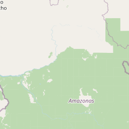
Map view of Duida, Marahuaca National Park

Use this park location map to pinpoint Duida, Marahuaca National Park in Venezuela, understand its exact geographic position, and read its mapped placement within the surrounding landscape more clearly.

Pigeon | © OpenStreetMap contributors
Park atlas

Compare protected landscapes and map regional park geography surrounding this iconic Venezuelan wilderness area.

Discover Related National Parks and Protected Areas Near Duida–Marahuaca National Park

Explore other national parks and protected areas sharing the distinctive tepui geology and Amazonian ecosystems found near Duida–Marahuaca National Park. Comparing these adjacent protected landscapes provides a clearer understanding of regional conservation efforts and the interconnectedness of Venezuela's diverse wilderness terrain.
National parkAmazonas
Mapped location lies within the park boundary#1 closest

Parque nacional Duida-Marahuaca: Geographic Overview of Protected Tepui Landscapes in Venezuela

Mapping the highland ecosystems and river systems of Amazonas

Parque nacional Duida-Marahuaca protects a vast expanse of remote wilderness, anchored by the prominent Cerro Duida, Cerro Huachamacari, and Cerro Marahuaca. This site offers deep insights into the park's sandstone topography and hydrological connectivity within the broader Guayana Shield, providing a clear geographic understanding of these isolated table-top mesas and their surrounding forest habitats.

Area
2,100 km²
Established
1978
IUCN
II
Relief
Mountain
National parkAmazonas
About 56 km away#2 closest

Southeast

Parima Tapirapecó National Park: Venezuela's Largest Protected Area within the Guayanan Highlands

Explore its vast geographic extent and critical Orinoco River basin landscape.

Parima Tapirapecó National Park is an expansive protected territory in Venezuela's Amazonas region, holding the title of the country's largest national park and ranking among the world's most significant protected lands. Its geography is defined by the ancient Guayanan Highlands, protecting the vital headwaters of the Orinoco River and a mosaic of tropical forests and savannas. This park offers deep insights into landscape preservation on a grand scale, crucial for understanding regional geography and protected area distribution.

Area
38,290 km²
Established
1991
IUCN
II
Scope
Terrestrial
National parkAmazonas
About 124 km away#3 closest

West

Yapacana National Park: Ancient Geology and Botanical Significance in Venezuela's Amazonas

Discover the dramatic plateau landscapes and unique flora of this protected national park.

Delve into the distinct geography and protected landscape identity of Yapacana National Park, a significant national park within Venezuela's Amazonas region. This page serves as a comprehensive atlas entry, detailing the park's core features, including its iconic Yapacana hill, a dramatic tepui formation representative of the ancient Guayana Shield. Understand the park's geological heritage and its exceptional botanical value, marked by unique floristic connections, all within the context of its Amazonian basin setting.

Area
3,200 km²
Established
1978
IUCN
II
Relief
Highland
National parkBolívar
About 126 km away#4 closest

Northeast

Parque nacional Jaua-Sarisariñama: Protected Tepui Landscapes in Bolívar

Mapping the sandstone mesas and remote wilderness of the Venezuelan Guiana Shield.

Parque nacional Jaua-Sarisariñama stands as one of the most secluded protected areas in Venezuela, defined by its massive tepuis and dramatic vertical sinkholes. This geography encompasses critical headwaters and ancient Precambrian rock formations that rise abruptly from surrounding lowland forests, providing a stable habitat for isolated species across the Guiana Shield.

Area
3,300 km²
Established
1978
IUCN
II
Relief
Highland
National parkAmazonas
About 200 km away#5 closest

South

Serranía de la Neblina National Park: The World's Highest Tepui and Cloud Forest Protected Landscape

Explore its mist-shrouded peaks and deep canyons.

Serranía de la Neblina National Park is a paramount protected area in Venezuela's Amazonas state, famed for its highest tepui mountain. Established in 1978, this vast national park sprawls across 13,600 square kilometers of untamed Amazonian terrain. Its iconic Serranía de la Neblina is continuously wrapped in fog, presenting a unique landscape rich in endemic species and geological wonders like the Baría Grande Canyon. Discover its mapped geography and critical role in Guayanan Highlands conservation.

Area
13,600 km²
Established
1978
IUCN
II
Relief
Mountain
Natural monumentVenezuela
About 217 km away#6 closest

North

Monumento Natural Formaciones de Tepuyes: Protected Landscapes and Geological Map

Ancient tepuy table-top mountains in the Venezuelan Guayana Shield

Monumento Natural Formaciones de Tepuyes spans over one million hectares, safeguarding extraordinary geological formations defined by sheer vertical escarpments and flat-topped summits. As a vital protected area within the Guayana Shield, the site offers an essential view into isolated highland geography, endemic ecosystems, and the contrast between ancient mountain plateaus and tropical forest lowlands.

Area
10,698.2 km²
Established
1991
Relief
Mountain
Climate
Tropical
National parkVichada Department
About 314 km away#7 closest

Northwest

El Tuparro National Natural Park: Mapped Protected Landscape in Colombia's Vichada Department

Explore the geography and savanna terrain of this Orinoco basin national park.

El Tuparro National Natural Park stands as a significant protected area in the Vichada Department, embodying the ecological richness of Colombia's Llanos Orientales. Its landscape comprises extensive tropical savannas, striking gallery forests along major rivers like the Orinoco, and dramatic rapids. This page provides an atlas-focused view of El Tuparro National Natural Park, detailing its geographic boundaries and its importance as a conservation corridor within the region, crucial for understanding South American protected lands.

Area
5,480 km²
Established
1970
IUCN
II
Relief
Lowland
Natural monumentAmazonas
About 319 km away#8 closest

Northwest

Monumento natural Piedra la Tortuga: Granite Outcrops and Archaeological Landscapes

A vital protected monument in the Amazonas region of Venezuela

Discover the geological significance of Monumento natural Piedra la Tortuga, where ancient Precambrian granite formations rise above tropical savannas and gallery forests. This protected area preserves a unique concentration of indigenous history, including major petroglyphs and burial sites, while supporting diverse bird species and riparian ecosystems within the Amazonas region.

Area
5.03 km²
Established
1992
Relief
Upland
Climate
Tropical

Common questions about visiting, size, designation, and location context for Duida, Marahuaca National Park

Duida, Marahuaca National Park FAQs for park facts, access, geography, and protected area context

Find quick answers about Duida, Marahuaca National Park, including protected-area facts, park geography, trail and visitor context, and how the park fits into its surrounding country and regional landscape.
MoriAtlas Explorer

Continue Your Protected Areas Search Across the Global Atlas

Deepen your exploration by continuing the structured search for national parks and protected areas worldwide. Utilize the comprehensive filtering capabilities to compare different conservation landscapes and refine your understanding of global park geography. Discover more about the distribution and characteristics of protected natural areas.

Global natural geography