Why Eungella National Park stands out
Eungella National Park is most renowned for protecting the longest continuous stretch of subtropical rainforest in Australia, a remarkable conservation achievement on an isolated mountain massif. The park is famous for its population of platypus, which can be observed at the Broken River viewing platform, one of the most reliable locations in Australia to see these unusual semi-aquatic mammals. The park is also celebrated as a centre of endemism for Australian rainforest species, with multiple endemic frogs, reptiles, birds, crustaceans and insects found only within this area. The Eungella honeyeater, described in 1983, is the most recently described Australian bird species, highlighting the park's ongoing significance for biodiversity discovery.
Eungella National Park history and protected-area timeline
Eungella National Park was originally declared over 49,610 hectares in 1941, establishing protected status for this significant rainforest area. In 1986, the park was substantially expanded to include additional land at Mount Beatrice and a small area of former State Forest near Finch Hatton, bringing the total protected area to its current extent of 52,900 hectares. The expansion helped to consolidate the protection of the rainforest ecosystem and improve connectivity between forest patches. The park is situated in the traditional country of the Wirri people, an Aboriginal group whose language and cultural practices are associated with this landscape. The name Eungella itself comes from the Aboriginal language and translates to 'land of the cloud', a reference to the persistent mist and high rainfall that characterise the area. The Queensland Parks and Wildlife Service manages the park, with management focused on preserving the natural condition of the area and protecting its cultural resources while providing nature-based visitor experiences.
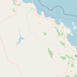
Eungella National Park landscape and geographic character
The landscape of Eungella National Park is dominated by the rugged terrain of the Clarke Range, a mountain system that rises steeply from the Pioneer Valley to form an isolated mountainous plateau. The Eungella Plateau reaches elevations of 1259 metres at Mount Dalrymple and similar heights at Mount William, creating a highland environment distinct from the surrounding lowlands. The terrain is characterised by steep ridgelines, deep valleys, and numerous streams that cascade down the mountain slopes. The park sits at the end of the Pioneer Valley, a flat-bottomed valley that provides access to the elevated plateau. The rainforest clings to the mountain slopes and valleys, while the surrounding eucalypt forests and woodlands create a visible boundary between the wet rainforest interior and the drier surrounding landscapes. Streams such as Finch Hatton Creek have carved gorges through the terrain, creating scenic waterfalls including Aralen Falls. The combination of elevation, substantial rainfall and the protection of the mountain slopes from fire has allowed this subtropical rainforest to persist where it might otherwise have been reduced by natural or human-caused disturbances.
Eungella National Park ecosystems, habitats, and plant life
The nature of Eungella National Park is defined by its subtropical rainforest ecosystems, which represent the longest continuous stretch of this vegetation type in Australia. The park contains a range of rainforest formations, from complex mesophyll vine forest in the wettest locations to notophyll vine forest at higher elevations and on poorer soils. On eastern-facing slopes and ridge tops, red stringybark eucalypts emerge above the canopy of notophyll vine forest, while drier western slopes support hoop pine. The rainforest is bordered by eucalypt forests and woodlands across much of its extent. The park preserves approximately half of the rainforest that existed in the region at the time of European settlement, a significant conservation achievement given the extensive logging that has occurred elsewhere. The vegetation communities, including rainforests, vine thickets and vine forests, are considered fire-sensitive and do not require fire for regeneration. This isolation and the persistence of well-developed rainforest have allowed the evolution of a distinctive biota with numerous endemic species.
Eungella National Park wildlife and species highlights
Eungella National Park supports exceptional biodiversity with over 175 species of mammals, reptiles, birds and amphibians recorded within its boundaries. The park is particularly significant for its endemic species, with several frogs, reptiles, birds, crustaceans and insects found nowhere else. The bird fauna includes 111 species, with the Eungella honeyeater being the most recently described Australian bird species, first collected in 1975 and formally described in 1983. This bird is endemic to the highland rainforest of the Clarke Range. The park supports several species at the limits of their distribution, including the red-necked crake, buff-breasted paradise kingfisher and white-browed robin at their southern extent, and the regent bowerbird, brown thornbill and glossy black cockatoo at their northern limit. The amphibian fauna is especially significant, with three endemic frog species: the endangered Eungella dayfrog, the near-threatened Eungella tinker frog, and the northern gastric-brooding frog, which is believed extinct. The park is one of eleven areas in Australia recognised for high levels of frog endemism. Platypus are commonly observed at the Broken River viewing platform, and the park supports 28 species of mammals including several bat species. Reptile diversity includes three species of leaf-tailed geckos and the orange-spotted rainforest skink, which is restricted to upland rainforest above 900 metres.
Eungella National Park conservation status and protection priorities
Eungella National Park represents one of the most significant conservation areas in eastern Australia, protecting the nation's longest continuous subtropical rainforest and a remarkable concentration of endemic species. The park is recognised as a centre of endemism for Australian rainforest species, with multiple species found nowhere else on Earth. The rainforest ecosystem serves as a critical refuge during periods of climate change, with the Clarke Range and Eungella area identified as one of three key refuge areas in mid-east Queensland during past periods of rainforest contraction. The park faces significant threats including habitat fragmentation, invasive species such as cane toads, red foxes, feral cats and feral pigs, fire which can fragment the rainforest and alter species composition, and the potential spread of cinnamon fungus. The critically endangered Eungella spiny crayfish is restricted to the creeks of the Clarke Range, vulnerable to the cumulative impacts of invasive species and climate change. The park's management focuses on preserving natural conditions while providing sustainable nature-based visitor experiences.
Eungella National Park cultural meaning and human context
Eungella National Park is situated in the traditional country of the Wirri people, an Aboriginal Australian group whose language and cultural practices are associated with this landscape. The name Eungella comes from the Aboriginal language and translates to 'land of the cloud', a reference to the persistent mist and high rainfall that characterise the plateau. This linguistic heritage provides a cultural dimension to the park, connecting the landscape to the indigenous peoples who have lived in this region for thousands of years. European visitors have noted the unusual foraging behaviour of platypus and documented an apparent feeding association between azure kingfishers and platypus, where the birds watch for fish disturbed by the platypus while foraging. This observation reflects the park's role as a place where natural history discoveries continue to be made and where ecological relationships can be studied in relatively intact ecosystems.
Top sights and standout views in Eungella National Park
Eungella National Park offers several standout features that distinguish it as a premier protected area in Queensland. The Broken River area provides one of the most reliable platypus viewing opportunities in Australia, with a dedicated viewing platform overlooking the river where these unusual mammals can be regularly observed. The park contains over 20 kilometres of walking tracks, including scenic lookouts offering panoramic views over the Pioneer Valley from elevated positions within the rainforest. Aralen Falls and other waterfall features add to the scenic appeal of the mountainous terrain. The Fern Flat campground provides backcountry camping access to the rainforest interior, while the Broken River picnic area offers day visitor facilities. The exceptional concentration of endemic species, including the recently described Eungella honeyeater and several endemic frogs, makes the park significant for scientific research and biodiversity conservation. The visitor survey conducted in 2001 estimated that visitors to the park spend approximately 10.9 million dollars annually in the local region, demonstrating the economic value the park provides to surrounding communities.
Best time to visit Eungella National Park
Eungella National Park can be visited throughout the year, though the cooler temperatures at higher elevations make the warmer months more comfortable for walking and outdoor activities. The park receives high rainfall throughout the year, averaging 2240 millimetres annually, so wet weather can be expected at any time. The summer months from December to February typically bring warmer conditions in the lowlands but the plateau remains cooler. Winter months from June to August can bring cooler temperatures, particularly at night, but generally offer more stable weather conditions. The platypus at Broken River can be observed year-round, though early morning visits typically offer the best viewing opportunities when the animals are most active. The Eungella dayfrog breeds between January and May, so visitors interested in amphibian observation may find this period particularly rewarding. The mist and cloud that give the area its name are most common during the cooler months, adding to the atmospheric quality of the rainforest landscape.