Mori Atlas logo
National parkÎles Ehotilé National Park

Discover the mapped boundaries and coastal landscape character of this unique West African protected area.

Îles Ehotilé National Park: Protected Island Ecosystem in Ivory Coast's National Park System

Îles Ehotilé National Park represents a significant protected landscape within Ivory Coast, focusing on the conservation of its unique island ecosystems. Located along the Gulf of Guinea, this national park encompasses a cluster of islands and their surrounding marine environments, offering a distinct representation of West African coastal and island biodiversity. Users can explore the geographic context of this protected area, understanding its terrain, mapped boundaries, and its role as a key component of Ivory Coast's natural heritage and protected land network.

island national parkcoastal protected areaWest AfricaIvory Coast parksGulf of Guineamarine ecosystem

Îles Ehotilé National Park

National park

Park overview

Structured park overview, official facts, and landscape profile for Îles Ehotilé National Park

Îles Ehotilé National Park park facts, protected area profile, and essential visitor context

Review the core facts for Îles Ehotilé National Park, including designation, size, terrain, visitor scale, habitats, and operating context in one park-focused overview.

About Îles Ehotilé National Park

Îles Ehotilé National Park is one of Ivory Coast's designated national parks, established to protect the nation's natural landscapes and biodiversity. Located along the country's coastal zone, the park encompasses islands and surrounding waters that support distinct ecological communities. Ivory Coast, situated in West Africa, maintains a network of protected areas spanning various ecological zones from coastal regions to interior forests and savannas. The national park designation provides a formal framework for conservation management, ensuring the preservation of natural habitats and the species they support. This particular park contributes to the country's protected area coverage by focusing on island and coastal ecosystems that are representative of the Gulf of Guinea environment.

Quick facts and research context for Îles Ehotilé National Park

Îles Ehotilé National Park is situated in Ivory Coast, a country in West Africa along the Gulf of Guinea. The park protects a cluster of islands and their associated marine environments. As a national park within Ivory Coast's protected areas network, it contributes to the conservation of the nation's coastal and island biodiversity. The park forms part of Ivory Coast's broader strategy to preserve representative ecosystems across different geographic zones of the country.

Protection and recognition

Understanding the official conservation history and spatial management of the island reserve

Documented Protection Status and Legal Designation of Îles Ehotilé National Park

Established in 2005 with a mixed protection scope, Îles Ehotilé National Park represents a critical geographic unit in regional marine and terrestrial conservation planning. Reviewing such official designation records allows researchers and geographers to trace the precise management history and legislative status of West African island reserves.

Protection details

Protection scope
Mixed
Designated year
2005
Park context

Deeper park guide and search-rich context for Îles Ehotilé National Park

Îles Ehotilé National Park history, landscape, wildlife, and travel context

Explore Îles Ehotilé National Park through its history, landscape character, ecosystems, wildlife, conservation priorities, cultural context, and seasonal travel timing in a structured park guide built for atlas discovery and search intent.

Why Îles Ehotilé National Park stands out

The park is known for protecting island ecosystems along Ivory Coast's coastline. It represents a coastal and marine protected area within the Ivorian national park system, preserving habitats that include island vegetation, coastal zones, and associated marine environments. The park's significance lies in its representation of West African island biodiversity and its role in conserving coastal ecosystems that are characteristic of the Gulf of Guinea region.

Îles Ehotilé National Park history and protected-area timeline

Îles Ehotilé National Park was established as part of Ivory Coast's national park system, which developed through successive phases of protected area designation throughout the country's modern history. Ivory Coast created its national park network to preserve representative samples of the nation's diverse ecosystems, ranging from coastal zones to interior forests. The specific designation of this park reflects the government's recognition of the ecological value of the island chain and surrounding marine areas. As with other Ivorian national parks, the establishment of this protected area followed legal frameworks for nature conservation that were developed during the country's post-independence period.

Îles Ehotilé National Park landscape and geographic character

The park encompasses a group of islands located along Ivory Coast's coastline in the Gulf of Guinea region of West Africa. The landscape features island terrain with associated coastal environments, including shoreline features, vegetation-covered land areas, and surrounding marine waters. The coastal setting places this park within a broader geographic context of West African shorelines characterized by beaches, tidal zones, and adjacent oceanic waters. Island landscapes in this region typically feature vegetation that differs from mainland areas due to coastal influences and the isolated nature of island habitats.

Îles Ehotilé National Park ecosystems, habitats, and plant life

The park protects island and coastal ecosystems characteristic of the Gulf of Guinea coastline. Island environments in this part of West Africa support specialized vegetation communities adapted to coastal conditions, including salt tolerance, wind exposure, and maritime influences. The surrounding marine waters contain ecosystems associated with coastal and shallow-water environments. These island and coastal habitats collectively support biodiversity including various bird species, marine life, and island-adapted organisms. The protection provided by national park status helps preserve these ecological communities from development pressures and other threats that could degrade sensitive island environments.

Îles Ehotilé National Park wildlife and species highlights

The island and coastal ecosystems of the park support wildlife adapted to these environments. Coastal and island habitats in West Africa serve as important areas for bird species, including both resident birds and migratory species that utilize the Gulf of Guinea coastline as part of broader migration routes. Marine environments surrounding the islands contain fish species and other aquatic organisms typical of West African coastal waters. The isolated nature of island habitats can support specialized species adapted to island conditions, contributing to the overall biodiversity value of the protected area.

Îles Ehotilé National Park conservation status and protection priorities

Îles Ehotilé National Park contributes to Ivory Coast's conservation framework by protecting island and coastal ecosystems that represent a distinct habitat type within the nation's protected area network. The national park designation provides legal protection for the area's natural values, including its island landscapes, coastal environments, and associated biodiversity. Conservation of island ecosystems is particularly important in West Africa given the limited representation of such habitats within protected area systems and the vulnerability of island environments to various pressures. The park's establishment reflects a commitment to maintaining representative examples of the country's ecological diversity.

Îles Ehotilé National Park cultural meaning and human context

The islands protected by the park are located within the broader cultural context of Ivory Coast's coastal regions, which have historically supported fishing communities and maritime activities. The Gulf of Guinea coastline has been an area of human settlement and economic activity for generations, with coastal communities maintaining traditional relationships with marine resources. The park exists within this cultural landscape, where local communities have historically interacted with the island environments in various ways.

Top sights and standout views in Îles Ehotilé National Park

The park's standout features include its status as a protected island ecosystem in West Africa, its location within Ivory Coast's national park system, and its role in preserving coastal and marine biodiversity along the Gulf of Guinea. As a representative example of island conservation in the region, it provides protection for habitats that are limited in protected area coverage across West Africa. The park's island landscapes offer a distinct visual and ecological character compared to the mainland protected areas of Ivory Coast.

Best time to visit Îles Ehotilé National Park

The best time to visit would generally correspond to Ivory Coast's dry season, which typically runs from November to March, offering more favorable conditions for outdoor exploration. Visitors interested in wildlife viewing and experiencing the island environments should consider how seasonal patterns affect the park's accessibility and the behavior of wildlife species.
Monthly climate preview

Long-term representative point measurements tracking monthly temperature and precipitation rhythm

Îles Ehotilé National Park Climate Normals, Annual Temperature and Precipitation Patterns

Representative coordinate records show measured monthly temperature and precipitation patterns spanning from 1991 to 2020 at Îles Ehotilé National Park. Reviewing the complete twelve-month climatology profile reveals specific seasonal shifts in average daily maximum and minimum temperatures.
Annual mean26 °C
24 °C28 °C
Jan27°
Feb28°
Mar28°
Apr28°
May27°
Jun26°
Jul25°
Aug24°
Sep25°
Oct26°
Nov27°
Dec27°
Warmest month
March

27.7 °C

Coolest month
August

24.3 °C

Wettest month
June

9.2 mm/day

Driest month
January

1.3 mm/day

Park location guide

Geography guide, regional context, and park location map for Îles Ehotilé National Park

Îles Ehotilé National Park park geography, regions, and map view in Ivory Coast

Understand where Îles Ehotilé National Park sits in Ivory Coast through a broader geographic reading of the surrounding landscape, nearby location context, and its mapped position within the national park landscape.

How Îles Ehotilé National Park fits into Ivory Coast

Ivory Coast, officially the Republic of Côte d'Ivoire, is a West African country with a coastline on the Gulf of Guinea. It gained independence from France in 1960 and is now a presidential republic. The country is a major producer of cocoa and coffee, with Abidjan serving as its largest city and economic hub, while Yamoussoukro is the official capital.

Wider geography shaping Îles Ehotilé National Park in Ivory Coast

Ivory Coast is situated on the southern coast of West Africa along the Gulf of Guinea. It borders Guinea to the northwest, Liberia to the west, Mali to the northwest, Burkina Faso to the northeast, Ghana to the east, and the Atlantic Ocean to the south. The terrain includes coastal plains, interior highlands, and forested regions.

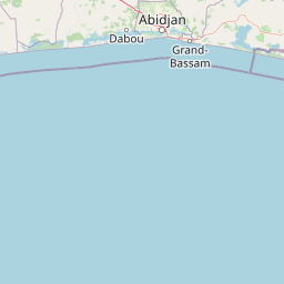
Map view of Îles Ehotilé National Park

Use this park location map to pinpoint Îles Ehotilé National Park in Ivory Coast, understand its exact geographic position, and read its mapped placement within the surrounding landscape more clearly.

Pigeon | © OpenStreetMap contributors
Park atlas

Compare coastal protected areas and island ecosystems across the West African region, exploring diverse national park geography.

Discover Related National Parks and Protected Areas Near Îles Ehotilé National Park, Ivory Coast

Continue your park discovery beyond Îles Ehotilé National Park by exploring other protected areas and national parks throughout Ivory Coast and the surrounding West African coastal region. Compare diverse protected landscapes, trace the regional spread of island and marine conservation, and understand their unique geographic context within the Gulf of Guinea.
National parkComoé District
About 0.8 km away#1 closest

Southeast

Parc national des îles Ehotilé: Geography and Protected Landscapes of the Aby Lagoon Archipelago

Coastal national park featuring unique estuarine terrain and mangrove ecosystems.

Parc national des îles Ehotilé preserves a rare six-island archipelago within the Aby lagoon. The area showcases diverse aquatic environments, including salt-tolerant mangrove forests and dense woodland habitats that support large fruit bat colonies and West African manatee populations. This protected landscape represents a critical estuarine intersection in southeastern Cote d'Ivoire, offering deep insight into the region's complex hydrological and botanical geography.

Area
105 km²
Established
1974
IUCN
II
National parkGhana
About 74 km away#2 closest

East

Nini-Suhien National Park: Protected Coastal Forest Geography and Mapping in Ghana

Regional forest landscapes and conservation boundaries

Nini-Suhien National Park serves as a vital anchor for coastal forest conservation in southwestern Ghana. This profile provides an atlas-level understanding of the park's location, its physical landscape features, and its role within the larger Ankasa Conservation Area for researchers and geography enthusiasts.

Area
160 km²
Established
1976
IUCN
II
Relief
Lowland
National parkGhana
About 74 km away#3 closest

East

Nini-Suhien National Park: Geographic Atlas and Protected Area Boundary Mapping

Regional landscape context and protected terrain in Ghana.

Nini-Suhien National Park serves as a crucial protected area within the geography of Ghana. This entry provides structured information regarding the park boundaries and regional landscape characteristics, facilitating a deeper understanding of its place in the broader West African natural landscape and mapping framework.

IUCN
II
Nature reserveWestern North Region
About 75 km away#4 closest

Northeast

Boin Tano Forest Reserve: Mapping Ghana's Protected Tropical Nature Reserve Landscapes

Regional geography and habitat analysis in Western North Region

Boin Tano Forest Reserve stands as a vital protected area in Ghana, recognized for its complex mosaic of equatorial forest, grassland, and shrubland. This 129 square kilometre reserve serves as a sanctuary for diverse primate, antelope, and bird populations, reflecting the rich biodiversity of the Upper Guinean forest ecosystem within the Western North Region.

Area
129 km²
Established
1968
IUCN
V
Relief
Lowland
National parkAbidjan
About 91 km away#5 closest

West

Banco National Park National Park: Primary Forest Landscape and Abidjan Geography

Explore mapped boundaries and urban conservation.

Banco National Park is a globally significant protected area, uniquely preserving dense primary tropical forest within the urban sprawl of Abidjan, Ivory Coast. This national park offers critical insights into urban conservation, featuring rare tree species and providing essential ecosystem services like water supply and carbon sequestration for the surrounding region. Its landscape, characterized by the Gbangbo River and rare mahogany and avodire trees, forms a vital geographic element within the metropolitan atlas.

Area
30 km²
Established
1953
IUCN
II
Relief
Lowland
National parkAbidjan
About 91 km away#6 closest

West

Parc national du Banco: Protected Tropical Rainforest and Urban Water Reserve in Abidjan

A dense primary forest island within a major urban landscape

Parc national du Banco preserves a significant block of primary tropical vegetation in the center of Abidjan. Functioning as both a vital municipal water reservoir and a complex wildlife refuge, this protected area offers a unique intersection of tropical forest ecology and dense urban development. Its central core of rare hardwood species and distinct river corridors illustrate a rare conservation landscape surrounded by the growth of a major West African metropolis.

Area
34.4 km²
Established
1953
IUCN
II
Relief
Lowland
National parkWestern North Region
About 101 km away#7 closest

North

Bia National Park: Ghana's Vital Protected Forest Landscape with West Africa's Tallest Trees

Explore the unique mapped geography and biodiversity of this key conservation area.

Bia National Park serves as a crucial protected landscape in Ghana's Western North Region, celebrated for harboring some of West Africa's tallest trees and a rich diversity of wildlife. This detailed entry provides context on its mapped boundaries and ecological significance as one of the last relatively untouched forest remnants in the region. Understand the park's place within Ghana's geography and its value for conservation research, showcasing its unique transitional forest ecosystem and the documented species it protects.

Area
563 km²
Established
1974
IUCN
II
Climate
Tropical
Protected landscapeWestern Region
About 109 km away#8 closest

Northeast

Mamiri Forest Reserve: Mapped Geography and Protected Landscape Identity in Western Ghana

Ecological transition zone of the Upper Guinea forest block

Spanning roughly 45 square kilometers, Mamiri Forest Reserve is defined by its unusual, elongated geometry and dissected hill-and-valley topography. This protected landscape serves as a vital transition zone between wet and moist evergreen forest types, supporting a complex array of seasonal wetland patches and upland forest ridges. Recognized for its significance as an Important Bird Area, it remains a critical remnant of the original high forest system found in this part of Ghana.

Area
45 km²
Established
1949
IUCN
V
Relief
Upland

Common questions about visiting, size, designation, and location context for Îles Ehotilé National Park

Îles Ehotilé National Park FAQs for park facts, access, geography, and protected area context

Find quick answers about Îles Ehotilé National Park, including protected-area facts, park geography, trail and visitor context, and how the park fits into its surrounding country and regional landscape.
MoriAtlas Explorer

Continue Your Protected Areas Search Across the Global Atlas

Deepen your exploration by continuing the structured search for national parks and protected areas worldwide. Utilize the comprehensive filtering capabilities to compare different conservation landscapes and refine your understanding of global park geography. Discover more about the distribution and characteristics of protected natural areas.

Global natural geography