
Why Kepulauan Seribu National Park stands out
Kepulauan Seribu is best known for its extensive coral reef systems spanning the Java Sea, its role as a critically important nesting site for endangered hawksbill sea turtles (rarely found in other Indonesian waters), and its unique position as the only marine national park within a world capital's administrative boundaries. The park also preserves significant Dutch colonial maritime heritage through the Onrust Island Archaeological Park, which contains the remains of a 17th-century VOC shipyard and fort. The archipelago's accessibility from Jakarta makes it a vital green space for the metropolitan population while maintaining genuine ecological significance as a biodiversity-rich marine corridor.
Kepulauan Seribu National Park history and protected-area timeline
The Thousand Islands have played a significant role in regional history since the early 17th century when the Dutch East India Company established a naval base on Onrust Island in 1615. Jan Pieterszoon Coen envisioned the location as a trade and defense base, constructing a small rectangular fort with two bastions in 1656, later expanded in 1671 into an asymmetrical pentagonal structure. The islands served multiple historical functions through the colonial period: as ship repair facilities for the VOC, as a quarantine station for returning Hajj pilgrims from 1911 to 1933, and as a detention facility for various political prisoners. British forces attacked and destroyed facilities on multiple occasions during the early 1800s, after which the Dutch rebuilt and expanded the installations. Following Indonesian independence, the islands transitioned through various uses including a leprosarium and eventually came under protection as both a nature reserve and archaeological heritage site. Onrust Island and its neighbors were declared an archaeological park in 2002 to protect Dutch colonial-era ruins and artifacts.
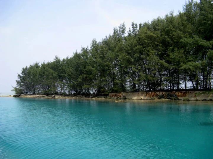
Kepulauan Seribu National Park landscape and geographic character
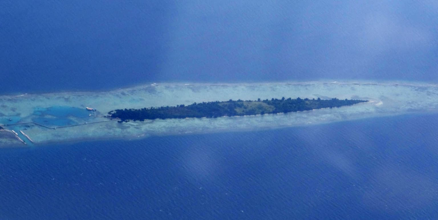
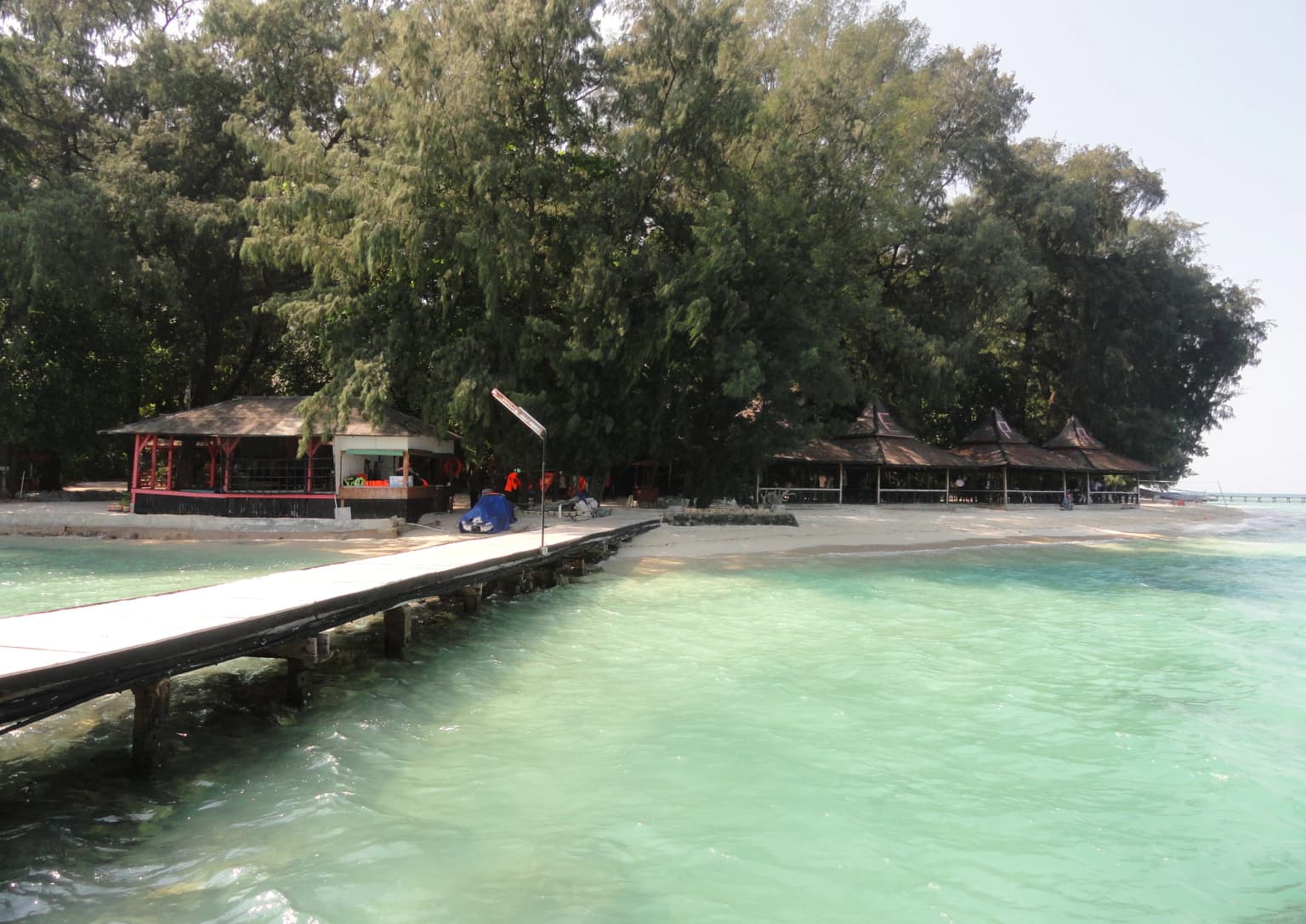
The Kepulauan Seribu archipelago consists of low-lying coral islands and reef platforms ranging from tiny sandbars to larger islands supporting settlements and vegetation. The islands sit on extensive reef systems, with most islands displaying minimal elevation above sea level, typically only a few meters at their highest points. The marine landscape features diverse coral formations including reef platforms, lagoon areas, and seagrass beds. Coastal vegetation varies by island, with larger islands supporting coconut palms, mangroves, and coastal forest, while smaller islets may be mere sand exposure or contain only sparse vegetation. The reef systems extend significantly beyond the actual land areas, creating a complex underwater topography of coral ridges, channels, and reef flats that support the park's marine biodiversity.

Kepulauan Seribu National Park ecosystems, habitats, and plant life
The marine ecosystem of Kepulauan Seribu supports a rich diversity of tropical Indo-Pacific marine life within a relatively accessible location. Coral reef communities form the foundation of the park's ecological significance, with reef platforms hosting hundreds of coral species across various formations. Seagrass beds provide critical habitat for marine species, while mangrove forests along coastlines function as nurseries for fish and invertebrates. The park's position in the Java Sea places it within a major maritime biogeographic transition zone, contributing to the diversity of fish and invertebrate species. Sea vegetation includes various Rhodophyta, Chlorophyta, and Phaeophyta algae, along with seagrass species. The park is particularly significant as a nesting site for hawksbill turtles, an endangered species whose population had nearly reached extinction before conservation breeding programs began on Pramuka Island.
Kepulauan Seribu National Park wildlife and species highlights
Kepulauan Seribu supports significant marine and coastal wildlife populations despite its proximity to a major metropolitan area. The park's coral reef ecosystems support 54 sea biota species forming part of the reef community, along with 144 documented fish species and two species of giant clam. Sea turtles represent a particular conservation focus: both hawksbill and green sea turtles use the islands for nesting, with hawksbills being especially notable as an endangered species rarely found in other Indonesian waters. Turtle breeding programs on Pramuka Island involve egg hatching in semi-natural conditions and juvenile turtle rearing before release. Coastal bird species number at least 17, with monitor lizards, golden ring snakes, and reticulated pythons found in mangrove areas. The waters around more distant islands support marine megafauna including dolphins and occasional whale sightings.
Kepulauan Seribu National Park conservation status and protection priorities
The park holds significant conservation value as Indonesia's only marine national park within a national capital's jurisdiction, serving both ecological and educational functions for Jakarta's population. The designation as IUCN category II national park reflects its mandate to protect representative marine ecosystems while allowing sustainable use. turtle breeding programs on Pramuka Island represent a targeted conservation effort for endangered hawksbill populations that had nearly reached local extinction. Certain islands, particularly Panjaliran Barat and Panjaliran Timur, are designated as fully protected areas where public access is prohibited to safeguard turtle nesting. The park faces ongoing conservation challenges from Jakarta Bay pollution, tourism pressure, and the vulnerability of low-lying coral islands to sea level rise and storm damage. Management balances conservation with the economic importance of tourism and fishing for local communities.
Kepulauan Seribu National Park cultural meaning and human context
The Kepulauan Seribu islands carry deep historical significance extending beyond their ecological value. The archipelago has been inhabited for centuries by various ethnic groups including the Betawi, Orang Pulo, Sundanese, Javanese, Bugis, and Mandar peoples, each contributing to the cultural fabric of the islands. Dutch colonial history is particularly well-preserved on islands like Onrust, where VOC-era fortifications, shipyards, and quarantine facilities remain as archaeological heritage. The Onrust Island Archaeological Park protects ruins from the Dutch East India Company period, representing colonial maritime infrastructure that once supported trade routes connecting Jakarta (then Batavia) to the wider Indonesian archipelago. Local communities maintain traditional livelihoods including fishing and small-scale tourism, while the islands also serve as weekend recreation destinations for Jakarta residents seeking escape from urban life.

Top sights and standout views in Kepulauan Seribu National Park
The park offers diverse experiences across its islands, from wildlife viewing to historical exploration. Pramuka Island serves as the administrative center and features turtle conservation facilities where visitors can learn about breeding programs. Onrust Island provides insight into colonial maritime history through its preserved Dutch fortifications and shipyard ruins. Coral reef diving and snorkeling opportunities exist throughout the archipelago, with clearer waters found at more distant northern islands. Rambut Island functions as a bird sanctuary, with seasonal populations of migratory birds estimated at 20,000 to 50,000 individuals arriving from Australia between March and September. Tidung Besar Island, the largest in the archipelago, features traditional villages and is connected to Tidung Kecil by a wooden bridge.
Best time to visit Kepulauan Seribu National Park
The optimal time to visit Kepulauan Seribu generally falls within the dry season from May through October, when calmer seas and clearer water conditions prevail for snorkeling and diving activities. The monsoon season from November through April brings rougher waters and reduced visibility, though this period may offer fewer crowds at some islands. Water temperatures remain warm throughout the year, typical of tropical marine environments. Visitors seeking turtle sightings should be aware that nesting occurs year-round with some seasonal variation, while bird migrations peak between March and September. Weather conditions can change rapidly in the Java Sea, and boat services may be affected during strong monsoon periods.