Mori Atlas logo
National parkKhar Turan National Park

Discover the mapped boundaries, diverse arid terrain, and critical wildlife of this vast national park in Semnan Province.

Khar Turan National Park: Iran's Premier Protected Desert Landscape and Cheetah Stronghold

Khar Turan National Park, situated in Semnan Province, Iran, represents one of the most significant protected areas in the Middle East. As the country's second-largest national park and a UNESCO Biosphere Reserve, it offers a profound exploration of arid and semi-desert ecosystems. Users can discover its expansive terrain, which includes mountain ranges, lowlands, sand dunes, and salt pans, all mapped within a vital sanctuary for endangered species like the Asiatic cheetah and Persian onager.

Desert LandscapeUNESCO Biosphere ReserveCritically Endangered SpeciesAsiatic Cheetah ConservationPersian OnagerWildlife Refuge

Khar Turan National Park

National park

Park overview

Structured park overview, official facts, and landscape profile for Khar Turan National Park

Khar Turan National Park park facts, protected area profile, and essential visitor context

Review the core facts for Khar Turan National Park, including designation, size, terrain, visitor scale, habitats, and operating context in one park-focused overview.

About Khar Turan National Park

Khar Turan National Park represents one of Iran's most significant conservation achievements and a critical refuge for desert-adapted wildlife in the Middle East. Located in the northeastern desert region of the country within Semnan Province, the park occupies a strategic position on the Iranian plateau where desert and steppe ecosystems transition into more mountainous terrain. The protected area forms a contiguous complex with the adjacent Touran Wildlife Refuge, creating a massive conservation landscape of over 1.4 million hectares that ranks as the second-largest reserve in Iran. This extensive area encompasses remarkable topographic diversity, including rocky highlands, undulating plains, mountain massifs, scattered sand dunes, and vast salt pan expanses. The park's designation as a UNESCO Biosphere Reserve reflects international recognition of its ecological value and its success in demonstrating that conservation can coexist with the needs of desert environments. The "little Africa" moniker captures the surprising biological richness found within this seemingly inhospitable terrain, where specialized species have evolved remarkable adaptations to survive in conditions of extreme aridity and temperature fluctuation. Khar Turan serves as a living laboratory for understanding desert ecology and the complex dynamics of predator-prey relationships in arid ecosystems.

Quick facts and research context for Khar Turan National Park

Khar Turan National Park covers approximately 1.4 million hectares in Semnan Province, making it the second-largest protected area in Iran. The park sits southeast of Shahrud on the Iranian plateau and shares a border with Touran Wildlife Refuge. Its landscapes range from arid highlands and mountain terrain to lowland plains, sand seas, and salt flats. The area is recognized as a UNESCO Biosphere Reserve, reflecting its global significance for desert ecosystem conservation. The park is home to several critically endangered species, including one of the world's largest remaining populations of Asiatic cheetahs.

Protection and recognition

Mapping official conservation status and documented management boundaries of terrestrial reserves

Khar Turan National Park Protection Status and Terrestrial Designation

Users can examine the documented protection status, management scope, and conservation boundaries established for Khar Turan National Park. Evaluating verified terrestrial designation records provides essential geographical context for understanding regional conservation frameworks and protected landscape boundaries.

Protection details

Protection scope
Terrestrial
Transboundary protection
No
Park context

Deeper park guide and search-rich context for Khar Turan National Park

Khar Turan National Park history, landscape, wildlife, and travel context

Explore Khar Turan National Park through its history, landscape character, ecosystems, wildlife, conservation priorities, cultural context, and seasonal travel timing in a structured park guide built for atlas discovery and search intent.

Why Khar Turan National Park stands out

Khar Turan National Park is best known as the primary stronghold of the critically endangered Asiatic cheetah in Iran, hosting one of the largest remaining populations of this vanishing big cat. The park is also celebrated for its population of Persian onagers, a rare wild ass species surviving in small numbers across the Iranian plateau. Its landscape diversity, spanning from mountain ranges to salt pans and sand dunes, has earned it the nickname "little Africa" in reference to its surprisingly rich biodiversity within an arid setting. The UNESCO Biosphere Reserve designation underscores its global importance as a model for conserving desert ecosystems while maintaining sustainable relationships between wildlife and the harsh environment.

Khar Turan National Park history and protected-area timeline

Khar Turan National Park was established as part of Iran's expanding network of protected areas during the latter half of the twentieth century, reflecting growing recognition of the need to preserve the country's unique desert ecosystems and endangered wildlife. The park's establishment followed extensive surveys documenting the region's exceptional biodiversity and the presence of species found nowhere else on Earth. Over subsequent decades, the protected area gained international recognition through its designation as a UNESCO Biosphere Reserve, placing it among the select group of global conservation areas dedicated to balancing environmental protection with sustainable use. The park's management has focused on protecting critical habitat for endangered species while addressing the challenges of desert conservation, including water scarcity, habitat fragmentation, and the impacts of climate change on arid ecosystems. Research and monitoring programs have been particularly important for tracking populations of the Asiatic cheetah and other threatened species, with camera trap surveys providing regular insights into population trends and breeding success.

Khar Turan National Park landscape and geographic character

The landscape of Khar Turan National Park presents a sweeping panorama of arid and semi-arid terrain that defies simplistic characterization as mere desert. The park's topography encompasses a remarkable range of landforms, from rugged mountain ridges and rocky highlands that rise above the surrounding plains to vast lowland areas that stretch toward the horizon. Rolling terrain gives way to pockets of sand dunes, while extensive salt pans create stark white expanses that shimmer in the sunlight, particularly in the more arid portions of the reserve. The elevation gradient from higher mountain zones to lower plains creates diverse microhabitats that support different communities of plants and animals. The color palette of the landscape shifts with the seasons and lighting conditions, ranging from golden-browns during dry periods to grayer tones in rocky sections. This topographic diversity is one of the park's defining characteristics, making it a compelling destination for understanding how life adapts to survive in environments where water is scarce and temperatures fluctuate dramatically between seasons.

Khar Turan National Park ecosystems, habitats, and plant life

Khar Turan's natural environment represents one of the most ecologically significant desert ecosystems in Asia, characterized by specialized vegetation adapted to extreme aridity and temperature extremes. The park's habitats include desert steppe, semi-desert shrubland, and mountainous zones, each supporting distinct communities of plants and animals that have evolved remarkable strategies for survival. Vegetation is concentrated primarily in areas where water accumulates seasonally or where groundwater is accessible, creating patches of green amidst the predominantly brown and tan expanses. The UNESCO Biosphere Reserve status reflects the park's role in demonstrating how protected areas can maintain ecological integrity while serving as models for sustainable desert management. The park's ecological significance extends beyond its borders, serving as a reference site for understanding how large carnivores and their prey persist in arid environments and how desert ecosystems function under natural conditions with minimal human disturbance.

Khar Turan National Park wildlife and species highlights

Khar Turan National Park harbors an extraordinary concentration of critically endangered species, making it one of the most important conservation sites in the Middle East. The park is best known as the primary stronghold of the Asiatic cheetah, a magnificent big cat driven to the edge of extinction across its former range through much of Central and South Asia. Current estimates suggest a population of approximately a dozen or more cheetahs within the park, with documented breeding activity and family groups observed through camera trap surveys. The most recent significant record is the April 2024 observation of what appears to be the largest known family group of Asiatic cheetahs in Iran, comprising a female and her five cubs. Beyond the cheetah, the park supports important populations of the Persian onager, a wild ass species with only around 600 individuals remaining in the wild, predominantly in Iran. The Ustyurt mountain sheep, Chinkara gazelle subspecies, Iranian ground jay, and Pale rock finch represent additional critically endangered species calling this reserve home. This remarkable assemblage of threatened species in a single protected area makes Khar Turan globally significant for carnivore conservation and desert wildlife preservation.

Khar Turan National Park conservation status and protection priorities

Khar Turan National Park represents a critical conservation priority at both national and international levels due to its unique assemblage of endangered species and its role as a living desert ecosystem. The UNESCO Biosphere Reserve designation acknowledges the park's dual mandate of biodiversity protection and sustainable ecosystem management, positioning it as a model for conservation in arid environments. The park's significance for the Asiatic cheetah cannot be overstated, as it may represent the last viable population capable of ensuring the species' survival in the wild. Conservation challenges include the inherent vulnerabilities of small populations, the impacts of climate change on desert water resources, and the need to maintain connectivity between protected areas across the Iranian plateau. Ongoing research and monitoring through camera traps and field surveys provide essential data for adaptive management strategies, while anti-poaching efforts help protect vulnerable species from illegal hunting. The park's status as a second-largest reserve in Iran reflects the country's commitment to preserving its natural heritage despite the competing demands of economic development.

Khar Turan National Park cultural meaning and human context

Khar Turan National Park occupies a region that has been part of the historical landscape of human habitation and transhumance across the Iranian plateau, though the park's core areas have long been characterized by low population density due to the challenging desert environment. The surrounding regions of Semnan Province have been inhabited for millennia, with evidence of human activity in the broader area dating to ancient periods. The park's name reflects its place within the local geography, while the "little Africa" nickname represents a more recent characterization highlighting its ecological distinctiveness. The traditional land use patterns in the broader region have included seasonal livestock movement, though the park's protected status now limits such activities within its boundaries. Local communities in the surrounding areas maintain connections to the landscape and its cultural heritage, though the extreme aridity of the core park areas has historically limited intensive settlement.

Top sights and standout views in Khar Turan National Park

Khar Turan National Park stands as one of Earth's great desert wilderness areas and a critical refuge for some of the world's most endangered wildlife. The opportunity to observe Asiatic cheetahs in their natural desert habitat represents a once-in-a-lifetime wildlife experience that draws conservation-minded visitors from around the world. The park's vast landscapes, stretching from mountain highlands to salt pans and sand dunes, offer a profound sense of remote wilderness rarely found in populated regions of the Middle East. The successful documentation of breeding cheetah populations, including the remarkable 2024 observation of a female with five cubs, provides hope for the survival of a species that seemed destined for extinction just decades ago. As a UNESCO Biosphere Reserve, the park demonstrates that ambitious conservation goals can be achieved while respecting the ecological realities of desert environments.

Best time to visit Khar Turan National Park

The optimal time to visit Khar Turan National Park depends on the experience sought, though spring and autumn generally offer the most comfortable conditions for exploring the park's landscapes and wildlife. Spring brings mild temperatures and occasional wildflower blooms that add color to the typically brown terrain, while autumn offers similar comfortable conditions as summer heat diminishes. Winter can bring cold nights and occasional frost, though daytime temperatures are often moderate and the reduced vegetation makes wildlife more visible in some areas. Summer months feature extreme heat that can make outdoor activities challenging and limit wildlife activity to cooler parts of the day. Water availability in the park varies seasonally, affecting both landscape appearance and wildlife distribution. Visitors interested in wildlife viewing should consider that camera trap surveys have documented cheetah activity across multiple seasons, though the cooler months may offer better opportunities for observing animals during daylight hours.
Monthly climate preview

Long-term representative point measurements tracking monthly temperature ranges and precipitation patterns

Khar Turan National Park Climate Normals and Annual Weather Rhythm

Representative coordinate records show average monthly temperatures shifting alongside low daily precipitation levels across the calendar year. Examining the full twelve-month profile provides complete historical averages for detailed temperature and precipitation comparison.
Annual mean18 °C
4 °C32 °C
Jan
Feb
Mar11°
Apr18°
May24°
Jun30°
Jul32°
Aug30°
Sep25°
Oct19°
Nov11°
Dec
Warmest month
July

31.9 °C

Coolest month
January

3.9 °C

Wettest month
March

0.8 mm/day

Driest month
August

0 mm/day

Park location guide

Geography guide, regional context, and park location map for Khar Turan National Park

Khar Turan National Park park geography, regions, and map view in Iran

Understand where Khar Turan National Park sits in Iran through a broader geographic reading of the surrounding landscape, nearby location context, and its mapped position within the national park landscape.

How Khar Turan National Park fits into Iran

Iran is a West Asian nation with a population exceeding 92 million, making it the 17th most populous country globally. It borders seven countries and has coastlines along the Caspian Sea, Persian Gulf, and Gulf of Oman. Tehran is the capital and largest city, while Persian is the official language.

Wider geography shaping Khar Turan National Park in Iran

Iran occupies a strategic position in West Asia, bordering Iraq to the west, Turkey, Azerbaijan, and Armenia to the northwest, Turkmenistan to the northeast, Afghanistan to the east, and Pakistan to the southeast. It has coastlines along the Caspian Sea to the north, the Persian Gulf to the south, and the Gulf of Oman to the southeast. The terrain includes mountain ranges such as the Zagros and Alborz, as well as arid desert areas.

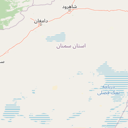
Map view of Khar Turan National Park

Use this park location map to pinpoint Khar Turan National Park in Iran, understand its exact geographic position, and read its mapped placement within the surrounding landscape more clearly.

Pigeon | © OpenStreetMap contributors

Location context for Khar Turan National Park

Semnan Province
Recorded earthquake history

Examine Historical Earthquake Records for Khar Turan National Park

Browse the archive of seismic activity associated by location with Khar Turan National Park. MoriAtlas provides this factual catalogue to help users understand recorded earthquake patterns and geographic proximity within the Semnan Province region.

Khar Turan National Park Earthquake History

Catalogued events

6 events

Strongest magnitude

Magnitude 4.8

Most recent event

Feb 10, 2005

This history includes earthquakes recorded inside the park or within 50 km of its borders

Park atlas

Uncover the geographic context of surrounding desert ecosystems, mountain ranges, and vital conservation landscapes across Iran.

Discover Nearby National Parks and Protected Areas Around Khar Turan National Park

Explore national parks and wildlife refuges beyond Khar Turan National Park, mapping diverse arid ecosystems and critical conservation areas across the Iranian Plateau. Compare landscapes, species strongholds, and geographic features to deepen your understanding of regional protected area distribution.
National parkGolestan province
About 187 km away#1 closest

North

Golestan National Park: Mapped Protected Area in Golestan Province, Iran

Explore its geographic context and landscape identity.

Golestan National Park is a designated national park situated in Iran's Golestan province. This page details its protected landscape, offering insights into its geographic placement and mapped boundaries. Ideal for users seeking to understand the park's role within regional geography and its specific natural terrain features, this entry serves as a primary atlas point for Golestan National Park.

Area
918.95 km²
IUCN
II
Relief
Mountain
Climate
Temperate
National parkIran
271 km away#2 closest

West

Kavir National Park: A Major Protected Desert Landscape in Iran

Explore its arid terrain, conservation significance, and mapped boundaries.

Kavir National Park stands as a significant protected area within Iran, encompassing a vast 4,000 square kilometer expanse of desert and steppe landscapes on the western flank of the Kavir Desert. Designated as a national park, it plays a crucial role in preserving one of the Middle East's most extensive arid ecosystems and serves as a critical sanctuary for endangered species, including the Asiatic cheetah and Persian leopard. Its stark, open terrain offers a profound example of Iran's natural heritage and provides essential data for understanding regional geography and protected land distribution.

Area
4,000 km²
Established
1982
IUCN
II
Relief
Lowland
Watercolor illustration of a rolling landscape with scattered trees and distant hills
National parkIran
272 km away#3 closest

Northeast

Tandooreh National Park: National Park in Iran with Detailed Geographic and Landscape Context

Explore protected area boundaries and regional terrain within Iran's geography.

Tandooreh National Park offers a distinct geographic identity within Iran's expansive natural atlas. As a designated national park, it serves as a vital point for understanding mapped protected landscapes, analyzing regional terrain patterns, and appreciating the country's commitment to conservation. This entry provides the structured geographic details necessary for exploring the park's specific landscape characteristics and its place within the broader Iranian context.

Area
355.4 km²
Established
1982
IUCN
II
Relief
Mountain
National parkMazandaran Province
About 353 km away#4 closest

West

Lar National Park National Park: Mapped Protected Landscape and Alborz Geography

Alpine terrain and regional context within Mazandaran Province.

Lar National Park stands as a critical national park, encompassing approximately 30,000 hectares of alpine and sub-alpine wilderness in Mazandaran Province, Iran. Its protected landscape is characterized by steep mountain valleys and ridgelines, situated at the southern base of Mount Damavand. This atlas-focused view reveals the park's mapped boundaries and its significant geographic position within the Central Alborz mountain range, crucial for understanding Iran's protected natural areas.

Area
300 km²
Established
1976
IUCN
II
Relief
Mountain
National parkTehran Province
384 km away#5 closest

West

Sorkheh Hesar National Park: Protected Mountain Forest Landscape Near Tehran

Explore its mapped terrain and regional protected area context.

Sorkheh Hesar National Park stands as a significant protected forest area within Tehran Province, Iran. Spanning 9,380 hectares, this mountainous national park is characterized by its unique semi-arid climate and crucial role in conserving threatened species, including the Persian fallow deer and Persian leopard. The Jajrood River flows through its landscape, enhancing biodiversity and supporting a rich forest ecosystem. Its proximity to Tehran makes it a notable example of urban-adjacent conservation, offering valuable insights into protected land management and regional geography.

Area
93.8 km²
Established
1980
IUCN
II
Climate
Arid
Watercolor painting of rolling hills, a body of water, and vegetation
National parkBaku
About 694 km away#6 closest

Northwest

Absheron National Park: Coastal Azerbaijan National Park with Caspian Seal Habitats

Explore mapped geography and semi-desert terrain near Baku.

Absheron National Park, located near Baku on the Absheron Peninsula, is a significant national park safeguarding coastal Caspian Sea environments. Its protected landscapes feature semi-arid terrain and are vital for the conservation of Caspian seals and migratory waterbirds. MoriAtlas provides a structured overview of this unique protected area, focusing on its geographic features, ecological importance, and its role as a key national park within Azerbaijan's atlas of natural reserves.

Area
7.83 km²
Established
2005
IUCN
II
Relief
Lowland
National parkIran
About 707 km away#7 closest

South

Khabr National Park: Protecting Iran's Montane Terrain and Landscapes

Explore its mapped boundaries and geographic significance.

Khabr National Park represents a vital protected area within Iran's Kerman Province, specifically recognized for its rugged mountainous terrain. Situated in a region known for its topographic complexity, the park serves as a conservation focus for the montane ecosystems characteristic of southeastern Iran. Understanding Khabr National Park offers insight into the mapped landscapes and regional geography of the Zagros foothills, highlighting its importance as a protected natural asset.

IUCN
II
Access
Access unknown
Scope
Terrestrial
Season
Seasonal
Nature reserveLankaran District
About 711 km away#8 closest

Northwest

Ghizil-Agaj State Reserve: Mapping the Caspian Coastal Protected Landscape in Azerbaijan

Regional geography and wetland terrain in Lankaran District

Spanning the shallow inlets of the southwestern Caspian Sea, Ghizil-Agaj State Reserve represents a critical protected wetland area. Its geography is defined by a transition between open water, marshy coastal strips, and salt-affected semi-desert zones. By analyzing the reserve's boundaries and hydrological features, one gains a clearer understanding of how this significant natural landscape functions within the broader environmental context of the South Caucasus.

Area
884 km²
Established
1929
Relief
Lowland
Climate
Subtropical

Common questions about visiting, size, designation, and location context for Khar Turan National Park

Khar Turan National Park FAQs for park facts, access, geography, and protected area context

Find quick answers about Khar Turan National Park, including protected-area facts, park geography, trail and visitor context, and how the park fits into its surrounding country and regional landscape.
MoriAtlas Explorer

Continue Your Protected Areas Search Across the Global Atlas

Deepen your exploration by continuing the structured search for national parks and protected areas worldwide. Utilize the comprehensive filtering capabilities to compare different conservation landscapes and refine your understanding of global park geography. Discover more about the distribution and characteristics of protected natural areas.

Global natural geography