

Mori Atlas logo
Marine protected areaKoh Rong National Park

Explore the mapped geography and island archipelago of this significant Gulf of Thailand marine park.

Koh Rong National Park: Cambodia's Pioneering Marine Protected Area Landscape

(Koh Rong Marine National Park)

Koh Rong National Park represents Cambodia's inaugural marine national park, established to protect the unique ecosystems of the Koh Rong Archipelago. This protected landscape comprises seven tropical islands situated in the Gulf of Thailand, covering extensive land and marine territories. Its designation as a marine protected area highlights its critical role in conserving coastal and island environments, featuring dense vegetation, sandy beaches, and surrounding coral reef systems that are integral to its geographic and ecological identity.

Marine National ParkIsland ArchipelagoTropical IslandsCoral ReefsImportant Bird AreaCoastal Protection
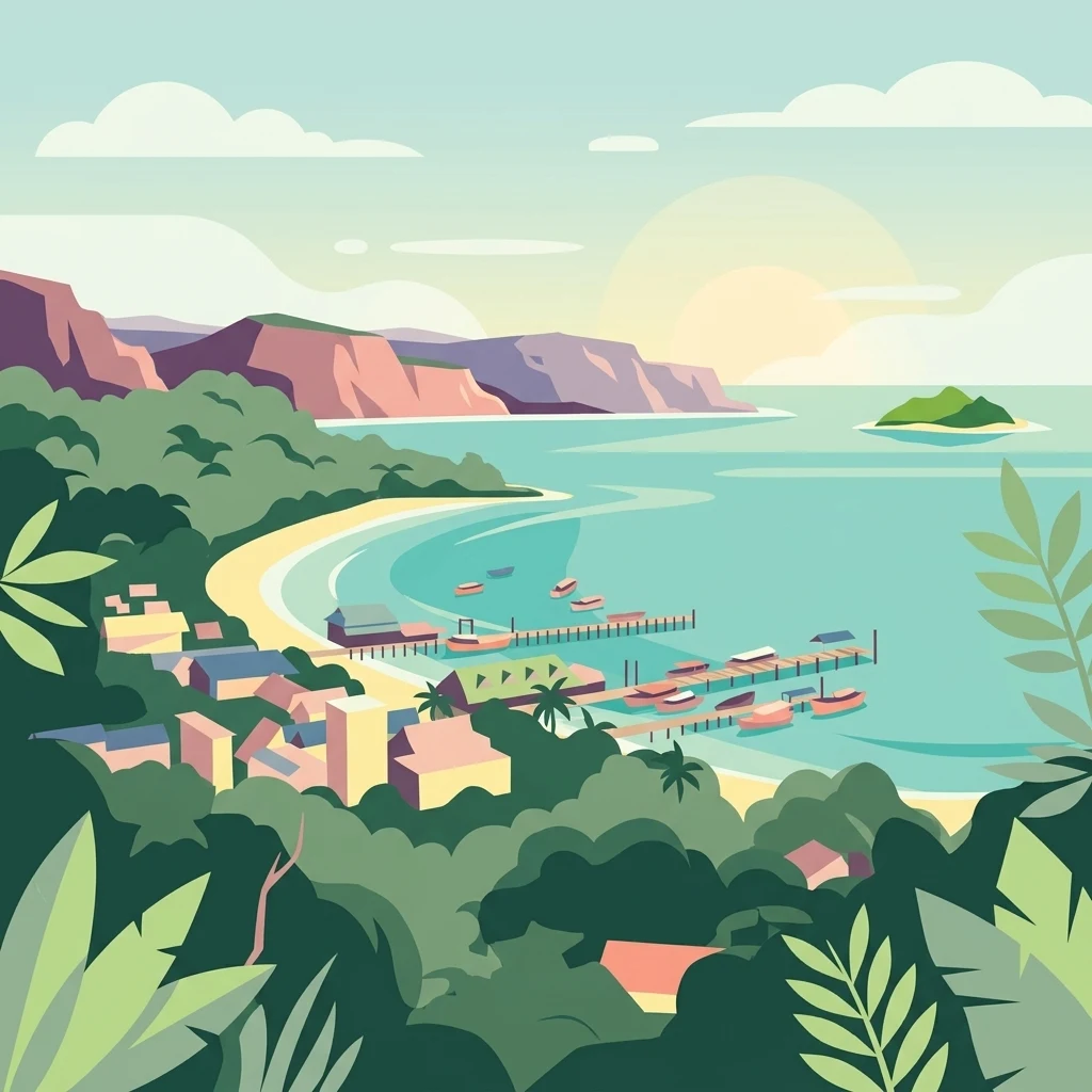
Illustration of tropical coastal scene with beach settlement, pier with boats, cliffs, and island in the distance

Koh Rong National Park

Marine protected area

Park overview

Structured park overview, official facts, and landscape profile for Koh Rong Marine National Park

Koh Rong Marine National Park park facts, protected area profile, and essential visitor context

Review the core facts for Koh Rong Marine National Park, including designation, size, terrain, visitor scale, habitats, and operating context in one park-focused overview.

About Koh Rong Marine National Park

Koh Rong Marine National Park represents a landmark achievement in Cambodia's environmental protection efforts, serving as the nation's first designated marine national park. Located in the warm waters of the Gulf of Thailand off the southwestern coast of Cambodia, the park protects the Koh Rong Archipelago, a chain of seven islands spanning Koh Rong, Koh Rong Sanloem, Koh Oun, Koh Song Saa, Koh Tatiem, Koh Touch, Koh Manoa Krav, and Koh Manoa Knong. The establishment of this protected area in February 2018 marked a pivotal moment in Cambodian conservation history, reflecting growing governmental commitment to preserving marine biodiversity and coastal ecosystems that had previously lacked formal national-level protection. The Ministry of Environment holds administrative responsibility for the park, overseeing management of both terrestrial island environments and the surrounding marine waters that form the backbone of the archipelago's ecological identity. Beyond its conservation mandate, the Koh Rong Archipelago has emerged as a destination of growing tourism significance, with visitors drawn to its pristine beaches, coral reef diving opportunities, and the relatively undeveloped character of its islands compared to more commercialized Southeast Asian coastal destinations.

Quick facts and research context for Koh Rong Marine National Park

Koh Rong Marine National Park is located in Preah Sihanouk province, Cambodia, protecting the seven islands of the Koh Rong Archipelago in the Gulf of Thailand. Established in February 2018, it was Cambodia's first designated marine national park, covering 524 square kilometers of land and water. The park is governed by Cambodia's Ministry of Environment and has been recognized by BirdLife International as an Important Bird Area due to its population of Malaysian plovers.

Protection and recognition

Exploring the mixed protection scope and official designations of the Cambodian island park

Koh Rong National Park Protection Status and Designation Framework

National park databases record the official boundaries and mixed protection scope of Koh Rong National Park to help researchers understand its geographic management. Explorers can examine documented classification records and find essential designation details defining the conservation framework of the island environment.

Protection details

Protection scope
Mixed
Transboundary protection
No
Park context

Deeper park guide and search-rich context for Koh Rong Marine National Park

Koh Rong Marine National Park history, landscape, wildlife, and travel context

Explore Koh Rong Marine National Park through its history, landscape character, ecosystems, wildlife, conservation priorities, cultural context, and seasonal travel timing in a structured park guide built for atlas discovery and search intent.

Why Koh Rong Marine National Park stands out

Koh Rong Marine National Park is best known as Cambodia's pioneering marine protected area, established to conserve the country's first dedicated marine park. The archipelago is distinguished by its tropical island landscapes, surrounding coral reef environments, and designation as an Important Bird Area supporting significant populations of Malaysian plovers. The park encompasses diverse coastal and marine habitats across seven islands, representing a cornerstone of Cambodia's emerging marine conservation framework.
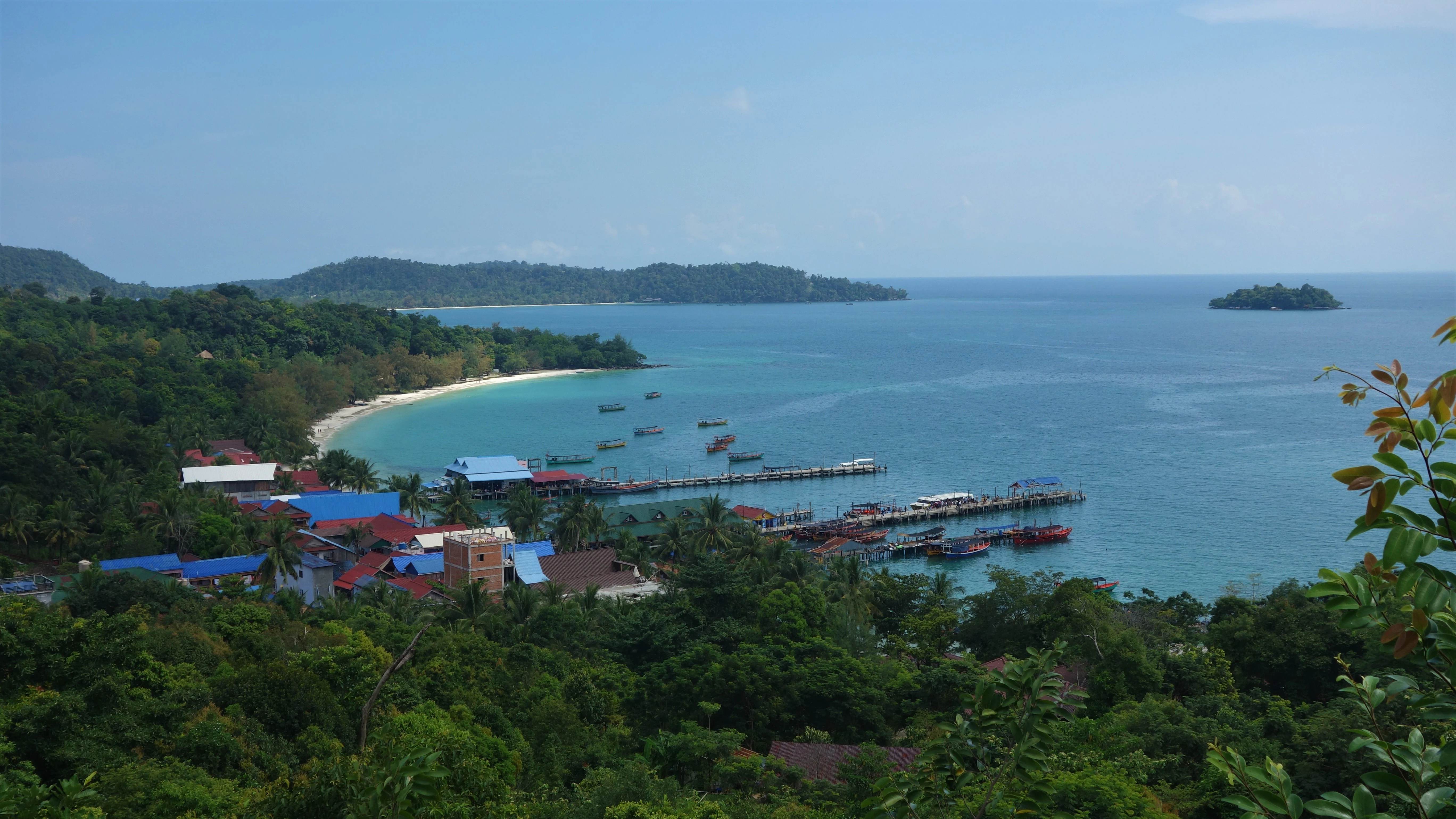
Panoramic coastal landscape showing sandy beach, turquoise ocean, docked boats, and dense green forest with buildings along the shoreline
Coastal view of Koh Rong Island with sandy beach, turquoise water, and red-roofed buildings

Koh Rong Marine National Park history and protected-area timeline

Koh Rong Marine National Park was officially established in February 2018, representing Cambodia's first marine national park and a significant expansion of the country's protected area network. Prior to this designation, the islands of the Koh Rong Archipelago lacked formal national-level protection despite their ecological importance and growing tourism pressure. The creation of the park reflected Cambodia's broader environmental policy evolution, which had previously focused primarily on terrestrial protected areas. The Ministry of Environment assumed responsibility for park management, implementing a framework designed to balance conservation objectives with sustainable tourism development. This establishment came amid increasing recognition of the need to protect marine coastal ecosystems in the Gulf of Thailand, which face pressures from development, fishing activity, and climate-related impacts.

Koh Rong Marine National Park landscape and geographic character

The Koh Rong Archipelago consists of seven islands situated in the Gulf of Thailand, characterized by tropical island landscapes featuring dense vegetation-covered landmasses, sandy beaches, and surrounding marine environments. The islands display typical Southeast Asian coastal geography, with the main islands of Koh Rong and Koh Rong Sanloem serving as the largest and most prominent landforms in the archipelago. The terrestrial portions feature tropical forest vegetation, while the surrounding waters contain coral reef systems and seagrass beds that contribute to the marine ecosystem's complexity. The landscape transitions from forested island interiors to coastal beaches and reef-flanked shorelines, creating a mosaic of habitats that defines the archipelago's physical character.

Koh Rong Marine National Park ecosystems, habitats, and plant life

The marine and terrestrial environments of Koh Rong Marine National Park support interconnected tropical ecosystems. The surrounding waters of the Gulf of Thailand contain coral reef communities that provide habitat for various marine species, while the islands themselves support terrestrial vegetation communities. The designation as an Important Bird Area by BirdLife International highlights the significance of the archipelago for avian species, particularly the Malaysian plover, which breeds and feeds in the coastal areas. The marine component encompasses both coral reef and pelagic environments, creating a protected area that addresses both coastal and open-water conservation needs within a single management framework.

Koh Rong Marine National Park wildlife and species highlights

The Koh Rong Archipelago provides habitat for several notable wildlife species, with the Malaysian plover representing a particularly significant bird population. This shorebird species relies on the archipelago's sandy beaches and coastal areas for breeding and foraging, making the protected area designation particularly important for its conservation. The surrounding marine waters support reef-associated fish species and other invertebrates that inhabit the coral structures. While comprehensive species inventories for the park remain limited in available sources, the Important Bird Area designation indicates the archipelago's role in supporting populations of conservation concern.

Koh Rong Marine National Park conservation status and protection priorities

The establishment of Koh Rong Marine National Park marked a foundational step in Cambodia's marine conservation framework, creating the country's first dedicated marine protected area. The park's designation as an Important Bird Area by BirdLife International further elevates its conservation significance at an international level, recognizing the archipelago's role in supporting significant bird populations. The 524-square-kilometer protected area encompasses both terrestrial and marine environments, enabling integrated conservation management across the island ecosystem. The Ministry of Environment's oversight reflects governmental commitment to maintaining the park's ecological integrity while establishing sustainable use frameworks that balance conservation with compatible human activities.

Koh Rong Marine National Park cultural meaning and human context

The Koh Rong Archipelago exists within the broader context of Cambodia's coastal communities and maritime traditions. The islands have historically supported small-scale fishing communities and have more recently become destinations for tourism development. The protected area designation intersects with these existing human uses, establishing conservation frameworks that must balance environmental protection with the livelihoods and activities of local communities who depend on the archipelago's resources. This cultural dimension reflects the broader challenge of integrating conservation objectives with sustainable development in Cambodia's coastal regions.

Top sights and standout views in Koh Rong Marine National Park

Koh Rong Marine National Park stands as Cambodia's first marine national park, a pioneering protected area established in 2018 to conserve tropical island and marine ecosystems in the Gulf of Thailand. The archipelago's designation as an Important Bird Area underscores its international conservation significance, particularly for Malaysian plover populations. Seven islands are included within the 524-square-kilometer protected boundary, spanning both land and water environments. The park represents a cornerstone of Cambodia's emerging marine conservation strategy and provides habitat for both terrestrial and marine biodiversity.

Best time to visit Koh Rong Marine National Park

The best time to visit Koh Rong Marine National Park generally corresponds to the dry season in Cambodia, typically from November to May, when rainfall is minimal and sea conditions are more favorable for marine activities such as snorkeling and diving around the reef systems. The cooler dry season offers more comfortable conditions for exploring the islands, though temperatures remain warm given the tropical location. The wet season from May to October brings increased rainfall and rougher sea conditions, which may limit access to some areas and reduce visibility for underwater activities. Visitors seeking to maximize their experience of the park's marine environments should consider planning trips during the dry season months when conditions are most suitable for reef exploration and island activities.
Monthly climate preview

Long-term representative point measurements tracking monthly temperature and rainfall cycles

Koh Rong National Park Climate Normals: Annual Temperature and Precipitation Patterns

Representative coordinate records show persistent warmth alongside distinct monthly precipitation variations across the year. Detailed twelve-month climate normals provide deeper insight into long-term meteorological patterns.
Annual mean28 °C
27 °C29 °C
Jan27°
Feb27°
Mar28°
Apr29°
May29°
Jun29°
Jul28°
Aug28°
Sep28°
Oct28°
Nov28°
Dec27°
Warmest month
May

29.2 °C

Coolest month
January

27 °C

Wettest month
July

13.7 mm/day

Driest month
February

0.9 mm/day

Park location guide

Geography guide, regional context, and park location map for Koh Rong Marine National Park

Koh Rong Marine National Park park geography, regions, and map view in Cambodia

Understand where Koh Rong Marine National Park sits in Cambodia through a broader geographic reading of the surrounding landscape, nearby location context, and its mapped position within the national park landscape.

How Koh Rong Marine National Park fits into Cambodia

Cambodia is a unitary parliamentary constitutional elective monarchy in Southeast Asia. The country spans 181,035 km² and is characterized by a low-lying plain centered around the Mekong River and Tonlé Sap, Southeast Asia's largest lake. Its capital and largest city is Phnom Penh. The nation has a tropical climate and is home to a predominantly Khmer ethnic population. Cambodia has a history dating back to the Khmer Empire established in 802 AD.

Wider geography shaping Koh Rong Marine National Park in Cambodia

Cambodia occupies 181,035 km² in Mainland Southeast Asia. It is bordered by Thailand to the northwest, Laos to the north, and Vietnam to the east, with a coastline along the Gulf of Thailand in the southwest. The terrain is dominated by a low-lying central plain centered around the confluence of the Mekong River and Tonlé Sap, Southeast Asia's largest lake. The country has a tropical climate.

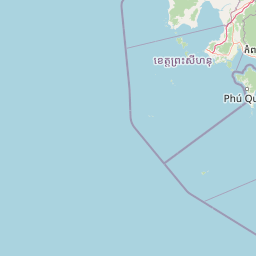
Map view of Koh Rong Marine National Park

Use this park location map to pinpoint Koh Rong Marine National Park in Cambodia, understand its exact geographic position, and read its mapped placement within the surrounding landscape more clearly.

Pigeon | © OpenStreetMap contributors

Browse comprehensive imagery to understand the diverse coastal geography, coral reefs, and tropical island environments within this Cambodian protected area.

Koh Rong National Park: Visual Landscapes, Island Scenery, and Protected Marine Habitats

Visually explore the distinctive landscapes of Koh Rong National Park, showcasing its tropical islands, sandy beaches, dense vegetation, and vital marine environments including coral reefs. These compelling images provide essential insight into the park's physical terrain, diverse habitats, and overall protected-area character, enhancing geographic understanding of Cambodia's pioneering marine conservation efforts.

Panoramic coastal landscape showing sandy beach, turquoise ocean, docked boats, and dense green forest with buildings along the shoreline

Park atlas

Compare coastal and island protected area geography, mapping their spread around Koh Rong National Park.

Explore Adjacent National Parks, Marine Protected Areas Near Koh Rong National Park

Discover other national parks and protected areas near Koh Rong National Park, focusing on marine conservation landscapes, island ecosystems, and coastal geography across Cambodia. Comparing these diverse protected areas provides valuable geographic context for understanding regional conservation efforts and distinct environmental features.
National parkCambodia
About 20 km away#1 closest

North

Botum Sakor National Park: Cambodia's Largest National Park and Coastal Wilderness

Explore its mapped geography and protected landscape features.

Botum Sakor National Park represents Cambodia's largest national park, offering a unique protected landscape where the Cardamom Mountains meet the Gulf of Thailand. The park's diverse geography includes extensive evergreen forests, grasslands, and significant coastal wetland ecosystems, such as mangrove and freshwater swamp forests. Examining its mapped boundaries reveals a critical area for biodiversity and regional ecological context within Southeast Asia's protected lands.

Area
1,825.85 km²
Established
1993
IUCN
II
Relief
Lowland
National parkSihanoukville Province
About 55 km away#2 closest

Southeast

Ream National Park: Protected Coastal Landscape and Marine Biodiversity in Sihanoukville Province

Explore unique mangrove ecosystems and mapped terrain within Cambodia.

Ream National Park is a significant protected area in Cambodia, celebrated for its intricate coastal and terrestrial ecosystems. This national park offers a detailed view of mangrove wetlands, evergreen forests, rolling hills, and marine habitats like coral reefs and sea grass beds. Situated in Sihanoukville Province, its landscape is characterized by rivers flowing through the terrain into the sea, providing vital habitats for diverse species and contributing to its atlas significance for regional geography and protected-area study.

Area
210 km²
Established
1993
IUCN
II
Relief
Mountain
Watercolor illustration of a sandy beach with calm water and mountainous landscape in the background
National parkKiên Giang Province
About 72 km away#3 closest

Southeast

Phú Quốc National Park: Comprehensive Protected Island Landscape and Geography

Explore the mapped terrain and unique ecosystems of this national park.

Phú Quốc National Park offers a unique exploration of a fully protected tropical island ecosystem, encompassing significant landmass and marine territory within Kiên Giang Province. As Vietnam's largest island national park, it showcases a diverse array of landscapes, from dense forests blanketing rolling hills to vital coastal and marine protected areas essential for regional biodiversity. This park provides a focused lens for understanding island protected area management and geographic context within the Gulf of Thailand.

Area
314.22 km²
Established
2001
IUCN
II
Relief
Mixed relief
National parkKampot Province
About 86 km away#4 closest

East

Preah Monivong Bokor National Park: An ASEAN Heritage Mountain Park in Kampot Province

Explore diverse forests and colonial history within its mapped terrain.

Preah Monivong Bokor National Park is a protected national park in Kampot Province, Cambodia, distinguished by its mountainous geography within the Dâmrei Mountains. Covering over 1,500 square kilometers, it showcases varied forest ecosystems and is recognized as an ASEAN Heritage Park. The park's landscape combines significant natural biodiversity with remnants of French colonial history, offering a rich context for atlas-based geographic exploration and protected-area understanding.

Area
1,544.58 km²
Established
1993
IUCN
II
Relief
Mountain
National parkKoh Kong province
About 92 km away#5 closest

Northeast

Southern Cardamom National Park: A Vital Protected Landscape in Koh Kong Province

Explore its mapped boundaries and conservation significance.

Southern Cardamom National Park is a crucial protected area in southwestern Cambodia, encompassing a significant portion of the Cardamom Mountains. This national park serves as a vital atlas point for understanding the regional geography and conservation efforts in Southeast Asia. Its expansive territory is dedicated to safeguarding critical habitats and supporting ambitious wildlife programs, making it a cornerstone of landscape-level conservation and a key element in mapping the protected areas of the region.

Area
4,103.92 km²
Established
2016
IUCN
II
Relief
Mountain
National parkKampong Speu Province
About 100 km away#6 closest

Northeast

Kirirom National Park: Cambodia's Pioneering Protected Mountain Landscape

Explore its mapped terrain and regional geography in Kampong Speu Province

Kirirom National Park stands as Cambodia's foundational national park, safeguarding a significant portion of the eastern Cardamom Mountains. This protected landscape is defined by its elevated terrain and mountain forest ecosystems, offering a distinct geographic character within Kampong Speu Province. Its atlas-style exploration reveals the mapped boundaries and regional context of this pioneering conservation area, providing insight into Cambodia's commitment to preserving its natural heritage.

Area
283.75 km²
Established
1993
IUCN
II
Relief
Mixed relief
National parkKep Province
About 116 km away#7 closest

East

Kep National Park: Cambodia's Coastal Mountain Protected Landscape

Explore mapped terrain and panoramic viewpoints of this national park.

Kep National Park is a protected national park situated in Kep Province, Cambodia, known for its unique hilly terrain that rises from the coastal lowlands. This protected area offers elevated viewpoints with commanding sights across the Gulf of Thailand, stretching towards Phu Quoc island and the distant Bokor Ranges. Its landscape character is defined by the contrast between its mountainous interior and the surrounding flat coastal regions, making it a significant feature for understanding regional geography and mapped protected areas. The park provides an accessible experience of Cambodia's coastal mountainous ecosystems.

Area
11.52 km²
Established
1993
IUCN
II
Relief
Mountain
National parkCambodia
About 139 km away#8 closest

North

Central Cardamom Mountains National Park: Cambodia's Premier Protected Rainforest Landscape

Explore Extensive Rainforest, Diverse Habitats, and Mountain Terrain

Central Cardamom Mountains National Park is Cambodia's largest protected area, a testament to significant rainforest conservation efforts. This national park spans approximately 4,010 square kilometers, showcasing a dynamic mountainous landscape with diverse ecological zones from coastal areas to peaks over 1,500 meters. Discover the geographic distribution of its protected boundaries and the rich tapestry of habitats that define this vital Southeast Asian natural reserve, offering deep context for atlas-based exploration.

Area
4,010.65 km²
Established
1999
IUCN
II
Relief
Mountain

Common questions about visiting, size, designation, and location context for Koh Rong Marine National Park

Koh Rong Marine National Park FAQs for park facts, access, geography, and protected area context

Find quick answers about Koh Rong Marine National Park, including protected-area facts, park geography, trail and visitor context, and how the park fits into its surrounding country and regional landscape.
MoriAtlas Explorer

Continue Your Protected Areas Search Across the Global Atlas

Deepen your exploration by continuing the structured search for national parks and protected areas worldwide. Utilize the comprehensive filtering capabilities to compare different conservation landscapes and refine your understanding of global park geography. Discover more about the distribution and characteristics of protected natural areas.

Global natural geography
