Why Morrocoy National Park stands out
Morrocoy National Park is best known for its extensive mangrove ecosystems that dominate the coastal landscape and serve as critical bird sanctuaries, particularly on the mangrove-covered island of Pájaros. The park's network of small cays with pristine white sand beaches, such as Cayo Sombrero and Cayo Azul, represent some of the most distinctive coastal scenery in northern Venezuela. The area supports exceptional biodiversity across marine, coastal, and terrestrial environments, including approximately 266 bird species, four species of marine turtles, and diverse coral reef communities. The juxtaposition of mangroves, cays, and the surrounding tropical dry forest creates a unique composite landscape that distinguishes Morrocoy from other Venezuelan protected areas.
Morrocoy National Park history and protected-area timeline
Morrocoy National Park was officially declared a national park on May 26, 1974, establishing federal protection for the coastal ecosystems and landscapes of the Falcón State shoreline. The creation of the park reflected growing recognition in Venezuela during the 1970s of the need to preserve representative coastal and marine environments along the Caribbean coast. The park was assigned to INPARQUES, Venezuela's national park service, for management and administration. In subsequent years, the park gained additional recognition when BirdLife International designated it as an Important Bird Area, acknowledging the global significance of its bird populations. The park exists within the same geographic area as the Cuare Wildlife Refuge, and both protected areas work together to preserve the ecological integrity of the broader coastal zone.
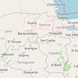
Morrocoy National Park landscape and geographic character
The physical landscape of Morrocoy National Park is defined by the intersection of coastal lowlands, rolling hills, marine waters, and a distinctive chain of cays. The Chichiriviche hills represent the most prominent topographic feature, with the highest peak reaching 285 meters above sea level. These hills rise abruptly from the surrounding coastal plain and form a visual anchor for the park, visible from the marine areas and cays offshore. The hills are composed of limestone of Tertiary coral origin, part of the Capadare-Agua Linda geological formation. The coastal zone consists of tidal flats, coastal lagoons, marshes, and extensive mangrove areas that transition smoothly between terrestrial and marine environments. The cays and islets scattered along the coast feature shallow seabeds and saline shoals, with beaches of fine white sand that are characteristic of the Caribbean coast. The marine portion of the park includes the clear, warm waters of the Caribbean Sea surrounding the cays, with coral reef formations occurring in the shallower areas.
Morrocoy National Park ecosystems, habitats, and plant life
The ecological character of Morrocoy National Park reflects its position in the tropical dry forest zone of northwestern Venezuela, with vegetation patterns closely tied to geomorphological position and moisture availability. The park's vegetation ranges from evergreen species such as olives in the more stable coastal areas to deciduous species including Bursera simaruba in transitional zones. Along the coast and in mangrove areas, specialized plants such as glass grass have adapted to high salinity soils. The eastern slopes of the Chichiriviche hills support xerophytic vegetation including cacti species. The mangrove forests represent the most ecologically significant vegetation type, forming a continuous belt along the coast and around the cays. These mangroves dominate approximately 4,500 hectares and provide critical habitat functions for numerous species. Marine ecosystems include extensive seagrass beds, which serve as primary food for green turtles, and coral reef communities that support diverse marine life. The underwater environment also features a wide variety of algae species contributing to the overall productivity of the marine area.
Morrocoy National Park wildlife and species highlights
Morrocoy National Park supports exceptional wildlife diversity across marine, wetland, and terrestrial environments. The park is home to approximately 266 bird species, with notable populations including the scarlet ibis, which roosts in the mangroves, as well as vulnerable species such as the American flamingo, tricolored heron, and brown pelican. The park has been designated an Important Bird Area by BirdLife International due to its significance for waterbirds and mangrove-associated species. The mangrove-covered island of Pájaros serves as a particularly important bird sanctuary. Mammals found in the park include brocket deer and white-tailed deer in the hill areas, as well as anteaters, crab-eating foxes, howler monkeys, three-toed sloths, opossums, pacas, agoutis, and peccaries. Marine mammals including dolphins and whales use the park as a refuge. The marine environment supports four species of threatened sea turtles: green, hawksbill, leatherback, and olive ridley, as well as the American crocodile. Fish diversity includes grouper, snapper, tarpon, snook, barracuda, and numerous reef species, while shellfish include mangrove oysters, spiny lobsters, and various crab species.
Morrocoy National Park conservation status and protection priorities
Morrocoy National Park plays a significant conservation role in Venezuela's protected area system, preserving representative examples of Caribbean coastal ecosystems that face multiple pressures. The park's designation as an Important Bird Area by BirdLife International acknowledges its global significance for bird conservation, particularly for waterbird populations that depend on mangrove habitats. The marine protected area status helps preserve coral reef communities and seagrass beds that serve as feeding grounds for endangered sea turtles. However, the park faces conservation challenges, as the source material notes that wildlife has suffered from human activity and there has been a significant decline in coral species in recent years. The mangrove ecosystem, covering approximately 4,500 hectares, provides critical ecological services including coastal protection, nutrient cycling, and habitat provision, making its preservation essential for maintaining the overall health of the coastal zone.
Morrocoy National Park cultural meaning and human context
Morrocoy National Park exists within a region of historical human settlement along the Falcón coast, with neighboring towns including Tucacas, Chichiriviche, Boca de Aroa, and Tocuyo de la Costa that predate the park's establishment. These communities have traditional connections to the marine and coastal resources of the area, including fishing activities that continue in the surrounding waters. The park's name and local identity are tied to the broader geographical context of the Gulf Triste coastline. The cave of the Holy Virgin mentioned in the source material represents a cultural landmark within the park, indicating the presence of historical human use and spiritual connection to certain sites within the protected area.
Top sights and standout views in Morrocoy National Park
Morrocoy National Park's standout features include its extensive mangrove forests covering approximately 4,500 hectares that form a critical ecological backbone for the entire protected area, its network of pristine cays with white sand beaches such as Cayo Sombrero and Cayo Azul accessible primarily by boat, and its designation as an Important Bird Area supporting significant populations of waterbirds including the iconic scarlet ibis. The park offers exceptional opportunities for snorkeling and diving among coral reefs and mangroves, particularly at Los Juanes where two islands provide access to reef environments. The Chichiriviche hills provide the only significant topographic variation in the park and support terrestrial mammal species. The clear Caribbean waters surrounding the cays create ideal conditions for observing marine turtles and reef fish.
Best time to visit Morrocoy National Park
The climate of Morrocoy National Park is warm tropical throughout the year, with temperatures relatively stable between 27 and 35 degrees Celsius, dropping to 23-26 degrees during cooler periods. The rainy season extends from August to December, with November and December typically receiving the highest precipitation. For visitors seeking optimal conditions, the drier months from January through July generally offer more stable weather and clearer skies, making them favorable for beach activities, snorkeling, and wildlife observation. The period from October to December, while wetter, may still provide good birdwatching opportunities as waterfowl populations become more concentrated in the mangroves as water levels rise.