Why Salawin National Park stands out
Salawin National Park is best known for protecting a substantial stretch of the Salween River as it flows through northern Thailand, together with the mountainous forest landscape of the Dawna Range. The park contains Thailand's second-largest teak tree and supports one of the more intact forest ecosystems in the region. Its location along the Thai-Burma border places it at the crossroads of multiple forest types and provides habitat for significant wildlife including tigers, gaurs, and gibbons. The park is also notable for its cultural dimension, encompassing Karen communities such as Ta Tar Fan village.
Salawin National Park history and protected-area timeline
The area that became Salawin National Park was originally designated as the Salawin National Reserved Forest. In 1989, a formal survey was conducted to assess the Mae Yuam and Salawin forests, establishing the scientific basis for potential protection. The formal establishment of Salawin National Park was approved in 1993, and the park was officially declared as Thailand's 78th national park on November 9, 1994, covering an area of 450,950 rai (approximately 721 square kilometers). The park's conservation history has been marked by significant challenges. In 1997, a major illegal logging scandal was uncovered, involving collusion between forestry officials and military personnel. The illegal harvesting operations, which continued from 1996 to 1998, affected nearly a third of the trees within Salawin National Park as well as adjacent areas of the Salawin Wildlife Sanctuary. This event represented one of the most significant instances of protected area degradation in Thailand during that period and prompted increased attention to enforcement and monitoring within the park.
Salawin National Park landscape and geographic character
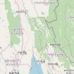
Salawin National Park's landscape is defined by the mountainous terrain of the Dawna Range, a branch of the Thanon Thong Chai Range that extends along the Thai-Burma border. The topography is characterized by steep, forested slopes and narrow valleys carved by the park's numerous tributaries. Elevation ranges from approximately 200 meters along the main river corridors to 1,109 meters at Doi Khun Mae Kon, the highest peak within the park. The Salween River, one of Southeast Asia's longest rivers, forms the western boundary of the park and represents its most significant watercourse. The park contains the headwaters and tributaries of several major rivers including the Yuam River, Kong Kha, Mae Ngae, and Han River, all of which ultimately flow into the Salween system. This dendritic drainage pattern has created a complex landscape of ridges and valleys with limited areas of flatter terrain restricted to the river floodplains and terraces.
Salawin National Park ecosystems, habitats, and plant life
The ecological character of Salawin National Park reflects its position in the transitional zone between the Himalayan-influenced forests of mainland Southeast Asia and the more tropical forest types of the Indochinese peninsula. The park supports several distinct forest types. Deciduous dipterocarp forest dominates the lower slopes and valleys, with teak (Tectona grandis) being the most economically and ecologically significant species. The park is notable for containing Thailand's second-largest teak tree. Semi-evergreen and dry evergreen forests occur at higher elevations and in areas with more moisture. Dipterocarp forest types present in the park include species such as Andaman redwood (Pterocarpus dalbergioides), various Dipterocarpus species, mai daeng (Xylia xylocarpa), makha (Afzelia xylocarpa), Siamese sal (Shorea obtusa), and takhian (Hopea odorata). The forest composition reflects the park's significance as a remaining area of relatively intact forest in northern Thailand, though past logging pressure has left an imprint on forest structure and composition.
Salawin National Park wildlife and species highlights
Salawin National Park supports a diverse mammalian fauna reflective of the forests and mountains of the Thai-Burma border region. Large mammals present in the park include tigers (Panthera tigris), gaurs (Bos gaurus), and various cervids. Smaller mammals include barking deer (muntjac), sambar deer, bears (Ursus spp.), gibbons (Hylobatidae), black giant squirrels, palm civets, serows, wild boars, hares, and treeshrews. The avian fauna includes both passerine and non-passerine species. Passerines documented in the park include brown shrikes, dark-necked tailorbirds, sooty-headed bulbuls, and white wagtails. Non-passerine birds include kingfishers and dollarbirds. The park also supports a notable butterfly fauna, with species such as the common birdwing (Troides helena), common mormon (Papilio polytes), common sailor (Neptis hylas), common sergeant (Athyma perius), magpie crow (Euploea radamanthus), orange oakleaf (Kallima inachus), and red helen (Papilio helenus) recorded. This diversity reflects the park's position within a biodiversity-rich region and its function as a corridor for wildlife movement along the mountainous border landscape.
Salawin National Park conservation status and protection priorities
Salawin National Park represents an important conservation area in northern Thailand, protecting significant watershed and forest resources along the country's border with Burma. The park's conservation significance derives from several factors: the presence of intact forest ecosystems in a region that has experienced extensive land-use change; the protection of the Salween River and its tributaries, which provide water resources for downstream communities; and the habitat it provides for species of conservation concern including tigers and gaurs. However, the park has faced significant conservation challenges. The illegal logging scandal of the late 1990s resulted in substantial forest degradation, with nearly a third of the park's trees harvested illegally between 1996 and 1998. This event highlighted vulnerabilities in park protection and management. The park exists within a complex of protected areas along the Thai-Burma border, connected to the Salawin Wildlife Sanctuary and other conservation units. This broader regional context is important for conservation planning, as many species utilize ranges that cross the international boundary.
Salawin National Park cultural meaning and human context
Salawin National Park contains populated areas within its boundaries, including the Karen village of Ta Tar Fan and the riverside settlement of Mae Sam Laep. The Karen people are the primary indigenous community in this border region, maintaining traditional practices that include agriculture and use of forest resources. The park's establishment required consideration of the relationship between conservation objectives and the rights and livelihoods of these local communities. The Salween River itself holds cultural significance for the various communities along its course, serving as a transportation route, source of livelihood, and boundary marker between Thailand and Burma. The border location has historically shaped human settlement patterns in the area, with both Thai and Burmese communities maintaining connections across the river. This human dimension adds complexity to park management, balancing biodiversity protection with recognition of traditional land uses and community needs.
Top sights and standout views in Salawin National Park
Salawin National Park's standout features include its dramatic mountain scenery within the Dawna Range, the scenic Salween River corridor forming the western boundary, and the presence of Thailand's second-largest teak tree. The park offers a relatively remote and less-visited wilderness experience compared to more accessible northern Thai parks, with opportunities to explore river landscapes, mountain trails, and Karen village communities. The biodiversity of the park, including significant mammal species such as tigers and gaurs, underscores its ecological importance. The park's establishment in 1994 and subsequent conservation challenges, particularly the illegal logging scandal, illustrate both the vulnerabilities and the ongoing commitment to protecting this frontier forest landscape.
Best time to visit Salawin National Park
Salawin National Park can be visited throughout the year, with each season offering different conditions. The cool dry season from November through February offers the most comfortable temperatures for exploration and represents the optimal period for wildlife viewing, as animals are more active near water sources and vegetation is less dense. The summer months from March to May bring higher temperatures and the beginning of the wet season, though this period still allows for park visits. The rainy season from June through October brings increased precipitation that can affect access to some areas and makes river crossings more challenging, but also results in lush forest scenery. Visitors should be aware that the park's remote location means that access and facilities are limited compared to more established tourism destinations in northern Thailand.