

Why Sierra Nevada de Santa Marta National Park stands out
Sierra Nevada de Santa Marta is best known for its extraordinary elevational gradient that creates multiple distinct ecological zones within a compact area. The range features the world's highest coastal peaks, tropical glaciers, and an isolated position that has allowed unique species to evolve. The park protects the northernmost páramo ecosystem in South America and contains extraordinary concentrations of endemic hummingbirds, with seven species found nowhere else on Earth. The area is also renowned for its cultural significance as the heartland of the Tairona civilization and the continuing presence of indigenous communities who maintain traditional governance over portions of the territory. The dramatic scenery of snow-capped peaks visible from Caribbean beaches creates one of the most striking visual landscapes in the world.
Sierra Nevada de Santa Marta National Park history and protected-area timeline
Sierra Nevada de Santa Marta National Park was established in 1964, becoming Colombia's second-oldest national park following the creation of Los Farallones de Cali. The selection of this area for early protection reflected recognition of its extraordinary ecological significance and scenic value. In 1979, the park was designated as a Biosphere Reserve by UNESCO through the Man and the Biosphere Programme, acknowledging its global importance for biodiversity conservation. The park exists within a complex landscape of indigenous territories, with the Kogui, Arhuaco, Kankuamo, and Wiwa peoples maintaining ancestral homelands within and adjacent to the protected area. The Tairona civilization, which flourished in this region before Spanish colonization, left architectural and cultural heritage that remains significant. More recently, the park gained international recognition when a 2013 report by the International Union for Conservation of Nature identified it as the most irreplaceable protected area in the world for threatened species, underscoring its critical importance for global biodiversity.
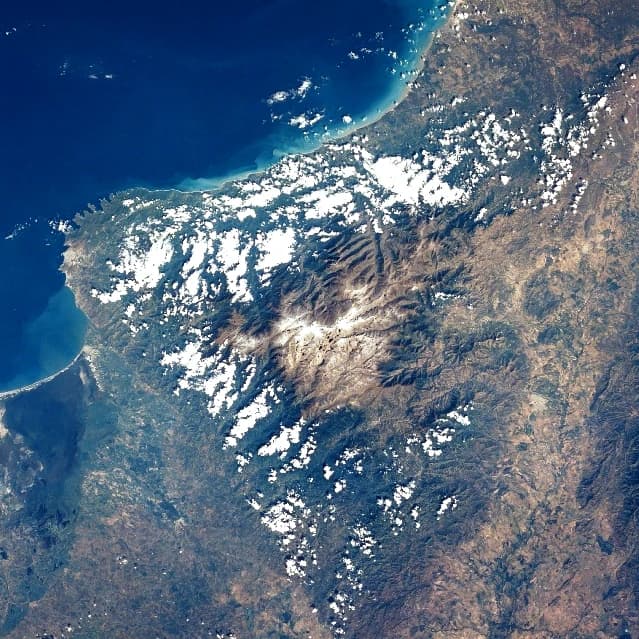
Sierra Nevada de Santa Marta National Park landscape and geographic character
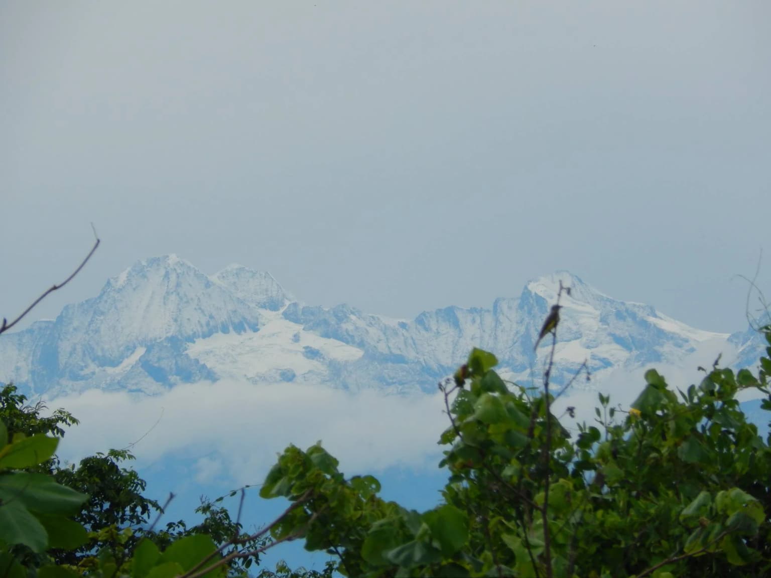
The Sierra Nevada de Santa Marta presents a dramatic landscape defined by its rapid transition from Caribbean coastal lowlands to tropical glaciers within an extremely short horizontal distance. The mountain range forms a compact, roughly circular mass covering about 17,000 square kilometers, with the highest peaks reaching approximately 5,700 meters at Pico Cristóbal Colón and Pico Simón Bolívar. The range rises so abruptly from the surrounding lowlands that it creates one of the most prominent mountain relief features on Earth, ranking as the world's fifth most topographically prominent summit. The geology consists primarily of Cretaceous metamorphic rocks including schists and gneisses, with Tertiary quartz-dioritic intrusives. The lower slopes feature dry forest environments, while the middle elevations support humid montane forests. Above 3,300 meters, the Santa Marta Páramo creates a unique high-altitude grassland ecosystem that represents the northernmost extension of páramo habitat in South America. Above 5,000 meters, permanent snow caps persist, creating a striking visual contrast with the Caribbean beaches visible from the lower elevations.
Sierra Nevada de Santa Marta National Park ecosystems, habitats, and plant life
The Sierra Nevada de Santa Marta supports an extraordinary range of ecosystems due to its dramatic elevational gradient and geographic isolation. From the Caribbean coast, the landscape transitions through xeric scrub, dry forests, humid montane forests, cloud forests, páramo grasslands, and finally to permanent snow. The Santa Marta montane forests, occurring above 500 to 800 meters, are separated from other moist forests by lower-elevation barriers and harbor exceptional numbers of endemic species. Cloud forests develop above 1,000 meters, with Sub-Andean forests forming a canopy of 25 to 35 meters between 1,000 and 2,500 meters. Higher-elevation Andean forests between 2,500 and 3,300 meters grow to 15 to 20 meters in height. The Santa Marta Páramo, occurring between 3,300 and 5,000 meters, represents the northernmost enclave of this ecosystem type in South America. The area contains more than 3,000 species of vascular plants, including the palm Attalea maripa used by indigenous peoples for beverages. Of Colombia's 340 endemic species, 44 are found within the park, reflecting the exceptional evolutionary significance of this isolated mountain system.
Sierra Nevada de Santa Marta National Park wildlife and species highlights
The wildlife of Sierra Nevada de Santa Marta is characterized by extraordinary endemism and diversity across its multiple habitats. The park supports approximately 440 species of birds, including notable species such as the black-fronted wood-quail, king vulture, Andean condor, Santa Marta warbler, and Santa Marta parakeet. Seven species of endemic hummingbirds are found in the park, representing a remarkable concentration of restricted-range species. Of the 3,057 endangered species in Colombia, 44 are found within this protected area. Mammals present include tapir, cougar, jaguar, otter, and brocket deer. The range is home to about 20 endemic bird species. Several reptiles are named after the region, including the lizard Anolis santamartae, the snake Atractus sanctaemartae, and the lizard Lepidoblepharis sanctaemartae. The combination of isolated evolution and multiple habitat types has created a faunal community of exceptional conservation significance.
Sierra Nevada de Santa Marta National Park conservation status and protection priorities
Sierra Nevada de Santa Marta holds exceptional conservation significance as one of the world's most irreplaceable protected areas. The 2013 IUCN assessment ranked this park as the most irreplaceable in the world for threatened species, reflecting the extraordinary number of endemic species found nowhere else. The park's designation as a UNESCO Biosphere Reserve in 1979 recognizes both its ecological importance and the role of indigenous communities in maintaining traditional land management practices. The protected area serves critical ecosystem services by providing freshwater to approximately 1.2 million people through its network of 36 rivers. The isolation of the Sierra Nevada from the Andes has allowed unique evolutionary trajectories, resulting in exceptionally high concentrations of endemic species across multiple taxa. Conservation challenges include managing the interface between indigenous territories and protected core zones, addressing pressures from surrounding populations, and responding to the impacts of climate change on high-altitude ecosystems and glaciers.
Sierra Nevada de Santa Marta National Park cultural meaning and human context
Sierra Nevada de Santa Marta holds profound cultural significance as the heartland of the pre-Columbian Tairona civilization, one of the most sophisticated indigenous cultures in the Americas. The Tairona built extensive stone cities and terrace systems throughout the mountains, with archaeological evidence of their sophisticated social organization still visible in the landscape. Today, approximately 30,000 indigenous people from four ethnic groups the Kogui, Arhuaco, Kankuamo, and Wiwa continue to inhabit the region, maintaining traditional governance structures and spiritual practices. These communities live in Resguardos Indigenas, indigenous reserves, located primarily in the mid-highlands, and maintain complex relationships with the protected area. The indigenous perspective views the mountains as sacred, and their traditional land management practices have contributed to the preservation of ecological diversity. The park exists within this cultural landscape, requiring careful consideration of indigenous rights and traditional knowledge in management approaches.
Top sights and standout views in Sierra Nevada de Santa Marta National Park
Sierra Nevada de Santa Marta National Park offers unparalleled combination of scenic grandeur, ecological diversity, and cultural significance. The dramatic rise from Caribbean beaches to snow-capped peaks within 42 kilometers creates one of the world's most spectacular mountain silhouettes. The protected area contains the highest coastal mountains in the tropics and supports ecosystems ranging from tropical dry forests to high-altitude páramo. The park protects 44 of Colombia's 340 endemic species, including seven endemic hummingbirds and exceptional concentrations of restricted-range wildlife. The UNESCO Biosphere Reserve designation recognizes both the ecological significance and the continuing presence of indigenous communities with deep ancestral connections to the landscape. The 2013 recognition as the world's most irreplaceable protected area for threatened species underscores the critical importance of this area for global biodiversity conservation.
Best time to visit Sierra Nevada de Santa Marta National Park
The Sierra Nevada de Santa Marta can be visited year-round, though the characteristics of the experience vary by season. The lower elevations and coastal areas maintain warm temperatures throughout the year, while higher elevations experience cooler conditions. The rainy season typically occurs from May to November, with the most intense rainfall at elevations between 500 and 1,500 meters where annual precipitation can exceed 4,000 millimeters. The dry season from December through April often provides more stable conditions for hiking and exploration, though afternoon rains can occur even during this period. Temperature at higher elevations can drop to near freezing, while coastal areas remain warm. Visitors seeking to explore the full elevational range should be prepared for variable conditions. Access to the highest peaks has been historically challenging due to indigenous community preferences and security concerns, though ascents have been accomplished with proper permissions and local guidance.