
Mori Atlas logo
National parkUgam-Chatkal National Park

Discover the mapped boundaries and diverse terrain of this national park in the Tashkent Region.

Ugam-Chatkal National Park: Uzbekistan's Premier Alpine Protected Landscape

Ugam-Chatkal National Park represents a significant protected mountainous area within Uzbekistan's Tashkent Region. This national park encompasses approximately 668,350 hectares of the dramatic Ugam Range, forming a core component of Central Asia's alpine geography. Users can explore the park's extensive natural landscapes, from its rugged peaks reaching 4,000 meters to its varied forest ecosystems, all defined within its mapped protected boundaries. The park's designation highlights its importance for conservation and understanding regional protected land distribution.

National parkMountain protected areaUNESCO Biosphere ReserveAlpine ecosystemsCentral AsiaTashkent Region
Stylized illustration of a river flowing through a mountain valley with rocky shores, green vegetation, and mountain peaks under a clear sky

Ugam-Chatkal National Park

National park

Park overview

Structured park overview, official facts, and landscape profile for Ugam-Chatkal National Park

Ugam-Chatkal National Park park facts, protected area profile, and essential visitor context

Review the core facts for Ugam-Chatkal National Park, including designation, size, terrain, visitor scale, habitats, and operating context in one park-focused overview.

About Ugam-Chatkal National Park

Ugam-Chatkal National Park represents a remarkable mountain protected area in the heart of Central Asia, showcasing the natural diversity of Uzbekistan's highest terrain. The park's location in northeastern Uzbekistan places it at a critical ecological crossroads between the more humid Kazakh steppe ecosystems to the north and the arid Central Asian deserts to the south. This positioning contributes to the park's remarkable biodiversity, with more than 1,000 plant species documented within its boundaries, including 70 distinct tree species that create varied forest communities across the mountain slopes. The Ugam Range serves as the park's geographic spine, a majestic mountain chain that attains elevations of 4,000 meters and defines the character of the entire protected landscape. Below these alpine peaks, the terrain drops through forest-clad valleys and rocky ridgelines, creating a complex mosaic of habitats that support diverse wildlife populations. The park's inclusion of the Chatkal Biosphere Reserve, designated by UNESCO in 1978, demonstrates its international significance as a conservation area of global importance.

Quick facts and research context for Ugam-Chatkal National Park

Ugam-Chatkal National Park covers 668,350 hectares in northeastern Uzbekistan's Tashkent Region, making it one of the country's largest protected areas. The park spans the Bostonliq, Parkent, and Ohangaron districts along the Kazakhstan border. The Ugam Range dominates the terrain, reaching elevations up to 4,000 meters with alpine zones above the treeline. The park contains the Chatkal Biosphere Reserve, a UNESCO-designated area since 1978. Three hydroelectric power stations operate within the park boundaries, utilizing the mountain rivers and streams. The region features a continental climate with winter temperatures ranging from -14.5°C to -32°C and summer highs reaching 33.5°C to 42°C.

Protection and recognition

Mapping documented terrestrial conservation scope and transboundary geographic status

Ugam-Chatkal National Park Protection Status and Transboundary Territory Designation

Verified records outline the terrestrial protection status and transboundary framework governing Ugam-Chatkal National Park. Documenting official designation boundaries helps researchers analyze international conservation cooperation across regional borders.

Protection details

Protection scope
Terrestrial
Transboundary protection
Yes
Park context

Deeper park guide and search-rich context for Ugam-Chatkal National Park

Ugam-Chatkal National Park history, landscape, wildlife, and travel context

Explore Ugam-Chatkal National Park through its history, landscape character, ecosystems, wildlife, conservation priorities, cultural context, and seasonal travel timing in a structured park guide built for atlas discovery and search intent.

Why Ugam-Chatkal National Park stands out

Ugam-Chatkal National Park is best known for its dramatic alpine landscapes dominated by the Ugam Range, which rises sharply from the surrounding valleys to create one of Uzbekistan's most visually striking mountain environments. The park is distinguished by its ecological diversity, with over 1,000 plant species including 70 tree types creating distinct vegetation zones across the mountain slopes. The northern and eastern forested slopes contrast sharply with the open, sparsely wooded southern exposures, offering varied terrain within a single protected area. The Chatkal Biosphere Reserve within the park is internationally significant, protecting ancient petroglyphs dating to 1,000-2,000 BCE that depict riders, houses, and dogs. This combination of geological grandeur, biodiversity, and archaeological significance makes the park a unique conservation treasure in Central Asia.
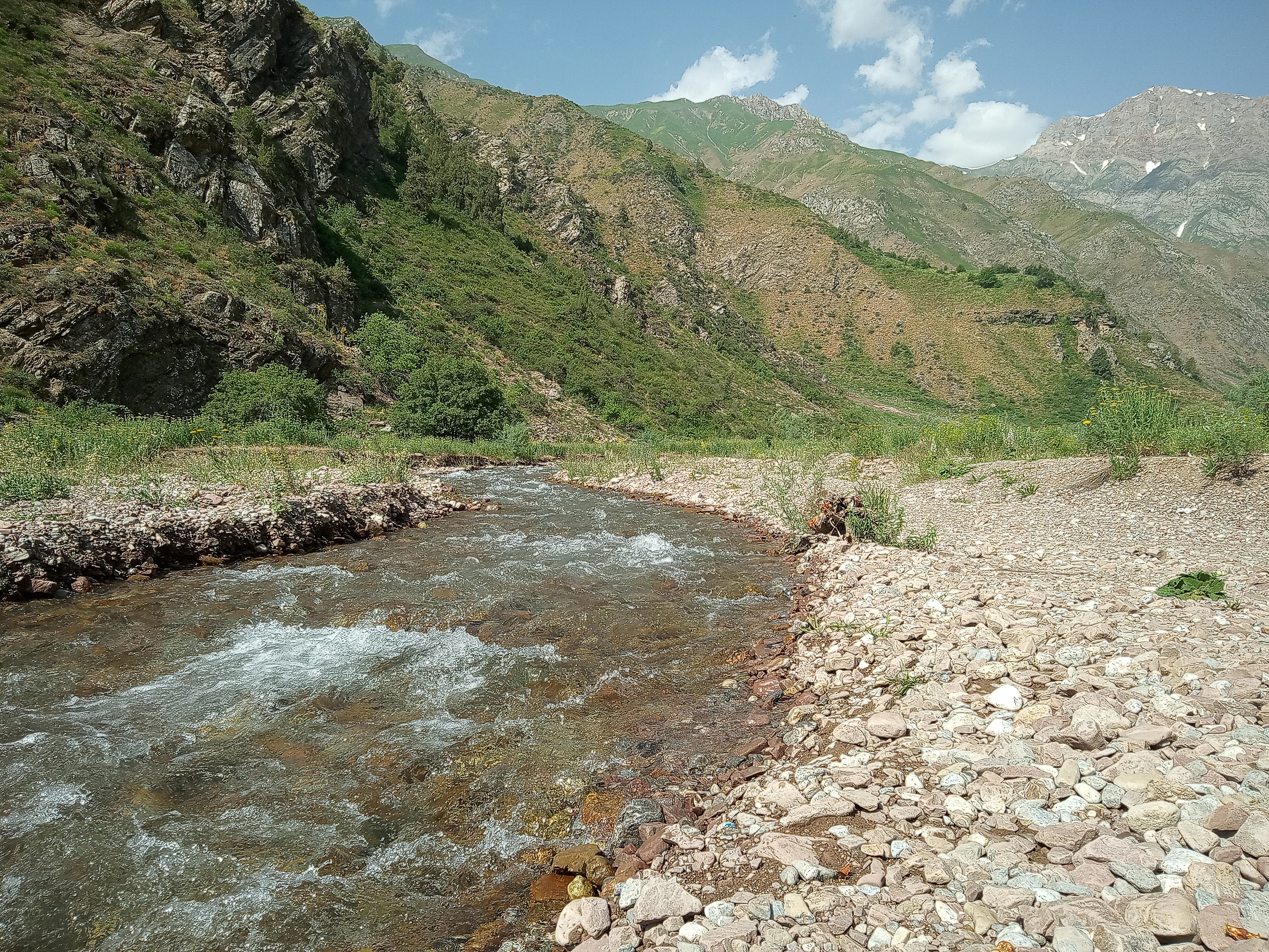
River flowing through rocky riverbank with mountainous backdrop in natural landscape
Mountain river flowing through Ugam-Chatkal National Park

Ugam-Chatkal National Park history and protected-area timeline

Ugam-Chatkal National Park was established in 1992 as part of Uzbekistan's developing network of protected areas following the dissolution of the Soviet Union. The creation of the park reflected a growing recognition of the need to preserve the unique mountain ecosystems of the Tashkent Region, which had previously been managed under different administrative frameworks. Within the park lies the Chatkal Biosphere Reserve, which carries a longer conservation heritage and was inscribed by UNESCO in 1978 as part of the World Network of Biosphere Reserves. This earlier recognition highlighted the global significance of the Chatkal mountain environment, particularly for its ecological diversity and cultural heritage. The reserve contains the Tereksai Petroglyphs, archaeological evidence of human presence in these mountains dating back to 1,000-2,000 BCE. These ancient rock carvings depicting riders, houses, and dogs represent significant evidence of early human settlement in the highland regions of Central Asia.

Ugam-Chatkal National Park landscape and geographic character

The landscape of Ugam-Chatkal National Park is dominated by the imposing Ugam Range, a mountain chain that rises dramatically from the surrounding terrain to reach elevations of 4,000 meters above sea level. The park encompasses approximately 668,350 hectares of mountainous terrain, with the rugged peaks, steep ridgelines, and deep valleys creating a dramatic alpine environment characteristic of the western Tian Shan mountain system. The terrain varies significantly across the park, with the higher elevations featuring rocky alpine zones above the treeline, while the mid-mountain slopes support dense forest growth. The northern and eastern slopes of the range are extensively forested, creating a green landscape that contrasts sharply with the more open, sparsely wooded or completely exposed southern slopes. Mountain rivers and streams cascade down the valleys, their waters feeding the hydroelectric facilities located within the park boundaries. The overall effect is a landscape of considerable visual diversity, ranging from lush forested valleys to stark alpine summits, all within a single protected area.

Ugam-Chatkal National Park ecosystems, habitats, and plant life

The ecological character of Ugam-Chatkal National Park is defined by its elevation-driven vegetation zonation and the interplay between moist northern slopes and drier southern exposures. The park supports more than 1,000 plant types, including approximately 70 tree species that create distinct forest communities across different elevations and aspects. The northern and eastern slopes of the Ugam Range are cloaked in forest, with tree cover extending up the mountainsides until the alpine zone interrupts the woody vegetation. In contrast, the southern slopes receive less moisture and support more sparse woodland or transition directly to open mountain grasslands. This variation creates ecological diversity within a relatively compact area, as different plant communities support different animal populations and ecological processes. The continental climate shapes these ecosystems, with annual precipitation ranging from 400 to 900 millimeters and extreme seasonal temperature variations that influence the types of vegetation that can survive in this mountain environment.

Ugam-Chatkal National Park wildlife and species highlights

The wildlife community of Ugam-Chatkal National Park reflects the park's diverse habitats, from forested valleys to alpine zones. The mammalian fauna includes wild boars that thrive in the forest undergrowth, mountain goats navigating the rocky terrain, and large predators including brown bears and wolves that occupy the remote mountain areas. Foxes and rabbits are more commonly encountered, representing the smaller mammalian community that inhabits both the forested and open areas of the park. The bird population is particularly diverse, with many species adapted to the various habitat types found within the park boundaries. The elevation range from valley floors to alpine zones creates opportunities for different bird communities, while the mix of forest and open ground supports varied ecological niches. The Chatkal Biosphere Reserve portion of the park provides additional habitat protection for species that require larger, connected wild areas for their survival.

Ugam-Chatkal National Park conservation status and protection priorities

Ugam-Chatkal National Park serves as a critical protected area for Uzbekistan's mountain ecosystems and represents the country's commitment to preserving its natural heritage. The park's inclusion of the Chatkal Biosphere Reserve, designated by UNESCO in 1978, demonstrates its international recognition as an area of global conservation significance. This biosphere reserve status reflects both the ecological importance of the mountain ecosystems and the presence of significant cultural heritage in the form of the Tereksai Petroglyphs. The protection of 47,945 hectares within the Chatkal portion of the park ensures preservation of both biodiversity and archaeological values. The park's role in protecting watersheds that feed the hydroelectric facilities within its boundaries also demonstrates the connection between ecosystem protection and human infrastructure needs in this mountainous region.

Ugam-Chatkal National Park cultural meaning and human context

The cultural significance of Ugam-Chatkal National Park extends beyond its ecological values to include important archaeological heritage preserved within the Chatkal Biosphere Reserve. The Tereksai Petroglyphs represent evidence of human presence in these mountains dating to 1,000-2,000 BCE, making them among the oldest archaeological sites in the region. These ancient rock carvings depict riders, houses, and dogs, providing insights into the lives of prehistoric peoples who inhabited this mountain landscape. The presence of these petroglyphs demonstrates that the Ugam-Chatkal mountain region has supported human communities for thousands of years, with the landscape serving as both a habitat and a source of cultural expression for successive generations. This archaeological dimension adds depth to the park's conservation significance, protecting not only natural ecosystems but also the tangible remains of human history in these mountains.

Top sights and standout views in Ugam-Chatkal National Park

Ugam-Chatkal National Park offers visitors access to some of Uzbekistan's most spectacular mountain scenery, with the Ugam Range providing a dramatic backdrop of peaks reaching 4,000 meters. The park's ecological diversity, with over 1,000 plant species and varied forest communities across its slopes, creates a rich environment for nature observation and scientific study. The Chatkal Biosphere Reserve within the park combines natural protection with cultural heritage, preserving ancient petroglyphs that document prehistoric human presence in these mountains. The contrast between the forested northern slopes and the more open southern exposures provides visual evidence of the park's ecological complexity. The UNESCO biosphere reserve designation highlights the international recognition of this area's significance as a conservation area of global importance.

Best time to visit Ugam-Chatkal National Park

Ugam-Chatkal National Park experiences a continental climate with significant seasonal variation that influences the character of a visit. Summer temperatures can reach 33°C to 42°C in the lower valleys, while winter brings extreme cold with temperatures ranging from -14.5°C to -32°C. The summer months typically offer the most accessible conditions for exploration, with the mountain trails and higher elevations providing escape from valley heat. Spring and early summer bring increased water availability and active wildlife, while the autumn season offers pleasant temperatures and the opportunity to observe fall coloration in the deciduous forests. The winter months present challenging conditions due to extreme cold and snow cover, but offer different experiences for those prepared for mountain winter environments. Annual precipitation ranges from 400mm to 900mm, with the wetter periods typically occurring in spring.
Monthly climate preview

Long-term monthly temperature and precipitation rhythms recorded across the protected landscape

Ugam-Chatkal National Park Climate Normals and Annual Temperature Patterns

Ugam-Chatkal National Park exhibits a measured annual cycle of shifting temperatures and precipitation rates based on historical coordinate climatology. Examining the complete twelve-month record reveals detailed shifts in average temperature and precipitation across the regional terrain.
Annual mean8 °C
-6 °C21 °C
Jan-6°
Feb-4°
Mar
Apr
May13°
Jun18°
Jul21°
Aug20°
Sep15°
Oct
Nov
Dec-4°
Warmest month
July

21.4 °C

Coolest month
January

-5.6 °C

Wettest month
February

2.3 mm/day

Driest month
August

0.2 mm/day

Park location guide

Geography guide, regional context, and park location map for Ugam-Chatkal National Park

Ugam-Chatkal National Park park geography, regions, and map view in Uzbekistan

Understand where Ugam-Chatkal National Park sits in Uzbekistan through a broader geographic reading of the surrounding landscape, nearby location context, and its mapped position within the national park landscape.

How Ugam-Chatkal National Park fits into Uzbekistan

Uzbekistan is a doubly landlocked country in Central Asia, bordered by Kazakhstan, Kyrgyzstan, Tajikistan, Afghanistan, and Turkmenistan. It is the most populous country in Central Asia, with Tashkent as its capital and largest city. The population is predominantly Uzbek-speaking and Sunni Muslim.

Wider geography shaping Ugam-Chatkal National Park in Uzbekistan

Uzbekistan is located in Central Asia, bordered by Kazakhstan to the north, Kyrgyzstan to the northeast, Tajikistan to the southeast, Afghanistan to the south, and Turkmenistan to the southwest. The terrain includes mountains in the east and southeast, valleys, and vast desert areas. As a doubly landlocked country, it has no direct access to any sea.

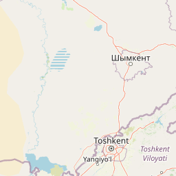
Map view of Ugam-Chatkal National Park

Use this park location map to pinpoint Ugam-Chatkal National Park in Uzbekistan, understand its exact geographic position, and read its mapped placement within the surrounding landscape more clearly.

Pigeon | © OpenStreetMap contributors

Location context for Ugam-Chatkal National Park

Tashkent Region
Natural feature types

Explore the Topographic Landscape and Named Features of Ugam-Chatkal National Park

Delve into the detailed landscape of Ugam-Chatkal National Park by browsing its mapped natural features and protected mountain landmarks. This collection on MoriAtlas organizes the regional geography, providing a focused view of the summits, forests, and valleys that characterize this significant Central Asian wilderness.
Recorded earthquake history

Examine Historical Earthquake Records for Ugam-Chatkal National Park

Explore the structured catalogue of documented seismic activity associated with Ugam-Chatkal National Park. MoriAtlas provides these historical records to facilitate geographic discovery and analysis of regional seismic events without implying causation or predicting future activity within the park landscape.

Ugam-Chatkal National Park Earthquakes

Catalogued events

32 events

Strongest magnitude

Magnitude 5.2

Most recent event

Jul 9, 2026

This history includes earthquakes recorded inside the park or within 50 km of its borders

Explore the Diverse Habitats and Dramatic Alpine Environment of Uzbekistan's Premier Mountain Wilderness Through Detailed Imagery

Ugam-Chatkal National Park Photos: Visualizing the Mountain Landscapes, Scenery, and Protected Terrain

Delve into the captivating visual identity of Ugam-Chatkal National Park, a vast protected area in Uzbekistan, by exploring its varied landscapes and unique ecosystems through photography. These images offer a detailed reference to understand the park's imposing Ugam Range, its distinct forest zones, and the rugged alpine terrain that defines this significant Central Asian conservation region.

River flowing through rocky riverbank with mountainous backdrop in natural landscape

Park atlas

Browse surrounding mountain parks and protected areas to trace Central Asia's unique geographic spread.

Discover More Protected Mountain Landscapes: National Parks Near Ugam-Chatkal National Park

After exploring Ugam-Chatkal National Park, discover additional national parks and protected areas within Uzbekistan and across the surrounding Central Asian mountain systems. Comparing these diverse alpine ecosystems and designated UNESCO landscapes reveals the broader regional spread of conservation efforts and mapped park geography.
Watercolor painting of a landscape featuring green hills, grassy foreground, and distant mountains under a soft sky
National parkSouth Kazakhstan Region
Park boundaries overlap#1 closest

North

Sayram-Ugam National Park: Protected Landscape and Geographic Context in South Kazakhstan

Explore dramatic alpine terrain and ancient juniper forests.

Delve into Sayram-Ugam National Park, a protected national park situated in the South Kazakhstan Region. This expansive area showcases striking mountain topography with seven natural altitude zones, from mountain steppe to permanent snowfields. It is distinguished by its vast juniper forests and serves as a crucial conservation site for wild fruit and nut tree genetic diversity, offering a unique lens for understanding Central Asian mountain ecology and landscape context.

Area
1,490 km²
Established
2007
IUCN
II
Relief
Mountain
State or regional parkKyrgyzstan
About 8.2 km away#2 closest

Northeast

Kara-Buura State Nature Park: Kyrgyzstan's Protected Mountain Landscapes and Natural Terrain

Explore the mapped geography and protected area context.

Kara-Buura State Nature Park is a designated state or regional park within Kyrgyzstan, crucial for understanding the country's protected natural areas. Located in the Tian Shan mountain range, the park encompasses diverse alpine and semi-arid landscapes, typical of this high-altitude region. Its mapped boundaries and geographic setting provide valuable context for atlas exploration and appreciating the conservation efforts aimed at preserving Kyrgyzstan's natural heritage, offering a unique lens into the country's mountainous terrain.

IUCN
II
Nature reserveJalal-Abad Region
About 72 km away#3 closest

East

Padyshata State Nature Reserve: Geographic Profile and Protected Forest Atlas

Chatkal Range ecosystems in the western Tien Shan

Covering 158 square kilometers, Padyshata State Nature Reserve is a strictly managed protected area defined by its vertical zonation, ranging from rocky mountain slopes to expansive juniper and Semenov fir forests. This geographic profile outlines the terrain, habitat structure, and the vital role of this reserve within the broader Kyrgyz forest conservation network.

Area
158.46 km²
Established
2003
IUCN
Ia
Relief
Mountain
Protected areaKyrgyzstan
About 86 km away#4 closest

East

Alatay State Nature Park Protected Area: Mapped Landscape and Regional Geography

Explore the protected boundaries and geographic context of this Kyrgyz natural landscape.

Alatay State Nature Park is a designated protected area within Kyrgyzstan, contributing to the country's vast network of natural landscapes. This page provides detailed geographic information, emphasizing the park's mapped boundaries and its role within the broader regional context of the Tian Shan mountains. It serves as a crucial point for understanding the park's landscape identity and its atlas-level significance as a protected natural territory in Central Asia.

Access
Access unknown
National parkKyrgyzstan
About 86 km away#5 closest

East

Besh-Tash Nature Park National Park: Mapped Geography and Protected Landscape Identity

Explore the natural terrain and park boundaries in Kyrgyzstan.

Discover Besh-Tash Nature Park, a designated national park located within the mountainous terrain of Kyrgyzstan. This page focuses on its role as a protected landscape, providing insight into its mapped geographic context and regional significance. Understanding Besh-Tash Nature Park involves examining its natural setting and its contribution to conservation efforts in Central Asia, offering a factual atlas perspective for explorers.

Nature reserveJalal-Abad Region
About 114 km away#6 closest

East

Ryazan-Say Botanical Zakaznik: Protected Botanical Landscapes in the Jalal-Abad Region

Nature reserve geography and relict plant conservation in Kyrgyzstan

Ryazan-Say Botanical Zakaznik is a concentrated nature reserve dedicated to the survival of rare, relict subtropical flora. The protected area encompasses a narrow, steep-walled gorge system that funnels moisture to sustain species like wild fig and pomegranate. This site provides a critical reference for studying how sheltered mountain canyons maintain ecological diversity within the wider landscape of western Kyrgyzstan.

Area
1.1 km²
Established
1987
IUCN
IV
Relief
Upland
State or regional parkKyrgyzstan
About 152 km away#7 closest

South

Sarkent State Nature Park: A Protected Landscape in Kyrgyzstan's Tian Shan Mountains

Explore mapped boundaries and regional geographic context.

Sarkent State Nature Park is a key state or regional park situated within the dramatic mountain geography of Kyrgyzstan. Its designation protects a significant natural landscape, offering users a valuable point of reference for understanding regional protected areas and the intricate terrain of Central Asia. This detail entry provides context for its mapped boundaries and its place within the broader atlas of protected lands.

National parkJizzakh Region
181 km away#8 closest

Southwest

Zaamin National Park: National Park Protected Landscape in Jizzakh Region

Explore its mapped boundaries and natural geography.

Zaamin National Park represents a crucial component of protected natural landscapes within Uzbekistan, situated in the Jizzakh Region. This national park detail page provides essential geographic context, focusing on the park's mapped boundaries and its role as a protected area. Users can delve into the regional geography and landscape features that contribute to Zaamin National Park's unique identity, offering a factual basis for atlas-style exploration and understanding of conservation lands.

Area
156 km²
Established
1926
IUCN
II
Relief
Mountain

Common questions about visiting, size, designation, and location context for Ugam-Chatkal National Park

Ugam-Chatkal National Park FAQs for park facts, access, geography, and protected area context

Find quick answers about Ugam-Chatkal National Park, including protected-area facts, park geography, trail and visitor context, and how the park fits into its surrounding country and regional landscape.
MoriAtlas Explorer

Continue Your Protected Areas Search Across the Global Atlas

Deepen your exploration by continuing the structured search for national parks and protected areas worldwide. Utilize the comprehensive filtering capabilities to compare different conservation landscapes and refine your understanding of global park geography. Discover more about the distribution and characteristics of protected natural areas.

Global natural geography