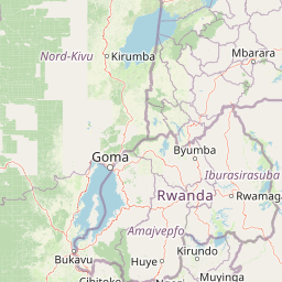

Why Virunga National Park stands out
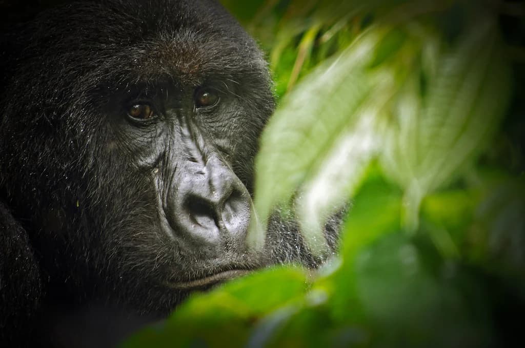
Virunga is world-famous for its mountain gorilla populations, which inhabit the montane forests of the southern and central sectors. The park protects approximately one-third of the remaining mountain gorillas on Earth, making it globally critical for the survival of this endangered species. Beyond primates, the park is distinguished by its dramatic volcanic landscapes, including the permanently active Nyiragongo volcano with its persistent lava lake, and the nearby Nyamuragira, one of Africa's most active volcanoes. The park's Albertine Rift location makes it a biodiversity hotspot, protecting more than 300 endemic species including the golden monkey, Rwenzori turaco, and numerous other birds, plants, and amphibians found nowhere else on the planet. The combination of glacial peaks, volcanic activity, montane forests, and savanna plains within a single protected area creates a uniquely diverse landscape.
Virunga National Park history and protected-area timeline
Virunga National Park traces its origins to the early 1920s when European conservationists including Victor van Straelen, Jean Massart, and Jean-Marie Derscheid championed the creation of a protected area in the Belgian Congo. Albert National Park was established in April 1925 as the Congo's first national park, originally conceived as a science-oriented nature reserve aimed at studying and preserving wildlife and local indigenous populations. In 1926, Derscheid led the first Belgian mission to map the park, which encompassed around 500 square kilometers around the extinct volcanoes Mount Karisimbi and Mount Mikeno. The protected area was expanded in 1929 when Virunga National Park was established, encompassing the Virunga Mountains, parts of the Rutshuru Territory, and the plains south of Lake Edward. Originally spanning 2,920.98 square kilometers, the park was gradually enlarged in subsequent decades. In 1969, the two parks were merged under the name Virunga National Park, which was inscribed as a UNESCO World Heritage Site in 1979. The park was designated a Ramsar site of international importance in 1996. In 2011, British company Soco International was granted concessions for oil exploration within the park, sparking international protests that ultimately led the company to cease operations. In 2021, an agreement between DRC President Felix Tshisekedi and UK Prime Minister Boris Johnson provided additional protection, though the government subsequently auctioned oil exploration blocks within the park in 2022, generating continued conservation concerns.
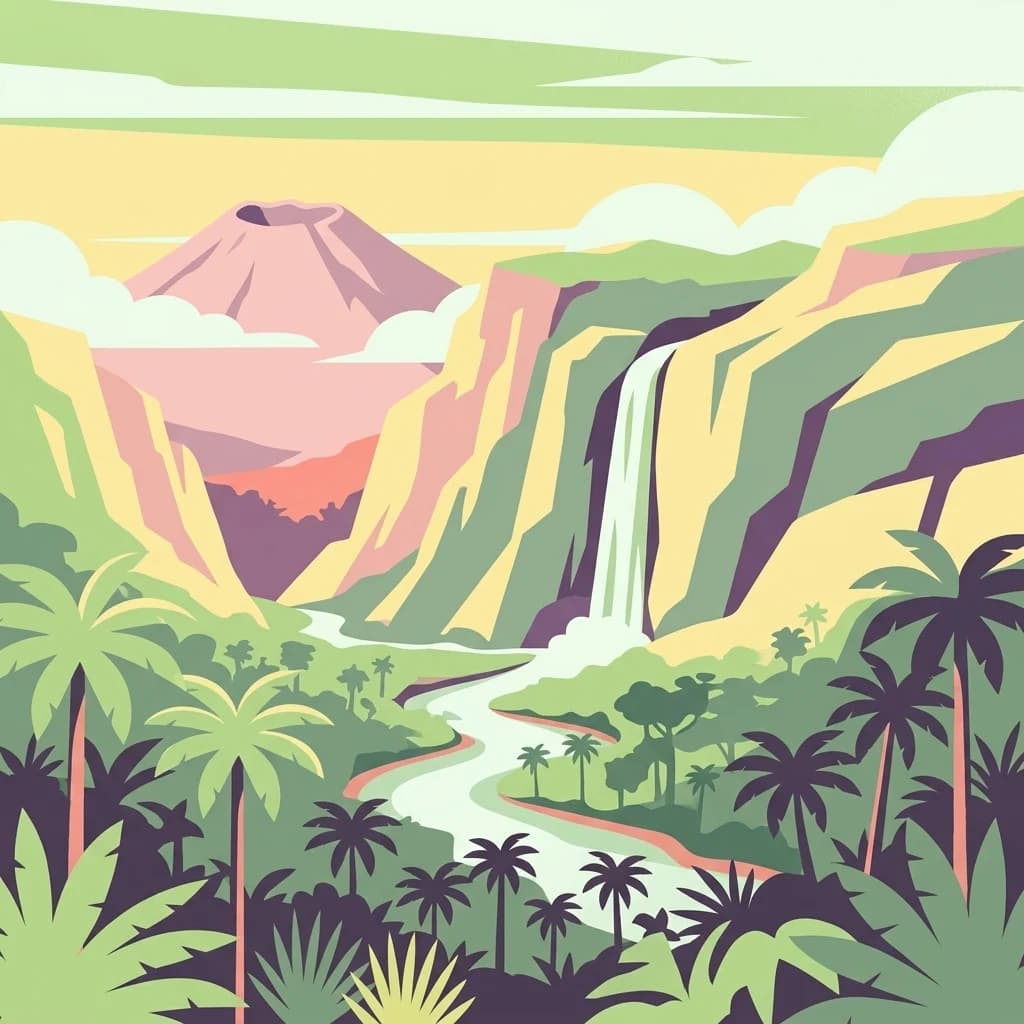
Virunga National Park landscape and geographic character
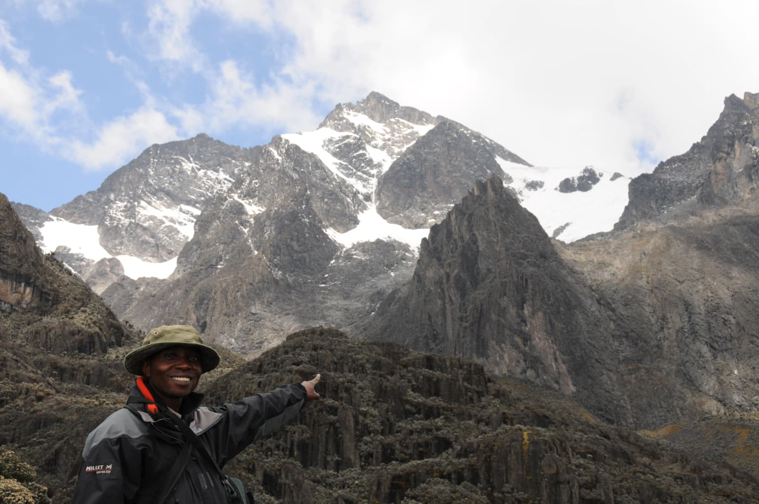
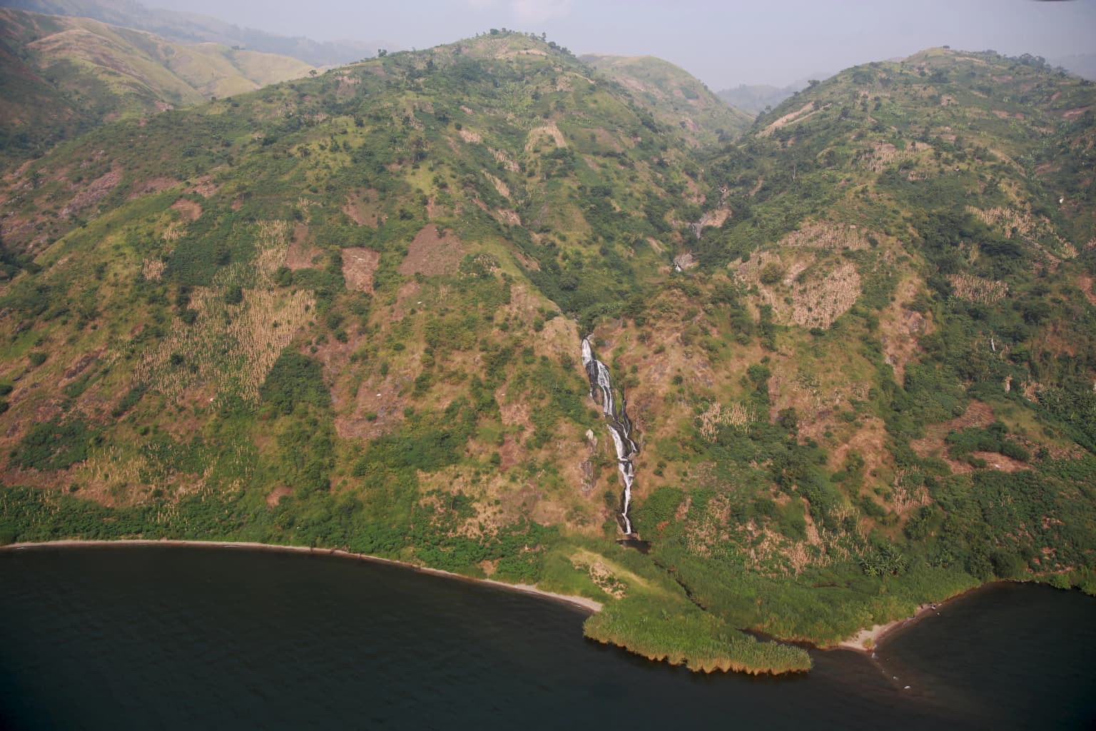
Virunga National Park presents an extraordinary diversity of landscapes shaped by volcanic activity, tectonic forces, and ecological gradients. The northern sector contains the Rwenzori Mountains, also known as the Mountains of the Moon, with Mount Stanley reaching 5,109 meters and supporting glaciers in a tropical setting. The Semliki River valley at 680 meters represents the park's lowest point. The central sector encompasses the western and southern shores of Lake Edward and the Rwindi-Rutshuru plains, featuring wetlands, grasslands, and marshlands. The southern sector is dominated by the Virunga Mountains, a volcanic massif containing seven of the eight volcanoes in the range, including the active Nyiragongo and Nyamuragira. Nyiragongo's permanent lava lake is one of only a handful globally, and its frequent eruptions have created extensive lava fields that influence local hydrology. The boundary zone between central and southern sectors contains Lake Ondo, Kibuga pond, marshlands at lava flow ends, and the Molindi spring. The park sits on the Congo-Nile watershed divide, with the unusual feature that the divide runs underground in some areas. Nearly 75 percent of the lower Rutshuru River's water originates from the Molindi River, which resurfaces rainfall absorbed by southern lava fields.
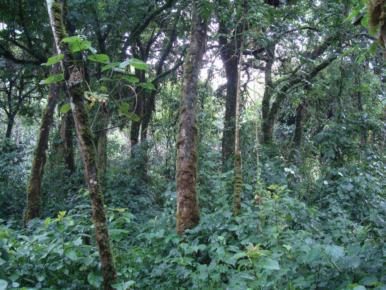
Virunga National Park ecosystems, habitats, and plant life
Virunga National Park's ecological diversity stems from its location in the Albertine Rift, one of Africa's most species-rich regions. The park contains 2,077 plant species, including 264 tree species and 230 plants endemic to the Albertine Rift. The plains are dominated by wetlands and grasslands featuring papyrus sedge, jointed flatsedge, common reed, sacaton grasses, ambatch, conkerberry, paperbark thorn, and kowai fruit. Montane forests between 1,800 and 2,800 meters in the southern sector are dominated by Ficalhoa laurifolia and Podocarpus milanjianus, with trees reaching up to 25 meters height. African alpine bamboo grows at altitudes of 2,300 to 2,600 meters, while subalpine vegetation above 2,600 meters features African redwood, tree heath, heather, and mosses. The park's climate is influenced by the Intertropical Convergence Zone and El Niño-Southern Oscillation, with rainy seasons from March to mid-May and September to November. Mean monthly rainfall varies from 30-40 millimeters in the savanna around Lake Edward to 220 millimeters in the northern sector. Average temperatures range from 23-28°C at lower altitudes to 16-24°C at higher elevations.
Virunga National Park wildlife and species highlights
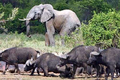
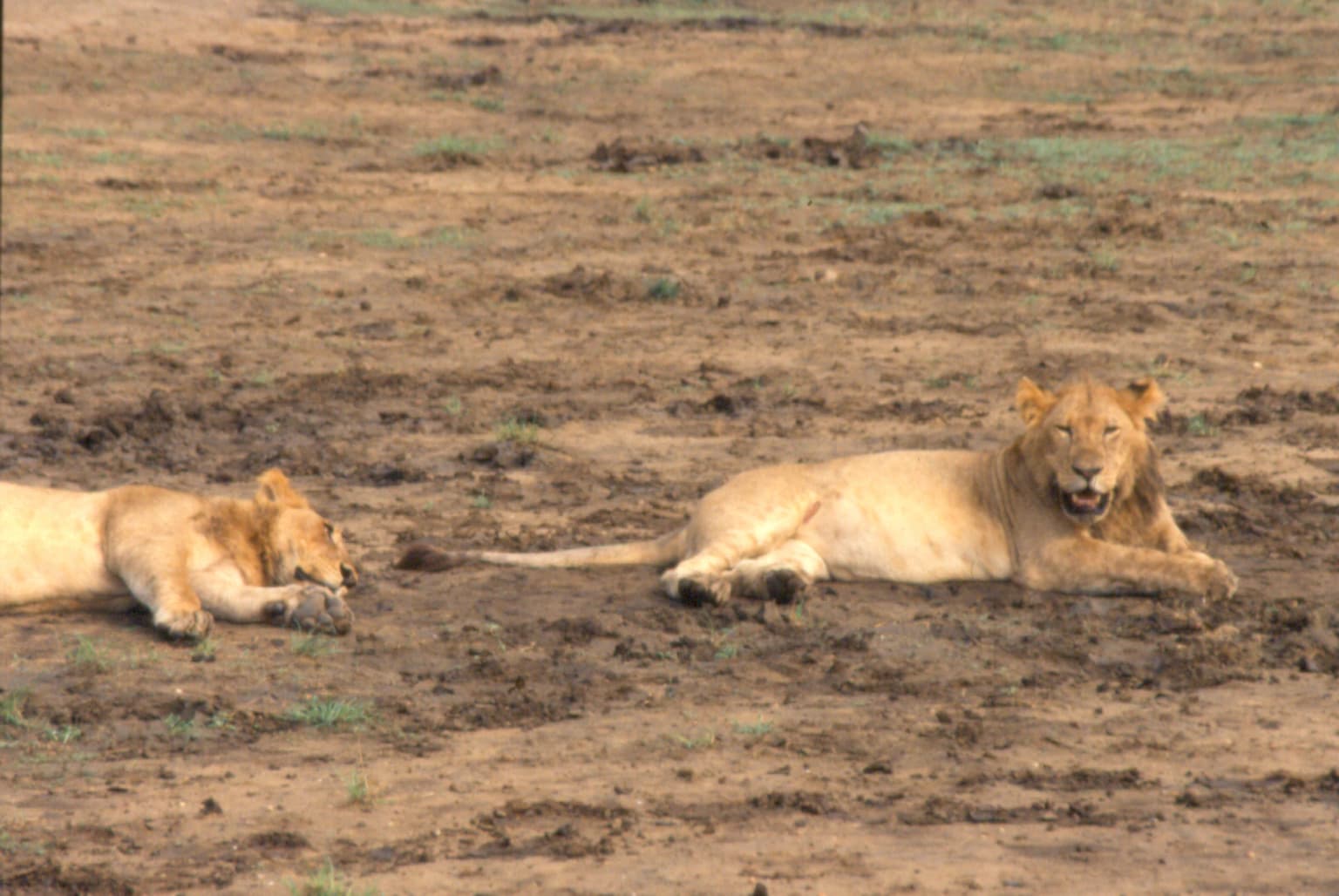
Virunga National Park supports exceptional biodiversity with 196 mammal species, 706 bird species, 109 reptiles, and 65 amphibians recorded. The park is globally significant for its mountain gorilla population, with the subspecies Gorilla beringei beringei inhabiting the montane forests. Other primates include common chimpanzee, golden monkey, red-tailed monkey, blue monkey, De Brazza's monkey, Central African red colobus, mantled guereza, olive baboon, and grey-cheeked mangabey. Large mammals include African bush elephant, hippopotamus, African buffalo, okapi, and various duiker species. The park forms a Lion Conservation Unit with adjacent Queen Elizabeth National Park. The northern sector hosts African leopard, giant pangolin, tree pangolin, crested porcupine, and Lord Derby's scaly-tailed squirrel. Bird diversity is exceptional, particularly for Albertine Rift endemics including Rwenzori turaco, Rwenzori batis, Archer's ground robin, Kivu ground thrush, collared apalis, mountain masked apalis, dusky crimson-wing, Shelley's crimsonwing, and numerous sunbird species. The Semliki River and Lake Edward provide habitat for Nile crocodile.
Virunga National Park conservation status and protection priorities
Virunga National Park holds significant conservation importance as a UNESCO World Heritage Site, Ramsar Wetland, and IUCN Category II protected area. The park was inscribed on the World Heritage List in 1979 for its rich diversity of habitats, exceptional biodiversity, and endemic species, particularly its mountain gorilla habitat. Since 1994, it has been listed on the List of World Heritage in Danger due to civil unrest, poaching, and increased human presence following the Rwandan genocide and subsequent Congo Wars. The park faces ongoing threats from armed rebel groups, illegal hunting, deforestation, and oil exploration pressures. Conservation efforts have been militarized, with park rangers receiving paramilitary training to combat poaching and armed groups. Management transitioned to a public-private partnership between the Congolese government and the Virunga Foundation in 2010, with the European Commission subsidizing approximately 80 percent of management costs. Hydroelectric dams constructed by 2016 provide electricity to over 200,000 rural people, demonstrating integrated conservation-development approaches. The park protects critical habitat for mountain gorillas, representing one of the last strongholds for this endangered species.
Virunga National Park cultural meaning and human context
Virunga National Park is home to and adjacent to several ethnic groups including Mbuti, Nande, Hunde, Kumu, Hutu, Tutsi, and Basongora peoples. The Mbuti are indigenous forest dwellers who historically relied on the lands now within the park for food and shelter. The park's establishment in the 1920s resulted in indigenous peoples losing traditional land rights and being evicted from the protected area. Between the late 1930s and 1955, an estimated 85,000 Rwandophone people were relocated to nearby Masisi in North Kivu. Local communities rely on activities prohibited within the park, including farming, hunting, fishing, logging, and charcoal production, creating complex human-wildlife dynamics. The charcoal trade from the park represents an annual value of US$28-30 million, with approximately 80 percent of Goma's charcoal supply sourced from Virunga. These communities face difficult choices between conservation regulations and livelihood survival, particularly in the context of regional conflict and displacement.
Top sights and standout views in Virunga National Park
Virunga National Park offers unparalleled ecological and geological features within a single protected area. The opportunity to observe mountain gorillas in their natural habitat remains the park's most celebrated attraction, with guided treks into the montane forests providing rare encounters with these endangered primates. Nyiragongo volcano provides the extraordinary experience of viewing a permanent lava lake from its crater rim, one of only a few such sites globally. The Rwenzori Mountains offer challenging high-altitude trekking to glaciers and alpine zones in a tropical setting. The park's position in the Albertine Rift provides exceptional birdwatching opportunities, with numerous endemic species including the Rwenzori turaco and Albertine Rift_SPECIFIC sunbirds. The transboundary conservation landscape connecting Virunga with Rwanda's Volcanoes National Park and Uganda's Mgahinga Gorilla National Park creates one of Africa's most important wildlife corridors. Tchegera Island in Lake Kivu offers scenic beauty and biodiversity distinct from the mainland park.
Best time to visit Virunga National Park
The optimal time to visit Virunga National Park depends on the specific activities planned, though the dry seasons generally offer more accessible conditions. The main rainy seasons occur from March to mid-May and September to November, which can make some trails difficult and reduce visibility for wildlife viewing. The driest conditions prevail in the savanna areas around Lake Edward, though the northern sector receives up to 220 millimeters of monthly precipitation even during drier periods. Gorilla trekking is possible year-round, though conditions are generally better during drier months when trails are more manageable. The park has experienced periodic closures due to security concerns, and visitors should check current conditions before planning trips. The period from December through February typically offers more stable weather, though volcanic activity and regional security situations can affect access. For birdwatching, the wet seasons may provide better opportunities to observe migratory species and observe active breeding behaviors.