

Mori Atlas logo
National parkWaterberg Plateau Park

Examining the geological formations, ancient terrain, and conservation boundaries of this central Namibian highland.

Waterberg Plateau Park: A Comprehensive Geographic Atlas of Namibia's Distinctive Table Mountain National Park

Waterberg Plateau Park occupies a unique geographic position in central Namibia, rising as a formidable table mountain formation above the expansive Kalahari savanna plains. This protected landscape functions as a vital ecological sanctuary, utilizing its steep cliffs and elevated terrain as a natural barrier for regional biodiversity conservation. The park provides an essential case study in geological heritage, featuring rock strata exceeding 850 million years in age and serving as a critical habitat for endangered wildlife species.

table mountainKalahari ecosystemwildlife conservationendangered speciesblack rhinocerosbirdwatching
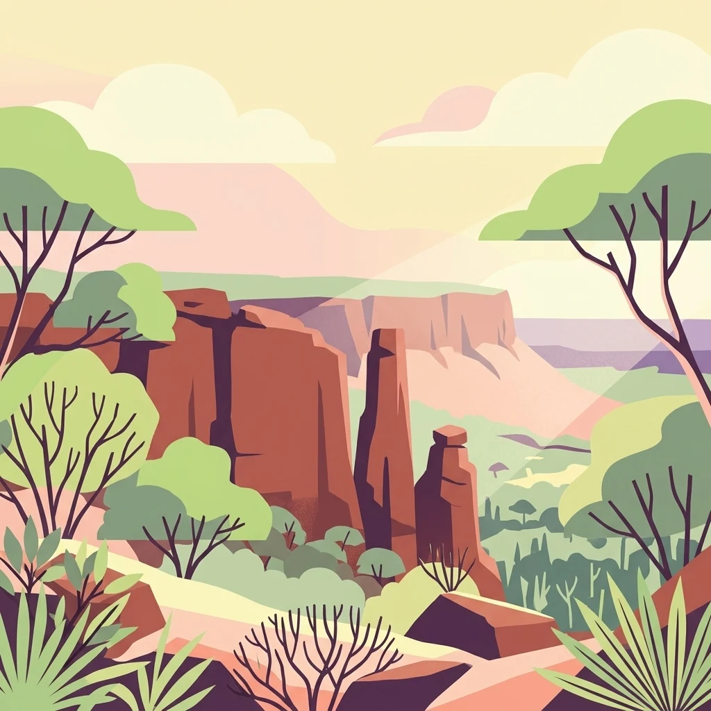
Illustration showing a plateau landscape with rock formations, trees, and vegetation typical of Waterberg Plateau Park

Waterberg Plateau Park

National park

Park overview

Structured park overview, official facts, and landscape profile for Waterberg Plateau Park

Waterberg Plateau Park park facts, protected area profile, and essential visitor context

Review the core facts for Waterberg Plateau Park, including designation, size, terrain, visitor scale, habitats, and operating context in one park-focused overview.

About Waterberg Plateau Park

Waterberg Plateau Park represents one of Namibia's most distinctive protected areas, combining dramatic geological features with meaningful conservation achievements. The park is centered on the Waterberg Plateau, a tabular mountain formation that rises abruptly from the flat Kalahari savanna, creating a striking visual landmark visible across the eastern Namibian landscape. The name Waterberg derives from Afrikaans and translates to "water mountain," reflecting the mountain's historical role in capturing moisture from seasonal rainfall that sustained wildlife and human inhabitants alike. The plateau's most distinctive characteristic is its relative inaccessibility; the steep cliffs and rocky slopes surrounding the plateau make it naturally defended against ground-based predators and human disturbance, a feature that proved invaluable when the park was developed as a conservation sanctuary in the 1970s. Beyond its ecological function, Waterberg carries profound historical significance as the site of the Battle of Waterberg in 1904, a pivotal conflict during the Herero and Namaqua Wars that fundamentally shaped Namibia's colonial history.

Quick facts and research context for Waterberg Plateau Park

Waterberg Plateau Park spans 405 square kilometers in central Namibia, established as a protected nature reserve in 1972 and declared a National Monument in 1956. The park centers on the Waterberg, a prominent table mountain that rises dramatically above the Kalahari plains of eastern Namibia. The plateau's inaccessibility from below made it an ideal location for relocating endangered species, and the park has successfully bred and supplied animals to other Namibian protected areas. Over 200 bird species inhabit the park, alongside rare small antelope species on the lower hills. The mountain contains dinosaur tracks estimated at 200 million years old.

Protection and recognition

Examine documented terrestrial protection parameters and official recognition metrics.

Waterberg Plateau Park Protection Status and Designated Conservation Scope

Waterberg Plateau Park maintains a documented terrestrial protection scope within its regional conservation framework. Official records compile available designation data and management parameters for geographic analysis.

Protection details

Protection scope
Terrestrial
Transboundary protection
No
Park context

Deeper park guide and search-rich context for Waterberg Plateau Park

Waterberg Plateau Park history, landscape, wildlife, and travel context

Explore Waterberg Plateau Park through its history, landscape character, ecosystems, wildlife, conservation priorities, cultural context, and seasonal travel timing in a structured park guide built for atlas discovery and search intent.

Why Waterberg Plateau Park stands out

Waterberg Plateau Park is best known for its dramatic table mountain landscape, which stands as a striking geological landmark in Namibia's Kalahari region. The park has become synonymous with successful wildlife conservation, particularly as a sanctuary for endangered species including the black rhinoceros, which was reintroduced to the area in 1989 from Damaraland. The plateau's unique isolation has allowed it to function as a natural refuge, protecting species from predators and poaching pressures that threatened their survival elsewhere in Namibia. The mountain's ancient geology, with rock formations exceeding 850 million years old, and preserved dinosaur tracks add significant scientific and educational value to the park's natural assets.
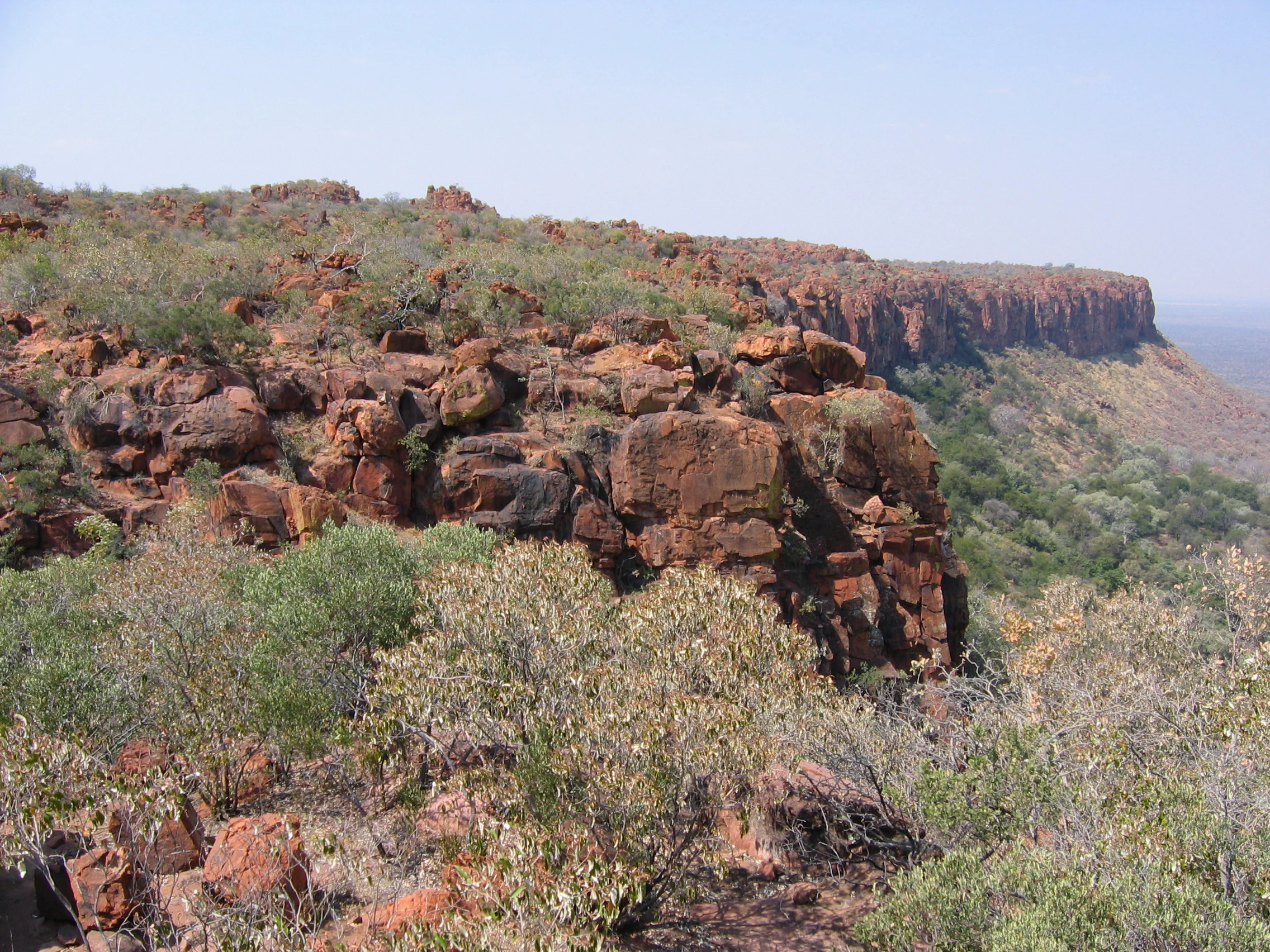
View of a flat-topped rocky plateau with red-brown rock formations and sparse vegetation under clear sky
The distinctive red sandstone plateau of Waterberg Plateau Park with its characteristic cliffs and sparse vegetation

Waterberg Plateau Park history and protected-area timeline

Waterberg Plateau Park was established as a nature reserve in 1972, encompassing both the plateau and approximately 405 square kilometers of surrounding land. The timing of the park's creation was directly tied to Namibia's conservation challenges; the inaccessibility of the plateau made it an ideal location for relocating endangered animal species that faced predation and poaching threats in other parts of the country. During the early 1970s, several of Namibia's most endangered species were moved to the protected plateau environment, where the natural barriers provided security. The conservation program proved remarkably successful, with Waterberg eventually becoming a breeding source that supplied rare animals to other Namibian protected areas. A significant milestone came in 1989 when the black rhinoceros was reintroduced to the park from Damaraland, further strengthening the park's role in preserving Namibia's threatened megafauna. The plateau itself had been declared a National Monument in 1956, recognizing its geological and cultural significance prior to its formal designation as a national park.

Waterberg Plateau Park landscape and geographic character

The landscape of Waterberg Plateau Park is defined by its dramatic central mountain formation, a classic table mountain (tableland) that rises abruptly from the surrounding Kalahari plains. The Waterberg itself presents a distinctive flat-topped silhouette, with steep cliffs and rocky escarpments creating a nearly impassable barrier around the plateau's edges. The mountain is composed of ancient rock strata dating back over 850 million years, making it one of Namibia's oldest geological formations. Surrounding the base of the mountain, the landscape transitions into savannah rangeland that extends across the broader Kalahari basin. The combination of the elevated plateau and the surrounding flat plains creates a striking visual contrast that defines the park's character. The lower hills and foothills of the mountain support different vegetation communities than the plateau summit, adding to the landscape diversity within the protected area.

Waterberg Plateau Park ecosystems, habitats, and plant life

Waterberg Plateau Park is recognized as an ecologically diverse and biologically rich protected area within Namibia's Kalahari Sandveld ecosystem. The park supports over 200 species of birds, including several rare species that inhabit the various microhabitats created by the mountain's topography. The lower hills of the plateau are home to rare species of small antelope, which find refuge in the rocky terrain and denser vegetation away from the open savanna. The plateau's isolation has allowed distinctive ecological communities to develop, separated from the pressures that affect the surrounding Kalahari plains. The mountain's ancient geological foundation creates unique soil conditions and microclimates that support plant communities adapted to the elevated environment. However, the surrounding savannah rangeland faces challenges from woody plant encroachment, which reduces overall biodiversity in areas beyond the protected plateau core.

Waterberg Plateau Park wildlife and species highlights

The wildlife of Waterberg Plateau Park reflects its role as a sanctuary for Namibia's endangered species. The park has played a crucial role in protecting and breeding several species that were threatened with extinction elsewhere in the country. The black rhinoceros, specifically the south-western black rhinoceros subspecies, was reintroduced to the park in 1989 from Damaraland, establishing a breeding population in the protected environment. The plateau's inaccessible nature provided ideal conditions for establishing conservation populations of endangered species, with the natural cliffs acting as barriers against predators and poachers. Beyond the flagship megafauna, the park supports diverse birdlife with over 200 species documented, including rare and endemic species adapted to the Kalahari environment. Small antelope species inhabit the lower hills and rocky sections of the mountain, utilizing the varied terrain for cover and foraging.

Waterberg Plateau Park conservation status and protection priorities

Waterberg Plateau Park represents a landmark success in Namibian conservation history. The park was specifically chosen as a protected sanctuary in the 1970s because the plateau's natural inaccessibility provided security for endangered species that could not be protected in more open savanna environments. The relocation program that established breeding populations of endangered Namibian wildlife proved highly successful, with the park later functioning as a source population for restocking other national parks throughout the country. The reintroduction of black rhinoceros in 1989 further cemented the park's conservation significance, contributing to broader efforts to recover this critically endangered species in Namibia. The designation of the plateau as a National Monument in 1956 recognized its geological and cultural importance before the formal protected area was established, demonstrating long-standing recognition of the site's exceptional value.

Waterberg Plateau Park cultural meaning and human context

Waterberg Plateau Park holds deep historical and cultural significance for Namibia, particularly in relation to the Herero people and the colonial-era conflicts that shaped the nation. The foothills of the mountain were the site of the Battle of Waterberg in 1904, one of the major turning points in Namibia's history during the Herero and Namaqua Wars against German colonial forces. This battle marked the last major resistance of the Herero people, after which the subsequent genocide resulted in the deaths of nearly two-thirds of the Herero population. Some survivors escaped to British Bechuanaland (now Botswana), where they received asylum. The graves of German soldiers who died at Waterberg remain visible near the Bernabe De La Bat rest camp at the park's base, providing a somber historical presence within the protected area. Prior to these colonial-era events, the San people were the first human inhabitants of the region, leaving rock engravings believed to be several thousand years old. A small group of San maintained their traditional lifestyle on the plateau until the late 1960s, representing one of the last remaining populations practicing that ancient way of life in the region.

Top sights and standout views in Waterberg Plateau Park

Waterberg Plateau Park combines exceptional natural beauty with profound historical significance. The dramatic table mountain itself is the park's most recognizable feature, rising like a fortress from the Kalahari plains and providing panoramic views across eastern Namibia. The successful conservation program that made Waterberg a sanctuary for endangered species, particularly the black rhinoceros reintroduction, represents one of Namibia's greatest protected area achievements. The ancient geological formations, including dinosaur tracks estimated at 200 million years old, add unique scientific interest to the park's assets. The historical significance of the Battle of Waterberg site provides cultural depth beyond typical wildlife-focused protected areas. The bird diversity exceeding 200 species makes the park a notable destination for ornithological observation, while the success in breeding and supplying animals to other Namibian parks demonstrates its functional importance in the national conservation network.

Best time to visit Waterberg Plateau Park

Waterberg Plateau Park can be visited throughout the year, though the optimal time for experiencing the park's landscapes and wildlife is during the dry winter months from May to October when temperatures are milder and wildlife congregates more visibly around water sources. The summer months from November to April bring higher temperatures but also the brief rainy season, which transforms the surrounding Kalahari plains with fresh vegetation and can create more verdant scenery within the park. The distinctive table mountain landscape remains impressive in all seasons, though the dramatic contrast between the green season and the dry season creates different visual experiences. Visitors interested in wildlife viewing may find the dry season more productive for sighting animals, while bird enthusiasts might appreciate the wetter months when migrant species arrive.
Monthly climate preview

Long term representative temperature and precipitation averages by month

Waterberg Plateau Park Climate Normals and Annual Weather Patterns

Waterberg Plateau Park exhibits measured monthly temperature variations alongside distinct precipitation rhythms across its representative coordinate. Reviewing the complete twelve month climatology profile provides detailed insight into long term atmospheric norms.
Annual mean22 °C
14 °C27 °C
Jan26°
Feb25°
Mar24°
Apr22°
May18°
Jun15°
Jul14°
Aug18°
Sep22°
Oct25°
Nov26°
Dec27°
Warmest month
December

26.5 °C

Coolest month
July

14.4 °C

Wettest month
February

3.1 mm/day

Driest month
July

0 mm/day

Park location guide

Geography guide, regional context, and park location map for Waterberg Plateau Park

Waterberg Plateau Park park geography, regions, and map view in Namibia

Understand where Waterberg Plateau Park sits in Namibia through a broader geographic reading of the surrounding landscape, nearby location context, and its mapped position within the national park landscape.

How Waterberg Plateau Park fits into Namibia

Namibia is a sovereign country in Southern Africa that gained independence from South Africa in 1990. It is the driest country in sub-Saharan Africa, characterized by the Namib Desert along its coast. The population is approximately 3 million, with Windhoek as the capital and largest city. Namibia operates as a unitary semi-presidential republic with a multi-party system.

Wider geography shaping Waterberg Plateau Park in Namibia

Namibia occupies 825,615 km2 in Southern Africa, making it the 34th largest country in the world. It is bordered by the Atlantic Ocean to the west, Angola and Zambia to the north, Botswana to the east, and South Africa to the south. The country features the Namib Desert along its coastal region, with varied terrain including savannas, mountains, and plateaus inland. A notable geographic feature is that Zimbabwe lies less than 200 metres away along the Zambezi river near Kazungula in the northeast.

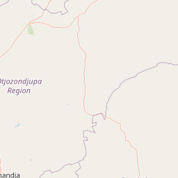
Map view of Waterberg Plateau Park

Use this park location map to pinpoint Waterberg Plateau Park in Namibia, understand its exact geographic position, and read its mapped placement within the surrounding landscape more clearly.

Pigeon | © OpenStreetMap contributors

Location context for Waterberg Plateau Park

Oshikoto

Explore the dramatic cliffs, ancient geology, and protected habitats of central Namibia

Waterberg Plateau Park Photos and Scenery: Visualizing the Table Mountain Landscape

Visual records reveal the dramatic table mountain and savanna ecosystems that define Waterberg Plateau Park. Examining these protected landscapes helps observers understand the unique terrain, geological heritage, and ecological refuge dynamics of the region.

View of a flat-topped rocky plateau with red-brown rock formations and sparse vegetation under clear sky

Park atlas

Compare regional park geography and adjacent protected landscapes across central Namibia

Explore Other Parks Near Waterberg Plateau Park and Surrounding Protected Areas

Browsing other parks near Waterberg Plateau Park reveals connected conservation landscapes and regional biodiversity patterns across the Kalahari basin. Examining adjacent protected areas provides essential geographical context for comparing table mountain habitats with surrounding savanna rangelands.
National parkNamibia
Mapped location lies within the park boundary#1 closest

Waterberg Plateau Park: A Detailed Atlas of a Protected Table Mountain in Namibia

Geographic overview of the Kalahari plateau ecosystem and protected wilderness

Waterberg Plateau Park offers a deep look into one of Namibia's most recognizable natural landmarks, featuring a classic table mountain formation that rises dramatically from the savannah. This protected area provides a rich study of geological heritage, including ancient strata and isolated plateau ecosystems that support a wide range of bird species and rare fauna. The park serves as a foundational site for conservation, marking a contrast between the elevated plateau and the expansive plains below.

Area
405 km²
Established
1972
IUCN
II
Relief
Highland
Wildlife reserveOtjozondjupa
About 74 km away#2 closest

Southwest

Okonjati Game Reserve: Mapped Protected Landscapes and Wildlife Geography in Namibia

Ecological terrain and historical mountain setting in Otjozondjupa.

Situated in the heart of Namibia, Okonjati Game Reserve represents a significant private conservation effort centered on the Etjo massif. This 360 square kilometer protected landscape features a blend of rocky uplands and savanna plains, providing a unique habitat for rhinoceroses, elephants, and hippopotamuses while preserving fossilized dinosaur tracks and modern historical landmarks.

Area
360 km²
Established
1975
Relief
Upland
Climate
Arid
National parkKunene Region
About 116 km away#3 closest

Northwest

Etosha National Park National Park: Mapped Protected Landscape and Regional Geography

Discover its protected boundaries and geographic context.

Gain a structured understanding of Etosha National Park, a prominent national park within Namibia's Kunene Region. This entry focuses on the park's protected landscape identity, detailing its mapped boundaries and geographic significance. Explore Etosha National Park through the lens of atlas-driven discovery, appreciating its role as a key protected area and its contribution to the regional geography of the surrounding landscape.

Area
22,270 km²
Established
1907
IUCN
II
Visitors
200K annual
Protected landscapeOtjozondjupa
About 178 km away#4 closest

South

Von-Bach-Erholungsgebiet: A Protected Landscape of Dam Waters and Bushveld Terrain

Geographic overview of the Otjozondjupa recreation reserve.

The Von-Bach-Erholungsgebiet landscape defines a unique intersection between the northern Eros Mountain foothills and the Von-Bach Dam reservoir. Characterized by khaki bushveld, scattered acacia, and rolling ridges, this protected area serves as a primary hub for water-based recreation and bushland exploration in central Namibia.

Area
43 km²
Established
1972
IUCN
V
Relief
Upland
Protected areaNamibia
About 193 km away#5 closest

South

Gross Barmen Protected Area: Landscape Geography and Thermal Spring Mapping in Namibia

Central Namibia thermal spring and historic natural monument

Gross Barmen is a state-managed recreation area in central Namibia, centered on a natural sulfurous spring that emerges within a flat thornveld landscape. This protected area acts as both a cultural heritage site and a geological feature, providing a clear window into the regional terrain of the Otjozondjupa area through its thermal waters and historical mission foundations.

Area
1 km²
Established
1968
Relief
Lowland
Climate
Arid
Nature reserveWindhoek
About 239 km away#6 closest

South

Südwest-Naturreservat: A Protected Botanical Nature Reserve in Central Windhoek

Conservation landscapes and native flora in the Khomas Highland

Located in central Windhoek, Südwest-Naturreservat functions as a key protected area and botanical site. It showcases a diverse collection of Namibian plants across both landscaped and natural terrain, offering a focused look at arid and semi-arid flora within an accessible urban environment that highlights the region's unique biodiversity.

Area
0.12 km²
Established
1970
IUCN
V
Relief
Upland
National parkNamibia
About 276 km away#7 closest

Northeast

Mangetti National Park: Protected Landscape and Geographic Atlas in Namibia

Explore mapped boundaries within Namibia's arid terrain.

Mangetti National Park serves as a crucial protected area, offering insights into Namibia's unique geography and conservation landscapes. Delve into the mapped extent of this national park, understanding its specific location and its contribution to the atlas of protected lands in southern Africa. Examine its geographic character and the context it provides for appreciating the country's natural heritage.

Area
420 km²
Established
2008
IUCN
II
Relief
Lowland
National parkNamibia
About 300 km away#8 closest

Southwest

Namib-Naukluft National Park: Namibia's Iconic Desert Landscape and Protected Terrain

Explore its ancient dunes, Naukluft mountains, and coastal geography.

Namib-Naukluft National Park is a colossal protected area in Namibia, holding the distinction of being Africa's largest national park. This park is renowned for its iconic sand dunes, particularly at Sossusvlei, which are among the highest in the world and display dramatic colors due to iron oxidation. The landscape also features the rugged Naukluft Mountains and vital coastal fog zones, creating a diverse arid environment. Delve into the mapped geography and unique terrain of this ancient desert setting, understanding its protected landscape significance within Namibia's atlas.

Area
49,768 km²
Established
1907
IUCN
II
Relief
Mixed relief

Common questions about visiting, size, designation, and location context for Waterberg Plateau Park

Waterberg Plateau Park FAQs for park facts, access, geography, and protected area context

Find quick answers about Waterberg Plateau Park, including protected-area facts, park geography, trail and visitor context, and how the park fits into its surrounding country and regional landscape.
MoriAtlas Explorer

Continue Your Protected Areas Search Across the Global Atlas

Deepen your exploration by continuing the structured search for national parks and protected areas worldwide. Utilize the comprehensive filtering capabilities to compare different conservation landscapes and refine your understanding of global park geography. Discover more about the distribution and characteristics of protected natural areas.

Global natural geography