Mori Atlas logo
National parkWest MacDonnell National Park

Discover the dramatic mapped landscape and protected gorges of the West MacDonnell Ranges.

West MacDonnell National Park: Australia's Red Centre National Park Atlas and Geography

(West MacDonnell National Park (Tjoritja))

West MacDonnell National Park, located in Australia's Northern Territory, offers a profound exploration of the Red Centre's iconic geography. This expansive national park protects the western section of the MacDonnell Ranges, showcasing rugged sandstone ridges, deep gorges, and vital waterholes that define its unique arid landscape. As a significant conservation reserve, it preserves not only outstanding natural values but also a landscape deeply connected to ancient Aboriginal cultural heritage, providing a rich context for atlas-based discovery and understanding the resilience of Australia's outback environment.

National ParkAustraliaMacDonnell RangesOutbackMountain LandscapeNorthern Territory

West MacDonnell National Park

National park

Park overview

Structured park overview, official facts, and landscape profile for West MacDonnell National Park

West MacDonnell National Park park facts, protected area profile, and essential visitor context

Review the core facts for West MacDonnell National Park, including designation, size, terrain, visitor scale, habitats, and operating context in one park-focused overview.

About West MacDonnell National Park

West MacDonnell National Park protects a substantial portion of the MacDonnell Ranges, a mountain system that runs east-west across the heart of Australia's arid interior. The park encompasses diverse terrain including rugged ridgelines, deep gorges, seasonal creeks, and permanent waterholes that provide critical habitat for wildlife in an otherwise arid landscape. The geological foundations of the ranges are ancient, with some rocks exceeding 600 million years old, and the landscape has been shaped by subsequent uplift, erosion, and the action of water cutting through the stone over millennia. The park's position in central Australia places it within a semi-arid to arid climate zone characterized by low rainfall and high temperatures, yet the mountain environment creates pockets of相对湿润的栖息地 that support surprising biodiversity. The area has been inhabited by Aboriginal people for many thousands of years, with the Western Arrarnta and other Indigenous groups maintaining deep connections to country throughout the region.

Quick facts and research context for West MacDonnell National Park

West MacDonnell National Park occupies a significant portion of the western MacDonnell Ranges in Australia's Northern Territory, protecting a landscape defined by its dramatic mountain topography, permanent desert waterholes, and endemic plant and animal species adapted to the arid interior. The area is characterized by rugged ridgelines, narrow gorges, and isolated mountain peaks that rise from the surrounding plains, creating diverse microhabitats that support surprising biodiversity. The park is deeply intertwined with Aboriginal cultural traditions and contains numerous sites of significance to local Indigenous communities.

Protection and recognition

Mapping the terrestrial conservation framework and official park registration records

West MacDonnell National Park Protected Area Designation and Terrestrial Status

Atlas explorers can verify the official terrestrial protection status and documented geographic boundary records for West MacDonnell National Park. Structured geographic tracking helps researchers clarify international conservation alignments and trace the legal designation history of sensitive arid landscapes.

Protection details

Protection scope
Terrestrial
Park context

Deeper park guide and search-rich context for West MacDonnell National Park

West MacDonnell National Park history, landscape, wildlife, and travel context

Explore West MacDonnell National Park through its history, landscape character, ecosystems, wildlife, conservation priorities, cultural context, and seasonal travel timing in a structured park guide built for atlas discovery and search intent.

Why West MacDonnell National Park stands out

West MacDonnell National Park is best known for its spectacular mountain scenery within Australia's Red Centre, particularly the dramatic West MacDonnell Ranges with their distinctive red-tinged quartzite peaks and gorges. The park features iconic landmarks including Simpsons Gap, Standley Chasm, and numerous other gorges that offer refuge for wildlife in the arid landscape. It is renowned for supporting remarkable biodiversity in an arid environment, with numerous endemic species found nowhere else on Earth, and for preserving a landscape of profound Aboriginal cultural importance.

West MacDonnell National Park history and protected-area timeline

West MacDonnell National Park was established as part of broader conservation efforts to protect the outstanding natural and cultural values of the MacDonnell Ranges region. The establishment of the park reflected growing recognition in the latter half of the twentieth century of the need to preserve central Australia's unique mountain landscapes and the biodiversity they support. The park's management has evolved to accommodate both conservation objectives and recognition of its cultural significance to Aboriginal traditional owners. The area has a long human history stretching back tens of thousands of years, with archaeological evidence throughout the region demonstrating continuous Aboriginal occupation and use of the landscape.

West MacDonnell National Park landscape and geographic character

The landscape of West MacDonnell National Park is defined by the western reaches of the MacDonnell Ranges, a series of parallel ridges and isolated peaks that rise abruptly from the surrounding flat plains of the central Australian interior. The geology is dominated by ancient quartzites and metamorphic rocks that have been uplifted and heavily eroded over geological time. Deep, narrow gorges cut through the ranges, often with permanent or seasonal waterholes at their bases where water collects after rains. The distinctive red coloration of the rocks is characteristic of the Australian outback, with iron-rich sediments and weathering giving the landscape its iconic appearance. Occasional pandanus palms and eucalypts mark the watercourses and gorges, providing stark contrast to the otherwise arid-adapted vegetation of the slopes and plains.

West MacDonnell National Park ecosystems, habitats, and plant life

The nature of West MacDonnell National Park reflects the remarkable adaptability of life in Australia's arid interior. The mountain ranges create a complex environment with various microclimates and habitats, from the exposed rocky ridges to the shaded, moisture-retaining gorges. Vegetation communities range from sparse grasslands on the plains to more dense shrublands and woodlands in the sheltered valleys, with stands of prominent trees such as river red gum and desert oak occurring along watercourses and around permanent waterholes. The park supports a range of birdlife adapted to the arid environment, with numerous species occupying different niches across the landscape. Reptiles are particularly diverse, with many species specialized for life in the rocky outcrops and crevices of the ranges.

West MacDonnell National Park wildlife and species highlights

West MacDonnell National Park supports a surprising diversity of wildlife given the arid conditions, with numerous species adapted to survive in this challenging environment. Birdlife includes various parrots, honeyeaters, and ground-dwelling species that have adapted to feed on the sparse but reliable resources of the outback. Reptiles are well-represented, with numerous lizard and snake species occupying the rocky terrain and forested gullies. Mammals include both larger species such as red kangaroos that move across the broader landscape and smaller marsupials that shelter in the more vegetated areas. The permanent waterholes within the park's gorges provide critical refuges for aquatic life and attract wildlife from across the wider region, especially during dry periods when water becomes scarce across the surrounding plains.

West MacDonnell National Park conservation status and protection priorities

West MacDonnell National Park represents an important conservation reserve in Australia's arid interior, protecting a mountainous landscape that would otherwise face pressures from pastoral development and other land uses. The park preserves not only significant natural values but also cultural landscapes of deep importance to Aboriginal people. Management of the park works to balance visitor access with protection of sensitive ecosystems and cultural sites. The conservation of the MacDonnell Ranges region acknowledges the ecological significance of these mountain islands in a sea of arid plains, which function as refuges for species that cannot survive in the surrounding desert.

West MacDonnell National Park cultural meaning and human context

The landscape of West MacDonnell National Park holds profound significance for Aboriginal people, particularly the Western Arrarnta traditional owners whose connections to country extend back tens of thousands of years. The gorges, waterholes, and ridges of the ranges are associated with Dreaming stories and traditional practices that remain important to contemporary Indigenous communities. The park's dual name, Tjoritja, reflects this cultural heritage, with the name carrying deep meaning in Aboriginal language. Archaeological evidence throughout the region demonstrates continuous Aboriginal presence and land management over a very long timeframe, with the landscape shaping and being shaped by Indigenous knowledge and practices.

Top sights and standout views in West MacDonnell National Park

West MacDonnell National Park offers access to some of the most impressive mountain scenery in Australia's Red Centre, with its deep gorges, striking rock formations, and permanent waterholes providing memorable visitor experiences. The park's walking trails allow exploration of the distinctive landscape, from short walks to waterholes to more extended treks through the ranges. The combination of dramatic natural scenery, cultural significance, and the opportunity to observe wildlife in an arid environment makes this park a standout destination in central Australia.

Best time to visit West MacDonnell National Park

The cooler months from May to September represent the most comfortable time to visit West MacDonnell National Park, when daytime temperatures are milder and conditions are more suitable for outdoor activities. Summer temperatures in central Australia can be extreme, making the gorges and shaded areas particularly valuable during hot weather. The park can be visited year-round, though visitors should be prepared for the characteristic arid conditions regardless of season.

Monthly climate preview

Long-term temperature ranges and monthly precipitation averages for West MacDonnell National Park

West MacDonnell National Park Climate Normals and Annual Weather Patterns

Representative coordinate measurements record the annual rhythm of average temperatures and precipitation levels across West MacDonnell National Park. Detailed monthly climate records supply complete statistical profiles for evaluating long-term weather norms at a single reference point.
Annual mean22 °C
13 °C30 °C
Jan30°
Feb29°
Mar26°
Apr22°
May17°
Jun13°
Jul13°
Aug15°
Sep21°
Oct24°
Nov27°
Dec29°
Warmest month
January

30.1 °C

Coolest month
July

12.8 °C

Wettest month
February

1.6 mm/day

Driest month
August

0.1 mm/day

Park location guide

Geography guide, regional context, and park location map for West MacDonnell National Park

West MacDonnell National Park park geography, regions, and map view in Australia

Understand where West MacDonnell National Park sits in Australia through a broader geographic reading of the surrounding landscape, nearby location context, and its mapped position within the national park landscape.

How West MacDonnell National Park fits into Australia

Australia is a constitutional monarchy and federal parliamentary democracy comprising six states and ten territories. With a population of nearly 28 million, it is one of the world's most urbanised countries, with most people concentrated on the eastern seaboard. The country has a high Human Development Index and is known for its cultural diversity, ancient Aboriginal heritage, and unique wildlife.

Wider geography shaping West MacDonnell National Park in Australia

Australia occupies the entire Australian continent, the island of Tasmania, and numerous smaller islands. It is the world's flattest and driest inhabited continent, featuring vast deserts in the interior (the Outback), tropical rainforests along the eastern coast, and a coastline bordering the Indian and Pacific Oceans.

Map view of West MacDonnell National Park

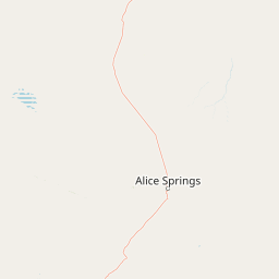
Use this park location map to pinpoint West MacDonnell National Park in Australia, understand its exact geographic position, and read its mapped placement within the surrounding landscape more clearly.

Pigeon | © OpenStreetMap contributors

Location context for West MacDonnell National Park

Northern Territory
Park atlas

Compare the diverse protected landscapes of the MacDonnell Ranges and central Australia, extending beyond West MacDonnell National Park.

Discover Other National Parks and Protected Areas Near West MacDonnell National Park

Explore adjacent national parks and protected areas across Australia's Red Centre, tracing the distinct arid landscapes and dramatic mountain ranges that surround West MacDonnell National Park. Compare their unique ecological features, conservation priorities, and geographic context to deepen your understanding of the region's resilient outback environment.
National parkNorthern Territory
Mapped location lies within the park boundary#1 closest

Tjoritja / West MacDonnell National Park: National Park Atlas and Protected Landscape

Explore the dramatic MacDonnell Ranges terrain and geography.

Delve into the protected geography of Tjoritja / West MacDonnell National Park, a significant national park in Australia's Northern Territory. This landscape features striking mountain formations, deep gorges like Standley Chasm and Glen Helen, and is intrinsically linked to the famous Larapinta Trail and the Arrernte people's cultural heritage. Understanding its mapped boundaries and regional context provides essential insight into this iconic Central Australian protected area.

Area
2,568.61 km²
Established
1992
IUCN
II
Relief
Mountain
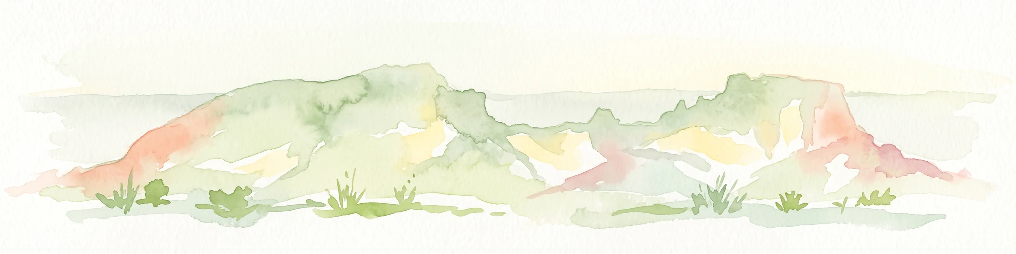
Watercolor painting of a landscape with green valleys, pink and yellow mountain peaks, and distant hills
National parkNorthern Territory
About 48 km away#2 closest

West

Finke Gorge National Park: Explore Its Protected Landscape and Geographic Identity

Mapped boundaries and natural terrain within Northern Territory.

Finke Gorge National Park represents a significant protected area within the Northern Territory, Australia. This national park offers valuable insights into the region's geography, mapped landscapes, and natural terrain. Detailed information helps users understand the park's protected boundaries and its role in the broader context of Australian conservation lands, ideal for focused atlas exploration.

Area
452.85 km²
Established
1966
IUCN
V
Visitors
18K annual
Wildlife reserveNorthern Territory
About 67 km away#3 closest

East

Kuyunba Conservation Reserve: Wildlife Protected Landscape in Central Australia

Mapped geography and rocky habitat near Alice Springs

Kuyunba Conservation Reserve represents a focused approach to habitat protection in the Northern Territory. The terrain is defined by its rocky hills and boulder-filled escarpments, offering critical shelter for wildlife in an arid, drought-adapted desert region. This site provides a clear view of how targeted land management supports specialized ecological niches in inland Australia.

Area
6.29 km²
Established
1970
IUCN
V
Relief
Upland
Nature reserveNorthern Territory
About 82 km away#4 closest

Southwest

Illamurta Springs Conservation Reserve: Geography and Protected Landscape Atlas

Desert-fringe oasis in the Northern Territory

Located in the arid heart of central Australia, Illamurta Springs Conservation Reserve anchors a rare permanent water source at the base of the James Range. This protected area offers deep insight into the region's geography, balancing an essential oasis habitat with significant cultural storylines and remnants of frontier history in the Northern Territory.

Area
1.29 km²
Established
1969
IUCN
V
Relief
Upland
Nature reserveNorthern Territory
About 86 km away#5 closest

West

Tnorala Conservation Reserve: Geological Wonders and Protected Landscapes of the Northern Territory

An iconic circular impact crater preserved as a cultural and natural sanctuary

Tnorala Conservation Reserve stands as a sentinel in the Northern Territory, defined by its striking five-kilometre-wide ring of hills. This protected area offers a look at a massive, ancient impact crater remnant that rises sharply from the surrounding desert plains, serving as a critical point of geological interest and a deeply revered sacred site for the Western Arrernte people.

Relief
Mountain
Climate
Arid
Access
Access unknown
Scope
Terrestrial
Nature reserveNorthern Territory
About 89 km away#6 closest

Southeast

Rainbow Valley Conservation Reserve: Geological Atlas and Protected Landscape Mapping

Examining the arid-zone terrain of Northern Territory, Australia.

The Rainbow Valley Conservation Reserve is a significant protected landscape known for its 350-million-year-old banded sandstone bluffs and diverse arid-zone habitats. This overview provides a focused look at the park's geological structure, claypan terrain, and its status as a vital site for Aboriginal heritage, offering a clear understanding of its place within the broader Northern Territory geographic context.

Area
24.83 km²
Established
1990
IUCN
V
Visitors
6.8K annual
Nature reserveNorthern Territory
About 91 km away#7 closest

Southeast

Napwerte / Ewaninga Rock Carvings Conservation Reserve: Protected Desert Landscape Map

Cultural heritage and arid basin geography in the Northern Territory

Napwerte / Ewaninga Rock Carvings Conservation Reserve protects a unique desert site defined by its extensive collection of prehistoric Arrernte rock engravings. The landscape encompasses rocky outcrops, red sand dunes, and a seasonal claypan that captures rare rainfall, creating a significant intersection of archaeological history and arid-zone ecology in central Australia.

Area
0.06 km²
Established
1970
IUCN
V
Relief
Lowland
Natural monumentNorthern Territory
About 99 km away#8 closest

South

Henbury Meteorites Conservation Reserve: Geological and Cultural Impact Site Mapping

Northern Territory desert monument and crater field atlas

Henbury Meteorites Conservation Reserve preserves a series of striking impact craters in the heart of the Northern Territory desert. This protected area offers insights into the geological mechanics of meteorite falls and the enduring cultural significance of the site within central Australian history. Its compact crater field creates a distinct topography against the surrounding arid plains, making it a focal point for understanding terrestrial impact morphology.

Area
0.16 km²
Established
1964
IUCN
III
Relief
Lowland

Common questions about visiting, size, designation, and location context for West MacDonnell National Park

West MacDonnell National Park FAQs for park facts, access, geography, and protected area context

Find quick answers about West MacDonnell National Park, including protected-area facts, park geography, trail and visitor context, and how the park fits into its surrounding country and regional landscape.
MoriAtlas Explorer

Continue Your Protected Areas Search Across the Global Atlas

Deepen your exploration by continuing the structured search for national parks and protected areas worldwide. Utilize the comprehensive filtering capabilities to compare different conservation landscapes and refine your understanding of global park geography. Discover more about the distribution and characteristics of protected natural areas.

Global natural geography