
Mori Atlas logo
National parkArchipiélago de Juan Fernández National Park

Discover a Biosphere Reserve with extreme endemism and dramatic terrain in the Valparaíso Region.

Archipiélago de Juan Fernández National Park: Isolated Volcanic Island Landscape & Protected Geography

Archipiélago de Juan Fernández National Park preserves a globally significant, isolated island ecosystem featuring dramatic volcanic terrain, steep mountainous landscapes, and unique endemic biodiversity. Situated in the South Pacific, west of mainland Chile, this protected national park encompasses Robinson Crusoe Island, Alejandro Selkirk Island, and Santa Clara Island, forming a critical habitat for species found nowhere else on Earth. Its designation as a Biosphere Reserve underscores its importance for conservation and understanding isolated evolutionary processes through map-based geographic discovery.

Volcanic IslandsBiosphere ReserveEndemic SpeciesIsland ConservationSeabird ColoniesEndemic Birds
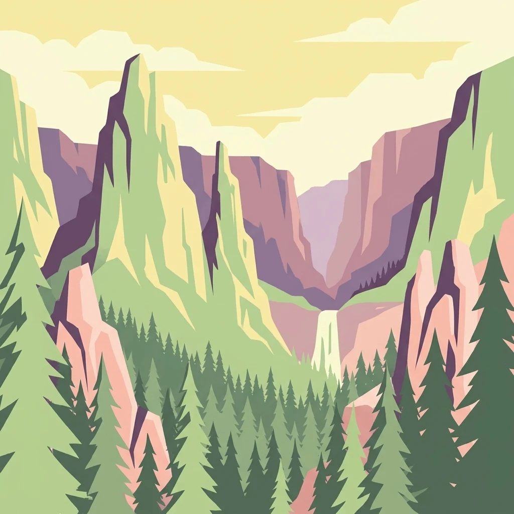
Stylized illustration of a mountainous valley featuring a waterfall, dense forest, and rocky cliffs

Archipiélago de Juan Fernández National Park

National park

Park overview

Structured park overview, official facts, and landscape profile for Archipiélago de Juan Fernández National Park

Archipiélago de Juan Fernández National Park park facts, protected area profile, and essential visitor context

Review the core facts for Archipiélago de Juan Fernández National Park, including designation, size, terrain, visitor scale, habitats, and operating context in one park-focused overview.

About Archipiélago de Juan Fernández National Park

Archipiélago de Juan Fernández National Park protects a remote volcanic archipelago in the South Pacific that represents one of Chile's most ecologically significant protected areas. The islands, born from submarine volcanic activity, sit approximately 665 kilometers west of the Chilean mainland, creating extreme geographic isolation that has driven remarkable evolutionary divergence. The park encompasses three main islands: Robinson Crusoe (the largest and most visited), Alejandro Selkirk (named after the real-life inspiration for Robinson Crusoe), and the smaller Santa Clara. This island chain forms part of the Juan Fernández Ridge, a series of seamounts and islands that rise from the deep ocean floor. The terrain is predominantly mountainous, with steep cliffs, deep ravines, and elevations exceeding 900 meters on Robinson Crusoe. The park's establishment in 1935 reflected early recognition of the islands' unique biological value, though formal protection was significantly enhanced when UNESCO designated the entire archipelago a Biosphere Reserve in 1977. Today, the park is managed by CONAF (Corporación Nacional Forestal), Chile's national forest corporation, which works to balance conservation with the needs of the small resident communities on the islands.

Quick facts and research context for Archipiélago de Juan Fernández National Park

The park spans approximately 96 square kilometers across three main islands in the Juan Fernández Archipelago, located in the Valparaíso Region of Chile. It was established on January 16, 1935, making it one of Chile's older protected areas. The archipelago experiences a subtropical climate with Mediterranean influence, moderated by the cold Humboldt Current and southeast trade winds. The park contains 209 native vascular plant species, of which 126 (62 percent) are endemic, including 12 endemic genera and one endemic family. The islands support three endemic bird species and two endemic subspecies, while marine waters host the Juan Fernández fur seal and endemic lobster species. The park received around 1,400 visitors in 2012, with numbers varying significantly by year.

Protection and recognition

Tracing terrestrial protection designations and official biosphere reserve status across the island chain

Protection Status and UNESCO Recognition of Archipiélago de Juan Fernández National Park

Terrestrial boundary conservation defines the management scope of Archipiélago de Juan Fernández National Park within its isolated island geography. Official designations highlight its international integration, notably through its established status as a UNESCO Biosphere Reserve.

International recognition

Protection details

Protection scope
Terrestrial
Designated year
1977
Transboundary protection
No
Core area
1,170.28 km²
Buffer area
598.8 km²
Park context

Deeper park guide and search-rich context for Archipiélago de Juan Fernández National Park

Archipiélago de Juan Fernández National Park history, landscape, wildlife, and travel context

Explore Archipiélago de Juan Fernández National Park through its history, landscape character, ecosystems, wildlife, conservation priorities, cultural context, and seasonal travel timing in a structured park guide built for atlas discovery and search intent.

Why Archipiélago de Juan Fernández National Park stands out

The park is best known for its extraordinary level of endemism, being one of the world's most biologically isolated island ecosystems. It protects the critically endangered Juan Fernández firecrown, a hummingbird found nowhere else on Earth with a population of approximately 500 individuals. The archipelago serves as the entire global breeding grounds for two threatened petrel species and hosts significant seabird colonies. The volcanic islands contain ancient endemic plant lineages related to southern South America, New Zealand, and Australia, including the endemic family Lactoridaceae. The park also preserves the world's only population of the Juan Fernández fur seal, which was rediscovered in 1965 after being thought extinct and has since recovered to several thousand individuals.
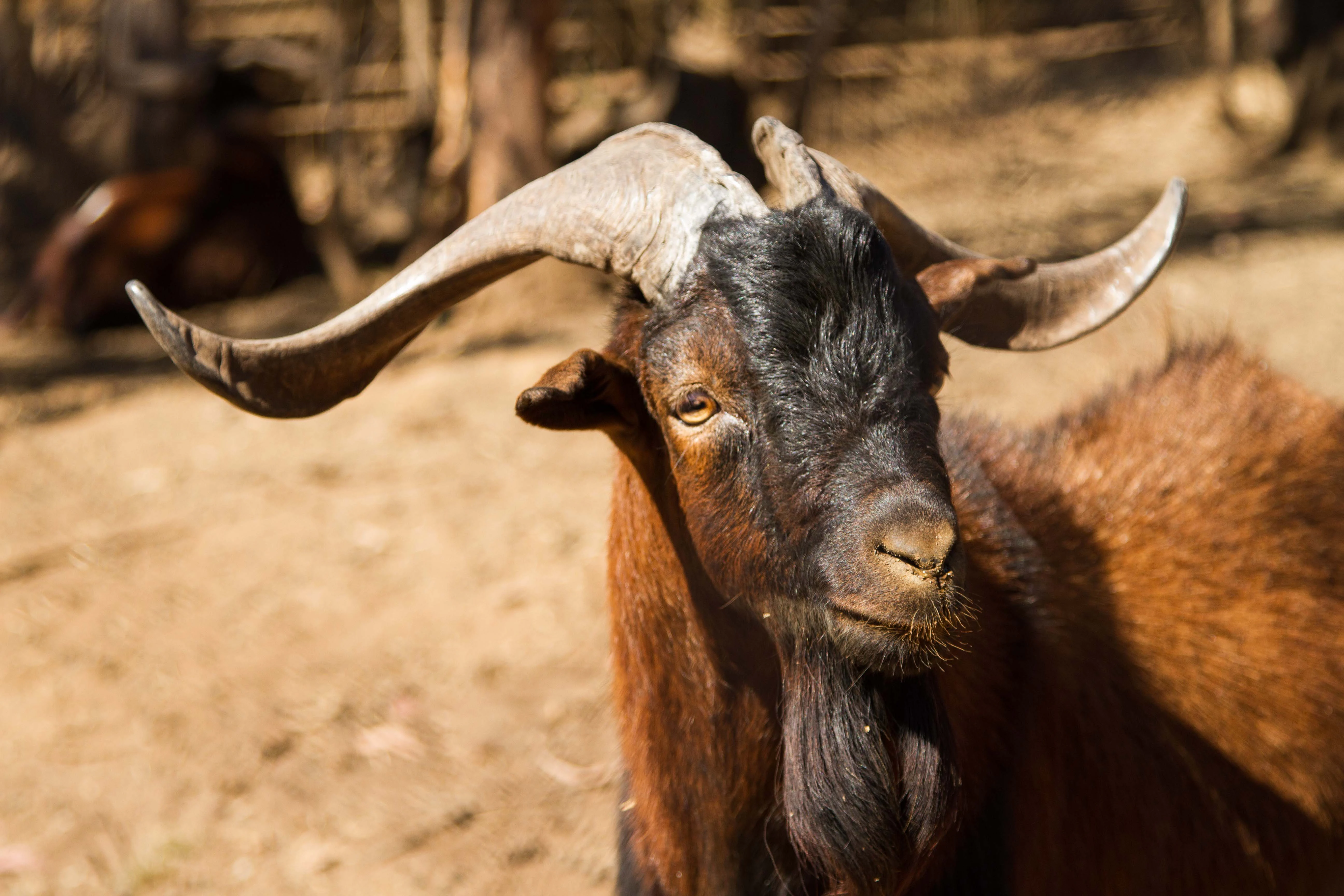
Brown and black goat with large curved horns standing outdoors
Juan Fernández goat specimen

Archipiélago de Juan Fernández National Park history and protected-area timeline

The Juan Fernández Archipelago was discovered by Spanish navigator Juan Fernández in 1574, and the islands later became famous as the real-life inspiration for Daniel Defoe's novel Robinson Crusoe. The islands remained relatively isolated for centuries, with limited settlement and exploitation. Recognition of the islands' extraordinary biological importance came relatively early, leading to the establishment of the national park in 1935, one of Chile's first protected areas. In 1977, the archipelago received additional international recognition when UNESCO designated it a Biosphere Reserve, acknowledging the global significance of its endemic species and evolutionary isolation. The Chilean government further protected the islands' subsurface resources in 1989 through a decree establishing the park as a place of scientific interest for mining purposes, adding another layer of environmental protection. The history of human presence has also introduced invasive species that continue to pose conservation challenges, with feral goats, rats, and other introduced animals threatening native ecosystems.

Archipiélago de Juan Fernández National Park landscape and geographic character

The park encompasses dramatic volcanic island landscapes characterized by steep mountainous terrain, deep ravines, and rugged coastlines. Robinson Crusoe Island, the largest in the archipelago, rises sharply from the ocean with a central mountain peak exceeding 900 meters in elevation. The island's topography features numerous quebradas (wooded ravines) that descend from the central highlands to the coast. Alejandro Selkirk Island is similarly mountainous, with grassland dominating lower elevations while upper slopes support forest and scrub vegetation. Santa Clara is the smallest of the three main islands and is covered primarily with grassland. The volcanic origins of these islands are evident in the dramatic cliffs, rocky shores, and the absence of extensive sandy beaches. The marine environment surrounding the islands features clear waters, rocky reefs, and significant submerged地形, supporting diverse marine life. Elevation zones on the islands create distinct vegetation bands, from coastal grasslands through forest zones to alpine shrubland at the highest points.
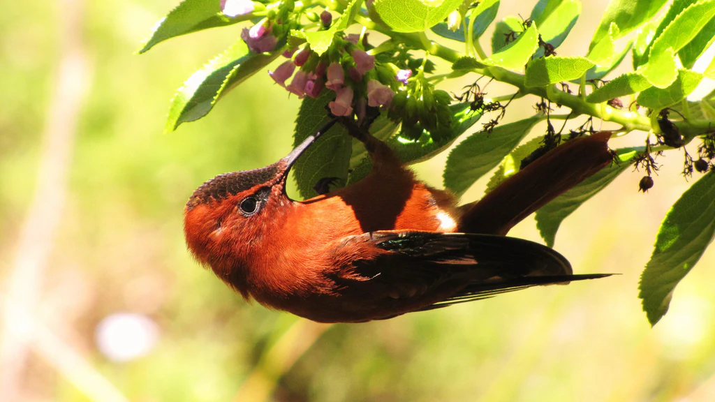
A brown hummingbird with dark wings feeding on small pink flowers among green leaves.
Juan Fernández Firecrown hummingbird feeding on small pink flowers.

Archipiélago de Juan Fernández National Park ecosystems, habitats, and plant life

The Juan Fernández Archipelago represents a distinct ecoregion characterized by extraordinary endemism resulting from millions of years of geographic isolation. The islands contain 209 native vascular plant species, with approximately 62 percent found nowhere else on Earth, including 12 endemic genera and the sole endemic plant family Lactoridaceae. This exceptional level of endemism places the archipelago among the world's most important island biodiversity hotspots. Plant communities follow distinct elevation patterns, with grasslands and shrublands at lower elevations, transitioning through forest zones dominated by endemic species like Drimys confertifolia, Nothomyrcia fernandeziana, and Myrceugenia schulzei, to alpine vegetation at higher elevations. Tree fern forests of the endemic Dicksonia species characterize the upper forest zones. The vegetation shows clear biogeographic connections to southern South America, with relatives found in the temperate rainforests of Chile and the Magellanic subpolar forests, as well as to New Zealand and Australia through the Antarctic flora. The islands' volcanic soils and varied microclimates support this remarkable plant diversity despite the limited land area.
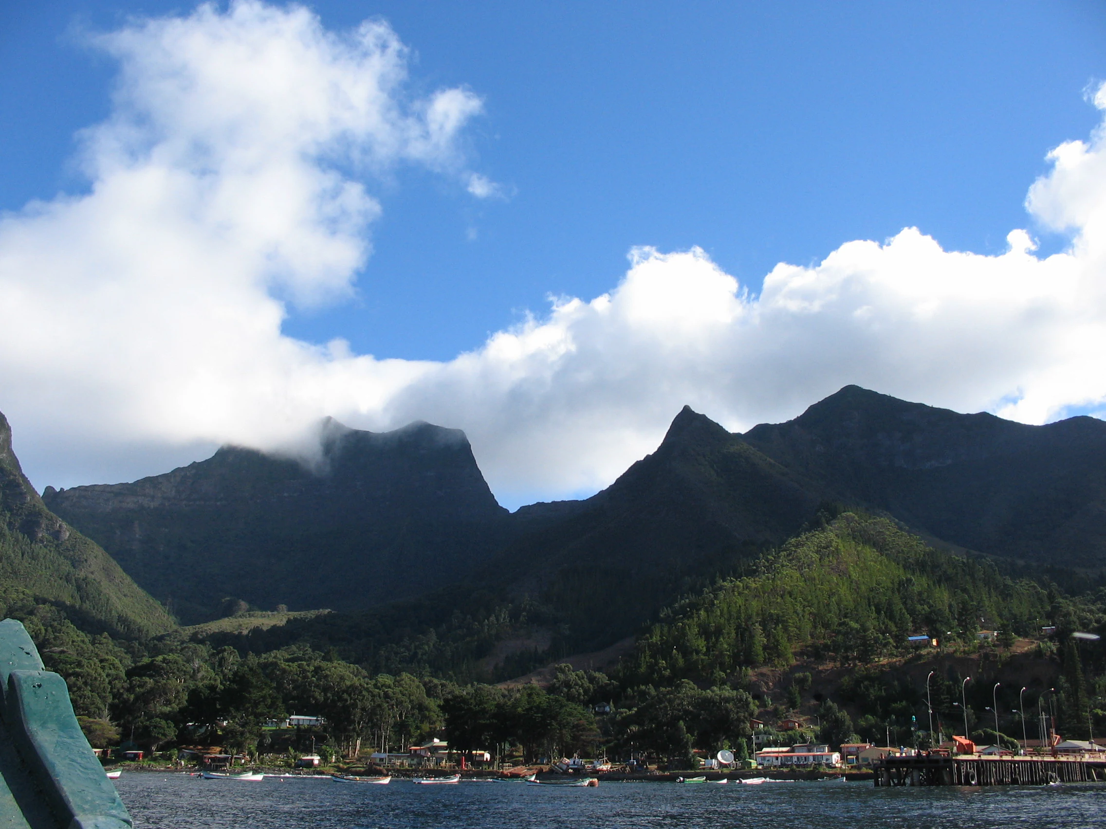
Mountainous landscape of Robinson Crusoe Island with green hills, a body of water, and coastal buildings under a partly cloudy sky
Scenic view of Robinson Crusoe Island with mountains and coastal settlement under a partly cloudy sky

Archipiélago de Juan Fernández National Park wildlife and species highlights

The Juan Fernández Islands support a distinctive fauna characterized by the absence of native land mammals, reptiles, or amphibians, reflecting the islands' extreme isolation. The park is critically important for seabirds, hosting the entire known global breeding populations of Stejneger's Petrel and the Juan Fernández Petrel, both classified as vulnerable. The islands support three fully endemic bird species: the Juan Fernández firecrown (a large hummingbird and one of the world's rarest), the Juan Fernández tit-tyrant, and the Masafuera rayadito. The Juan Fernández firecrown, with a population of approximately 500 individuals, represents one of the most threatened birds in the Americas. Marine mammals are well represented, with the Juan Fernández fur seal having recovered from near extinction in the 1960s to several thousand individuals today. The endemic Juan Fernández spiny lobster inhabits the surrounding marine waters. However, introduced species including goats, rats, mice, and feral cats pose significant threats to native wildlife through predation and habitat destruction.
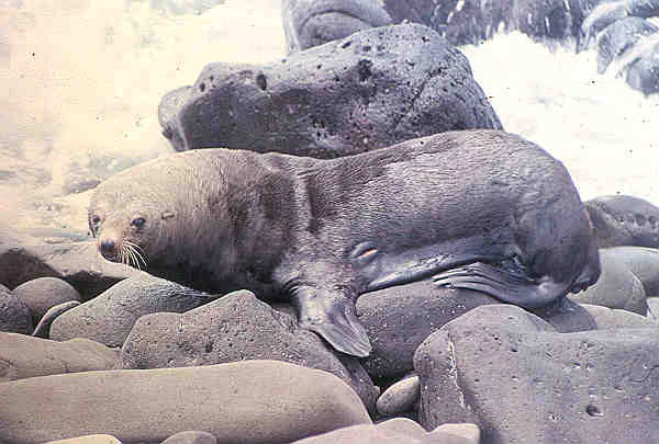
A fur seal lying on dark volcanic rocks with ocean waves in the background
Juan Fernández fur seal resting on rocky shoreline

Archipiélago de Juan Fernández National Park conservation status and protection priorities

The park's conservation significance is recognized internationally through its UNESCO Biosphere Reserve designation and its status as an Important Bird Area. The extreme endemism means that many species exist nowhere else, making the park critical for global biodiversity conservation. Several species are listed as endangered or threatened, including the Juan Fernández firecrown and the endemic petrels that breed exclusively on these islands. Conservation challenges include invasive species control, particularly managing feral goat populations that have transformed much of the island vegetation and threaten native plant species. The Juan Fernández Goat, descended from domestic animals left by early explorers, has been particularly destructive to endemic vegetation. CONAF carries out ongoing invasive species management programs targeting goats, rats, mice, thrushes, sparrows, and feral cats. The protection of the park's subsurface as a place of scientific interest for mining purposes provides additional environmental safeguards. The recovery of the Juan Fernández fur seal from near extinction demonstrates the potential for successful conservation when threats are addressed.

Archipiélago de Juan Fernández National Park cultural meaning and human context

The Juan Fernández Archipelago carries significant cultural weight due to its association with Daniel Defoe's novel Robinson Crusoe, making it one of the world's most famous islands through literature. The story was inspired by the real-life experiences of Alexander Selkirk, a Scottish sailor who was marooned on what is now Alejandro Selkirk Island from 1704 to 1709, surviving alone for over four years. This historical connection has shaped the islands' identity and continues to influence how they are perceived internationally. The islands have been inhabited intermittently since their discovery, with small communities developing on Robinson Crusoe Island. The Chilean Navy maintains a presence, and the islands are served by periodic flights from Santiago and occasional naval vessel visits. The isolation and literary history contribute to a strong sense of place among residents, while also creating unique challenges for conservation and sustainable development.

Top sights and standout views in Archipiélago de Juan Fernández National Park

The park's standout features include its extraordinary endemism with over 60 percent of plant species found nowhere else, the critically endangered Juan Fernández firecrown hummingbird, and the globally important seabird colonies supporting vulnerable petrel species. The dramatic volcanic island landscapes with their steep mountains, deep ravines, and clear marine waters create a visually striking environment. The recovery story of the Juan Fernández fur seal demonstrates successful conservation. The UNESCO Biosphere Reserve status reflects international recognition of the islands' global biodiversity significance. The literary connection to Robinson Crusoe adds a unique cultural dimension that distinguishes this park from other protected areas.

Best time to visit Archipiélago de Juan Fernández National Park

The islands experience a subtropical climate with a distinct dry season during the warmer summer months (roughly November through March) and wetter winter conditions. The best time to visit depends on interests: summer months typically offer more stable weather and easier access to outdoor activities, while winter brings higher rainfall particularly at higher elevations. The Humboldt Current influences the climate year-round, moderating temperatures and creating the unique Mediterranean-influenced subtropical conditions. Visitors should note that access to the islands is limited, with weekly flights from Santiago and occasional naval ship visits. The small scale of operations means that visitor numbers remain low throughout the year, creating an intimate experience with nature but requiring advance planning.
Monthly climate preview

Long-term representative measurements of annual temperature and precipitation rhythm

Archipiélago de Juan Fernández National Park Climate Normals and Weather by Month

Representative coordinates record measured monthly temperature ranges and precipitation levels across the annual cycle at Archipiélago de Juan Fernández National Park. Devolved twelve-month climatology data details long-term averages for detailed comparison across the protected area.
Annual mean16 °C
13 °C19 °C
Jan18°
Feb19°
Mar19°
Apr18°
May16°
Jun15°
Jul14°
Aug13°
Sep13°
Oct13°
Nov15°
Dec16°
Warmest month
February

18.7 °C

Coolest month
September

12.9 °C

Wettest month
May

2 mm/day

Driest month
January

0.2 mm/day

Park location guide

Geography guide, regional context, and park location map for Archipiélago de Juan Fernández National Park

Archipiélago de Juan Fernández National Park park geography, regions, and map view in Chile

Understand where Archipiélago de Juan Fernández National Park sits in Chile through a broader geographic reading of the surrounding landscape, nearby location context, and its mapped position within the national park landscape.

How Archipiélago de Juan Fernández National Park fits into Chile

Chile is a presidential republic in western South America, extending as a narrow strip along the western edge of the continent between the Andes Mountains and the Pacific Ocean. It is the southernmost country in the world and the closest to Antarctica. The country is bordered by Peru, Bolivia, and Argentina, and administers several Pacific islands including Easter Island. Chile is a major copper producer and has a population of approximately 19.6 million.

Wider geography shaping Archipiélago de Juan Fernández National Park in Chile

Chile occupies a narrow strip of land along the western edge of South America, extending approximately 4,300 km north to south but only about 350 km east to west at its widest point. The country is sandwiched between the Andes Mountains to the east and the Pacific Ocean to the west. It shares borders with Peru to the north, Bolivia to the northeast, and Argentina to the east. Southern Chile borders the Drake Passage. Chile also administers several Pacific islands including Juan Fernández Islands, Isla Salas y Gómez, Desventuradas Islands, and Easter Island, plus the Chilean Antarctic Territory.

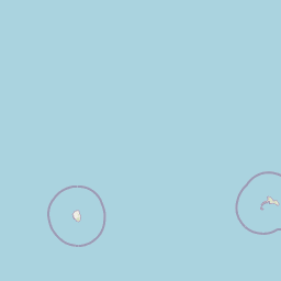
Map view of Archipiélago de Juan Fernández National Park

Use this park location map to pinpoint Archipiélago de Juan Fernández National Park in Chile, understand its exact geographic position, and read its mapped placement within the surrounding landscape more clearly.

Pigeon | © OpenStreetMap contributors

Location context for Archipiélago de Juan Fernández National Park

Valparaíso Region
Natural feature types

Explore Named Geographic Features in Archipiélago de Juan Fernández National Park

Navigate the complex topography of Archipiélago de Juan Fernández National Park by browsing its catalog of named natural features. MoriAtlas provides structured access to the diverse volcanic landscapes, mountain peaks, and coastal landforms that define this remote archipelago in the South Pacific.
Recorded earthquake history

Review the Archipiélago de Juan Fernández National Park Earthquake History

Consult the historical catalogue of recorded seismic events associated with the islands of Archipiélago de Juan Fernández National Park. MoriAtlas provides this data as an indexed record of epicentre proximity to support geographic research and understanding of seismic history in the region.

Archipiélago de Juan Fernández Earthquake History

Catalogued events

1 event

Strongest magnitude

Magnitude 4.5

Most recent event

Nov 9, 2018

This history includes earthquakes recorded inside the park or within 50 km of its borders

View dramatic volcanic island terrain, unique coastal habitats, and endemic species environments through essential park imagery.

Visual Exploration: Archipiélago de Juan Fernández National Park Landscapes and Protected Area Photography

Browse photos of Archipiélago de Juan Fernández National Park to visually understand its dramatic volcanic island landscapes and unique endemic habitats. These images reveal the rugged coastline, mountainous terrain, and specific protected area environments that define this globally significant UNESCO Biosphere Reserve.

Brown and black goat with large curved horns standing outdoors

Colorful coral reef with pink and orange corals, small fish swimming in clear blue water with sunlit background

A brown hummingbird with dark wings feeding on small pink flowers among green leaves.

Mountainous landscape of Robinson Crusoe Island with green hills, a body of water, and coastal buildings under a partly cloudy sky

A fur seal lying on dark volcanic rocks with ocean waves in the background

Goat with large curved horns standing on stone block in concrete enclosure

Park atlas

Explore the unique island geography and protected marine ecosystems surrounding the Juan Fernández Archipelago, tracing connected conservation landscapes.

Discover More Protected Areas Near Archipiélago de Juan Fernández National Park and Surrounding South Pacific Islands

Browse additional national parks and protected areas related to Archipiélago de Juan Fernández National Park, exploring other distinct island and coastal conservation landscapes across the South Pacific. Compare diverse geographic features, unique endemic species, and conservation efforts across these significant protected regions, gaining valuable atlas insights into remote oceanic ecosystems.
National parkLa Araucanía Region
687 km away#1 closest

Southeast

Nahuelbuta National Park: Ancient Araucaria Forests and Protected Highland Geography

Discover its mapped boundaries atop the Cordillera de Nahuelbuta.

Nahuelbuta National Park is a significant national park in Chile's La Araucanía Region, celebrated for its ancient monkey puzzle tree forests atop the Cordillera de Nahuelbuta. This protected area showcases a unique highland landscape with rugged terrain and exposed rocky outcrops, preserving species more typical of Andean and Patagonian environments. Understanding its mapped geography and protected landscape identity is key to appreciating its ecological importance and distinct position within South America's natural atlas.

Area
68 km²
Established
1939
IUCN
II
Relief
Mountain
National parkLibertador General Bernardo O'Higgins Region
704 km away#2 closest

East

Las Palmas de Cocalán National Park: Chile's National Park Protected Landscape Atlas

Explore geographic boundaries and regional context.

Delve into the protected landscape identity of Las Palmas de Cocalán National Park, situated within the Libertador General Bernardo O'Higgins Region. This page provides detailed atlas-style information, focusing on the park's geographic features and its role as a national park. Understand the mapped natural terrain and the regional importance of this conserved area for comprehensive geographic discovery.

Area
3.709 km²
Established
1971
IUCN
II
Relief
Mixed relief
Watercolor painting of a coastal landscape featuring palm trees, mountains, and a body of water
National parkValparaíso Region
713 km away#3 closest

East

La Campana National Park: Protected Landscape of Chilean Wine Palms

Explore its mapped terrain and regional geographic context.

La Campana National Park represents a significant protected landscape within Chile, celebrated for its exceptional concentration of Chilean Wine Palms (Jubaea chilensis). As a national park situated in the Valparaíso Region, it showcases a diverse range of Mediterranean ecosystems and dramatic coastal mountain terrain. This page provides detailed atlas-style context, highlighting the park's unique botanical heritage, its distinct geographic setting, and its importance as a mapped natural area for regional landscape studies.

Area
80 km²
Established
1967
IUCN
II
Visitors
39.6K annual
National parkMaule Region
734 km away#4 closest

East

Radal Siete Tazas National Park: Iconic Seven Cups Waterfall System and Pre-Andean Terrain Exploration

Mapped protected landscape in Maule Region, Chile.

Radal Siete Tazas National Park showcases a remarkable cascade of seven natural rock pools and waterfalls along the Claro River, a defining feature within its steep pre-Andean topography. This national park in Chile's Maule Region offers a landscape rich with volcanic influences and dramatic riverine erosion. Users can explore its distinct terrain, mapped boundaries, and the striking visual geography that makes this protected area a significant natural landmark for atlas-based discovery.

Area
41.4 km²
Established
2008
IUCN
II
Relief
Mountain
Watercolor illustration of a river winding through a valley with rolling hills and green vegetation in the foreground.
National parkCoquimbo Region
741 km away#5 closest

East

Bosque de Fray Jorge National Park: National Park Protected Landscape & Geographic Atlas

Explore mapped boundaries and regional natural landscape context.

Bosque de Fray Jorge National Park is a key protected area offering unique insights into Chile's natural landscapes. This entry provides detailed geographic context, focusing on its status as a national park and its mapped boundaries within the Coquimbo Region. Discover its place in the regional atlas and understand its protected landscape identity for focused geographic exploration.

Area
100 km²
Established
1941
IUCN
II
Visitors
13.1K annual
National parkSantiago Metropolitan Region
767 km away#6 closest

East

Río Clarillo National Park: National Park Boundaries and Geographic Atlas Context

Mapped protected landscape in Santiago Metropolitan Region.

Discover the distinct protected landscape of Río Clarillo National Park, a national park situated within Chile's Santiago Metropolitan Region. This entry is designed for atlas-style exploration, focusing on the park's mapped boundaries, its integration into the regional geography, and its significance as a protected natural area. Understand the geographic context and landscape characteristics that define Río Clarillo National Park, enabling a deeper appreciation of its role within the broader conservation map.

Area
101.85 km²
Established
1982
IUCN
IV
Relief
Upland
National parkBío Bío Region
781 km away#7 closest

Southeast

Laguna del Laja National Park: Mapped Protected Area in Chile's Bío Bío Region

Explore regional park geography and landscape context.

Laguna del Laja National Park represents a key protected area with distinct geographic attributes within the Bío Bío Region. This profile focuses on its identity as a national park, providing context for its mapped boundaries and natural landscape. Discover its place in regional geography, offering valuable insights for any atlas-focused exploration of Chile's protected lands.

Area
119 km²
Established
1958
IUCN
II
Visitors
48.8K annual
National parkChile
795 km away#8 closest

Southeast

Tolhuaca National Park National Park: Mapped Boundaries and Chilean Geography

Explore the protected landscape and regional context of this park.

Tolhuaca National Park is a protected national park located in Chile, offering a distinct point for geographic and landscape discovery. This detailed view focuses on the park's mapped boundaries, its environmental setting within Chile, and its overall protected-area identity. Engage with structured data that clarifies its position in the broader atlas of natural landscapes, providing context for regional geography and conservation efforts.

Area
64.74 km²
Established
1935
IUCN
II
Visitors
6.5K annual

Common questions about visiting, size, designation, and location context for Archipiélago de Juan Fernández National Park

Archipiélago de Juan Fernández National Park FAQs for park facts, access, geography, and protected area context

Find quick answers about Archipiélago de Juan Fernández National Park, including protected-area facts, park geography, trail and visitor context, and how the park fits into its surrounding country and regional landscape.
MoriAtlas Explorer

Continue Your Protected Areas Search Across the Global Atlas

Deepen your exploration by continuing the structured search for national parks and protected areas worldwide. Utilize the comprehensive filtering capabilities to compare different conservation landscapes and refine your understanding of global park geography. Discover more about the distribution and characteristics of protected natural areas.

Global natural geography