Mori Atlas logo
National parkHat Khanom–Mu Ko Thale Tai National Park

Discover the mapped boundaries and regional geography within Nakhon Si Thammarat Province.

Hat Khanom–Mu Ko Thale Tai National Park: National Park Protected Landscape and Geographic Context

Hat Khanom–Mu Ko Thale Tai National Park stands as a significant protected natural area within Thailand's Nakhon Si Thammarat Province. As a national park, its designation signifies a commitment to preserving its unique landscape for scientific study and geographic understanding. This page offers an atlas-centric view, focusing on the park's mapped boundaries and its integral role within the regional geography, providing essential context for landscape exploration.

national parkcoastal parkisland archipelagomangrove forestlimestone mountainssouthern Thailand

Hat Khanom–Mu Ko Thale Tai National Park

National park

Park overview

Structured park overview, official facts, and landscape profile for Hat Khanom, Mu Ko Thale Tai National Park

Hat Khanom, Mu Ko Thale Tai National Park park facts, protected area profile, and essential visitor context
Review the core facts for Hat Khanom, Mu Ko Thale Tai National Park, including designation, size, terrain, visitor scale, habitats, and operating context in one park-focused overview.

About Hat Khanom, Mu Ko Thale Tai National Park

Hat Khanom–Mu Ko Thale Tai National Park represents a coastal protection initiative that captures two fundamental elements of Thailand's southern landscape: the mainland beaches of the Khanom coast and the offshore islands of the Thale Tai archipelago. The park straddles administrative boundaries in two provinces, encompassing territory in Khanom and Sichon districts of Nakhon Si Thammarat Province, as well as Don Sak and Ko Samui districts of Surat Thani Province. This geographic positioning places the park along a transition zone between the mainland peninsula and the marine environments of the Gulf, creating ecological diversity that spans from mountain forest to coral-influenced waters.

The park area includes approximately 312 square kilometers of combined land and sea territory. Primary forest dominates the terrestrial landscape, dissected by numerous streams that originate in the limestone highlands and flow toward the coast. The mountains reach elevations exceeding 800 meters, creating a dramatic backdrop to the coastal plain. Mangrove forests line the estuarine zones, providing critical ecological functions for coastal protection and marine productivity. The marine component centers on eight named islands distributed across the gulf between Khanom and Ko Samui, each contributing to the overall biodiversity and scenic character of the protection area.

Quick facts and research context for Hat Khanom, Mu Ko Thale Tai National Park

The park covers approximately 312 square kilometers spanning Khanom and Sichon districts in Nakhon Si Thammarat Province, and Don Sak and Ko Samui districts in Surat Thani Province. Three park protection units manage the area: the Tham Khao Wong Thong unit, the Khlong Khanom Mangrove Forest unit, and the Thong Ching Unit. The highest elevation reaches 814 meters at Khao Luang peak. The Thale Tai archipelago consists of eight islands in the Gulf of Thailand, while the terrestrial portion includes tropical evergreen forest, dry evergreen forest, mangrove forests, beach forest, and limestone forest habitats.

Park context

Deeper park guide and search-rich context for Hat Khanom, Mu Ko Thale Tai National Park

Hat Khanom, Mu Ko Thale Tai National Park history, landscape, wildlife, and travel context
Explore Hat Khanom, Mu Ko Thale Tai National Park through its history, landscape character, ecosystems, wildlife, conservation priorities, cultural context, and seasonal travel timing in a structured park guide built for atlas discovery and search intent.

Why Hat Khanom, Mu Ko Thale Tai National Park stands out

Hat Khanom, Mu Ko Thale Tai is distinguished by its dual terrestrial and marine character, combining mainland beach environments with a scattered island archipelago. The park protects significant primary forests on limestone mountains, extensive mangrove ecosystems along the coast, and serves as a corridor for diverse wildlife including tigers, sambar deer, gibbons, and the Malayan sun bear. The Thale Tai islands create important marine habitats in the Gulf of Thailand, supporting coastal bird populations and aquatic species. The landscape is defined by dramatic limestone peaks rising from the coastal plain, fringed by mangrove forests and sandy beaches.

Hat Khanom, Mu Ko Thale Tai National Park history and protected-area timeline

The establishment of Hat Khanom–Mu Ko Thale Tai National Park has proceeded as a staged process, with the park remaining in preparation status as of the mid-2010s. The protection initiative reflects recognition of the area's ecological significance and the need to coordinate management across two provincial jurisdictions. Thailand's national park system, administered by the Department of National Parks, Wildlife and Plant Conservation, has pursued the formal designation to provide systematic protection for the combined coastal, forest, and marine environments that characterize this stretch of the Gulf of Thailand coastline. The park's establishment process includes ongoing survey work and boundary refinement, with formal announcement in the Royal Gazette pending completion of these preparatory steps.

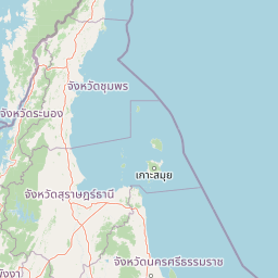
Hat Khanom, Mu Ko Thale Tai National Park landscape and geographic character

The park's landscape exhibits a characteristic southern Thai coastal topography combining limestone mountainous terrain with flat coastal lowlands and offshore islands. The limestone mountains rise abruptly from the inland areas, with peaks including Khao Luang reaching approximately 814 meters above sea level. These karst formations create distinctive visual profiles and support specialized vegetation communities adapted to the rocky substrates. The coastal zone features beaches associated with the Hat Khanom area, where sandy shores meet the Gulf of Thailand. Mangrove forests occupy the intertidal zones where freshwater streams mix with tidal saltwater, creating complex root systems that stabilize the shoreline. The marine landscape includes the islands of the Thale Tai archipelago, each varying in size and character, scattered across the gulf waters.

Hat Khanom, Mu Ko Thale Tai National Park ecosystems, habitats, and plant life

The ecological character of Hat Khanom–Mu Ko Thale Tai encompasses multiple habitat types that support considerable biodiversity. The primary forest systems include species such as Intsia palembanica, various Dipterocarpus species, ironwood, Sandoricum koetjape, and teak. These tropical evergreen and semi-evergreen forests form the core terrestrial habitat. The mangrove forests represent a critical coastal ecosystem, containing mangroves, taboon, and Thespesia populneoides. Limestone mountain areas support specialized plant communities including chanpah and Opuntia elatior. The combination of forest-covered mountains, coastal plains, mangrove zones, and island environments creates a gradient of habitats that supports diverse ecological communities across the park.

Hat Khanom, Mu Ko Thale Tai National Park wildlife and species highlights

The wildlife community within Hat Khanom–Mu Ko Thale Tai reflects the diverse habitats present in the park. Mammal species documented include wild pig, various monkeys, semno, Indochinese ground squirrel, goral, muntjac, Malayan sun bear, tiger, sambar deer, and gibbon. Bird populations are particularly diverse, with species including crested serpent eagle, thick-billed pigeon, Oriental magpie-robin, shama, dove, cormorant, Nicobar pigeon, Pacific reef egret, and green imperial pigeon. Reptile and amphibian communities include tortoises, snakes, chameleons, and various frog species including Bufo asper. Aquatic species in the park's waters include serpenthead fish, crabs, shrimp, saltwater fish, and snakeheads.

Hat Khanom, Mu Ko Thale Tai National Park conservation status and protection priorities

The park contributes to Thailand's conservation framework by protecting a representative sample of southern coastal and marine ecosystems. The combination of primary forest, mangrove systems, and island environments addresses multiple conservation priorities including watershed protection, coastal stabilization, and marine habitat preservation. The limestone forest habitats support species with limited distribution, while the mangroves function as nurseries for marine fish and crustaceans. The park's pending official status reflects ongoing efforts to integrate terrestrial and marine protection within a unified management framework. Three park protection units provide on-ground management presence across the terrestrial and mangrove areas.

Hat Khanom, Mu Ko Thale Tai National Park cultural meaning and human context

The park occupies a coastal region with traditional connections to fishing and maritime activities. The communities of Khanom and surrounding areas have historically utilized the coast and nearby islands for livelihood purposes. The Thale Tai archipelago has served as a navigational and resource zone within the broader Gulf of Thailand marine environment. The naming of the park in Thai reflects this coastal and island character, with "หาดขนอม" indicating the beach orientation and "หมู่เกาะทะเลใต้" indicating the southern island group.

Top sights and standout views in Hat Khanom, Mu Ko Thale Tai National Park

The park's defining quality lies in its combination of mainland and marine environments within a single protection framework. Limestone mountains covered in primary forest rise behind beaches and mangrove forests, while the Thale Tai islands extend the protected area into the Gulf of Thailand. The diversity of habitats from mountain peak to island shore supports varied wildlife communities including large mammals, forest birds, and marine species. Three protection units manage distinct zones within the park, from mountain forest through coastal mangrove to island environments.

Best time to visit Hat Khanom, Mu Ko Thale Tai National Park

The park experiences a tropical climate with rainfall occurring throughout most of the year due to southwesterly and northeasterly wind influences. Two primary seasons characterize the year: a summer period from February through April and a rainy season extending from May through January. Visitors seeking optimal conditions for forest exploration and wildlife observation may find the drier months more comfortable, though the park's year-round rainfall means that moisture and green vegetation are consistent features regardless of season. The marine environments and island components are accessible across seasons, though sea conditions may vary with the monsoon patterns affecting the Gulf of Thailand.

Park location guide

Geography guide, regional context, and park location map for Hat Khanom, Mu Ko Thale Tai National Park

Hat Khanom, Mu Ko Thale Tai National Park park geography, regions, and map view in Thailand
Understand where Hat Khanom, Mu Ko Thale Tai National Park sits in Thailand through a broader geographic reading of the surrounding landscape, nearby location context, and its mapped position within the national park landscape.

How Hat Khanom, Mu Ko Thale Tai National Park fits into Thailand

Thailand is a Southeast Asian nation formerly called Siam, located in mainland Southeast Asia. It operates as a unitary parliamentary constitutional monarchy under King Vajiralongkorn. The country borders Myanmar, Laos, Cambodia, and Malaysia, with maritime boundaries involving Vietnam, Indonesia, and India. Thailand has a population of nearly 66 million and covers approximately 513,120 km². Historically, the Sukhothai Kingdom marks the beginning of Thai history, followed by the powerful Ayutthaya Kingdom.

Wider geography shaping Hat Khanom, Mu Ko Thale Tai National Park in Thailand

Thailand occupies mainland Southeast Asia with borders to Myanmar (west/northwest), Laos (east/northeast), Cambodia (southeast), and Malaysia (south). The country has coastline along the Gulf of Thailand to the southeast and the Andaman Sea to the southwest. The territory covers approximately 513,120 km².

Map view of Hat Khanom, Mu Ko Thale Tai National Park

Use this park location map to pinpoint Hat Khanom, Mu Ko Thale Tai National Park in Thailand, understand its exact geographic position, and read its mapped placement within the surrounding landscape more clearly.

Pigeon | © OpenStreetMap contributors

Location context for Hat Khanom, Mu Ko Thale Tai National Park

Nakhon Si Thammarat ProvinceSurat Thani Province
Park atlas

Trace the regional geography of connected protected areas, marine environments, and coastal landscapes in Southern Thailand.

Explore Nearby National Parks and Protected Areas Beyond Hat Khanom–Mu Ko Thale Tai National Park
After reviewing Hat Khanom–Mu Ko Thale Tai National Park, browse other national parks and protected areas in the surrounding coastal and island geography of southern Thailand. This comparative view helps users trace similar limestone mountain formations, expansive mangrove ecosystems, and significant marine habitats within the broader regional park atlas.
National parkSurat Thani Province

Mu Ko Ang Thong National Park: National Park with Distinct Protected Landscape and Geographic Context

Explore mapped boundaries within Surat Thani Province, Thailand.

Mu Ko Ang Thong National Park serves as a key protected area, offering a focused study of its specific geography and landscape features within the broader atlas of Surat Thani Province. As a national park, its mapped boundaries are crucial for understanding conservation landscapes in this part of southern Thailand. Users exploring this destination will find detailed context on its natural terrain and regional geographic placement.

Area
102 km²
Established
1980
IUCN
II
Visitors
134.3K annual
National parkSurat Thani Province

Than Sadet, Ko Pha-ngan National Park: A Royal Heritage Protected Landscape in Surat Thani

Island geography, royal rivers, and mountain terrain exploration.

Delve into Than Sadet, Ko Pha-ngan National Park, a protected area in Surat Thani Province renowned for its fusion of natural beauty and historical significance. This park protects diverse ecosystems, including dense forests, the famous Than Sadet waterfall and river system, and mountainous interiors, culminating in views from Khao Ra. As a key protected landscape, its mapped boundaries reveal a vital natural sanctuary with deep royal connections, inviting exploration of its unique geographic context and heritage within the Thai atlas.

Area
43 km²
Established
2018
IUCN
II
Visitors
158.1K annual
National parkSurat Thani Province

Kaeng Krung National Park: Exploring Protected Area Boundaries and Regional Geography

A National Park within Surat Thani Province's diverse landscapes.

Kaeng Krung National Park is a distinct protected area situated in Surat Thani Province, Thailand. This page provides essential context for understanding the park's geographic significance, its mapped boundaries, and its contribution to the regional protected landscape atlas. Explore the fundamental geographic characteristics that define this important natural reserve and its surrounding terrain.

Area
541 km²
Established
1991
IUCN
II
Visitors
909 annual
National parkSurat Thani Province

Khao Sok National Park: Protected Landscape Atlas and Geographic Detail

Explore mapped boundaries and regional terrain in Surat Thani Province.

Khao Sok National Park represents a crucial protected landscape within the expansive geography of Surat Thani Province, Thailand. This detailed entry focuses on the park's identity as a national park, emphasizing its mapped boundaries and the surrounding natural terrain. Through structured information and geographic context, users can gain a clear understanding of Khao Sok National Park's place in the atlas, contributing to a more informed approach to landscape discovery.

Area
739 km²
Established
1980
IUCN
II
Visitors
419.5K annual
National parkKrabi Province

Khao Phanom Bencha National Park: Protected Mountainous Rainforest and Waterfall Landscapes

Explore Krabi Province's unique protected area and its dramatic geographic features.

Khao Phanom Bencha National Park represents a core protected landscape within Krabi Province, Thailand. Dominated by the imposing Khao Phanom Bencha mountain range, its terrain includes steep, forested slopes and intricate valley systems that give rise to impressive waterfalls. This national park is an essential component of the region's protected natural areas, offering a detailed look at its unique ecosystem and geographic character through mapped landscape context and atlas exploration.

Area
50 km²
Established
1981
IUCN
II
Visitors
17.3K annual
National parkRanong

Laem Son National Park: A Protected National Park in Ranong's Geographic Landscape

Explore the mapped natural terrain and protected area boundaries.

Laem Son National Park is a key protected area within Thailand's Ranong province, offering valuable insights into regional geography and landscape preservation. This entry focuses on its status as a national park, providing a structured view of its protected boundaries and environmental context. Understand its unique position within the mapped geography, vital for any comprehensive atlas exploration of protected lands in the region.

Area
315 km²
Established
1983
IUCN
II
Visitors
21.9K annual
National parkThailand

Khao Pu, Khao Ya National Park: Explore Protected Boundaries and Thailand Geography

A key national park for understanding regional landscape context.

Khao Pu, Khao Ya National Park stands as a vital protected area in Thailand, offering rich geographic details for atlas exploration. This page details its specific mapped boundaries and its identity as a national park, providing essential context for understanding natural landscapes within Southeast Asia. Users can gain insights into its regional significance and its contribution to the country's protected land network.

Area
694 km²
Established
1982
IUCN
II
Visitors
167.3K annual
National parkThailand

Ao Phang Nga National Park: A Protected National Park in Thailand's Geographic Atlas

Explore the mapped landscape and protected area identity.

Ao Phang Nga National Park offers a distinct protected landscape within Thailand, serving as a key entry in the national park atlas. This page focuses on delineating its geographic boundaries and understanding its specific characteristics as a national park. Users can discover the mapped context and regional setting, providing valuable insights into Thailand's protected natural areas and their conservation significance.

Area
400 km²
Established
1981
IUCN
II
Visitors
999K annual

Common questions about visiting, size, designation, and location context for Hat Khanom, Mu Ko Thale Tai National Park

Hat Khanom, Mu Ko Thale Tai National Park FAQs for park facts, access, geography, and protected area context
Find quick answers about Hat Khanom, Mu Ko Thale Tai National Park, including protected-area facts, park geography, trail and visitor context, and how the park fits into its surrounding country and regional landscape.
MoriAtlas Explorer

Continue Your Protected Areas Search Across the Global Atlas

Deepen your exploration by continuing the structured search for national parks and protected areas worldwide. Utilize the comprehensive filtering capabilities to compare different conservation landscapes and refine your understanding of global park geography. Discover more about the distribution and characteristics of protected natural areas.

Global natural geography