Mori Atlas logo
National parkMbaéré-Bodingué National Park

Discover the unique savanna and rainforest transition zone, mapped with rivers and natural terrain.

Mbaéré-Bodingué National Park: Central African Republic National Park Protected Landscape

Mbaéré-Bodingué National Park is a significant protected landscape in the southwestern Central African Republic, established to conserve its diverse ecological transition. This national park spans 866 square kilometers, bordered by the Mbaéré and Bodingué rivers, which define its name and geographic extent. Users can explore the park's mapped boundaries and understand its position within the regional geography of Central Africa, revealing a unique mosaic of savanna, lowland floodplain forest, and tropical rainforest.

rainforestsavannafloodplain forestIUCN Category VCentral African Republicgreat apes

Mbaéré-Bodingué National Park

National park

Park overview

Structured park overview, official facts, and landscape profile for Mbaéré-Bodingué National Park

Mbaéré-Bodingué National Park park facts, protected area profile, and essential visitor context

Review the core facts for Mbaéré-Bodingué National Park, including designation, size, terrain, visitor scale, habitats, and operating context in one park-focused overview.

About Mbaéré-Bodingué National Park

Mbaéré-Bodingué National Park represents one of the Central African Republic's newer protected areas, established in 2007 to conserve a distinctive landscape where multiple ecosystem types converge. The park is positioned in the southwestern part of the country, with the Mbaéré River marking its eastern boundary and the Bodingué River defining its western edge. This riverine framing contributes to the park's ecological character, creating floodplain environments that support different plant communities compared to the surrounding landscapes. The 866-square-kilometer protected area encompasses lowland forest, tropical rainforest, and savanna habitats, reflecting the transitional nature of this geographic zone. The park was created through the joint efforts of the Central African Ministry of Water, Forests, Hunting and Fishing and the discontinued Forest Ecosystems in Central Africa program, demonstrating both national and regional conservation priorities. While the park itself protects core natural habitats, the surrounding region continues to support human populations who maintain traditional relationships with the land through hunting, fishing, and other activities.

Quick facts and research context for Mbaéré-Bodingué National Park

Mbaéré-Bodingué National Park spans 866 square kilometers in southwestern Central African Republic, located between the Mbaéré and Bodingué rivers. Established in 2007 through collaboration between the Ministry of Water, Forests, Hunting and Fishing and the ECOFAC program, the park protects a transition zone between savanna ecosystems and dense tropical rainforest. The protected area provides habitat for elephants, gorillas, buffalos, chimpanzees, hippos, and more than 400 bird species. Local ethnic communities continue to inhabit and utilize the surrounding area, maintaining traditional hunting and fishing practices.

Protection and recognition

Documented terrestrial boundaries and global protected area classification

Mbaéré-Bodingué National Park: Official Protected Area Profile and Registry

Official registry records outline the terrestrial conservation framework of Mbaéré-Bodingué National Park within the regional wilderness landscape. Verifying global protection status and database identifiers offers essential geographic context for analyzing central African conservation networks.

Protection details

Protection scope
Terrestrial
Transboundary protection
No
WDPA ID
28034625
Park context

Deeper park guide and search-rich context for Mbaéré-Bodingué National Park

Mbaéré-Bodingué National Park history, landscape, wildlife, and travel context

Explore Mbaéré-Bodingué National Park through its history, landscape character, ecosystems, wildlife, conservation priorities, cultural context, and seasonal travel timing in a structured park guide built for atlas discovery and search intent.

Why Mbaéré-Bodingué National Park stands out

Mbaéré-Bodingoué National Park is best known for its exceptional ecological diversity, encompassing three distinct habitat types within a relatively compact protected area. The park protects a transition zone where savanna ecosystems meet tropical rainforest, creating a unique mosaic of floodplain forests, gallery forests, and open grassland environments. This ecological blending makes it significant for wildlife conservation in the Central African region, providing habitat for populations of African forest elephants, western gorillas, and chimpanzees. The area's importance is further underscored by its designation as an IUCN Category V protected landscape, recognizing both its natural values and the cultural context of local communities who depend on the land.

Mbaéré-Bodingué National Park history and protected-area timeline

Mbaéré-Bodingué National Park was established in 2007 through the collaborative efforts of the Central African Republic's Ministry of Water, Forests, Hunting and Fishing and the Forest Ecosystems in Central Africa program, known by its French acronym ECOFAC. This establishment reflected a growing commitment within the Central African region to protect representative samples of diverse forest and savanna ecosystems. The creation of the park came during a period when Protected Area management in Central Africa was receiving increased attention, particularly for regions containing significant biodiversity value. The park's designation as an IUCN Category V protected landscape indicates that conservation objectives were balanced with consideration for sustainable human use and the maintenance of cultural landscapes. Since its establishment, the park has served as a conservation unit within the broader network of protected areas in the Central African Republic, which includes several other national parks and forest reserves that collectively protect much of the country's ecological heritage.

Mbaéré-Bodingué National Park landscape and geographic character

The landscape of Mbaéré-Bodingué National Park is defined by its position between two river systems and the convergence of distinct ecological zones. The Mbaéré and Bodingué rivers, which bound the park on either side, create seasonal flooding patterns that develop lowland floodplain forests along their courses. These riverine corridors support dense vegetation that contrasts sharply with the surrounding savanna, creating gallery forests that penetrate the grassland environments. The park's terrain transitions from more open savanna plains to increasingly dense forest as one moves toward the river systems, with the floodplain forests representing the most lush and biodiverse habitats. The combination of water bodies, forest corridors, and open savanna creates a visually varied landscape that characterizes this southwestern corner of the Central African Republic. This mosaic of habitats reflects the broader pattern of Central African landscapes where forest and savanna exist in dynamic equilibrium, influenced by factors including soil type, fire regimes, and human activity.

Mbaéré-Bodingué National Park ecosystems, habitats, and plant life

The nature of Mbaéré-Bodingué National Park is characterized by the convergence of three major habitat types that create unusual ecological diversity within a single protected area. The savanna portions of the park support grass-dominated ecosystems adapted to seasonal rainfall patterns and periodic fire. Between these open grasslands, the lowland floodplain forests develop along river courses, creating wooded environments that remain greener throughout the year due to consistent water availability. The tropical rainforest sections represent the most biodiverse habitats, with dense canopies supporting多层 plant communities. This ecological variety creates a complex environment where different species assemblages overlap, contributing to the park's significance for regional biodiversity. The floodplain forests also serve important ecological functions including water regulation, soil stabilization, and providing movement corridors for wildlife species moving between different habitat types.

Mbaéré-Bodingué National Park wildlife and species highlights

Mbaéré-Bodingué National Park provides habitat for a remarkable diversity of wildlife, with the combination of forest and savanna environments supporting multiple large mammal species. African forest elephants occupy the park's forest and floodplain areas, representing a species of significant conservation concern across its range. Western gorillas, specifically the western lowland gorilla subspecies, are present in the forest habitats, making this park important for protecting great ape populations. Chimpanzees also inhabit the wooded areas, living in communities that traverse both forest and more open environments. Buffalo herds move through the savanna sections, while hippos are found in the river systems that bound the park. Beyond these large mammals, the park is particularly notable for its bird diversity, with more than 400 species recorded within its boundaries. This avian community includes both forest-dwelling species and savanna-specialists, reflecting the park's varied habitats. The overlapping presence of elephants, gorillas, chimpanzees, and numerous other species indicates a relatively intact ecological community.

Mbaéré-Bodingué National Park conservation status and protection priorities

Mbaéré-Bodingué National Park contributes to the Central African Republic's protected area network, which collectively covers significant portions of the country's territory and represents important conservation assets for the region. The park's designation as an IUCN Category V protected landscape reflects a conservation approach that acknowledges both natural values and human presence, differing from the strict protection of Category I or II designations. This approach recognizes that many Central African landscapes have been shaped by human activity over generations, and that conservation outcomes may depend on maintaining sustainable relationships between local communities and the land. The presence of elephants, gorillas, and chimpanzees within the park connects it to broader conservation priorities across Central Africa, where these species face significant pressures from habitat loss and hunting. The park also plays a role in protecting watersheds and maintaining ecosystem services for surrounding communities.

Mbaéré-Bodingué National Park cultural meaning and human context

The area surrounding Mbaéré-Bodingué National Park is inhabited by various ethnic groups who maintain traditional livelihoods connected to hunting and fishing. These communities have historical relationships with the landscape that predate the park's formal establishment, and their activities continue to shape the human environment around the protected area. The park's designation as a Category V protected landscape explicitly acknowledges this cultural dimension, recognizing that the region's character reflects both natural processes and human land use over time. Fishing in the Mbaéré and Bodingué rivers provides important protein sources for local populations, while hunting contributes to livelihoods and food security. However, these traditional activities also create pressures on wildlife populations, and balancing conservation objectives with community needs remains an ongoing challenge for management. The relationship between park management and local communities represents an important aspect of the protected area's ongoing story.

Top sights and standout views in Mbaéré-Bodingué National Park

Mbaéré-Bodingué National Park stands out for its ecological diversity within a relatively compact area, protecting the transition between Central African savanna and tropical rainforest ecosystems. The park provides protected habitat for four of the region's most notable large mammal species: African forest elephants, western gorillas, chimpanzees, and hippos. Its riverside location creates a distinctive landscape of floodplain forests, gallery woodlands, and open savanna that supports more than 400 bird species. As one of the newer protected areas in the Central African Republic, established in 2007, the park represents ongoing national commitment to biodiversity conservation. The Category V designation reflects a management approach that integrates natural protection with the sustainable use expectations of local communities.

Best time to visit Mbaéré-Bodingué National Park

The park's location in the southern Central African Republic places it within a tropical climate zone characterized by distinct wet and dry seasons. The wet season typically runs from May through October, bringing higher rainfall and creating lush green conditions across the savanna and forest environments. Wildlife viewing may be somewhat more challenging during peak wet months when vegetation is dense, though animal activity around water sources can increase. The dry season from November through April offers easier movement through landscapes and more visible wildlife as animals congregate around remaining water sources. Visitors interested in bird observation may find the wet season particularly rewarding as migrant species arrive and resident birds are more active. The timing of a visit ultimately depends on individual priorities regarding weather conditions, wildlife activity, and tolerance for seasonal variations in access and comfort.

Monthly climate preview

Trace long-term monthly temperature averages and precipitation totals across the protected landscape.

Mbaéré-Bodingué National Park Climate Normals and Annual Temperature Patterns

Mbaéré-Bodingué National Park exhibits a measured annual rhythm defined by shifting monthly temperature ranges and distinct precipitation shifts across the representative coordinate. Examining the complete twelve-month climatology reveals detailed long-term averages for both temperature and precipitation.
Annual mean25 °C
24 °C28 °C
Jan26°
Feb28°
Mar28°
Apr27°
May26°
Jun25°
Jul24°
Aug24°
Sep24°
Oct24°
Nov24°
Dec25°
Warmest month
March

27.5 °C

Coolest month
September

23.7 °C

Wettest month
September

7.4 mm/day

Driest month
January

0.4 mm/day

Park location guide

Geography guide, regional context, and park location map for Mbaéré-Bodingué National Park

Mbaéré-Bodingué National Park park geography, regions, and map view in Central African Republic

Understand where Mbaéré-Bodingué National Park sits in Central African Republic through a broader geographic reading of the surrounding landscape, nearby location context, and its mapped position within the national park landscape.

How Mbaéré-Bodingué National Park fits into Central African Republic

The Central African Republic is a landlocked nation in Central Africa with an area of approximately 622,984 km². It is bordered by six countries and features diverse terrain including Sudano-Guinean savanna in the central region, a Sahelo-Sudanian zone in the north, and equatorial forests in the south. Two-thirds of the country lies within the Ubangi River basin, while the remaining third is in the Chari River basin.

Wider geography shaping Mbaéré-Bodingué National Park in Central African Republic

The Central African Republic occupies a vast landlocked territory in Central Africa. It shares borders with Chad to the north, Sudan to the northeast, South Sudan to the east, the Democratic Republic of the Congo to the south, the Republic of the Congo to the southwest, and Cameroon to the west. The terrain consists primarily of savanna, with the Ubangi River serving as a major waterway draining two-thirds of the country into the Congo River system.

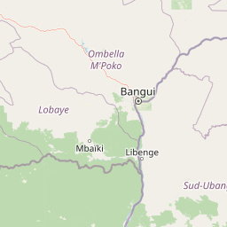
Map view of Mbaéré-Bodingué National Park

Use this park location map to pinpoint Mbaéré-Bodingué National Park in Central African Republic, understand its exact geographic position, and read its mapped placement within the surrounding landscape more clearly.

Pigeon | © OpenStreetMap contributors
Park atlas

Trace the Surrounding Protected Landscapes and Riverine Habitats in the Central African Republic

Explore Other National Parks and Protected Areas Near Mbaéré-Bodingué National Park

Browse other national parks and protected areas within the Central African Republic, exploring diverse landscapes from tropical rainforests to savanna ecosystems. Compare geographic features, conservation efforts, and the regional spread of protected zones to deepen your understanding of Central African conservation.
National parkCongo
About 112 km away#1 closest

Southwest

Nouabalé-Ndoki National Park: Congo National Park & Protected Landscape Atlas

Explore protected area geography and mapped terrain.

Nouabalé-Ndoki National Park is a designated national park in Congo, offering rich opportunities for geographic discovery and atlas exploration. This page details the park's protected landscape, its mapped boundaries, and its significance within the regional geography of Congo. Users can investigate the park's natural terrain and its place within the broader atlas of protected areas.

Area
3,921.61 km²
Established
1993
IUCN
II
Relief
Lowland
Watercolor painting showing rolling hills, green vegetation, and a pinkish river area
National parkCentral African Republic
About 163 km away#2 closest

Southwest

Dzanga-Ndoki National Park National Park: Mapped Boundaries and Geographic Context in Central Africa

Explore protected landscape geography and park atlas details.

Gain a structured understanding of Dzanga-Ndoki National Park as a protected area in the Central African Republic. This page focuses on its precise geographic scope, mapped park boundaries, and its identity as a National Park. It serves as an entry point for exploring the park's landscape context and its place within the atlas of protected natural areas, offering factual details for geographic discovery.

Area
1,143.26 km²
Established
1990
IUCN
II
Relief
Lowland
National parkCameroon
About 197 km away#3 closest

Southwest

Lobéké National Park National Park: A Protected Landscape within the Congo Basin

Explore its semi-evergreen forest, unique bais, and riverine ecosystems.

Lobéké National Park represents a core protected national park within the vast Congo Basin, renowned for its exceptionally high densities of African forest elephants and western lowland gorillas. Covering over 2,000 square kilometers of largely untouched semi-evergreen forest, the park features distinct ecosystems including mineral-rich bais clearings, saline swamp savannas, and diverse riverine habitats. As a crucial component of the Sangha Trinational protected area, Lobéké National Park offers a profound look into Central African wilderness and its unique natural geography.

Area
2,178 km²
Established
1999
IUCN
II
Relief
Lowland
National parkEast Province
About 248 km away#4 closest

Southwest

Boumba Bek National Park: National Park with Protected Landscape Identity in East Province

Explore its geographic context and mapped protected boundaries.

Boumba Bek National Park is a key protected area within Cameroon's East Province, offering a dedicated focus for understanding national park landscapes. This resource facilitates discovery of its precise geographic footprint and its significance as a mapped protected land. Users can delve into its regional context and explore the atlas-level details defining its protected status and natural landscape character.

Area
2,382 km²
Established
2005
IUCN
II
Relief
Lowland
National parkCameroon
About 298 km away#5 closest

Southwest

Nki National Park: Protected National Park Landscape in Cameroon

Explore the geographic context and mapped boundaries.

Nki National Park is a designated national park in Cameroon, offering a distinct protected landscape for geographic study. This page provides essential context for understanding the park's place within the country's natural geography and protected areas atlas. Explore its mapped terrain and protected boundary details to gain a clearer picture of this natural entity within Central Africa's diverse geography.

Area
3,093 km²
Established
2005
IUCN
II
Relief
Upland
National parkCuvette-Ouest Department
About 321 km away#6 closest

Southwest

Odzala-Kokoua National Park National Park: Mapped Protected Landscape in Cuvette-Ouest

Explore its geographic boundaries and regional terrain.

Odzala-Kokoua National Park is a key national park entity, offering a distinct protected landscape within the Cuvette-Ouest Department. This page provides an atlas-style exploration of its mapped boundaries and geographic context. Delve into the specifics of this protected area to understand its contribution to the regional geography and natural landscape, facilitating structured discovery of its terrain.

Area
13,500 km²
Established
1935
IUCN
II
Visitors
50 annual
National parkCongo
About 391 km away#7 closest

South

Ntokou-Pikounda National Park: Congo's Protected Landscape and Regional Geographic Atlas

Explore the mapped boundaries of this national park in Congo.

Ntokou-Pikounda National Park serves as a critical point of reference for understanding protected landscapes in Congo. As a national park, its geographic scope and mapped boundaries are essential for atlas-based discovery. This detailed entry facilitates an exploration of its protected terrain and regional context, highlighting its significance within the broader conservation geography.

Area
4,572 km²
Established
2012
IUCN
II
Relief
Lowland
National parkCameroon
About 429 km away#8 closest

West

Deng Deng National Park: Protected Landscape & Gorilla Habitat in East Cameroon

Discover the mapped geography and conservation significance of this national park.

Deng Deng National Park in Cameroon's East Region offers a unique glimpse into the Northern Congolian forest-savanna mosaic ecoregion. Spanning about 683 square kilometers and shaped by the Sanaga River, it is critically important as the northernmost known habitat for western lowland gorillas. Its diverse terrain supports not only gorillas but also elephants, chimpanzees, and pangolins, highlighting its role in Central African biodiversity and regional landscape context.

Area
682.64 km²
Established
2010
IUCN
II
Climate
Tropical

Common questions about visiting, size, designation, and location context for Mbaéré-Bodingué National Park

Mbaéré-Bodingué National Park FAQs for park facts, access, geography, and protected area context

Find quick answers about Mbaéré-Bodingué National Park, including protected-area facts, park geography, trail and visitor context, and how the park fits into its surrounding country and regional landscape.
MoriAtlas Explorer

Continue Your Protected Areas Search Across the Global Atlas

Deepen your exploration by continuing the structured search for national parks and protected areas worldwide. Utilize the comprehensive filtering capabilities to compare different conservation landscapes and refine your understanding of global park geography. Discover more about the distribution and characteristics of protected natural areas.

Global natural geography