

Why Mu Ko Similan National Park stands out
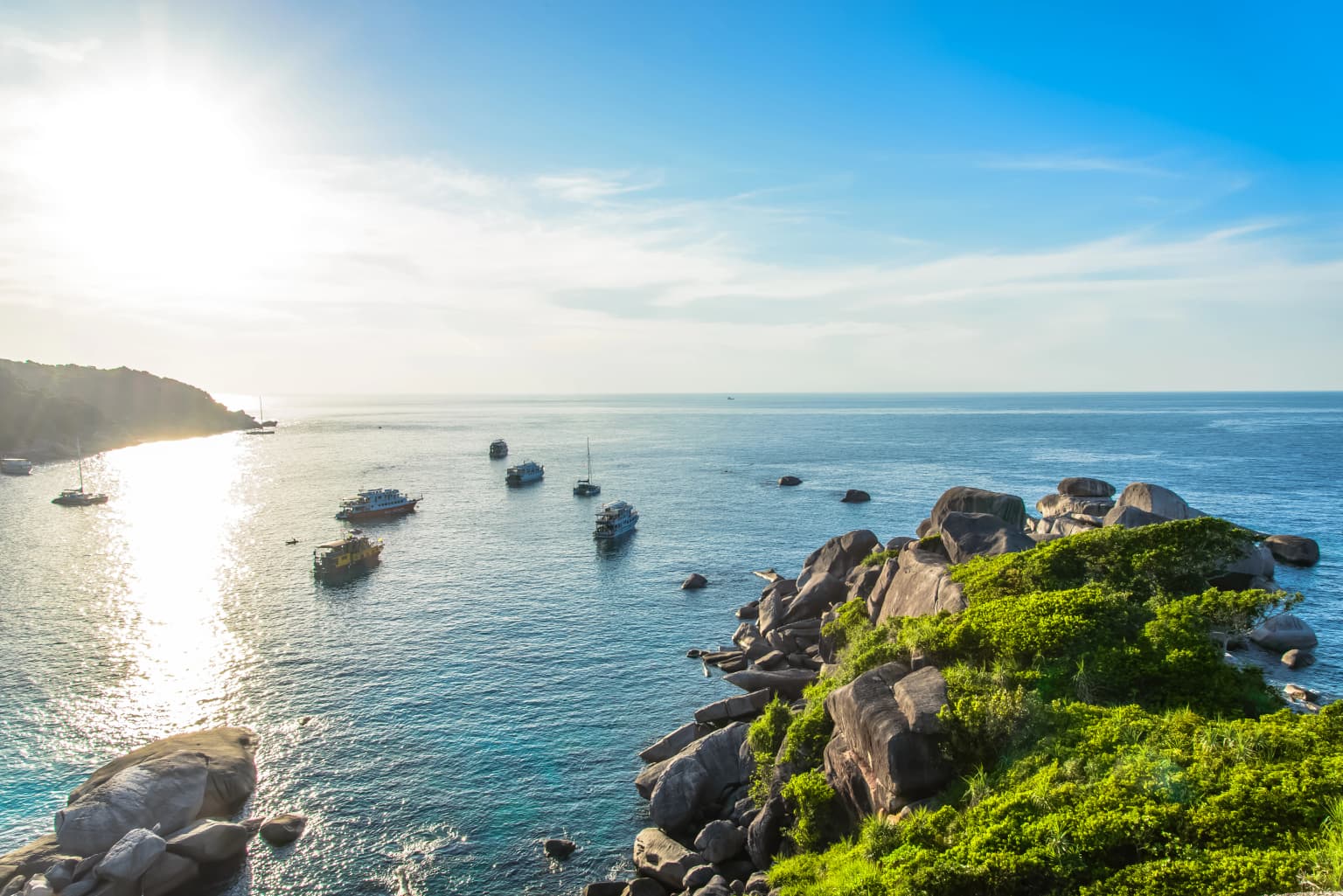
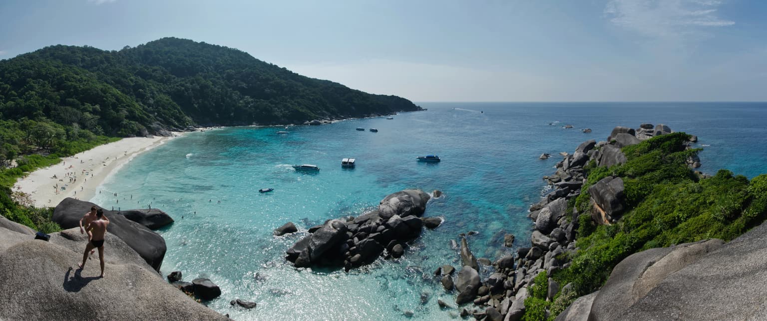
Mu Ko Similan is internationally renowned as one of Southeast Asia's premier diving destinations. The islands feature dramatic underwater rock formations, vibrant coral reefs in diverse shapes resembling deer, leaves, brains, and mushrooms, and exceptional marine biodiversity including whale sharks, sea turtles, dolphins, and moray eels. Above water, the islands are celebrated for their scenic granite boulder landscapes, fine white sand beaches, and the unique rock formations on Ko Similan that resemble boots and sail sails. The archipelago has been designated an Important Bird Area by BirdLife International due to its population of vulnerable pale-capped pigeons.
Mu Ko Similan National Park history and protected-area timeline
Mu Ko Similan National Park was established on September 1, 1982 (BE 2525), following a one-year assessment by Thailand's forestry department to evaluate the natural significance of the archipelago. The park originally encompassed nine islands, with Ko Bon and Ko Tachai (Islands 10 and 11) added to the national park in 1998, expanding protection to the full eleven-island configuration. The park has faced significant environmental pressures from its popularity, leading to substantial management interventions. In October 2016, Ko Tachai was indefinitely closed to tourists to allow environmental recovery following damage from excessive visitor traffic. After re-opening in October 2018, the park implemented a daily visitor limit of 3,850, reduced from the previous average of approximately 7,000 visitors per day. The islands were severely impacted by the 2004 Indian Ocean tsunami, with scuba divers reporting violent underwater currents and footage showing the surge flooding inland across the islands. The park has also faced ongoing challenges from illegal fishing activities despite official prohibitions.
Mu Ko Similan National Park landscape and geographic character
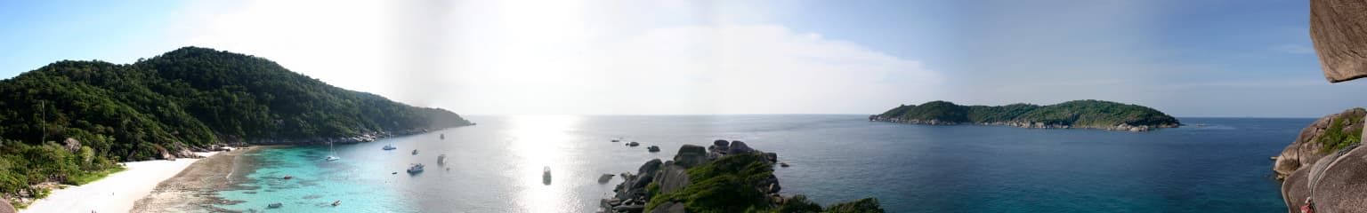
The Mu Ko Similan archipelago consists of eleven numbered islands arranged in a north-to-south chain, each with distinct topographical features. Ko Similan (Island 8), the largest island, features granite boulder formations along its northern shoreline that resemble large boots, with additional sail-shaped rock formations nearby. The island has fine white sand beaches and reaches relatively modest elevations. Ko Huyong (Island 1) contains the longest and widest beach in the park but is closed to visitors to protect turtle nesting areas. Ko Hin Pousar (Island 7) is named for its skull-like profile and features an underwater valley with soft coral formations. Ko Miang (Island 4), the second-largest island, serves as the location of the park headquarters and features more extensive forest cover. The islands rise from a shallow continental shelf, with the surrounding sea averaging around 18 metres (60 feet) depth, creating ideal conditions for coral reef development. The underwater landscape is characterized by massive granite rock formations covered in coral, creating dramatic seascapes that attract divers from around the world.
Mu Ko Similan National Park ecosystems, habitats, and plant life
The marine ecosystem of Mu Ko Similan represents one of the most biodiverse environments in Thai waters. The coral reefs feature numerous species in various formations, including branching, brain, plate, and mushroom corals that create complex habitats for marine life. The underwater rock formations provide substrate for extensive coral growth and create interesting topological features such as underwater valleys and swim-throughs. The surrounding waters support populations of reef fish, pelagic species, and marine megafauna. The terrestrial environments feature tropical vegetation adapted to the island setting, including coastal vegetation, scrub, and forested areas on larger islands. The archipelago has been identified as an Important Bird Area due to the presence of the pale-capped pigeon, a vulnerable species that uses the islands as habitat. The marine protected area status aims to preserve the critical coral reef ecosystems that support this biodiversity.
Mu Ko Similan National Park wildlife and species highlights
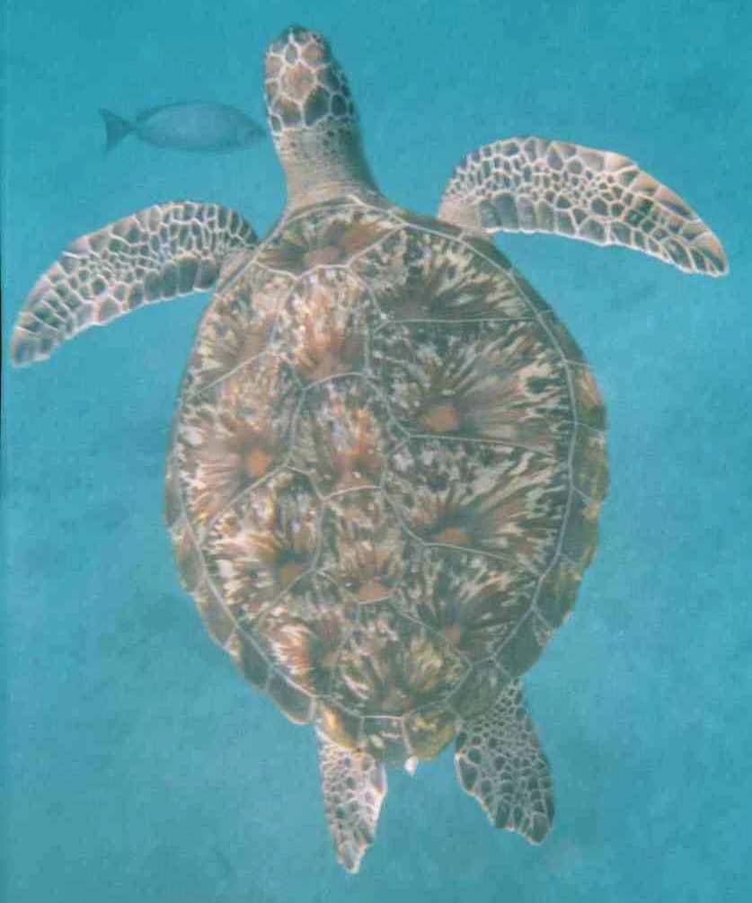
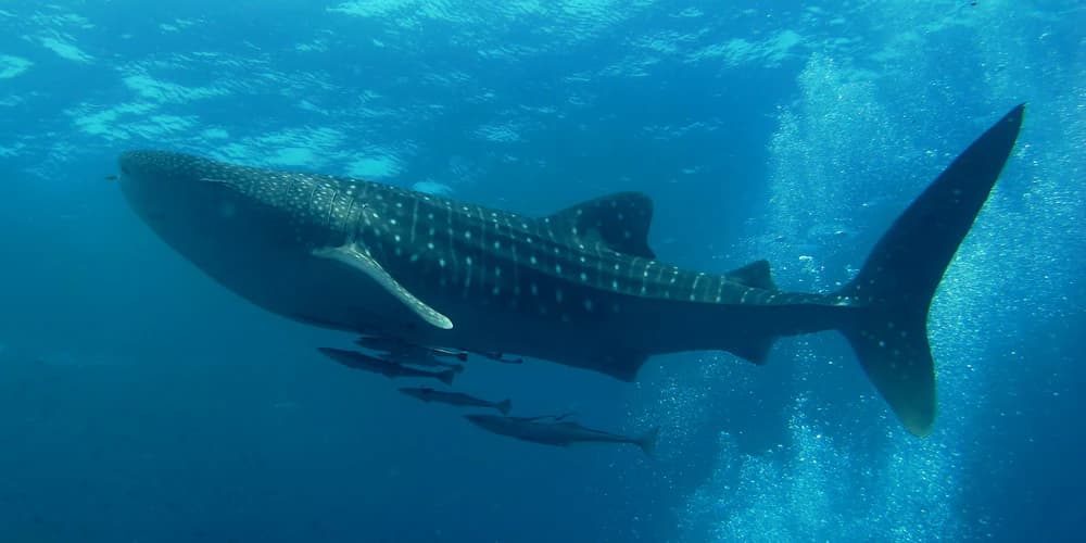
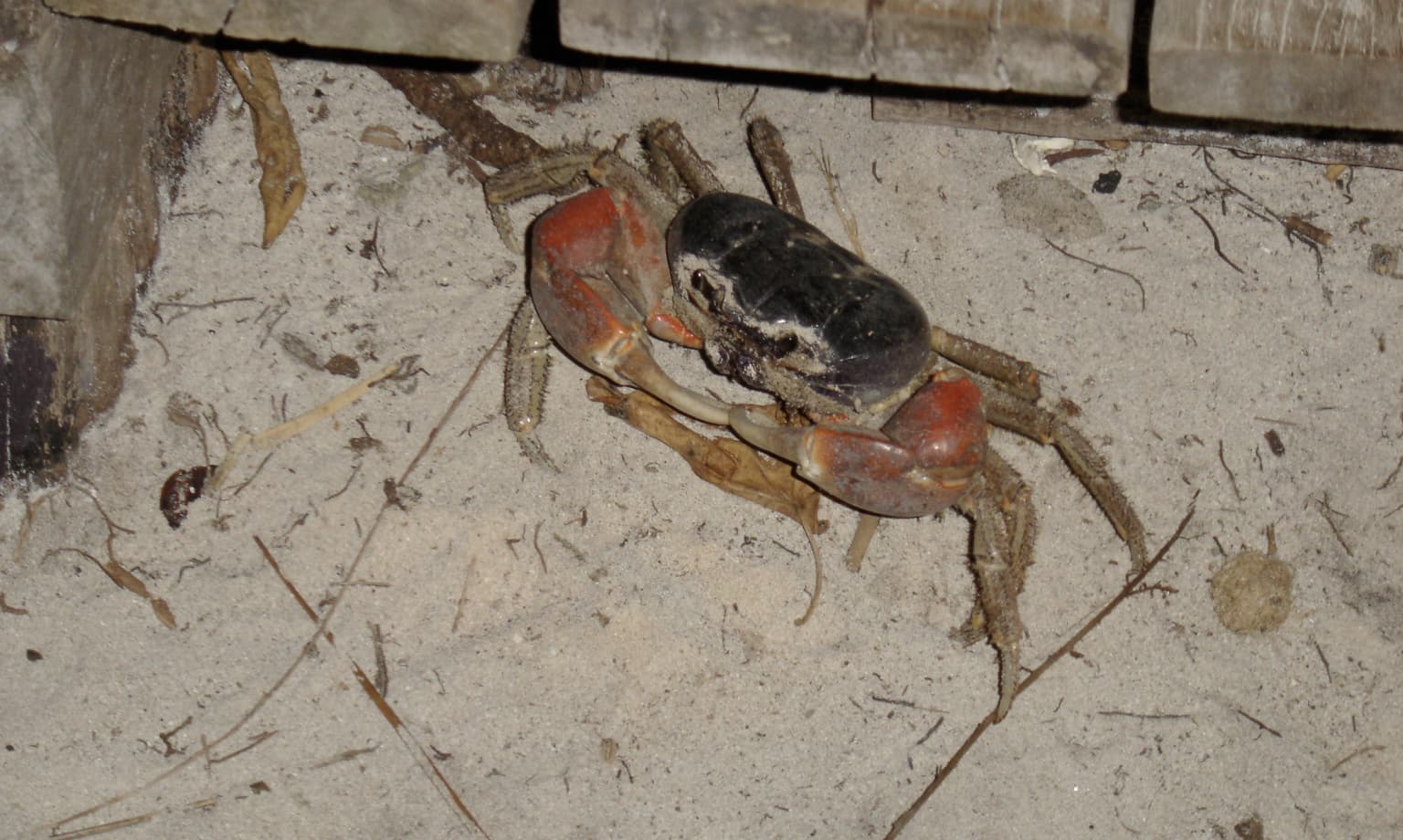
Mu Ko Similan supports diverse wildlife both above and below the waterline. The marine environment hosts numerous fish species, including trevallies, batfish, barracuda, golden pilot jacks, and triggerfish. The islands are known for encounters with whale sharks, the largest fish in the sea, particularly around Ko Hin Pousar where they are observed with greater frequency. Sea turtles, including green turtles and hawksbill turtles, use the beaches for nesting, particularly on Islands 1, 2, and 3, which are restricted from public access to protect these activities. Dolphins are also reported in the surrounding waters. Above water, the islands support birdlife including the Nicobar pigeon, flying foxes, and mangrove monitor lizards. The terrestrial environment includes various invertebrate species such as the hairy-legged mountain crab found on Ko Miang. The waters around Ko Bon and Ko Tachai have been identified as areas with particularly high marine diversity.
Mu Ko Similan National Park conservation status and protection priorities
Mu Ko Similan faces significant conservation challenges despite its protected area status. The park was designated as a marine protected area to preserve its exceptional coral reef ecosystems, but enforcement of fishing prohibitions remains problematic, with illegal fishing activities and ghost nets continuing to impact marine life. The islands serve as critical nesting habitat for sea turtles, prompting the closure of Islands 1, 2, and 3 to public access to support turtle hatching protection programs. Island 3 is privately owned by a member of the Thai royal family, adding complexity to management. The high volume of visitors, reaching 5,000 to 6,000 per day during peak season, has caused environmental degradation, leading to the closure of Ko Tachai in 2016 and the implementation of daily visitor limits. The famous Fantasy Rock formation was closed in 2000 due to severe deterioration from excessive tourism. Management efforts include removing all overnight accommodations from the islands to reduce environmental impact.
Mu Ko Similan National Park cultural meaning and human context
The Similan Islands hold cultural significance rooted in their maritime location and traditional use by local communities. The name Similan originates from the Yawi (Kedah Malay) language, reflecting the historical connections between the islands and the Malay-speaking communities of the region. The archipelago marks the maritime boundary between Thailand and India, a position that has influenced its strategic and cultural significance. Local fishing communities have traditionally utilized the waters around the islands, though modern marine protected area regulations have restricted these activities. The turtle nesting beaches, particularly on the northern islands, represent a natural heritage that has been recognized through conservation measures, with certain islands closed to protect these cultural and natural nesting sites.
Top sights and standout views in Mu Ko Similan National Park
Mu Ko Similan offers exceptional diving and snorkeling opportunities around its nine islands, with the underwater world featuring dramatic granite rock formations covered in vibrant coral reefs in shapes resembling deer, leaves, brains, and mushrooms. Ko Similan presents iconic above-water scenery with its massive granite boulders and sail-shaped rocks, while Ko Hin Pousar is renowned as the best location in the park for encountering whale sharks. The restricted turtle nesting islands (1, 2, and 3) protect important breeding populations, with Ko Huyong's beach serving as a protected egg-laying site. The park's designation as an Important Bird Area reflects its significance for the vulnerable pale-capped pigeon. The implementation of visitor limits and island closures demonstrates active conservation management to preserve this marine ecosystem.
Best time to visit Mu Ko Similan National Park
The optimal time to visit Mu Ko Similan National Park is during the dry season from mid-October to mid-May, when weather conditions are favorable and the park is open to visitors. The peak tourist season coincides with this period, bringing higher visitor numbers but also the most reliable boat services from Tab Lamu Port near Khao Lak. The monsoon season from May 16 to October 15 requires the park to close for visitor safety and environmental protection, allowing the ecosystem to recover during the rainy period. Diving conditions are generally best during the open season when water visibility is higher, though the park's closure during monsoon helps maintain the marine environment's health for the following season.