


Mori Atlas logo
National parkMu Ko Similan National Park

Discover mapped park boundaries, granite island terrain, and diverse coral reef ecosystems within this Andaman Sea national park.

Mu Ko Similan National Park: Exploring Thailand's Iconic Marine Protected Landscape and Archipelago Geography

Mu Ko Similan National Park represents a vital protected marine landscape within Thailand's Andaman Sea. This atlas-focused entry details the archipelago's unique geography, characterized by dramatic granite boulder formations rising from clear waters and extensive coral reef systems that define its underwater topography. Understanding the park's mapped boundaries and landscape context reveals why it is a celebrated destination for marine conservation and geographic discovery, showcasing the natural heritage of the Similan Islands.

Marine National ParkIsland ArchipelagoCoral ReefsDiving DestinationAndaman SeaSea Turtle Nesting
Stylized illustration of a tropical beach with large boulders, turquoise water, lush green hills, and palm trees under a bright sun

Mu Ko Similan National Park

National park

Park overview

Structured park overview, official facts, and landscape profile for Mu Ko Similan National Park

Mu Ko Similan National Park park facts, protected area profile, and essential visitor context

Review the core facts for Mu Ko Similan National Park, including designation, size, terrain, visitor scale, habitats, and operating context in one park-focused overview.

About Mu Ko Similan National Park

Mu Ko Similan National Park represents one of Thailand's most significant marine conservation areas, protecting a chain of continental islands that rise from the Andaman Sea continental shelf. The archipelago's location approximately 70 kilometres offshore places it at the maritime boundary between India and Thailand, creating a unique ecological position where tropical marine ecosystems thrive in relatively clear waters. The park's establishment in 1982 followed a one-year assessment by Thailand's forestry department, recognizing the exceptional natural value of both the terrestrial and underwater environments. Over time, the park has become subject to significant management challenges due to its popularity, leading to the implementation of visitor restrictions, temporary closures of sensitive islands, and the removal of overnight accommodations to preserve the natural environment. The park is part of a broader network of protected areas in Thailand's southern peninsula that includes adjacent marine parks such as Mu Ko Surin to the north.

Quick facts and research context for Mu Ko Similan National Park

Mu Ko Similan National Park is located in Phang Nga Province, southern Thailand, in the Andaman Sea. The archipelago consists of nine main islands numbered from north to south, with Ko Similan (Island 8) being the largest. The park was established on September 1, 1982, covering roughly 80,000 rai (128 square kilometres) of marine and terrestrial area. The park headquarters is situated on Ko Miang (Island 4). Visitor access is available from Tab Lamu Port near Khao Lak from mid-October to mid-May, with the rainy season (May 16 to October 15) requiring closure. The park has implemented daily visitor limits to manage environmental impacts on its sensitive ecosystems.

Protection and recognition

Tracking the official conservation status and designation details of the marine protected area.

Mu Ko Similan National Park Protection Status and Protected Area Designation

National park datasets provide verified insight into the legal frameworks and protection designations established for Mu Ko Similan National Park. Evaluating documented conservation profiles helps researchers and conservationists understand the official management boundaries and maritime stewardship efforts shaping the region.

Protection details

Protection scope
Mixed
Transboundary protection
No
Park context

Deeper park guide and search-rich context for Mu Ko Similan National Park

Mu Ko Similan National Park history, landscape, wildlife, and travel context

Explore Mu Ko Similan National Park through its history, landscape character, ecosystems, wildlife, conservation priorities, cultural context, and seasonal travel timing in a structured park guide built for atlas discovery and search intent.

Why Mu Ko Similan National Park stands out

Mu Ko Similan is internationally renowned as one of Southeast Asia's premier diving destinations. The islands feature dramatic underwater rock formations, vibrant coral reefs in diverse shapes resembling deer, leaves, brains, and mushrooms, and exceptional marine biodiversity including whale sharks, sea turtles, dolphins, and moray eels. Above water, the islands are celebrated for their scenic granite boulder landscapes, fine white sand beaches, and the unique rock formations on Ko Similan that resemble boots and sail sails. The archipelago has been designated an Important Bird Area by BirdLife International due to its population of vulnerable pale-capped pigeons.
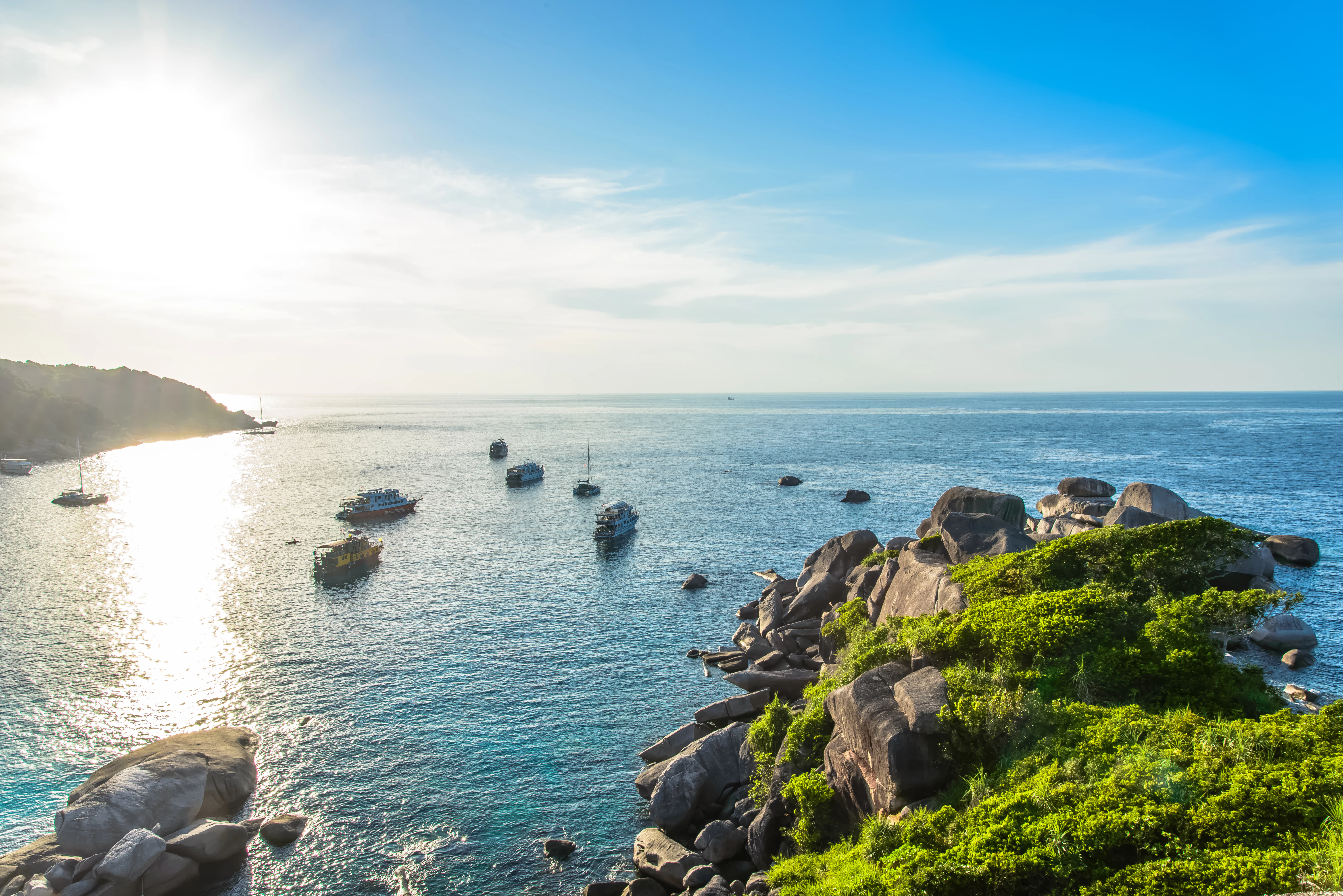
Rocky coastline with lush green vegetation overlooking the Andaman Sea with several boats anchored in the water under a clear blue sky
Scenic coastal viewpoint from Koh 8 in Mu Ko Similan National Park

Mu Ko Similan National Park history and protected-area timeline

Mu Ko Similan National Park was established on September 1, 1982 (BE 2525), following a one-year assessment by Thailand's forestry department to evaluate the natural significance of the archipelago. The park originally encompassed nine islands, with Ko Bon and Ko Tachai (Islands 10 and 11) added to the national park in 1998, expanding protection to the full eleven-island configuration. The park has faced significant environmental pressures from its popularity, leading to substantial management interventions. In October 2016, Ko Tachai was indefinitely closed to tourists to allow environmental recovery following damage from excessive visitor traffic. After re-opening in October 2018, the park implemented a daily visitor limit of 3,850, reduced from the previous average of approximately 7,000 visitors per day. The islands were severely impacted by the 2004 Indian Ocean tsunami, with scuba divers reporting violent underwater currents and footage showing the surge flooding inland across the islands. The park has also faced ongoing challenges from illegal fishing activities despite official prohibitions.

Mu Ko Similan National Park landscape and geographic character

The Mu Ko Similan archipelago consists of eleven numbered islands arranged in a north-to-south chain, each with distinct topographical features. Ko Similan (Island 8), the largest island, features granite boulder formations along its northern shoreline that resemble large boots, with additional sail-shaped rock formations nearby. The island has fine white sand beaches and reaches relatively modest elevations. Ko Huyong (Island 1) contains the longest and widest beach in the park but is closed to visitors to protect turtle nesting areas. Ko Hin Pousar (Island 7) is named for its skull-like profile and features an underwater valley with soft coral formations. Ko Miang (Island 4), the second-largest island, serves as the location of the park headquarters and features more extensive forest cover. The islands rise from a shallow continental shelf, with the surrounding sea averaging around 18 metres (60 feet) depth, creating ideal conditions for coral reef development. The underwater landscape is characterized by massive granite rock formations covered in coral, creating dramatic seascapes that attract divers from around the world.
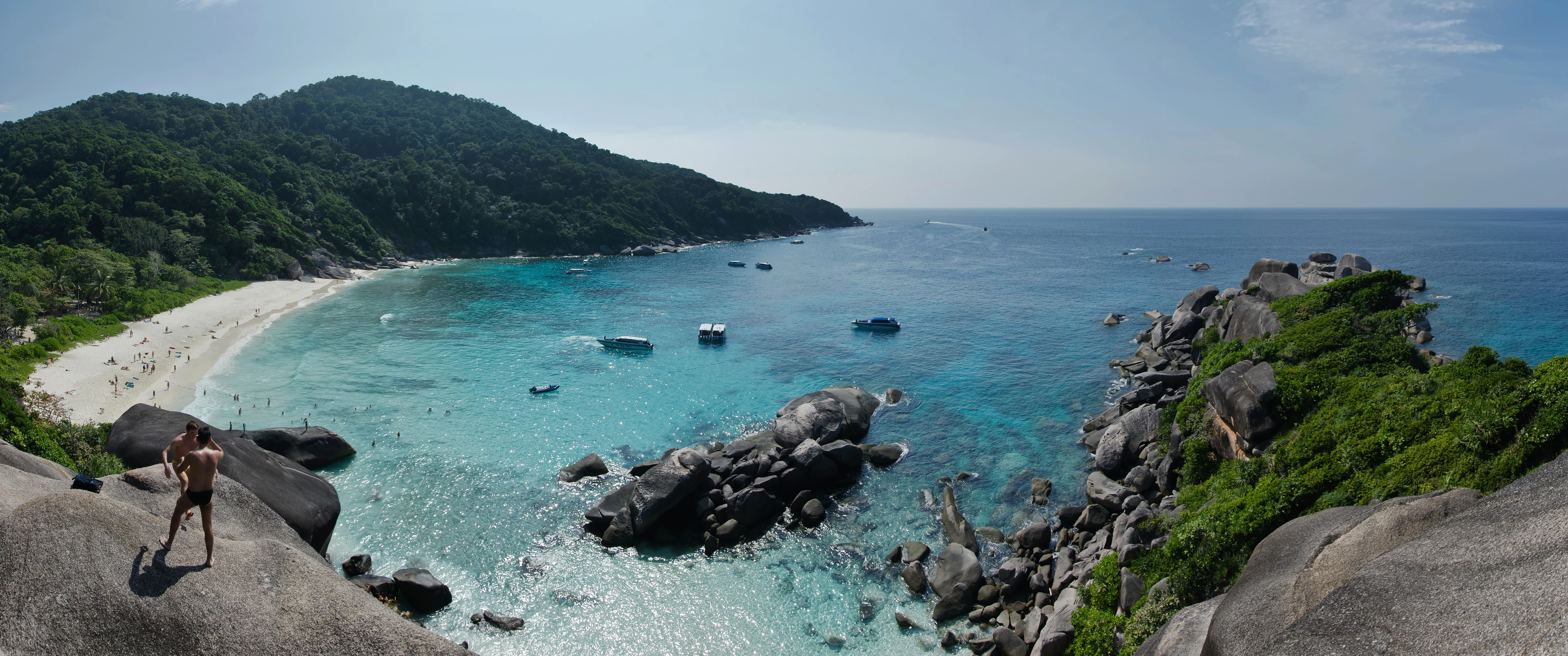
Panoramic landscape of Ko Similan beach with turquoise water, rocky outcrops, lush green hills, and a person standing on a rock
Panoramic view of Ao Kuerk Bay from Ko Similan Island, Thailand

Mu Ko Similan National Park ecosystems, habitats, and plant life

The marine ecosystem of Mu Ko Similan represents one of the most biodiverse environments in Thai waters. The coral reefs feature numerous species in various formations, including branching, brain, plate, and mushroom corals that create complex habitats for marine life. The underwater rock formations provide substrate for extensive coral growth and create interesting topological features such as underwater valleys and swim-throughs. The surrounding waters support populations of reef fish, pelagic species, and marine megafauna. The terrestrial environments feature tropical vegetation adapted to the island setting, including coastal vegetation, scrub, and forested areas on larger islands. The archipelago has been identified as an Important Bird Area due to the presence of the pale-capped pigeon, a vulnerable species that uses the islands as habitat. The marine protected area status aims to preserve the critical coral reef ecosystems that support this biodiversity.

Panoramic landscape of Similan Islands showing coastal waters, sandy beach, and lush green hills with small boats in the sea
Panoramic view of Similan Islands archipelago with turquoise waters, sandy beach, and lush green hills

Mu Ko Similan National Park wildlife and species highlights

Mu Ko Similan supports diverse wildlife both above and below the waterline. The marine environment hosts numerous fish species, including trevallies, batfish, barracuda, golden pilot jacks, and triggerfish. The islands are known for encounters with whale sharks, the largest fish in the sea, particularly around Ko Hin Pousar where they are observed with greater frequency. Sea turtles, including green turtles and hawksbill turtles, use the beaches for nesting, particularly on Islands 1, 2, and 3, which are restricted from public access to protect these activities. Dolphins are also reported in the surrounding waters. Above water, the islands support birdlife including the Nicobar pigeon, flying foxes, and mangrove monitor lizards. The terrestrial environment includes various invertebrate species such as the hairy-legged mountain crab found on Ko Miang. The waters around Ko Bon and Ko Tachai have been identified as areas with particularly high marine diversity.
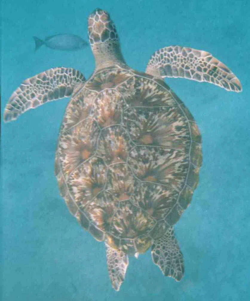
Hawksbill sea turtle with patterned shell swimming in turquoise water, accompanied by a small fish
Hawksbill sea turtle swimming in clear blue waters of the Similan Islands

Mu Ko Similan National Park conservation status and protection priorities

Mu Ko Similan faces significant conservation challenges despite its protected area status. The park was designated as a marine protected area to preserve its exceptional coral reef ecosystems, but enforcement of fishing prohibitions remains problematic, with illegal fishing activities and ghost nets continuing to impact marine life. The islands serve as critical nesting habitat for sea turtles, prompting the closure of Islands 1, 2, and 3 to public access to support turtle hatching protection programs. Island 3 is privately owned by a member of the Thai royal family, adding complexity to management. The high volume of visitors, reaching 5,000 to 6,000 per day during peak season, has caused environmental degradation, leading to the closure of Ko Tachai in 2016 and the implementation of daily visitor limits. The famous Fantasy Rock formation was closed in 2000 due to severe deterioration from excessive tourism. Management efforts include removing all overnight accommodations from the islands to reduce environmental impact.

Mu Ko Similan National Park cultural meaning and human context

The Similan Islands hold cultural significance rooted in their maritime location and traditional use by local communities. The name Similan originates from the Yawi (Kedah Malay) language, reflecting the historical connections between the islands and the Malay-speaking communities of the region. The archipelago marks the maritime boundary between Thailand and India, a position that has influenced its strategic and cultural significance. Local fishing communities have traditionally utilized the waters around the islands, though modern marine protected area regulations have restricted these activities. The turtle nesting beaches, particularly on the northern islands, represent a natural heritage that has been recognized through conservation measures, with certain islands closed to protect these cultural and natural nesting sites.
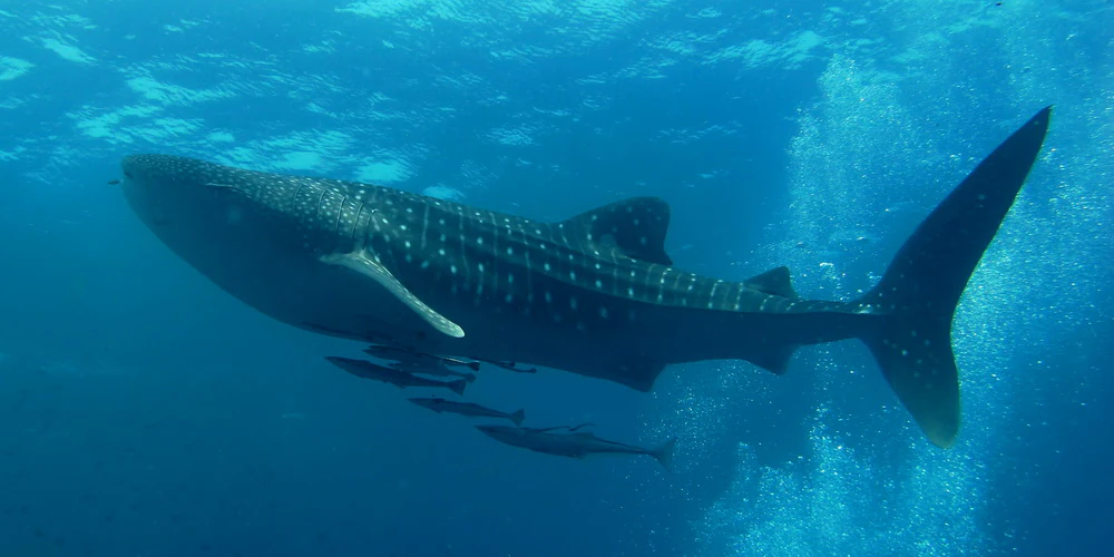
Whale shark with spotted pattern swimming in clear blue water with small fish and rising bubbles.
Whale shark swimming in the Andaman Sea near Mu Ko Similan National Park.

Top sights and standout views in Mu Ko Similan National Park

Mu Ko Similan offers exceptional diving and snorkeling opportunities around its nine islands, with the underwater world featuring dramatic granite rock formations covered in vibrant coral reefs in shapes resembling deer, leaves, brains, and mushrooms. Ko Similan presents iconic above-water scenery with its massive granite boulders and sail-shaped rocks, while Ko Hin Pousar is renowned as the best location in the park for encountering whale sharks. The restricted turtle nesting islands (1, 2, and 3) protect important breeding populations, with Ko Huyong's beach serving as a protected egg-laying site. The park's designation as an Important Bird Area reflects its significance for the vulnerable pale-capped pigeon. The implementation of visitor limits and island closures demonstrates active conservation management to preserve this marine ecosystem.
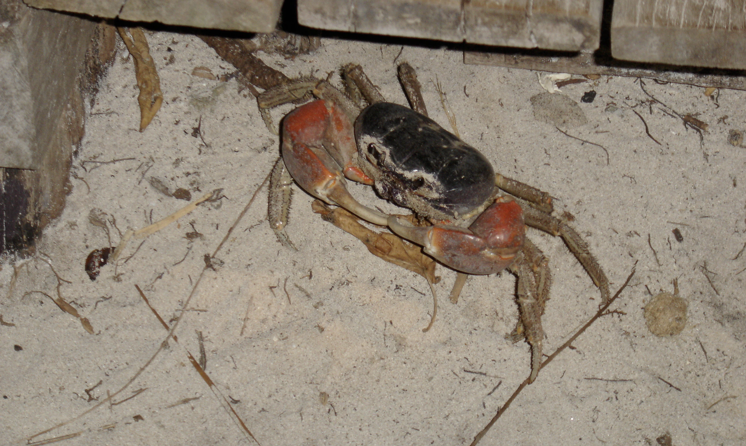
A crab with reddish legs and dark body on sandy ground near wooden planks
Hairy-legged mountain land crab on sandy beach at Ko Miang, Similan Islands

Best time to visit Mu Ko Similan National Park

The optimal time to visit Mu Ko Similan National Park is during the dry season from mid-October to mid-May, when weather conditions are favorable and the park is open to visitors. The peak tourist season coincides with this period, bringing higher visitor numbers but also the most reliable boat services from Tab Lamu Port near Khao Lak. The monsoon season from May 16 to October 15 requires the park to close for visitor safety and environmental protection, allowing the ecosystem to recover during the rainy period. Diving conditions are generally best during the open season when water visibility is higher, though the park's closure during monsoon helps maintain the marine environment's health for the following season.
Monthly climate preview

Long-term monthly temperature averages and precipitation statistics for Mu Ko Similan National Park

Mu Ko Similan National Park Climate Normals and Annual Temperature Patterns

Historical climate data for Mu Ko Similan National Park demonstrates sustained warm temperatures alongside distinct monthly precipitation variations across the representative coordinate. Analyzing twelve-month climatology normals clarifies long-term thermal rhythms and moisture distribution patterns within the protected area.
Annual mean28 °C
27 °C29 °C
Jan27°
Feb28°
Mar28°
Apr29°
May29°
Jun29°
Jul28°
Aug28°
Sep28°
Oct27°
Nov28°
Dec28°
Warmest month
April

28.8 °C

Coolest month
October

27.5 °C

Wettest month
September

10.3 mm/day

Driest month
February

1 mm/day

Park location guide

Geography guide, regional context, and park location map for Mu Ko Similan National Park

Mu Ko Similan National Park park geography, regions, and map view in Thailand

Understand where Mu Ko Similan National Park sits in Thailand through a broader geographic reading of the surrounding landscape, nearby location context, and its mapped position within the national park landscape.

How Mu Ko Similan National Park fits into Thailand

Thailand is a Southeast Asian nation formerly called Siam, located in mainland Southeast Asia. It operates as a unitary parliamentary constitutional monarchy under King Vajiralongkorn. The country borders Myanmar, Laos, Cambodia, and Malaysia, with maritime boundaries involving Vietnam, Indonesia, and India. Thailand has a population of nearly 66 million and covers approximately 513,120 km². Historically, the Sukhothai Kingdom marks the beginning of Thai history, followed by the powerful Ayutthaya Kingdom.

Wider geography shaping Mu Ko Similan National Park in Thailand

Thailand occupies mainland Southeast Asia with borders to Myanmar (west/northwest), Laos (east/northeast), Cambodia (southeast), and Malaysia (south). The country has coastline along the Gulf of Thailand to the southeast and the Andaman Sea to the southwest. The territory covers approximately 513,120 km².

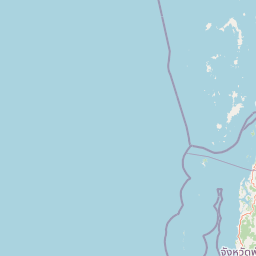
Map view of Mu Ko Similan National Park

Use this park location map to pinpoint Mu Ko Similan National Park in Thailand, understand its exact geographic position, and read its mapped placement within the surrounding landscape more clearly.

Pigeon | © OpenStreetMap contributors

Explore the Andaman Sea's Protected Scenery, Granite Island Formations, and Vibrant Coral Reef Habitats

Visual Guide to Mu Ko Similan National Park: Photos of Iconic Island Landscapes and Marine Environments

Browse comprehensive imagery of Mu Ko Similan National Park to visually understand its distinctive island terrain, white sand beaches, and critical marine protected areas. These photographs illustrate the park's diverse underwater ecosystems, showcasing vibrant coral reefs and the unique granite formations that define its globally recognized natural character.

Rocky coastline with lush green vegetation overlooking the Andaman Sea with several boats anchored in the water under a clear blue sky

Panoramic view of Mu Ko Similan National Park showing sandy beach, turquoise waters, large granite boulders, and visitors swimming under clear blue sky

Panoramic landscape of Ko Similan beach with turquoise water, rocky outcrops, lush green hills, and a person standing on a rock

Panoramic landscape of Similan Islands showing coastal waters, sandy beach, and lush green hills with small boats in the sea

Hawksbill sea turtle with patterned shell swimming in turquoise water, accompanied by a small fish

Colorful fish with black, white, orange, and green markings swimming near coral reef

Whale shark with spotted pattern swimming in clear blue water with small fish and rising bubbles.

A crab with reddish legs and dark body on sandy ground near wooden planks

Park atlas

Map connected protected landscapes and marine environments across the Andaman Sea, for context to Mu Ko Similan.

Discover Nearby National Parks and Marine Protected Areas Surrounding Mu Ko Similan National Park

After exploring Mu Ko Similan National Park, continue your discovery by mapping other national parks and marine protected areas across the Andaman Sea and surrounding southern Thailand. Compare diverse park geography, trace the regional spread of conservation landscapes, and examine varied protected marine and terrestrial environments.
National parkPhang Nga Province
About 71 km away#1 closest

East

Khao Lak, Lam Ru National Park: Protected National Park Landscape and Geography

Explore its mapped boundaries and regional context in Phang Nga Province.

This entry focuses on Khao Lak, Lam Ru National Park, a designated national park offering a distinct protected landscape within Phang Nga Province, Thailand. It provides structured data and map context crucial for understanding its geographic scope and regional significance. Explore the park's mapped boundaries, its role as a protected area, and its contribution to the broader landscape of southern Thailand, fostering a deeper appreciation for its natural geography and atlas-derived insights.

Area
125 km²
Established
1991
IUCN
II
Visitors
72.2K annual
National parkPhang Nga Province
About 71 km away#2 closest

East

Khao Lampi, Hat Thai Mueang National Park: Mountain Rainforest and Andaman Coast Atlas

Explore the mapped geography and protected boundaries.

Delve into Khao Lampi, Hat Thai Mueang National Park, a key protected area within Phang Nga Province, Thailand. This unique national park showcases a striking dichotomy: the lush, waterfall-adorned slopes of the Khao Lampi mountains contrast with the pristine Andaman Sea coastline of Hat Thai Mueang beach, a critical site for sea turtle nesting. The park's mapped landscape encompasses dense tropical rainforest, significant mangrove ecosystems, and important natural terrain, offering a comprehensive view of diverse protected environments for atlas exploration.

Area
72 km²
Established
1986
IUCN
II
Visitors
50.5K annual
National parkThailand
About 88 km away#3 closest

North

Mu Ko Surin National Park: Mapped Marine Protected Area in Thailand's Andaman Sea

Explore unique island geography and vibrant coral reef landscapes.

Mu Ko Surin National Park is a national park comprising a series of islands within Thailand's Andaman Sea, recognized for its exceptional marine biodiversity and well-preserved coral reefs. This protected area showcases a distinctive landscape where dense tropical forests meet extensive underwater ecosystems, offering a prime example of coastal natural geography. Understanding Mu Ko Surin National Park through its mapped boundaries and ecological significance provides valuable insight into Thailand's protected natural heritage and its role in regional conservation.

IUCN
II
Scope
Marine
National parkThailand
About 94 km away#4 closest

East

Ao Phang Nga National Park: A Protected National Park in Thailand's Geographic Atlas

Explore the mapped landscape and protected area identity.

Ao Phang Nga National Park offers a distinct protected landscape within Thailand, serving as a key entry in the national park atlas. This page focuses on delineating its geographic boundaries and understanding its specific characteristics as a national park. Users can discover the mapped context and regional setting, providing valuable insights into Thailand's protected natural areas and their conservation significance.

Area
400 km²
Established
1981
IUCN
II
Visitors
999K annual
National parkPhuket Province
About 95 km away#5 closest

Southeast

Sirinat National Park: Phuket Province Protected Coastal Landscape and Marine Atlas

Mapped boundaries, beach forests, and sea turtle nesting sites.

Sirinat National Park offers a unique opportunity to explore a protected coastal geography on Phuket Island. This national park preserves critical beach forest ecosystems, extensive shorelines like Hat Mai Khao, vital sea turtle nesting grounds, and surrounding marine environments including coral reefs and mangrove habitats. Its designation as a protected area provides essential context for understanding the natural landscape and its ecological significance within Thailand's regional geography.

Area
90 km²
Established
1981
IUCN
II
Visitors
51.2K annual
National parkSurat Thani Province
About 103 km away#6 closest

East

Khao Sok National Park: Protected Landscape Atlas and Geographic Detail

Explore mapped boundaries and regional terrain in Surat Thani Province.

Khao Sok National Park represents a crucial protected landscape within the expansive geography of Surat Thani Province, Thailand. This detailed entry focuses on the park's identity as a national park, emphasizing its mapped boundaries and the surrounding natural terrain. Through structured information and geographic context, users can gain a clear understanding of Khao Sok National Park's place in the atlas, contributing to a more informed approach to landscape discovery.

Area
739 km²
Established
1980
IUCN
II
Visitors
419.5K annual
National parkPhang Nga Province
About 107 km away#7 closest

Northeast

Si Phang-nga National Park: Protected Landscape Identity and Geographic Context in Phang Nga

Explore the park's mapped boundaries and unique karst landscape.

Si Phang-nga National Park stands as a key protected area, distinguished by its extraordinary limestone karst formations that dominate the coastal geography of Phang Nga Province, Thailand. The park's protected landscape features include dramatic pinnacles rising from mangrove-lined waters and intricate cave systems with archaeological significance. Delve into the unique natural terrain and map context that define this vital national park, offering a deep dive into its geological history and ecological importance.

Area
246 km²
Established
1988
IUCN
II
Visitors
21.3K annual
National parkSurat Thani Province
About 119 km away#8 closest

East

Khlong Phanom National Park: Protected National Park in Surat Thani Province, Southern Thailand

Discover its mapped boundaries and regional landscape context.

Khlong Phanom National Park is a designated national park providing valuable insight into the natural geography of Surat Thani Province. This protected landscape serves as a key entity for understanding regional terrain and the distribution of conservation areas in Southern Thailand. Explore its mapped geographic features and protected boundaries to gain a structured understanding of its place within the national park atlas.

Area
410 km²
Established
2000
IUCN
II
Visitors
1.7K annual

Common questions about visiting, size, designation, and location context for Mu Ko Similan National Park

Mu Ko Similan National Park FAQs for park facts, access, geography, and protected area context

Find quick answers about Mu Ko Similan National Park, including protected-area facts, park geography, trail and visitor context, and how the park fits into its surrounding country and regional landscape.
MoriAtlas Explorer

Continue Your Protected Areas Search Across the Global Atlas

Deepen your exploration by continuing the structured search for national parks and protected areas worldwide. Utilize the comprehensive filtering capabilities to compare different conservation landscapes and refine your understanding of global park geography. Discover more about the distribution and characteristics of protected natural areas.

Global natural geography