Mori Atlas logo
National parkAndré Félix National Park

Mapping the boundaries and geographic context of this critical national park.

André Félix National Park: Central African Republic's Protected Savanna Landscape Atlas

André Félix National Park represents a vital protected savanna ecosystem within the Central African Republic, recognized for its rolling terrain and critical role in conserving large African mammals. Established in 1960, this national park spans the ecologically significant Sudan-Guinea transition zone, featuring diverse landscapes from open grasslands to woodland and gallery forests along river corridors. As a key component of Central African Republic's protected areas, it offers a unique window into regional geography and wildlife conservation for atlas-based discovery.

National ParkSavannaCentral African RepublicWildlife ConservationElephant HabitatProtected Area

André Félix National Park

National park

Park overview

Structured park overview, official facts, and landscape profile for André Félix National Park

André Félix National Park park facts, protected area profile, and essential visitor context

Review the core facts for André Félix National Park, including designation, size, terrain, visitor scale, habitats, and operating context in one park-focused overview.

About André Félix National Park

André Félix National Park occupies a significant portion of central CAR's territory, situated in a region of transitional ecology between the Sudanian savanna to the north and the Guinean forest zone to the south. The protected area was created in 1960 as part of the Central African Republic's early efforts to establish a national park system and conserve representative examples of the country's diverse ecosystems. The park's extensive savanna landscapes support a range of wildlife species despite the pressures that exist throughout the region. The management of the park has faced challenges typical of protected areas in central Africa, including limited resources for anti-poaching efforts and the need to balance conservation with the livelihoods of local communities who have historically used the area for grazing and hunting. The park remains an important conservation area for maintaining biodiversity in the Central African Republic.

Quick facts and research context for André Félix National Park

André Félix National Park covers approximately 17,600 square kilometers of central CAR territory, making it one of the larger protected areas in the country. The park lies at an elevation ranging from 400 to 600 meters above sea level, with a landscape characterized by vast savanna plains interspersed with woodland patches and gallery forests along rivers. The ecosystem supports populations of African elephants, buffalo, giraffes, and various antelope species, though precise population estimates are not well documented. The park's location in the Sudan-Guinea transition zone gives it a distinctive ecological character combining elements of both savanna and forest habitats.

Protection and recognition

Examining terrestrial designation scope and documented conservation boundaries across global datasets

Documented Protection Status and Legal Designations of André Félix National Park

Naturalists can verify the documented terrestrial protection status and formal designation history of André Félix National Park within global databases. Analyzing the official conservation framework helps researchers map out regional environmental management strategies and trace geographic boundary data.

Protection details

Protection scope
Terrestrial
Transboundary protection
No
Park context

Deeper park guide and search-rich context for André Félix National Park

André Félix National Park history, landscape, wildlife, and travel context

Explore André Félix National Park through its history, landscape character, ecosystems, wildlife, conservation priorities, cultural context, and seasonal travel timing in a structured park guide built for atlas discovery and search intent.

Why André Félix National Park stands out

The park is best known for its population of large African mammals, particularly African elephants and buffalo that traverse the savanna landscapes. The protected area represents one of the most intact savanna ecosystems in the Central African Republic, with seasonal movements of wildlife between the park and surrounding lands. The park also contains significant populations of giraffes, which are among the most recognizable megafauna in the region. Additionally, the park provides important habitat forlion and various antelope species including waterbuck and bushbuck.

André Félix National Park history and protected-area timeline

André Félix National Park was established in 1960, coinciding with the independence of the Central African Republic from French colonial rule. The park was named in recognition of André Kolingba, who served as the country's first President following independence. The creation of the protected area reflected early post-colonial commitment to preserving the nation's natural heritage and establishing a system of national parks. During the subsequent decades, the park experienced varying levels of protection and management attention, with periods of both relative stability and periods when conservation activities were limited due to political instability and resource constraints. The park's establishment represented a significant step in CAR's approach to biodiversity conservation, aiming to protect the country's savanna ecosystems and the large mammals they support.

André Félix National Park landscape and geographic character

The landscape of André Félix National Park consists primarily of rolling savanna terrain with elevations ranging between 400 and 600 meters above sea level. The vegetation transitions between open grass-dominated savanna and woodland areas with scattered trees, particularly along the stronger lines where gallery forests develop along watercourses. The park contains several seasonal watercourses that contribute to the ecological diversity of the area, providing critical water sources for wildlife during the dry season. The terrain is generally flat to gently undulating, typical of the central African plateau region. The combination of open savanna and woodland creates a landscape of considerable scenic value, with vast views across the grassland punctuated by isolated trees and tree clusters.

André Félix National Park ecosystems, habitats, and plant life

The park is situated in the Sudan-Guinea transition zone, an ecological region characterized by the intermingling of savanna and forest elements. The vegetation consists predominantly of savanna grasslands with scattered woody species, transitioning to denser woodland in certain areas and gallery forests along rivers. This mosaic of habitats supports a range of ecological communities and provides important dry-season refuge for species that move between the park and adjacent areas. The park's position in this transitional zone gives it ecological significance beyond what its size alone would suggest, as it contains elements of both northern and southern African biomes. The seasonal patterns of rainfall influence the character of the landscape throughout the year, with distinct wet and dry seasons affecting vegetation structure and wildlife behavior.

André Félix National Park wildlife and species highlights

André Félix National Park supports populations of several large mammal species characteristic of the central African savanna. African elephants are present in the park, though their numbers have been affected by poaching pressure across the region. Buffalo populations persist in the savanna areas, often forming herds that move through the grasslands. Giraffes are among the most visible large mammals, their distinctive silhouettes observable across the open savanna. The park also provides habitat for various antelope species, including waterbuck that favor areas near water and bushbuck that inhabit more wooded sections. Lion presence has been documented in the park, representing the apex predator in the savanna ecosystem. Birdlife includes species typical of African savanna environments, with numerous raptors and waterfowl using the park's habitats.

André Félix National Park conservation status and protection priorities

André Félix National Park represents an important conservation area within the Central African Republic's protected area network. The park plays a critical role in maintaining viable populations of large mammals in a country where wildlife outside protected areas faces significant pressure from hunting and habitat conversion. The savanna ecosystem protected within the park is representative of a biome that has experienced substantial loss across its range in central Africa. Conservation challenges include addressing poaching, which has impacted elephant populations throughout the region, and managing human-wildlife conflict where park boundaries intersect with areas used by local communities. The park's continued protection is essential for maintaining biodiversity in the central African region.

André Félix National Park cultural meaning and human context

The area surrounding André Félix National Park is home to pastoralist communities who have traditionally used the savanna landscapes for grazing livestock, particularly cattle. These communities have historical connections to the land that predates the establishment of the protected area. The relationship between local populations and the park's resources has evolved since the 1960 establishment, with varying degrees of interaction between conservation objectives and traditional land use practices. The park exists within a broader cultural landscape where the rhythms of rural life in CAR continue to shape human-environment relationships.

Top sights and standout views in André Félix National Park

The park's defining features include its extensive savanna landscapes, populations of large African mammals including elephants and giraffes, and its location in the ecologically significant Sudan-Guinea transition zone. The combination of open grasslands and woodland creates a distinctive visual environment that represents classic central African scenery. The park provides some of the best opportunities in CAR for observing free-ranging wildlife in a relatively intact savanna ecosystem.

Best time to visit André Félix National Park

The optimal period for visiting André Félix National Park corresponds with the dry season, typically from November through April, when wildlife congregates more predictably around remaining water sources and vegetation is less dense, improving visibility. The wet season from May to October transforms the landscape with fresh vegetation but can make wildlife viewing more challenging and some areas less accessible. The dry season months offer the most favorable conditions for observing elephants, buffalo, and giraffes as they move through the savanna.

Monthly climate preview

Long-term representative coordinate measurements detailing annual temperature and monthly precipitation patterns

André Félix National Park Climate Normals, Monthly Temperature and Precipitation Rhythms

André Félix National Park exhibits measured monthly temperature variations alongside distinct precipitation shifts spanning the twelve-month climatology record. Reviewing the complete monthly profile provides deeper insight into long-term climate normals and regional meteorological patterns.
Annual mean27 °C
24 °C31 °C
Jan26°
Feb29°
Mar31°
Apr31°
May30°
Jun27°
Jul25°
Aug24°
Sep25°
Oct25°
Nov25°
Dec25°
Warmest month
April

31.3 °C

Coolest month
August

24.1 °C

Wettest month
August

8.4 mm/day

Driest month
December

0 mm/day

Park location guide

Geography guide, regional context, and park location map for André Félix National Park

André Félix National Park park geography, regions, and map view in Central African Republic

Understand where André Félix National Park sits in Central African Republic through a broader geographic reading of the surrounding landscape, nearby location context, and its mapped position within the national park landscape.

How André Félix National Park fits into Central African Republic

The Central African Republic is a landlocked nation in Central Africa with an area of approximately 622,984 km². It is bordered by six countries and features diverse terrain including Sudano-Guinean savanna in the central region, a Sahelo-Sudanian zone in the north, and equatorial forests in the south. Two-thirds of the country lies within the Ubangi River basin, while the remaining third is in the Chari River basin.

Wider geography shaping André Félix National Park in Central African Republic

The Central African Republic occupies a vast landlocked territory in Central Africa. It shares borders with Chad to the north, Sudan to the northeast, South Sudan to the east, the Democratic Republic of the Congo to the south, the Republic of the Congo to the southwest, and Cameroon to the west. The terrain consists primarily of savanna, with the Ubangi River serving as a major waterway draining two-thirds of the country into the Congo River system.

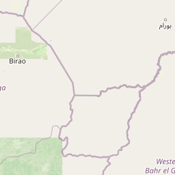
Map view of André Félix National Park

Use this park location map to pinpoint André Félix National Park in Central African Republic, understand its exact geographic position, and read its mapped placement within the surrounding landscape more clearly.

Pigeon | © OpenStreetMap contributors
Park atlas

Compare protected areas across the Central African Republic's savanna and forest transition zones.

Explore Other National Parks Near André Félix National Park and Surrounding Central African Savanna Landscapes

Continue your exploration from André Félix National Park by browsing other protected areas and national parks across the Central African Republic's savanna and woodland landscapes. Map connected conservation efforts and regional park geography to understand the broader ecological context of these vital African ecosystems.
National parkSudan
About 82 km away#1 closest

Southeast

Radom National Park: A National Park in Sudan Offering Protected Landscape and Geographic Context

Explore mapped boundaries and regional terrain within Sudan.

Radom National Park is an important protected area designated as a national park in Sudan. This entry focuses on its specific geographic features and landscape characteristics, providing users with a detailed view of its mapped boundaries and regional context. Understanding Radom National Park's place within the atlas of African protected lands helps illuminate its natural terrain and conservation significance.

Area
12,509.7 km²
Established
1980
IUCN
II
Relief
Lowland
National parkCentral African Republic
About 209 km away#2 closest

West

St Floris National Park: Central African Republic's Expansive Protected Savanna Landscape

Discover its mapped boundaries and regional geographic context.

St Floris National Park, situated in the Central African Republic, is a vast protected savanna ecosystem vital for understanding regional geography and landscape conservation. This national park spans approximately 17,400 square kilometers, featuring diverse terrain from open grasslands to riverine woodlands and floodplains, critical for large mammal populations and birdlife. Its mapped extent and ecological significance make it a key entry in any atlas of protected areas, showcasing the challenges and importance of savanna conservation in Central Africa.

Area
17,400 km²
Established
1979
IUCN
II
Scope
Terrestrial
National parkChad
About 349 km away#3 closest

West

Aouk National Park National Park: Mapped Protected Landscape and Regional Geography

Explore Chad's Aouk National Park boundaries and terrain.

Investigate Aouk National Park, a significant national park in Chad, through its detailed mapping and protected landscape attributes. This entry provides insight into the park's geographic placement within Central Africa, emphasizing its role as a conservation area. Users can explore the mapped boundaries and regional geographic context, facilitating a structured understanding of this protected territory for atlas-based research and discovery.

Area
7,400 km²
IUCN
II
Access
Moderate access
Scope
Terrestrial
National parkSila Province
About 367 km away#4 closest

Northwest

Goz Beïda National Park: National Park Protected Landscape and Geographic Context

Explore mapped boundaries and regional terrain.

Gain a structured understanding of Goz Beïda National Park, a key protected area within Sila Province. This detail page provides insights into its geographic setting, offering mapped landscape context for atlas-based discovery. Learn about the park's specific protected area identity and its position within the regional geography.

Area
3,000 km²
IUCN
II
Scope
Terrestrial
Water
No major water
National parkCentral African Republic
About 371 km away#5 closest

Southwest

Bamingui-Bangoran National Park: Protected Landscape and Geographic Context in Central Africa

Explore the savanna, forest, and riverine landscapes of this expansive national park.

Bamingui-Bangoran National Park represents a significant protected area within the Central African Republic, offering a rich landscape for geographic exploration. This page details the park's extensive savanna and tropical dry forest habitats, its role within the Guinea-Congo Forest biome, and its vital river systems like the Bamingui and Bangoran Rivers. Gain a clear understanding of its protected boundaries and its importance in regional conservation, providing valuable context for atlas-based discovery of Central African natural landscapes.

Area
11,191 km²
Established
1993
IUCN
II
Relief
Upland
National parkGuéra Region
About 394 km away#6 closest

West

Zakouma National Park: Chad's Premier National Park and Protected Landscape

Explore the mapped savanna, acacia forests, and wildlife geography.

Zakouma National Park is Chad's oldest and most ecologically vital protected area, spanning 3,000 square kilometers of Sudano-Sahelian landscape. Situated within the Guéra Region, it is globally recognized for its exceptional Kordofan giraffe population, significant elephant recovery, and ongoing conservation successes, offering a unique view into African wildlife and protected area management.

Area
3,000 km²
Established
1963
IUCN
II
Relief
Lowland
National parkChad
About 589 km away#7 closest

West

Siniaka-Minia National Park: Discover its Protected Landscape and Geographic Context in Chad

Explore mapped park boundaries and regional natural landscapes.

Siniaka-Minia National Park stands as a protected national park within the vast geography of Chad, offering critical insights for atlas exploration. This entry details the park's protected landscape features and its contribution to the regional natural geography. Understand its mapped boundaries and its significance as a conservation area, providing valuable context for anyone exploring the protected lands of Central Africa.

Area
4,260 km²
Established
1965
IUCN
IV
Relief
Mixed relief
National parkMoyen-Chari Region
About 593 km away#8 closest

West

Manda National Park: National Park Protected Landscape and Geographic Identity in Moyen-Chari

Discover mapped terrain and regional context for this Chad national park.

Manda National Park, a protected natural area within Chad's Moyen-Chari Region, offers valuable insights into regional geography and mapped protected landscapes. This detail page provides focused information on the park's identity as a national park, emphasizing its geographic setting and the importance of its mapped boundaries for structured atlas exploration. Understand how this protected area contributes to the diverse natural terrain of the Moyen-Chari Region.

Area
1,140 km²
Established
1969
IUCN
II
Climate
Tropical

Common questions about visiting, size, designation, and location context for André Félix National Park

André Félix National Park FAQs for park facts, access, geography, and protected area context

Find quick answers about André Félix National Park, including protected-area facts, park geography, trail and visitor context, and how the park fits into its surrounding country and regional landscape.
MoriAtlas Explorer

Continue Your Protected Areas Search Across the Global Atlas

Deepen your exploration by continuing the structured search for national parks and protected areas worldwide. Utilize the comprehensive filtering capabilities to compare different conservation landscapes and refine your understanding of global park geography. Discover more about the distribution and characteristics of protected natural areas.

Global natural geography