Mori Atlas logo
National parkArchipiélago Los Roques National Park

Discover the mapped landscape, coral reefs, and protected island geography of Los Roques.

Archipiélago Los Roques National Park: Venezuela's Premier Caribbean Marine Protected Area

(Parque Nacional Archipiélago Los Roques)

Archipiélago Los Roques National Park represents a significant protected marine territory within Venezuela's Caribbean expanse. This vast archipelago, composed of numerous islands and keys surrounded by extensive coral reefs and seagrass beds, forms one of the southern Caribbean's most crucial marine ecosystems. As a national park, it is dedicated to preserving the unique terrestrial and underwater environments, offering a lens into the region's biodiversity and conservation priorities.

Marine National ParkCaribbean IslandsCoral ReefsProtected Marine AreaVenezuelan ParksCaribbean Conservation

Archipiélago Los Roques National Park

National park

Park overview

Structured park overview, official facts, and landscape profile for Archipiélago Los Roques National Park

Archipiélago Los Roques National Park park facts, protected area profile, and essential visitor context

Review the core facts for Archipiélago Los Roques National Park, including designation, size, terrain, visitor scale, habitats, and operating context in one park-focused overview.

About Archipiélago Los Roques National Park

Archipiélago Los Roques National Park represents one of Venezuela's most significant marine protected areas, established to safeguard the unique ecological values of this Caribbean archipelago. The park encompasses a chain of islands, keys, and coral reefs situated in the Caribbean Sea, creating a complex and diverse ecosystem that supports both marine and terrestrial species. The marine environment features extensive coral reef formations, sea grass beds, and shallow lagoons that provide habitat for numerous fish species, marine mammals, and invertebrates. The terrestrial components, though limited in size on individual islands, support specialized vegetation communities adapted to the coastal environment. The isolation of this archipelago in the Caribbean has helped preserve relatively undisturbed ecosystems, making the area valuable for scientific study and conservation. The park's designation reflects Venezuela's commitment to protecting its Caribbean marine heritage and the ecological processes that sustain these tropical marine environments.

Quick facts and research context for Archipiélago Los Roques National Park

Located in the Venezuelan Caribbean, this national park protects an archipelago of approximately 40 islands, keys, and cays surrounded by extensive coral reef systems. The park is renowned for its marine biodiversity, including numerous fish species, sea turtles, and invertebrates. The terrestrial components include small islands with distinctive vegetation adapted to the coastal marine environment. The area has been recognized as important for conservation due to its coral reef ecosystems and position within the Caribbean marine biogeographic region.

Protection and recognition

Analyzing official marine conservation status and global Ramsar wetland frameworks

Archipiélago Los Roques National Park Protected Area Status and Marine Recognition

National park datasets provide verified insight into the marine protection scope and conservation status of Archipiélago Los Roques National Park. Exploring documented designations reveals how international frameworks like the Ramsar Convention catalog the unique aquatic environment within global protected area databases.
Park context

Deeper park guide and search-rich context for Archipiélago Los Roques National Park

Archipiélago Los Roques National Park history, landscape, wildlife, and travel context

Explore Archipiélago Los Roques National Park through its history, landscape character, ecosystems, wildlife, conservation priorities, cultural context, and seasonal travel timing in a structured park guide built for atlas discovery and search intent.

Why Archipiélago Los Roques National Park stands out

Los Roques National Park is best known for its exceptional marine environment, particularly its well-developed coral reef systems that rank among the most extensive in the Venezuelan Caribbean. The archipelago features pristine beaches, crystal-clear waters, and rich marine life that make it a destination for snorkeling and diving. The park protects critical habitat for sea turtles and serves as an important area for Caribbean reef ecosystem conservation.

Archipiélago Los Roques National Park history and protected-area timeline

The establishment of Archipiélago Los Roques as a national park reflects Venezuela's broader efforts to protect its coastal and marine natural heritage. The park was formally designated to preserve the archipelago's ecological values while allowing for sustainable use of its marine resources. Over time, the protected area has become recognized as a critical zone for maintaining Caribbean marine biodiversity and ecosystem function. The park's management has focused on balancing conservation objectives with the sustainable use of marine resources in this remote Caribbean location.

Archipiélago Los Roques National Park landscape and geographic character

The landscape of Los Roques National Park is defined by its marine setting, with a chain of islands, coral keys, and extensive reef systems dominating the visual character. The archipelago features low-lying coral islands with sandy beaches and sparse vegetation, surrounded by turquoise Caribbean waters. The marine landscape includes coral reef flats, sea grass meadows, and deep channels that create varied underwater topography. Above water, the islands present a typically Caribbean appearance with palm trees, scrub vegetation, and exposed coral limestone terrain. The combination of islands, reefs, and clear blue waters creates a distinctive tropical marine landscape typical of the southern Caribbean.

Archipiélago Los Roques National Park ecosystems, habitats, and plant life

The nature of Los Roques is fundamentally marine, with coral reef ecosystems forming the ecological backbone of the protected area. These reef systems support high biodiversity, including numerous species of tropical fish, sponges, corals, and other marine invertebrates. Sea grass beds in the shallow areas provide important habitat for marine turtles and dugongs. The islands provide nesting habitat for seabirds and serve as important waypoints for migratory species in the Caribbean. The overall ecological character reflects a healthy tropical marine environment with intact coral communities and functional ecosystem processes.

Archipiélago Los Roques National Park wildlife and species highlights

The wildlife of Los Roques National Park is dominated by marine species that inhabit the extensive coral reef systems surrounding the islands. Fish diversity is notably high, with many species of reef fish present in the protected waters. Sea turtles, including green turtles and hawksbill turtles, use the area for feeding and nesting. The islands support colonies of seabirds, including various tern species and brown pelicans. The marine environment also hosts invertebrates such as lobsters, crabs, and numerous shell species that are characteristic of Caribbean reef ecosystems.

Archipiélago Los Roques National Park conservation status and protection priorities

Los Roques National Park plays a crucial role in Caribbean marine conservation as one of Venezuela's largest and most important marine protected areas. The park's coral reef systems represent significant marine ecosystems that require protection from threats such as overfishing, coastal development, and climate change impacts. Designation as a national park provides a framework for managing human activities and maintaining ecological integrity. The protected status helps preserve critical habitat for endangered marine species and maintains the natural processes that sustain Caribbean marine biodiversity.

Archipiélago Los Roques National Park cultural meaning and human context

The archipelago has historical connections to fishing communities that have utilized the marine resources of the area over generations. The traditional fishing culture of the Caribbean is woven into the human history of the region, though the park's protected status now regulates how these resources can be used. The remote nature of the islands has limited extensive human settlement, helping preserve the natural environment that characterizes the park today.

Top sights and standout views in Archipiélago Los Roques National Park

The park's most notable features include extensive coral reef systems ideal for diving and snorkeling, pristine white-sand beaches on the islands, and the opportunity to experience a relatively undeveloped Caribbean marine environment. The clear Caribbean waters provide excellent visibility for underwater exploration, while the isolated island setting offers a sense of remoteness uncommon in more accessible Caribbean destinations. The combination of marine and island environments creates a distinctive protected area that represents Venezuelan Caribbean conservation priorities.

Best time to visit Archipiélago Los Roques National Park

The optimal time to visit Los Roques National Park corresponds to the dry season, typically from December through April, when weather conditions are most favorable and the likelihood of rainfall is reduced. During this period, sea conditions tend to be calmer and visibility for underwater activities is generally better. The Caribbean climate means that the park can be visited throughout the year, though the wet season from May to November brings increased precipitation and occasionally rougher sea conditions.
Monthly climate preview

Long-term representative temperature and precipitation patterns across twelve recorded months

Archipiélago Los Roques National Park Climate Normals and Weather by Month

Representative coordinates document measured monthly average temperatures spanning 25.95 degrees Celsius to 28.32 degrees Celsius alongside varied daily precipitation rates from 0.42 millimeters to 3.67 millimeters. Accessing the complete monthly profile provides deeper historical context regarding recorded thermal and precipitation trends for Archipiélago Los Roques National Park.
Annual mean27 °C
26 °C28 °C
Jan26°
Feb26°
Mar26°
Apr26°
May27°
Jun27°
Jul27°
Aug28°
Sep28°
Oct28°
Nov28°
Dec27°
Warmest month
September

28.3 °C

Coolest month
February

26 °C

Wettest month
August

3.7 mm/day

Driest month
March

0.4 mm/day

Park location guide

Geography guide, regional context, and park location map for Archipiélago Los Roques National Park

Archipiélago Los Roques National Park park geography, regions, and map view in Venezuela

Understand where Archipiélago Los Roques National Park sits in Venezuela through a broader geographic reading of the surrounding landscape, nearby location context, and its mapped position within the national park landscape.

How Archipiélago Los Roques National Park fits into Venezuela

Venezuela is a country in northern South America with coastline along the Caribbean Sea and Atlantic Ocean. It borders Colombia, Brazil, Guyana, and Trinidad and Tobago. The country has an area of approximately 916,445 km² and a population of about 31.8 million. Caracas is the capital and largest city. Venezuela consists of 23 states and the Capital District.

Wider geography shaping Archipiélago Los Roques National Park in Venezuela

Venezuela is located on the northern coast of South America. The continental territory is bordered by the Caribbean Sea and Atlantic Ocean to the north, Colombia to the west, Brazil to the south, and Guyana to the east. Trinidad and Tobago lies to the northeast. The country includes various islands and islets in the Caribbean Sea known as the Federal Dependencies.

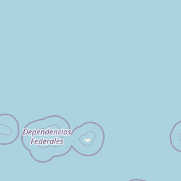
Map view of Archipiélago Los Roques National Park

Use this park location map to pinpoint Archipiélago Los Roques National Park in Venezuela, understand its exact geographic position, and read its mapped placement within the surrounding landscape more clearly.

Pigeon | © OpenStreetMap contributors
Recorded earthquake history

Review Recorded Seismic Activity near Archipiélago Los Roques National Park

Examine the historical catalogue of earthquakes associated with Archipiélago Los Roques National Park. This resource provides insight into past seismic events near the archipelago through a structured archive of USGS data, allowing for a clear view of regional seismic history within the MoriAtlas framework.

Archipiélago Los Roques National Park Earthquakes

Catalogued events

3 events

Strongest magnitude

Magnitude 4.7

Most recent event

Apr 16, 2017

This history includes earthquakes recorded inside the park or within 50 km of its borders

Park atlas

Explore more protected areas, comparing marine and island parks across the surrounding Caribbean geography.

Explore Other National Parks and Protected Areas Near Archipiélago Los Roques National Park

Continue your exploration from Archipiélago Los Roques National Park by browsing more national parks and protected marine areas in Venezuela, offering a wider view of Caribbean conservation. Compare diverse park geographies, from coral reef ecosystems to other island and coastal protected landscapes, providing valuable regional context for your discovery.
National parkDependencias Federales
Mapped location lies within the park boundary#1 closest

West

Parque nacional Archipiélago de Los Roques: Caribbean Coral Atoll and Marine Protected Area

Mapping the reef architecture and maritime geography of the Dependencias Federales

Explore the expansive marine geography of Parque nacional Archipiélago de Los Roques, a massive protected coral atoll system. This unique environment features vibrant reef barriers, extensive seagrass meadows, and shallow turquoise lagoons that define one of the Caribbean's most significant conservation zones.

Area
2,112 km²
Established
1972
IUCN
II
Relief
Lowland
Watercolor painting showing a winding river flowing through a landscape with rolling hills in the background
National parkVenezuela
118 km away#2 closest

South

El Ávila National Park: Venezuela's Premier Coastal Mountain National Park Exploration

Discover diverse terrain, mapped boundaries, and unique geographic context.

El Ávila National Park offers an exceptional gateway into Venezuela's mountainous protected landscapes. This national park features a dramatic rise from the Caribbean coast into varied terrain, including unique cloud forest and alpine zones. Its mapped geography showcases steep slopes, deep ravines, and remarkable elevation changes, providing a significant atlas-style study of coastal mountain environments. Exploring El Ávila National Park reveals a vital natural barrier and a rich ecosystem supporting diverse flora and fauna, making it a key destination for understanding regional protected areas.

Area
819 km²
Established
1958
IUCN
II
Relief
Mountain
National parkVenezuela
136 km away#3 closest

South

Macarao National Park: Venezuela's National Park with Mapped Boundaries and Regional Atlas Context

Explore its protected landscape and geographic setting within South America.

Delve into Macarao National Park, a significant national park situated in Venezuela. This page offers an atlas-centric view of the park, detailing its mapped boundaries and highlighting its importance within the regional geography of northern South America. Understand how Macarao National Park contributes to the country's network of protected landscapes and provides foundational geographic context for explorers and researchers.

Area
150 km²
Established
1973
IUCN
II
Relief
Mountain
Natural monumentMiranda
About 137 km away#4 closest

South

Monumento natural Cueva Alfredo Jahn: Exploring Protected Limestone Caves in Miranda

Geology, karst topography, and cave system mapping

Monumento natural Cueva Alfredo Jahn serves as a primary geological research site and protected natural area in the Serranía Litoral. The cave system, shaped by perennial waterways, features significant calcite formations and mineral rarity. Examine the mapped extent, elevations, and landscape context of this central Venezuelan cave complex.

Area
0.58 km²
Established
1978
IUCN
III
Visitors
3.5K annual
Watercolor painting depicting mountains, a lake, and green vegetation
National parkVenezuela
138 km away#5 closest

Southwest

Henri Pittier National Park: Venezuela's Oldest National Park, Coastal Range Geography

Explore protected landscapes, cloud forests, and birdwatching geography.

Henri Pittier National Park is Venezuela's foundational protected area, established in 1937 and spanning over 107,800 hectares within the Venezuelan Coastal Range. This national park is renowned for its exceptional biodiversity, particularly its over 500 bird species and its distinctive cloud forest ecosystems, which include the iconic Gyranthera caribensis tree. The park's geography extends from rugged mountain terrain to coastal bays and beaches, with the Paso de Portachuelo serving as a significant migratory bird corridor. Its mapped boundaries enclose a rich mosaic of natural landscapes vital for understanding regional conservation and protected area geography in northern South America.

Area
1,078 km²
Established
1937
IUCN
II
Relief
Mountain
Natural monumentAragua
About 147 km away#6 closest

South

Monumento Natural Pico Codazzi: Karst Landscapes and Mountain Corridors in Aragua

Exploring protected summit terrain and regional mountain connectivity

Spanning over 11,850 hectares, Monumento Natural Pico Codazzi preserves a complex mountain landscape defined by limestone massifs, vertical cliffs, and subterranean cave systems. Located in Aragua, this protected area functions as a biological bridge between major national parks, safeguarding a critical environment for migratory bird transit and high-altitude cloud forest stability across the Coastal Range.

Area
118.5 km²
Established
1991
Relief
Mountain
Climate
Tropical
National parkBonaire
147 km away#7 closest

West

Washington-Slagbaai National Park: Mapping the Protected Terrain of Northern Bonaire

Saline wetlands, volcanic peaks, and coastal ecology

Washington-Slagbaai National Park represents a cornerstone of Bonaire's conservation identity. The protected area features a striking blend of salt-tolerant mangrove systems, expansive salinas, and the rising slopes of Brandaris. This geographic overview highlights the physical characteristics and ecological distribution within one of the oldest national parks in the Dutch Caribbean, mapping the convergence of arid scrubland and marine environments.

Area
56.43 km²
Established
1969
Relief
Upland
Water
Major water bodies
National parkVenezuela
156 km away#8 closest

Southwest

Morrocoy National Park: Venezuela's Coastal National Park with Distinct Protected Geography

Explore the mapped protected landscape and regional context.

Morrocoy National Park stands as a key protected area within Venezuela, offering a distinct focus for geographic exploration. As a national park, its mapped boundaries delineate a significant natural landscape critical for understanding regional conservation and the country's broader atlas of protected lands. Discover the unique geographic characteristics and the atlas-driven context of this important Venezuelan protected area.

Area
320.9 km²
Established
1974
IUCN
II
Relief
Mixed relief

Common questions about visiting, size, designation, and location context for Archipiélago Los Roques National Park

Archipiélago Los Roques National Park FAQs for park facts, access, geography, and protected area context

Find quick answers about Archipiélago Los Roques National Park, including protected-area facts, park geography, trail and visitor context, and how the park fits into its surrounding country and regional landscape.
MoriAtlas Explorer

Continue Your Protected Areas Search Across the Global Atlas

Deepen your exploration by continuing the structured search for national parks and protected areas worldwide. Utilize the comprehensive filtering capabilities to compare different conservation landscapes and refine your understanding of global park geography. Discover more about the distribution and characteristics of protected natural areas.

Global natural geography