Why Bosque de Fray Jorge National Park stands out
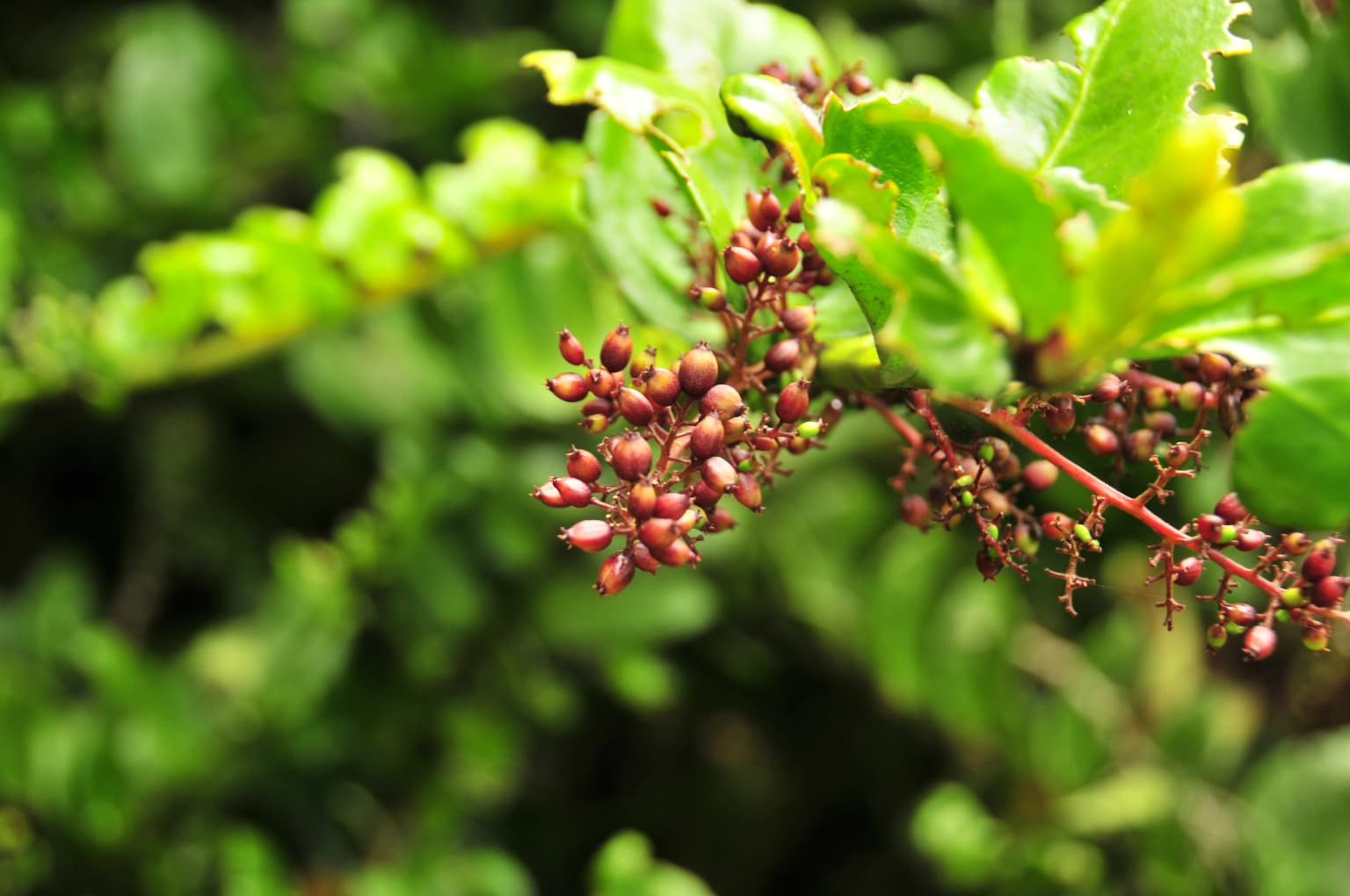
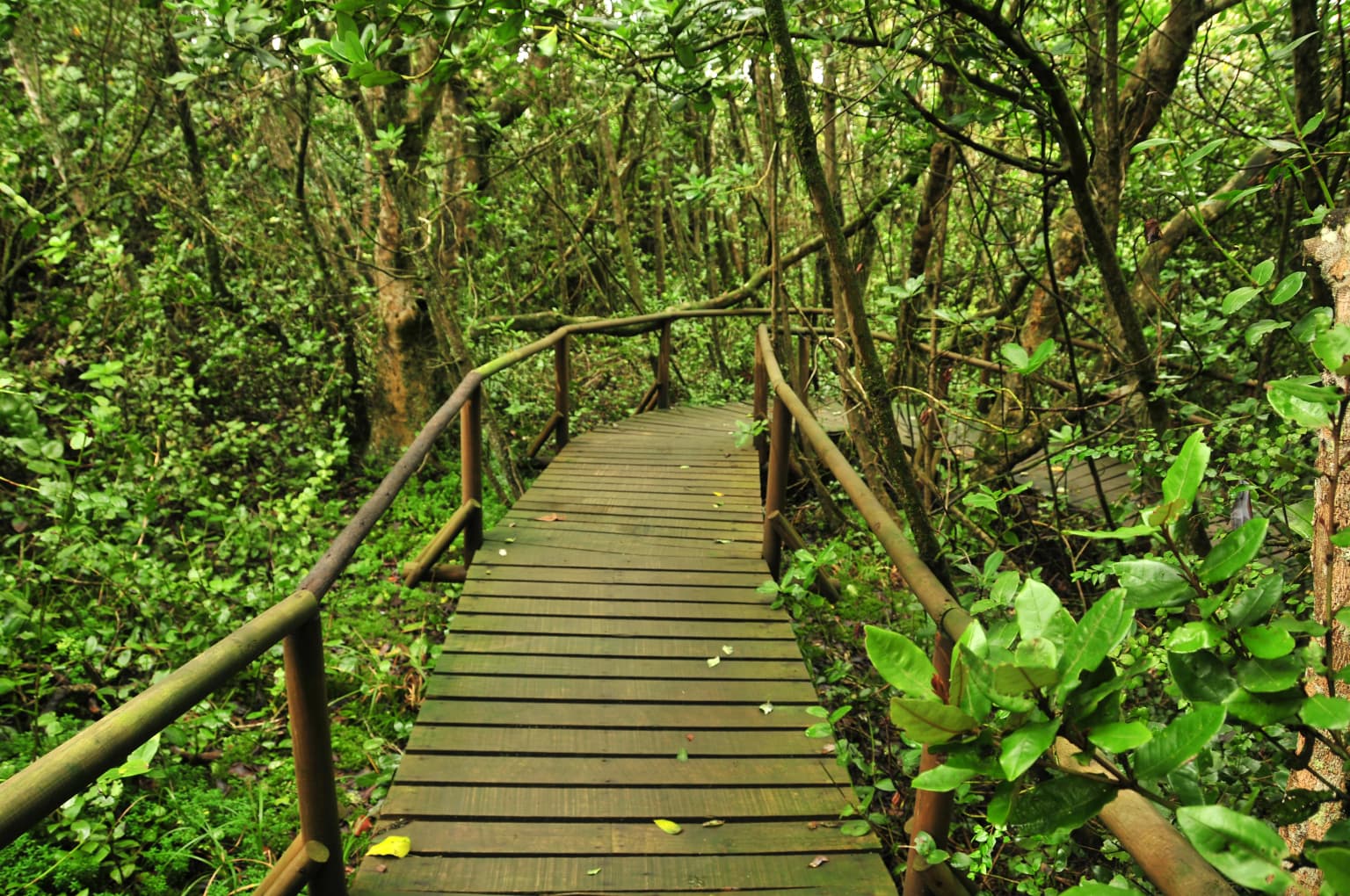
Bosque de Fray Jorge is best known for preserving the northernmost remnants of the Valdivia temperate rain forest, an ecosystem that typically thrives in southern Chile's wetter climates. The park's fog-fed forests represent a striking ecological phenomenon where a moist, subtropical-influenced woodland survives within the shadow of the Atacama Desert. The park contains the tree species Olivillo (Aextoxicon punctatum), epiphytic plants like Sarmienta scandens, and serves as the northern range limit for numerous Chilean plant species. It also holds distinction as South America's only certified Starlight dark sky reserve. The forest's extraordinary age, with genetic evidence suggesting divergence from southern forests over 20 million years ago, makes it a living laboratory for understanding forest evolution and climate-driven contraction.
Bosque de Fray Jorge National Park history and protected-area timeline
The history of Bosque de Fray Jorge reflects both ecological isolation and human discovery. The forest that would become the park's centerpiece was first documented in 1627 when a Franciscan priest from La Serena, searching for timber in a region where construction materials were scarce, embarked on a search with the help of mules. According to accounts, the priest miraculously discovered this forest and returned with timber used to construct portions of the bell tower of the Church of San Francisco in La Serena, one of the city's historic religious buildings. This discovery introduced the forest to European settlement records and eventually led to recognition of its ecological importance. The park was formally established in 1941 during the administration of President Juan Antonio Ríos, making it one of Chile's older protected areas. Management of the park was entrusted to the Corporación Nacional Forestal (CONAF), the national forest authority. In 1977, UNESCO recognized the park's global significance by incorporating it into the World Network of Biosphere Reserves, acknowledging its role as a conservation site of international importance. More recently, in 2020, the lower reaches of the Limarí River, which forms the park's southern boundary, were designated as a Ramsar Wetland, extending international protection to the riparian ecosystems connected to the park.
Bosque de Fray Jorge National Park landscape and geographic character
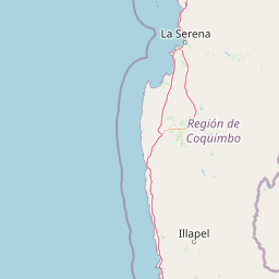
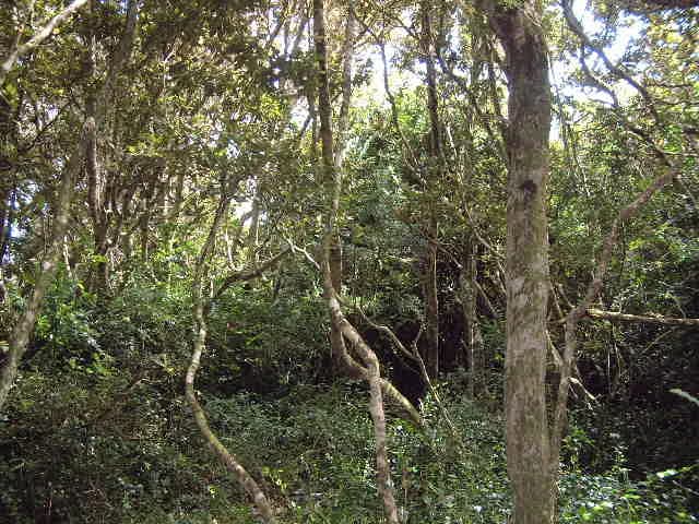
The physical landscape of Bosque de Fray Jorge is defined by its location within the Cordillera de Talinay, a coastal mountain range that forms part of the broader Chilean Coastal Range. The terrain consists of steep mountain slopes descending toward the Pacific Ocean, with elevations varying across the park's extent. The landscape presents a dramatic visual contrast between the dark, dense canopy of the forest and the surrounding hillsides of semiarid scrubland that characterize the broader region. The park's forest-covered areas are concentrated in valleys and on slopes where fog moisture accumulates, creating distinct patches of green amid the otherwise brown and tan terrain. The Limarí River flows along the park's southern boundary, its lower reaches protected as part of the Ramsar-designated wetland area. The park's elevation and coastal position create a unique setting where the influences of the ocean, including fog and maritime air masses, interact with the continental climate patterns of north-central Chile.
Bosque de Fray Jorge National Park ecosystems, habitats, and plant life
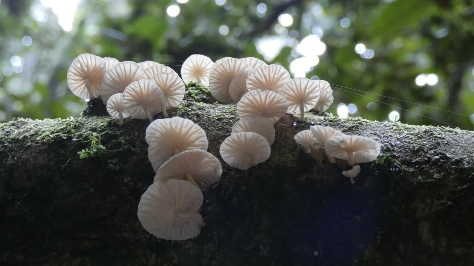
The ecological character of Bosque de Fray Jorge is defined by its status as a relictual fragment of the Valdivia temperate rain forest, an ecosystem type that normally extends from roughly the Biobío Region southward. This makes Fray Jorge the northernmost occurrence of this forest type anywhere in the world, creating an island of temperate biodiversity within a subtropical to arid matrix. The forest's survival depends entirely on the camanchaca fog system, which provides the majority of moisture through direct condensation rather than precipitation. The vegetation structure includes the endemic Olivillo (Aextoxicon punctatum) as a dominant canopy species, accompanied by various shrub and understory plants adapted to the moisture-rich but nutrient-limited conditions. Epiphytes are particularly well-represented, with species like Sarmienta scandens and Griselinia scandens growing on tree branches and trunks. The forest represents a remarkable example of ecological persistence, having survived as a refugium while surrounding areas transformed into arid scrubland over millions of years. Recent genetic research based on metazoans indicates that the forest's lineage diverged from southern populations over 20 million years ago, during the Paleogene and Neogene periods, making this forest a living record of ancient ecological conditions.
Bosque de Fray Jorge National Park wildlife and species highlights
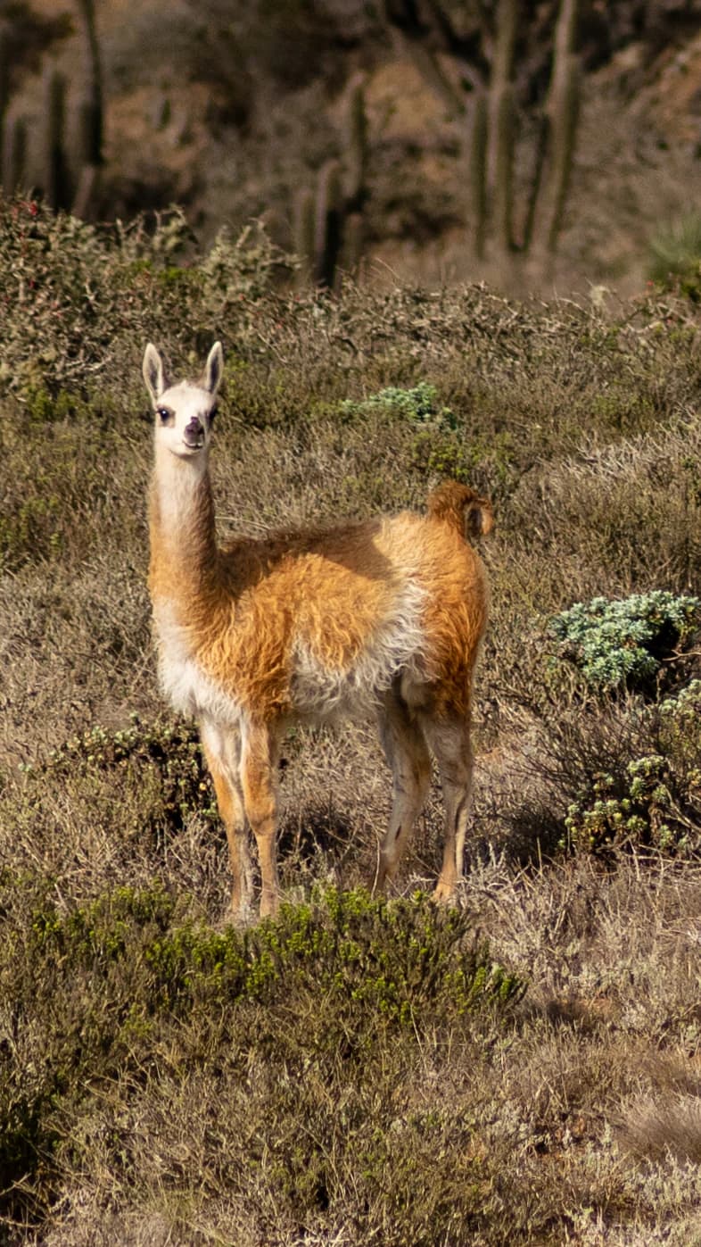
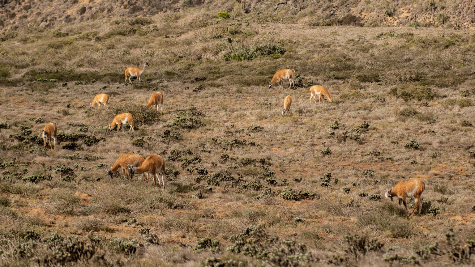
Bosque de Fray Jorge supports a diverse community of wildlife despite its relatively small forest area, a result of the unique habitat conditions created by the fog-fed forest in an otherwise arid region. Mammals found in the park include the common degu, a small rodent that lives in colonies within the forest understory, as well as foxes and the more elusive puma that ranges through the broader landscape. Guanacos, South American camelids, are also present in the park and can often be observed grazing in more open areas. The bird community is particularly noteworthy, with species adapted to both forest and scrubland habitats. The Chilean tinamou and the long-tailed meadowlark are among the commonly observed bird species. Additional avian residents include the picaflor, a small hummingbird that feeds on nectar from the park's flowering plants, and the tucúquere, a Magellanic horned owl that inhabits the forest and surrounding areas. The diverse avifauna reflects the park's position as a transition zone between different ecological communities.
Bosque de Fray Jorge National Park conservation status and protection priorities
Bosque de Fray Jorge holds exceptional conservation significance as one of Chile's oldest protected areas and as a UNESCO Biosphere Reserve since 1977. The park's designation as a biosphere reserve recognizes its dual role in preserving biodiversity and supporting scientific research into forest ecology and climate change impacts. The forest's status as the northernmost remnant of the Valdivia temperate rain forest makes it irreplaceable, as similar conditions cannot be replicated elsewhere due to the specific climatic and geographic requirements of the fog-fed system. Conservation efforts focus on protecting the existing forest cover and managing the impacts of visitor use on the sensitive ecosystem. The 2020 designation of the Limarí River's lower reaches as a Ramsar Wetland has expanded protection to include the riparian corridor that connects to the park. Additionally, the park has subsurface protection as a place of scientific interest for mining purposes, established by Supreme Decree in 1989, which provides an additional layer of legal protection against potential mineral extraction.
Bosque de Fray Jorge National Park cultural meaning and human context
While Bosque de Fray Jorge is primarily valued for its ecological significance, the park also carries historical importance tied to the human history of the Coquimbo Region. The forest's discovery in 1627 by a Franciscan priest seeking timber for the Church of San Francisco represents the earliest documented interaction between European settlers and this unique ecosystem. This connection to the religious and colonial history of La Serena, one of Chile's oldest cities, provides cultural context for understanding why this particular forest gained recognition when other similar ecosystems might have been exploited for resources. The park's location within the territory historically inhabited by indigenous communities adds potential depth to its cultural context, though the primary narrative in available sources focuses on the discovery and subsequent conservation history rather than deeper indigenous heritage connections.
Top sights and standout views in Bosque de Fray Jorge National Park
The most compelling highlights of Bosque de Fray Jorge include its extraordinary status as the world's northernmost Valdivia temperate rain forest, a living relic of ancient forest systems that survived millions of years of regional aridification. The fog-fed forest ecosystem, sustained by the camanchaca phenomenon, creates an unlikely oasis of biodiversity at the edge of the Atacama Desert. The park's UNESCO Biosphere Reserve status since 1977 and Ramsar Wetland designation for associated riverine ecosystems reflect its international recognition. The presence of Olivillo-dominated forest, the diversity of epiphytic plants, and the northern range limits of numerous species make it botanically significant. The distinction as South America's only certified Starlight dark sky reserve adds an astronomical dimension to the park's attractions, offering exceptional conditions for stargazing in a region renowned for clear skies.
Best time to visit Bosque de Fray Jorge National Park
The optimal time to visit Bosque de Fray Jorge depends on what visitors hope to experience, though the fog system that sustains the forest operates year-round and creates consistent conditions throughout the seasons. The coastal fog tends to be most persistent during the cooler months from late autumn through winter and into early spring, typically providing reliable moisture for the forest. Summer months may see slightly less fog but can still offer good conditions for exploration. Temperature differences between seasons are moderate given the coastal location, with cooler conditions in winter and warmer but not extreme temperatures in summer. The park remains accessible throughout the year, though visitors should be aware that some trails and interior areas may have varying conditions depending on recent weather patterns. The dry season from November through March typically offers more comfortable conditions for hiking, while the cooler winter months may provide more dramatic fog displays within the forest.