
Why Cape Range National Park stands out
Cape Range National Park is best known for its spectacular limestone landscape, which stands as a unique geological feature along Australia's western coastline. The park contains over 700 caves, making it one of the most cave-dense regions in the country, with many more expected to remain undiscovered. Yardie Creek, a dramatic gorge where water pools behind a sandbar, represents one of the park's most iconic visual landmarks. The park's flora is exceptionally diverse, with more than 630 wildflower species including the distinctive bird flower and desert sturt pea. Its position adjacent to Ningaloo Reef creates a rare transition from arid terrestrial landscapes to vibrant marine environments.
Cape Range National Park history and protected-area timeline
The land now comprising Cape Range National Park has a history of human occupation extending back to Aboriginal peoples, though the more recent European history begins with pastoral settlement in the late 19th century. In 1876, J. Brockman acquired pastoral leases covering the North West Cape region, establishing cattle grazing operations in the area. In 1888, Brockman sold portions of his lease to ornithologist Thomas Carter, who purchased both Yardie Creek Station and Ningaloo Station. Carter became the first European settler in the area, formally establishing a pastoral station in 1889. The pastoral era continued for decades, but recognition of the region's unique natural values eventually led to protection. The area was declared a national park in 1964, with formal establishment following in 1965. In 1987, the offshore marine area adjacent to the park was declared as Ningaloo Marine Park, extending conservation protection to the reef ecosystem that lies just offshore from the Cape Range coastline.
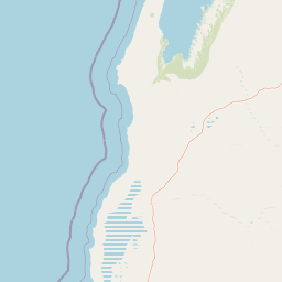
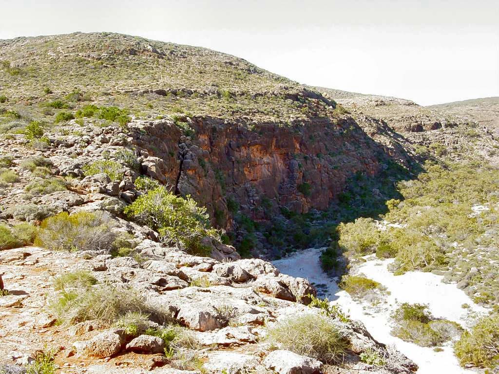
Cape Range National Park landscape and geographic character
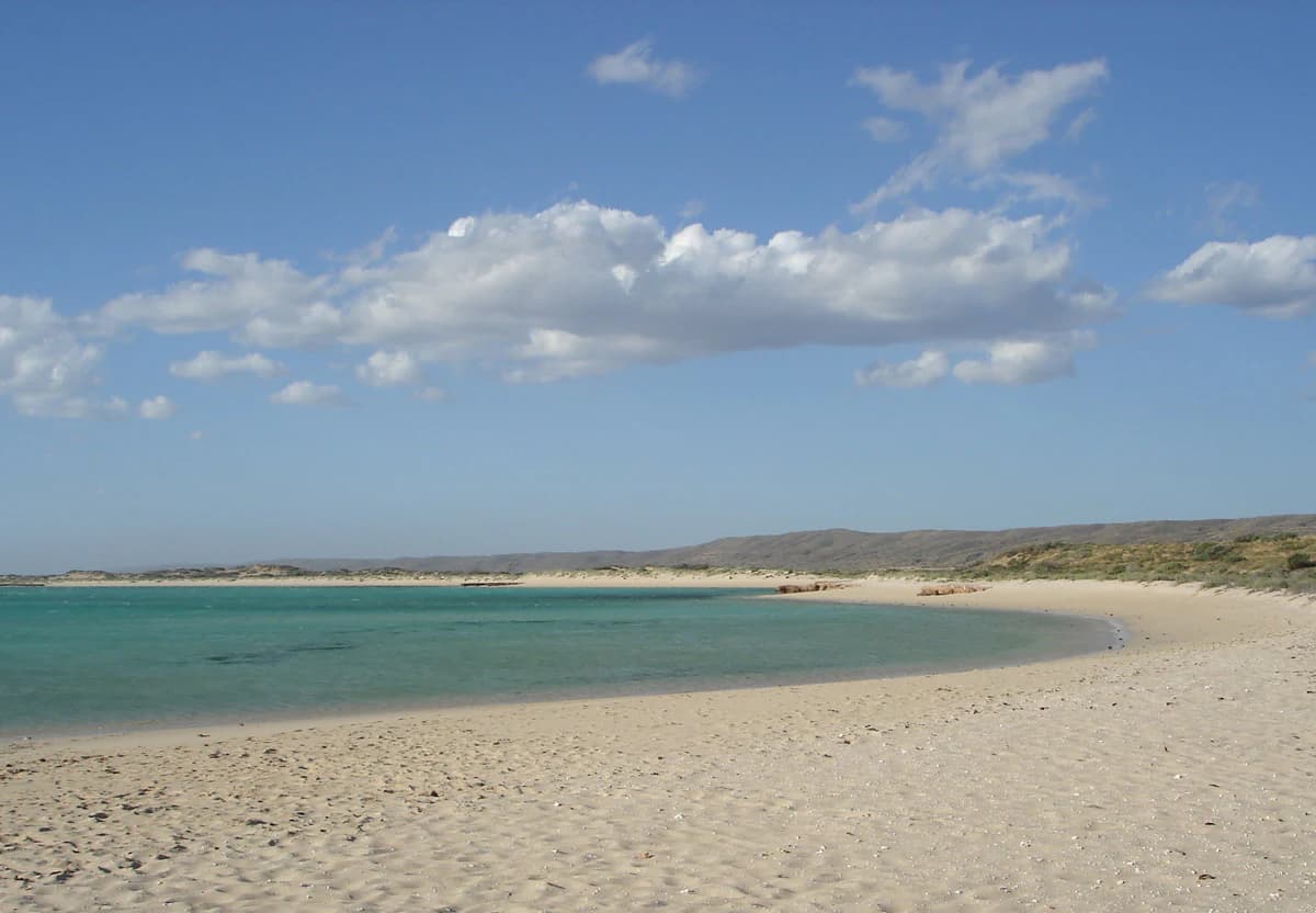
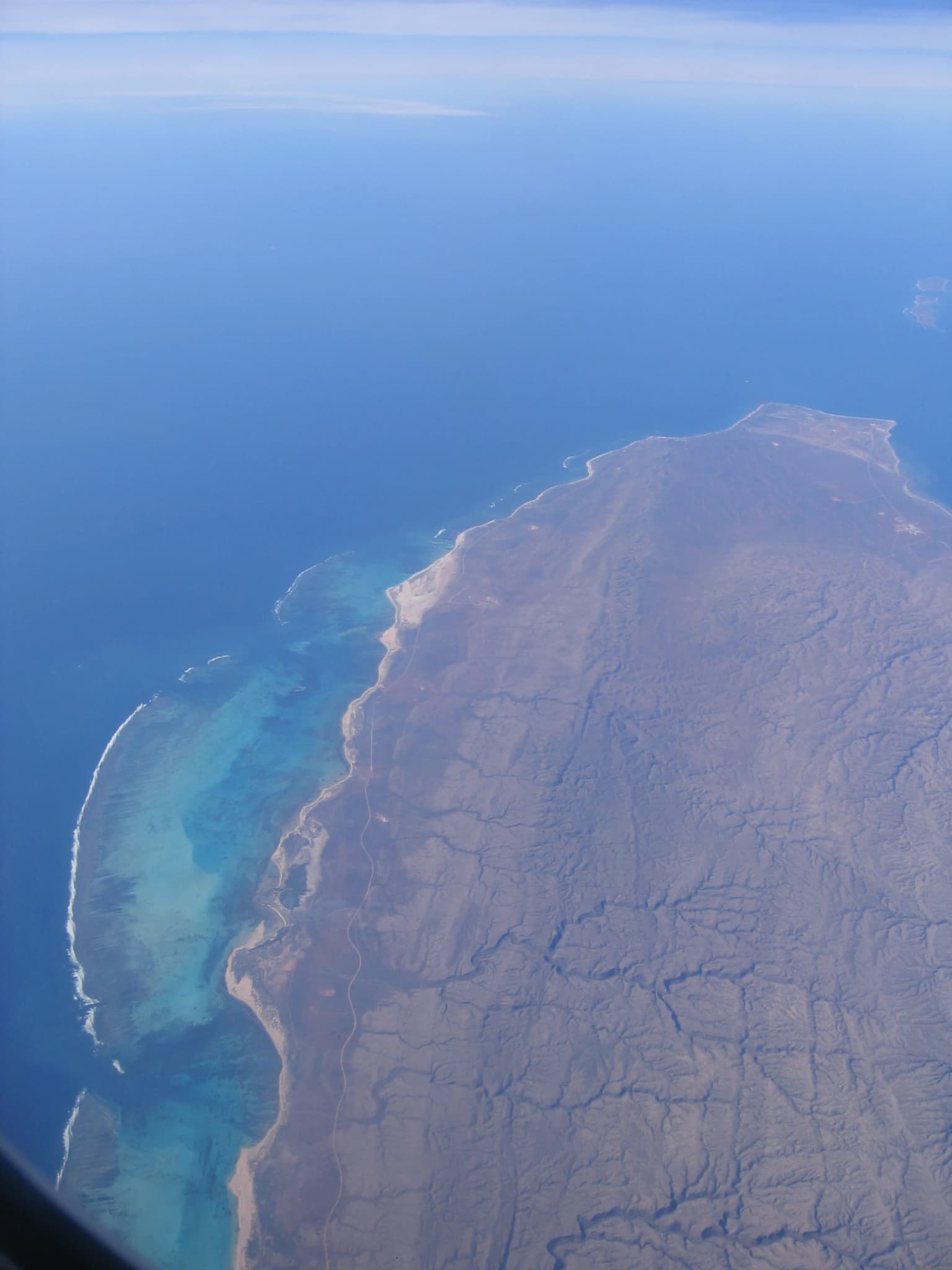
The landscape of Cape Range National Park is defined by its distinctive limestone geology, which sets it apart from surrounding regions along Western Australia's coast. The park occupies the western side of the North West Cape peninsula, forming a backbone of elevated plateaus that represent the only limestone-dominated highlands on the North West Coast of Australia. These plateaus rise to approximately 314 meters above sea level, creating a rugged and dramatic backdrop against the flat coastal plains and the Indian Ocean. Deep canyons have been carved into the limestone over geological time, carved by the flow of water that has gradually eroded the rock formation. The park encompasses numerous pristine beaches where the limestone meets the sea, creating sheltered coves and dramatic cliff faces. The landscape includes Yardie Creek, a particularly spectacular gorge where water accumulates behind a sandbar, creating a permanent pool in an otherwise arid landscape. The combination of elevation, erosion, and the proximity to the ocean has created a landscape of exceptional visual diversity within a relatively compact area.
Cape Range National Park ecosystems, habitats, and plant life
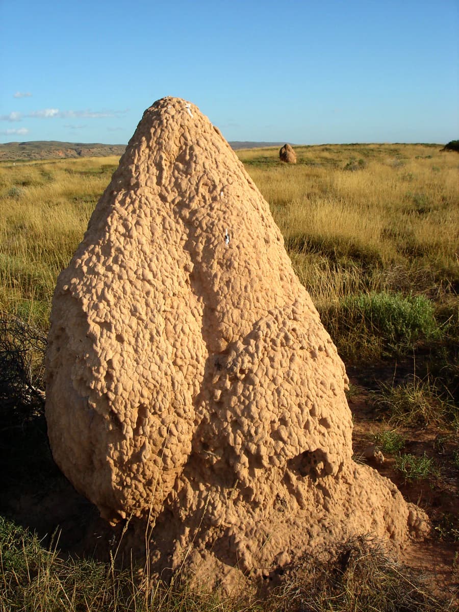
The nature of Cape Range National Park reflects the convergence of arid and semi-natural environments in a landscape shaped by limestone geology. The park supports an extraordinary diversity of plant life, with more than 630 species of wildflower documented within its boundaries. These wildflowers typically bloom toward the end of winter, transforming the landscape with color during the cooler months. Vegetation communities vary dramatically from the coast to the inland areas, with mangroves found in coastal zones, acacia woodlands on the plains, and specialized plants adapted to the rocky canyon environments. The park contains numerous endemic plant species adapted to the limestone substrate, including grevillea, verticordia, and the distinctive minilya lily. The arid portions of the park feature extensive spinifex grasslands, while the deeper canyons support more lush vegetation where water is available. The cave systems within the park represent a unique underground environment, with darkness-adapted ecosystems existing in the more than 700 documented caves.
Cape Range National Park wildlife and species highlights
Cape Range National Park supports a rich diversity of wildlife despite its arid setting, with the limestone landscape creating numerous microhabitats that support both common and specialized species. Mammal species found within the park include rock wallabies, which are particularly well-suited to the rugged terrain and cliff faces, red kangaroos that traverse the open plains, euros (eastern wallaroos) that inhabit the rocky slopes, and emus that roam throughout the park. The birdlife is exceptionally diverse, with over 100 species documented including numerous parrots, honeyeaters, and desert-adapted species. Reptile diversity is equally impressive, with 80 species recorded including various snakes, lizards, and skinks adapted to the arid conditions. The park's caves provide habitat for specialized troglobitic species that have adapted to life in complete darkness. The proximity to Ningaloo Reef means that marine wildlife is also accessible from the park's coastline, with seasonal whale shark encounters possible in the adjacent waters.
Cape Range National Park conservation status and protection priorities
Cape Range National Park represents an important conservation outcome in Western Australia, protecting a unique geological landscape and the biodiversity it supports. The park's establishment in 1965 marked recognition of the region's outstanding natural values, particularly its distinctive limestone geology and the biodiversity associated with this rare landscape type. The protection extends beyond the terrestrial environment through the adjacent Ningaloo Marine Park, which was declared in 1987 to protect the reef ecosystem. Together, these protected areas create a comprehensive conservation framework spanning both land and sea. The park's cave systems represent a particularly significant conservation priority, with over 700 documented caves and the reasonable expectation that many more remain undiscovered. These caves provide habitat for specialized species and contain scientific information about the region's geological history. The wildflower diversity, with over 630 species, represents another significant conservation value, with many species endemic to the region.
Cape Range National Park cultural meaning and human context
The cultural context of Cape Range National Park encompasses both Aboriginal heritage and more recent European history. The traditional owners of the land have connections to the area that extend back thousands of years, with the park's landscape featuring in Aboriginal cultural knowledge and heritage. The European settlement history of the area began with pastoral leases in the late 19th century, with J. Brockman establishing the first recorded pastoral lease in 1876 covering the North West Cape. Thomas Carter became the first European settler when he established Yardie Creek Station in 1889, purchasing parts of the original lease. The pastoral era left lasting modifications to the landscape, though the transition to national park status in 1965 removed the grazing pressure and allowed natural processes to resume. The park also contains historical infrastructure from World War II, including radar towers at Vlamingh Head, reflecting the strategic importance of this coastline during the mid-20th century.
Top sights and standout views in Cape Range National Park
Cape Range National Park offers several standout features that make it distinctive among Western Australia's protected areas. The limestone plateau landscape is unique on Australia's North West Coast, providing dramatic scenery with elevation changes of over 300 meters and deep canyons carved over millions of years. The park contains over 700 caves, with the probability that many more remain undiscovered, making it one of the most cave-dense regions in Australia. Yardie Creek Gorge represents a particularly spectacular feature, where permanent water pools behind a sandbar in a dramatic canyon setting. The wildflower display in late winter is exceptional, with over 630 species including the iconic bird flower and desert sturt pea. The park's adjacency to Ningaloo Reef creates a rare opportunity to experience both terrestrial and marine environments in a single visit, with the reef accessible directly offshore from the park's coastline.
Best time to visit Cape Range National Park
The optimal time to visit Cape Range National Park is during the cooler months of autumn and winter, from April through September, when temperatures are more comfortable for outdoor exploration. Wildflower season typically peaks toward the end of winter, from late August through September, when the bloom of over 630 wildflower species transforms the landscape with color. Summer months from December through February bring intense heat that can make outdoor activities challenging, though early morning excursions remain possible. The park can be visited year-round, but the shoulder seasons of autumn and spring offer the most comfortable conditions for hiking and exploration. The marine environment of adjacent Ningaloo Reef is accessible year-round, though different seasons offer different wildlife experiences, with whale sharks typically present from March to July.