Why Capoompeta National Park stands out
Capoompeta National Park is best known for its remarkable ecological diversity within a relatively compact mountain landscape. The park protects significant areas of both dry sclerophyll forest and subtropical rainforest, creating a mosaic of habitats unusual in the New England tableland. The fern basins scattered throughout the park represent a particularly distinctive landscape feature, supporting specialised plant communities in the moist valley floors. These diverse habitats make the park particularly important for wildlife conservation in the region.
Capoompeta National Park history and protected-area timeline
Capoompeta National Park was established in 1999 when it was formally declared as a protected area under the National Parks and Wildlife Act. The creation of the park reflected growing recognition during the 1990s of the ecological significance of the New England tableland's mountain forests and the need to protect the unique fern basin communities found in the region. The park was assigned IUCN Category II status, reflecting its primary purpose of ecosystem conservation and natural landscape preservation. Management of the park falls to the NSW National Parks and Wildlife Service, which continues to oversee protection of the area's natural values while allowing public access for nature-based recreation.
Capoompeta National Park landscape and geographic character
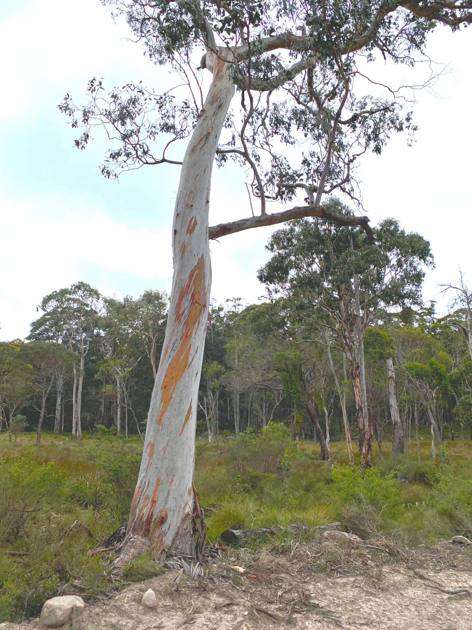
The terrain of Capoompeta National Park is defined by its mountainous character, with elevations varying across the park's 39 square kilometre extent. The landscape features a series of ridges and valleys that create diverse microclimates and forest communities. The fern basins represent a particularly distinctive landscape feature, these are moist, sheltered depressions where ferns and moisture-loving plants thrive in contrast to the surrounding dry forest landscapes. Dry sclerophyll forest predominates on the steeper slopes and ridgelines, while the more protected valleys and lower areas support closed rainforest communities. The park's position away from major population centres has helped preserve its natural landscape character since European settlement.
Capoompeta National Park ecosystems, habitats, and plant life
The ecological character of Capoompeta National Park is defined by the mixing of dry forest and rainforest communities across the mountainous terrain. This diversity of forest types within a relatively small area creates important habitat heterogeneity that supports a range of plant species. The fern basins represent specialised wetland-like environments that support plant communities adapted to constant moisture and shade. These unique microhabitats contribute significantly to the park's overall biodiversity value, creating refuge areas for species that require humid conditions. The transition between dry and wet forest types across the park's topography reflects the influence of aspect, elevation, and soil moisture on vegetation patterns in this part of New South Wales.
Capoompeta National Park wildlife and species highlights
The diverse forest habitats within Capoompeta National Park provide important environments for native wildlife species adapted to the New England region's conditions. The mix of dry forest and rainforest communities supports different assemblages of animals throughout the park, with species moving between habitat types according to season and resource availability. The protected status of the area ensures that these wildlife communities have access to relatively intact habitats, away from the heavy development pressures that have affected much of the surrounding agricultural landscape. While specific species details are limited in available sources, the park's conservation significance derives from its role in protecting connected habitats across the New England tableland.
Capoompeta National Park conservation status and protection priorities
The establishment of Capoompeta National Park in 1999 represented a significant contribution to conservation of the New England region's biodiversity. The park protects a representative sample of the mountain forest ecosystems that characterise this part of northern New South Wales, including both the widespread dry sclerophyll forests and the more restricted rainforest communities found in the sheltered valleys. The IUCN Category II designation reflects the park's primary function as a protected area for ecosystem conservation rather than recreational use. The fern basins within the park represent particularly sensitive environments that benefit from formal protection, as these moist microhabitats could easily be degraded by inappropriate activities or development. By preserving this mountainous landscape in a relatively undeveloped state, the park helps maintain ecological connectivity across the New England tableland.
Capoompeta National Park cultural meaning and human context
The Capoompeta area lies within the traditional country of Aboriginal peoples who have long inhabited the New England region of New South Wales. The mountain landscapes and diverse forest environments of this area would have provided resources for Indigenous communities over many thousands of years, though detailed historical documentation of traditional Aboriginal use of the specific park area is limited in readily available sources. The landscape's modern management under the NSW National Parks and Wildlife Service represents a continuation of protective stewardship over these lands, though the park does not carry specific indigenous heritage designations in the available source material.
Top sights and standout views in Capoompeta National Park
The standout features of Capoompeta National Park include its remarkable forest diversity within a compact mountain landscape, the distinctive fern basins that create unique ecological pockets throughout the terrain, and its wild undeveloped character that offers a remote wilderness experience. The park's location near several regional towns including Glen Innes, Deepwater and Tenterfield makes it accessible for day visits, while the absence of facilities ensures that those who venture here experience a genuine backcountry environment. The scenic drives leading to the park from these towns themselves offer attractive forest and highland scenery.
Best time to visit Capoompeta National Park
The best time to visit Capoompeta National Park would be during the cooler months of autumn and winter when the weather is more comfortable for bushwalking and forest exploration. The New England region's climate means that summer can be hot and dry, potentially making extended outdoor activity less comfortable. Winter temperatures in the highlands can be cold, particularly at night, but the clear skies and reduced humidity often provide pleasant daytime conditions for walking. Visitors should be self-sufficient as no facilities exist within the park, and those planning to explore the fern basins or longer trails should ensure they have appropriate navigation equipment and supplies.